Regional overview
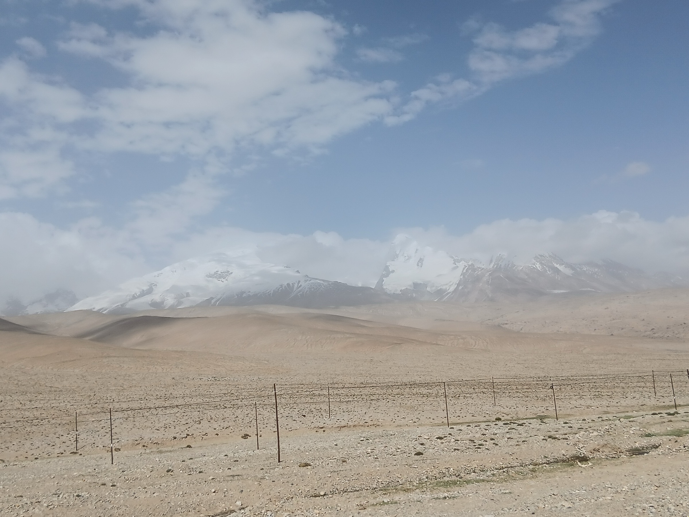
The Khunjerab-Karakoram frontier region is the southern high-pass end of China’s Karakoram Highway corridor, running from Tashkurgan towards the China-Pakistan border at Khunjerab Pass / Hongqilafu. It is a road-accessed, high-altitude border landscape of dry valleys, snow mountains, wildlife reserve terrain, frontier monuments, and the headwaters of the Taktumbash / Khunjerab valley system.
For hiking catalogue purposes, this is the most restricted of the four Xinjiang Pamir sub-regions in this batch. The pass is a live border crossing and surrounding country includes border-control zones, Taxkorgan Nature Reserve / wildlife habitat, undeveloped mountains, and seasonal snow terrain. The 2 May 2026 Tashkurgan county notice prohibits unauthorised hiking, camping, crossing, mountaineering, and similar outdoor activity in undeveloped/unopened mountains, no-man’s-land, protected-area core and buffer zones, border-control areas, and old roads/pastoral tracks.
No reliable official day-hiking trail network or GPX downloads were found for the Chinese Khunjerab side. The five entries below are therefore access-controlled viewpoint walks and candidate roadside/heritage walks, not open mountain trails. Each requires current local confirmation before publication as a recommended hike.
Selection rationale
The selection records the five most defensible public walking objectives in the frontier corridor: the Khunjerab border-monument plateau, the national-gate scenic area, the pass approach viewpoint zone, the former/lower port valley around Pileri/Taktumbash, and a wildlife-viewing pullout walk. These represent the region’s essential landscapes while explicitly avoiding unauthorised wilderness travel.
Summary table
| # | Hike | Route type | Distance | Max elevation | Difficulty |
|---|---|---|---|---|---|
| 1 | Khunjerab Pass Border Monument Plateau Walk | Short out-and-back | Approx. 0.5–2 km | 4,693 m | Easy–moderate at very high altitude |
| 2 | Hongqilafu National Gate Scenic-Area Walk | Short out-and-back | Approx. 1–3 km | Approx. 4,600–4,700 m | Easy–moderate at very high altitude |
| 3 | Karakoram Highway Pass-Approach Viewpoint Walk | Roadside viewpoint walk | Approx. 1–4 km | Approx. 4,300–4,650 m | Moderate |
| 4 | Pileri / Lower Khunjerab Port Heritage-Valley Walk | Candidate out-and-back | Approx. 2–5 km | Approx. 3,800–4,200 m | Candidate only |
| 5 | Taxkorgan Nature Reserve Legal Pullout Wildlife-Viewing Walk | Candidate short out-and-back | Approx. 1–3 km | Approx. 3,800–4,500 m | Candidate only |
1. Khunjerab Pass Border Monument Plateau Walk
Snapshot
Itinerary
The route stays within the official pass visitor area, walking from the legal parking or drop-off point to the China-Pakistan border monument / pass viewpoint and back. The route should not leave the signed visitor boundary, road shoulder, or official viewing surface.
The pass elevation and location are well verified, and open-licence media exist. Exact visitor walking boundaries and current opening rules were not verified in an official route map.
Why it is essential
Khunjerab Pass is the symbolic and geographic climax of the Karakoram Highway on the China-Pakistan frontier. Even a short walk here is one of the defining experiences of the region.
Equipment
- Warm windproof clothing, hat/gloves outside midsummer, sunglasses, sun protection, water, and slow pacing
- No technical equipment is required for the official viewpoint walk
Hazards and notes
- Very high altitude is the main hazard
- Weather can shift quickly, with snow, wind, and low visibility
- Border photography rules, road closures, frontier permits, and visitor limits must be followed
- Do not walk away from the official visitor area
GPX / KML links
| Source | URL | Format | Notes |
|---|---|---|---|
| OpenStreetMap search: Khunjerab Pass | openstreetmap.org | Map/search | OSM data is ODbL; landmark cross-check only |
| Wikimedia Commons category: Khunjerab Pass | commons.wikimedia.org | Media / linked map tools | Elevation, location, photo-source cross-check only |
External links
- Go Western China — Khunjerab Pass overview
- Tashkurgan county outdoor-activity restriction notice (2 May 2026)
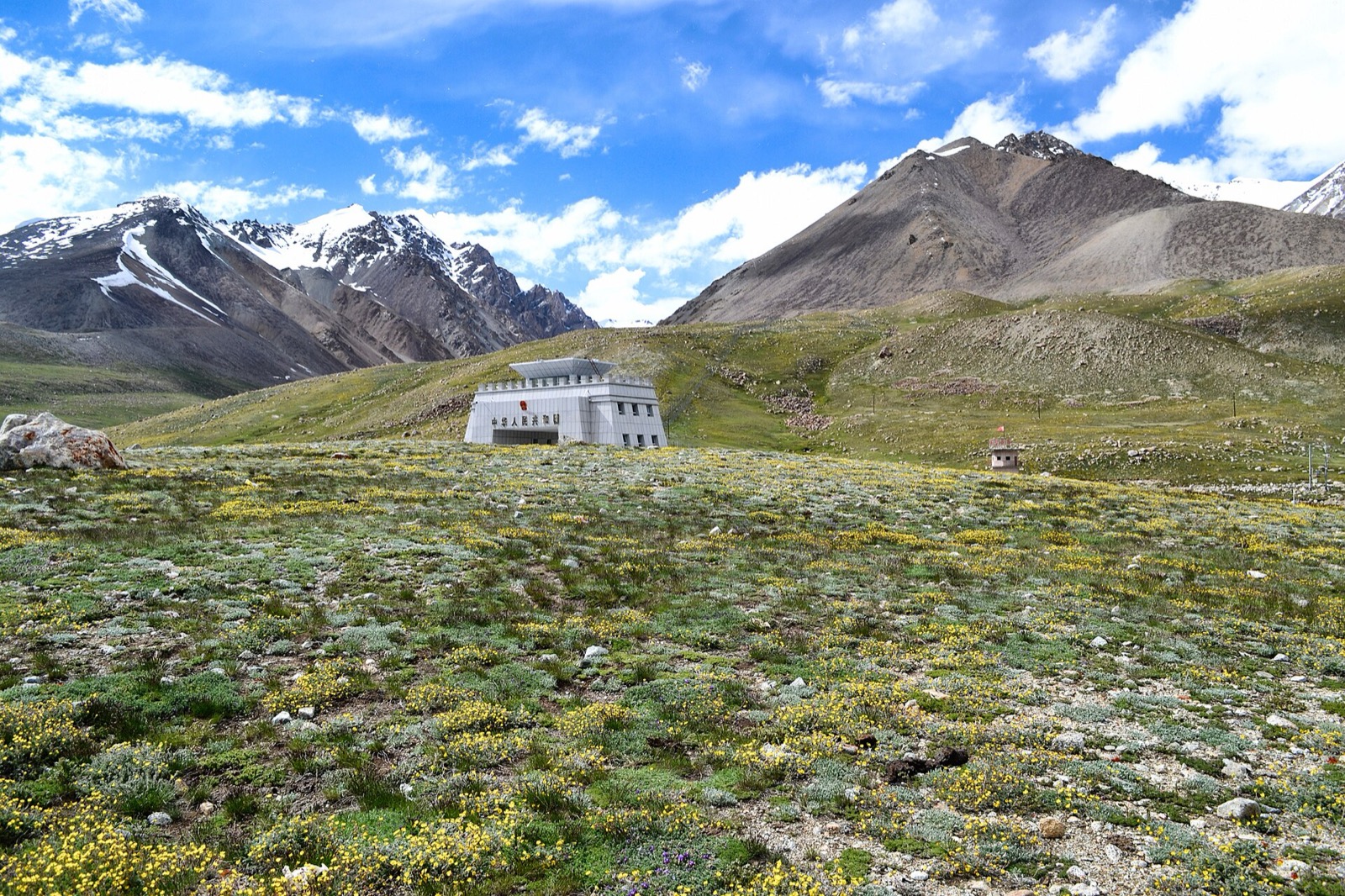
2. Hongqilafu National Gate Scenic-Area Walk
Snapshot
Itinerary
This scenic-area walk links the official national-gate viewing area, monument/photo points, and any open visitor platforms. The route is intentionally short and controlled. It should not be extended towards border infrastructure, side valleys, or hillsides.
Why it is essential
The national gate is the public-facing frontier landmark of the Chinese Khunjerab corridor and is the most defensible non-technical walking objective in the border zone.
Equipment
- Warm windproof clothing, hat, gloves in cold weather, sunglasses, sunscreen, water, and personal ID / permits as required by authorities
Hazards and notes
- Border rules are non-negotiable; photography, movement, and stopping may be controlled
- Altitude illness can occur quickly near 4,700 m, especially after rapid ascent from Tashkurgan or Kashgar
GPX / KML links
| Source | URL | Format | Notes |
|---|---|---|---|
| OpenStreetMap search: Hongqilafu National Gate | openstreetmap.org | Map/search | OSM data is ODbL; landmark cross-check only |
| LoongWander: Hongqilafu National Gate Tourist Scenic Area | loongwander.com | Travel/scenic-area page | Site terms apply; access and scenic-area context only |
External links
- LoongWander — Hongqilafu National Gate tourist scenic area
- Go Western China — Khunjerab Pass overview
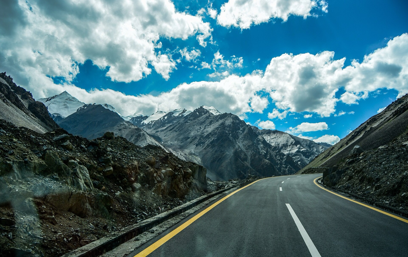
3. Karakoram Highway Pass-Approach Viewpoint Walk
Snapshot
Itinerary
The route uses only legal viewpoint stops on the Chinese approach to Khunjerab Pass, walking a short distance along safe visitor surfaces to photograph the Karakoram Highway, high valley, and snow-mountain backdrop. It is a catalogue placeholder for an official scenic-road viewpoint walk, not a defined mountain trail.
Why it is essential
The Karakoram Highway is the structuring feature of this frontier region. A pass-approach viewpoint walk represents the road, valley, and high-Karakoram setting without leaving legal access zones.
Equipment
- Sturdy shoes, warm windproof clothing, water, sunglasses, sun protection, and high-visibility caution near roads
Hazards and notes
- Traffic, narrow shoulders, altitude, wind, and border-control limits are the key hazards
- Do not walk on blind bends or leave a legal pullout
- Route needs local verification before publication
GPX / KML links
| Source | URL | Format | Notes |
|---|---|---|---|
| OpenStreetMap search: Karakoram Highway Khunjerab China | openstreetmap.org | Map/search | OSM data is ODbL; road/landmark cross-check only |
| XinjiangTravel.org: Karakoram Highway overview | xinjiangtravel.org | Travel/landform overview | Site terms apply; corridor context only |
External links
4. Pileri / Lower Khunjerab Port Heritage-Valley Walk
Snapshot
Itinerary
Historic and encyclopaedic sources describe the old/lower Khunjerab port area in the Taktumbash valley below the pass. A legal heritage-valley walk would remain beside permitted road or visitor areas, using the landscape to interpret the old port, river valley, and approach to the modern pass.
No current official public walking route, route file, or exact visitor boundary was found. This entry should not be published as a recommended hike until local authorities confirm access.
Why it is essential
The old port / lower valley explains how the modern pass relates to older frontier logistics and the Taktumbash river corridor.
Equipment
- Standard high-altitude walking equipment: sturdy shoes, warm windproof layer, water, sun protection, and navigation backup if a legal route is confirmed
Hazards and notes
- Border-control rules, protected-area boundaries, road traffic, altitude, and unclear public access make this candidate only
- Do not enter port infrastructure, patrol roads, or side valleys without permission
GPX / KML links
| Source | URL | Format | Notes |
|---|---|---|---|
| OpenStreetMap search: Taktumbash River Khunjerab | openstreetmap.org | Map/search | OSM data is ODbL; landmark cross-check only |
| Wikipedia: 红其拉甫口岸 (Khunjerab port) | zh.wikipedia.org | Background page | Wikipedia / linked sources terms apply; background only |
External links
- LoongWander — Hongqilafu National Gate tourist scenic area
- Tashkurgan county outdoor-activity restriction notice (2 May 2026)
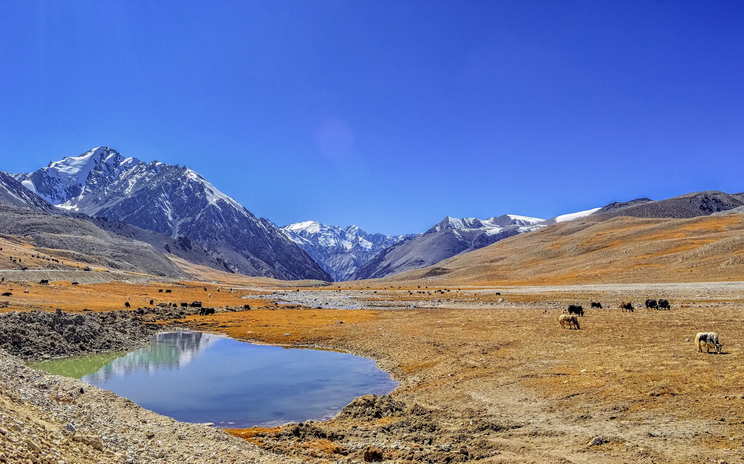
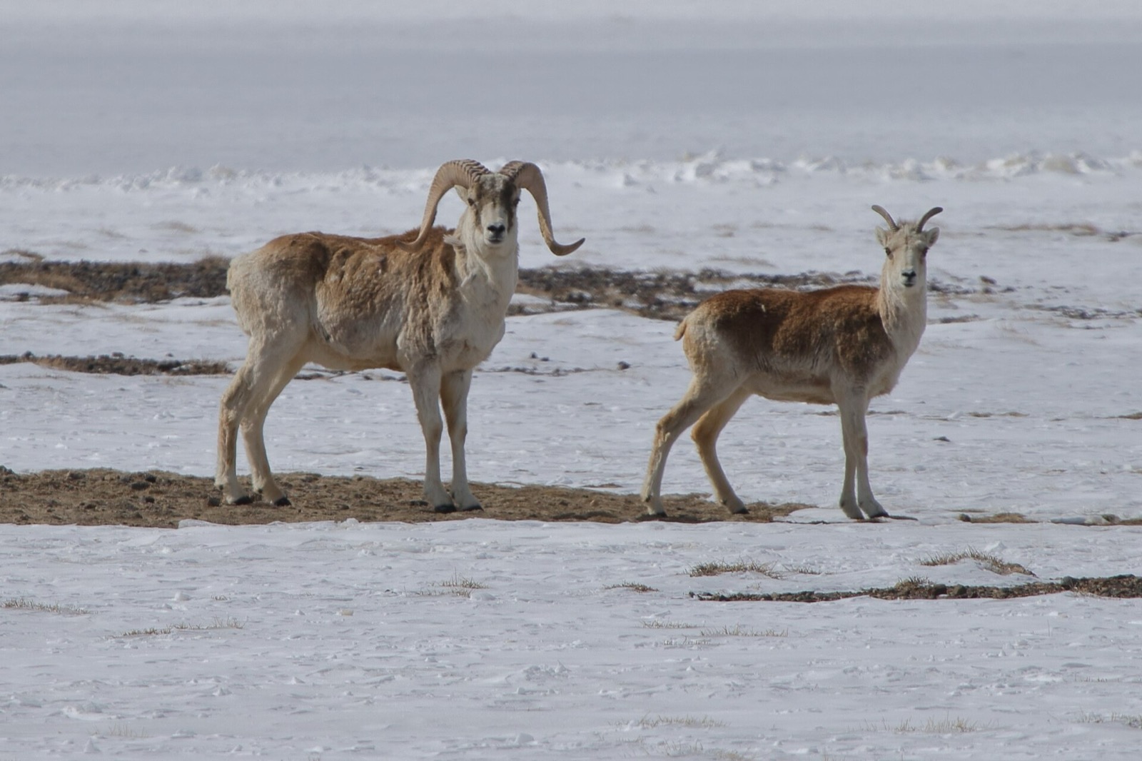
5. Taxkorgan Nature Reserve Legal Pullout Wildlife-Viewing Walk
Snapshot
Itinerary
This candidate is a short legal wildlife-viewing walk from an approved pullout or viewing point in the broader Taxkorgan Nature Reserve / Khunjerab corridor. The route should not leave road-adjacent visitor space, and it should keep a long distance from wildlife, especially Marco Polo sheep / argali habitat.
The nature reserve and its wildlife importance are well documented, but no public hiking route was found. This entry is retained only to flag the essential conservation character of the corridor.
Why it is essential
The Khunjerab side of Tashkurgan is not only a border road; it is part of an internationally important high-Pamir wildlife landscape.
Equipment
- Warm windproof clothing, binoculars, water, sun protection, and camera with a long lens
- Do not approach or feed wildlife
Hazards and notes
- Protected-area core and buffer zones are not public hiking terrain
- Current county restrictions prohibit unauthorised activity in natural-reserve core/buffer areas and border-control zones
- This candidate requires explicit local confirmation
GPX / KML links
| Source | URL | Format | Notes |
|---|---|---|---|
| OpenStreetMap search: Taxkorgan Nature Reserve | openstreetmap.org | Map/search | OSM data is ODbL; protected-area context only |
| ICIMOD record: Taxkorgan Nature Reserve | lib.icimod.org | Protected-area record | Site terms apply; conservation context only |
External links
- ICIMOD — Taxkorgan Nature Reserve record
- Tashkurgan county outdoor-activity restriction notice (2 May 2026)
External links
| Source | URL |
|---|---|
| LoongWander — Hongqilafu National Gate tourist scenic area | loongwander.com |
| Go Western China — Khunjerab Pass overview | gowesternchina.com |
| XinjiangTravel.org — Karakoram Highway overview | xinjiangtravel.org |
| Tashkurgan county outdoor-activity restriction notice (2 May 2026) | finance.sina.com.cn |
| ICIMOD — Taxkorgan Nature Reserve record | lib.icimod.org |