Regional overview
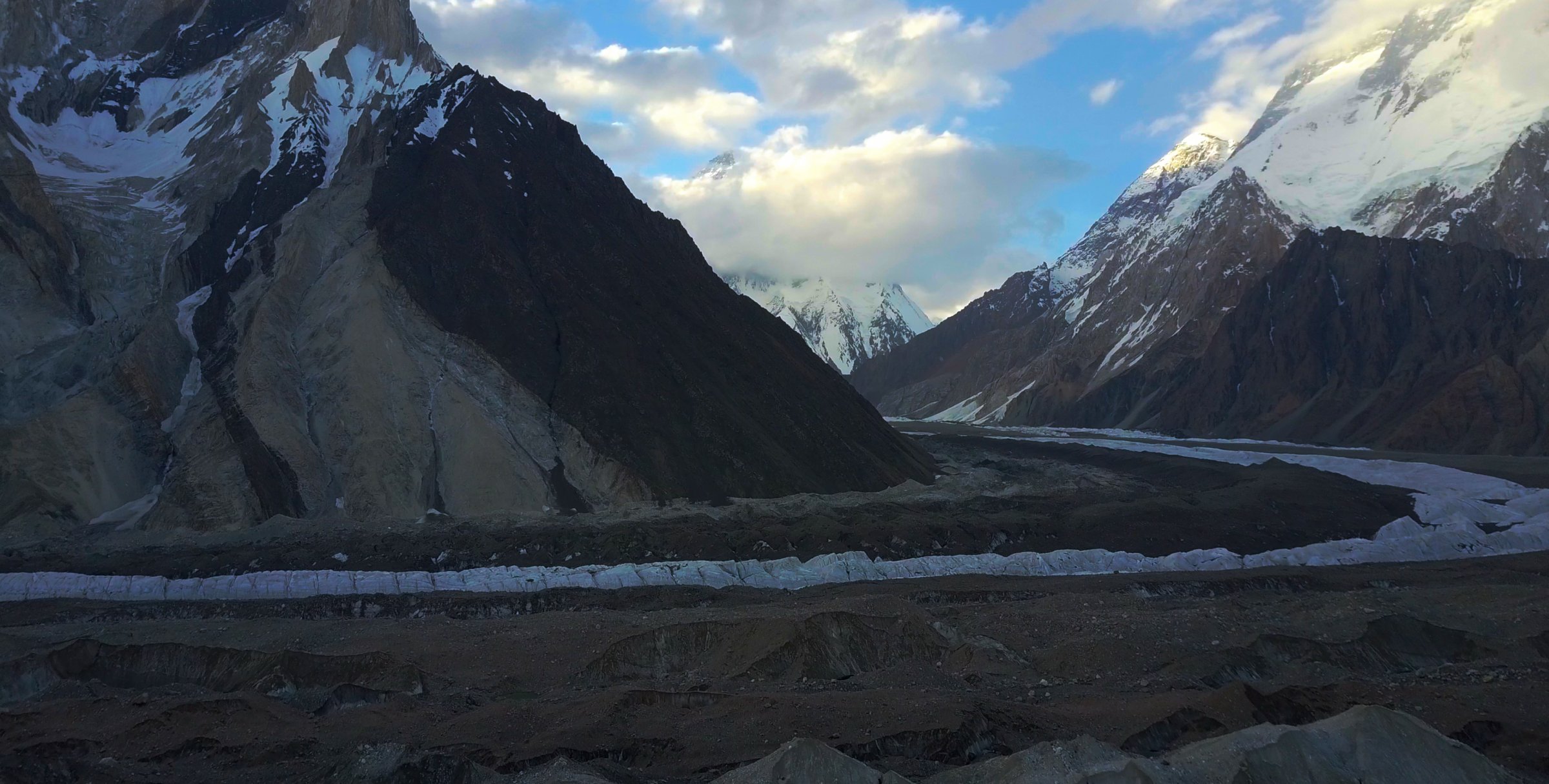
The Baltoro / Central Karakoram is not a normal day-hiking district. It is the high expedition corridor of Central Karakoram National Park, reached from Skardu through Shigar, Askole, and the Braldu valley, then walked on moraine, glacier, and rough campsites towards Paiju, Urdukas, Goro, Concordia, and K2 Base Camp. The landscape is dominated by the Baltoro Glacier, Trango Towers, Masherbrum, Broad Peak, Gasherbrum, and K2.
Because there are no road-accessible day-hike trailheads deep in the Baltoro, the five entries below are best understood as essential single-day stages or camp-based day objectives within a permitted, guided multi-day trek. They are feasible as day walks for acclimatised, fit trekkers already in the corridor; they are not independent casual day trips from Skardu.
Foreign trekkers normally require Central Karakoram National Park / Gilgit-Baltistan trekking permissions, a licensed guide or tour operator, porter and camp logistics, and current security/administrative clearances. Weather, glacier conditions, floods, rockfall, landslides, and altitude can alter stages substantially.
Selection rationale
The selected hikes cover the essential Baltoro progression: the Braldu approach to Paiju, the transition onto the Baltoro Glacier, the Trango-view climb to Urdukas, the central Baltoro glacier day to Goro II, and the camp-based day objective from Concordia towards K2 Base Camp. All five are supported by current AllTrails route records and cross-checked against recent K2 Base Camp trekking guides, but GPX reuse rights remain unresolved.
Summary table
| # | Hike | Country | Route type | Distance | Gain | Max elevation | Difficulty |
|---|---|---|---|---|---|---|---|
| 1 | Jhola to Paiju | Pakistan | Point-to-point expedition stage | 20.4 km | 634 m | 3,391 m | Hard |
| 2 | Paiju to Khoburtse | Pakistan | Point-to-point expedition stage | 13.2-14.7 km depending on source | 603 m | 3,841-3,930 m depending on source | Hard |
| 3 | Khoburtse to Urdukas | Pakistan | Point-to-point expedition stage | 5.8 km in AllTrails; longer itinerary variants possible | 273 m | 4,037 m | Hard |
| 4 | Urdukas to Goro II | Pakistan | Point-to-point expedition stage | 11.1-13 km depending on source | 321 m | 4,246-4,350 m depending on source | Hard |
| 5 | Concordia to K2 Base Camp and return | Pakistan | Out-and-back from expedition camp | Approx. 23.5 km round trip from paired one-way records | Approx. 650 m cumulative gain | 5,010-5,150 m depending on source | Very hard |
1. Jhola to Paiju
Snapshot
Itinerary
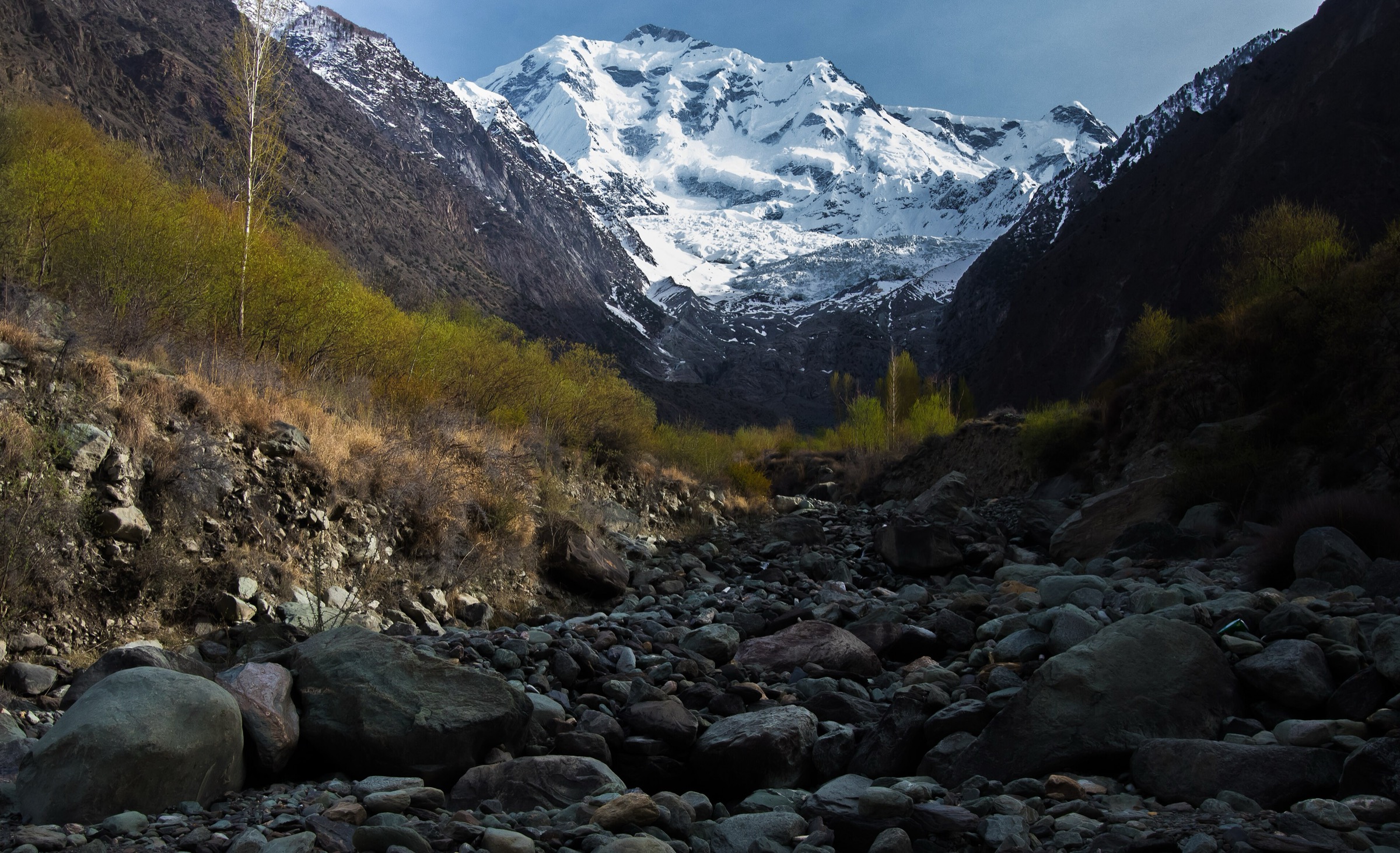
The stage follows the Braldu valley from Jhola towards Paiju, staying below the first full Baltoro Glacier walking days. The line crosses dry, exposed terrain, side streams, and rough river-valley tracks, with Paiju Peak and the lower Baltoro approach becoming more prominent. Paiju camp is a major staging point before the route moves onto moraine and glacier terrain.
The day is long and can be hot lower in the valley. Water is available from streams but must be treated and may be silty.
Why it is essential
Paiju is the key threshold camp of the K2 Base Camp trek: the last major pre-glacier staging point and the first place where the Central Karakoram granite towers begin to dominate the route.
Equipment
- Mountain hiking equipment plus expedition-camp kit carried by the trekking party
- Sturdy boots and trekking poles
- Sun hat, high-UV sunglasses, sunscreen
- Warm layer and waterproof/windproof shell
- Water treatment
- Snacks and headtorch
Hazards and notes
- Heat, dehydration, flash floods, loose side-stream crossings, dust, and altitude gain are the main issues.
- A CKNP permit, licensed guide, and expedition logistics are required for normal foreign-trekker access.
GPX / KML links
| Source | URL | Format / access | Reuse status |
|---|---|---|---|
| AllTrails: K2 Base Camp Trek: Jhola-Paiju | alltrails.com | Route page / app map | AllTrails terms apply; source-map used; do not reuse geometry without separate rights check |
| OpenStreetMap search: Jhola Paiju Baltoro | openstreetmap.org | Map/search | OSM data is ODbL; geometry cross-check only |
External links
- AllTrails — K2 Base Camp Trek: Jhola-Paiju
- The Hiking Life — K2 Base Camp trek guide
- The Adventure Consultancy — K2 Base Camp itinerary
- Visit Gilgit-Baltistan — Central Karakoram National Park context
2. Paiju to Khoburtse
Snapshot
Itinerary
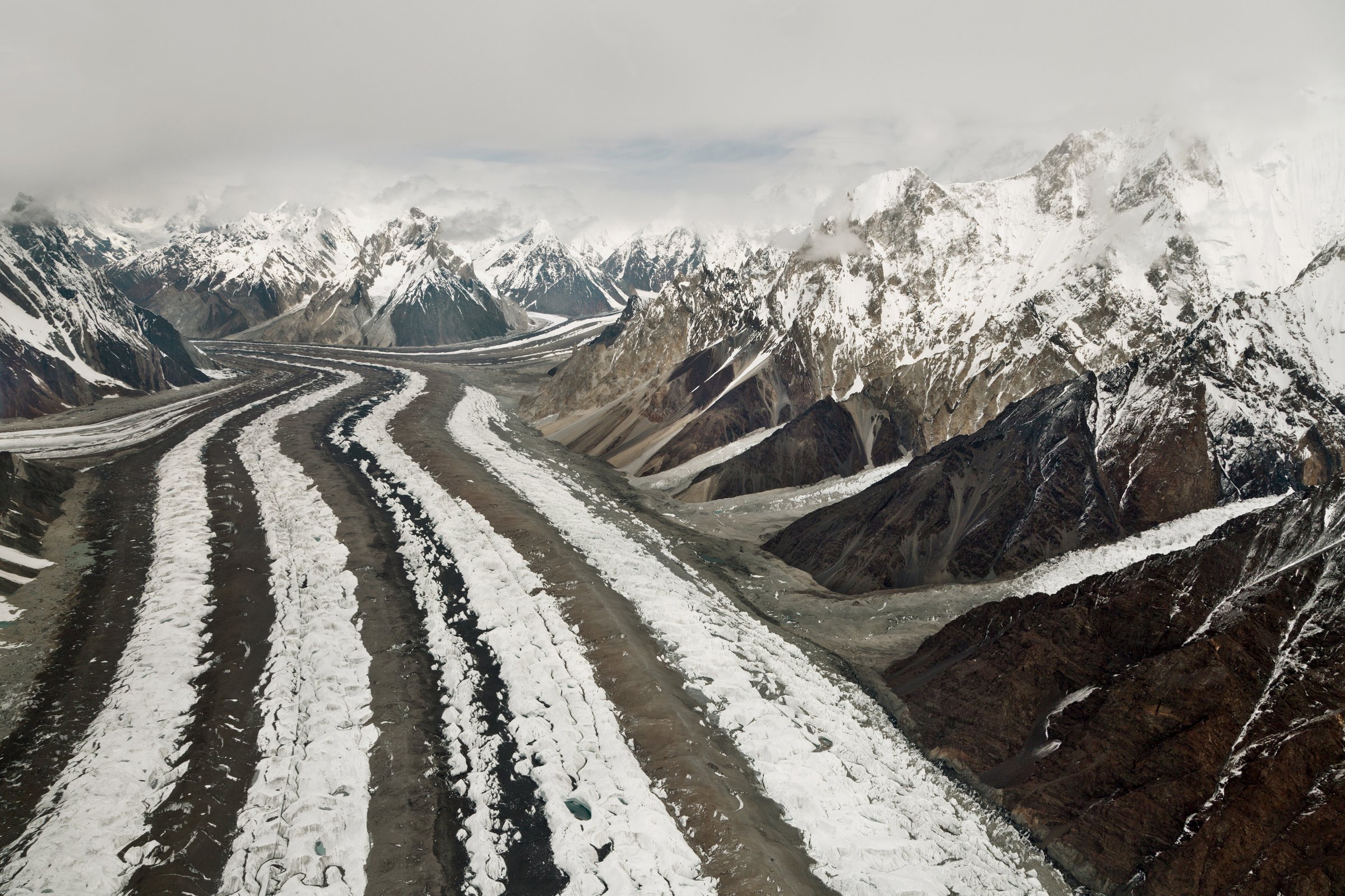
From Paiju, the route leaves the dry approach and climbs towards the Baltoro Glacier. The day introduces glacier-margin walking, rough lateral moraine, meltwater channels, and views towards the Trango Towers and Cathedral group. Khoburtse is a rugged camp on or beside the glacier debris, with no permanent hut facilities.
This stage is often remembered as the first serious glacier-moraine day of the K2 route. The line can change as ice, meltwater, and moraine conditions shift.
Why it is essential
This is the transition from Karakoram valley trekking to the Baltoro itself. The scale of the glacier and granite towers becomes immediate, making it one of the defining single-day stages of the Central Karakoram.
Equipment
- Sturdy boots with good edging
- Trekking poles
- Warm and waterproof layers
- Sun protection
- Water treatment
- Gloves for cold morning starts
- Headtorch
- Microspikes are not normally standard for summer trekking, but traction needs should be checked with the guide team
Hazards and notes
- Unstable moraine, stream crossings, rockfall from side slopes, intense sun, and cold katabatic winds are the main hazards.
- Stay with the guide-approved line; glacier-margin shortcuts can be dangerous.
GPX / KML links
| Source | URL | Format / access | Reuse status |
|---|---|---|---|
| AllTrails: K2 Base Camp Trek: Paiju-Khoburtse | alltrails.com | Route page / app map | AllTrails terms apply; source-map used; do not reuse geometry without separate rights check |
| OpenStreetMap search: Paiju Khoburtse Baltoro | openstreetmap.org | Map/search | OSM data is ODbL; geometry cross-check only |
External links
- AllTrails — K2 Base Camp Trek: Paiju-Khoburtse
- The Hiking Life — K2 Base Camp trek guide
- Explore Share — K2 Base Camp stages
3. Khoburtse to Urdukas
Snapshot
Itinerary
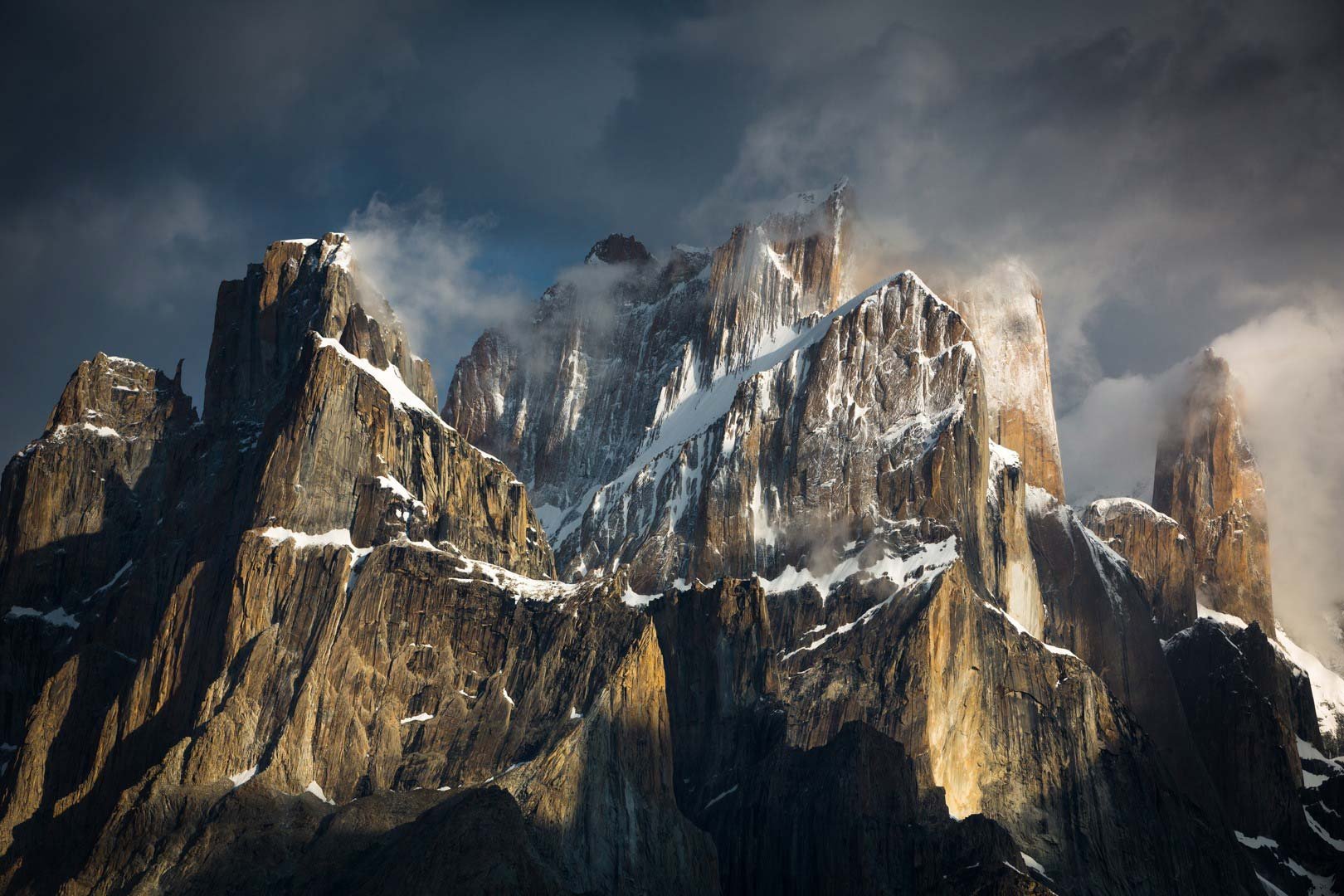
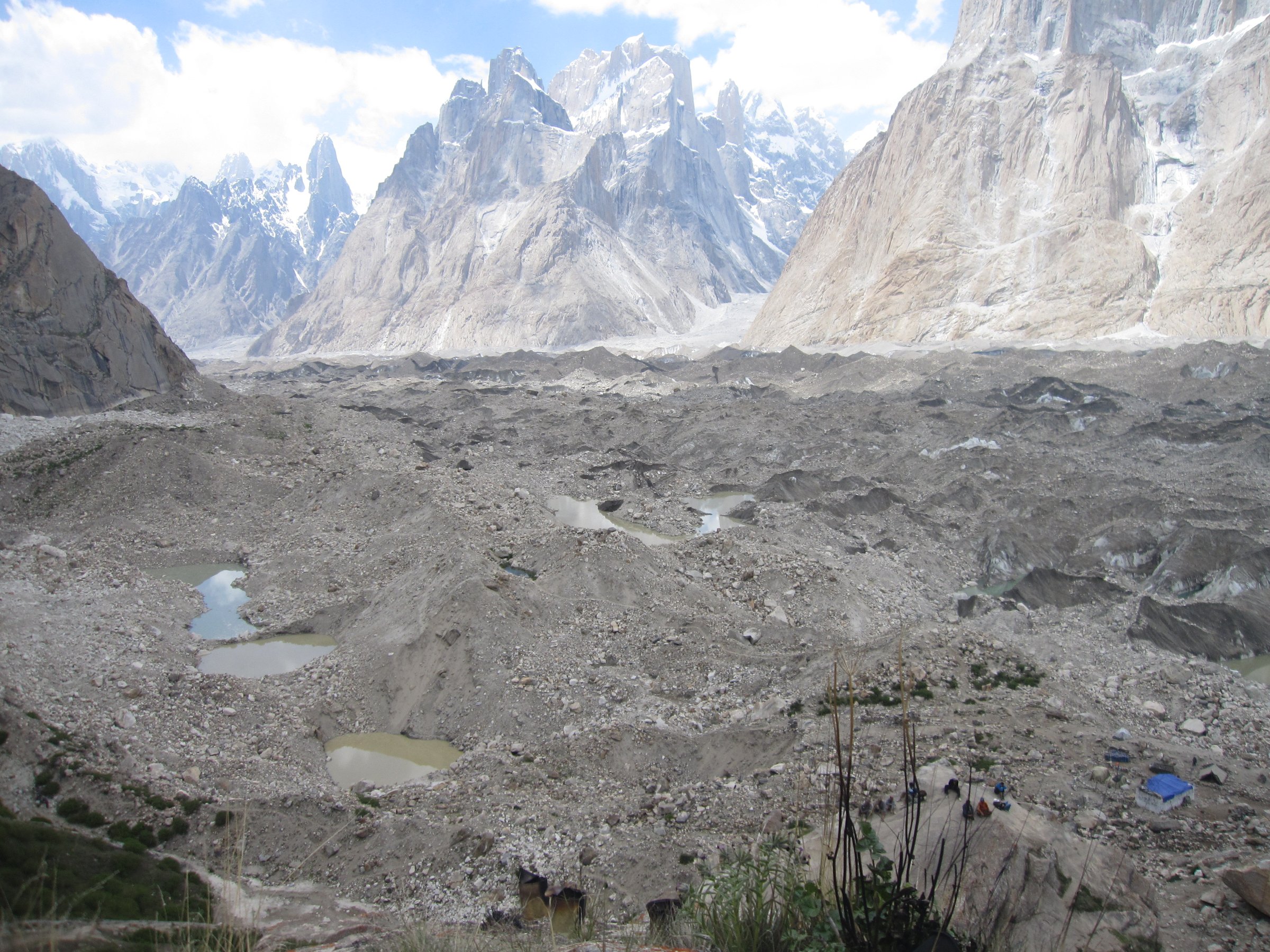
The route continues along rough Baltoro moraine and climbs towards Urdukas, a classic campsite set on terraces above the glacier. The stage is shorter than the approach days, but the walking remains slow and uneven. Views towards the Trango Towers, Uli Biaho, Cathedral group, and the broad Baltoro trough are the major features.
Urdukas is commonly used as an acclimatisation and rest point because it sits above the glacier with relatively strong views and water access.
Why it is essential
Urdukas is one of the iconic Baltoro campsites and the best-known balcony over the lower glacier. This stage gives the catalogue a shorter but highly scenic glacier-margin day.
Equipment
- Mountain hiking equipment: boots and trekking poles
- Layered clothing and waterproof shell
- Sun and UV protection
- Water treatment
- Snacks and headtorch
- Gloves are useful on cold moraine mornings
Hazards and notes
- Moraine instability, rockfall, cold wind, and altitude symptoms are the main concerns.
- The short distance should not lead to rushing; acclimatisation pacing matters.
GPX / KML links
| Source | URL | Format / access | Reuse status |
|---|---|---|---|
| AllTrails: K2 Base Camp Trek: Khoburtse-Urdukas | alltrails.com | Route page / app map | AllTrails terms apply; source-map used; do not reuse geometry without separate rights check |
| OpenStreetMap search: Urdukas Baltoro | openstreetmap.org | Map/search | OSM data is ODbL; geometry cross-check only |
External links
4. Urdukas to Goro II
Snapshot
Itinerary
From Urdukas the route drops fully onto the upper Baltoro Glacier environment and continues over ice, moraine, and rubble towards Goro II. The valley widens and the walking becomes more austere, with long views to Masherbrum, Gasherbrum IV, Broad Peak, and the surrounding snow peaks when weather is clear.
Goro II is a high, exposed glacier camp. The day is sensitive to wind, whiteout, and meltwater channels, and camp placement can vary.
Why it is essential
This is the first full central-Baltoro stage, where the route feels entirely glacial and high-alpine. It is essential because it leads from the relative shelter of Urdukas into the heart of the Baltoro basin.
Equipment
- High-altitude mountain hiking equipment: boots with strong soles and trekking poles
- Warm insulation and waterproof/windproof shell
- Hat/gloves
- Sun and glacier-glare protection
- Water treatment
- Food and headtorch
Hazards and notes
- Altitude, whiteout, cold wind, uneven moraine, hidden ice, and meltwater are the main issues.
- Guides may alter the exact line daily.
- Camp water must be treated and may be very silty.
GPX / KML links
| Source | URL | Format / access | Reuse status |
|---|---|---|---|
| AllTrails: K2 Base Camp Trek: Urdukas-Goro II | alltrails.com | Route page / app map | AllTrails terms apply; source-map used; do not reuse geometry without separate rights check |
| OpenStreetMap search: Goro II Baltoro | openstreetmap.org | Map/search | OSM data is ODbL; geometry cross-check only |
External links
- AllTrails — K2 Base Camp Trek: Urdukas-Goro II
- The Hiking Life — K2 Base Camp trek guide
- Adventure Consultancy — K2 Base Camp itinerary
5. Concordia to K2 Base Camp and return
Snapshot
Itinerary
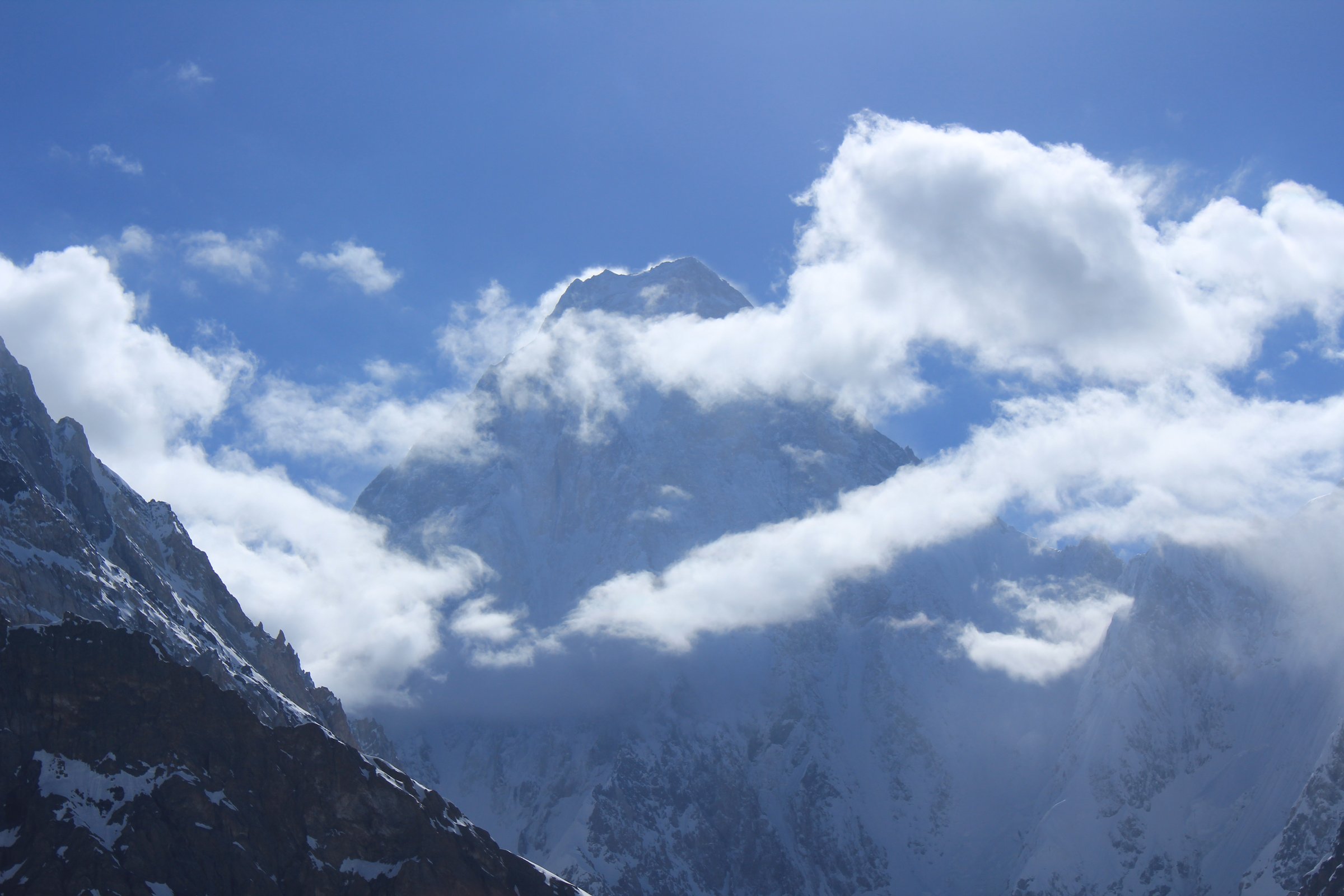
From Concordia, the route follows the Godwin-Austen Glacier towards the base of K2. The walking is on high glacial moraine and ice-debris terrain, with Broad Peak, K2, and the surrounding peaks dominating the route. Many parties treat K2 Base Camp as a demanding out-and-back day from Concordia rather than moving camp, depending on conditions and logistics.
The exact base-camp position changes with season, expedition layout, and glacier conditions. The route should not be attempted in poor visibility or by poorly acclimatised trekkers.
Why it is essential
This is the iconic objective of the Baltoro: the walk from Concordia towards K2, the world’s second-highest mountain. It is included because it is the central day objective of the region, even though it depends completely on a multi-day approach.
Equipment
- Full high-altitude mountain hiking equipment: stiff-soled boots and trekking poles
- Warm layers and waterproof/windproof shell
- Hat/gloves
- Glacier-level sun protection and sunglasses
- Water treatment
- Food and emergency layer
- Headtorch
- Crampons or microspikes are not standard for all summer trekking parties but should be assessed by the guide team
Hazards and notes
- Altitude sickness, crevasse-adjacent glacier terrain, unstable moraine, whiteout, cold wind, rock and icefall zones, and long return distance are serious hazards.
- The day should be attempted only with guide approval, stable weather, and adequate acclimatisation.
GPX / KML links
| Source | URL | Format / access | Reuse status |
|---|---|---|---|
| AllTrails: K2 Base Camp Trek: Concordia-K2 Base Camp | alltrails.com | Route page / app map | AllTrails terms apply; source-map used; do not reuse geometry without separate rights check |
| AllTrails: K2 Base Camp Trek: K2 Base Camp-Concordia | alltrails.com | Route page / app map | AllTrails terms apply; reverse-route cross-check only |
| OpenStreetMap search: Concordia K2 Base Camp | openstreetmap.org | Map/search | OSM data is ODbL; geometry cross-check only |
External links
- AllTrails — K2 Base Camp Trek: Concordia-K2 Base Camp
- AllTrails — K2 Base Camp Trek: K2 Base Camp-Concordia
- The Hiking Life — K2 Base Camp trek guide
- Adventure Consultancy — K2 Base Camp itinerary
External links
| Source | URL |
|---|---|
| The Hiking Life — K2 Base Camp trek guide | thehikinglife.com |
| Adventure Consultancy — K2 Base Camp itinerary | adventureconsultancy.com |
| Explore Share — K2 Base Camp stages | explore-share.com |
| Visit Gilgit-Baltistan — Central Karakoram National Park context | visitgilgitbaltistan.gov.pk |
| Pakistan Tourism Development Corporation publications | tourism.gov.pk |
| AllTrails — K2 Base Camp Trek: Jhola-Paiju | alltrails.com |
| AllTrails — K2 Base Camp Trek: Paiju-Khoburtse | alltrails.com |
| AllTrails — K2 Base Camp Trek: Khoburtse-Urdukas | alltrails.com |
| AllTrails — K2 Base Camp Trek: Urdukas-Goro II | alltrails.com |
| AllTrails — K2 Base Camp Trek: Concordia-K2 Base Camp | alltrails.com |
| AllTrails — K2 Base Camp Trek: K2 Base Camp-Concordia | alltrails.com |