Regional overview
The Chitral Hindu Kush is a dry, steep, culturally complex mountain region at the north-west edge of Pakistan. Chitral town sits below Chitral Gol National Park and the skyline of Tirich Mir, while Upper Chitral opens towards Booni, Mastuj, the Tirich and Torkhow valleys, and the high road to Shandur. The lower valleys combine walnut, apricot and mulberry villages with pine and deodar slopes; the upper valleys become broader, colder, and more exposed.
Walking is less formalised than in the Alps or Himalaya trekking centres. Many “day hikes” are jeep-assisted ridge, valley, pass, or village walks rather than signed park trails with official GPX files. Local guides are strongly recommended for Chitral Gol, Kalash inter-valley paths, Tirich Valley, and any route leaving inhabited areas.
The normal hiking season is late May to October, with July to September giving the most reliable access to high roads and passes. Spring is important for Qaqlasht and Chitral festivals, while winter and early spring bring snow, closed high roads, and serious cold at Shandur, Zani Pass, and upper Chitral trailheads.
Selection rationale
These five hikes cover the main walking characters of Chitral: the protected Chitral Gol / Birmoghlasht ridge above Chitral town, a Kalash valley irrigation-channel walk, an inter-valley Kalash pass, the Tirich Mir viewpoint descent from Zani Pass, and the Shandur high-plateau lake walk. Route statistics are much weaker than for more heavily mapped mountain regions; the entries therefore emphasise verified landmarks and access while marking GPX-grade data as unresolved.
Summary table
| # | Hike | Country | Route type | Distance | Gain | Max elevation | Difficulty |
|---|---|---|---|---|---|---|---|
| 1 | Birmoghlasht and Chitral Gol viewpoint walk | Pakistan | Jeep-assisted out-and-back / short loop | Approx. 3–6 km from roadhead; 15 km / 1,340 m if walked from Chitral town by road | Approx. 100–250 m from roadhead; 1,340 m by road from Chitral | Approx. 2,940 m | Moderate; hard if walked from town |
| 2 | Bumburet Kalash irrigation-channel walk | Pakistan | Out-and-back / village traverse | Approx. 5–8 km | Minor–moderate | Approx. 1,600–1,900 m | Easy–moderate |
| 3 | Birir Pass Kalash valley traverse | Pakistan | Point-to-point traverse | Approx. 10–16 km | Approx. 900–1,400 m depending start | Approx. 3,000 m | Hard |
| 4 | Zani Pass to Shagrom Tirich valley view walk | Pakistan | High-pass descent / point-to-point | Approx. 8–12 km | Mostly descent; gain unresolved | 3,840 m at Zani Pass | Moderate–hard |
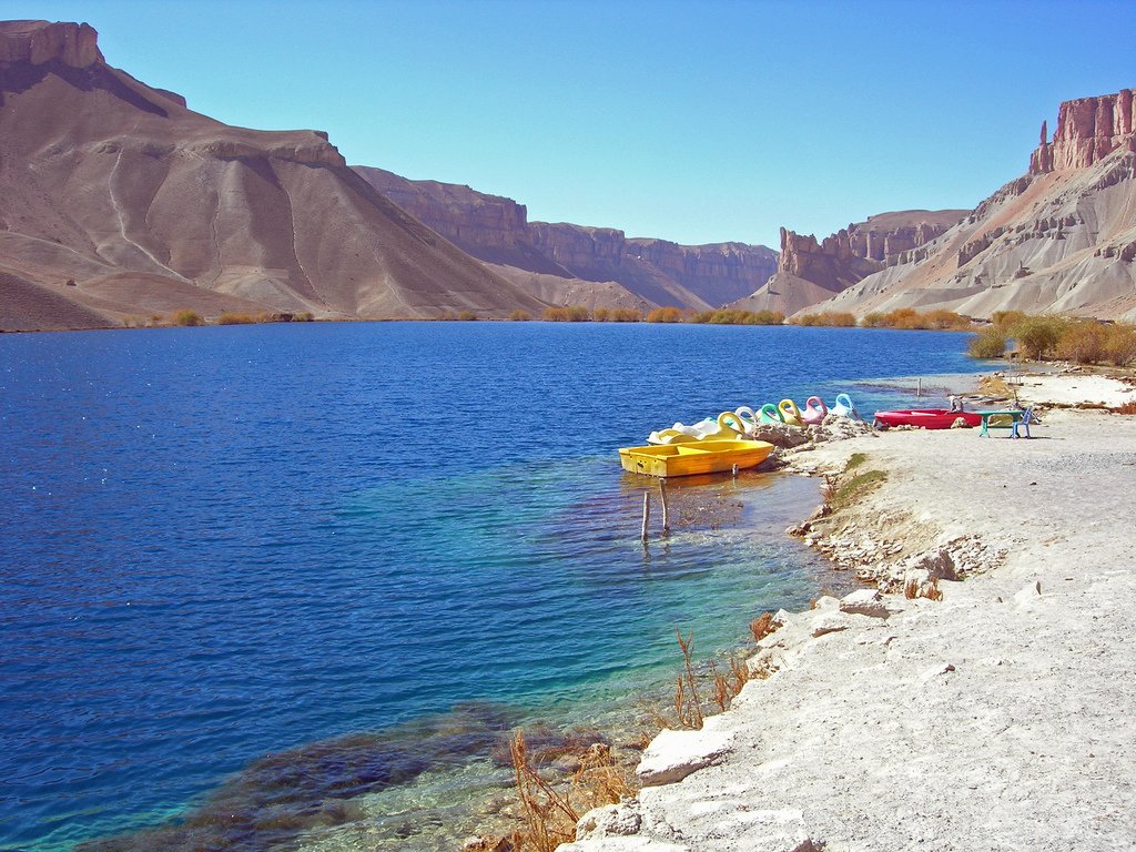
| 5 | Shandur Lake and polo-ground circuit | Pakistan | Short high-plateau loop | Approx. 3–6 km | Minor | Approx. 3,738 m | Easy–moderate at altitude |
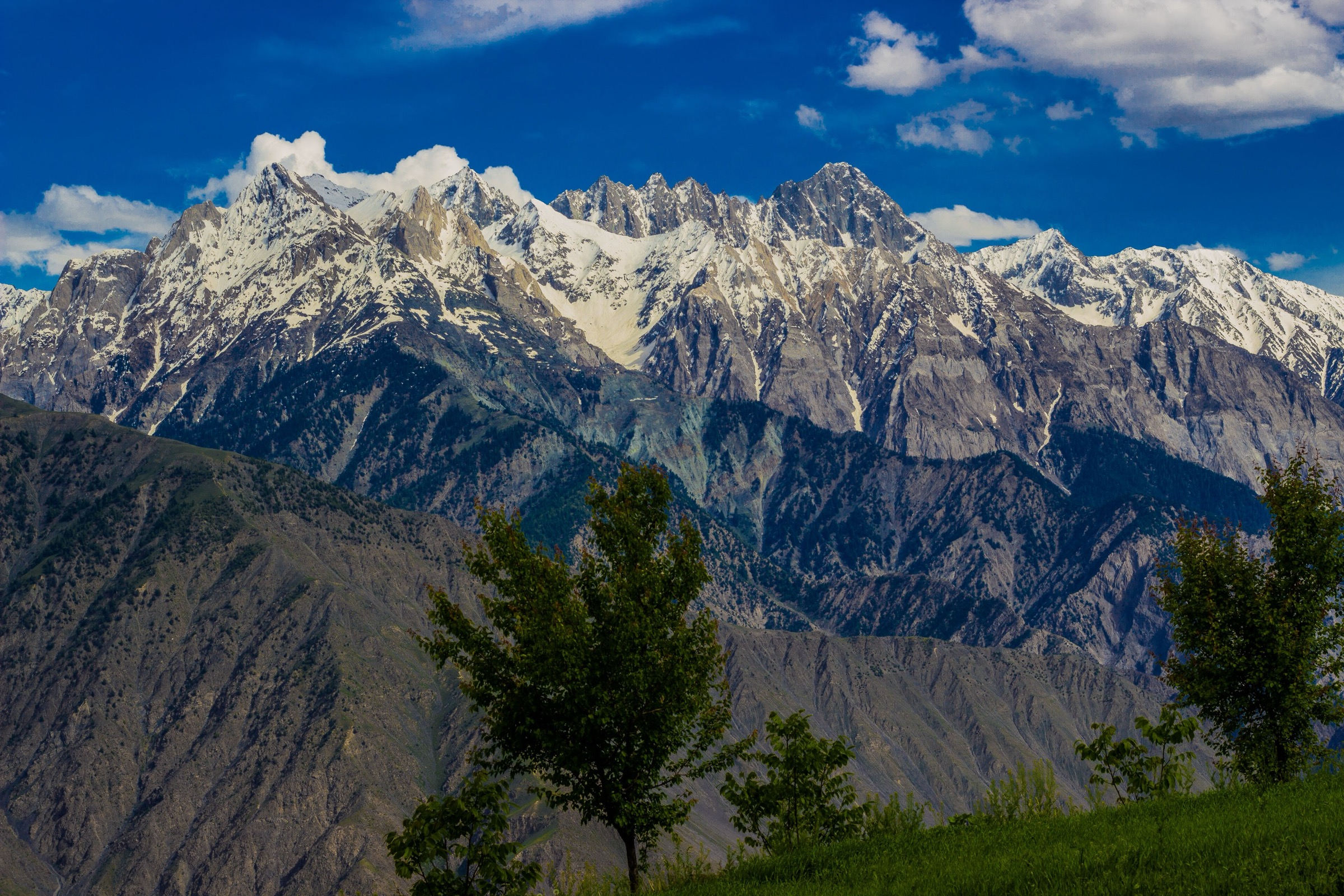
1. Birmoghlasht and Chitral Gol viewpoint walk
Snapshot
Itinerary
From Chitral town, the rough access road climbs steeply towards Birmoghlasht, the former summer residence area close to the core of Chitral Gol National Park. Most walkers shorten the approach by jeep and begin the day near the fort or wildlife hut area. From there, local paths and tracks lead to viewpoints over Chitral town, the Chitral River, the dry Hindu Kush side valleys, and, in clear conditions, the Tirich Mir skyline.
The walking route is not published as a single official trail. The safest catalogue treatment is a jeep-assisted viewpoint walk based around Birmoghlasht rather than a claimed fixed GPX line. Walkers wanting to continue deeper towards Gokhshal or Chimersun Pass should treat that as guided backcountry trekking.
Why it is essential
This is the most accessible high-level Chitral Gol walk and the natural introduction to the Chitral Hindu Kush: national-park habitat, markhor country, Tirich Mir views, and the historical Birmoghlasht summer-fort landscape above Chitral town.
Equipment
- Mountain hiking equipment: sturdy boots, sun protection, windproof layer, warm layer
- Water, food, map/GPS, and trekking poles
- Binoculars are useful for wildlife viewing
Hazards and notes
- The access road is narrow, steep, unpaved, and more serious after rain or snow.
- Chitral Gol is protected habitat; stay on established tracks, avoid disturbing wildlife, and confirm park entry rules locally.
- Snow may block high access outside summer.
- A local guide is recommended for any route beyond the Birmoghlasht viewpoint area.
GPX / KML links
| Source | URL | Format / access | Reuse status |
|---|---|---|---|
| OpenStreetMap search: Birmoghlasht / Chitral Gol | openstreetmap.org | Map/search | OSM data is ODbL; geometry cross-check only |
| Chitral Travel: Chitral Gol over Chimersun Pass itinerary | chitraltravel.com | Itinerary source | Site terms apply; access and landmark verification only |
| Dangerous Roads: Chitral Gol access road | dangerousroads.org | Road profile | Site terms apply; road distance/elevation context only |
External links
- Pakistan Tourism Development Corporation — Chitral travel guide (PDF)
- KP Tourism / TCKP
- Chitral Travel — Chitral Gol over Chimersun Pass
- Dangerous Roads — Chitral Gol road profile
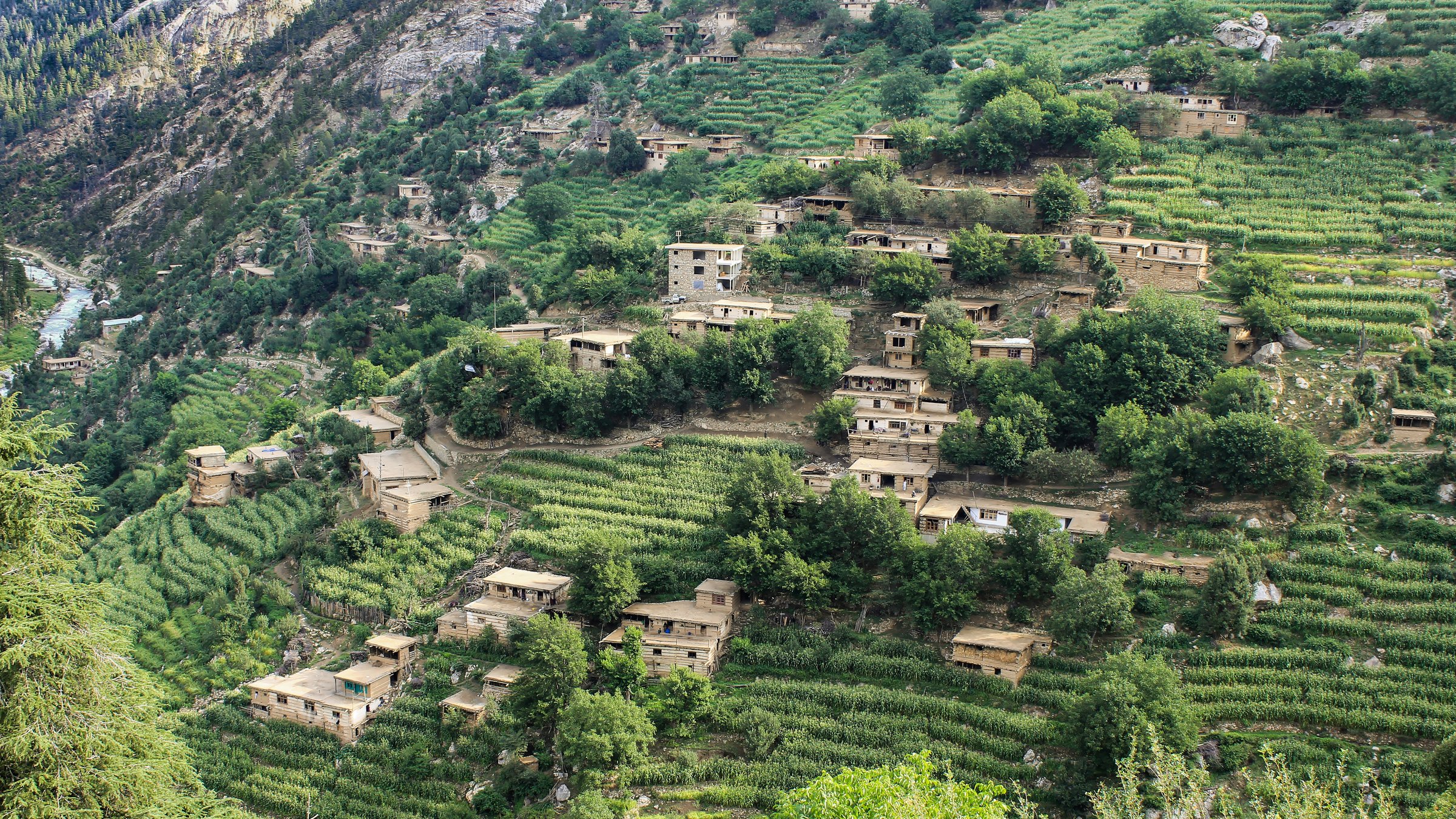
2. Bumburet Kalash irrigation-channel walk
Snapshot
Itinerary
The walk follows the agricultural side of Bumburet rather than a high pass. From the village road, local footpaths and irrigation-channel tracks pass orchards, terraced fields, wooden houses, shrines, side streams, and open views across the valley. The exact channel route varies by village access, water maintenance, and local restrictions; permission and guidance should be sought before entering fields or shrine areas.
This is a cultural landscape walk rather than a wilderness hike. It is best treated as a slow half-day route with a local guide who can identify public paths, explain access etiquette, and avoid entering private or sacred spaces.
Why it is essential
Bumburet is the largest and most visited of the Kalash valleys. A channel-and-village walk gives the catalogue a culturally important Chitral day hike, balancing the national-park and high-pass routes with the inhabited landscape that makes Chitral distinctive.
Equipment
- Standard hiking equipment: walking shoes, sun protection, water, light rain layer
- Modest clothing appropriate for village settings
- Carry cash for local guide services or community fees if requested
Hazards and notes
- Paths may be narrow above channels and terraces.
- Do not photograph people, ritual spaces, or domestic courtyards without permission.
- Festival periods bring crowds and traffic.
- Access to the Kalash valleys can require local registration or permits; current KP tourism and district rules should be checked before travel.
GPX / KML links
| Source | URL | Format / access | Reuse status |
|---|---|---|---|
| OpenStreetMap search: Bumburet Kalash Valley | openstreetmap.org | Map/search | OSM data is ODbL; geometry cross-check only |
| PTDC / KP Kalash brochure | tourism.gov.pk | PDF brochure | Reuse terms not stated; timing and access context only |
External links
- PTDC / KP — Kalash brochure (PDF)
- Visit Chitral Valley — Kalasha Valleys
- Pakistan Tourism Development Corporation — Chitral travel guide (PDF)
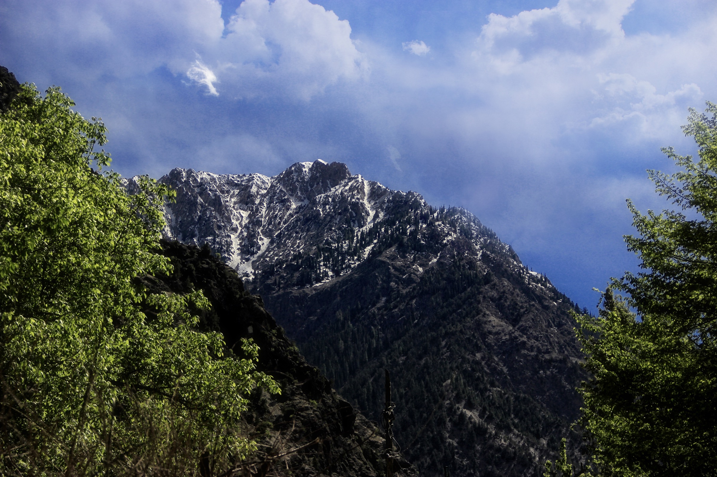
3. Birir Pass Kalash valley traverse
Snapshot
Itinerary
The classic inter-valley idea is to link the Kalash valleys by climbing from the Birir side to the pass between Birir and Bumburet, then descending into Bumburet or continuing towards Rumbur as part of a longer guided route. Chitral Travel publishes a Birir-to-Bumburet/Rumbur trekking itinerary, but the online source does not provide GPX-grade statistics.
For catalogue use, this route should be treated as a guided pass traverse rather than a casual village walk. The route crosses pastoral ground and side valleys above settled areas, with no confirmed waymarking or official trail file found in this pass.
Why it is essential
This is the most natural day-scale pass objective in the Kalash area and gives the Chitral entry a true inter-valley mountain traverse. It links the cultural valleys with the surrounding Hindu Kush terrain rather than staying only on valley roads.
Equipment
- Mountain hiking equipment: sturdy boots, trekking poles, sun protection
- Windproof/waterproof layer, warm layer
- Food, water, map/GPS, and headtorch
- A local guide is strongly recommended
Hazards and notes
- Navigation, heat, loose slopes, dogs near settlements or herds, and uncertain access are the main issues.
- Snow may remain on the pass in early season.
- Cultural sensitivity is essential in all Kalash villages.
- Do not attempt the traverse without current local advice.
GPX / KML links
| Source | URL | Format / access | Reuse status |
|---|---|---|---|
| Chitral Travel: Birir Trek to Bumburet / Rumbur | chitraltravel.com | Itinerary page | Site terms apply; route concept only, statistics unresolved |
| OpenStreetMap search: Birir Pass Bumburet Rumbur | openstreetmap.org | Map/search | OSM data is ODbL; geometry cross-check only |
External links
- Chitral Travel — Birir Trek to Bumburet over Birir Pass to Rumbur
- PTDC / KP — Kalash brochure (PDF)
- Visit Chitral Valley — Kalasha Valleys
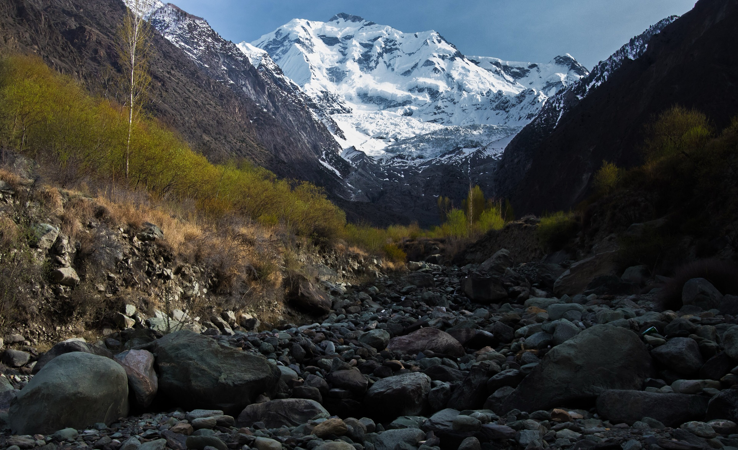
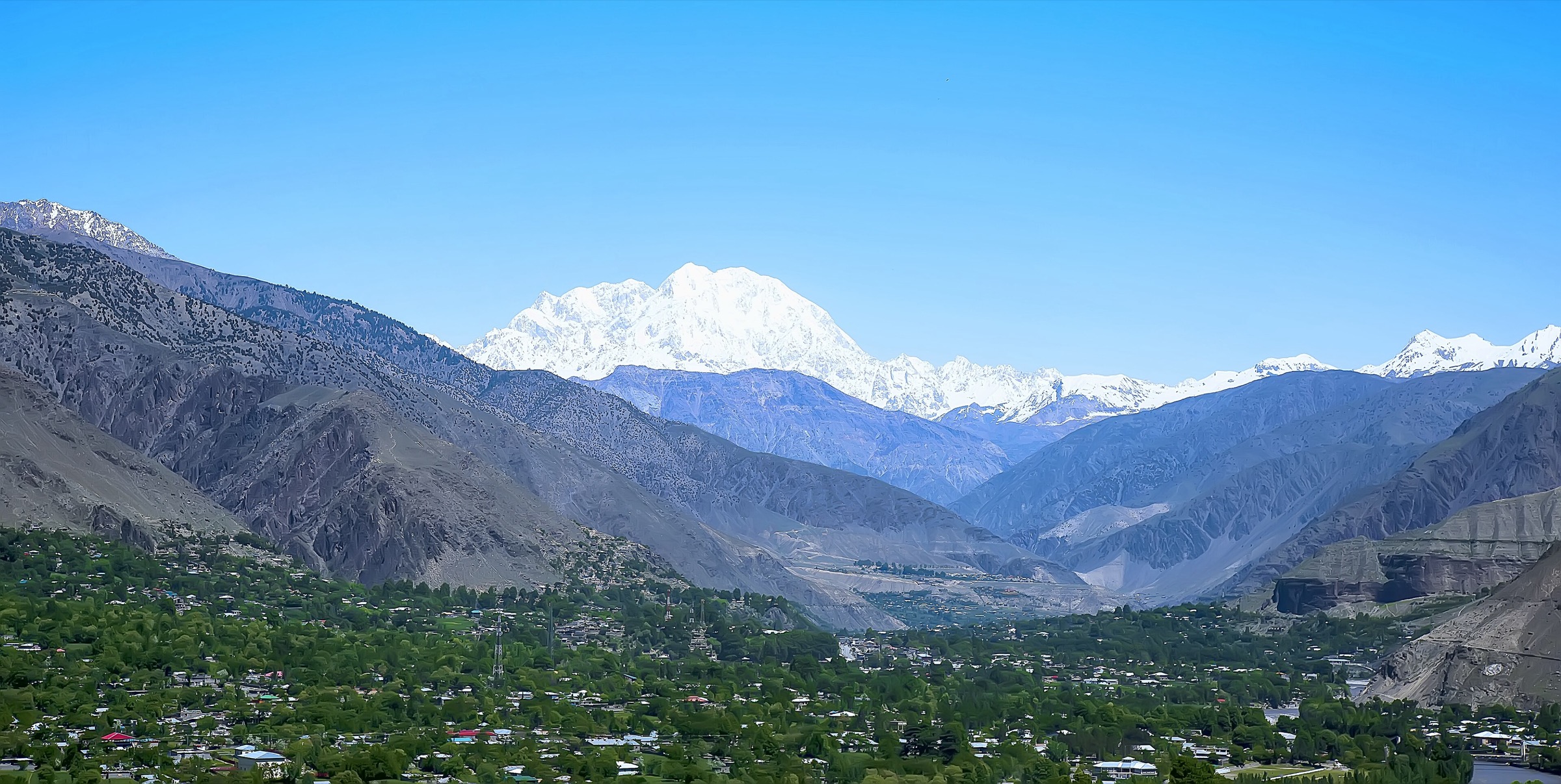
4. Zani Pass to Shagrom Tirich valley view walk
Snapshot
Itinerary
The Zani Pass route uses road access to reach a high crest with views across the Hindu Kush and Hindu Raj ranges, then descends into the Tirich Valley towards Shagrom. Visit Chitral Valley identifies Zani Pass at 3,840 m and notes that the Tirich Mir base-camp approach continues through the Tirich Valley past summer pastures and the lower Tirich Glacier area.
As a day-hike catalogue entry, the safe selection is the pass-to-valley viewpoint descent, not the multi-day Tirich Mir base-camp trek. The exact descent line, condition of jeep access, and local guide requirements need confirmation before publication-grade use.
Why it is essential
Tirich Mir is the defining mountain of Chitral and the highest peak of the Hindu Kush. Zani Pass is one of the clearest road-accessed walking viewpoints for the Tirich Valley and the surrounding high peaks without committing to glacier or base-camp trekking.
Equipment
- Mountain hiking equipment: sturdy boots, warm layer, windproof/waterproof layer
- Sun protection, gloves/hat outside midsummer
- Water, food, GPS/map backup, and headtorch
- Trekking poles are recommended for the descent
Hazards and notes
- Altitude, road access, snow, and navigation are the main issues.
- Weather can change quickly at the pass.
- Do not continue towards the lower Tirich Glacier or base camp without guide support, permits where required, and multi-day logistics.
GPX / KML links
| Source | URL | Format / access | Reuse status |
|---|---|---|---|
| OpenStreetMap search: Zani Pass Shagrom Tirich Valley | openstreetmap.org | Map/search | OSM data is ODbL; geometry cross-check only |
| Visit Chitral Valley: Tirich Valley | visitchitralvalley.com | Destination / route context | Site terms apply; landmark and access verification only |
External links
- Visit Chitral Valley — Tirich Valley
- Traveler Trails — Tirich Mir / Zani Pass
- Pakistan Tourism Development Corporation — Chitral travel guide (PDF)
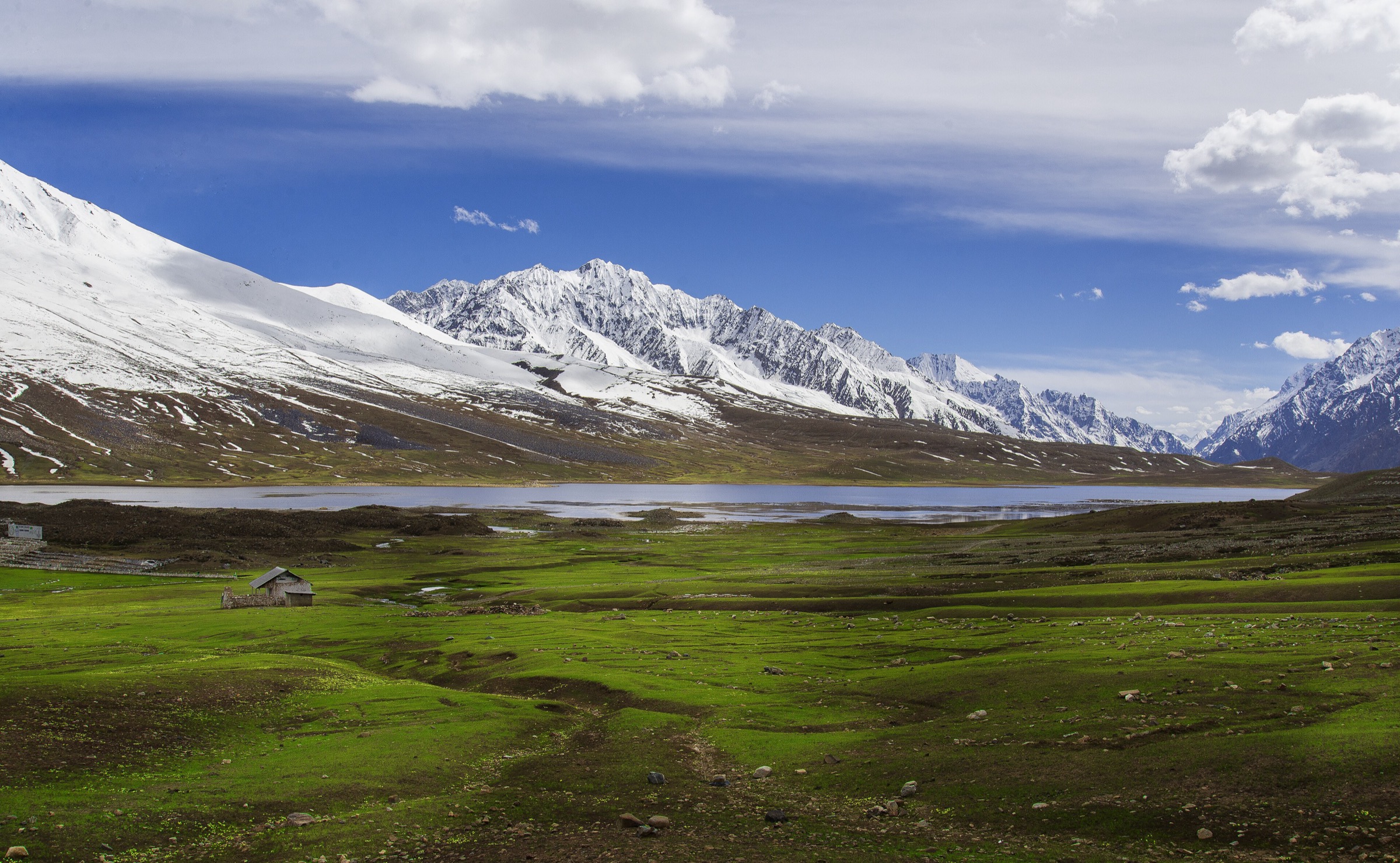
5. Shandur Lake and polo-ground circuit
Snapshot
Itinerary
From the Shandur roadhead, walk around the polo-ground area and along the shore of Shandur Lake, keeping to firm ground and avoiding wet meadow edges. The objective is a short acclimatised high-plateau walk rather than a long traverse. The route gives views over the lake, the polo ground, rolling summer pasture, and the surrounding high ridges between Chitral and Gilgit-Baltistan.
The exact loop depends on wet ground, local event fencing, and seasonal road access. During the Shandur Polo Festival, walking may be restricted by crowds, temporary camps, and event controls.
Why it is essential
Shandur is one of Chitral’s most famous high places: a 3,700 m pass, lake, and polo-ground landscape with major cultural importance. It adds a high plateau and festival landscape to the Chitral Hindu Kush selection.
Equipment
- Standard hiking equipment with high-altitude additions: warm layer, windproof shell, sun hat, sunglasses
- Water, snacks, and sturdy shoes
- Carry extra warm clothing even in summer
Hazards and notes
- Altitude, cold wind, lightning, snow patches, boggy lake margins, and road remoteness are the main hazards.
- The pass road can close outside summer.
- Festival dates, road conditions, and camping restrictions should be checked with official local sources before travel.
GPX / KML links
| Source | URL | Format / access | Reuse status |
|---|---|---|---|
| OpenStreetMap search: Shandur Lake | openstreetmap.org | Map/search | OSM data is ODbL; geometry cross-check only |
| Shandur.com overview | shandur.com | Destination overview | Site terms apply; elevation/access context only |
| Pakistan Tourism Portal: Shandur Pass | paktourismportal.com | Destination overview | Site terms apply; landmark and access context only |
External links
- Shandur.com overview
- Pakistan Tourism Portal — Shandur Pass
- Pakistan Tourism Development Corporation — Chitral travel guide (PDF)
Missing data and follow-up
- No official GPX/KML files were found for any selected Chitral hike.
- Route statistics for the Kalash traverse, Zani Pass descent, Birmoghlasht local walk, and Shandur circuit need GPS survey or local guide confirmation.
- Current Chitral Gol National Park entry rules, Kalash valley visitor permits, and Shandur event restrictions need direct local confirmation before publication.
- Several route descriptions rely on local operator pages and official tourism brochures rather than mapped trail databases.
External links
| Source | URL |
|---|---|
| Pakistan Tourism Development Corporation — Chitral travel guide (PDF) | tourism.gov.pk |
| PTDC / KP — Kalash brochure (PDF) | tourism.gov.pk |
| KP Tourism / TCKP | kptourism.com |
| KP Tourism / TCKP (legacy) | old.kptourism.com |
| Visit Chitral Valley | visitchitralvalley.com |
| Chitral Travel itineraries | chitraltravel.com |
| Pakistan Tourism Portal | paktourismportal.com |
| Dangerous Roads — Chitral Gol access road | dangerousroads.org |