Regional overview
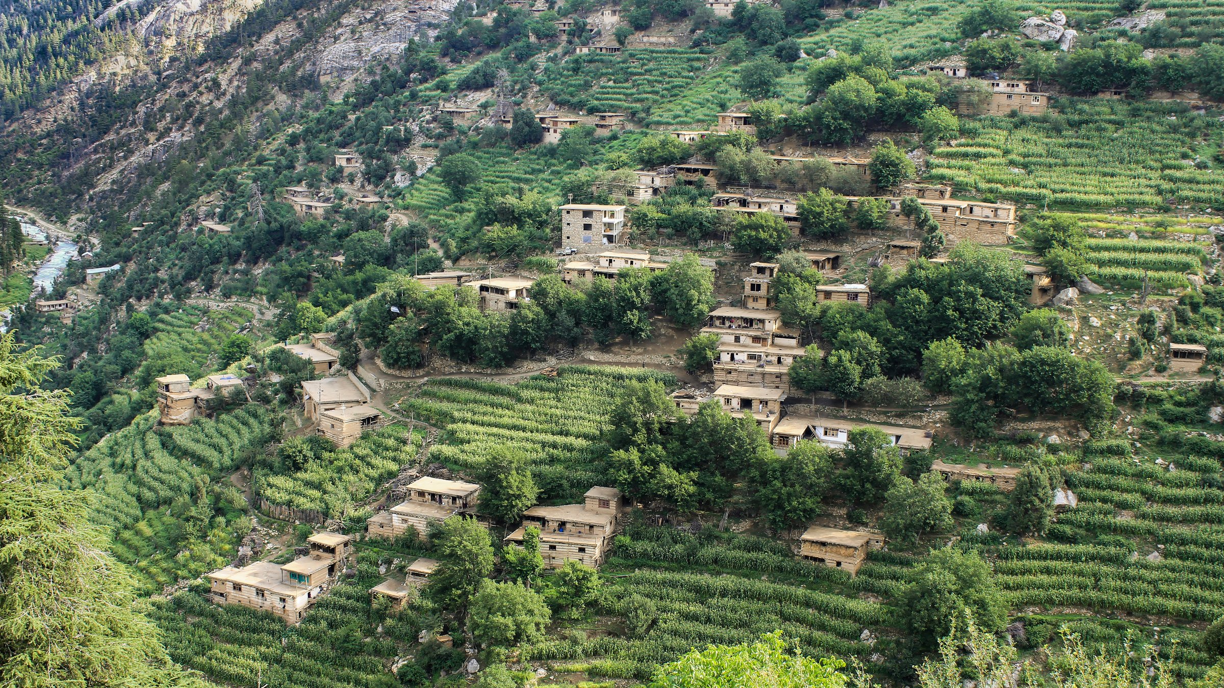
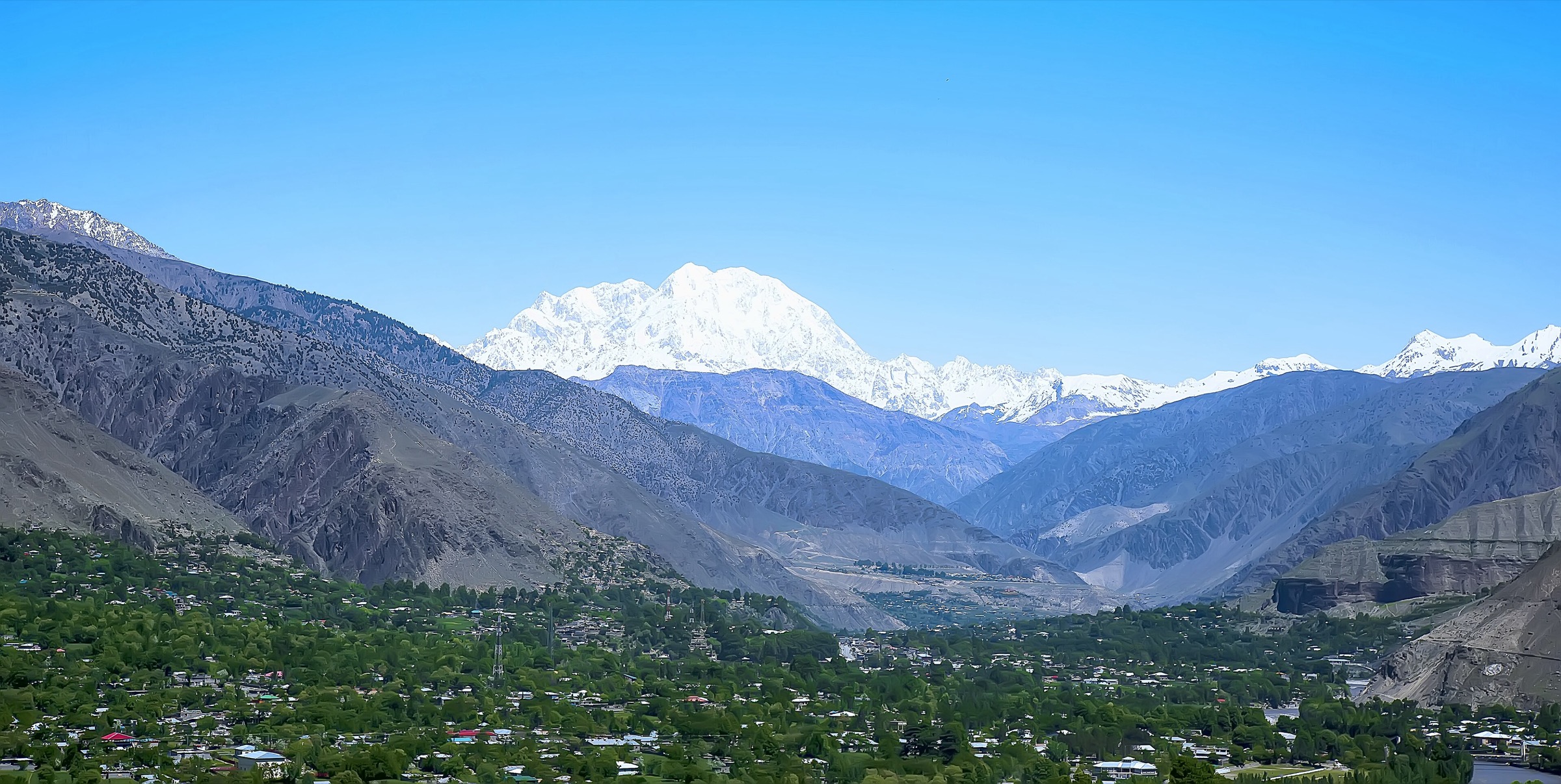
This entry treats the Afghan Hindu Kush as the central Afghan highlands around Bamyan, the Koh-e Baba, Band-e Amir, and nearby cultural valleys, excluding the separate Eastern Hindu Kush / Nuristan-Kunar and Wakhan Pamir entries. The walking character is high, dry, exposed, and only lightly formalised: wide valleys at about 2,500 m, eroded red and ochre ridges, travertine lake basins, Buddhist and Islamic ruins, and alpine side valleys rising towards the Koh-e Baba.
As of 6 June 2026, official Western travel advice remains severe. The UK FCDO advises against all travel to Afghanistan, and the US State Department rates Afghanistan Level 4, “Do Not Travel”. These hikes are therefore catalogue records of important day-walk objectives, not a current recommendation to travel. All access, permits, gender restrictions, local security, landmine risk, and guide requirements must be checked immediately before any field use.
Selection rationale
The five selected hikes cover the strongest day-scale walking themes around Bamyan: Afghanistan’s first national park at Band-e Amir, the harder Koh-e Baba / Foladi high-lake objective, the Kakrak Buddhist side valley, the Dragon Valley geological and legendary landscape, and the Red City fortress ridge at the eastern entrance to Bamyan. Route statistics are much weaker than in formal hiking regions; where exact cumulative ascent or GPX geometry was not found, the entry says so.
Summary table
| # | Hike | Country | Route type | Distance | Gain | Max elevation | Difficulty |
|---|---|---|---|---|---|---|---|
| 1 | Band-e Amir Lakes Sightseeing Walk | Afghanistan | Loop / out-and-back variants | 11.5 km from Visit Bamyan route listing; 3-4 hr shorter lake loop reported by secondary sources | lake basin around 2,900 m | Approx. 2,900 m | Easy-moderate at altitude |
| 2 | Foladi Lakes High Valley Hike | Afghanistan | Out-and-back | 14 km from Visit Bamyan route listing | High alpine; exact max unresolved | Hard | |
| 3 | Kakrak Valley Buddhist-Caves Walk | Afghanistan | Out-and-back / valley walk | 6 km from Visit Bamyan route listing | Approx. 2,500-2,700 m | Moderate | |
| 4 | Dara-e Ajdahar / Dragon Valley Walk | Afghanistan | Out-and-back / short site walk | Short site walk unresolved; about 14 km return if walked from Bamyan bazaar by road | Minor-moderate | Approx. 2,500-2,700 m | Easy-moderate |
| 5 | Shahr-e Zohak / Red City Ridge Walk | Afghanistan | Short out-and-back | Approx. 1-3 km on site | Cliff-top fortress elevation unresolved | Moderate; exposed and mine-risk sensitive |
1. Band-e Amir Lakes Sightseeing Walk

Snapshot
Itinerary
The walk links the accessible viewpoints and lake edges of Band-e Amir, a chain of intense blue travertine-dammed lakes in a dry highland basin west of Bamyan. Depending on local permissions and water levels, walkers can follow lake-shore tracks and low ridges between the main viewpoints around Band-e Haibat and neighbouring lakes, then return to the same vehicle point.
This is the safest catalogue treatment: a lake-viewing day walk, not a fixed official GPX route. Stay on established tracks and avoid unstable travertine edges, private ground, and any locally restricted areas.
Why it is essential
Band-e Amir is Afghanistan’s first national park and the country’s best-known natural day-walk landscape: turquoise lakes, limestone cliffs, high desert, and very strong cultural associations with Bamyan.
Equipment
Sturdy walking shoes, sun protection, warm layer, windproof shell, water, food, and navigation. Carry extra layers outside midsummer; weather changes fast at high elevation.
Hazards and notes
Official access rules, local security, gender restrictions, park fees, and road conditions can change. Do not swim or scramble on travertine dams unless explicitly allowed locally. Rescue infrastructure is limited.
GPX / KML links
| Source | URL | Format / access | Reuse status |
|---|---|---|---|
| Visit Bamyan route listing: Band Amir Sightseeing | visit-bamyan.com | Route listing | Site terms not found; statistics and route concept only; no GPX found |
| OpenStreetMap search: Band-e Amir | openstreetmap.org | Map/search | OSM data is ODbL; geometry cross-check only |
| Wikiloc search: Band-e Amir | wikiloc.com | User route database/search | Wikiloc terms apply; candidate route-file source only; individual tracks require rights and accuracy checks |
External links
- Visit Bamyan — route listings
- International Parks — Band-e Amir profile
- Afghan Adventure Blog — Band-e-Amir Lakes day trip guide
- UK FCDO — Afghanistan travel advice
- US State Department — Afghanistan travel advisory
2. Foladi Lakes High Valley Hike

Snapshot
Itinerary
The Foladi Lakes hike climbs from the western side of the Bamyan valley into the Koh-e Baba high country. Visit Bamyan lists it as a 14 km, 12 hour tough hiking route, which fits a long high-altitude day rather than a casual valley walk. The route should be arranged locally because the online source does not provide a mapped line, cumulative ascent, or access rules.
The likely day objective is the lake basin and surrounding meadows rather than Shah Foladi’s higher summit. The summit and any snow-covered ridge travel should be treated as mountaineering or advanced local guiding territory, not this day-hike entry.
Why it is essential
Foladi is the Bamyan-area route that best represents the Koh-e Baba mountain interior: high lakes, pastoral terrain, snow-fed side valleys, and the harder alpine character behind the cultural valley.
Equipment
Full mountain day kit: boots, waterproof/windproof shell, warm layer, gloves/hat, sun protection, food, 2-3 litres of water or purification, map/GPS, power bank, first-aid kit, and headtorch. Early-season snow may require traction equipment.
Hazards and notes
This is a long high-altitude day with weak online route documentation. Navigation, storms, snow patches, river crossings, lack of rescue, and access/security permissions are serious issues. Use a local guide.
GPX / KML links
| Source | URL | Format / access | Reuse status |
|---|---|---|---|
| Visit Bamyan route listing: Foladi Lakes | visit-bamyan.com | Route listing | Site terms not found; statistics and route concept only; no GPX found |
| OpenStreetMap search: Foladi Valley | openstreetmap.org | Map/search | OSM data is ODbL; geometry cross-check only |
External links
3. Kakrak Valley Buddhist-Caves Walk
Snapshot
Itinerary
The route explores the Kakrak side valley southeast of Bamyan, where the Kakrak River, cave sites, and historic Buddhist remains sit within the wider Bamyan Cultural Landscape. The online route listing gives 6 km and 5.5 hours but does not provide a mapped line, so the field route should be confirmed with a Bamyan guide or cultural-site authority.
The walk can be treated as a valley-and-caves day route rather than a summit hike. Avoid entering fragile caves, painted areas, or archaeological features unless access is explicitly allowed.
Why it is essential
Kakrak is one of the key side valleys in the Bamyan cultural landscape and adds the Buddhist cave landscape to the natural Band-e Amir and Koh-e Baba walking set.
Equipment
Walking shoes or boots, water, sun protection, modest clothing, light, and a local guide. A dust mask can be useful in dry wind.
Hazards and notes
Archaeological sites can be fragile, unstable, or restricted. Do not stray from known paths because unexploded ordnance and landmine risk remains a concern around some Afghan historic sites.
GPX / KML links
| Source | URL | Format / access | Reuse status |
|---|---|---|---|
| Visit Bamyan: Kakrak worth seeing | visit-bamyan.com | Route page | Site terms not found; distance/time only; no GPX found |
| OpenStreetMap search: Kakrak Valley Bamyan | openstreetmap.org | Map/search | OSM data is ODbL; geometry cross-check only |
External links
- Visit Bamyan — Kakrak worth seeing
- Visit Bamyan — About Bamyan
- UNESCO — Cultural Landscape and Archaeological Remains of the Bamiyan Valley
4. Dara-e Ajdahar / Dragon Valley Walk
Snapshot
Itinerary
From Bamyan, travel or walk west to Dara-e Ajdahar, the “Valley of the Dragon”. The site walk climbs around the long split rock ridge, springs, and shrine area associated with the local dragon legend. Visit Bamyan notes the site is about 7 km west of Bamyan bazaar and recommends decent footwear for the short climb.
If walking from Bamyan, treat the road approach as part of the day and confirm traffic/security locally. The route is not a formal marked hiking trail.
Why it is essential
Dragon Valley is one of Bamyan’s most distinctive short landscape walks: a geological feature, a local legend, and an accessible high-desert viewpoint close to town.
Equipment
Walking shoes, sun protection, water, modest clothing, and a local guide if combining with villages or off-road exploration.
Hazards and notes
The climb is short but exposed and dusty. Avoid private areas and shrine misuse. Security and access should be checked locally.
GPX / KML links
| Source | URL | Format / access | Reuse status |
|---|---|---|---|
| Visit Bamyan: Dragon Valley | visit-bamyan.com | Route/site page | Site terms not found; access and landmark verification only; no GPX found |
| OpenStreetMap search: Dara-e Ajdahar | openstreetmap.org | Map/search | OSM data is ODbL; geometry cross-check only |
External links
- Visit Bamyan — Dragon Valley
- Darya Expeditions — Valley of the Dragon / Dara-e-Ajdaha
- UK FCDO — Afghanistan travel advice
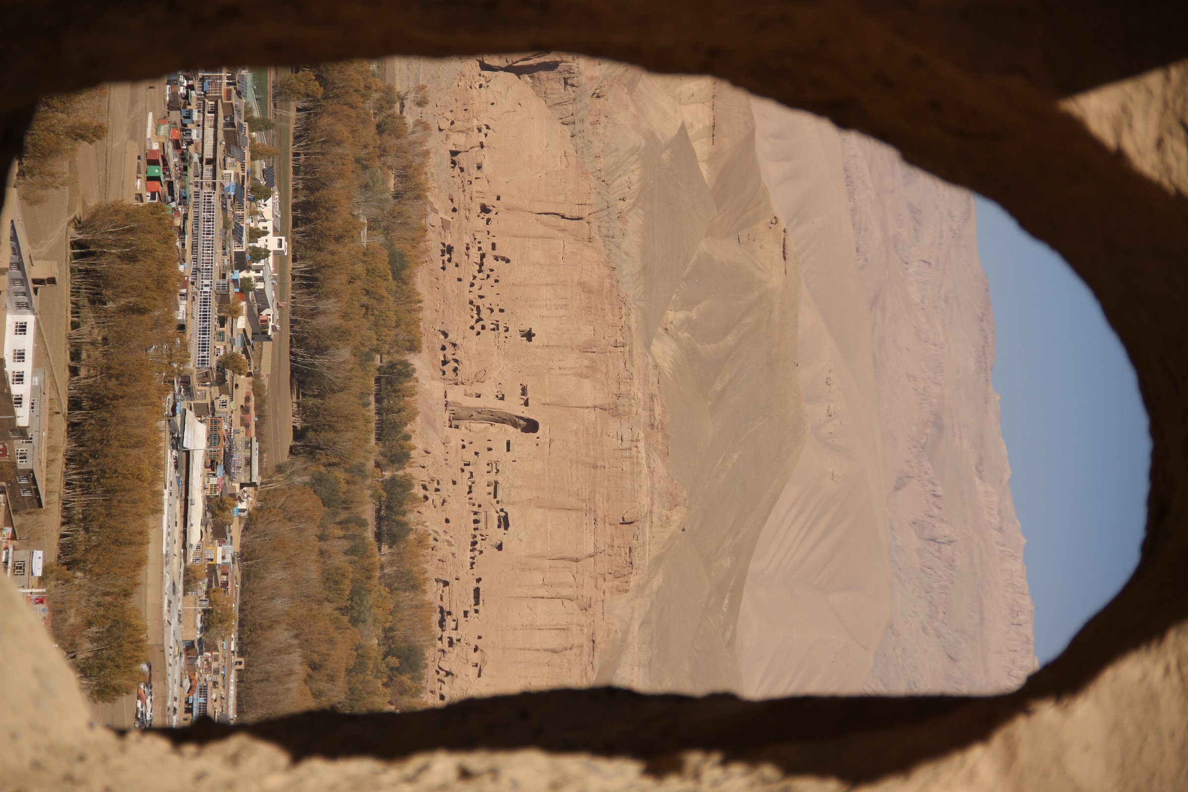
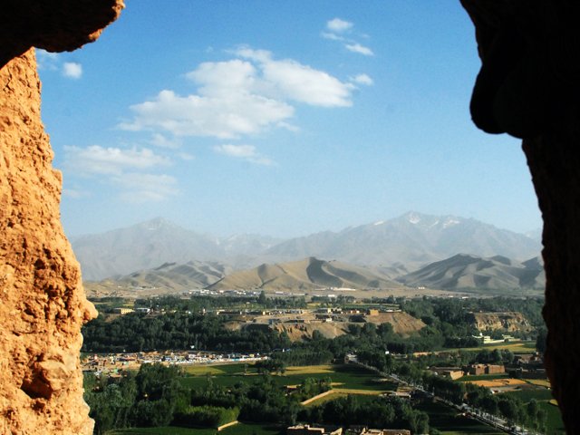
5. Shahr-e Zohak / Red City Ridge Walk
Snapshot
Itinerary
The walk climbs from the access point through the Red City ruins, where mud-brick and stone fortifications guard the confluence area at the entrance to the Bamyan valley. Lonely Planet describes the path passing towers, a rock tunnel, the main gateway, and switchbacks through ruined structures.
The exact safe walking line must be confirmed on site. Do not wander beyond the well-worn path or any local markers.
Why it is essential
Shahr-e Zohak gives the Afghan Hindu Kush entry its strongest short ridge-and-history walk: valley views, defensive architecture, red cliffs, and a direct link to Bamyan’s Silk Road and Ghorid-era landscape.
Equipment
Walking shoes with grip, water, sun protection, modest clothing, and a local guide. Avoid sandals on the dusty and eroded path.
Hazards and notes
Landmine and unexploded-ordnance risk is explicitly noted by guidebook sources for this site; stay on the well-worn route and obey all local warnings. The ruins are fragile and exposed.
GPX / KML links
| Source | URL | Format / access | Reuse status |
|---|---|---|---|
| Visit Bamyan: The Red City | visit-bamyan.com | Site page | Site terms not found; landmark verification only; no GPX found |
| OpenStreetMap search: Shahr-e Zohak | openstreetmap.org | Map/search | OSM data is ODbL; geometry cross-check only |
External links
- Visit Bamyan — The Red City
- Lonely Planet — Shahr-e Zohak
- UNESCO — news on Bamiyan cultural heritage
External links
| Source | URL |
|---|---|
| Visit Bamyan — route listings | visit-bamyan.com |
| Visit Bamyan — About Bamyan | visit-bamyan.com |
| Visit Bamyan — Kakrak worth seeing | visit-bamyan.com |
| Visit Bamyan — Dragon Valley | visit-bamyan.com |
| Visit Bamyan — The Red City | visit-bamyan.com |
| International Parks — Band-e Amir profile | internationalparks.org |
| Afghan Adventure Blog — Band-e-Amir Lakes day trip guide | afghan-tour.com |
| Darya Expeditions — Valley of the Dragon | daryaexpeditions.com |
| Lonely Planet — Shahr-e Zohak | lonelyplanet.com |
| UNESCO — Cultural Landscape and Archaeological Remains of the Bamiyan Valley | whc.unesco.org |
| UNESCO — news on Bamiyan cultural heritage | whc.unesco.org |
| UK FCDO — Afghanistan travel advice | gov.uk |
| US State Department — Afghanistan travel advisory | travel.state.gov |
| Wikiloc — Band-e Amir search | wikiloc.com |