Regional overview
The Korean mountain system is anchored by the Baekdu-daegan spine from Paektu/Baekdu in the north to Jirisan in the south, with major South Korean hiking centres in Seoraksan, Jirisan, Bukhansan, and Hallasan. Trails are often steep, stone-built, and popular, with strong national-park management in South Korea.
The normal walking seasons are spring and autumn. Summer brings heat, humidity, monsoon rain, and typhoon risk. Winter routes can be icy and serious, especially on granite slabs, summit ridges, and long high routes.
North Korea access is a major constraint. The Paektu entry below is included for geographic and cultural completeness only and is labelled candidate-only because ordinary independent hiking access and route-file verification are not available; U.S. passports are not valid for North Korea without special validation.
Selection rationale
The selected hikes represent Korean granite peaks, volcanic summit terrain, mainland high summits, urban national-park hiking, and the symbolic northern source mountain of the Baekdu-daegan.
Summary table
| # | Hike | Country | Route type | Distance | Gain | Max elevation | Difficulty |
|---|---|---|---|---|---|---|---|
| 1 | Ulsanbawi Trail, Seoraksan | South Korea | Out-and-back | 7.4 km | 566 m | 874 m | Hard |
| 2 | Hallasan Summit, Seongpanak to Gwaneumsa | South Korea | Point-to-point | 18.2 km | 1,176 m | 1,947 m | Hard |
| 3 | Jirisan Cheonwangbong via Jungsanri | South Korea | Out-and-back | 10.8 km | 1,283 m | 1,915 m | Hard |
| 4 | Bukhansan Baegundae via Bukhansan Ui | South Korea | Out-and-back | 8.7 km | 745 m | 836.5 m | Hard |
| 5 | Paektu/Baekdu Heaven Lake North Korean side | North Korea | Access-controlled tourist walk | Unresolved | Unresolved | 2,744 m | Candidate |
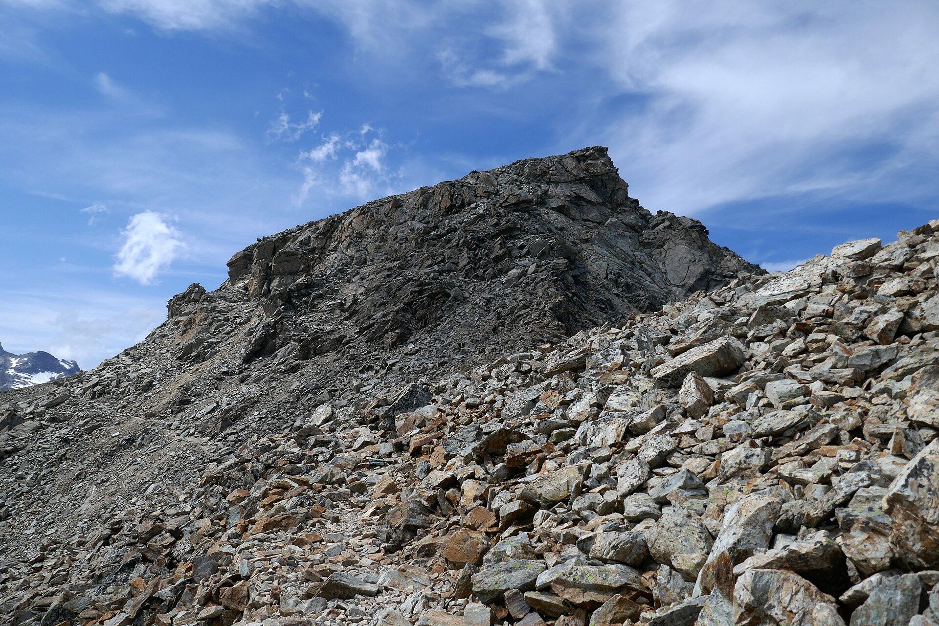
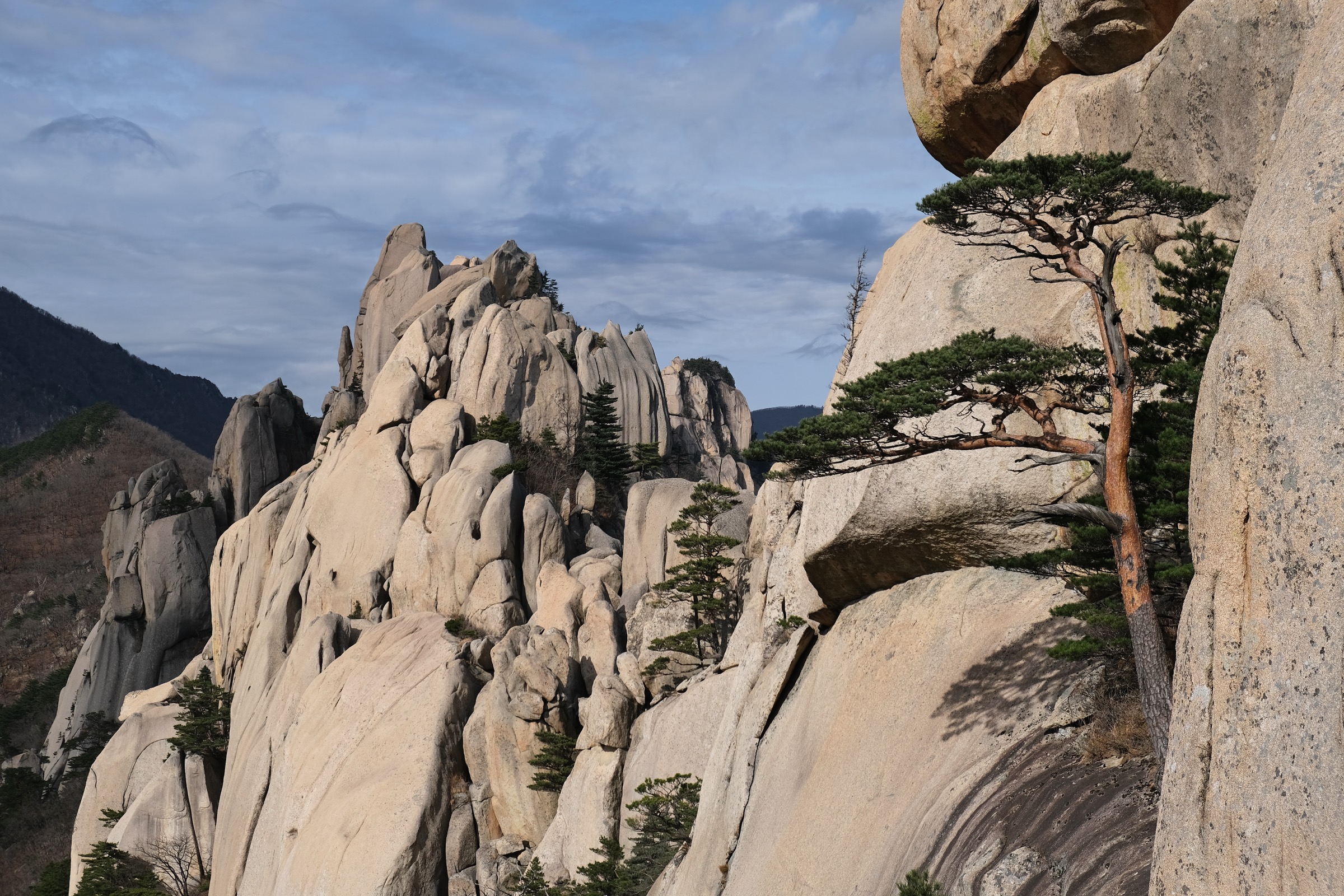
1. Ulsanbawi Trail, Seoraksan

Snapshot
Itinerary
The trail leaves the Seoraksan entrance area, passes Sinheungsa and Heundeulbawi, then climbs steep stair sections to the Ulsanbawi granite viewpoint. The final section is exposed to wind and crowding.
Why it is essential
Ulsanbawi is one of Seoraksan’s defining granite landmarks and offers a compact version of the park’s steep rock scenery.
Equipment
Standard hiking equipment, grippy footwear, weatherproof layer, water, and sun protection. Traction may be required in winter.
Hazards and notes
The upper stairs and railings can be icy or congested. Avoid thunderstorms, high wind, and wet rock conditions.
GPX / KML links
| Source | URL | Format / access | Reuse status |
|---|---|---|---|
| AllTrails — Ulsanbawi Trail | alltrails.com | Source route page | AllTrails terms; GPX reuse not confirmed |
External links
2. Hallasan Summit, Seongpanak to Gwaneumsa

Snapshot
Itinerary
The traverse climbs the long Seongpanak trail to Baengnokdam crater at Hallasan’s summit, then descends the steeper Gwaneumsa side. Only Seongpanak and Gwaneumsa reach the summit.
Why it is essential
Hallasan is South Korea’s highest mountain and Jeju’s central volcanic landmark. The traverse gives the complete summit experience rather than a shorter non-summit trail.
Equipment
Mountain hiking equipment, sturdy boots, waterproof layer, warm layer, food, water, headtorch, and traction in winter.
Hazards and notes
Reservation, cut-off times, weather closure, and trail rules must be checked on the official Hallasan site. Weather can change quickly; summit wind and winter ice are serious hazards.
GPX / KML links
| Source | URL | Format / access | Reuse status |
|---|---|---|---|
| AllTrails — Hallasan Summit through-hike | alltrails.com | Source route page | AllTrails terms; GPX reuse not confirmed |
External links
- AllTrails — Hallasan Summit through-hike
- Hallasan official / reservation site
- Wikipedia — Hallasan National Park
3. Jirisan Cheonwangbong via Jungsanri

Snapshot
Itinerary
The route climbs from Jungsanri toward Cheonwangbong, the highest peak of Jirisan and the highest summit on mainland South Korea. It is a steep, sustained ascent with stone steps, forest, and open summit terrain.
Why it is essential
Cheonwangbong is the highest summit of the Baekdu-daegan south of the DMZ and a central objective in South Korean mountain hiking.
Equipment
Mountain hiking equipment, sturdy boots, trekking poles, warm layer, waterproof layer, food, water, and headtorch.
Hazards and notes
The climb is long and steep. Weather at the summit can be cold and windy. Water availability should not be assumed above the lower trail.
GPX / KML links
| Source | URL | Format / access | Reuse status |
|---|---|---|---|
| AllTrails — Cheonwangbong via Jungsanri Visitor Center | alltrails.com | Source route page | AllTrails terms; GPX reuse not confirmed |
External links
- AllTrails — Cheonwangbong via Jungsanri Visitor Center
- Wikipedia — Jirisan
- Wikipedia — Jirisan National Park
4. Bukhansan Baegundae via Bukhansan Ui

Snapshot
Itinerary
The route climbs from the northern Seoul edge through Bukhansan National Park toward Baegundae, the highest peak in Seoul. The upper section uses steep granite, steps, and fixed handrails.
Why it is essential
Bukhansan is one of the world’s great urban national-park hikes, and Baegundae gives the classic granite summit above Seoul.
Equipment
Standard hiking equipment, grippy shoes, water, weatherproof layer, and gloves for cold handrail sections. Traction may be needed in winter.
Hazards and notes
Crowding, polished rock, ice, and exposed handrail sections are key hazards. Avoid storms and wet granite.
GPX / KML links
| Source | URL | Format / access | Reuse status |
|---|---|---|---|
| AllTrails — Bukhansan Ui · Insuam · Baegundae Peak | alltrails.com | Source route page | AllTrails terms; GPX reuse not confirmed |
External links
- AllTrails — Bukhansan Ui · Insuam · Baegundae Peak
- Wikipedia — Bukhansan
- Wikipedia — Bukhansan National Park
5. Paektu/Baekdu Heaven Lake North Korean side

Snapshot
Itinerary
This candidate refers to the North Korean side of Mount Paektu and Heaven Lake, normally visited through controlled tourist infrastructure rather than independent hiking. Public day-hike geometry, trail statistics, and GPX/KML data were not verified.
Why it is essential
Paektu/Baekdu is the symbolic northern source mountain of the Korean peninsula, the highest mountain in North Korea, and the northern anchor of the Baekdu-daegan concept.
Equipment
Warm mountain clothing, waterproof layer, sun protection, and footwear suitable for cold, windy volcanic terrain. Travel documentation and government-controlled itinerary requirements dominate practical planning.
Hazards and notes
For U.S. citizens, the U.S. State Department advisory says not to travel to North Korea and states that U.S. passports are invalid for travel to, in, or through North Korea unless specially validated. This is not a normal public hiking recommendation.
GPX / KML links
| Source | URL | Format / access | Reuse status |
|---|---|---|---|
| No public GPX/KML found | — | — | Manual creation not recommended without legal access/source data |
External links
- Wikipedia — Mount Paektu
- Wikipedia — Heaven Lake
- U.S. State Department — North Korea Travel Advisory
Missing data / follow-up work
- Official KNPS per-course pages should be checked directly for current closures, cut-off times, and reservation requirements.
- AllTrails GPX reuse rights remain unresolved; entries are source-route links only.
- Jirisan photo is park-level rather than Cheonwangbong-specific.
- Paektu is candidate-only; no public independent hiking route, GPX, or normal travel access was verified.
External links
| Resource | Link |
|---|---|
| AllTrails — Ulsanbawi Trail | alltrails.com |
| AllTrails — Hallasan Summit through-hike | alltrails.com |
| AllTrails — Cheonwangbong via Jungsanri Visitor Center | alltrails.com |
| AllTrails — Bukhansan Ui · Insuam · Baegundae Peak | alltrails.com |
| Hallasan official / reservation site | visithalla.jeju.go.kr |
| Wikipedia — Ulsanbawi | en.wikipedia.org |
| Wikipedia — Seoraksan National Park | en.wikipedia.org |
| Wikipedia — Hallasan National Park | en.wikipedia.org |
| Wikipedia — Jirisan National Park | en.wikipedia.org |
| Wikipedia — Bukhansan National Park | en.wikipedia.org |
| Wikipedia — Mount Paektu | en.wikipedia.org |
| U.S. State Department — North Korea Travel Advisory | travel.state.gov |