Regional overview
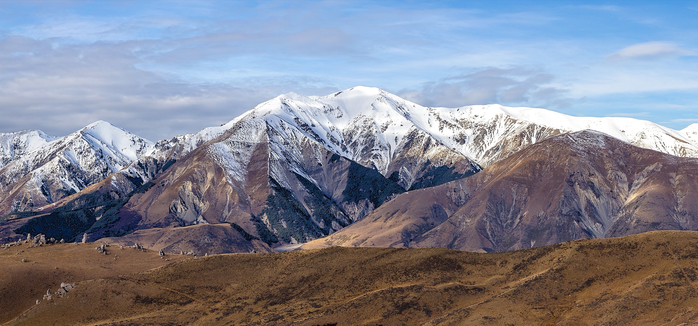
The Torlesse Range forms the prominent eastern wall of the Canterbury high country, rising abruptly from the Canterbury Plains to a chain of tussock-and-scree summits between 1,700 m and 2,000 m. The range is part of the Southern Alps foothills and sits about 75 minutes’ drive west of Christchurch along State Highway 73 — the Great Alpine Road that climbs over Arthur’s Pass. The eastern flank, bounded by the Waimakariri River to the north and the Kowai River to the south and visible above the small township of Springfield, is the most accessible mountain front in Canterbury. Most of it lies within the 21,000-hectare Korowai / Torlesse Tussocklands Park, which encompasses the Torlesse and Big Ben ranges.
The character is alpine but treeless: greywacke ridges, broad tussock spurs, extensive scree, and shattered summit blocks of fractured schist, with negligible bush cover above the river flats. There is no marked summit track in the area, no maintained public huts on the eastern side (Kowai / John Hayward Memorial Hut is owned by Lincoln University and is by-permission only), and no cellular coverage on the tops. The Department of Conservation (DOC) park map labels every route as “route only — unmarked”, and the agency repeats throughout its materials that these are objectives for fit, experienced and well-equipped trampers with topographic-map navigation skills.
All four hikes in this catalogue are serious alpine tramping objectives. None is a gentle walk; each carries real exposure to wind, weather, lightning, scree, and route-finding error in low cloud. Best season is mid-November to late April, when most snow has cleared the upper ridges and the rivers run lower. Snow can linger on south-facing scree into December and return in any month; winter ascents require ice axe and crampons and are mountaineering trips rather than tramps. The range is strongly weather-exposed: it stands at the first significant orographic barrier inland from the coast and catches sudden northwesterlies that can bring gale-force wind, lightning, and near-freezing rain in summer. Wasp populations are high January–April. The New Zealand Defence Force uses parts of the park for training exercises but there are no public closures.
Access has a specific gotcha worth flagging up front: the standard climbing route on Mount Torlesse (Hikes 1 and 4) crosses Brooksdale Station freehold/leasehold land, and formal permission is required from the station on 03 318 4748. DOC explicitly states it cannot pass on the contact. Castle Hill Peak and Foggy Peak from Porters Pass do not cross private land and need no permission. Dogs, firearms and vehicles are prohibited in the park without consent.
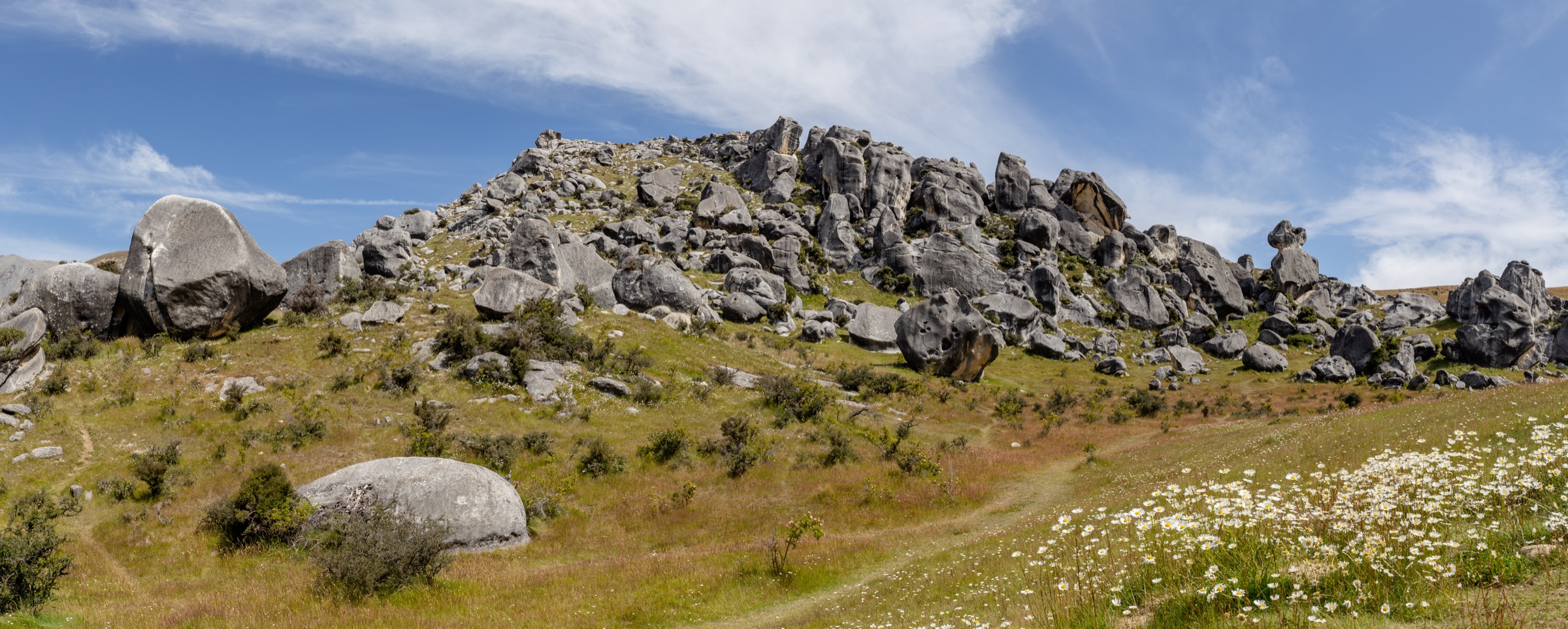
For frontcountry walks west of Porters Pass — including the Trig M Route — see the companion Korowai / Torlesse Tussocklands article. For the limestone tor walks and short loops around the Castle Hill Basin (Kura Tāwhiti), see that area’s dedicated catalogue.
Selection rationale
These four objectives represent the genuine essential day-walks of the eastern Torlesse Range as recognised by DOC, Wilderness Magazine, and the established Canterbury tramping community. Mount Torlesse is the iconic visible peak; Castle Hill Peak is the range high point and the standard “first big ridge” for Canterbury walkers; Foggy Peak is the standard short objective for less time; the Mount Torlesse–Red Peak traverse is the classic linkage between the two valleys. The Big Ben Range objectives (Ben More, Big Ben) and the Dry Acheron Track sit on the western/southern side of the park outside the area covered here. The Kura Tāwhiti limestone walks and the Korowai / Torlesse Tussocklands frontcountry walks west of Porters Pass — including the Trig M Route — are covered in their own articles.
No padding has been added: this is four objectives, all genuinely “essential” rather than obscure, all carrying mountain-tramping grading.
A note on summit heights
Mount Torlesse is 1,961 m. Every verifiable source — DOC, NZ Topo50, Wikipedia, Wilderness Magazine, AllTrails, Peakery, Hiking Scenery, Backcountry Bibles, Flightless Kiwis, and OpenStreetMap (node 563327452) — gives this figure. Castle Hill Peak at 1,998 m is the range high point.
Summary table
| # | Hike | Country | Route type | Distance | Gain | Max elevation | Difficulty |
|---|---|---|---|---|---|---|---|
| 1 | Mount Torlesse via Kowai River (Coal Pit Spur) | New Zealand | Out-and-back | 16–17 km | ~1,470 m | 1,961 m | Hard — mountain tramping, unmarked, navigation, private-land permission |
| 2 | Castle Hill Peak via Porters Pass and Foggy Peak | New Zealand | Out-and-back | 10–12 km | ~1,150 m | 1,998 m | Hard — mountain tramping, exposed scree, unmarked |
| 3 | Foggy Peak from Porters Pass | New Zealand | Out-and-back | ~5 km | ~800 m | 1,741 m | Moderate-to-hard — short but steep, exposed |
| 4 | Mount Torlesse → Red Peak loop via Kowai River | New Zealand | Loop | ~17–20 km | ~1,500–1,700 m | 1,961 m | Very hard — knife-edge ridge, river descent, route-finding |
1. Mount Torlesse via Kowai River (Coal Pit Spur)
Snapshot
Itinerary
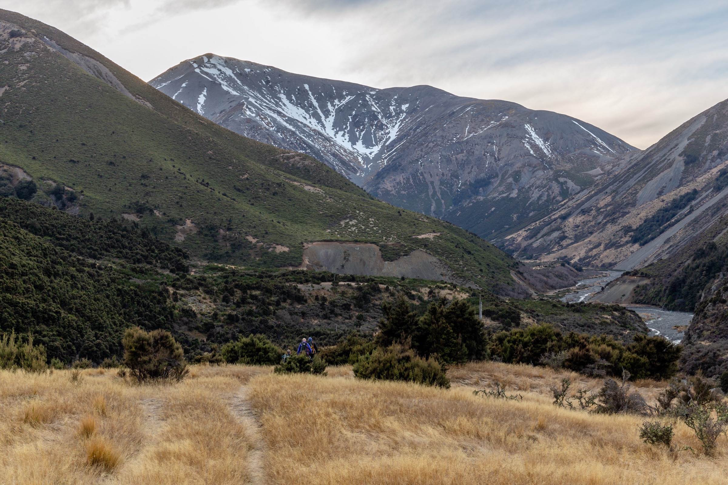
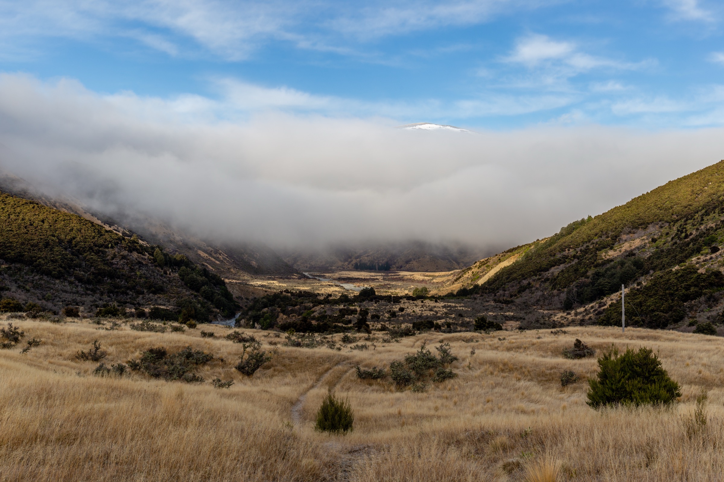
The walk starts at the lay-by opposite the historic Porters Pass roadman’s hut on SH73, where there is roadside parking. A locked gate marks the entry into the Kowai River valley and the Korowai / Torlesse Tussocklands Park beyond; the gate is climbed and not unlocked. An old 4WD track follows the true right (north) bank of the Kowai River. Two further gates are passed (leave as found) and a short ~50 m river crossing is required. After roughly 1.5 hr the track becomes vague ground trail and Kowai (John Hayward Memorial) Hut appears across the river — a private Lincoln University research hut not available to the public without permission.
The standard route, known locally as the Coal Pit Spur, climbs the spur on the true right of the side stream by the hut, taking the most direct line to Mount Torlesse. The initial gradient is moderate before the spur narrows into a steep, sustained tussock-and-scree ridge that rises about 1,100 m to the summit. The line stays on the ridge with minor zigzags. There are no markers, no cairns to depend on and no defined track underfoot in places. The summit is a typical Torlesse Range cluster of shattered greywacke blocks with sweeping views across the Canterbury Plains to Banks Peninsula and inland to the main divide. Return is by reverse of the ascent. Total time, summit-to-trailhead, is 3.5–4 hr in good conditions.
Why it is essential
Mount Torlesse is the most visually iconic peak above the Canterbury Plains — the sharply pyramidal summit that dominates the eastward view from State Highway 73 and from much of the inland Selwyn District. It carries the name of the range, of the surrounding park and of an important figure in colonial Canterbury survey history (Charles Obins Torlesse, who climbed its lower slopes in 1849 with Māori guides). For Canterbury trampers it is the recognised eastern-foothills test piece — long, unmarked, exposed and weather-sensitive — and is widely listed in regional tramping guidebooks as the standard hard day-trip from Christchurch.
Equipment
Mountain hiking equipment:
- Sturdy boots with edge-able soles for scree
- Trekking poles strongly recommended for the descent
- Full weatherproof shell and warm insulation layer
- Hat and gloves outside midsummer
- 2 L water minimum — there is no reliable water above the Kowai River
- Topographic map (NZTopo50 BW21 Springfield), compass and GPS
- Headtorch
- PLB (personal locator beacon) recommended; no cell coverage
- Ice axe and crampons if snow is present (often into December and from May)
Hazards and notes
- Private-land access. The Kowai River access route crosses Brooksdale Station land. DOC requires formal permission for the ascent to Mt Torlesse itself; the station number is 03 318 4748 (DOC does not publish this contact directly). Climb the gate but leave all gates as found, avoid disturbing stock, and do not bring dogs, firearms or vehicles.
- Weather sensitivity. The Torlesse front catches the first orographic uplift from coastal weather; conditions on the summit ridge can deteriorate from clear to gale-force whiteout within an hour. The peak is also a known lightning attractor in summer convective storms.
- Navigation. The route is unmarked and route-finding errors on descent in low cloud have caused parties to drop into the wrong drainage. Carry a map and confirm the ridge bearing before leaving the summit.
- River. The Kowai River crossing is normally trivial but can rise quickly in rain.
- Kowai Hut. Not a public hut; do not rely on it for shelter.
- Wasps January to April.
GPX / route file
| Source | URL |
|---|---|
| AllTrails — Mt Torlesse via Kowai River | alltrails.com |
| Hiking Is Good — From Mount Torlesse to Red Peak | hikingisgood.com |
| OpenStreetMap — Mount Torlesse summit node | openstreetmap.org |
| DOC — Korowai/Torlesse Tussocklands Park routes (text description) | doc.govt.nz |
No official park GPX exists. Authoritative geometry should be reconstructed from NZTopo50 BW21 contours and the OSM summit node.
2. Castle Hill Peak via Porters Pass and Foggy Peak
Snapshot
Itinerary
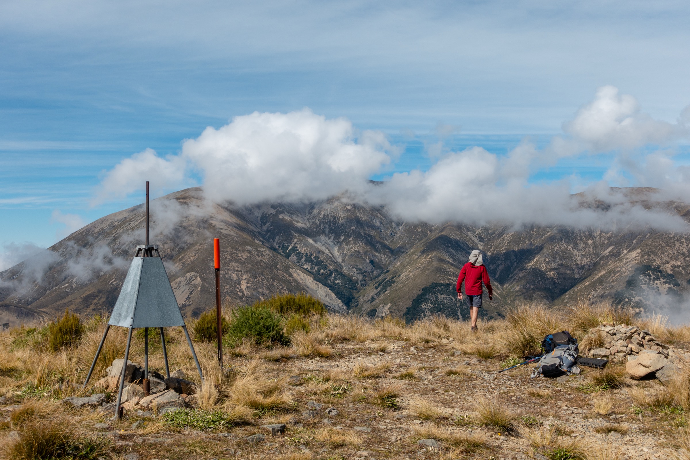
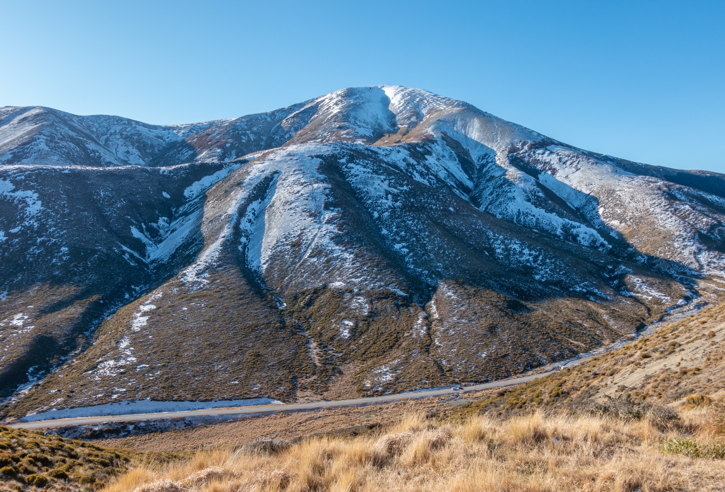
From the Porters Pass carpark on the high point of SH73, the route leaves the south side of the road and climbs immediately onto the ridge above. The first few hundred metres are marked with orange poles through scrub and tussock, after which the markers stop and a worn ground trail continues. The track gains height steadily through tussock, then steepens onto loose scree before reaching the cairn at Foggy Peak (1,741 m) — about 2–3 hr from the car.
From Foggy Peak the route follows the broad open ridge north-westwards, with continuous views to Lake Lyndon and the Craigieburn Range on one side and the Kowai catchment on the other. The ridge is mostly walking-pace until the final ascent of Castle Hill Peak, which is markedly steeper and narrows in places. The summit is a small high point of stacked greywacke. Return is by the same route; the descent down the scree from Foggy Peak back to Porters Pass is the most tiring section and the most common ankle-injury point.
Why it is essential
Castle Hill Peak is the high point of the Torlesse Range and the most-walked serious summit in the Canterbury foothills. The ridge between Foggy Peak and Castle Hill Peak is one of the most photographed tussock ridgelines in the South Island and a near-mandatory training objective for Canterbury alpine clubs. Unlike Mount Torlesse, it requires no private-land permission and is therefore the de facto “introduction to a serious Canterbury day climb” for visitors.
Equipment
Mountain hiking equipment:
- Sturdy boots; the descent scree is loose and ankle-rolling
- Trekking poles strongly recommended
- Wind shell — the ridge is fully exposed for over 80% of the distance
- Warm layer, hat, gloves outside midsummer
- 2.5 L water — there is no water source on the ridge
- Topographic map (NZTopo50 BW21), compass, GPS
- Sun protection — fully exposed
- Headtorch
Hazards and notes
- No water on route. Carry the full day’s water from Porters Pass.
- Exposure. The ridge is fully exposed to wind and weather; northwesterly gales arrive without much warning. Storms can produce lightning, hail or snow at any time of year.
- Scree descent. The descent from Foggy Peak is the highest-risk section for slips.
- Final summit cone. The last short climb to Castle Hill Peak is steep, narrow and rocky; in icy or wet conditions it becomes significantly more serious.
- Snow. Snow lingers in early spring on south-facing scree and can re-form after autumn storms. Out of midsummer, carry an ice axe if a snowline is visible.
- No permission required — the route is on public conservation land throughout.
GPX / route file
| Source | URL |
|---|---|
| AllTrails — Castle Hill Peak Track | alltrails.com |
| AllTrails — Foggy Peak and Castle Hill Peak Track | alltrails.com |
| Trailforks — Castle Hill Peak Track | trailforks.com |
| OpenStreetMap — Castle Hill Peak summit node | openstreetmap.org |
| DOC — Korowai/Torlesse Tussocklands Park routes (text description) | doc.govt.nz |
3. Foggy Peak from Porters Pass
Snapshot
Itinerary
From the Porters Pass carpark, the route follows the first section of the Castle Hill Peak route: orange poles for the first few hundred metres, then a worn ground trail steepening through tussock and onto loose scree. The gradient is relentless from soon after the carpark; there are no zigzags worth the name. The summit is marked by a cairn and provides 360-degree views across Lake Lyndon and the Craigieburn Range to the north, the higher Castle Hill–Mount Torlesse ridge running east, and the Big Ben Range and Canterbury Plains south. Many parties turn around at Foggy Peak rather than continue the much longer linkage to Castle Hill Peak. Return is by the same route.
Why it is essential
Foggy Peak is the most accessible serious viewpoint in the Torlesse Range. It gives the full range character — open tussock, scree, exposed summit — at roughly half the distance and a third of the time commitment of Castle Hill Peak, and it is the standard “short option from Porters Pass” listed in Canterbury walking guides. It belongs in the catalogue as the shortest objective in the area that still delivers a genuine Torlesse Range summit experience.
Equipment
Mountain hiking equipment:
- Sturdy boots
- Trekking poles recommended for the scree descent
- Wind shell and warm layer
- Hat, gloves outside midsummer
- 1.5–2 L water — none on route
- Sun protection
- Map / GPS
Hazards and notes
- No water on route.
- Loose scree on the upper third; ankle injuries on descent are the commonest incident.
- Wind exposure — the summit catches the same northwesterly gales as Castle Hill Peak.
- No permission required.
- Wasps in late summer.
GPX / route file
| Source | URL |
|---|---|
| AllTrails — variants under Castle Hill Peak Track | alltrails.com |
| Wikiloc — search “Foggy Peak Porters Pass” | wikiloc.com |
| OpenStreetMap — Foggy Peak area | openstreetmap.org |
4. Mount Torlesse → Red Peak loop via Kowai River
Snapshot
Itinerary
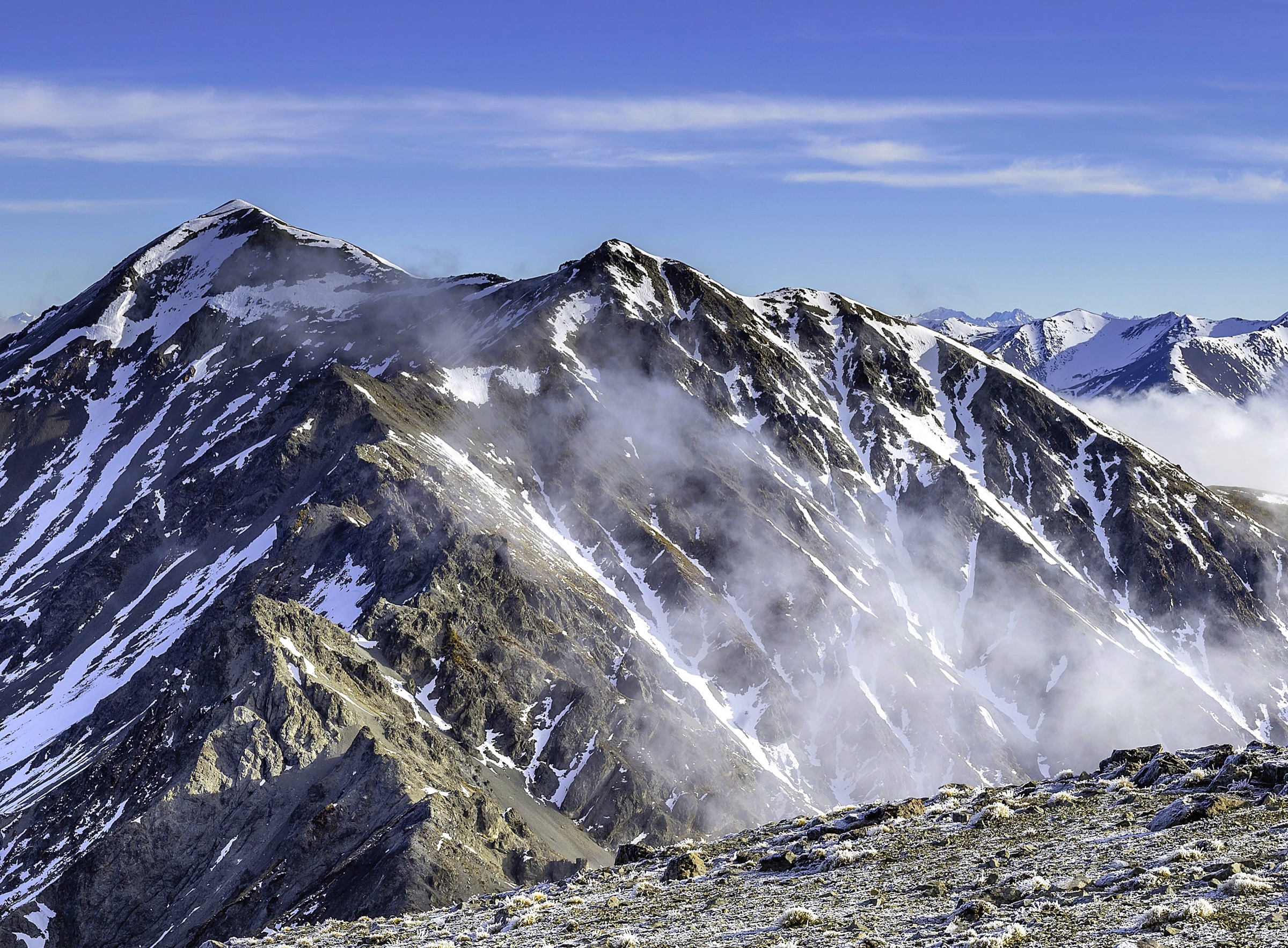
The ascent follows Hike 1 to the summit of Mount Torlesse. From the summit the route turns south along the main range crest, following the open ridge over a series of dips and bumps towards Red Peak (~1,935 m). This section of ridge includes narrow knife-edge passages and steep drop-offs in places and is exposed throughout; in any wind it becomes serious. From Red Peak the standard loop variant descends roughly 1 km of steep scree down to the upper Kowai River, then follows the river bed back to the original 4WD track. The river descent is the technical crux: it requires repeated crossings whose difficulty varies hugely with rainfall, and there are several waterfalls that must be bypassed by climbing through dense scrub on the steep valley walls. There is no track underfoot in the river-descent section, and AllTrails GPS traces in this stretch have been reported as misleading by parties who have attempted the loop in recent years.
Why it is essential
The Mount Torlesse–Red Peak loop is the classic full-range traverse of the central Torlesse Range and is the standard objective for trampers who have already climbed Mount Torlesse and want a more committing day. It includes both of the iconic peaks on the eastern range front and the most aesthetic ridge walking in the area. It is listed as the principal loop variant in Wilderness Magazine, Hiking Is Good, and the Canterbury / North Otago Tramping Club trip-report archives, and on AllTrails it appears as the second-most-saved Korowai / Torlesse objective after Castle Hill Peak.
Equipment
Mountain hiking equipment as for Hike 1, plus:
- River-crossing footwear or technique (the upper Kowai is normally trivial but can be serious after rain)
- Helmet recommended on the Red Peak scree descent (rockfall risk where parties are above each other)
- Mandatory PLB
- Ice axe and crampons if snow remains anywhere on the ridge
Hazards and notes
- All Hike 1 hazards apply, plus:
- Knife-edge ridge sections between Mount Torlesse and Red Peak with significant fall consequences.
- River descent. The Kowai descent from Red Peak is the most-cited reason this loop is graded above a standard Mount Torlesse return. Sustained route-finding through bluffs and bush.
- Daylight. Even fit parties commonly take 12+ hours; midsummer attempt only.
- Private-land permission still required from Brooksdale Station for the lower river section.
GPX / route file
| Source | URL |
|---|---|
| AllTrails — Mt Torlesse to Red Peak Loop | alltrails.com |
| Hiking Is Good — From Mount Torlesse to Red Peak | hikingisgood.com |
| NZ Bush Adventures — Kowai River / John Hayward Memorial Hut trip report | nzbushadventures.blogspot.com |
Companion articles and follow-up
For the Trig M Route and the other frontcountry walks west of Porters Pass, see the companion Korowai / Torlesse Tussocklands article. For the Kura Tāwhiti limestone tor walks and short loops around the Castle Hill Basin, see that area’s dedicated catalogue.
A handful of items merit a follow-up before relying on this article in the field:
- Brooksdale Station contact. The 03 318 4748 number is published on Wilderness Magazine and AllTrails comments, but DOC declines to share it directly. Telephone to confirm both the number and the current permission process before departing.
- GPX licences. No official park GPX exists for any of the four objectives. All available tracks are community-uploaded (AllTrails, Wikiloc, Trailforks, hikingisgood.com) and cannot be redistributed under their host platforms’ terms. The recommended workflow is to derive geometry from NZTopo50 BW21 contours plus the OSM summit nodes and treat the community GPX only for cross-checking spur lines.
- Foggy Peak summit OSM node. The OSM lat/lon for Foggy Peak should be re-queried directly before use.
- Junction Peak / Otarama Peak elevations. Sources disagree (Hiking Is Good cites Otarama at 1,963 m; Peakery and Flickr captions cite 1,966 m). The discrepancy does not affect any of the four day objectives.
- Photo seasonality. All Wikimedia images here are by Michal Klajban (Podzemnik) and were taken in winter; for a summer cover photo a Flickr “torlesse”-tagged candidate may be preferable, with individual licence checks required.
- Public transport. Confirmed there is no useful scheduled public transport to Porters Pass or Springfield. The TranzAlpine train passes through Springfield but does not provide practical day-hike access. Driving remains the only realistic option.
External links
| Source | URL |
|---|---|
| Department of Conservation — Korowai/Torlesse Tussocklands Park | doc.govt.nz |
| DOC — Korowai/Torlesse Tussocklands Park routes | doc.govt.nz |
| DOC — Korowai/Torlesse Tussocklands Park brochure (PDF) | doc.govt.nz |
| DOC — Dry Acheron Track | doc.govt.nz |
| NZ Mountain Safety Council — Plan My Walk | planmywalk.nz |
| Wilderness Magazine — Mt Torlesse, Korowai/Torlesse Tussocklands Park | wildernessmag.co.nz |
| Wilderness Magazine — Castle Hill Peak | wildernessmag.co.nz |
| Hiking Scenery — Mt Torlesse ascent | hikingscenery.com |
| Hiking Scenery — Castle Hill Peak via Foggy Peak | hikingscenery.com |
| Hiking Is Good — Mount Torlesse to Red Peak | hikingisgood.com |
| Backcountry Bibles — Castle Hill Peak | backcountry-bibles.blogspot.com |
| Backcountry Bibles — Mt Torlesse | backcountry-bibles.blogspot.com |
| Terra Incognita — Mt Torlesse Kowai River route | terraincognita.co.nz |
| Flightless Kiwis — Mt Torlesse in summer and winter | flightlesskiwis.com |
| Selwyn Connect — Foggy Peak and Castle Hill Peak | selwynconnect.co.nz |
| MeowtainPeople — Castle Hill Peak via Porters Pass and Foggy Peak | meowtainpeople.com |
| KOR Adventures — Hiking Foggy Peak | koradventuresco.com |
| Adventures From the South — Foggy Peak | adventuresftsouth.com |
| NZ Topo Map | topomap.co.nz |
| Wikipedia — Castle Hill Peak | en.wikipedia.org |
| Wikipedia — Charles Torlesse | en.wikipedia.org |
| OpenStreetMap — Mt Torlesse summit node | openstreetmap.org |
| OpenStreetMap — Castle Hill Peak summit node | openstreetmap.org |
| Wikimedia Commons — Torlesse Range category | commons.wikimedia.org |