Regional overview
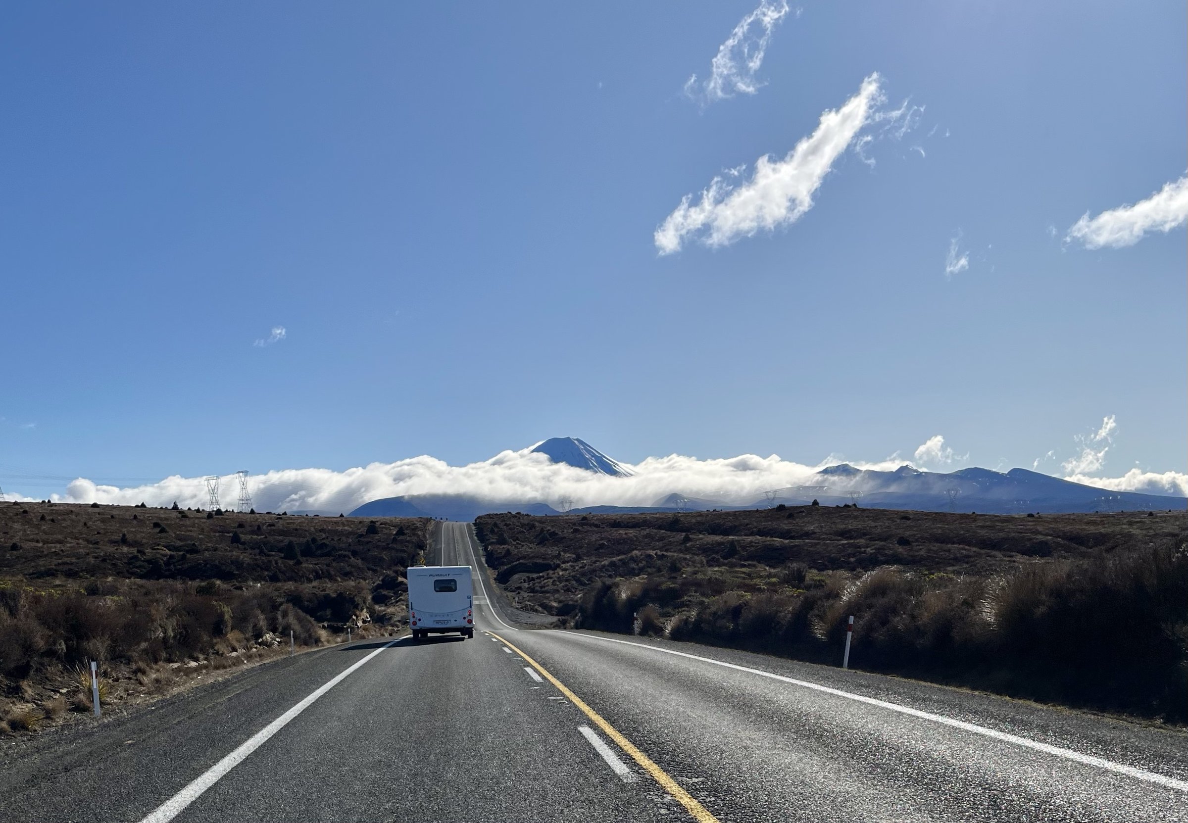
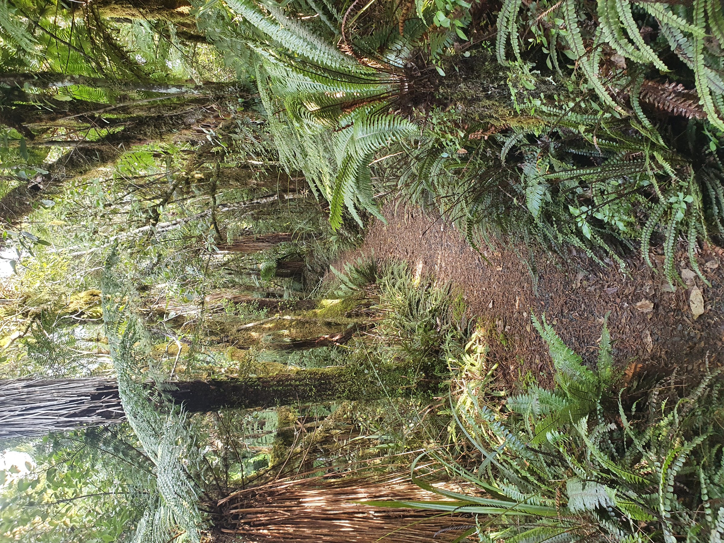
The Western Plateau entry covers the Whakapapa, National Park / Waimarino, Ohakune and Owhango edge of the Tongariro Volcanic Centre. Compared with the exposed central cones, the hiking character here mixes beech forest, podocarp forest, lava flows, silica terraces, old coach roads, river gorges, crater lakes and long views back to Ruapehu, Ngauruhoe and Hauhungatahi.
The area works well when upper alpine routes are stormbound, though tracks can still be muddy, slippery or exposed to sudden weather. Access is mainly by Whakapapa Village, SH47 / SH4, National Park village, Ohakune and Owhango.
Selection rationale
These five hikes represent the west-side range: a Whakapapa volcanic-chemical stream walk, a full backcountry valley loop, a Pīhanga crater-lake forest circuit, a rugged waterfall tramp near National Park, and the historic Ohakune Old Coach Road.
Summary table
| # | Hike | Country | Route type | Distance | Gain | Max elevation | Difficulty |
|---|---|---|---|---|---|---|---|
| 1 | Silica Rapids Walk | New Zealand | Loop | 6.9-7 km | ~206 m secondary | Easy-intermediate | |
| 2 | Whakapapaiti Valley Loop | New Zealand | Loop / road-return | ~15.9 km | ~561 m secondary | Intermediate / hard | |
| 3 | Rotopounamu Track | New Zealand | Loop | 5.0-5.8 km | ~194 m secondary | Lake 713 m | Easy-intermediate |
| 4 | Tupapakurua Falls Track | New Zealand | Out-and-back | 6.8-11 km variants | ~291 m secondary | Advanced tramping | |
| 5 | Ohakune Old Coach Road | New Zealand | Point-to-point | 12.7-15 km | ~436 m secondary | Easy-intermediate shared-use |
1. Silica Rapids Walk
Snapshot
Itinerary
The walk crosses Whakapapanui Stream, meanders through beech forest, passes iron-rich gold-toned stream beds and boardwalk wetlands, then reaches the creamy-white Silica Rapids before looping back by Bruce Road.
Why it is essential
It is the key west-side walk for seeing Ruapehu volcanic chemistry expressed in stream deposits and vegetation zones.
Equipment
Standard hiking equipment, with warm and waterproof layers.
Hazards and notes
No dogs. Wet boardwalks, stream edges and road-walking on the return need care.
Photos
| Image | Source | Author | Licence | Reuse notes | Attribution |
|---|---|---|---|---|---|
| Silica Rapids Walk | DOC track page | Jaime Apolonio | Creative Commons stated by DOC; version not visible in scraped page | Commercial / modification status unresolved until licence version checked | Jaime Apolonio / DOC page credit |
GPX / KML
- DOC Silica Rapids Walk: doc.govt.nz — DOC terms; no GPX found
- AllTrails Silica Rapids Loop Walk: alltrails.com — source-map reference only
External links
- DOC Silica Rapids Walk: doc.govt.nz
- AllTrails Silica Rapids Loop Walk: alltrails.com
2. Whakapapaiti Valley Loop
Snapshot
Itinerary
From Whakapapa, follow Silica Rapids for about 45 minutes to the Whakapapaiti turn-off. The track crosses forest and tussock, bridges Whakapapaiti River, then climbs toward Whakapapaiti Hut. From the upper valley it joins the Round the Mountain route toward Bruce Road and returns via Scoria Flat / Bruce Road.
Why it is essential
This is the west-side backcountry valley day route, with beech forest, river crossings, moraine views and a direct link into the Round the Mountain landscape.
Equipment
Mountain hiking equipment, trekking poles recommended, navigation backup, extra warm layer and headtorch.
Hazards and notes
DOC warns of an unbridged river crossing above the bridged lower crossing; do not cross flooded or doubtful streams. Some return variants involve road walking on Bruce Road.
Photos
| Image | Source | Author | Licence | Reuse notes | Attribution |
|---|---|---|---|---|---|
| Mt Ngauruhoe / Whakapapaiti page image | DOC track page | Wei-Hang Chua | Creative Commons stated by DOC; version not visible in scraped page | Commercial / modification status unresolved until licence version checked | Wei-Hang Chua / DOC page credit |
GPX / KML
- DOC Whakapapaiti Valley Track: doc.govt.nz — DOC terms; no GPX found
- AllTrails Whakapapaiti Valley Loop: alltrails.com — source-map reference only
- Te Araroa GPS downloads: teararoa.org.nz — useful where route overlaps TA; reuse terms need review
External links
- DOC Whakapapaiti Valley Track: doc.govt.nz
- DOC Round the Mountain Track: doc.govt.nz
- AllTrails Whakapapaiti Valley Loop: alltrails.com
- Te Araroa Trail Maps: teararoa.org.nz
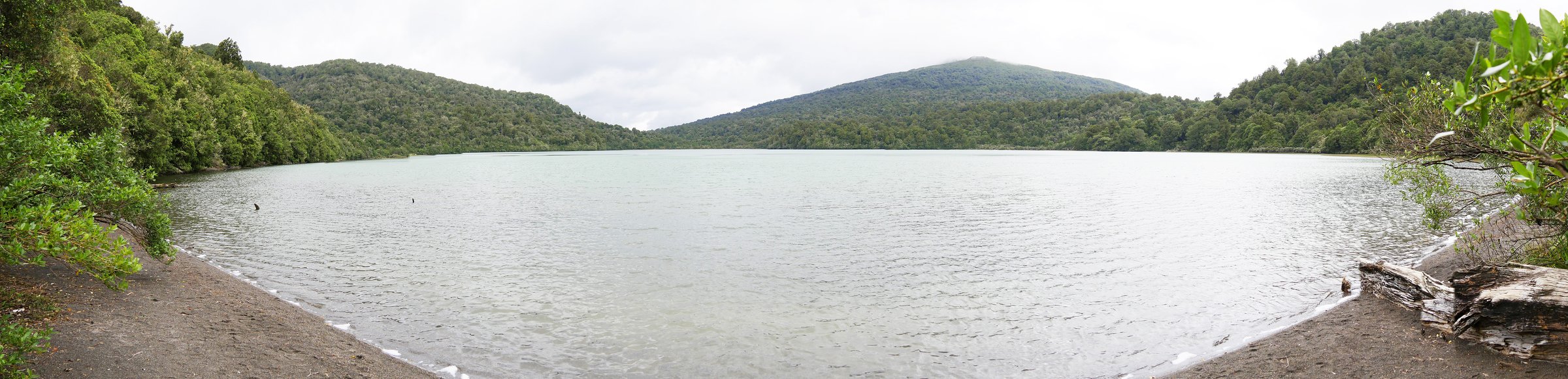
3. Rotopounamu Track
Snapshot
Itinerary
The track climbs gently from the road to a junction, then circles Lake Rotopounamu past Five Minute Beach, Long Beach and Ten Minute Beach before descending back to the car park.
Why it is essential
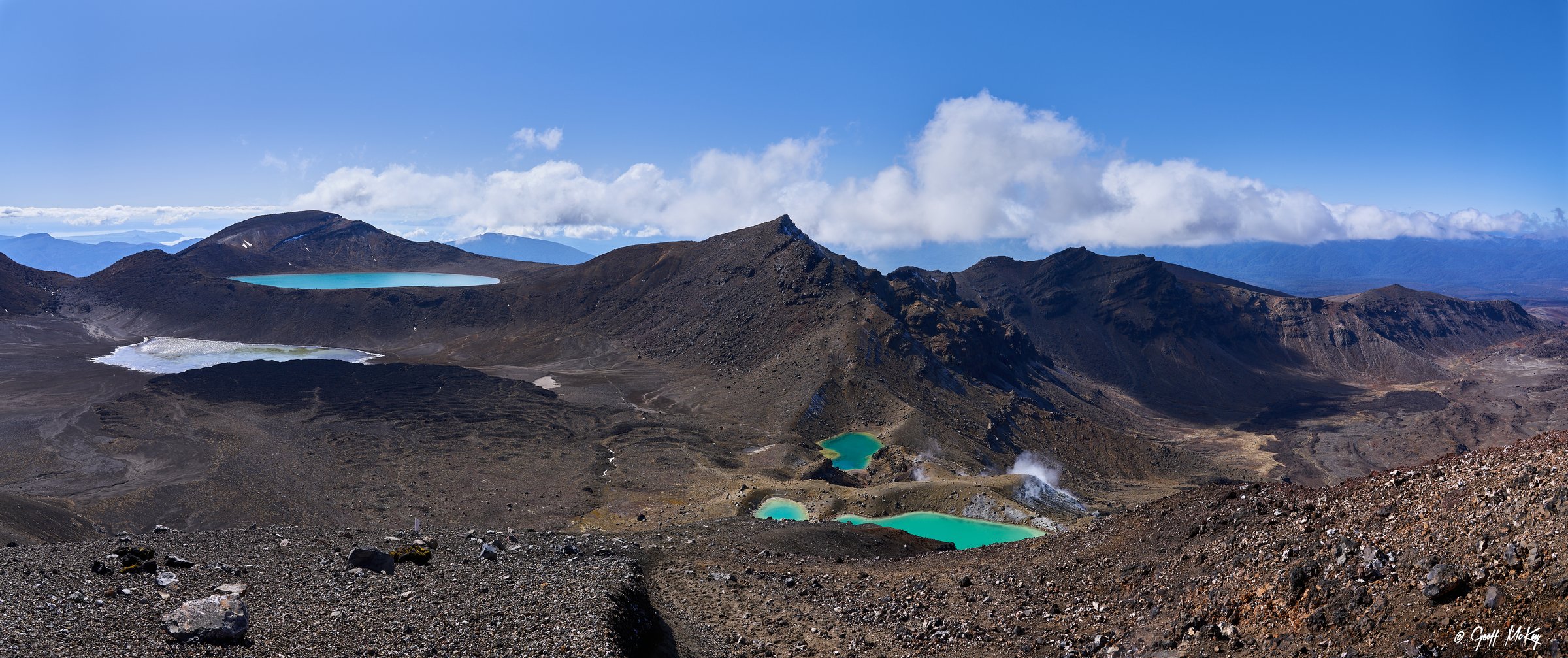
Rotopounamu is the main forested crater-lake walk on the western / northern edge of the Tongariro Volcanic Centre and contrasts strongly with the barren central cone routes.
Equipment
Standard hiking equipment. Swim / picnic use is seasonal; carry warm layers outside summer.
Hazards and notes
Take care crossing busy SH47 from the car park. Dogs are not permitted. DOC notes important biodiversity restoration work around the lake.
GPX / KML
- DOC Rotopounamu Track: doc.govt.nz — DOC terms; no GPX found
- AllTrails Rotopounamu Track: alltrails.com — source-map reference only
External links
- DOC Rotopounamu Track: doc.govt.nz
- AllTrails Rotopounamu Track: alltrails.com
4. Tupapakurua Falls Track
Snapshot
Itinerary
The route begins with an easy 20-minute walk to Taranaki Lookout, then becomes a more rugged backcountry track along a ridge and steeply down about 230 m to a stream. It climbs around bluffs to lookout points over the remote Tupapakurua Falls.
Why it is essential
It is the rugged western forest-and-waterfall tramp, with views to Ruapehu, Hauhungatahi and Taranaki before entering dense podocarp forest.
Equipment
Mountain hiking equipment, sturdy boots, poles, warm / waterproof layers, food, water, map / GPS and distress beacon recommended.
Hazards and notes
DOC maintains the track to the lookout but not to the falls. Mud, steep descents, stream proximity and bluffs make this unsuitable as a casual short walk.
GPX / KML
- DOC Tupapakurua Falls Track: doc.govt.nz — DOC terms; no GPX found
- AllTrails Tupapakurua Falls Track: alltrails.com — shorter route variant; source-map reference only
External links
- DOC Tupapakurua Falls Track: doc.govt.nz
- AllTrails Tupapakurua Falls Track: alltrails.com
5. Ohakune Old Coach Road
Snapshot
Itinerary
The track follows the former coach road between railheads, passing cobbled sections, native forest, old campsites, curved tunnels, the Hapuawhenua Viaduct, railway remains and the approach to Horopito.
Why it is essential
This is the most important cultural / historic day walk on the western flank, combining forest, rail engineering and early central plateau transport history.
Equipment
Standard hiking equipment, torch for tunnel exploration, waterproof layer and enough water.
Hazards and notes
The route is shared with mountain bikes and includes uneven gravel, cobbles, mud, narrow sections and railway crossings. DOC warns not to enter railway corridors and not to climb derelict viaducts.
Photos
| Image | Source | Author | Licence | Reuse notes | Attribution |
|---|---|---|---|---|---|
| Photo status | No licence-compatible Old Coach Road-specific image found in this pass | — | — | Unresolved | — |
GPX / KML
- DOC Ohakune Old Coach Road: doc.govt.nz — DOC terms; no GPX found
- AllTrails Ohakune Old Coach Road: alltrails.com — source-map reference only
External links
- DOC Ohakune Old Coach Road: doc.govt.nz
- AllTrails Ohakune Old Coach Road: alltrails.com
External links
| Resource | Link |
|---|---|
| DOC Silica Rapids Walk | doc.govt.nz |
| DOC Whakapapaiti Valley Track | doc.govt.nz |
| DOC Rotopounamu Track | doc.govt.nz |
| DOC Tupapakurua Falls Track | doc.govt.nz |
| DOC Ohakune Old Coach Road | doc.govt.nz |
| Te Araroa Trail Maps | teararoa.org.nz |