Regional overview
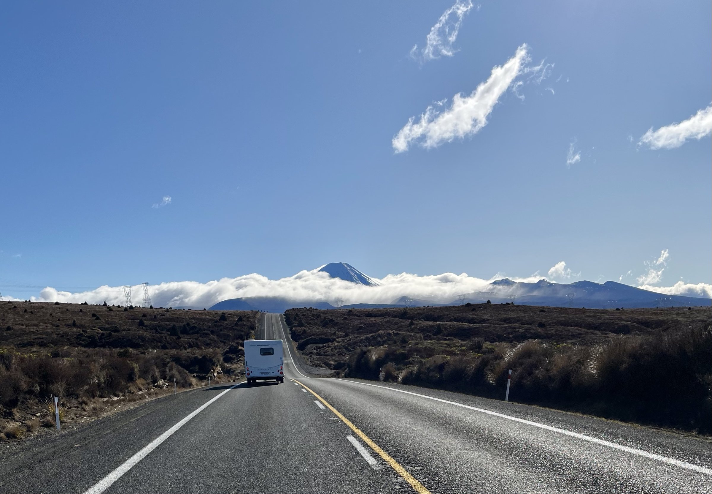
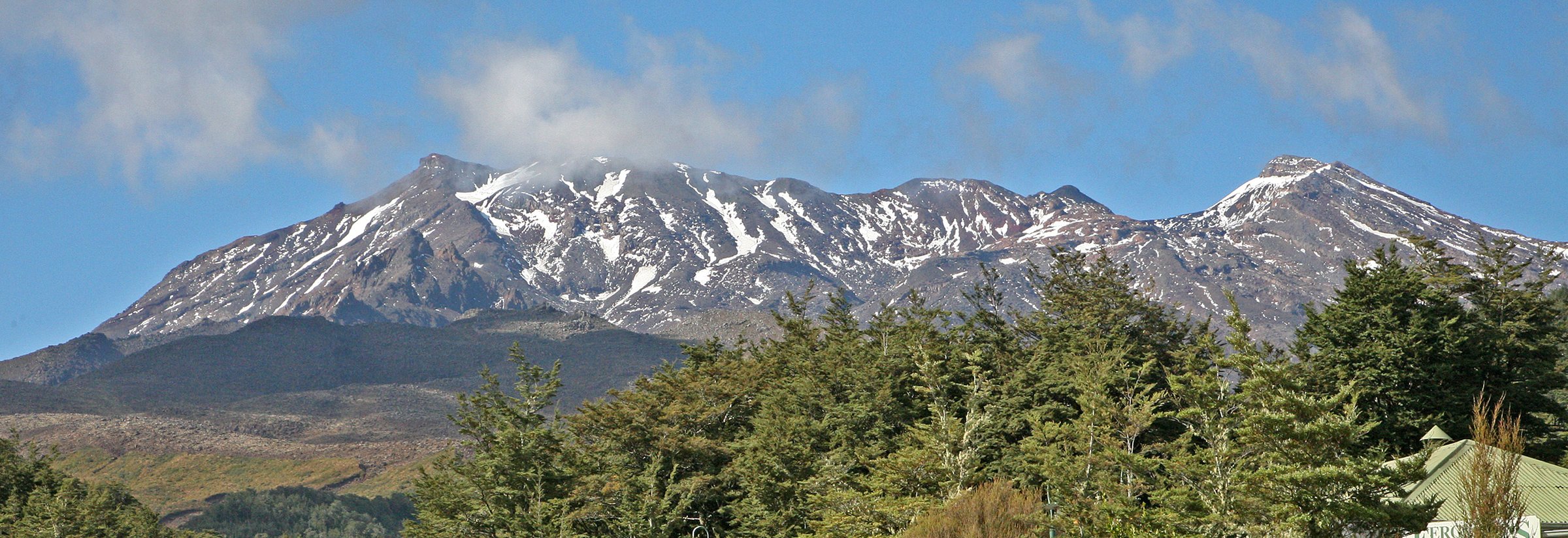
The Mount Ngauruhoe area is the volcanic core of Tongariro National Park, centred on Mangatepopo Valley, South Crater, Red Crater, Emerald Lakes, Oturere Valley and the Tama Saddle. The walking character is open, exposed and alpine rather than forested: scoria, lava flows, old explosion craters, cold springs, active volcanic vents, sulphur-stained ground and wide views to Ruapehu, Tongariro and the central plateau.
Main hiking access is from Mangatepopo Road, Ketetahi Road and Whakapapa Village. The most famous route is the Tongariro Alpine Crossing, but DOC also points walkers to lower-risk alternatives such as Taranaki Falls and Tama Lakes when conditions are poor. Peak climbing is deliberately excluded here: DOC states that climbing Mounts Ngauruhoe and Tongariro is disrespectful and unacceptable to Ngati Tuwharetoa.
The normal walking season is late October or November to April. Snow, ice, avalanche terrain, volcanic hazards, geothermal burns, poor visibility and severe wind can occur outside that window and sometimes in summer. DOC recommends shuttle access for the Alpine Crossing and notes summer parking restrictions at Mangatepopo.
Selection rationale
These five hikes cover the essential Ngauruhoe-area experiences without promoting the summit: the full Alpine Crossing, the Mangatepopo approach, the Red Crater/Emerald Lakes/Oturere volcanic heart, the Tama explosion-crater lakes, and the accessible Taranaki Falls lava-flow loop with Ngauruhoe views.
Summary table
| # | Hike | Country | Route type | Distance | Gain | Max elevation | Difficulty |
|---|---|---|---|---|---|---|---|
| 1 | Tongariro Alpine Crossing | New Zealand | Point-to-point | 20.2 km | +1,196 m change; ~853-1,202 m gain secondary | 1,886 m | Intermediate; expert in winter |
| 2 | Soda Springs Walk | New Zealand | Out-and-back | 6 km return | ~1,400 m approx | Easy-intermediate | |
| 3 | Tama Lakes Track | New Zealand | Out-and-back | 17.6-17.7 km return | ~545 m secondary | 1,314 m Upper Tama | Intermediate; upper side trip advanced |
| 4 | Mangatepopo to Oturere via Red Crater | New Zealand | Point-to-point day section | ~13.7 km | 1,886 m | Intermediate / advanced alpine | |
| 5 | Taranaki Falls Walking Track | New Zealand | Loop | 6.0-6.1 km | ~153 m secondary | Easy-intermediate |
1. Tongariro Alpine Crossing
Snapshot
Itinerary
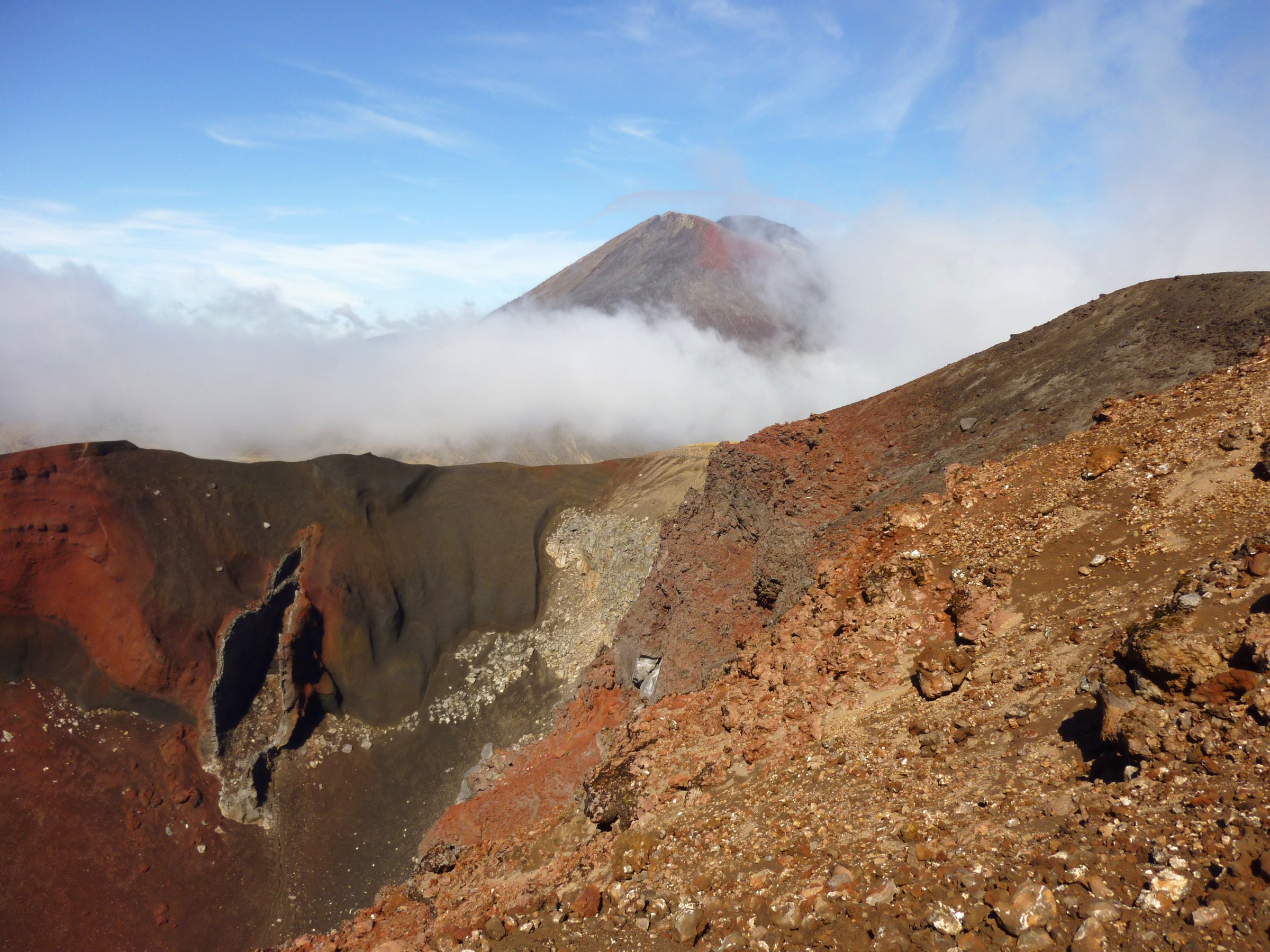
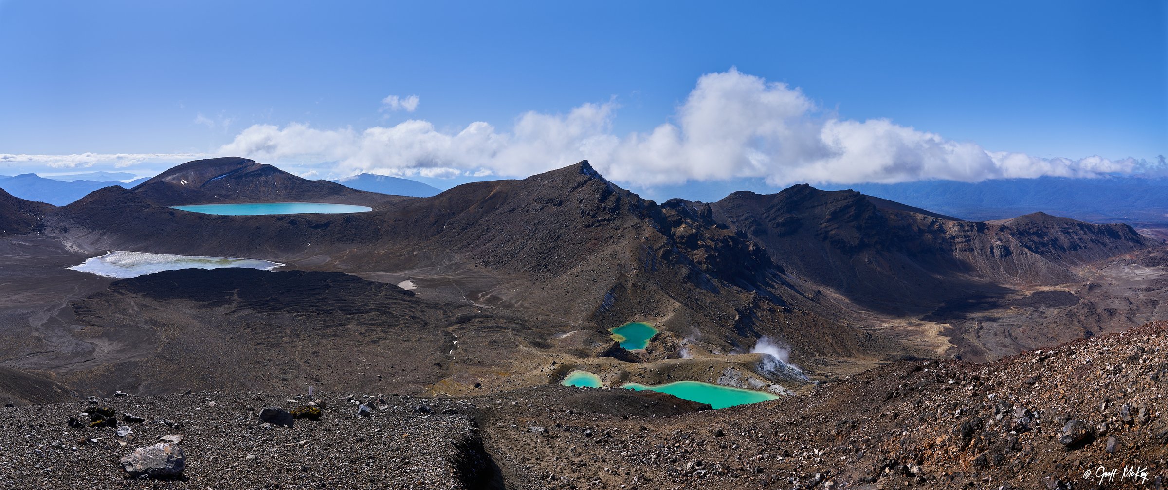
The route follows the Mangatepopo Valley from 1,120 m, passes the Soda Springs junction, climbs the Devil’s Staircase to South Crater, then ascends to Red Crater. A loose volcanic descent leads to the Emerald Lakes, followed by Blue Lake and the long northern descent to Ketetahi Road.
Why it is essential
This is New Zealand’s best-known volcanic day crossing and the key non-summit route through Ngauruhoe’s surrounding volcanic landscape.
Equipment
Mountain hiking equipment: sturdy boots, waterproof and windproof layers, warm layer, hat and gloves outside settled midsummer, food, two litres or more water, map and GPS, sun protection and headtorch. Winter requires alpine skills and equipment; guided travel is recommended by DOC.
Hazards and notes
DOC lists exposed uneven terrain, alpine weather, snow and ice, avalanche terrain in winter, volcanic risk, geothermal hazards near fumaroles and lakes, and loose rock on Red Crater. Stay on track, do not touch or enter the lakes, and respect the 2025 fire recovery rāhui.
GPX / KML
- DOC source map: doc.govt.nz — DOC terms; no GPX found
- Te Araroa GPS downloads: teararoa.org.nz — files generalised; reuse terms need review
- AllTrails route page: alltrails.com — source-map reference only
External links
- DOC Tongariro Alpine Crossing: doc.govt.nz
- Herenga a Nuku Tongariro Alpine Crossing entry
- Te Araroa Trail Maps: teararoa.org.nz
- AllTrails Tongariro Alpine Crossing: alltrails.com
2. Soda Springs Walk
Snapshot
Itinerary
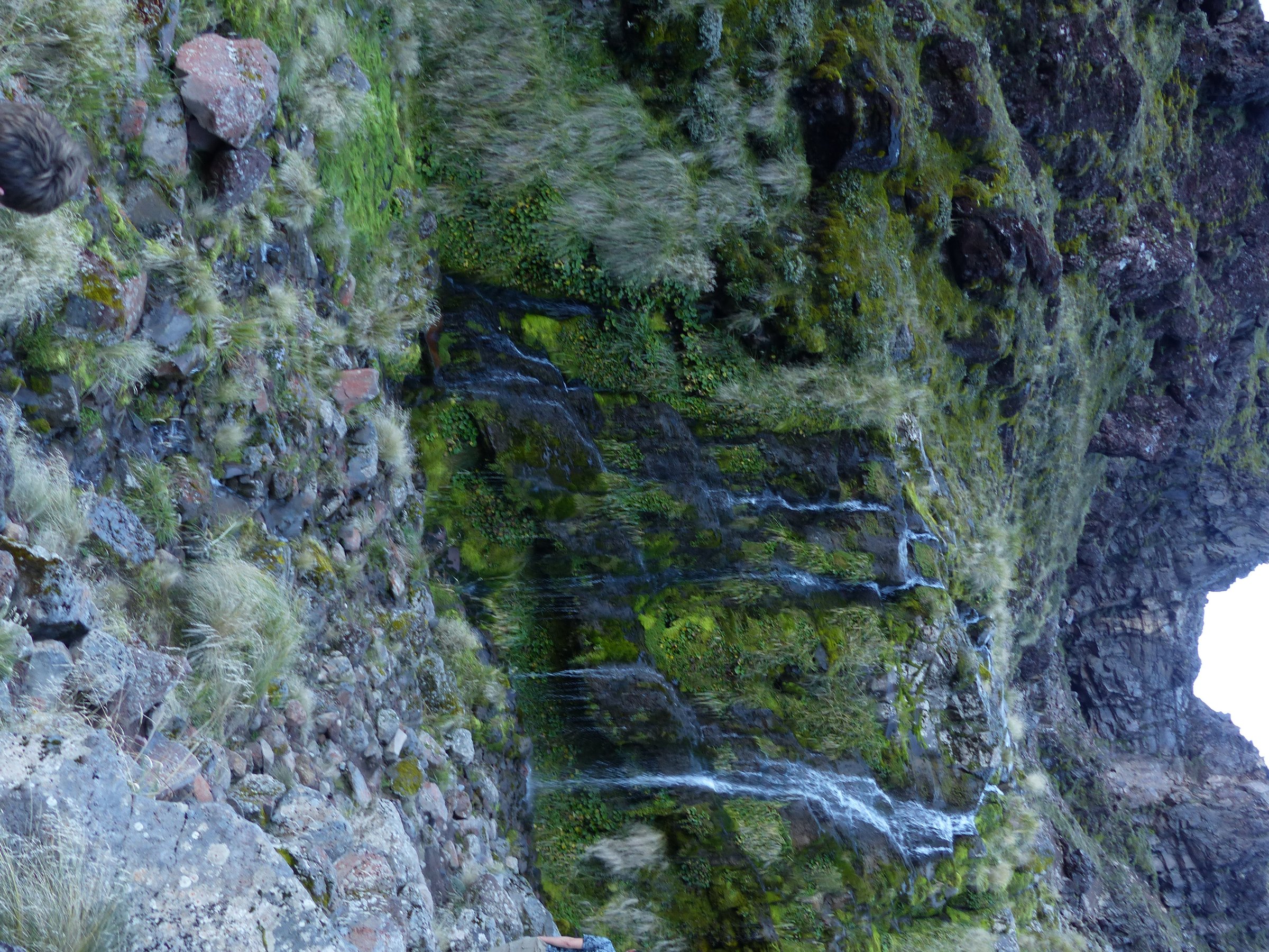
The track follows Mangatepopo Stream on the first section of the Alpine Crossing. It passes young dark Ngauruhoe lava flows and older revegetating flows before reaching the cold springs and small waterfall beneath the Mangatepopo headwall.
Why it is essential
This is the short, accessible introduction to Ngauruhoe’s lava-flow landscape and the lower valley used by the Alpine Crossing.
Equipment
Standard hiking equipment, with warm and waterproof clothing because the valley is exposed.
Hazards and notes
Parking at Mangatepopo is limited and time-restricted in the main season. The route uses part of the Alpine Crossing, so DOC recommends booking for track use. No dogs; drones require permits and are generally not approved by DOC.
GPX / KML
- DOC source map: doc.govt.nz — DOC terms; no GPX found
- AllTrails source map: alltrails.com — source-map reference only
External links
- DOC Soda Springs Walk: doc.govt.nz
- AllTrails Soda Springs Walk: alltrails.com
3. Tama Lakes Track
Snapshot
Itinerary
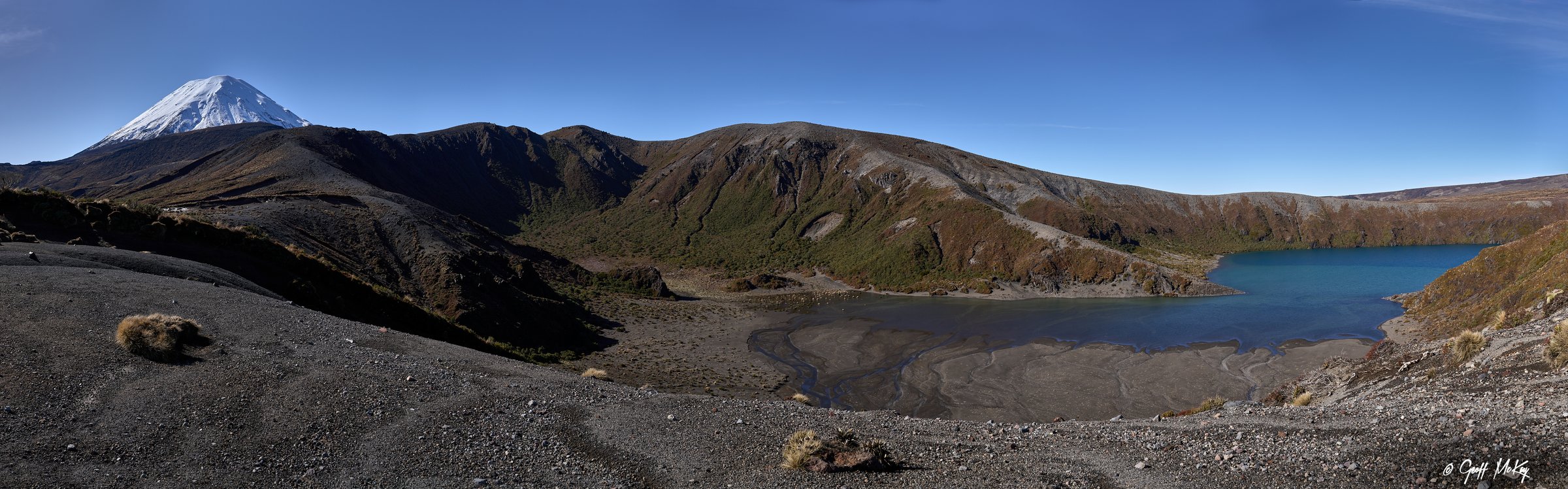
The track starts on the Taranaki Falls route, then continues beyond the falls over undulating tussock and alpine herbfields to Tama Saddle. The formed track ends at a broad clearing with views of Lower Tama Lake, Ngauruhoe and Ruapehu. The Upper Tama viewpoint is reached by a rough, steep, loose and unformed ridge route.
Why it is essential
Tama Lakes gives the best non-technical day view of the explosion craters between Ruapehu and Ngauruhoe and is DOC’s main alternative when the Alpine Crossing is unsuitable.
Equipment
Mountain hiking equipment. Add poles for the upper side trip, and winter alpine equipment if snow or ice is present.
Hazards and notes
DOC warns that there are no formed tracks down to the lakes and that the gullies are steep and unstable. Do not touch or swim in the lakes. Wind, low cloud and loose rock make the upper side trip substantially more serious.
GPX / KML
- DOC source map: doc.govt.nz — DOC terms; no GPX found
- AllTrails Tama Lakes via Taranaki Falls: alltrails.com — source-map reference only
- Gaia GPS Lower Tama Lake Loop: gaiagps.com — download availability noted; reuse terms need review
External links
- DOC Tama Lakes Track: doc.govt.nz
- AllTrails Tama Lakes Track via Taranaki Falls: alltrails.com
- Gaia GPS Lower Tama Lake Loop: gaiagps.com
4. Mangatepopo to Oturere via Red Crater and Emerald Lakes

Snapshot
Itinerary
The route follows the Alpine Crossing from Mangatepopo through South Crater to Red Crater and the Emerald Lakes. Instead of descending north to Ketetahi, it turns east on the Northern Circuit, dropping steeply past unusual jagged lava forms into Oturere Valley and the Oturere Hut area.
Why it is essential
This section links the most dramatic Ngauruhoe-side craters with the less-visited lava sculpture landscape of Oturere Valley.
Equipment
Mountain hiking equipment, navigation backup, headtorch and enough water for a dry exposed route. Winter or shoulder-season snow requires alpine skills and equipment.
Hazards and notes
This is not a simple car-to-car walk. DOC states the Northern Circuit is not operating as a Great Walk while Oturere Hut is being replaced, with availability returning for the 2026/27 season; check current closures and booking status before using this as a day section.
GPX / KML
- DOC source map / section stats: doc.govt.nz — DOC terms; no GPX found
- Te Araroa GPS downloads: teararoa.org.nz — covers relevant detour / route sections; reuse terms need review
- AllTrails Oturere Hut to Waihohonu section: alltrails.com — secondary geometry only
External links
- DOC Tongariro Northern Circuit: doc.govt.nz
- DOC Tongariro Alpine Crossing: doc.govt.nz
- Te Araroa Trail Maps: teararoa.org.nz
5. Taranaki Falls Walking Track
Snapshot
Itinerary
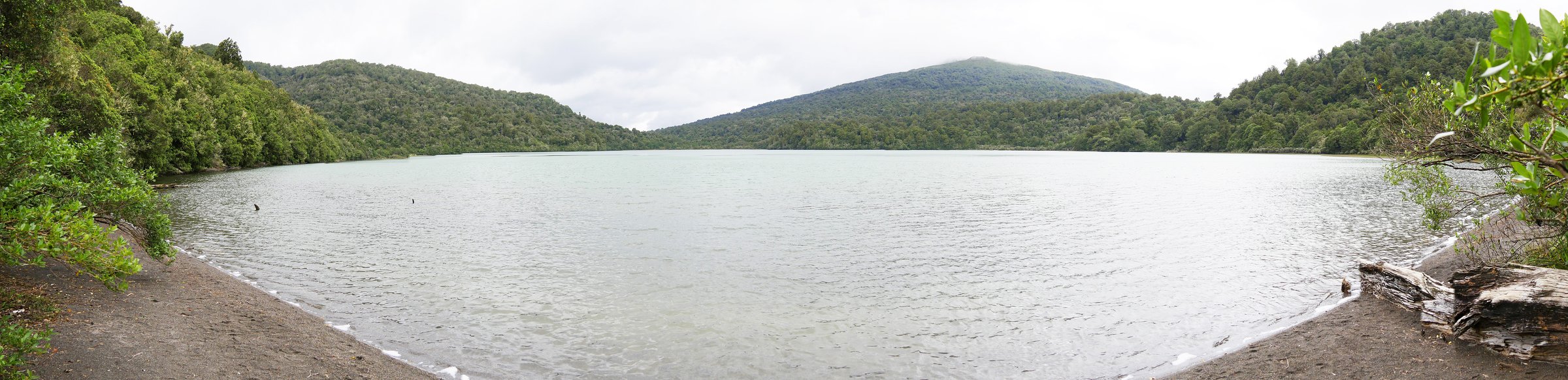
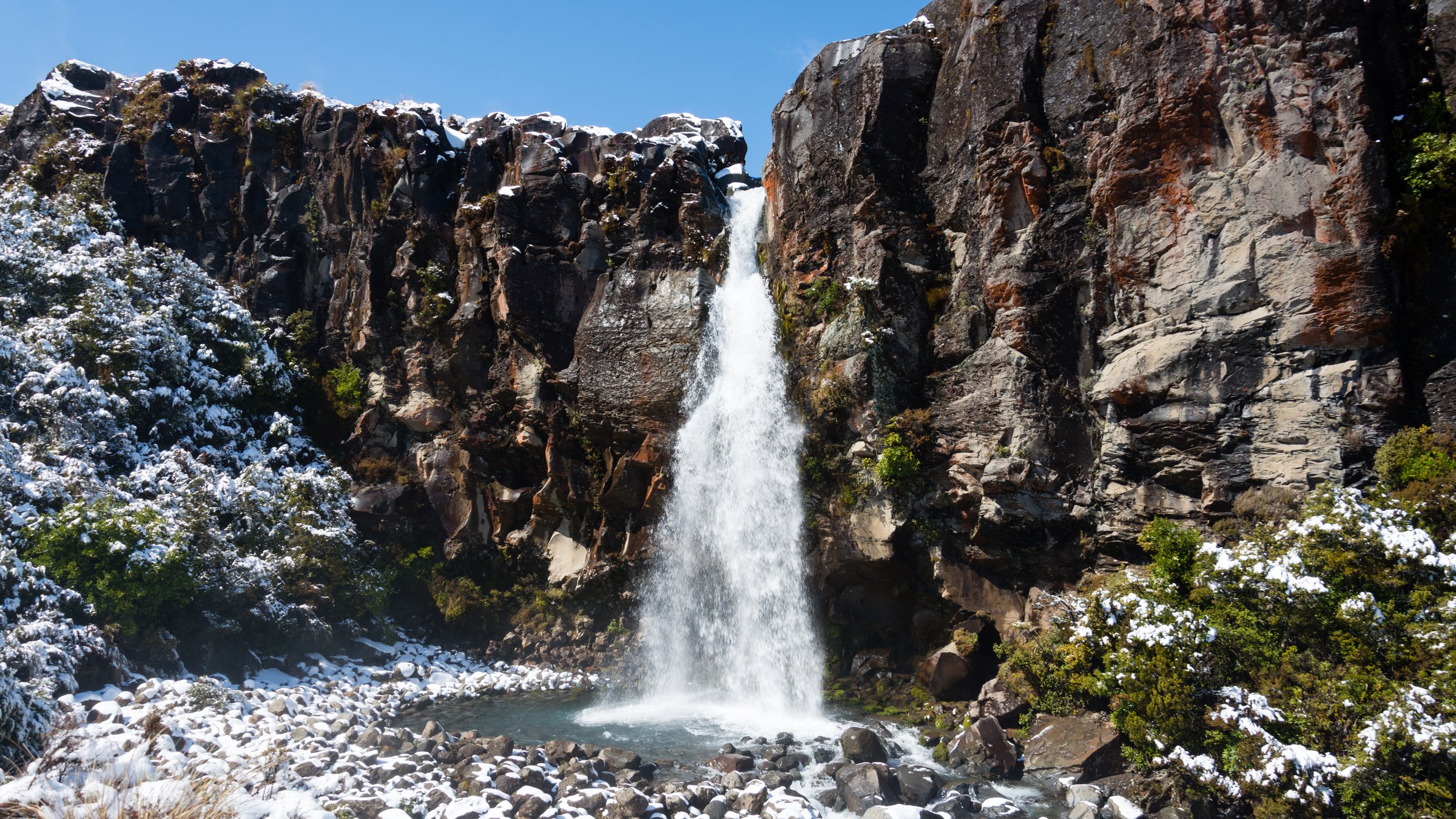
The loop crosses tussock and shrubland, enters mountain beech forest, follows Wairere Stream past Cascade Falls, then reaches the 20 m Taranaki Falls dropping over an andesite lava flow. The return climbs steps to join the Tama Lakes route before crossing open volcanic gullies back to Whakapapa.
Why it is essential
It is the classic short volcanic-landform walk of the Whakapapa / Ngauruhoe view area and a practical bad-weather alternative to the Alpine Crossing.
Equipment
Standard hiking equipment; carry waterproof clothing because Whakapapa weather changes quickly.
Hazards and notes
No dogs. DOC prohibits unauthorised drones in the national park. Steps and wet rock near the falls can be slippery.
GPX / KML
- DOC source map: doc.govt.nz — DOC terms; no GPX found
- Wilderness Magazine GPX: wildernessmag.co.nz — route described as best guess in PDF; reuse terms need review
- AllTrails Taranaki Falls Walk: alltrails.com — source-map reference only
External links
- DOC Taranaki Falls Walking Track: doc.govt.nz
- AllTrails Taranaki Falls Walk: alltrails.com
- Wilderness Magazine Taranaki Falls Track: wildernessmag.co.nz
External links
| Resource | Link |
|---|---|
| DOC Tongariro Alpine Crossing | doc.govt.nz |
| DOC Soda Springs Walk | doc.govt.nz |
| DOC Tama Lakes Track | doc.govt.nz |
| DOC Tongariro Northern Circuit | doc.govt.nz |
| DOC Taranaki Falls Walking Track | doc.govt.nz |
| Te Araroa Trail Maps | teararoa.org.nz |