Regional overview
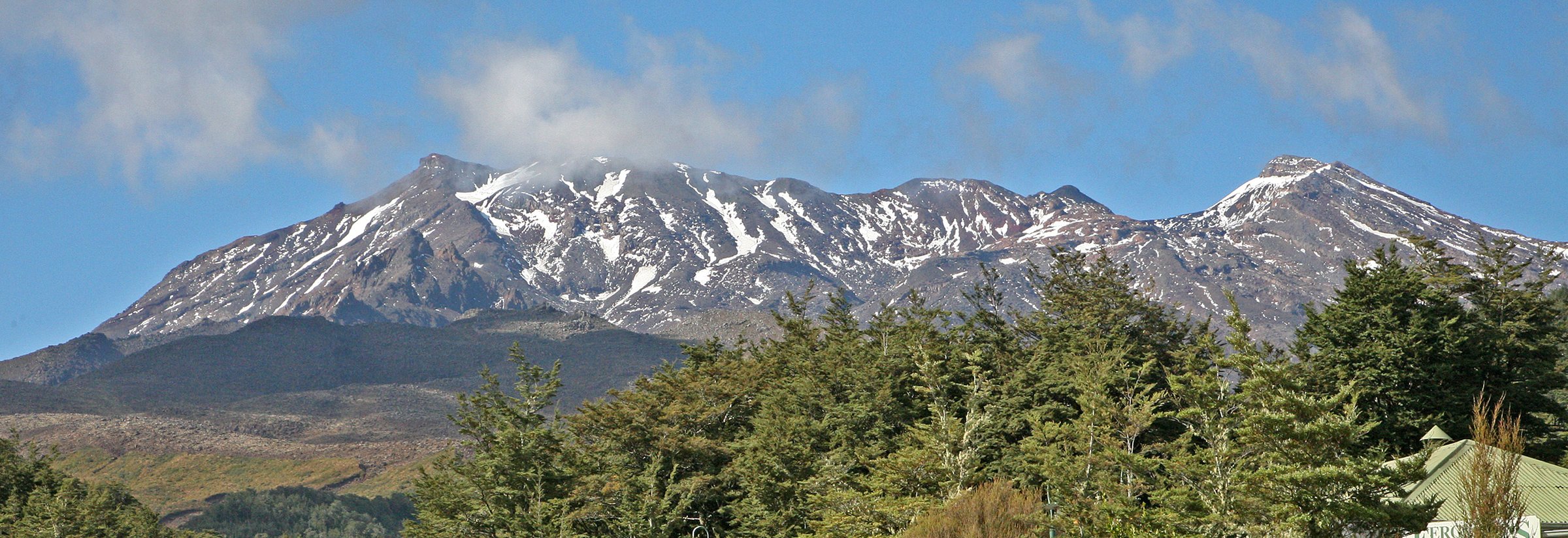
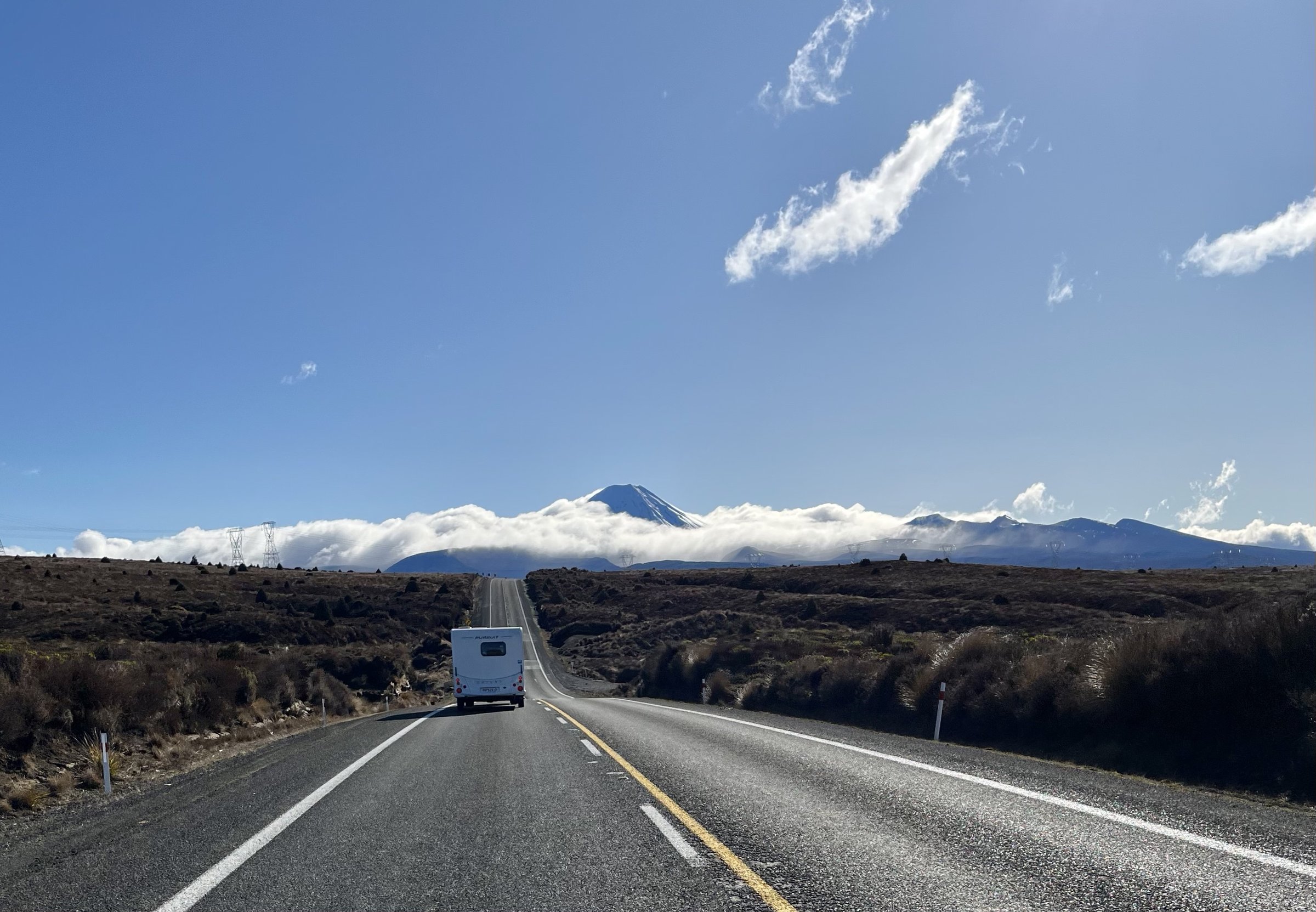
The Eastern Desert Road slopes cover the dry, open Rangipo / Desert Road side of Tongariro National Park: Waihohonu, Ohinepango Springs, Rangipo Hut, Tukino Road and the eastern sections of the Round the Mountain and Tongariro Northern Circuit tracks. The landscape is wind-scoured, pumice-rich and more desert-like than the western forest margins.
Many routes here are not simple roadside loops. Several essential walks are one-day sections of multi-day tracks, starting or ending at huts. They are included because the prompt permits clear one-day sections, but each is labelled for access reality.
Access is mainly from SH1 / Desert Road and Tukino Road. Tukino Access Road is rough, 4WD-only and passes an area with unexploded-ordnance warnings. Weather is exposed and harsh; in winter, snow, ice, avalanche risk and low visibility can make travel serious.
Selection rationale
These five routes represent the east-side catalogue: the historic Waihohonu approach, the Ohinepango cold springs, the desert traverse to Rangipo, the Oturere-Waihohonu volcanic foothill section, and the Tukino access route to Rangipo.
Summary table
| # | Hike | Country | Route type | Distance | Gain | Max elevation | Difficulty |
|---|---|---|---|---|---|---|---|
| 1 | Historic Waihohonu Hut Track | New Zealand | Out-and-back | 12.6-12.7 km | ~238 m secondary | Advanced tramping | |
| 2 | Desert Road to Waihohonu Hut and Ohinepango Springs | New Zealand | Out-and-back composite | ~15 km | ~300 m secondary composite | Advanced tramping | |
| 3 | Waihohonu Hut to Rangipo Hut | New Zealand | Hut-to-hut day section | 12.5-13.7 km | ~692 m secondary | 1,556 m at Rangipo Hut | Advanced tramping |
| 4 | Oturere Hut to Waihohonu Hut | New Zealand | Hut-to-hut day section | 8.1 km | ~234 m secondary | Intermediate tramping | |
| 5 | Tukino Road to Rangipo Hut | New Zealand | Out-and-back from 4WD road | 1,556 m at Rangipo Hut | Advanced / remote |
1. Historic Waihohonu Hut Track
Snapshot
Itinerary
The track leaves Desert Road, crosses beech forest and open tussock, crosses Ohinepango Stream and reaches the new Waihohonu Hut area. A short continuation leads to the historic 1903/04 Waihohonu Hut, formerly used by stage coaches.
Why it is essential
It is the most direct day access to the east-side historical heart of Tongariro National Park and its first hut.
Equipment
Mountain hiking equipment, navigation backup, warm / waterproof layers, food and water.
Hazards and notes
No dogs. The area is exposed and can be dry, windy, cold or snowy. Hut and Great Walk booking rules may apply if using the new Waihohonu facilities.
Photos
| Image | Source | Author | Licence | Reuse notes | Attribution |
|---|---|---|---|---|---|
| Track from Historic Waihohonu Hut | DOC track page | Sharon Hart | Creative Commons stated by DOC; version not visible in scraped page | Commercial / modification status unresolved until licence version checked | Sharon Hart / DOC page credit |
GPX / KML
- DOC Historic Waihohonu Hut Track: doc.govt.nz — DOC terms; no GPX found
- AllTrails Historic Waihohonu Hut Track: alltrails.com — source-map reference only
External links
- DOC Historic Waihohonu Hut Track: doc.govt.nz
- AllTrails Historic Waihohonu Hut Track: alltrails.com
2. Desert Road to Waihohonu Hut and Ohinepango Springs
Snapshot
Itinerary
Follow the Historic Waihohonu Hut Track from Desert Road to Waihohonu. From the hut area, continue to the signposted Ohinepango Springs side trip on the Round the Mountain Track, where clear cold water bubbles from beneath an old lava flow into Ohinepango Stream.
Why it is essential
This combines the historic hut approach with one of the eastern slopes’ most distinctive hydrological features.
Equipment
Mountain hiking equipment, navigation backup, water, food and layers for exposed desert weather.
Hazards and notes
This is a constructed day route from component sources rather than a named DOC day walk. Treat all composite distance / elevation as approximate.
Photos
| Image | Source | Author | Licence | Reuse notes | Attribution |
|---|---|---|---|---|---|
| Ohinepango Springs | DOC Round the Mountain image gallery | Sarah Wilcox | Creative Commons stated by DOC; version not visible in scraped page | Commercial / modification status unresolved until licence version checked | Sarah Wilcox / DOC page credit |
GPX / KML
- DOC Historic Waihohonu Hut Track: doc.govt.nz — component source map
- DOC Round the Mountain Track: doc.govt.nz — component source map
- AllTrails Waihohonu Hut to Ohinepango Springs: alltrails.com — source-map reference only
External links
- DOC Historic Waihohonu Hut Track: doc.govt.nz
- DOC Round the Mountain Track: doc.govt.nz
- AllTrails Waihohonu Hut to Ohinepango Springs: alltrails.com
3. Waihohonu Hut to Rangipo Hut
Snapshot
Itinerary
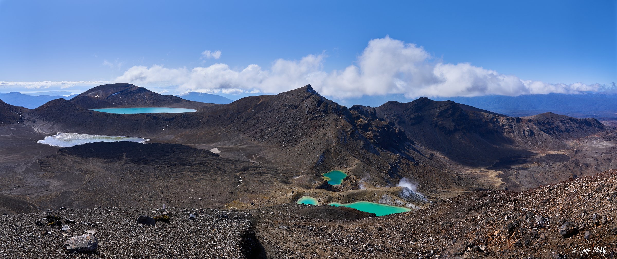
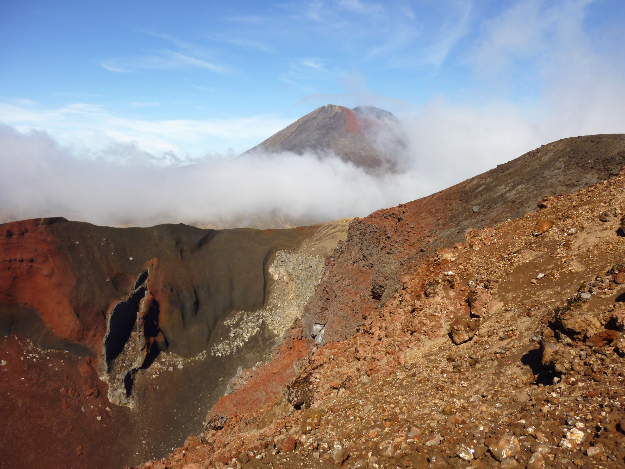
From Waihohonu, the Round the Mountain Track crosses one of the park’s driest landscapes, passing Ohinepango Springs and traversing wind-sculpted volcanic sands and rock on the eastern side of Ruapehu, past Tukino Road and Whangaehu River, to Rangipo Hut.
Why it is essential
This is the defining Rangipo Desert day section and the starkest east-side contrast to the park’s western forests.
Equipment
Mountain hiking equipment, navigation backup, extra water, sun / wind protection, emergency shelter and headtorch.
Hazards and notes
DOC notes the Round the Mountain Track is rugged, exposed and includes river crossings, winter snow / ice and avalanche risk. Whangaehu is a lahar path; move through quickly and do not linger.
Photos
| Image | Source | Author | Licence | Reuse notes | Attribution |
|---|---|---|---|---|---|
| Waihohonu Hut to Rangipo Hut | DOC Round the Mountain page | Sarah Wilcox | Creative Commons stated by DOC; version not visible in scraped page | Commercial / modification status unresolved until licence version checked | Sarah Wilcox / DOC page credit |
GPX / KML
- DOC Round the Mountain Track: doc.govt.nz — DOC terms; source map only
- AllTrails Waihohonu Hut to Rangipo Hut: alltrails.com — source-map reference only
- Te Araroa Trail Maps: teararoa.org.nz — covers detour / section data; reuse terms need review
External links
- DOC Round the Mountain Track: doc.govt.nz
- DOC Rangipo Hut: doc.govt.nz
- AllTrails Waihohonu Hut to Rangipo Hut: alltrails.com
- Te Araroa Trail Maps: teararoa.org.nz
4. Oturere Hut to Waihohonu Hut
Snapshot
Itinerary
The route undulates over stream valleys and open gravel fields, with sparse plant recolonisation in volcanic terrain. It sidles around Ngauruhoe’s foothills, descends into a Waihohonu Stream branch valley, crosses beech-clad ground and climbs toward Waihohonu Hut.
Why it is essential
It is the shortest representative eastern-foothill day section of the Northern Circuit, linking Oturere’s lava country with the Waihohonu valley.
Equipment
Mountain hiking equipment, navigation backup, warm / waterproof layers and water. Carry hut booking / itinerary details if part of a multi-day trip.
Hazards and notes
DOC states the Northern Circuit is not currently operating as a Great Walk while Oturere Hut is replaced; the Great Walk is available for the 2026/27 walking season. Confirm current track and hut status before use.
Photos
| Image | Source | Author | Licence | Reuse notes | Attribution |
|---|---|---|---|---|---|
| Photo status | No licence-compatible Oturere-Waihohonu-specific image found in this pass | — | — | Unresolved | — |
GPX / KML
- DOC Tongariro Northern Circuit: doc.govt.nz — DOC terms; source map only
- AllTrails Oturere Hut to Waihohonu Hut: alltrails.com — source-map reference only
- Te Araroa Trail Maps: teararoa.org.nz — route data source; reuse terms need review
External links
- DOC Tongariro Northern Circuit: doc.govt.nz
- AllTrails Oturere Hut to Waihohonu Hut: alltrails.com
- Te Araroa Trail Maps: teararoa.org.nz
5. Tukino Road to Rangipo Hut
Snapshot
Itinerary
From the point where the Round the Mountain Track crosses Tukino Road, follow the marked track east / southeast across the dry eastern Ruapehu slopes to Rangipo Hut. Return the same way unless continuing on a longer Round the Mountain itinerary.
Why it is essential
This is the shortest practical access to Rangipo Hut and gives day access to the eastern desert landscape without committing to the full Waihohonu-Rangipo section.
Equipment
Mountain hiking equipment, navigation backup, emergency shelter, warm / waterproof clothing, water and PLB recommended.
Hazards and notes
DOC states Tukino Road is rough, 4WD-only, not a recreational off-road track, and passes an area with unexploded-ordnance risk. The Tukino area has no formed or poled walking tracks beyond established routes and is remote with extreme weather, avalanche, rockfall, volcanic and lahar hazards.
Photos
| Image | Source | Author | Licence | Reuse notes | Attribution |
|---|---|---|---|---|---|
| Photo status | No licence-compatible Tukino-Rangipo-specific image found in this pass | — | — | Unresolved | — |
GPX / KML
- DOC Round the Mountain Track: doc.govt.nz — DOC terms; source map only
- DOC Tukino Area: doc.govt.nz — access and hazard source; not a route file
External links
- DOC Round the Mountain Track: doc.govt.nz
- DOC Tukino Area: doc.govt.nz
- DOC Rangipo Hut: doc.govt.nz
External links
| Resource | Link |
|---|---|
| DOC Historic Waihohonu Hut Track | doc.govt.nz |
| DOC Round the Mountain Track | doc.govt.nz |
| DOC Tongariro Northern Circuit | doc.govt.nz |
| DOC Rangipo Hut | doc.govt.nz |
| DOC Tukino Area | doc.govt.nz |
| Te Araroa Trail Maps | teararoa.org.nz |