Regional overview
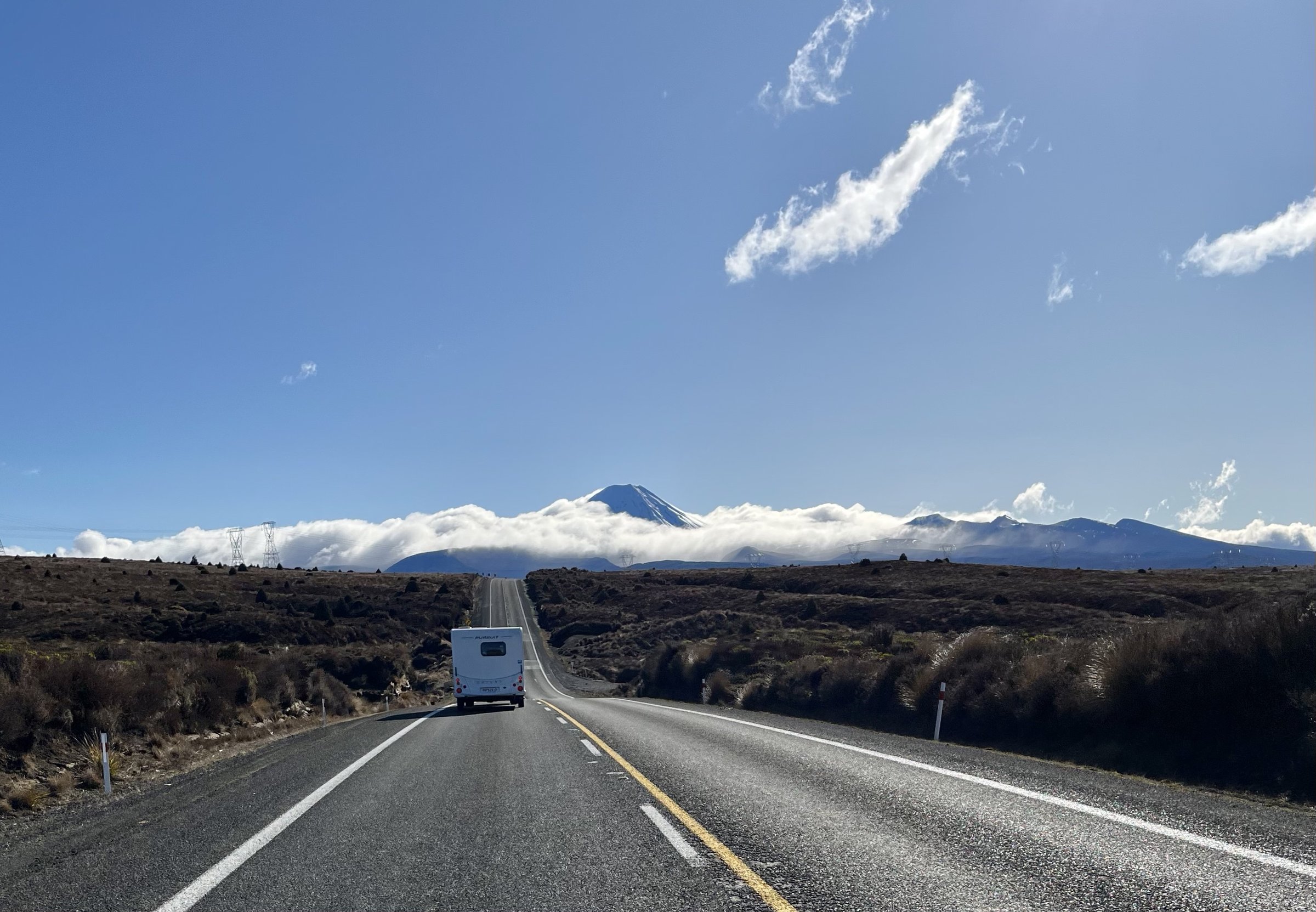
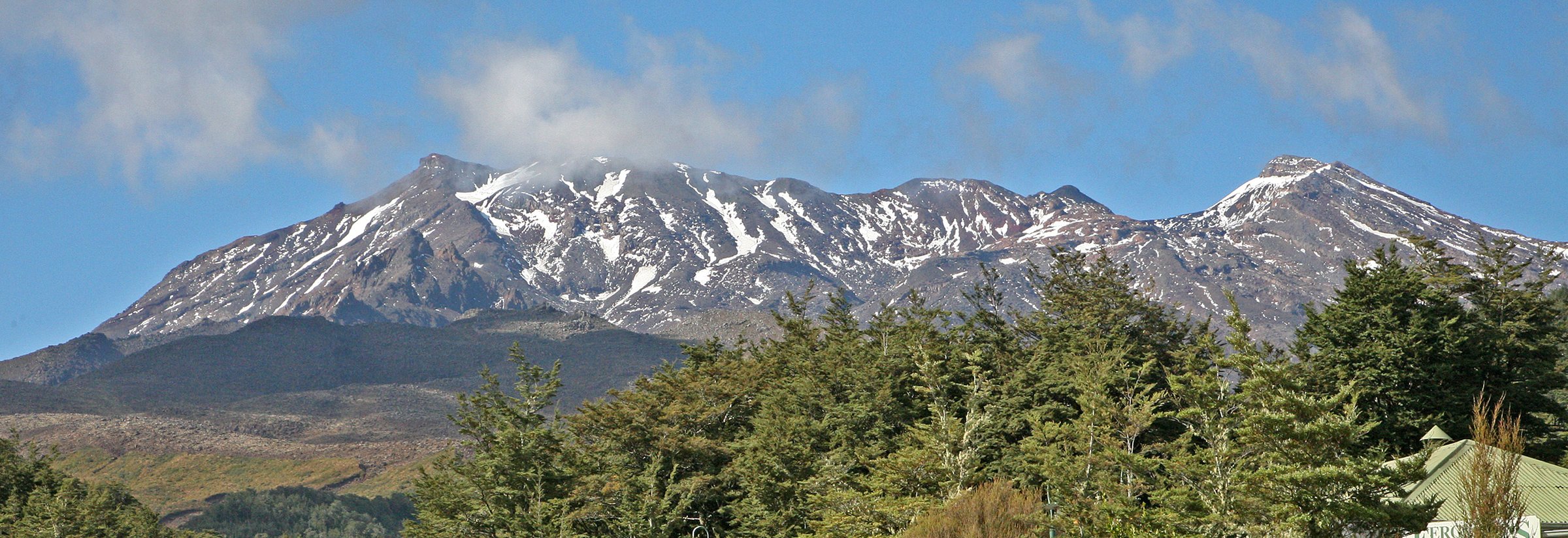
The Mount Ruapehu area is higher, colder and more alpine than the lower Tongariro tracks, with two main access corridors: Bruce Road to Whakapapa Ski Area on the northwestern flank and Ohakune Mountain Road to Tūroa / Waitonga on the southern flank. Terrain ranges from marked ski-area lava routes to mountain beech forest, boggy historic tracks, waterfalls and Round the Mountain sections.
Ruapehu is an active volcano with Te Wai a-moe / Crater Lake near the summit. DOC discourages summit-zone travel and states that there are no DOC-administered alpine climbing tracks on Ruapehu. The selected walks therefore avoid summit routes and focus on recognised short alpine walks and DOC tramping-track sections.
The normal summer walking window is December to April on the higher Whakapapa Ski Area walks, which are weather- and lift-dependent. Snow, ice, loose rock, high wind, avalanche risk and lahar paths are major considerations outside settled summer conditions.
Selection rationale
The set balances Ruapehu’s ski-field alpine viewpoints, lava cliffs, highest waterfall, historic forest approach track and Round the Mountain volcanic-valley terrain.
Summary table
| # | Hike | Country | Route type | Distance | Gain | Max elevation | Difficulty |
|---|---|---|---|---|---|---|---|
| 1 | Skyline Walk | New Zealand | Lift-assisted out-and-back | 2.3 km | ~280 m | 2,300 m | Alpine short walk |
| 2 | Meads Wall Track | New Zealand | Out-and-back | ~1 km | ~41 m secondary | Easy / moderate short walk | |
| 3 | Waitonga Falls Track | New Zealand | Out-and-back | 4 km | ~195 m secondary | Easy-intermediate | |
| 4 | Old Blyth Track | New Zealand | Out-and-back | 10.6-11 km | Intermediate tramping | ||
| 5 | Ohakune Mountain Road to Mangaturuturu Hut and Cascades | New Zealand | Out-and-back | 6-6.4 km | ~63 m secondary directional | Advanced tramping section |
1. Skyline Walk
Snapshot
Itinerary
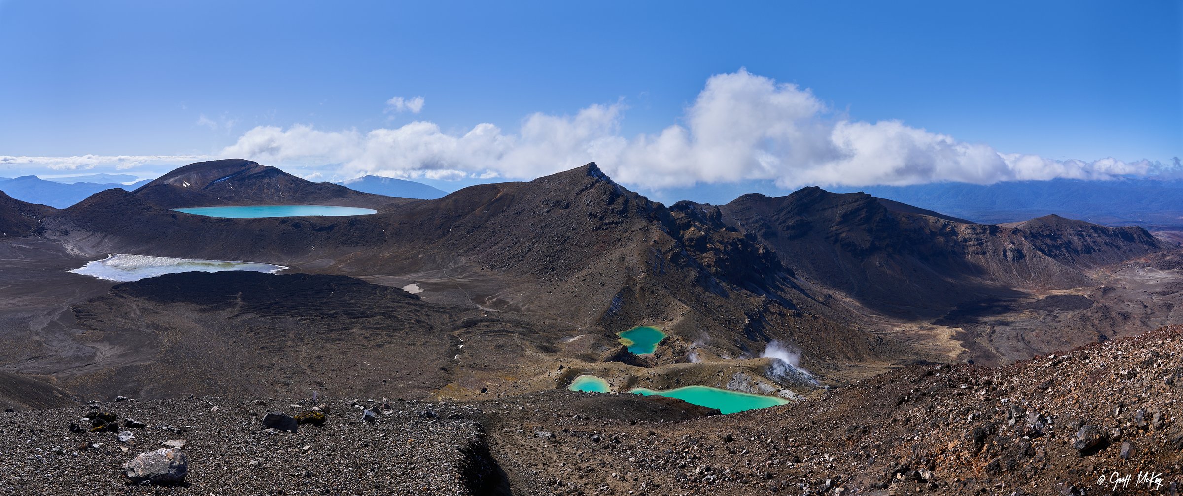
From the Sky Waka top station, the route climbs across loose volcanic ground to Skyline Ridge. The ridge opens to broad views over Tongariro National Park, Ngauruhoe and, in clear conditions, Lake Taupō and the volcanic plateau.
Why it is essential
It is the most accessible high-level Ruapehu viewpoint that avoids the summit hazard zone.
Equipment
Mountain hiking equipment: sturdy footwear, windproof / waterproof layer, warm layer, food, water, sun protection and navigation backup.
Hazards and notes
Whakapapa states summer walks open from December to April, weather dependent. Beyond Sky Waka, walkers are responsible for their own safety and should expect loose rock, cliffs, snow, ice and rapid weather changes. Gondola closure can affect return logistics.
GPX / KML
- Whakapapa Summer Short Walks source map: whakapapa.com — Whakapapa terms; source map only
- Visit Ruapehu Skyline Walk: visitruapehu.com — Visit Ruapehu terms; source page only
External links
- Whakapapa Short Walks: whakapapa.com
- Visit Ruapehu Skyline Walk: visitruapehu.com
- DOC Tukino / Ruapehu climbing warnings: doc.govt.nz
2. Meads Wall Track
Snapshot
Itinerary
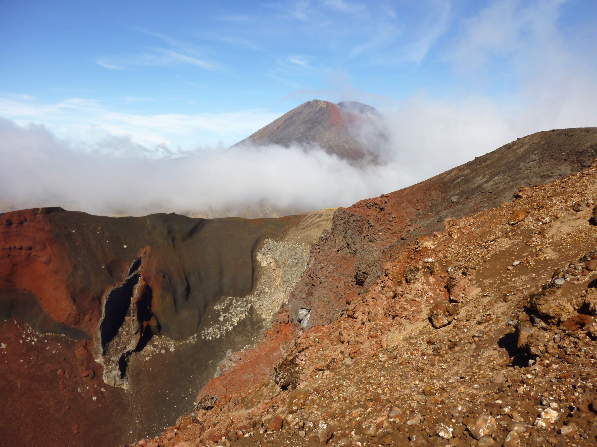
The short route crosses volcanic ski-field terrain to Meads Wall, a lava cliff and viewpoint above the Whakapapa base area. It gives close views of Ruapehu’s rugged flank and longer views toward Ngauruhoe.
Why it is essential
Meads Wall is an iconic accessible lava formation, also known as a Lord of the Rings filming location, and provides a quick sample of Ruapehu’s high volcanic terrain.
Equipment
Standard hiking equipment plus warm / windproof clothing; the route is short but alpine.
Hazards and notes
Keep clear of cliff edges and rock-climbing areas unless properly equipped. Weather changes rapidly at the ski field.
Photos
| Image | Source | Author | Licence | Reuse notes | Attribution |
|---|---|---|---|---|---|
| Photo status | No licence-compatible Meads Wall-specific image found in this pass | — | — | Unresolved | — |
GPX / KML
- Visit Ruapehu Meads Wall: visitruapehu.com — Visit Ruapehu terms; source page only
- Whakapapa Short Walks: whakapapa.com — Whakapapa terms; source map only
- AllTrails Mead’s Wall Track: alltrails.com — source-map reference only
External links
- Visit Ruapehu Meads Wall: visitruapehu.com
- Whakapapa Short Walks: whakapapa.com
- AllTrails Mead’s Wall Track: alltrails.com
3. Waitonga Falls Track
Snapshot
Itinerary
The well-formed track passes through mountain beech and kaikawaka forest, crosses an alpine wetland with Rotokawa pool reflections, then reaches Waitonga Falls, a 39 m waterfall and the highest in Tongariro National Park.
Why it is essential
It is Ruapehu’s classic waterfall walk and the easiest way to experience the southern flanks’ forest, wetland and mountain views.
Equipment
Standard hiking equipment; DOC recommends waterproofs, warm clothing, sturdy shoes, food, drink, sun protection and first aid.
Hazards and notes
No dogs. Boardwalk and forest sections can be wet or icy. Weather on Ruapehu is changeable year-round.
Photos
| Image | Source | Author | Licence | Reuse notes | Attribution |
|---|---|---|---|---|---|
| Waitonga Falls / track images | DOC track page | Dino Borelli / Robert McLellan / Carrie Donaldson as credited by DOC | Creative Commons stated on DOC page; version not visible in scraped page | Commercial / modification status unresolved until licence version checked | Attribution per DOC image credit |
GPX / KML
- DOC source map: doc.govt.nz — DOC terms; no GPX found
- AllTrails Waitonga Falls Track: alltrails.com — source-map reference only
External links
- DOC Waitonga Falls Track: doc.govt.nz
- AllTrails Waitonga Falls Track: alltrails.com
4. Old Blyth Track to Round the Mountain Junction
Snapshot
Itinerary
The historic route climbs through red beech and kaikawaka forest toward the Round the Mountain and Waitonga Falls tracks. Sections cross alpine bog where old corduroy logs still show how the early track was stabilised.
Why it is essential
It preserves a historic approach up Ruapehu and gives a compact backcountry-tramping sample from the Ohakune side.
Equipment
Mountain hiking equipment; sturdy boots are recommended due to mud, roots and large steps.
Hazards and notes
DOC notes the car park is very small and the track becomes very muddy during and after long rain. No dogs.
Photos
| Image | Source | Author | Licence | Reuse notes | Attribution |
|---|---|---|---|---|---|
| Photo status | No licence-compatible Old Blyth-specific image found in this pass | — | — | Unresolved | — |
GPX / KML
- DOC Old Blyth Track: doc.govt.nz — DOC terms; no GPX found
- AllTrails Old Blythe Track to Blythe Hut: alltrails.com — longer variant; source-map reference only
External links
- DOC Old Blyth Track: doc.govt.nz
- AllTrails Old Blythe Track: alltrails.com
5. Ohakune Mountain Road to Mangaturuturu Hut and Cascades
Snapshot
Itinerary
The Round the Mountain section drops from Ohakune Mountain Road into the Makotuku Valley, crosses a lava ridge and descends to the Mangaturuturu Valley via the Cascades, where a mountain stream runs over rock coated by pale silica deposits. Return by the same route.
Why it is essential
It is the shortest practical sample of Ruapehu’s wilder Round the Mountain terrain: lava ridges, alpine herbs, stream valleys and lahar-scoured landscapes.
Equipment
Mountain hiking equipment, navigation backup and extra warm layer. Treat or carry water.
Hazards and notes
DOC warns the Cascades can be slippery when wet or icy and that Round the Mountain includes unbridged crossings, rugged terrain, winter snow / ice, avalanche risk and volcanic hazards. Do not enter lahar paths unnecessarily.
Photos
| Image | Source | Author | Licence | Reuse notes | Attribution |
|---|---|---|---|---|---|
| Photo status | No licence-compatible Mangaturuturu / Cascades-specific image found in this pass | — | — | Unresolved | — |
GPX / KML
- DOC Round the Mountain Track: doc.govt.nz — DOC terms; no GPX found
- AllTrails Ohakune Mountain Road to Mangaturuturu Hut: alltrails.com — source-map reference only
External links
- DOC Round the Mountain Track: doc.govt.nz
- AllTrails Ohakune Mountain Road to Mangaturuturu Hut: alltrails.com
External links
| Resource | Link |
|---|---|
| Whakapapa Short Walks | whakapapa.com |
| Visit Ruapehu Skyline Walk | visitruapehu.com |
| Visit Ruapehu Meads Wall | visitruapehu.com |
| DOC Waitonga Falls Track | doc.govt.nz |
| DOC Old Blyth Track | doc.govt.nz |
| DOC Round the Mountain Track | doc.govt.nz |
| DOC Tukino area / Ruapehu climbing warnings | doc.govt.nz |