Regional overview
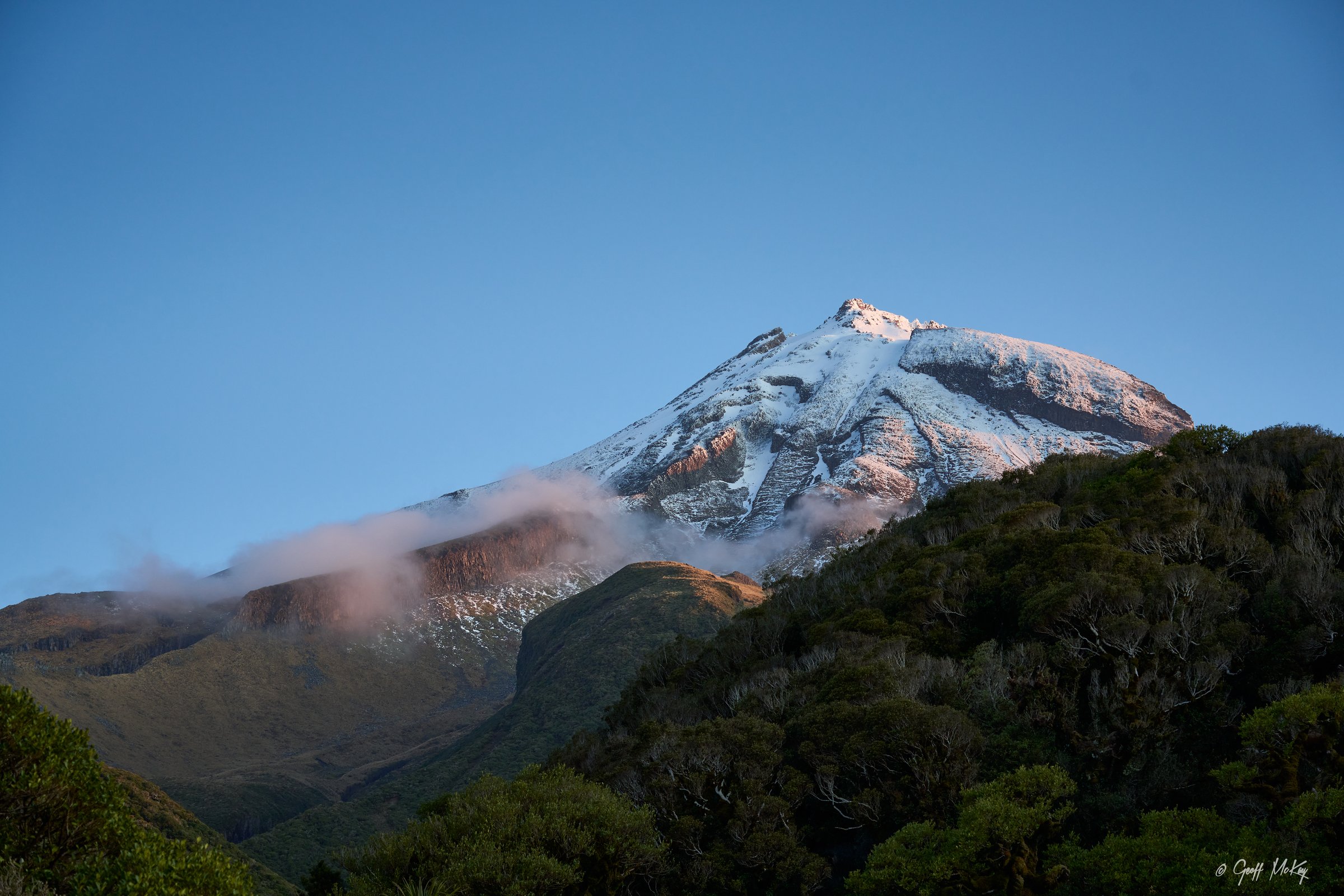
The Kaitake Range is the lowland coastal volcanic range behind Ōakura, forming the north-western part of Te Papa-Kura-o-Taranaki. Its tracks are lower than Taranaki Maunga and Pouākai, but they are steep, forested, muddy and sometimes overgrown.
DOC highlights nikau, titoke, kohekohe, puriri, pukeatea, karaka and fern-rich lowland coastal forest, plus a protected stand of old Californian redwoods at Lucy’s Gully. Patuhā Trig is the main high point and viewpoint. The range is usually accessed from Lucy’s Gully, Surrey Hill Road and Pukeiti.
Because the range has fewer maintained day-hike lines than the larger volcanic areas, the selection includes several Patuhā-focused route variants and the official Pukeiti rainforest track network. Boars Head Mine Track is not selected because DOC lists it as closed until further notice.
Selection rationale
The five hikes represent the main legal/open day options: Waimoku to Patuhā, Sefton-Waimoku loop, Davies to Patuhā, the Davies-Waimoku traverse, and the Pukeiti rainforest outer-tracks loop.
Summary table
| # | Hike | Country | Route type | Distance | Gain | Max elevation | Difficulty |
|---|---|---|---|---|---|---|---|
| 1 | Waimoku Track to Patuhā Trig | New Zealand | Out-and-back | Not stated by DOC; 2-3 hr to trig | 682 m | Advanced | |
| 2 | Sefton Ridge — Waimoku Loop | New Zealand | Loop | Sefton 2 km to Waimoku junction; loop distance unresolved | Near Patuhā junction / 682 m if trig included | Advanced | |
| 3 | Davies Track to Patuhā Trig | New Zealand | Out-and-back | 4.2 km one way | 682 m | Advanced | |
| 4 | Davies Track — Patuhā Trig — Waimoku Traverse | New Zealand | Point-to-point | DOC states 4 hr combined trip | 682 m | Advanced | |
| 5 | Pukeiti Rainforest Outer Tracks | New Zealand | Loop / linked tracks | 0.7-1.9 km segments; loop distance unresolved | c. 490 m Pukeiti Summit Track (secondary) | Easy-intermediate |
1. Waimoku Track to Patuhā Trig
Snapshot
Itinerary
From Lucy’s Gully, the Waimoku Track climbs through coastal lowland forest to Patuhā Trig. The final 100 m to the trig is an exposed rocky scramble. Return by the same route or link to Sefton Ridge.
Why it is essential
This is the direct classic route to the highest point of the Kaitake Range and gives coastal and Taranaki Maunga views from Patuhā.
Equipment
- Sturdy boots
- Waterproof layer
- Warm layer
- Food
- 2-3 litres of water
- Map/GPS
- Sun protection
- Walking poles and gaiters useful
Hazards and notes
- The last 100 m is exposed and scrambly.
- Tracks can be overgrown with small windfalls.
- Streams may flood after rain.
- No dogs.
GPX / KML links
| Source | URL | Format / access | Reuse status |
|---|---|---|---|
| DOC: Waimoku Track | doc.govt.nz | Official route page with map | DOC website terms; no GPX found |
| DOC: Kaitake Range brochure (PDF) | doc.govt.nz | PDF map/brochure | DOC website terms; source map only |
| Herenga ā Nuku: Kaitake Range walking tracks | herengaanuku.govt.nz | PDF/map source | Terms not checked; secondary map source; reuse unresolved |
External links
- DOC — Waimoku Track
- DOC — Kaitake Range brochure (PDF)
- Herenga ā Nuku — Kaitake Range walking tracks (PDF)
2. Sefton Ridge — Waimoku Loop
Snapshot
Itinerary
Sefton Ridge Track starts by Lucy’s Gully car park, crosses an unbridged stream and climbs steeply for 2 km to meet the Waimoku Track. Turning left on Waimoku returns downhill to Lucy’s Gully. Patuhā Trig can be added by turning uphill at the junction.
Why it is essential
This is the compact loop option from Lucy’s Gully and gives a steeper ridge alternative to the Waimoku out-and-back.
Equipment
- Sturdy boots
- Waterproof layer
- Warm layer
- Water
- Food
- Map/GPS
- Sun protection
Hazards and notes
- The initial stream crossing can become impassable after heavy rain.
- Many Kaitake tracks are overgrown with small windfalls, so times may be longer than map distance suggests.
- No dogs.
GPX / KML links
| Source | URL | Format / access | Reuse status |
|---|---|---|---|
| DOC: Sefton Ridge Track | doc.govt.nz | Official route page with map | DOC website terms; no GPX found |
| DOC: Kaitake Range brochure (PDF) | doc.govt.nz | PDF map/brochure | DOC website terms; source map only |
External links
3. Davies Track to Patuhā Trig
Snapshot
Itinerary
Davies Track starts at Surrey Hill Road, crosses farmland on marked access, then climbs through bush to Patuhā Trig. Return by the same route or continue toward Waimoku for a traverse.
Why it is essential
DOC identifies Davies Track as the easier alternative to the final scrambly Waimoku approach to Patuhā Trig, making it the key northern access route to the range high point.
Equipment
- Sturdy boots
- Waterproof layer
- Warm layer
- Food
- 2-3 litres of water
- Map/GPS
- Sun protection
Hazards and notes
- The access crosses private farmland; leave gates as found and stay on the marked route.
- Tracks can be overgrown with windfalls.
- Rivers and tributaries can flood.
- No dogs.
GPX / KML links
| Source | URL | Format / access | Reuse status |
|---|---|---|---|
| DOC: Davies Track | doc.govt.nz | Official route page with map | DOC website terms; no GPX found |
| DOC: Kaitake Range brochure (PDF) | doc.govt.nz | PDF map/brochure | DOC website terms; source map only |
External links
4. Davies Track — Patuhā Trig — Waimoku Traverse
Snapshot
Itinerary
Climb Davies Track from Surrey Hill Road to Patuhā Trig, then continue to the Waimoku junction and descend Waimoku Track to Lucy’s Gully. The traverse uses the easier Davies ascent and the direct Lucy’s Gully descent.
Why it is essential
This is the most complete Kaitake day traverse, linking the two main legal access points and crossing the range high point.
Equipment
- Sturdy boots
- Waterproof layer
- Warm layer
- Food
- 2-3 litres of water
- Map/GPS
- Sun protection
- Headtorch
Hazards and notes
- Transport logistics are required.
- The Waimoku side includes an exposed rocky section near the trig if descended that way.
- Private farmland access applies on Davies Track.
- No dogs.
GPX / KML links
| Source | URL | Format / access | Reuse status |
|---|---|---|---|
| DOC: Davies Track | doc.govt.nz | Official route page with map | DOC website terms; no GPX found |
| DOC: Waimoku Track | doc.govt.nz | Official route page with map | DOC website terms; no GPX found |
| DOC: Kaitake Range brochure (PDF) | doc.govt.nz | PDF map/brochure | DOC website terms; source map only |
External links
5. Pukeiti Rainforest Outer Tracks
Snapshot
Itinerary
Use the Pukeiti rainforest track network to form a longer linked walk through regenerating rainforest and remnant mature forest. A representative outer circuit can combine Kaitake Track, Summit Track, Jubilee Track, Saxton Track, Rimu Track and connecting garden paths, adjusted for any current closures.
Why it is essential
Pukeiti is the Kaitake area’s official rainforest walking hub and gives a lower, wetter forest counterpoint to the Patuhā tramping tracks.
Equipment
- Walking shoes or light boots
- Waterproof layer
- Warm layer
- Water
- Map/brochure
- Sun protection
Hazards and notes
- Taranaki Regional Council warns that three unbridged streams can be impassable after heavy rain.
- Mobile phone coverage is unreliable.
- Tracks may be under creation or improvement; stay out of closed areas.
- No dogs.
GPX / KML links
| Source | URL | Format / access | Reuse status |
|---|---|---|---|
| Taranaki Regional Council: Pukeiti | trc.govt.nz | Official route/network page | TRC terms not checked; no GPX found |
| Pukeiti rainforest day walks brochure (PDF) | trc.govt.nz | PDF map/brochure | TRC terms not checked; source map only |
External links
Missing data / follow-up work
- The Kaitake Range has fewer distinct official day-hike routes than larger regions; two selected entries are route combinations.
- Official GPX/KML downloads were not found.
- Elevation gain/loss and some exact loop distances are unresolved.
- Exact CC variants for DOC-hosted image candidates need confirmation.
- Boars Head Mine Track remains excluded because DOC lists it as closed until further notice.
External links
| Source | URL |
|---|---|
| DOC — Waimoku Track | doc.govt.nz |
| DOC — Sefton Ridge Track | doc.govt.nz |
| DOC — Davies Track | doc.govt.nz |
| DOC — Boars Head Mine Track (closure notice) | doc.govt.nz |
| DOC — Kaitake Range brochure (PDF) | doc.govt.nz |
| Taranaki Regional Council — Pukeiti | trc.govt.nz |
| TRC — Pukeiti rainforest day walks brochure (PDF) | trc.govt.nz |
| Herenga ā Nuku — Kaitake Range walking tracks (PDF) | herengaanuku.govt.nz |