Regional overview
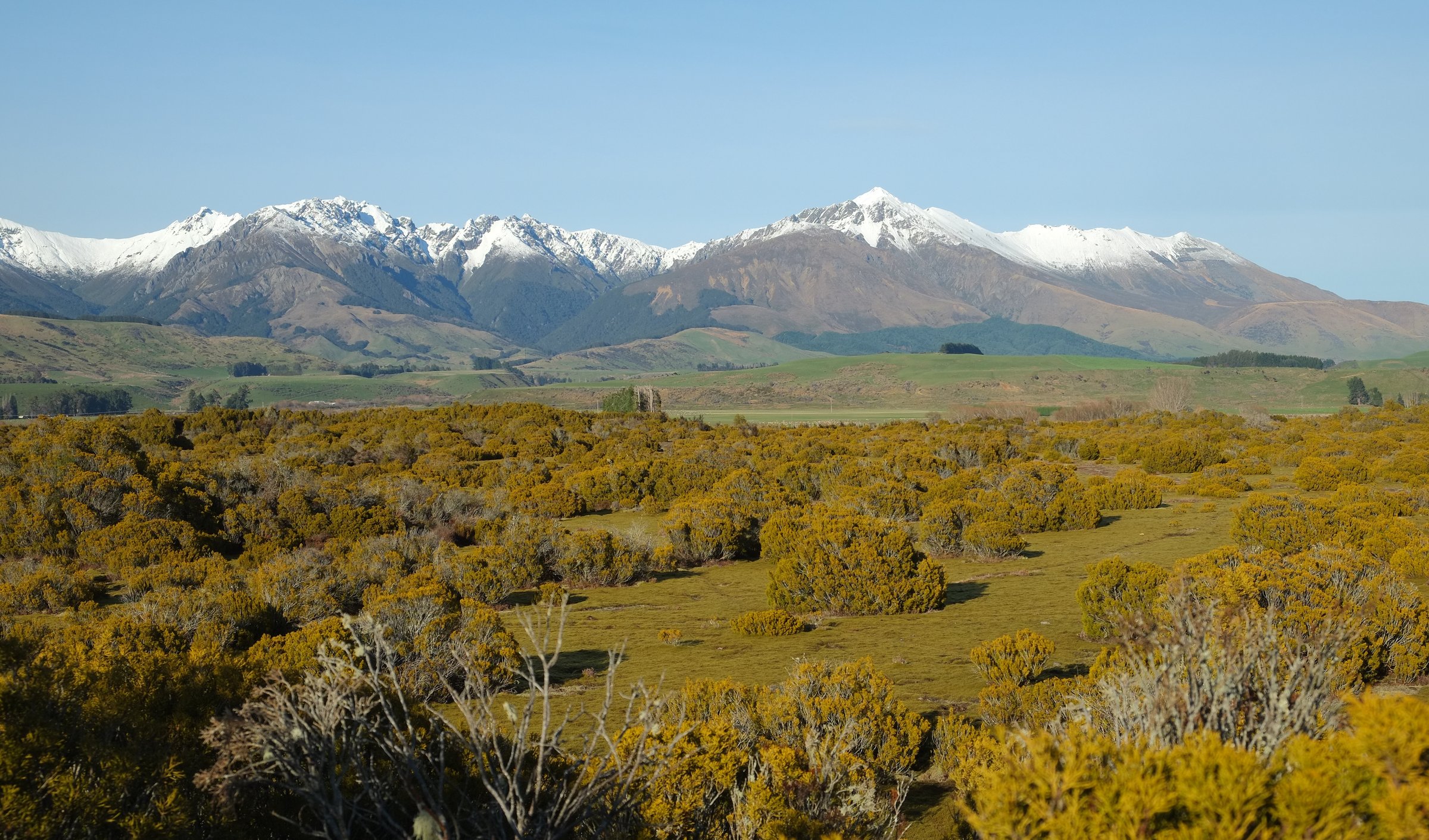
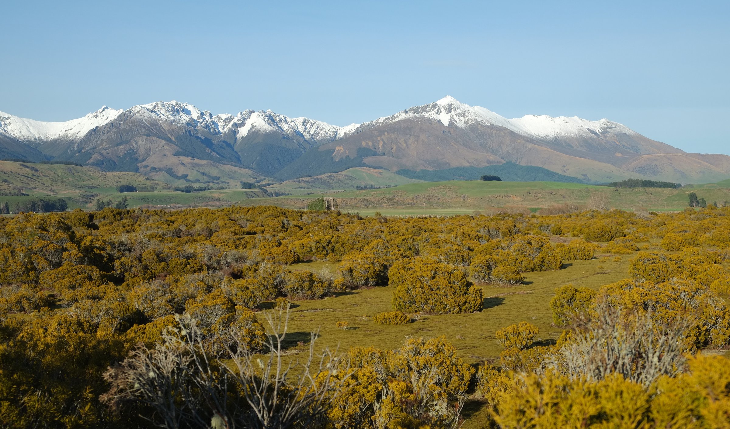
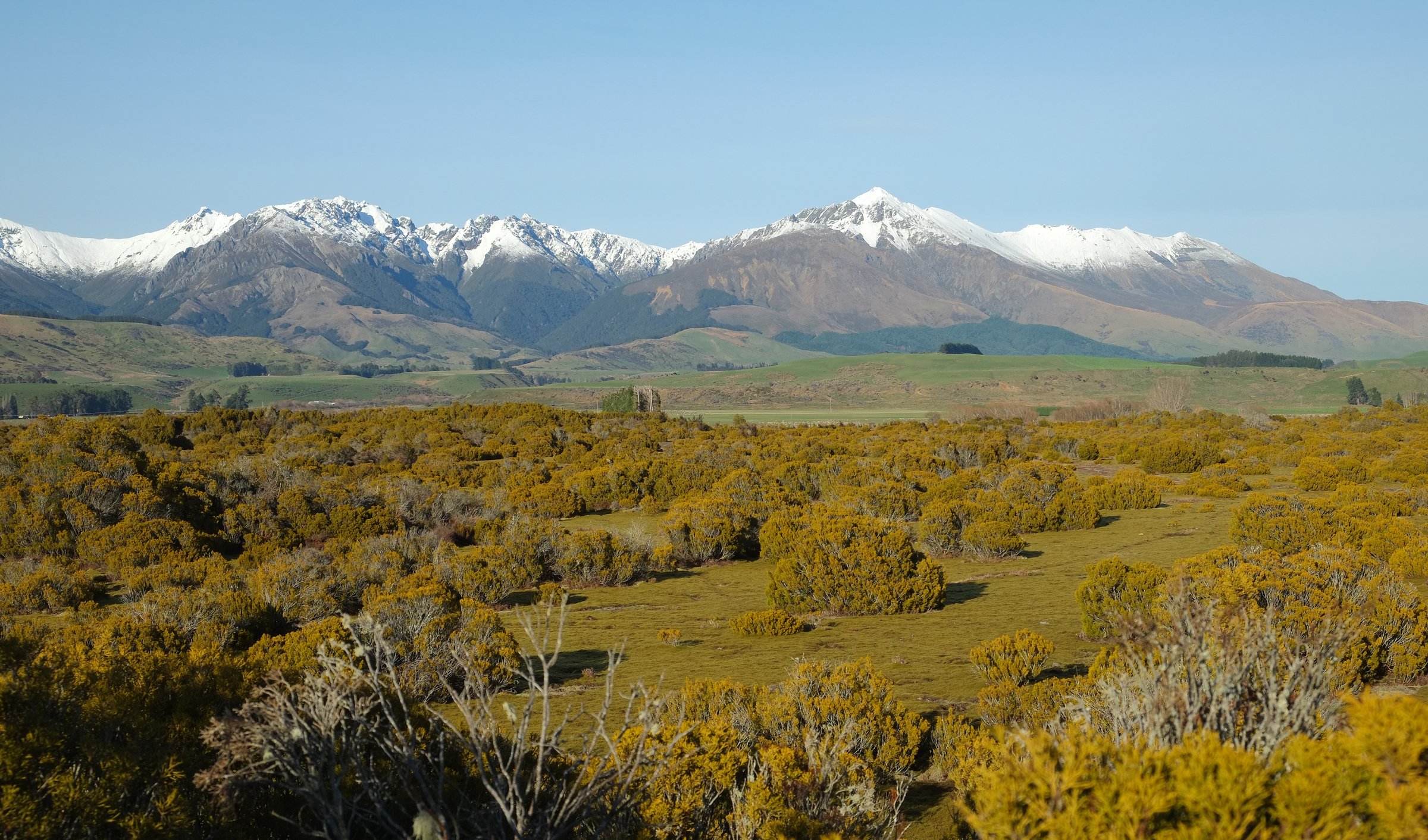
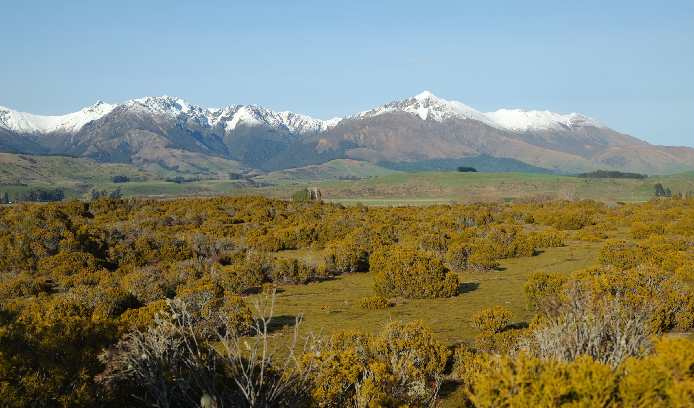
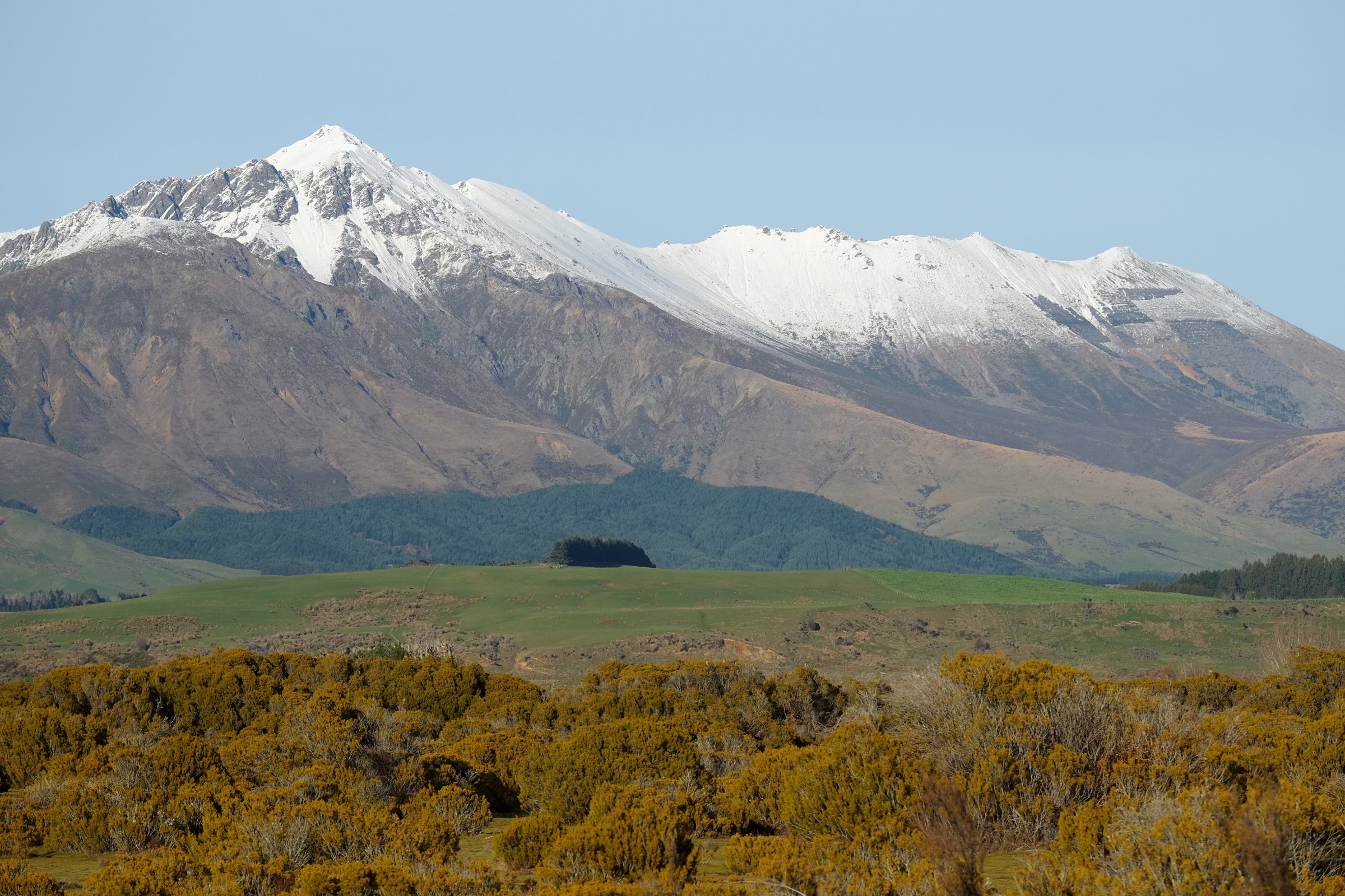
The Northern Takitimus are a remote Southland tramping area of beech forest, red tussock, peat wetlands, river terraces, open tops, private pastoral access and small backcountry huts. The range rises south-east of Te Anau and Manapouri; the northern public approach is mainly from SH94 / Princhester Road and from the Dunrobin / Aparima side. This is not a compact day-walk network. The clearest documented public walking is a set of DOC and Te Araroa backcountry sections around SH94 / Princhester Road, Lower Princhester Hut, the Dunrobin Valley, Aparima Hut, Lower Wairaki Hut and Telford.
Walking character is practical and backcountry-focused: road and farm access to Lower Princhester, Te Araroa stages over the Waterloo / Bog Burn divide, the marked Aparima River Track, rougher travel toward Lower Wairaki, and the exposed Telford Tops approach. These are sourceable day-sized route sections, but logistics often require hut stays, shuttles or strong out-and-back planning.
DOC and Te Araroa both emphasise navigation, weather and access discipline. Hazards include high rivers, marshy ground, faint or non-existent ground trail, private-land boundaries, farm operations, limited water on higher sections, cold wind, snow and avalanche risk in season, and poor-visibility route-finding. Dogs are not allowed on the selected routes.
Summary table
| # | Hike | Route type | Distance | Time | Elevation gain | Difficulty | Verification |
|---|---|---|---|---|---|---|---|
| 1 | SH94 / Princhester Road to Lower Princhester Hut | Out-and-back access stage | ~6 km one way; ~12 km return | ~1.5 hr one way | Unresolved | Road / farm access; backcountry approach | Te Araroa source; DOC hut page |
| 2 | Lower Princhester Hut to Aparima Hut via Waterloo Saddle | Point-to-point | 17 km one way | 5–6 hr | ~743 m (AllTrails) | Expert / Te Araroa stage | DOC + Te Araroa; stats AllTrails |
| 3 | Dunrobin Valley Road to Aparima Hut via Aparima River Track | Out-and-back | ~11.3–12 km return | 2 hr one way | ~126 m (AllTrails) | DOC advanced tramping | DOC route page verified |
| 4 | Aparima Hut to Lower Wairaki Hut | Point-to-point | 13.1 km | 6 hr | Unresolved | Expert backcountry stage | Te Araroa source; DOC hut pages |
| 5 | Lower Wairaki Hut to Telford Campsite | Point-to-point | 8 km (Te Araroa); ~12.2 km variant (AllTrails) | 4 hr | ~555 m (AllTrails) | Expert / hard | Te Araroa source; stats AllTrails |
Before you go
Access
Vehicle access is from SH94 for records 1 and 2 via Princhester Road, and from the Dunrobin Valley Road for record 3. Records 4 and 5 begin at backcountry huts and require prior positioning by walking in the day before, arranging a shuttle, or linking the sections into a multi-day trip. The Lower Wairaki approach from Ohai runs through Beaumont Station and requires landowner permission. Check road conditions, farm operations and station access before travel; no regular public transport is verified for any of these trailheads.
Standard kit
- Full tramping equipment for records 2, 4 and 5: boots, waterproof and warm layers, food, water treatment, map / GPS, compass, headlamp, first aid, emergency shelter, and a PLB.
- Lighter but still robust day kit for records 1 and 3, with rain and warm layers and enough water and food for delays.
- High-visibility clothing on Princhester Road if farm operations or hunting are active.
Common hazards
Faint or non-existent ground trail on the higher stages, unbridged river crossings on the Aparima and Wairaki lines, marshy ground, exposed tops with cold wind and poor-visibility route-finding, snow and avalanche risk in season, and private-land boundaries with permitted access only on the marked line. Dogs are not allowed on any of the routes.
1. SH94 / Princhester Road to Lower Princhester Hut
Snapshot
Itinerary
From SH94, follow Princhester Road toward DOC’s Lower Princhester Hut. Te Araroa describes this as a gravel public road and working-farm accessway; walkers must give way to stock and farm operations. Return the same way for a short day out, or use the hut as the start of longer Takitimu sections.
Why it is essential
The northern gateway walk into the Takitimu public tramping corridor and the most direct sourceable approach from SH94.
Hazards and notes
- Access-road walking through a working-farm environment, not a wilderness singletrack.
- Stay on the legal access line and give way to farm vehicles and stock.
- No dogs.
Photo status
No route-specific licence-compatible image was found in this pass. The cover panorama (Wilderness Reserve looking toward the Takitimu Mountains) is the closest available representation of the range’s northern aspect.
GPX / KML links
| Source | URL | Format | Notes |
|---|---|---|---|
| Te Araroa trail maps | teararoa.org.nz | Official GPX / KMZ hub | Te Araroa terms; reuse unresolved |
| Te Araroa 2025/26 Tracks GPX | teararoa.org.nz | GPX download | Reuse terms unresolved |
| Te Araroa Murihiku / Southland trail notes | teararoa.org.nz | Official trail notes | Source-route reference only |
| DOC Lower Princhester Hut | doc.govt.nz | Official hut page | DOC website terms; no GPX |
Further reading
2. Lower Princhester Hut to Aparima Hut via Waterloo Saddle
Snapshot
Itinerary
From Lower Princhester Hut, the route climbs through beech forest to the saddle between the Bog Burn and Waterloo Burn catchments. It then descends toward the Waterloo Station boundary and follows the permitted poled or marked line through tussock and bush-clad headlands to Aparima Hut.
Why it is essential
The classic northern Takitimu crossing — the first real mountain and backcountry section south from the Princhester access into the Aparima hut network.
Hazards and notes
- Waterloo Station is private land with permitted access only on the marked line.
- Stay on the route, respect farm operations and keep group sizes within stated limits.
- Snow, high rivers and poor visibility can all make the stage serious.
- No dogs.
GPX / KML links
| Source | URL | Format | Notes |
|---|---|---|---|
| Te Araroa trail maps | teararoa.org.nz | Official GPX / KMZ hub | Te Araroa terms; reuse unresolved |
| Te Araroa 2025/26 Section Routes GPX | teararoa.org.nz | GPX download | Reuse terms unresolved |
| DOC Princhester Saddle Route | doc.govt.nz | Official route page | DOC website terms; no GPX |
| AllTrails: Lower Princhester Hut to Aparima Hut | alltrails.com | Secondary route page | AllTrails terms; secondary statistics only |
Further reading
3. Dunrobin Valley Road to Aparima Hut via Aparima River Track
Snapshot
Itinerary
From Dunrobin Valley Road near Pleasant Creek, follow the Aparima River Track through red tussock, beech forest, peat wetland and river-terrace country to Aparima Hut. Return by the same track for the day-hike format, or link forward to record 4 as a hut-to-hut day.
Why it is essential
The most direct walking entry to the Aparima hut hub, giving a lower and more accessible view of northern Takitimu river-valley terrain than the Princhester crossing.
Hazards and notes
- Track approaches private-land boundaries near the hut — stay on the marked route.
- Avoid high-water conditions on the Aparima side.
- No dogs.
Photo status
No route-specific licence-compatible image was found in this pass. The Wilderness Reserve panorama used as the cover is the closest available representation of the surrounding red-tussock and beech-forest country.
GPX / KML links
| Source | URL | Format | Notes |
|---|---|---|---|
| DOC Aparima River Track | doc.govt.nz | Official route page | DOC website terms; no GPX |
| Te Araroa trail maps | teararoa.org.nz | Official GPX / KMZ hub | Te Araroa terms; reuse unresolved |
| AllTrails: Dunrobin Valley Road to Aparima Hut | alltrails.com | Secondary route page | AllTrails terms; secondary statistics only |
Further reading
4. Aparima Hut to Lower Wairaki Hut
Snapshot
Itinerary
From Aparima Hut, cross the Aparima swing bridge and take the Te Araroa route to the right rather than the left fork out toward Dunrobin Road. The route crosses marshland and forest, joins the Wairaki River Track line, and includes a river ford near Lower Wairaki Hut when river levels allow.
Why it is essential
The key transition from the Aparima hub into the Wairaki side of the range — a section that shows the rougher, less-formed character that distinguishes the Takitimus from nearby front-country walks.
Hazards and notes
- Te Araroa notes describe light or non-existent ground trail in places; navigation and concentration are required.
- Marshy ground, forest travel and an unbridged Wairaki ford near the hut.
- Do not proceed when rivers are high.
- No dogs.
Photo status
No route-specific licence-compatible image was found in this pass. The Excelsor Peak image on record 2 above is the closest available representation of the surrounding Takitimu tops.
GPX / KML links
| Source | URL | Format | Notes |
|---|---|---|---|
| Te Araroa trail maps | teararoa.org.nz | Official GPX / KMZ hub | Te Araroa terms; reuse unresolved |
| Te Araroa 2025/26 Tracks GPX | teararoa.org.nz | GPX download | Reuse terms unresolved |
| Te Araroa Murihiku / Southland trail notes | teararoa.org.nz | Official trail notes | Source-route reference only |
| DOC Aparima Hut | doc.govt.nz | Official hut page | DOC website terms |
| DOC Lower Wairaki Hut | doc.govt.nz | Official hut page | DOC website terms |
Further reading
5. Lower Wairaki Hut to Telford Campsite
Snapshot
Itinerary
From Lower Wairaki Hut, follow the Te Araroa route along the bush fringe and across a stream at about 600 m before carrying water for the climb. The route gains a ridge and the Telford Tops with views south in clear weather, then descends through grasslands to Telford Campsite.
Why it is essential
The compact high-country day stage of the northern Takitimu corridor — a transition from hut valley to exposed tops and the threshold of the Mount Linton side of the range.
Hazards and notes
- Carry water after the early stream; the tops sections have little reliable water.
- Telford Campsite has no shelter.
- Exposure, cold wind, poor visibility and snow can all make the stage serious.
- Access through Beaumont Station or onward across private land must be checked before departure.
- No dogs.
Photo status
No route-specific licence-compatible image was found in this pass. The View from Ohai image cited in the skeleton is 1,156 × 1,108 px, well below the site’s source-resolution floor, and was not used. The Excelsor Peak image on record 2 above is the closest available representation of the Takitimu tops.
GPX / KML links
| Source | URL | Format | Notes |
|---|---|---|---|
| Te Araroa trail maps | teararoa.org.nz | Official GPX / KMZ hub | Te Araroa terms; reuse unresolved |
| Te Araroa 2025/26 Tracks GPX | teararoa.org.nz | GPX download | Reuse terms unresolved |
| Te Araroa Google Earth KMZ | teararoa.org.nz | KMZ download | Reuse terms unresolved |
| AllTrails: Lower Wairaki Hut to Telford Campsite | alltrails.com | Secondary route page | AllTrails terms; secondary statistics only |
Further reading
Verification notes
- DOC does not publish per-route elevation gain, elevation loss or maximum elevation for these stages. Values used are either Te Araroa or AllTrails secondary figures (clearly flagged), or “Unresolved” rather than filled from unverified sources.
- Records 1, 4 and 5 have no route-specific licence-compatible photo on Wikimedia Commons at this pass. That is called out inline and the closest representative landscape image is referenced instead.
- The View from Ohai image cited by the source skeleton is only 1,156 × 1,108 px, below the site’s minimum source-resolution floor, and was not shipped. The two Pseudopanax public-domain landscapes from Wilderness Reserve are the two above-floor Takitimu landscape images located in this pass.
- Te Araroa GPX / KMZ files exist for these sections but their reuse terms were not resolved. No GPX / KML is shipped; source-file links are references only.
- Waterloo Station (record 2), Beaumont Station (record 5) and other private-land sections require permitted access on the marked line. Check current access rules before travel.
Further reading
| Source | URL |
|---|---|
| DOC Takitimu Conservation Area | doc.govt.nz |
| DOC Lower Princhester Hut | doc.govt.nz |
| DOC Princhester Saddle Route | doc.govt.nz |
| DOC Aparima River Track | doc.govt.nz |
| DOC Aparima Hut | doc.govt.nz |
| DOC Lower Wairaki Hut | doc.govt.nz |
| Te Araroa Murihiku / Southland trail notes | teararoa.org.nz |
| Te Araroa trail maps and GPS downloads | teararoa.org.nz |
| Wikipedia — Takitimu Mountains | en.wikipedia.org |