Regional overview
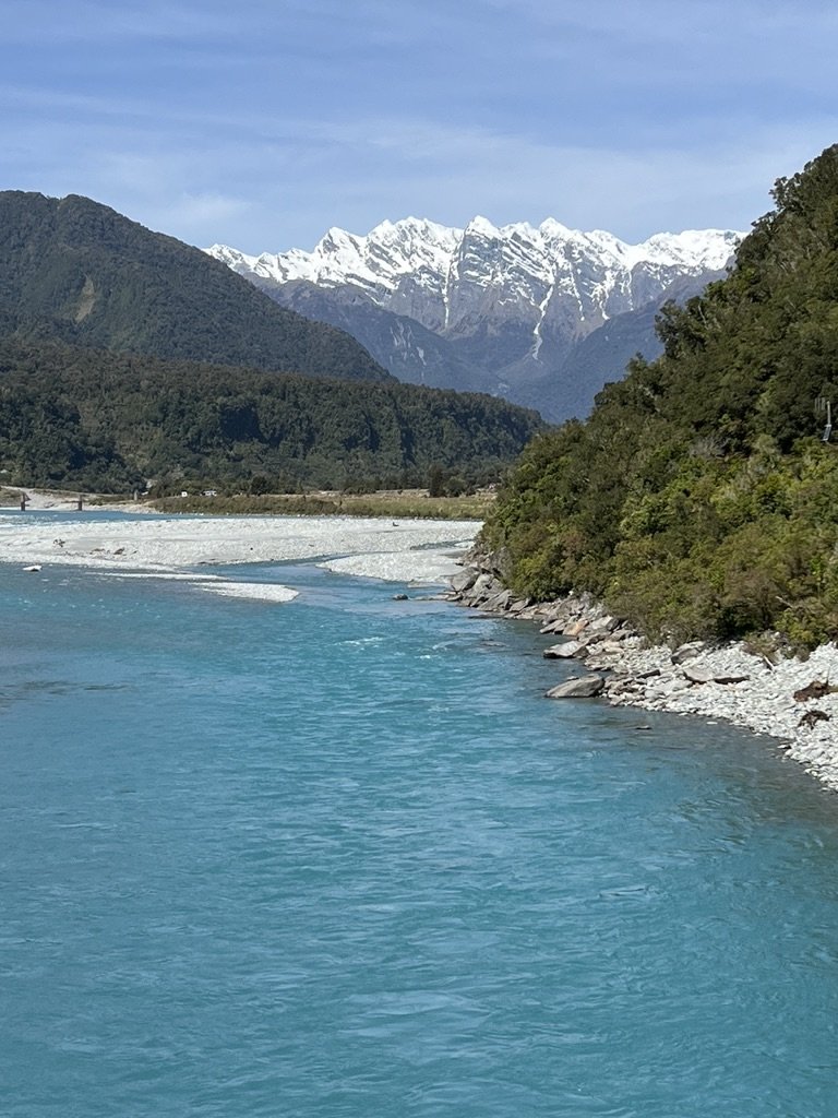
The Whataroa sector sits in the wet, glacier-fed West Coast face of the Southern Alps. Its walking character is river-valley tramping, boulder hopping, forest terraces, swing bridges, avalanche paths, glacier viewpoints and short coastal/alpine-lookout walks nearby. DOC warns that the Whataroa, Butler and Perth valleys flood rapidly, rainfall exceeds 5,000 mm annually in mountain areas, snow can occur in any season and river crossings must not be attempted when high.
The strict Whataroa, Butler and Perth valleys are rugged multi-day backcountry, not a five-day-walk destination. DOC identifies the road-end to Whataroa-Perth Track junction as an excellent day trip, but most onward routes are hut-to-hut or mountaineering access. To provide exactly five day-hikes for the wider Whataroa sector, this entry includes nearby Westland Tai Poutini / Franz Josef, Okarito and Fox Glacier routes that belong to the same West Coast Southern Alps travel corridor.
Selection rationale
The five selections balance one true Whataroa valley day trip, two major Franz Josef glacier-view hikes, one Okarito coastal/alpine viewpoint, and one Fox Glacier / Lake Gault forest-lake hike. This gives a practical guidebook set for the Whataroa West Coast sector without pretending the remote valleys provide five simple day walks.
Summary table
| # | Hike | Country | Route type | Distance | Gain | Max elevation | Difficulty |
|---|---|---|---|---|---|---|---|
| 1 | Whataroa Road End to Whataroa-Perth Track Junction | New Zealand | Out-and-back | 4 hr return | Advanced | ||
| 2 | Roberts Point Track | New Zealand | Out-and-back | 12.3 km return | 534 m secondary | 622 m secondary | Advanced |
| 3 | Alex Knob Track | New Zealand | Out-and-back | 17.2 km return | 1,101 m secondary | 1,290 m secondary | Advanced / hard |
| 4 | Okarito Trig Walk | New Zealand | Out-and-back | 4.2 km return | 183 m secondary | 151 m secondary | Easy-intermediate |
| 5 | Lake Gault Track | New Zealand | Out-and-back | 8 km return | 200 m DOC climb; 414 m secondary gain | 388 m secondary | Easy-intermediate |
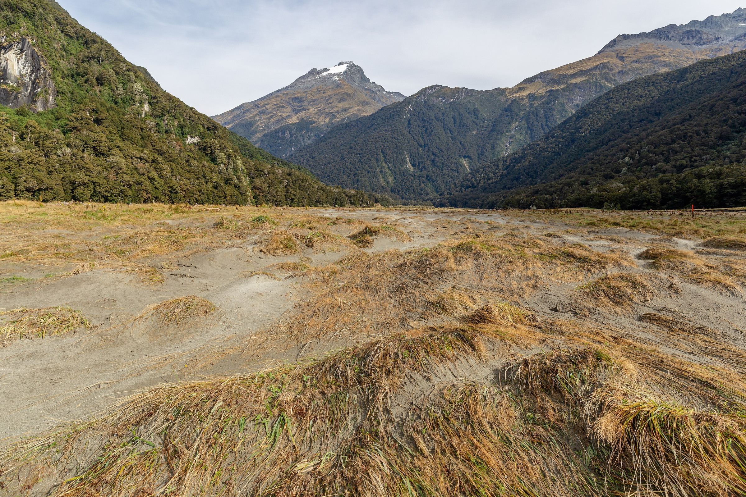
1. Whataroa Road End to Whataroa-Perth Track Junction
Snapshot
Itinerary
From the car park, follow the old 4WD track and markers up the true left bank of the Whataroa. The route passes the derelict bulldozer, Big Creek, Big Bend, river-edge sections and bush terraces before reaching the Whataroa-Perth swing bridge. About 100 m beyond the bridge is the signed junction of the Perth River and Whataroa River tracks. Return the same way.
Why it is essential
This is the core Whataroa day trip identified by DOC, giving a manageable sample of the valley’s river, forest and backcountry-tramping character without committing to the multi-day huts beyond.
Equipment
Boots, waterproofs, warm layers, food, water, map/GPS, headtorch, PLB recommended, river-condition judgement.
Hazards and notes
- Flooding, rockfall, avalanche and rapidly rising side creeks are major hazards.
- If Big Creek is difficult and more rain is imminent, DOC advises not entering the valley.
- Get permission for the private land near the car park and avoid disturbing stock.
GPX / KML links
| Source | URL | Format / access | Reuse status |
|---|---|---|---|
| DOC: Whataroa, Butler and Perth valleys tracks | doc.govt.nz | Official route page / guide | DOC terms; no GPX found; source map/description only |
| AllTrails: Whataroa Highway to Butler Junction Hut | alltrails.com | Longer route page | AllTrails terms apply; not a day-hike GPX; source only |
External links
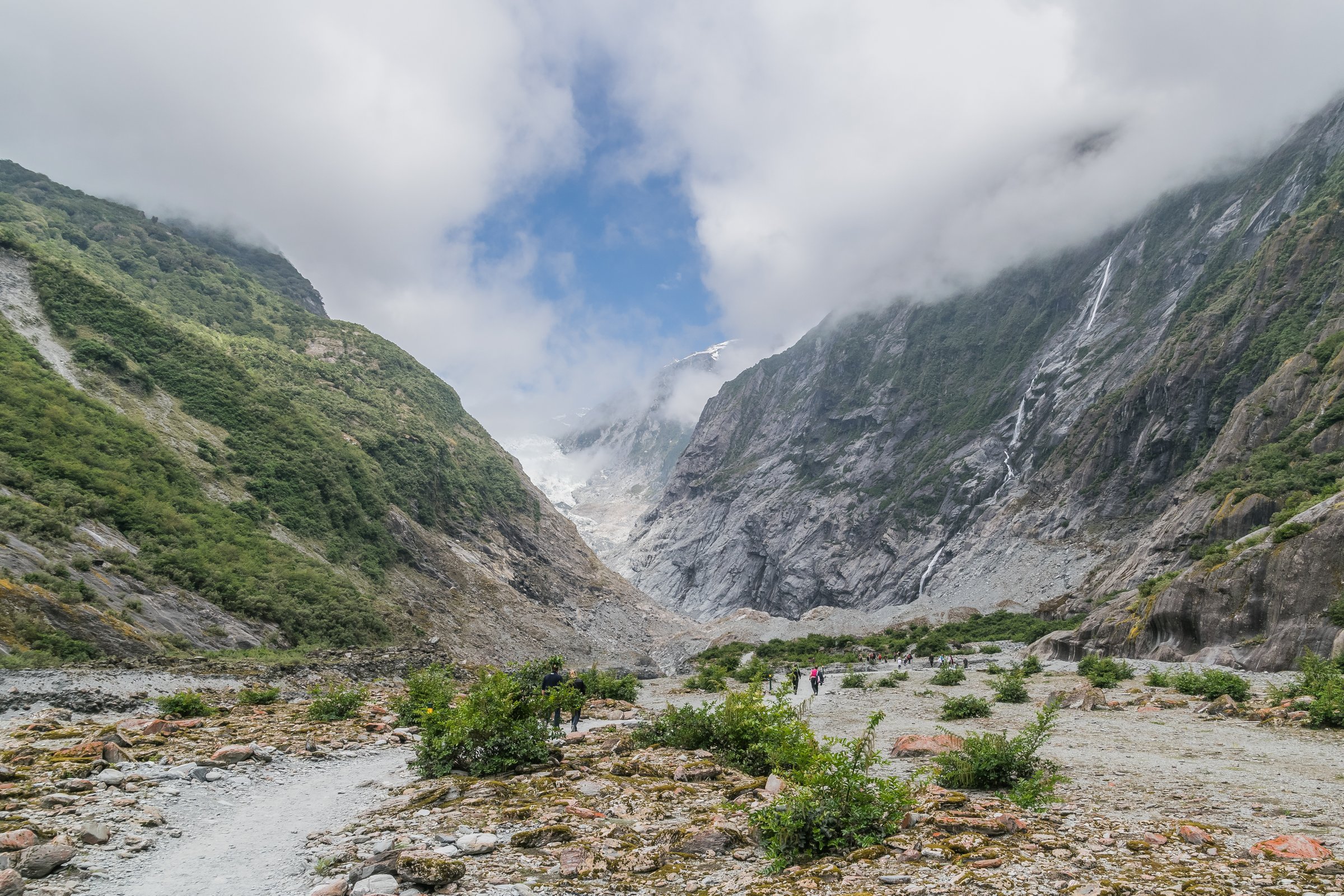
2. Roberts Point Track
Snapshot
Itinerary
Follow Douglas Walk from the glacier car park to Douglas Bridge, then take Roberts Point Track up the true right of the Waiho / Franz Josef Glacier valley. The track crosses side creeks, roots, rocks, ice-smoothed slabs, Hende’s Hut, Hende’s Gallery and Rope Creek suspension bridge before reaching the glacier viewpoint. Return the same way.
Why it is essential
Roberts Point is one of the classic West Coast glacier-view day hikes, combining rainforest, historic track engineering, swing bridges, waterfalls, rock slabs and close views toward Franz Josef Glacier.
Equipment
Hiking boots with strong grip, waterproofs, warm layer, food, water, insect repellent, sun protection, headtorch.
Hazards and notes
- DOC warns of many unbridged creek crossings, slippery slabs, steep drop-offs and fatal accidents.
- Stay on the track and platform, never cross the Waiho River without a bridge, and turn back if creeks are high.
GPX / KML links
| Source | URL | Format / access | Reuse status |
|---|---|---|---|
| DOC: Roberts Point Track | doc.govt.nz | Official route page / map | DOC terms; no GPX found; source map only |
| AllTrails: Roberts Point Track | alltrails.com | Route page | AllTrails terms apply; GPX reuse not confirmed |
External links
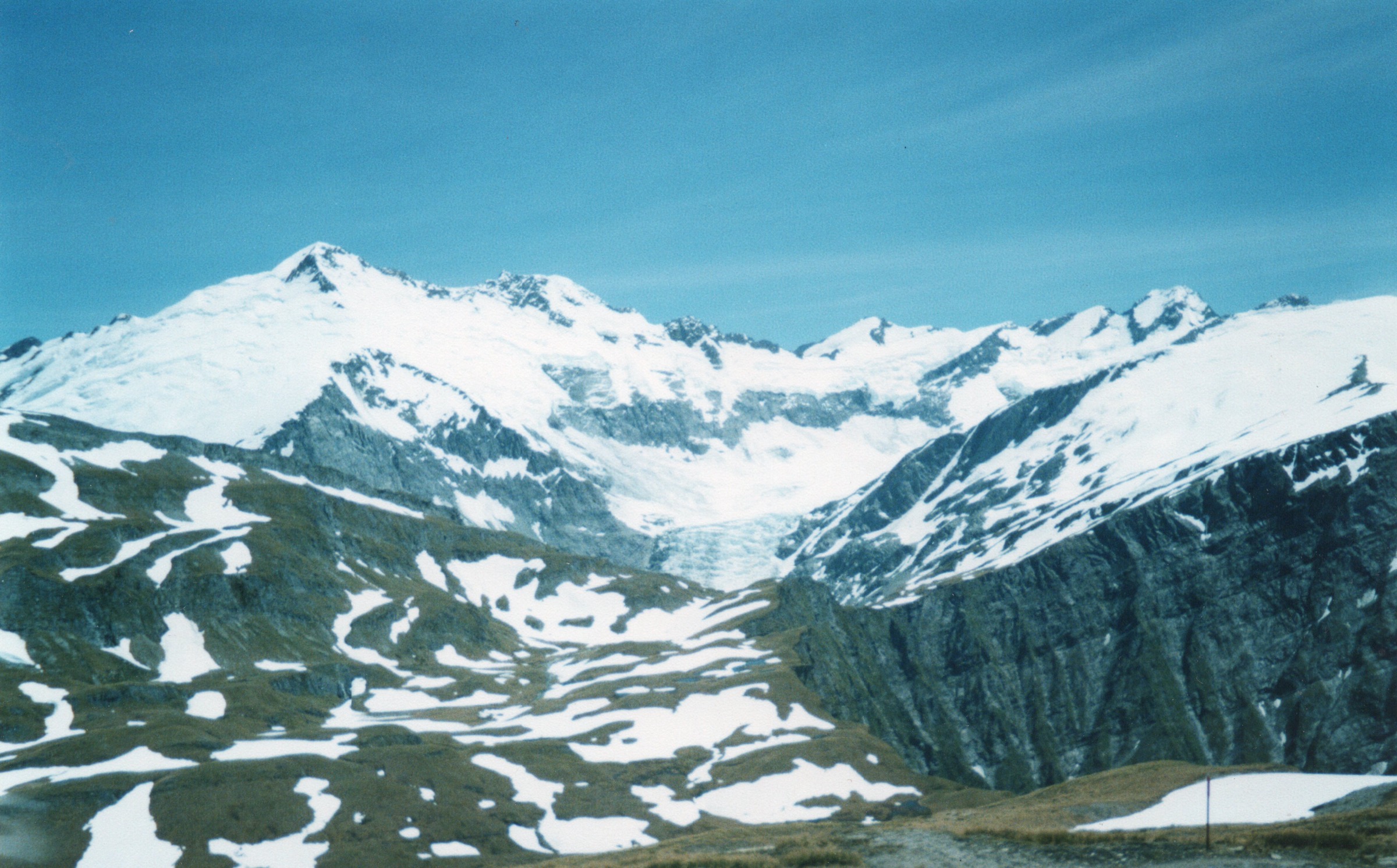
3. Alex Knob Track
Snapshot
Itinerary
The track climbs from lowland forest to Rata Lookout, then Christmas Lookout, then into subalpine scrub, alpine meadows and herb fields before reaching Alex Knob’s high glacier, mountain and coast views. Return by the same route.
Why it is essential
DOC describes Alex Knob as offering some of the best Franz Josef Glacier views without a helicopter. It is the sector’s major non-technical high viewpoint.
Equipment
Boots, waterproofs, warm layers, food, water, insect repellent, sun protection, headtorch, PLB recommended.
Hazards and notes
- The route is steep, long and weather-sensitive.
- Carry all water; DOC notes there is no water source on the track.
- In winter, do not continue beyond the snowline without alpine winter experience.
GPX / KML links
| Source | URL | Format / access | Reuse status |
|---|---|---|---|
| DOC: Alex Knob Track | doc.govt.nz | Official route page / map | DOC terms; no GPX found; source map only |
| AllTrails: Alex Knob and Christmas Lookout via Alex Knob Track | alltrails.com | Route page | AllTrails terms apply; GPX reuse not confirmed |
External links
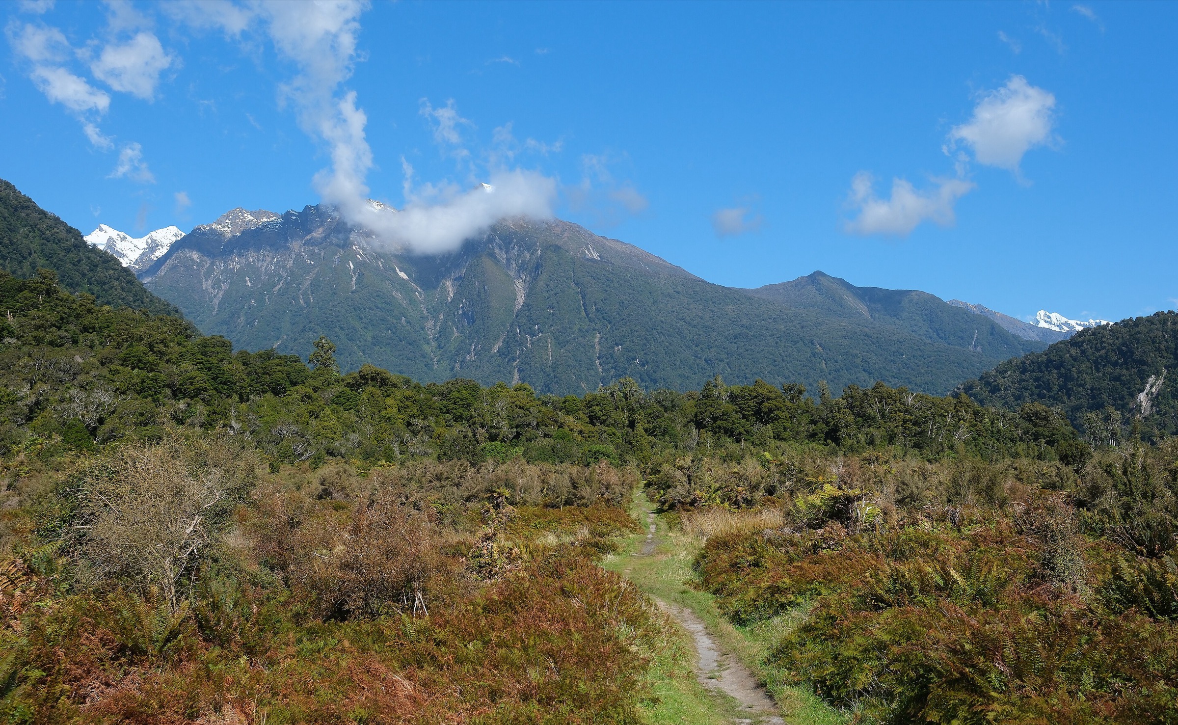
4. Okarito Trig Walk
Snapshot
Itinerary
The walk begins with the Okarito Wetland Walk and Three Mile Pack Track, then branches left after about 10–15 minutes and climbs gently to the trig viewpoint over Westland Tai Poutini National Park, forest, lagoons and beaches.
Why it is essential
It adds the coast-lagoon perspective to the Whataroa / West Coast sector: a short, accessible viewpoint from the sea edge back to the Southern Alps.
Equipment
Walking shoes, waterproof layer, water, sun/insect protection.
Hazards and notes
- No dogs.
- The track is comparatively easy, but wet West Coast weather can make surfaces slippery and obscure the view.
GPX / KML links
| Source | URL | Format / access | Reuse status |
|---|---|---|---|
| DOC: Okarito Trig Walk | doc.govt.nz | Official route page / map | DOC terms; no GPX found; source map only |
| AllTrails: Okarito Trig Walk | alltrails.com | Route page | AllTrails terms apply; GPX reuse not confirmed |
External links
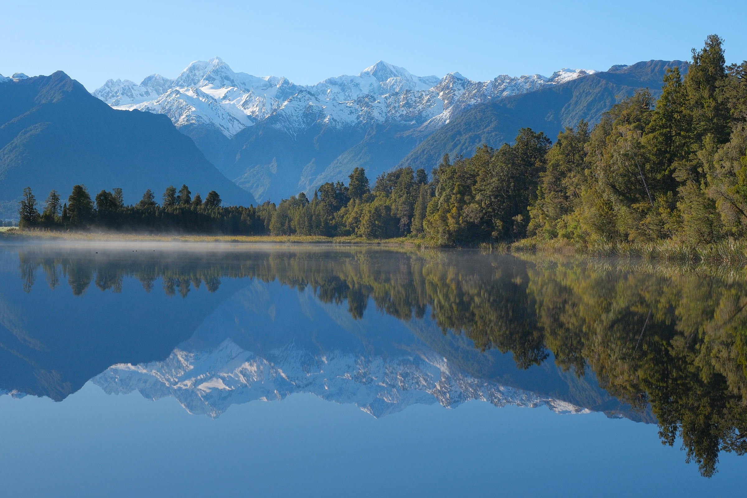
5. Lake Gault Track
Snapshot
Itinerary
From the Lake Matheson car park, follow the Lake Matheson / Te Ara Kairaumati walk anti-clockwise and branch onto the Lake Gault Track. The track climbs through podocarp forest, crosses small streams, passes a rest seat and reaches a lake lookout and shelter with Southern Alps views.
Why it is essential
Lake Gault is the sector’s quieter forest-lake and alpine-reflection route, complementing the Franz Josef glacier walks with a Fox Glacier / Lake Matheson-side objective.
Equipment
Sturdy walking shoes or light boots, waterproof layer, warm layer, water, insect repellent, sun protection.
Hazards and notes
- Small stream crossings, wet forest track and changing West Coast weather are the main issues.
- No dogs.
- Drone use on conservation land requires DOC authorisation.
GPX / KML links
| Source | URL | Format / access | Reuse status |
|---|---|---|---|
| DOC: Lake Gault Track | doc.govt.nz | Official route page / map | DOC terms; no GPX found; source map only |
| AllTrails: Lake Gault Walk | alltrails.com | Route page | AllTrails terms apply; GPX reuse not confirmed |
External links
External links
| Source | URL |
|---|---|
| DOC — Whataroa, Butler and Perth valleys tracks | doc.govt.nz |
| DOC — Roberts Point Track | doc.govt.nz |
| DOC — Alex Knob Track | doc.govt.nz |
| DOC — Okarito Trig Walk | doc.govt.nz |
| DOC — Lake Gault Track | doc.govt.nz |
| AllTrails — Whataroa Highway to Butler Junction Hut | alltrails.com |
| AllTrails — Roberts Point Track | alltrails.com |
| AllTrails — Alex Knob and Christmas Lookout via Alex Knob Track | alltrails.com |
| AllTrails — Okarito Trig Walk | alltrails.com |
| AllTrails — Lake Gault Walk | alltrails.com |