Regional overview
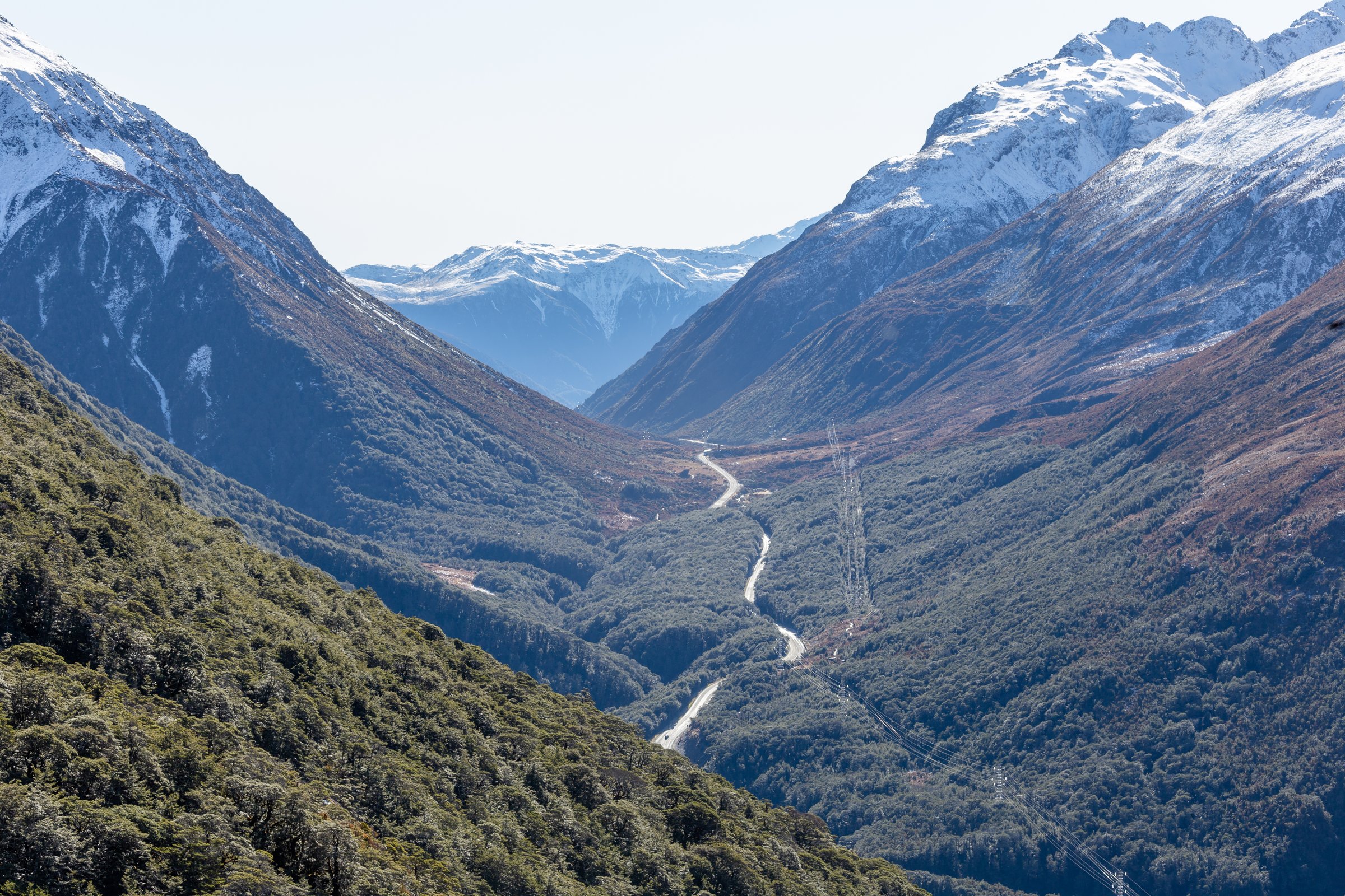
The Avalanche Peak area is the steep mountain amphitheatre immediately around Arthur’s Pass village. It sits on the Canterbury side of the Main Divide, where mountain-beech forest, waterfalls, short chasm walks, and abrupt avalanche-prone ridges rise directly from SH73 and the Bealey River.
DOC’s walking character for this area is unusually sharp-edged: several tracks begin as maintained tramping tracks from the village but stop at the bushline, while Avalanche Peak is the only local summit with a poled route to the top. The best season for the exposed routes is normally summer and autumn; winter and spring bring snow, ice, avalanche terrain, and navigation risk.
Arthur’s Pass village has road, bus, and TranzAlpine rail access, but several track ends are small or beside SH73. DOC specifically warns that the highway is unsafe to walk on where tracks are separated by road sections, so use the linked tracks and car parks rather than road-walking.
Selection rationale
These five hikes represent the core Avalanche Peak walking area: the marked summit route, two steep bushline climbs on adjacent ridges, the Mount Bealey bushline viewpoint, and the essential Devils Punchbowl waterfall walk. The set deliberately distinguishes official formed-track endpoints from unmarked alpine continuations.
Summary table
| # | Hike | Country | Route type | Distance | Gain | Max elevation | Difficulty |
|---|---|---|---|---|---|---|---|
| 1 | Avalanche Peak Track and Scotts Track Loop | New Zealand | Loop | 7.9-8.2 km | 1,065-1,100 m | 1,833 m | Advanced / strenuous |
| 2 | Mount Aicken Track to Bushline | New Zealand | Out-and-back | 2.8 km return to bushline by DOC | 540 m to bushline | Approx. 1,280 m | Advanced |
| 3 | Cons Track to Mount Cassidy Bushline | New Zealand | Out-and-back | 2.0-2.7 km return | 475-484 m | Approx. 1,220 m | Advanced |
| 4 | Mount Bealey Track to Bushline | New Zealand | Out-and-back | 3.2 km return to bushline by DOC | 610 m to bushline | Approx. 1,350 m | Advanced |
| 5 | Devils Punchbowl Walking Track | New Zealand | Out-and-back | 2.0-2.1 km | 69-112 m | 837 m | Easy-intermediate / moderate steps |
1. Avalanche Peak Track and Scotts Track Loop
Snapshot
Itinerary
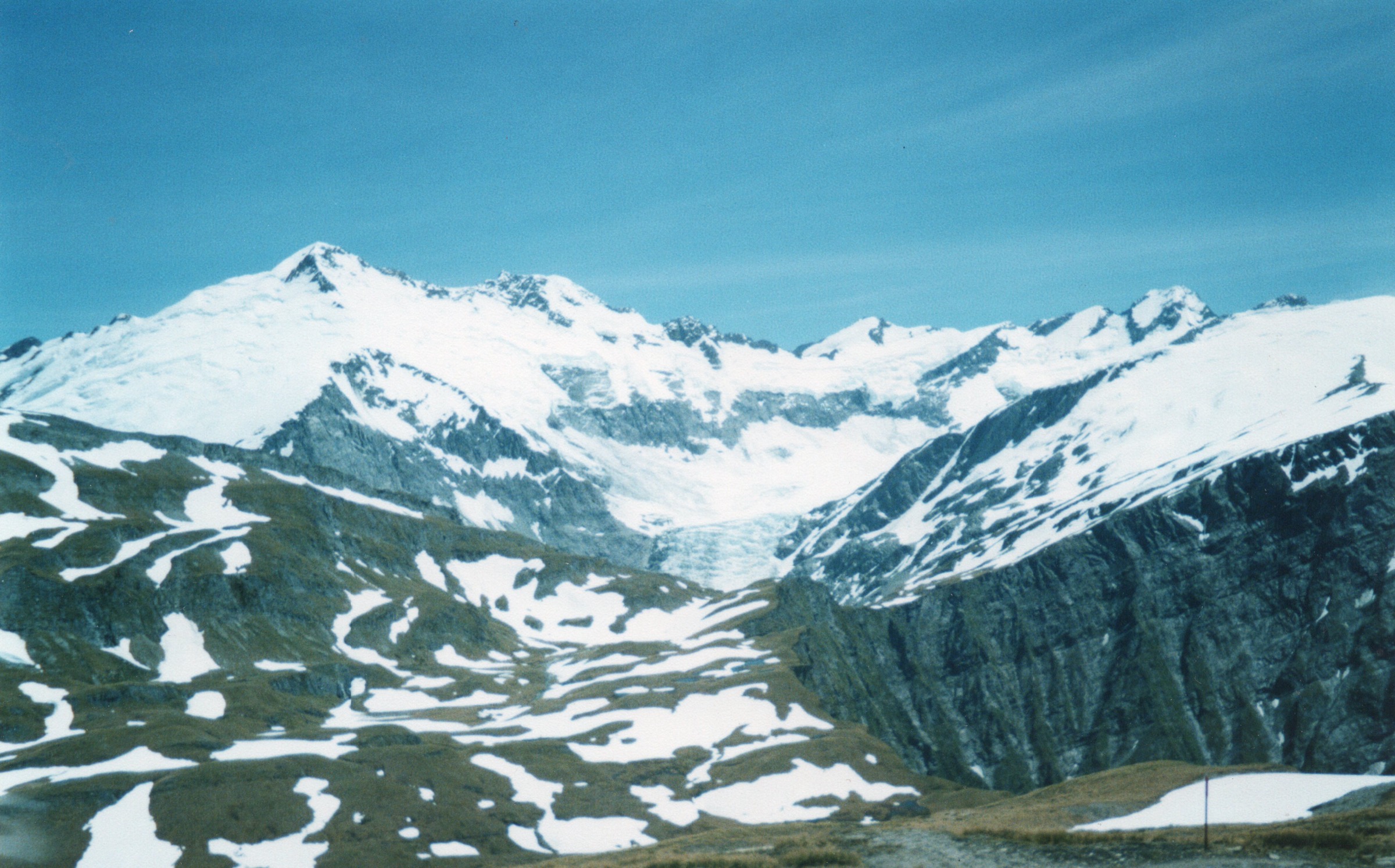
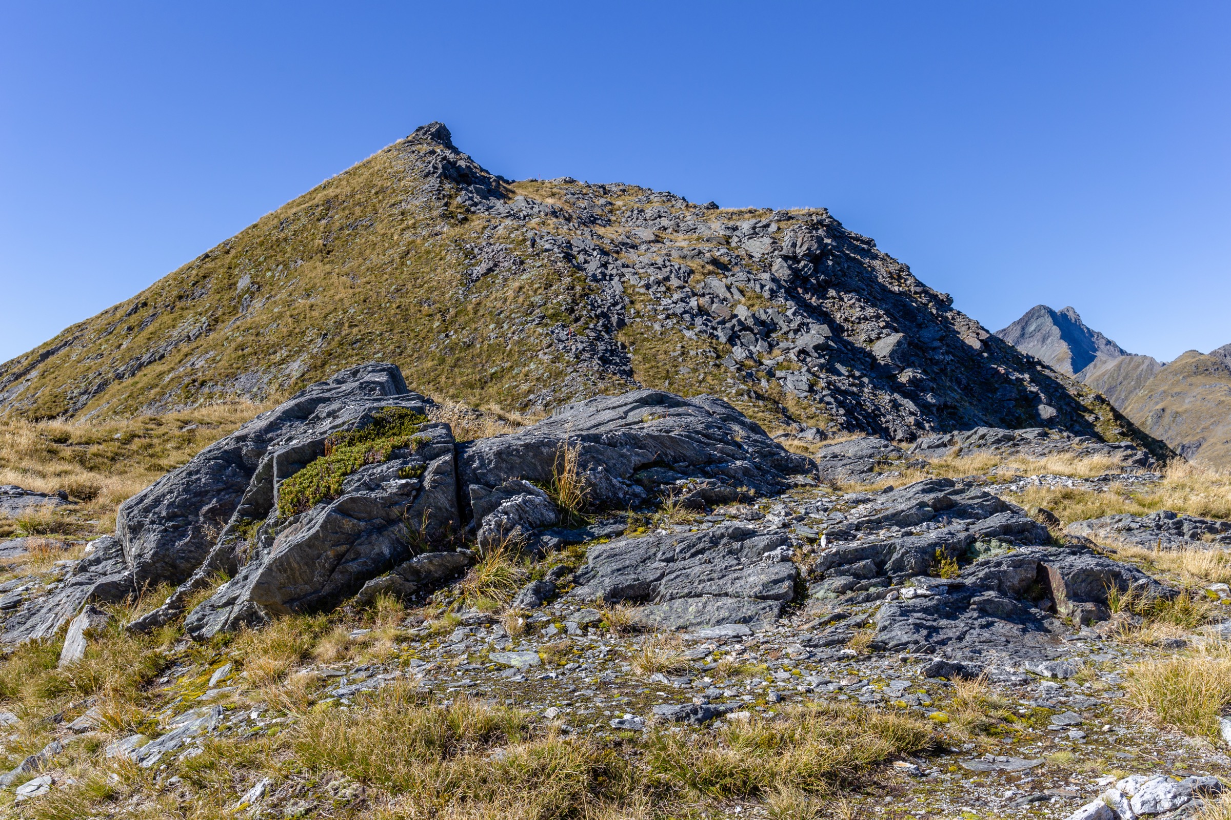
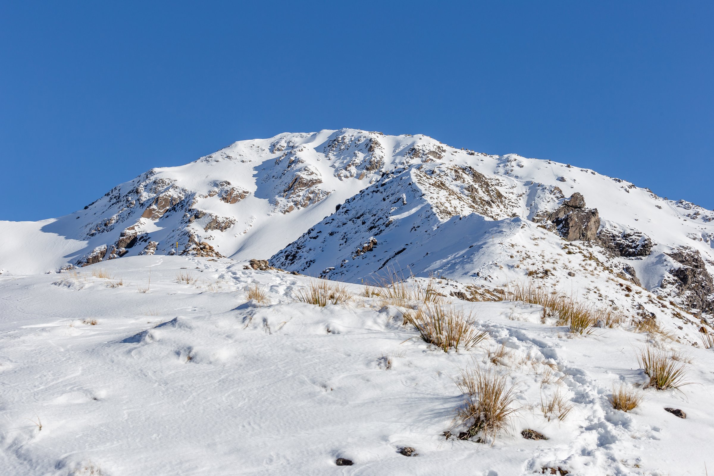
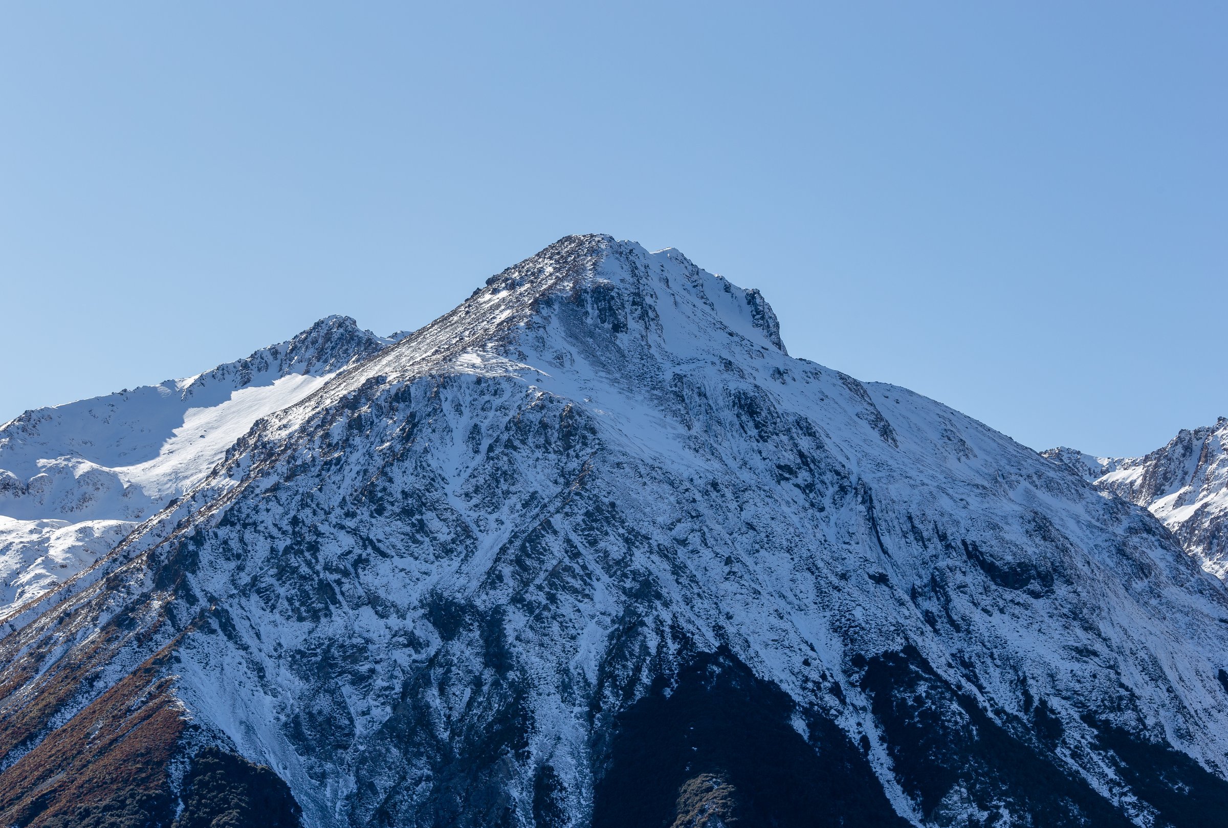
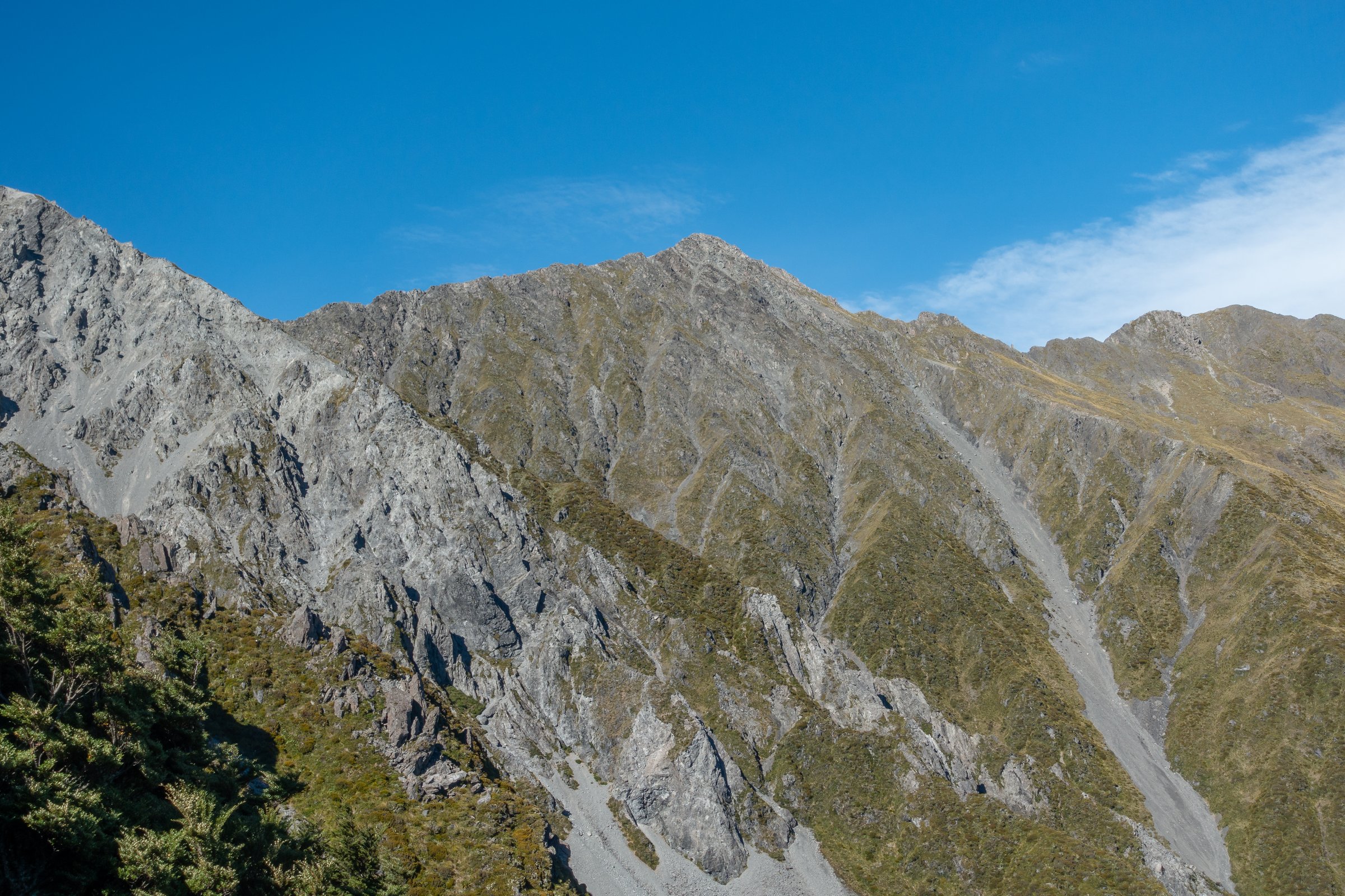
From Arthur’s Pass Visitor Centre, the Avalanche Peak Track climbs steeply beside Avalanche Creek through mountain-beech forest to the bushline. Beyond the bushline, yellow poles mark the exposed Avalanche Peak Route over tussock, scree, bluffs, and narrow ridge sections to the 1,833 m summit.
For the loop, descend first on the shared summit section, then follow orange poles onto Scotts Route. The route trends towards Mount Cassidy before dropping through tussock and beech forest to Scotts Track and SH73 near the Punchbowl car park. DOC advises using Avalanche Peak Track for the ascent and Scotts Track for the descent; the highway should not be used as a walking link.
Why it is essential
Avalanche Peak is the defining day summit of Arthur’s Pass village and the only local peak with a poled route to the summit. It gives close views of Mount Rolleston, Crow Glacier, the Bealey Valley, and the Main Divide skyline.
Equipment
- Mountain hiking equipment: sturdy boots, weatherproof shell, warm layer, food, water, sun protection, map/GPS, and navigation backup.
- Headtorch, emergency shelter, first-aid kit, and distress beacon are recommended for this full mountain day.
- In winter or when snow is present, DOC recommends ice axe and crampons; avalanche transceiver, probe, shovel, and avalanche skills are required for avalanche terrain.
Hazards and notes
- DOC states people have died on this route; it is steep, rocky, exposed, and has sheer drops.
- Avoid poor visibility, high wind, ice, and snow unless equipped and experienced.
- Avalanche, rockfall, navigation errors, steep drop-offs, rapid weather change, and darkness are key hazards.
- No dogs are allowed.
GPX / KML links
| Source | URL | Format / access | Reuse status |
|---|---|---|---|
| DOC: Avalanche Peak Route | doc.govt.nz | Official route page / map | DOC website terms; no GPX found |
| Plan My Walk: Avalanche Peak Route map | planmywalk.nz | Source route map | Plan My Walk terms not checked |
| AllTrails: Avalanche Peak Track and Scott’s Track Loop | alltrails.com | Route page / app map | AllTrails terms apply; GPX reuse not confirmed |
External links
- DOC — Avalanche Peak Route
- Plan My Walk — Avalanche Peak Route map
- AllTrails — Avalanche Peak Track and Scott’s Track Loop
2. Mount Aicken Track to Bushline
Snapshot
Itinerary
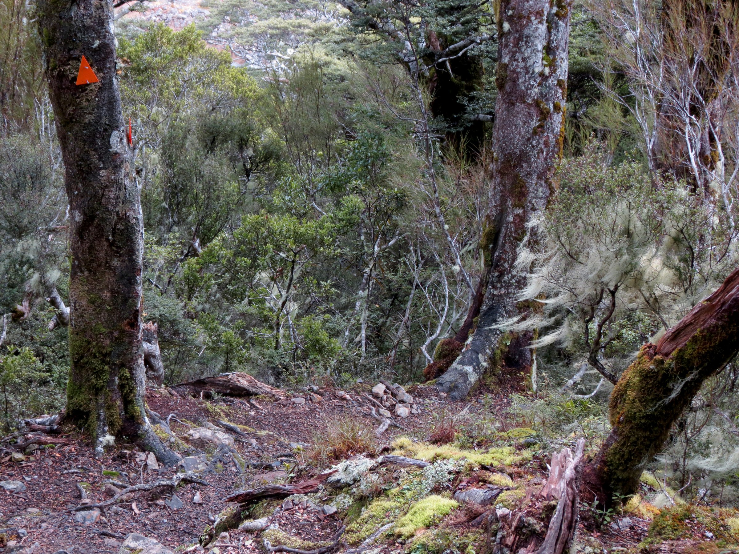
Start on the Devils Punchbowl Walking Track and take the signposted Mount Aicken turnoff about 15 minutes from the start. The track passes an old pipeline associated with rail-tunnel construction power generation, then climbs steeply through forest with roots, rough footing, and orange markers.
The maintained track ends at the bushline. Above this point there is no marked track to the Mount Aicken summit; any continuation is alpine route-finding terrain and is outside this catalogue route.
Why it is essential
Mount Aicken gives a serious, compact view into the west side of the village basin without committing to the full Avalanche Peak summit day. It also shows the historic rail-tunnel infrastructure that shaped Arthur’s Pass.
Equipment
- Mountain hiking equipment: boots, waterproof shell, warm layers, food, water, sun protection, map/GPS, and navigation backup.
- Emergency shelter, headtorch, charged phone, and distress beacon are recommended.
- Above bushline or in snow: compass/map skills, ice axe, crampons, avalanche transceiver, probe, shovel, and avalanche assessment skills are required.
Hazards and notes
- DOC says the track is steep and rugged, with fatalities above the bushline from falls.
- Do not descend off-track through bush or stream beds; DOC warns of cliffs.
- Avalanche paths can cross the track in winter and during snow conditions.
- AllTrails had a secondary March 2026 partial-closure note connected with the Devils Punchbowl bridge; this pass did not find matching current DOC closure text, so check with the Arthur’s Pass Visitor Centre before departure.
- No dogs are allowed.
GPX / KML links
| Source | URL | Format / access | Reuse status |
|---|---|---|---|
| DOC: Mount Aicken Track | doc.govt.nz | Official route page / map | DOC website terms; no GPX found |
| AllTrails: Mount Aicken Track | alltrails.com | Route page / app map | AllTrails terms apply; includes summit continuation beyond DOC’s maintained endpoint |
External links
3. Cons Track to Mount Cassidy Bushline
Snapshot
Itinerary
From the Devils Punchbowl Walking Track, Cons Track follows a steep crested ridge on the north side of Punchbowl Creek. Orange markers lead through forest over rough, rooty ground to the bushline below Mount Cassidy.
The formed track ends at the bushline. The Mount Cassidy summit is not reached by a marked track and should be treated as alpine route-finding terrain for experienced, equipped trampers only.
Why it is essential
Cons Track is a compact but serious ridge climb that faces Avalanche Peak across the village basin. It gives the steep West Coast-side character of the area in a shorter outing than Avalanche Peak.
Equipment
- Mountain hiking equipment: boots, rain shell, warm layer, food, water, sun protection, map/GPS, and navigation backup.
- Emergency shelter, headtorch, spare food, and distress beacon are recommended.
- Snow or above-bushline travel requires winter alpine equipment and avalanche skills.
Hazards and notes
- The track is steep, rugged, and rooty, with fall risks near the bushline.
- DOC warns there is no marked track to Mount Cassidy summit.
- Do not descend off-track or by streams because cliffs and bluffs are present.
- Avalanche paths can cross the track during winter and snow conditions.
- No dogs are allowed.
GPX / KML links
| Source | URL | Format / access | Reuse status |
|---|---|---|---|
| DOC: Cons Track | doc.govt.nz | Official route page / map | DOC website terms; no GPX found |
| AllTrails: Cons Track | alltrails.com | Route page / app map | AllTrails terms apply; GPX reuse not confirmed |
External links
4. Mount Bealey Track to Bushline
Snapshot
Itinerary
From Mount Bealey Road, the track climbs steeply through forest, following orange markers over uneven ground and tree roots. It reaches the bushline above Arthur’s Pass, where views open to the village basin, Avalanche Peak, Mount Rolleston, and the surrounding ranges.
The maintained DOC track ends at the bushline. There is no marked track or route to the summit, and DOC advises not proceeding beyond the bushline unless experienced and equipped for alpine route-finding.
Why it is essential
Mount Bealey is one of the best short, steep viewpoints over the Avalanche Peak area. It gives a different angle on the pass and skyline without requiring the full Avalanche Peak traverse.
Equipment
- Mountain hiking equipment: sturdy boots, waterproof shell, warm layer, food, water, sun protection, map/GPS, and navigation backup.
- Emergency shelter, headtorch, spare food, and distress beacon are recommended.
- Above bushline or in snow, take winter alpine equipment and avalanche safety gear only if trained to use it.
Hazards and notes
- DOC warns the track gains height quickly and involves scrambling over roots.
- Do not attempt off-track descents to the village; cliffs and steep bush terrain are present.
- Above the bushline there are steep sections, fall risk, and no marked route.
- Snow, freezing temperatures, and avalanches are winter hazards.
- No dogs are allowed.
GPX / KML links
| Source | URL | Format / access | Reuse status |
|---|---|---|---|
| DOC: Mount Bealey Track | doc.govt.nz | Official route page / map | DOC website terms; no GPX found |
| AllTrails: Mount Bealey Track | alltrails.com | Route page / app map | AllTrails terms apply; includes summit continuation beyond DOC’s maintained endpoint |
External links
5. Devils Punchbowl Walking Track
Snapshot
Itinerary
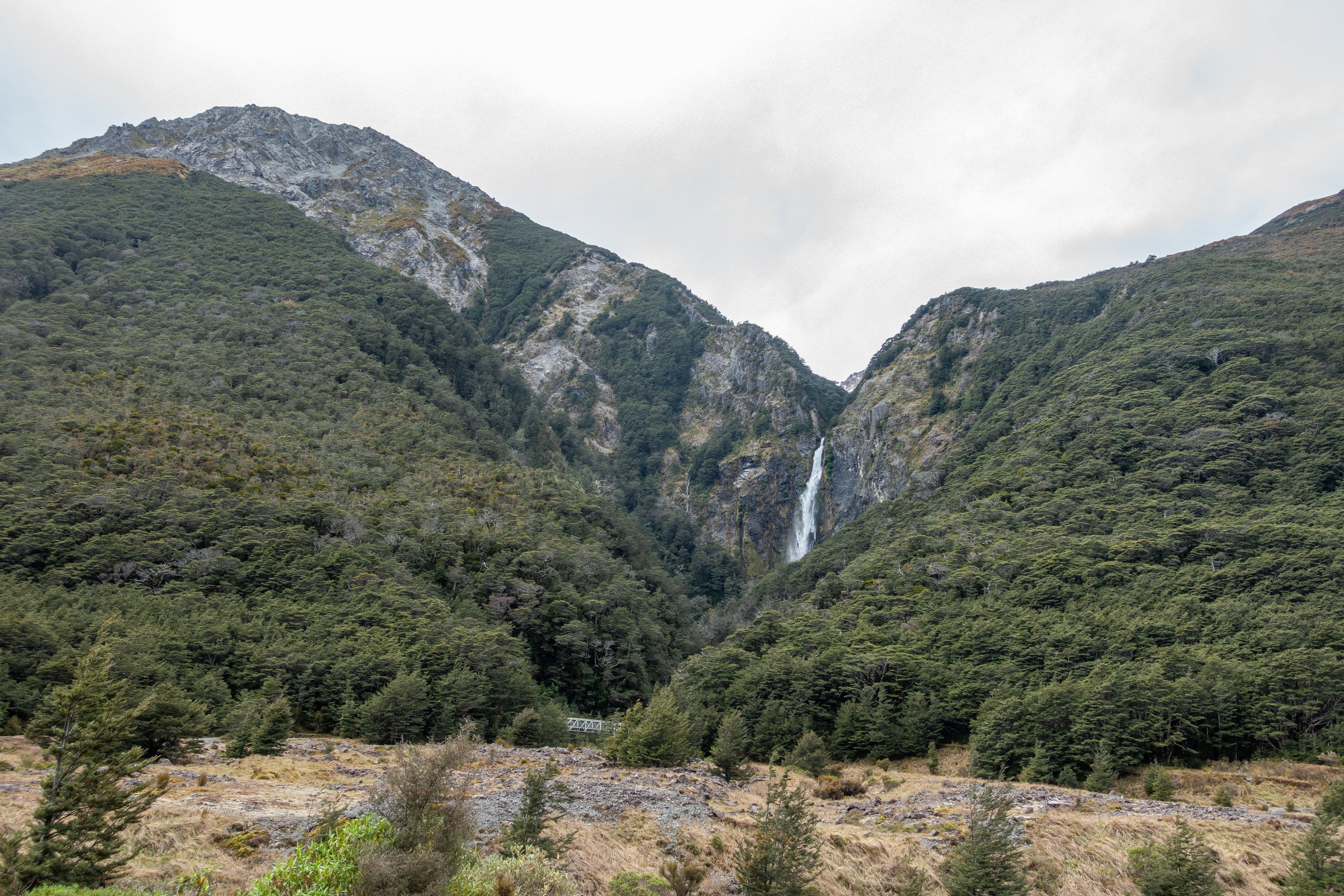
From Punchbowl car park, cross the Bealey River footbridge, then the bridge over Devils Punchbowl Creek. The track climbs through beech forest on a long stair section to a viewing platform below the 131 m waterfall.
Return by the same track. The route can be combined with Arthur’s Pass Walking Track, Cons Track, or Mount Aicken Track, but those add rougher terrain.
Why it is essential
Devils Punchbowl is the classic short walk of Arthur’s Pass village and the easiest way to experience the area’s waterfall, beech forest, river, and cliff scenery.
Equipment
- Standard hiking equipment: sturdy footwear, waterproof/windproof layer, warm layer, water, sun protection, and insect repellent.
- A headtorch is useful for late starts; twilight walks should be conservative because weather and light change quickly.
Hazards and notes
- There are many steps, narrow sections, and steep drop-offs.
- Wet and cold conditions can occur even in summer.
- Drone use on public conservation land requires DOC authorisation.
- No dogs are allowed.
GPX / KML links
| Source | URL | Format / access | Reuse status |
|---|---|---|---|
| DOC: Devils Punchbowl Walking Track | doc.govt.nz | Official route page / map | DOC website terms; no GPX found |
| Plan My Walk: Devils Punchbowl Walking Track map | planmywalk.nz | Source route map | Plan My Walk terms not checked |
| AllTrails: Devils Punchbowl Walking Track | alltrails.com | Route page / app map | AllTrails terms apply; GPX reuse not confirmed |
External links
- DOC — Devils Punchbowl Walking Track
- Plan My Walk — Devils Punchbowl Walking Track map
- AllTrails — Devils Punchbowl Walking Track
External links
| Source | URL |
|---|---|
| DOC — Avalanche Peak Route | doc.govt.nz |
| DOC — Mount Aicken Track | doc.govt.nz |
| DOC — Cons Track | doc.govt.nz |
| DOC — Mount Bealey Track | doc.govt.nz |
| DOC — Devils Punchbowl Walking Track | doc.govt.nz |
| Plan My Walk — Avalanche Peak Route map | planmywalk.nz |
| Plan My Walk — Devils Punchbowl Walking Track map | planmywalk.nz |
| AllTrails — Avalanche Peak Track and Scott’s Track Loop | alltrails.com |
| AllTrails — Mount Aicken Track | alltrails.com |
| AllTrails — Cons Track | alltrails.com |
| AllTrails — Mount Bealey Track | alltrails.com |
| AllTrails — Devils Punchbowl Walking Track | alltrails.com |