Regional overview
This compact Aoraki/Mount Cook National Park area sits below New Zealand’s highest peaks, with glacier valleys, moraine walls, alpine tarns and short but dramatic viewpoint tracks. The main walking bases are Aoraki/Mount Cook Village, White Horse Hill and the Blue Lakes/Tasman Valley car park.
DOC currently notes a major limitation: the full Hooker Valley Track is closed beyond Kakiroa/Mount Sefton View Lookout while a new bridge is built, likely until autumn 2026. White Horse Hill parking fees apply as a pilot from 15 December 2025 to 30 June 2026.
The normal walking season is spring to autumn, but weather can change rapidly year-round. Snow, ice and avalanche terrain affect the Sealy/Mueller routes, and DOC advises current-condition checks with the Aoraki/Mount Cook Visitor Centre.
Selection rationale
The five hikes cover the four supplied areas: Hooker Valley, Mueller Ridge, Sealy Range and Tasman Valley, plus Kea Point as the key short Mueller/Hooker viewpoint while the upper Hooker Valley remains closed.
Summary table
| # | Hike | Country | Route type | Distance | Gain | Max elevation | Difficulty |
|---|---|---|---|---|---|---|---|
| 1 | Hooker Valley Track to Kakiroa/Mount Sefton View Lookout | New Zealand | Out-and-back | 4.3 km | Not published | Not verified | Easy/intermediate |
| 2 | Kea Point Track | New Zealand | Out-and-back | 3.0 km | 90-180 m | c. 851-857 m | Easy/intermediate |
| 3 | Sealy Tarns Track | New Zealand | Out-and-back | 5.3-5.8 km | 543-600 m | c. 1,300-1,311 m | Strenuous |
| 4 | Mueller Hut Route | New Zealand | Out-and-back | 9.7-10.4 km | c. 1,050 m | c. 1,800-1,815 m | Advanced |
| 5 | Tasman Glacier View and Tasman Lake/River Tracks | New Zealand | Linked out-and-backs | 2.6-4.1 km | up to 86 m | c. 805 m | Easy/intermediate |
1. Hooker Valley Track to Kakiroa/Mount Sefton View Lookout
Snapshot
Itinerary
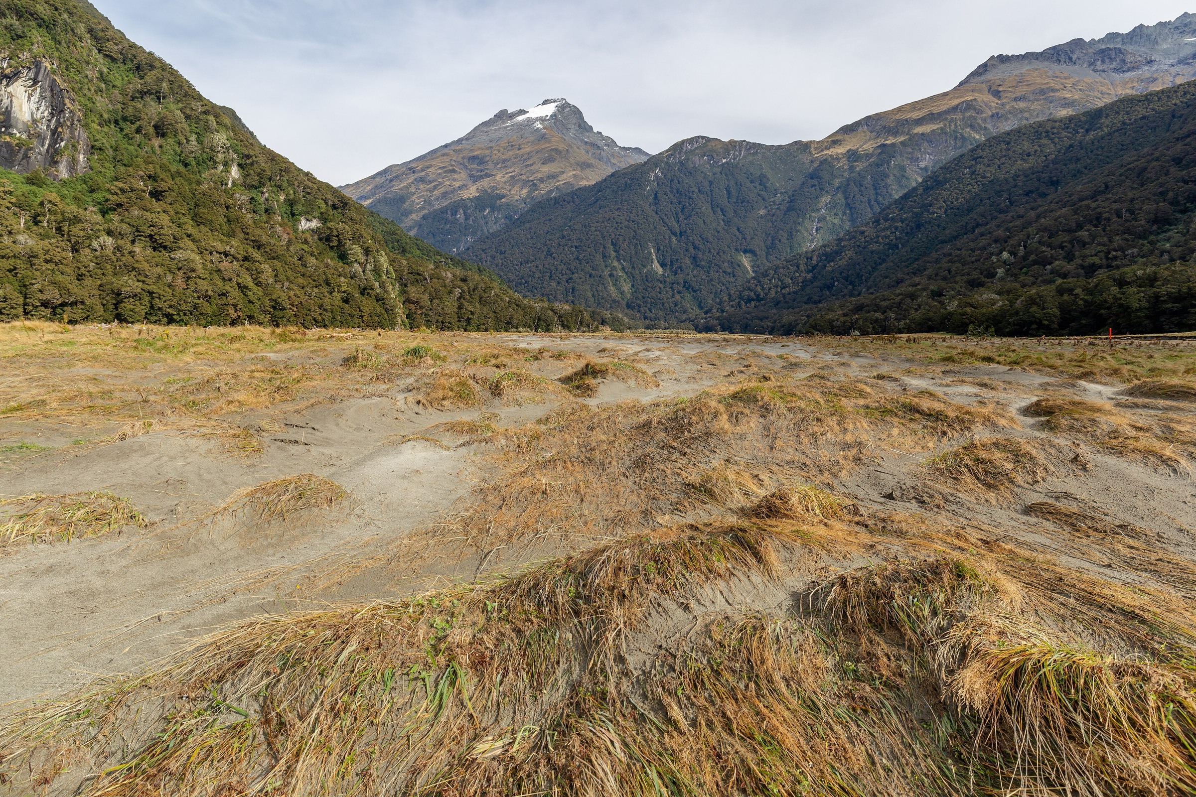
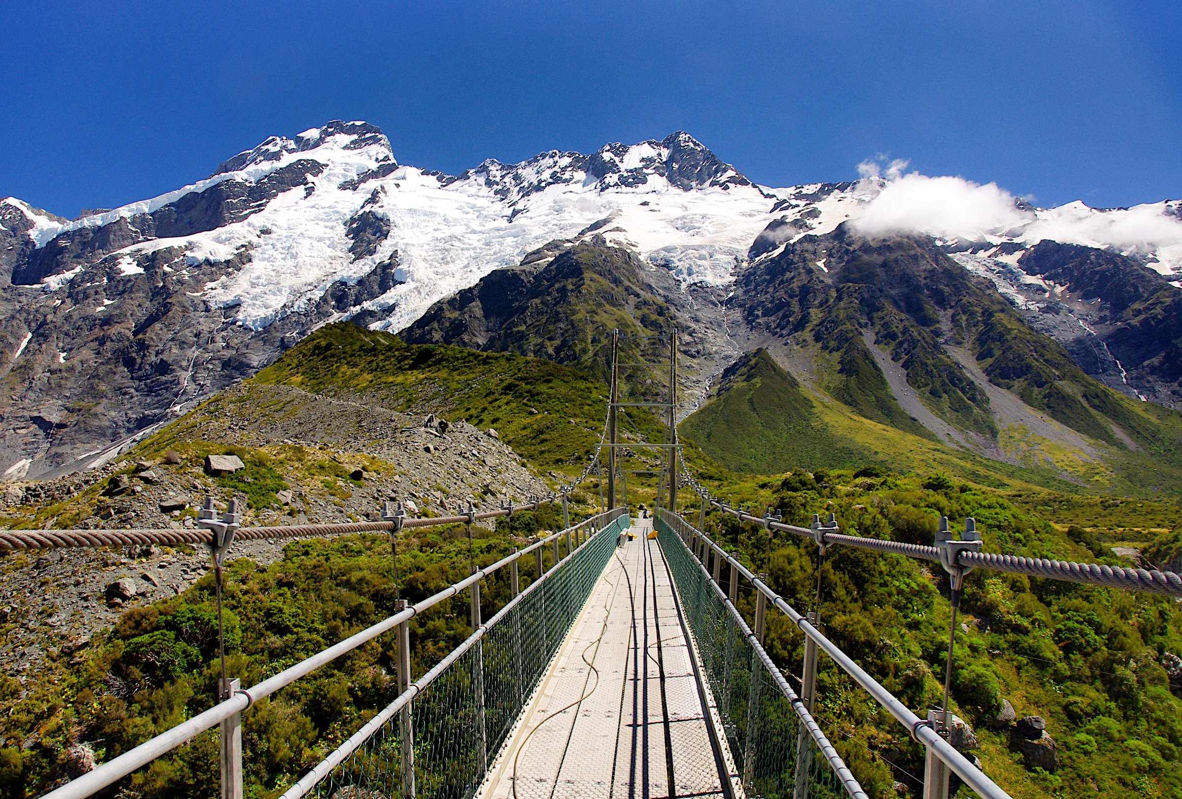
The current open route starts at White Horse Hill, passes the Alpine Memorial and Freda’s Rock, reaches Mueller Lake Lookout, crosses the first swing bridge and continues beside Mueller Lake to Kakiroa/Mount Sefton View Lookout. The track is closed beyond this point while bridge works continue.
Why it is essential
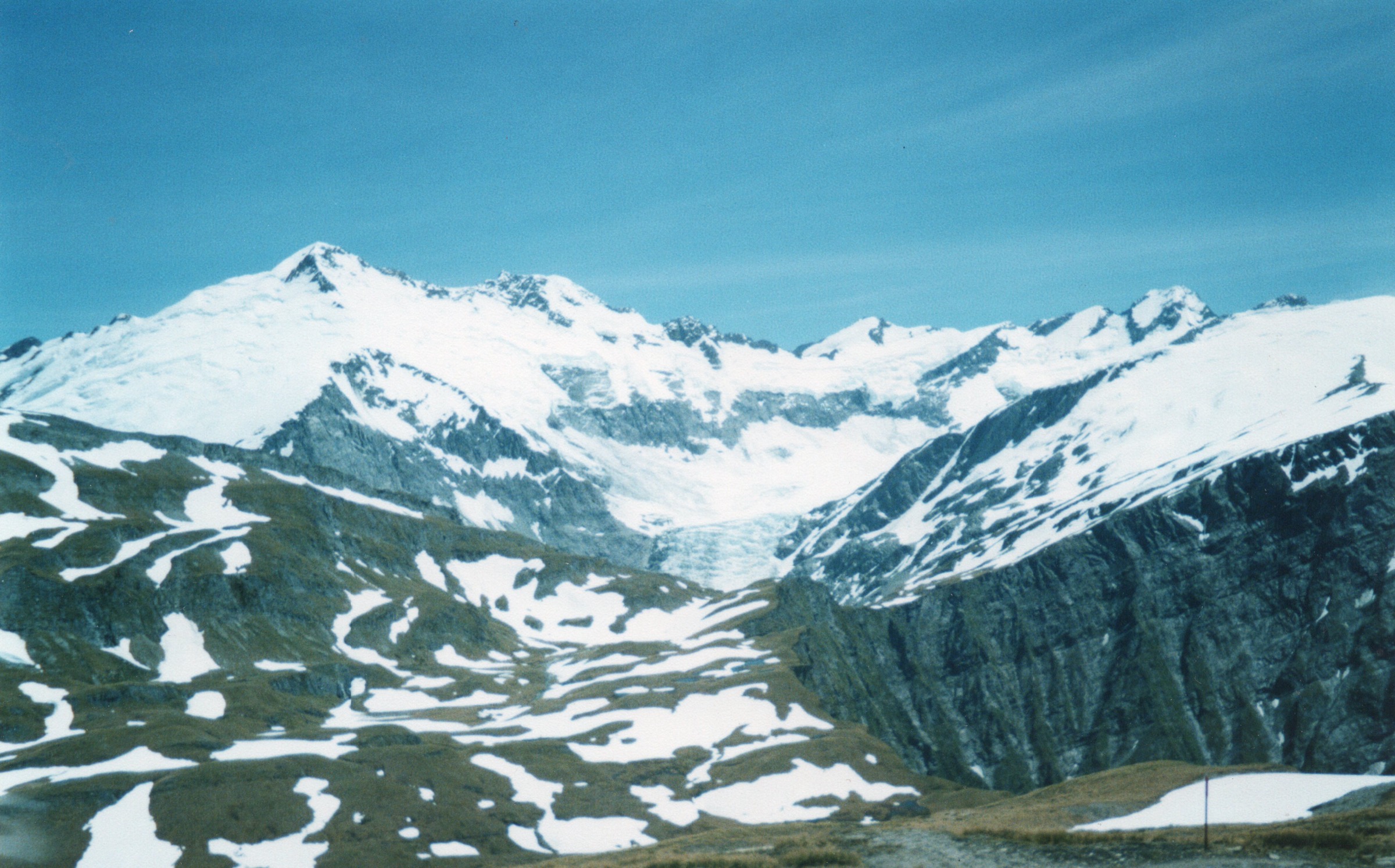
Even in partial form, this is the signature low-level approach into the Hooker/Mueller glacier landscape and gives close views of Mueller Lake, Mueller Glacier and Kakiroa/Mount Sefton.
Equipment
Standard hiking equipment. In winter DOC recommends microspikes and hiking poles where shaded sections become icy.
Hazards and notes
Do not continue past the closure. Stay out of Hooker and Tasman lakes; DOC notes the water is very cold and lake ice can be unsafe. No dogs, recreational drones or fires. White Horse Hill parking fees apply during the 2025-2026 pilot.
GPX / KML links
| Source | URL | Format / access | Reuse status |
|---|---|---|---|
| DOC current route page | doc.govt.nz | Source map | DOC terms; no GPX found |
| Hiking Project historic full route | hikingproject.com | GPX link shown | Adventure Projects terms; historic full-route geometry only, not current closure-compliant |
External links
2. Kea Point Track
Snapshot
Itinerary
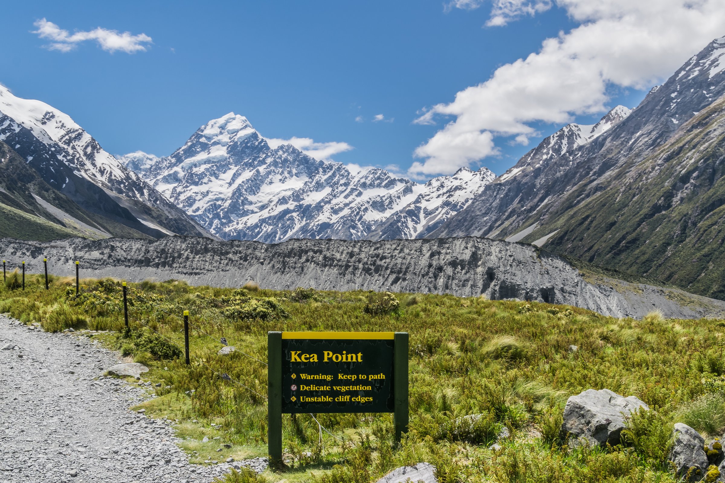
From White Horse Hill, the track follows open subalpine ground, passes the Sealy Tarns junction and climbs gently to the lookout above Mueller Lake. The longer village approach begins near the visitor centre.
Why it is essential
Kea Point is the best short alternative for Aoraki/Mount Cook and Mueller Lake views while the upper Hooker Valley Track is closed.
Equipment
Standard hiking equipment; sturdy shoes recommended.
Hazards and notes
Exposed to wind and fast weather changes. No dogs or recreational drones. White Horse Hill parking fees apply if starting there.
GPX / KML links
| Source | URL | Format / access | Reuse status |
|---|---|---|---|
| Hiking Project | hikingproject.com | GPX link shown | Adventure Projects terms; reuse not checked |
| DOC Kea Point Track | doc.govt.nz | Official route page | DOC terms; no GPX found |
External links
3. Sealy Tarns Track
Snapshot
Itinerary
Start on the Kea Point Track and turn onto the Sealy Tarns Track. The route climbs steeply on a long stepped path, often described by DOC as 2,200 steps, to the tarns and viewpoint over Hooker Valley, Mueller Lake and Aoraki/Mount Cook.
Why it is essential
This is the classic high balcony above the Hooker/Mueller valleys and the accessible gateway to the Sealy/Mueller alpine terrain.
Equipment
Mountain hiking equipment. Trekking poles recommended for the descent. Microspikes or crampons and ice axe may be needed when icy or snow-covered.
Hazards and notes
The track is steep, exposed to weather and has no shelter or alternative descent. DOC warns that snow and ice can make the track serious and that avalanche risk may exist in winter.
GPX / KML links
| Source | URL | Format / access | Reuse status |
|---|---|---|---|
| Hiking Project | hikingproject.com | GPX link shown | Adventure Projects terms; reuse not checked |
| DOC Sealy Tarns Track | doc.govt.nz | Official route page | DOC terms; no GPX found |
External links
4. Mueller Hut Route
Snapshot
Itinerary
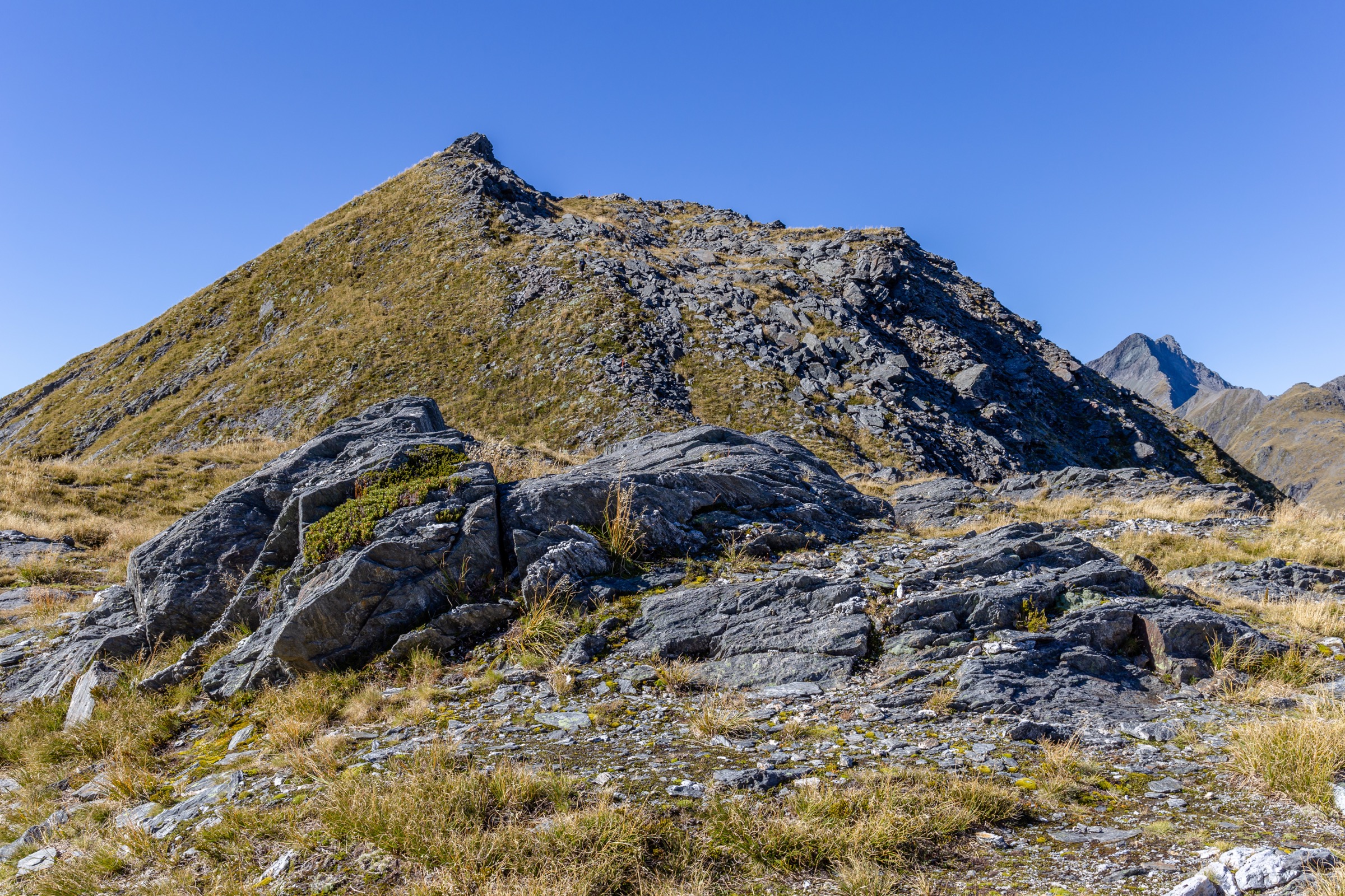
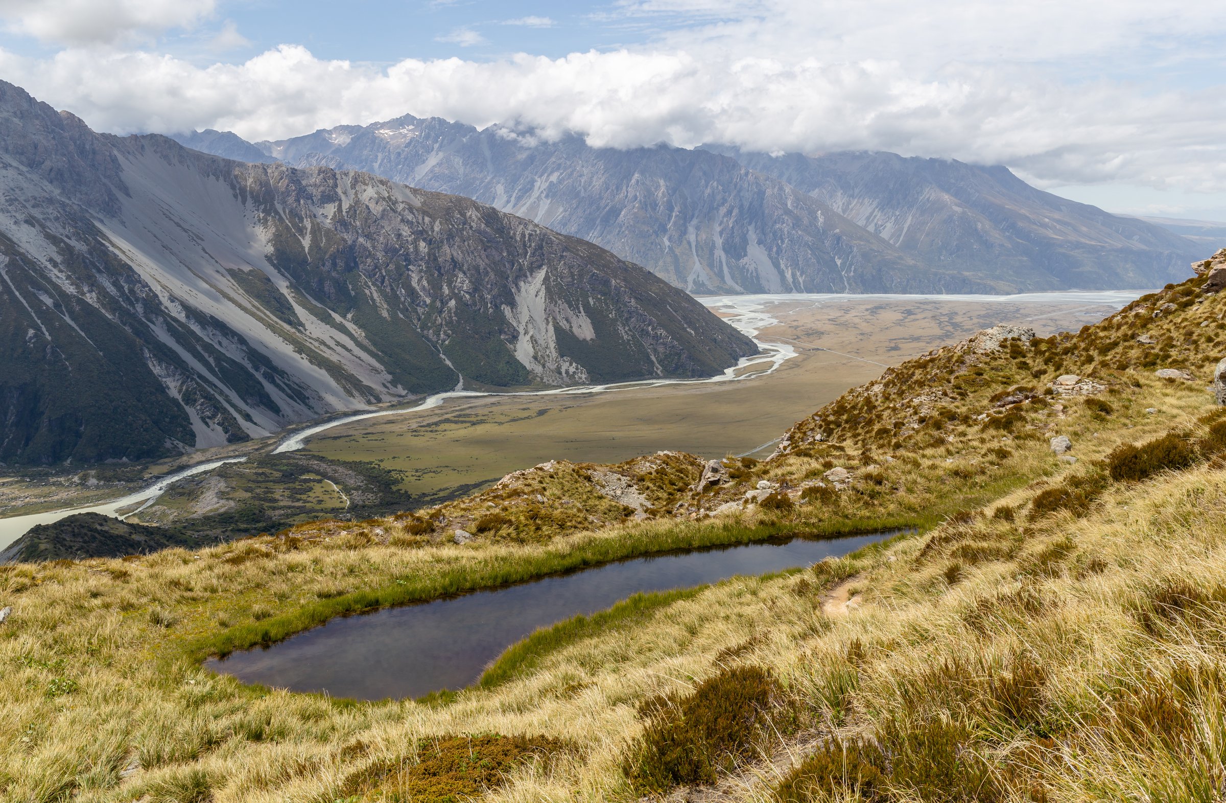
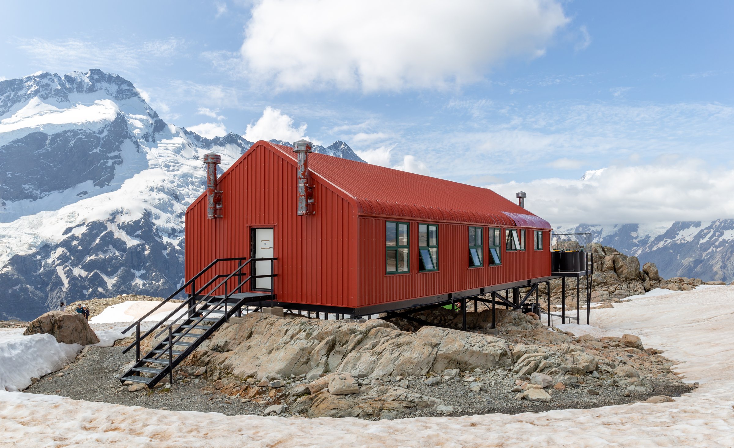
Follow the Sealy Tarns Track to the tarns, then continue on orange markers through tussock and rocky ground. The route climbs a loose scree slope to the skyline ridge, follows the ridge south and reaches Mueller Hut below Mt Ollivier. Return the same way.
Why it is essential
This is the region’s classic strenuous non-glacier alpine day route, with wide views over the Mueller Glacier, Mount Sefton ice cliffs and the Aoraki/Mount Cook massif.
Equipment
Mountain hiking equipment, navigation backup, headtorch and extra warm layers. In snow or winter conditions: ice axe, crampons, avalanche transceiver, probe and shovel, plus relevant skills.
Hazards and notes
DOC states this is not a maintained track above Sealy Tarns but an alpine route. Snow and ice may occur from March to November. Avalanche danger is significant in winter and spring. Register intentions at the visitor centre. Hut booking is required if staying overnight.
GPX / KML links
| Source | URL | Format / access | Reuse status |
|---|---|---|---|
| Hiking Project | hikingproject.com | GPX link shown | Adventure Projects terms; covers Sealy-to-hut section; combine with Sealy approach |
| DOC Mueller Hut Route | doc.govt.nz | Official route page | DOC terms; no GPX found |
External links
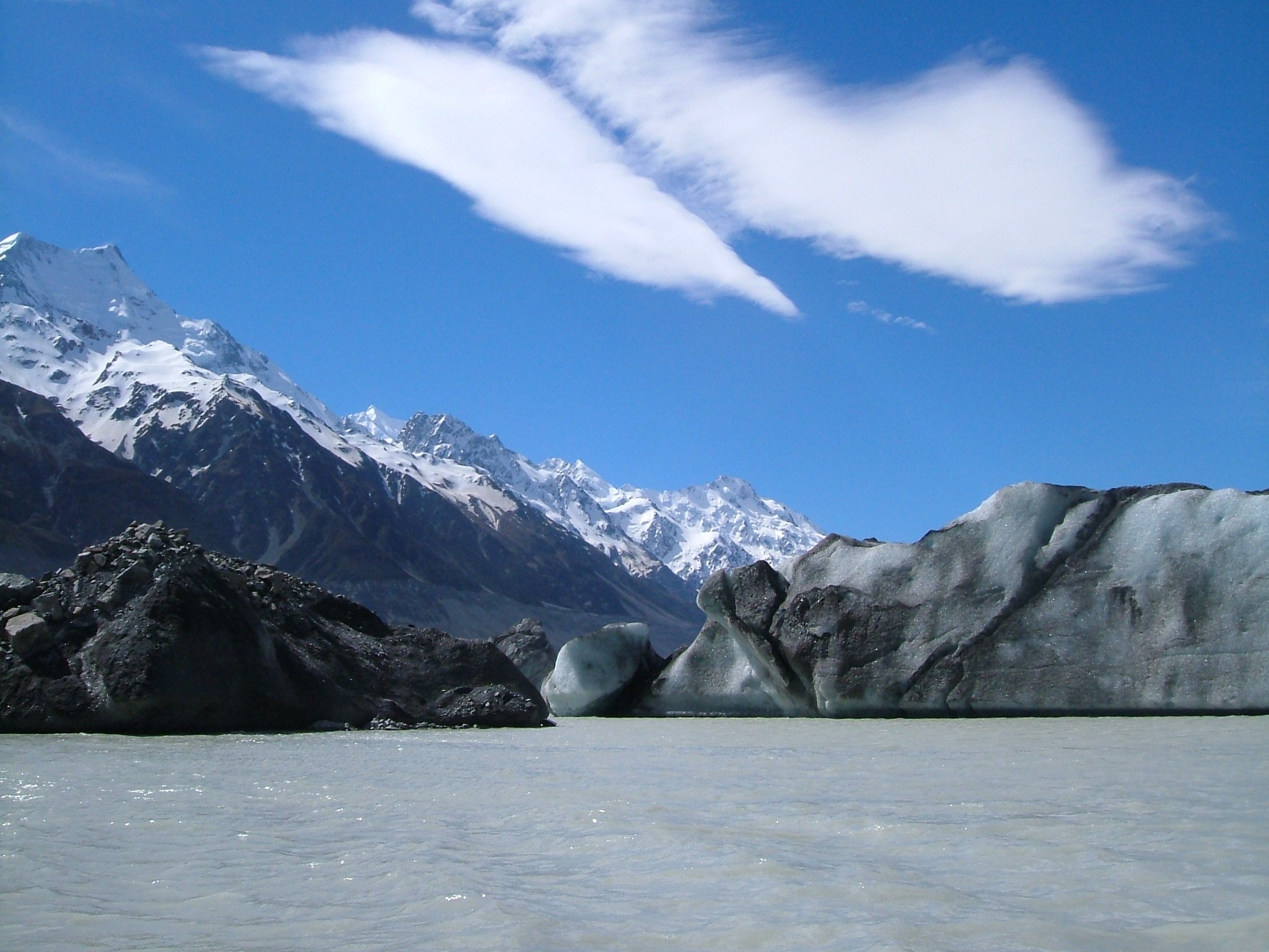
5. Tasman Glacier View and Tasman Lake/River Tracks
Snapshot
Itinerary
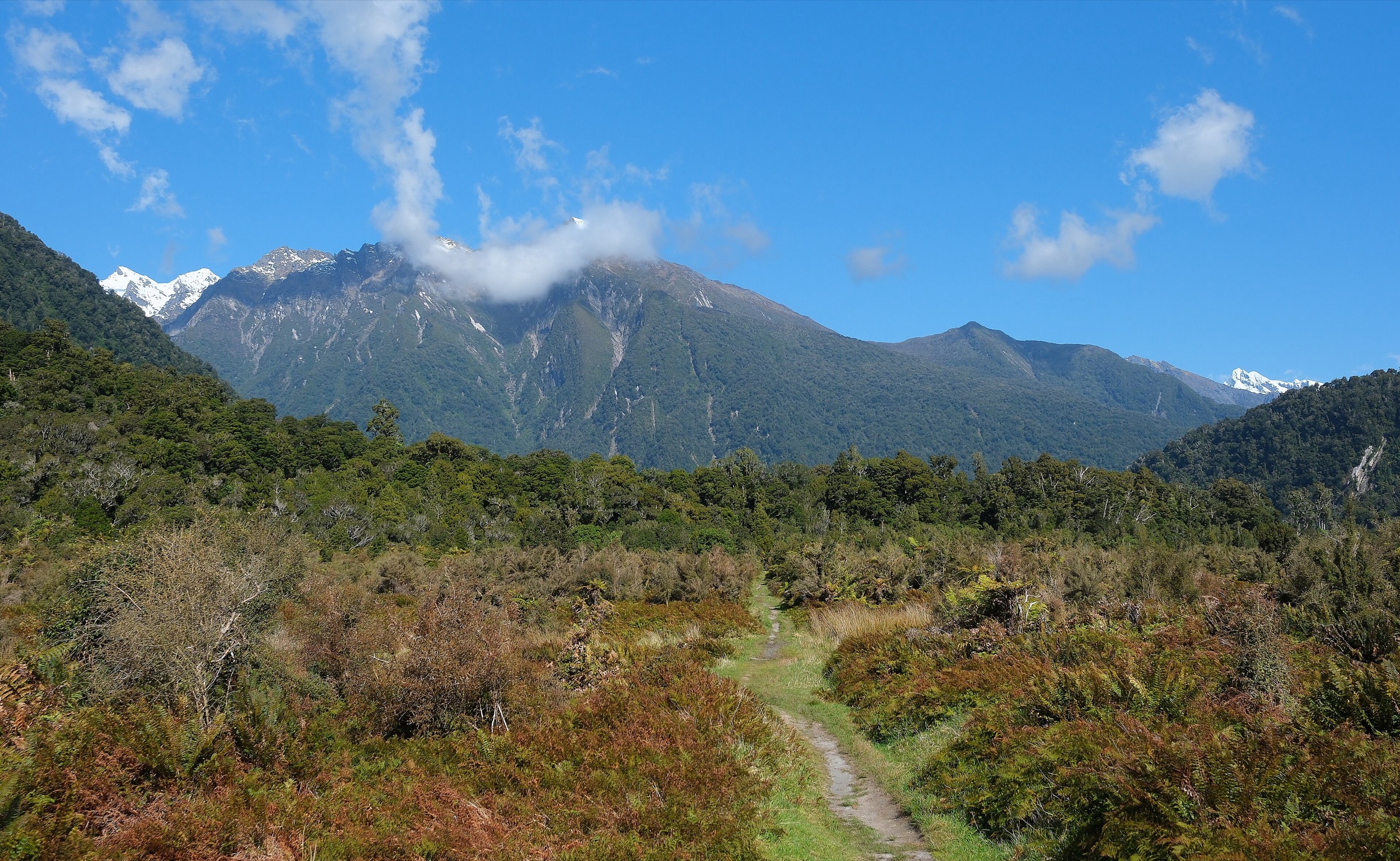
From the Blue Lakes car park, climb past the shelter and Blue Lakes to the moraine-wall viewpoint over Haupapa/Tasman Glacier and Tasman Lake. Return to the junction and follow the Tasman Lake/River branch toward the terminal-lake and river-source viewpoints.
Why it is essential
This is the shortest direct walking access to views of New Zealand’s longest glacier system and its rapidly changing terminal lake.
Equipment
Standard hiking equipment; sturdy footwear for steps and moraine surfaces.
Hazards and notes
Stay out of Tasman Lake and off lake ice. Icebergs can be unstable. Weather changes quickly in the alpine valley. No dogs or recreational drones.
GPX / KML links
| Source | URL | Format / access | Reuse status |
|---|---|---|---|
| Hiking Project Tasman Glacier View | hikingproject.com | GPX link shown | Adventure Projects terms; Glacier View branch only |
| DOC Tasman Glacier View Track | doc.govt.nz | Official route page | DOC terms |
| DOC Tasman Lake and River Track | doc.govt.nz | Official route page | DOC terms |
External links
- DOC — Tasman Glacier View Track
- DOC — Tasman Lake and River Track
- Hiking Project — Tasman Glacier View Track
External links
| Source | URL |
|---|---|
| DOC — Hooker Valley Track | doc.govt.nz |
| DOC — Kea Point Track | doc.govt.nz |
| DOC — Sealy Tarns Track | doc.govt.nz |
| DOC — Mueller Hut Route | doc.govt.nz |
| DOC — Tasman Glacier View Track | doc.govt.nz |
| DOC — Tasman Lake and River Track | doc.govt.nz |
| Hiking Project — Hooker Valley Track | hikingproject.com |
| Hiking Project — Kea Point | hikingproject.com |
| Hiking Project — Sealy Tarns Track | hikingproject.com |
| Hiking Project — Mueller Hut Track | hikingproject.com |
| Hiking Project — Tasman Glacier View Track | hikingproject.com |