Regional overview
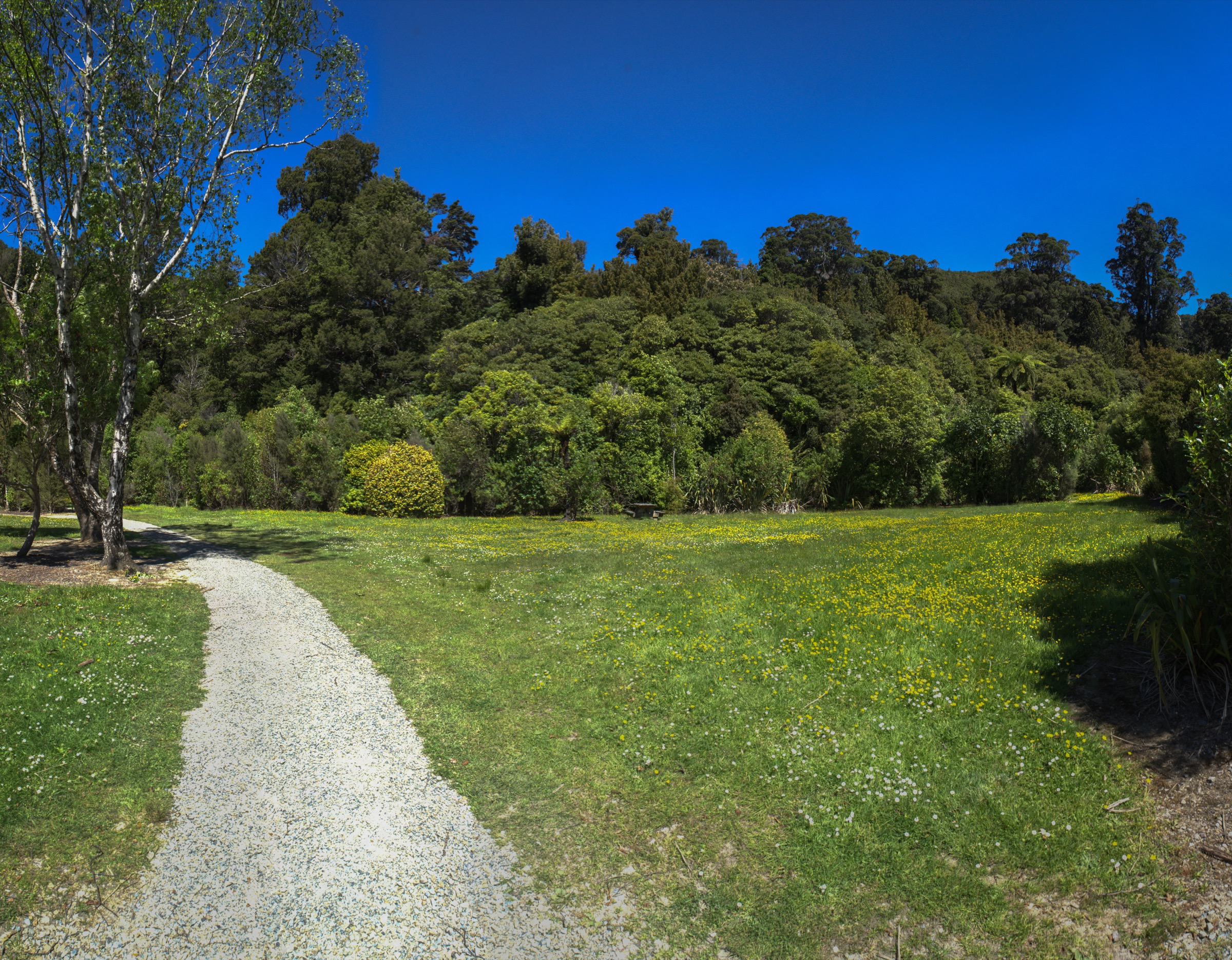
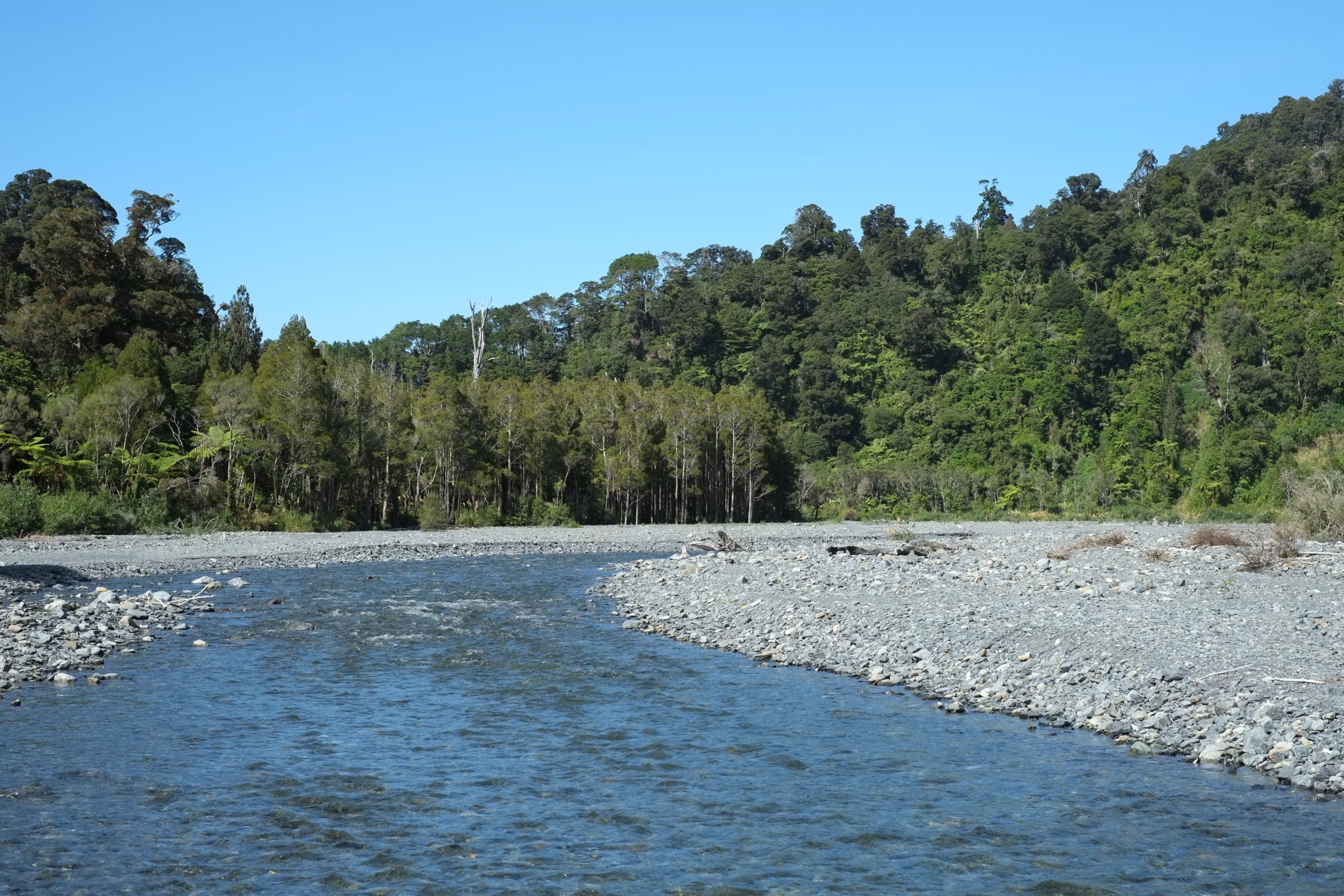
Remutaka Forest Park is the central forested core of the Remutaka Range, sitting between Wainuiomata, the South Wairarapa coast and the Orongorongo Valley south of Wellington. DOC describes the park as about 22,000 ha, with the Catchpool and Orongorongo valleys the most-used access area. The walking character is wet native forest — podocarp, broadleaf and beech — with broad river valleys, steep bush ridges, forested summits and long cross-range tramping routes.
The main day-hike base is the Catchpool car park at the end of the Catchpool Valley Road access from Wainuiomata. From here the Orongorongo Track feeds the valley system that carries Butcher Track, Cattle Ridge, McKerrow Track, Clay Ridge, Mount Matthews Track and the western half of the Papatahi Crossing. DOC’s headline hazard notes for the park are consistent across route pages: no cellphone reception in most of the park, rivers that can rise quickly, muddy tracks, steep drops and weather that changes fast.
Two planning points matter for this catalogue. First, the range’s proximity to Wellington makes these routes look shorter than they are — the longer summit and cross-range objectives need full tramping equipment, navigation and conservative river decisions, and are not casual half-day walks. Second, DOC does not publish elevation gain, loss or many maximum-elevation figures for the routes covered here in the pages checked; the only summit datums given are 706 m for Mount McKerrow, 941 m for Mount Matthews and 902 m for Papatahi. Distances and times below come directly from DOC route pages and the Remutaka Forest Park brochure PDF.
The sibling Northern Remutakas entry covers the Kaitoke, Tunnel Gully and Rail Trail side of the range and is the better starting point for shorter, more accessible day walks on the northern flank.
Selection rationale
The five selections cover the essential Forest Park experience. The Orongorongo Track is the iconic Catchpool-to-Orongorongo forest and river approach — the foundation for almost every longer route below. The Butcher / Cattle Ridge loop is the compact ridge day that adds Wellington Harbour views to the valley walk. Mount McKerrow via Clay Ridge is the central-park forest summit day. Mount Matthews is the highest point in the Remutakas at 941 m and the definitive strong-day objective. The Papatahi Crossing is included honestly as an advanced cross-range route — DOC’s own guidance says most parties should stay overnight — but it is the classic Forest Park through-line and belongs in an essential-routes list even if it sits at the edge of what most parties will do in a day.
Summary
| # | Hike | Trailhead | Route type | Distance | Max elevation | Difficulty |
|---|---|---|---|---|---|---|
| 1 | Orongorongo Track | Catchpool car park | Out-and-back | 10.4 km return | Not published | Easy–Moderate |
| 2 | Butcher Track and Cattle Ridge loop | Catchpool car park | Loop | 12 km | Not published | Moderate–Hard |
| 3 | Mount McKerrow via Clay Ridge / McKerrow Tracks | Catchpool or Wainuiomata side | Loop / out-and-back / traverse | 13.3 km (McKerrow Track); 6 h return option | 706 m | Hard |
| 4 | Mount Matthews Track | Catchpool car park via Orongorongo Track | Out-and-back | 5.2 km approach + 4.5 km summit track each way | 941 m | Very hard |
| 5 | Papatahi Crossing | Catchpool / Orongorongo side to Western Lake Road | Point-to-point cross-range | 10 km | 902 m | Very hard — normally overnight |
1. Orongorongo Track
Snapshot
Itinerary
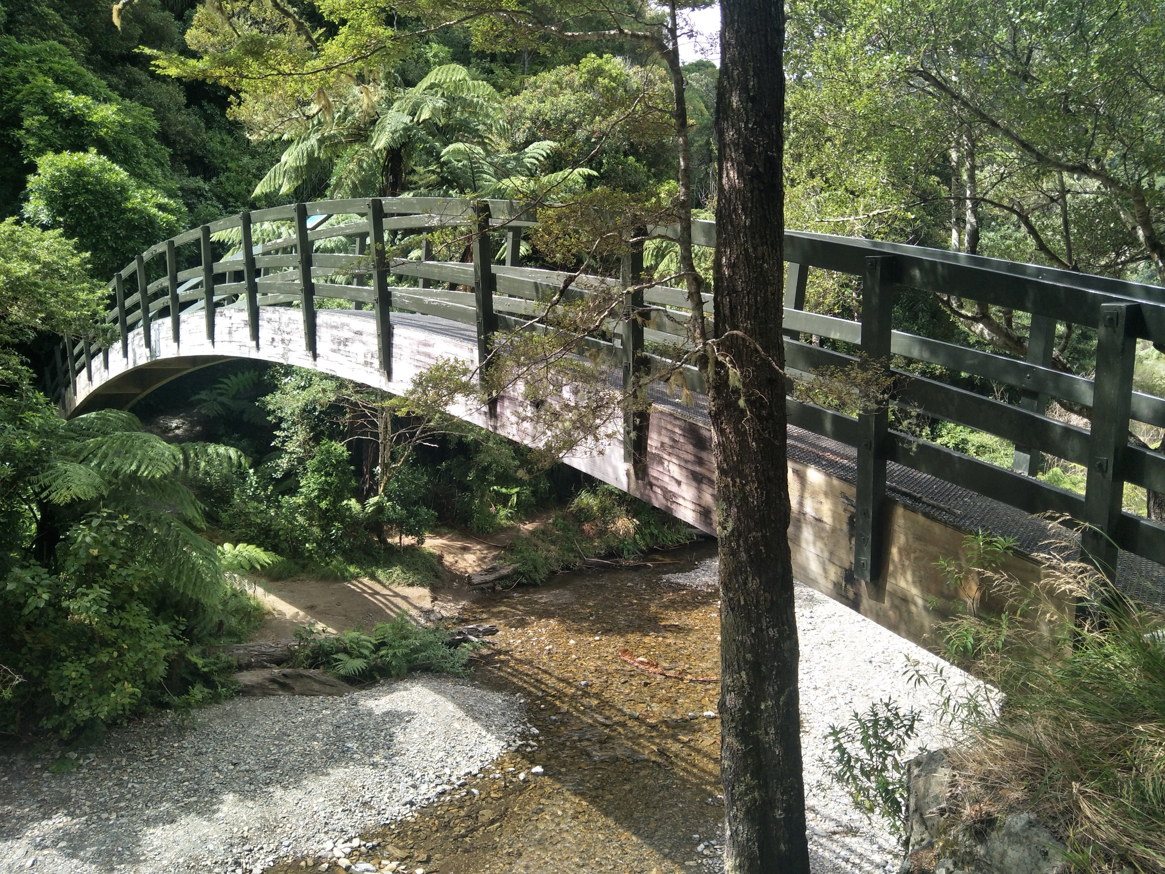
From the Catchpool car park, the well-used forest track runs through mixed podocarp, broadleaf and beech to the Turere Bridge footbridge over Turere Stream and out to the Orongorongo River valley. Streamside swimming holes and native forest carry the whole walk. Return by the same track.
Why it is essential
DOC describes the Orongorongo Track as the most popular track in Remutaka Forest Park. It is the classic lowland approach into the park’s main river valley and the foundation for every longer day and overnight route below.
Equipment
- Sturdy walking shoes
- Waterproof shell, warm layer
- 1.5–2 L water and food
- Offline map / GPS
- Carry more equipment if continuing beyond Turere Bridge
Hazards and notes
- No cellphone reception in most of the park
- Muddy tracks, steep drops and rapidly changing weather
- Do not enter or cross the Orongorongo River in unsafe flows
- Check DOC alerts before departure
2. Butcher Track and Cattle Ridge Track
Snapshot
Itinerary
From Catchpool, follow the Orongorongo Track for about 10 minutes to the Butcher Track junction. Butcher Track climbs steeply to viewpoints over Wellington Harbour, then joins the Cattle Ridge route and drops back toward the Orongorongo side near Turere Stream before rejoining the Orongorongo Track back to Catchpool.
Why it is essential
This is the best compact Catchpool ridge loop — a route that adds steep forest climbing, open harbour views and ridge travel to the otherwise valley-based Orongorongo experience, all inside a half-day-plus window from the standard trailhead.
Equipment
- Tramping shoes or boots
- Waterproof shell, warm layer
- 2 L water and food
- Offline map / GPS and compass
- Headlamp with spare batteries
Hazards and notes
- Steep climb on the Butcher Track section
- Muddy or slippery surfaces, especially after rain
- Fast-changing weather on the ridge; wind and cloud reach the tops before the valleys
- No cellphone reception should be assumed
3. Mount McKerrow via Clay Ridge / McKerrow Tracks
Snapshot
Itinerary
Use Clay Ridge or the McKerrow Track to climb from the forested valleys onto Mount McKerrow. The summit is largely bush-covered but is one of the central park’s principal high points. Depending on chosen access and time, return by the same route, combine with Clay Ridge for a loop, or drop off the far side toward Wainuiomata as a traverse.
Why it is essential
Mount McKerrow is the main central-forest summit day in the park — a longer, more committed tramping objective than the lower Catchpool loops, on a route that stays in bush the whole way and rewards navigation and time management rather than view-hunting.
Equipment
- Tramping boots
- Waterproof shell, warm layer and spare warm layer
- Map, compass and offline GPS
- Headlamp with spare batteries
- 2.5 L water and food
- Personal Locator Beacon recommended
Hazards and notes
- Summit views are largely obscured by vegetation — the day is about the tramp, not the panorama
- Steep, muddy and forested track conditions — expect slow travel in wet weather
- Windfall and poor visibility can complicate navigation on the forested tops
- No cellphone reception
4. Mount Matthews Track
Snapshot
Itinerary
Walk the Orongorongo Track from Catchpool to the river valley, then locate the Mount Matthews Track from the river bed. The track climbs steeply through bush to Mount Matthews at 941 m, the highest point in the Remutaka Range. Return by the same way — this is a long day from Catchpool.
Why it is essential
Mount Matthews is the highest summit in the Remutakas and the natural high-point objective for strong day-hikers in the Forest Park. It is the range’s benchmark serious day out.
Equipment
- Tramping boots
- Waterproof shell, warm layers and spare warm layer
- Map, compass and offline GPS
- Headlamp with spare batteries — long day, headlamp finish likely
- 3 L water and food
- Personal Locator Beacon
- First-aid kit
Hazards and notes
- Long, strenuous day from Catchpool — time margin matters more than fitness
- River-bed access to the summit track — do not commit if the Orongorongo is up
- Steep forested climb with poor visibility potential on the summit
- No cellphone reception; carry a PLB
5. Papatahi Crossing
Snapshot
Itinerary
The crossing links the western Orongorongo / Catchpool side with the Wairarapa side via North Boulder Creek, the Papatahi summit at 902 m, the Wharepapa River, the Wharepapa Hut area and Battery Stream, finishing at Western Lake Road.
Why it is essential
Papatahi is the classic cross-range route in Remutaka Forest Park. It is included here as an essential advanced objective for context — this is the through-line the range is known for — but it is honestly at the edge of what most parties will do in a day.
Equipment
- Full tramping equipment: boots, waterproof shell, warm layers and spare warm layer
- Water treatment
- Map, compass and offline GPS
- Headlamp with spare batteries — the 12 h time budget assumes at least one end in the dark
- Food for a very long day plus emergency rations
- Personal Locator Beacon
- Overnight backup (bivvy, extra warm layer) should be considered even for a day attempt
Hazards and notes
- DOC advises most parties should stay overnight — around 12 h suggests the day option is only for very fit parties in long summer daylight
- River crossings and remote terrain on both sides of the range
- Private-land constraints on the Wairarapa exit — check access before departure
- No dogs and no firearms without permission
- Difficult exit logistics — pre-arrange the pick-up before you start
Missing data / follow-up work
- No official GPX or KML downloads for any of the five routes were found in this pass; DOC’s route pages and the Remutaka Forest Park brochure PDF are the source-map references.
- DOC does not publish elevation gain, loss or many maximum-elevation figures for these routes. The only summit datums confirmed are 706 m (Mount McKerrow), 941 m (Mount Matthews) and 902 m (Papatahi).
- Butcher / Cattle Ridge loop — no licence-compatible route-specific imagery found on Wikimedia Commons.
- Mount McKerrow / Clay Ridge — DOC-hosted CC BY 2.0 imagery credited to Sarah Wilcox is available on the DOC route page but not mirrored on Commons; direct reuse would require the DOC licence workflow rather than the standard Commons pipeline used here.
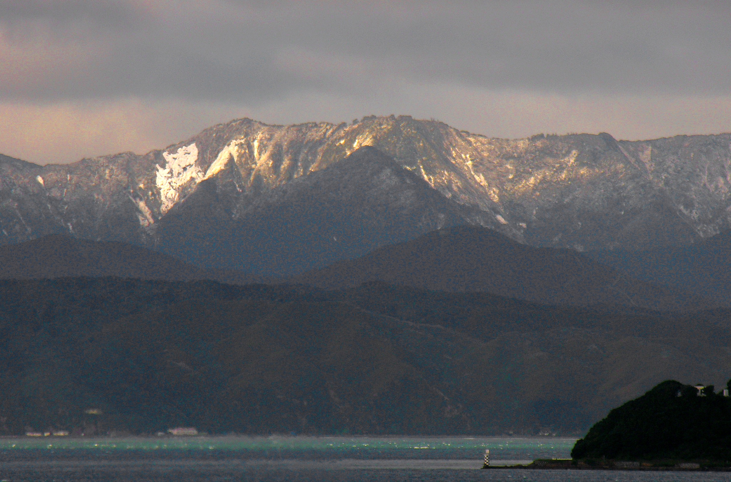
- Mount Matthews summit shot — no ship-ready high-resolution CC image located; the section figure used is a wider Remutaka Range skyline from Wellington rather than a Mount Matthews summit shot.
- Papatahi Crossing — DOC page image credited to Sharon Hart has an unresolved exact CC variant; not used pending confirmation.
- Public transport to the Catchpool trailhead and end-to-end logistics for the Papatahi Crossing remain unresolved.
Further reading
| Resource | Link |
|---|---|
| DOC — Remutaka Forest Park | doc.govt.nz |
| DOC — Catchpool and Orongorongo valleys | doc.govt.nz |
| DOC — Orongorongo Track | doc.govt.nz |
| DOC — McKerrow Track | doc.govt.nz |
| DOC — Clay Ridge Track | doc.govt.nz |
| DOC — Papatahi Crossing | doc.govt.nz |
| DOC — Remutaka Forest Park brochure (PDF) | doc.govt.nz |
| MetService — Wellington regional forecast | metservice.com |
| Wikipedia — Remutaka Range | en.wikipedia.org |
| Wikimedia Commons — Remutaka Range | commons.wikimedia.org |