Regional overview
The Matukituki Valley is the principal eastern walking gateway into Mount Aspiring National Park, west of Wanaka. The West Matukituki gives access to Raspberry Creek, Rob Roy Glacier, Aspiring Hut, Cascade Saddle, Liverpool Track, and French Ridge Track. The East Matukituki provides quieter valley walking toward Glacier Burn, Junction Flat, and more demanding alpine routes.
The walking character ranges from family-friendly valley and glacier-view tracks to serious alpine tramping routes with exposure, avalanche terrain, unbridged streams, and rapid weather change. The valley crosses private farm land near the road end, so walkers must stay on marked routes, leave gates as found, and respect livestock and landowner conditions.
The usual hiking season is late spring through autumn, but snow and avalanche terrain affect Rob Roy, Cascade Saddle, and upper West Matukituki routes from late autumn to early summer. DOC strongly warns that Cascade Saddle has had multiple fatalities and should only be attempted by experienced trampers in fine summer weather.
Selection rationale
The five hikes represent the Matukituki’s essential day-walk spectrum: the iconic Rob Roy Glacier viewpoint, the West Matukituki approach to Aspiring Hut, the quieter East Matukituki/Glacier Burn day walk, the serious Cascade Saddle high route from an Aspiring Hut base, and the Liverpool Hut viewpoint climb from the upper valley.
Summary table
| # | Hike | Country | Route type | Distance | Gain | Max elevation | Difficulty | Photo status |
|---|---|---|---|---|---|---|---|---|
| 1 | Rob Roy Glacier Track | New Zealand | Out-and-back | 10.8 km on AllTrails; DOC distance not exposed in checked snippet | 478 m on AllTrails | Moderate | Open candidate partly resolved | |
| 2 | West Matukituki Track to Aspiring Hut | New Zealand | Out-and-back | 18 km return | Moderate | Open DOC image candidate found | ||
| 3 | East Matukituki to Glacier Burn | New Zealand | Out-and-back | 10 km return | Moderate-advanced | Open DOC image candidate found | ||
| 4 | Cascade Saddle Route: Aspiring Hut to Cascade Saddle | New Zealand | Out-and-back day section | 12 km return from Aspiring Hut to Cascade Saddle by DOC one-way distance | 1,049 m on AllTrails Rees-Dart side-trip source | 1,835 m at pylon; Cascade Saddle 1,524 m | Expert / very hard | Open candidate found, exact image terms unresolved |
| 5 | Liverpool Track: Aspiring Hut to Liverpool Hut | New Zealand | Out-and-back day section | 14.6 km return on AllTrails Aspiring Hut route | 963 m on AllTrails | Hard | No licence-compatible image found |
1. Rob Roy Glacier Track
Snapshot
Itinerary
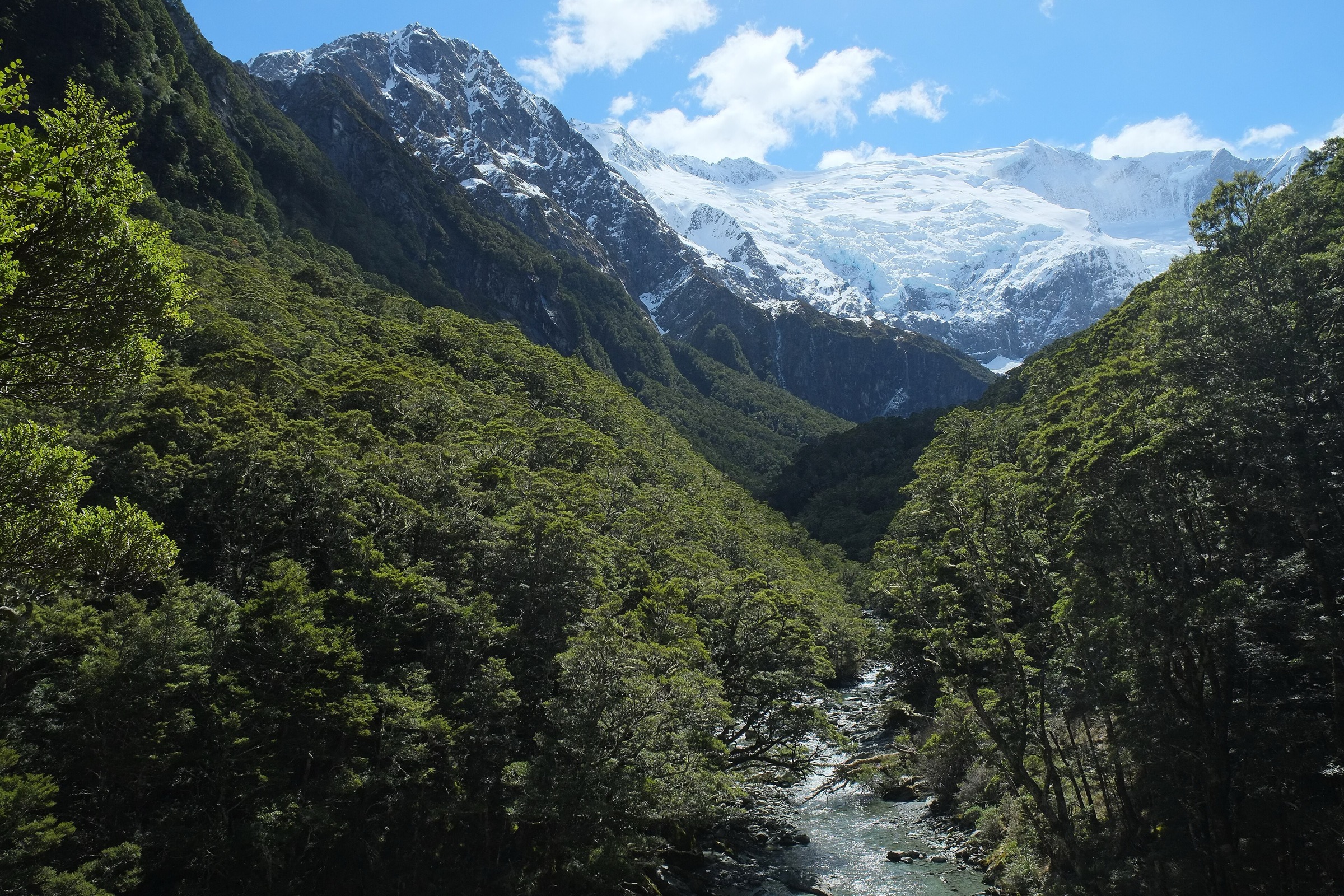
From Raspberry Creek car park, the route crosses the West Matukituki River by swing bridge after about 15 minutes. It then climbs through a small gorge, beech forest, and alpine vegetation toward lookouts with views of Rob Roy Glacier, snowfields, cliffs, and waterfalls. The track ends at the upper lookout.
DOC warns that travelling beyond the upper lookout is not recommended because of dangerous terrain, steep drop-offs, canyons, unstable ground, and fast-flowing water.
Why it is essential
Rob Roy Glacier Track is the classic Matukituki day walk: a relatively direct route from the valley road end into a dramatic alpine amphitheatre below glacier, cliff, and waterfall scenery.
Equipment
- Standard to mountain hiking equipment: sturdy shoes or boots, waterproof layer, warm layer, water, food, sun protection, and poles if desired.
- In colder months, carry extra warm clothing and traction if icy lower sections are expected.
- Avalanche rescue equipment is required only for parties deliberately entering avalanche terrain beyond DOC’s normal seasonal advice.
Hazards and notes
- DOC strongly recommends not going past the lower lookout from May to November because the track crosses active avalanche paths between lower and upper lookouts.
- The access road includes creek fords that can become impassable after rain.
- The track crosses private land; stay on the marked route, use stiles, leave gates as found, and avoid disturbing livestock.
- Swing bridge user limits may require waiting.
- No dogs are allowed.
Photos
| Image | Source | Author | Licence | Reuse notes | Attribution |
|---|---|---|---|---|---|
| View from the first lookout, Rob Roy Track | doc.govt.nz | Ambo Kangaroo | Creative Commons, exact variant unresolved from this pass | Potentially reusable, but exact commercial/modification terms require licence confirmation | “View from the first lookout” by Ambo Kangaroo, Creative Commons; source: Department of Conservation (NZ) |
GPX / KML links
| Source | URL | Format | Licence / terms | Reuse status |
|---|---|---|---|---|
| DOC: Rob Roy Track | doc.govt.nz | Official route page / source map | DOC terms; no GPX located on page | Official source checked; downloadable route file not found |
| AllTrails: Rob Roy Glacier Track | alltrails.com | Source route page / GPX via service | AllTrails terms apply | Secondary route source found; reuse not confirmed |
External links
2. West Matukituki Track to Aspiring Hut
Snapshot
Itinerary
The West Matukituki Track follows grassy farm flats and valley terraces from Raspberry Creek toward Aspiring Hut. DOC describes a couple of small bluffs that give views up and down the valley. The locked historic Cascade Hut can be seen from the last bluff, and Aspiring Hut is about 20 minutes beyond.
This is a natural day walk for fit walkers and also the access route for longer Matukituki tramps.
Why it is essential
Aspiring Hut is the social and geographic hub of the West Matukituki. The walk gives the classic open-valley view toward Mount Aspiring/Tititea country without the technical seriousness of the upper routes.
Equipment
- Standard hiking equipment: hiking shoes or boots, waterproof layer, warm layer, water, food, sun protection, and map/GPS.
- Carry extra warm clothing because the valley is exposed to sudden weather change.
- If staying at Aspiring Hut, carry the required hut equipment and confirmed booking.
Hazards and notes
- The track crosses private land; stay on the marked route and respect livestock/property.
- The road fords near Raspberry Creek can become impassable after heavy rain.
- Aspiring Hut sits in a known landslide debris path and may be temporarily closed when heavy rainfall is forecast.
- Avalanche terrain exists beyond Rough Creek just past Aspiring Hut; this day walk to the hut normally avoids the more serious upper-valley exposure.
Photos
| Image | Source | Author | Licence | Reuse notes | Attribution |
|---|---|---|---|---|---|
| West Matukituki Track | doc.govt.nz | DOC | CC BY 4.0 under DOC copyright terms for DOC-labelled images | Commercial reuse and modification appear allowed with attribution; DOC logos/design excluded | “West Matukituki Track”, Department of Conservation (NZ), CC BY 4.0 |
| Aspiring Hut in the Matukituki Valley | doc.govt.nz | Source page credits image as copyright symbol in snippet; exact author/licence unresolved | Unresolved / likely not reusable if marked © | Do not reuse until exact caption and rights are confirmed | Unresolved |
GPX / KML links
| Source | URL | Format | Licence / terms | Reuse status |
|---|---|---|---|---|
| DOC: West Matukituki Track | doc.govt.nz | Official route page / source map | DOC terms; no GPX located on page | Official source checked; downloadable route file not found |
| DOC Matukituki Valley tracks brochure | doc.govt.nz | PDF map and route guide | DOC terms | Source map found; no GPX found |
External links
3. East Matukituki to Glacier Burn
Snapshot
Itinerary
From Cameron Flat, ford the Matukituki River when safe. DOC notes that if the river is high, walkers should use the Otago Boys High Bridge about one hour upstream on the West Branch. Beyond the old Mount Aspiring Station homestead, the track passes through beech forest, climbs to a saddle, and descends to Glacier Burn.
The track continues up the burn’s true right before the bridge. The valley head has bluffs and waterfalls, but DOC notes there is no formed track beyond the river.
Why it is essential
The East Matukituki is the quieter counterpart to the Rob Roy/Aspiring Hut corridor. Glacier Burn gives a day walk with farm approach, beech forest, a saddle crossing, waterfalls, and a more remote feel.
Equipment
- Mountain hiking equipment: boots, waterproof layer, warm layer, food, water, map/GPS, and poles.
- Carry river-crossing judgement, a conservative turnaround plan, and dry spare layers.
- A personal locator beacon is recommended.
Hazards and notes
- Do not ford the Matukituki River if it is high or discoloured.
- DOC notes muddy sections and major slips on longer East Matukituki routes.
- Avalanche terrain can affect the area from May into November.
- The track crosses private land; stay on marked routes and respect livestock.
Photos
| Image | Source | Author | Licence | Reuse notes | Attribution |
|---|---|---|---|---|---|
| Cliffs at Aspiring Flat, East Matukituki Valley tracks | doc.govt.nz | DOC | CC BY 4.0 under DOC copyright terms for DOC-labelled images | Commercial reuse and modification appear allowed with attribution; image is broader East Matukituki context | “Cliffs at Aspiring Flat”, Department of Conservation (NZ), CC BY 4.0 |
GPX / KML links
| Source | URL | Format | Licence / terms | Reuse status |
|---|---|---|---|---|
| DOC: East Matukituki Valley tracks | doc.govt.nz | Official route page / source map | DOC terms; no GPX located on page | Official source checked; downloadable route file not found |
| DOC Matukituki Valley tracks brochure | doc.govt.nz | PDF map and route guide | DOC terms | Source map found; no GPX found |
External links
4. Cascade Saddle Route: Aspiring Hut to Cascade Saddle
Snapshot
Itinerary
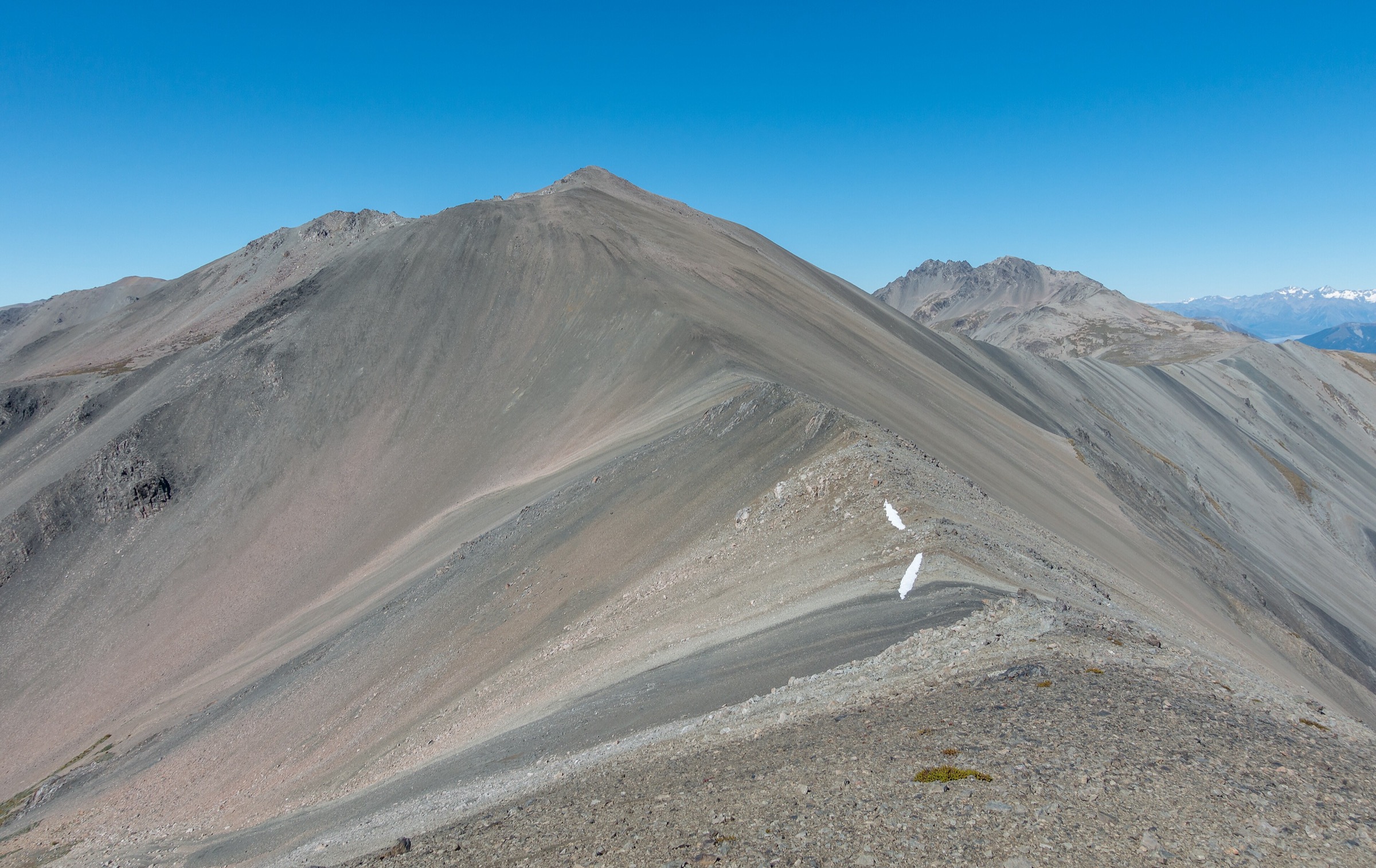
From Aspiring Hut, the route climbs steadily through mixed beech forest. Near the top of the bush there is an unbridged stream crossing that can flood in heavy rain. Above the bushline, the track becomes an orange-poled route following a steep snowgrass and tussock ridge with rocky outcrops, ledges, and exposure.
The pylon at 1,835 m marks the top of the steep Matukituki-side climb. DOC states that the final gully can hold snow for much of the year and is among the most dangerous parts of the route. From the pylon, the route continues to Cascade Creek and Cascade Saddle. For a day route, turn around at a pre-set time or at the saddle and return to Aspiring Hut; do not continue toward Dart Hut unless undertaking the full crossing.
Why it is essential
Cascade Saddle is the Matukituki’s great alpine tramping objective, with views toward Mount Aspiring/Tititea, the Dart Glacier area, and the upper West Matukituki. It is essential because of its status and scenery, not because it is suitable for all walkers.
Equipment
- Full mountain tramping equipment: boots, waterproofs, warm layers, gloves/hat, headtorch, emergency shelter, first-aid kit, food, water, map/GPS, and personal locator beacon.
- Conditional: ice axe, crampons, avalanche equipment, and the skills to use them if snow or avalanche terrain is present.
- Carry extra food and shelter in case streams or weather force a delay.
Hazards and notes
- DOC states multiple fatalities have occurred on this route.
- Do not attempt the route in wet, snowy, icy, windy, or low-visibility conditions.
- Steep snowgrass slopes, rocky ledges, drop-offs, unbridged streams, and navigation errors can be fatal.
- DOC recommends starting from the Matukituki side because ascent is safer than descent; this day-hike variant still requires descending the same route, so conditions must be excellent.
- Kea may damage gear near Cascade Creek campsite.
Photos
| Image | Source | Author | Licence | Reuse notes | Attribution |
|---|---|---|---|---|---|
| Crossing stream on the route between Matukituki and Cascade Saddle | doc.govt.nz | DOC | CC BY 4.0 under DOC copyright terms if image is DOC-labelled; exact page caption should be rechecked | Commercial reuse and modification appear allowed for DOC-labelled image with attribution | Department of Conservation (NZ), CC BY 4.0 |
GPX / KML links
| Source | URL | Format | Licence / terms | Reuse status |
|---|---|---|---|---|
| DOC: Cascade Saddle Route | doc.govt.nz | Official route page / source map | DOC terms; no GPX located on page | Official source checked; downloadable route file not found |
| DOC Cascade Saddle route brochure | doc.govt.nz | PDF map and route guide | DOC terms | Source map found; no GPX found |
| AllTrails: Rees-Dart Track optional side trip - Cascade Saddle Route | alltrails.com | Source route page / GPX via service | AllTrails terms apply | Secondary route source found; variant differs from Aspiring Hut out-and-back |
External links
- DOC — Cascade Saddle Route
- DOC — Cascade Saddle route brochure (PDF)
- AllTrails — Cascade Saddle side-trip route
- DOC — Mount Aspiring National Park management plan (PDF)
5. Liverpool Track: Aspiring Hut to Liverpool Hut
Snapshot
Itinerary
From Aspiring Hut, follow the West Matukituki Track through forest, across Cascade Creek, and over Shovel Flat toward Pearl Flat. At Pearl Flat, turn onto the signposted Liverpool Track. The route climbs steeply toward Liverpool Hut and involves rough ground where walkers may need to use hands on rocks and tree roots.
For a day hike, return to Aspiring Hut by the same route. From Raspberry Creek road end, this would be too long for most parties as a single day; it is best treated as a day section from an Aspiring Hut base.
Why it is essential
Liverpool Track is one of the Matukituki’s classic high-hut climbs. It gives fit walkers a demanding valley-to-viewpoint route above the West Matukituki without stepping into the more hazardous Cascade Saddle crossing.
Equipment
- Mountain hiking equipment: boots with good grip, waterproofs, warm layers, food, water, headtorch, map/GPS, and personal locator beacon.
- Poles may help on the approach, but hands may be needed on steep sections.
- Carry emergency shelter and extra food in case Shovel Flat, streams, or weather delay the return.
Hazards and notes
- DOC warns of steep, slippery terrain, rock/root scrambling, and fast-changing alpine weather.
- Shovel Flat has erosion and can be impassable in very heavy rain.
- Avalanche terrain affects the West Matukituki between Rough Creek and the Liverpool Track intersection from late autumn to early summer.
- No dogs are allowed.
Photos
No licence-compatible Liverpool-specific image found in this pass.
| Image | Source | Author | Licence | Reuse notes | Attribution |
|---|---|---|---|---|---|
| Unresolved | Unresolved | Unresolved | Unresolved | No verified reusable image candidate found for Liverpool Track/Liverpool Hut | Unresolved |
GPX / KML links
| Source | URL | Format | Licence / terms | Reuse status |
|---|---|---|---|---|
| DOC: Liverpool Track | doc.govt.nz | Official route page / source map | DOC terms; no GPX located on page | Official source checked; downloadable route file not found |
| AllTrails: Aspiring Hut to Liverpool Hut | alltrails.com | Source route page / GPX via service | AllTrails terms apply | Secondary route source found; reuse not confirmed |
| AllTrails: Liverpool Hut from Wanaka Mount Aspiring Roadend Carpark | alltrails.com | Longer road-end route source | AllTrails terms apply | Useful for full route context; too long for normal day hike |
External links
Missing data and follow-up
- Several official DOC pages did not expose elevation gain/loss in the checked pass; gain is only included where a secondary route record was checked.
- Rob Roy official DOC time/distance should be rechecked directly before final publication; the article uses AllTrails for current distance/gain and DOC for hazards/access.
- Exact Creative Commons variants for DOC-page images labelled “Creative Commons” need confirmation.
- No official DOC GPX files were found in this pass.
- French Ridge Track is a major Matukituki classic but was left as a follow-up/alternate because the five selected hikes already include two hard upper-valley objectives.
External links
| Source | URL |
|---|---|
| DOC — Matukituki Valley area | doc.govt.nz |
| DOC — Rob Roy Track | doc.govt.nz |
| DOC — West Matukituki Track | doc.govt.nz |
| DOC — East Matukituki Valley tracks | doc.govt.nz |
| DOC — Cascade Saddle Route | doc.govt.nz |
| DOC — Liverpool Track | doc.govt.nz |
| DOC — Matukituki Valley tracks brochure (PDF) | doc.govt.nz |
| DOC — copyright and image reuse | doc.govt.nz |
| AllTrails — Rob Roy Glacier Track | alltrails.com |
| AllTrails — Cascade Saddle side-trip route | alltrails.com |
| AllTrails — Aspiring Hut to Liverpool Hut | alltrails.com |