Regional overview
The Huxley Range is a ~25 km greywacke spur of the Southern Alps / Kā Tiritiri o te Moana on the South Island, running between the Hopkins River to the east and the Landsborough River to the west, with the Huxley River wrapping its eastern flank as a tributary of the Hopkins. Mt Huxley (2,505 m) is the high point, sitting on the Main Divide at the southern end of the range on the boundary between Canterbury and Otago and between Ruataniwha, Hāwea and Ahuriri Conservation Parks. The range is small in national terms — it does not appear on any “top New Zealand walks” list — but it carries one historically significant Main Divide crossing in Brodrick Pass (1,630 m), known in te reo Māori as Te Tarahaka, a pre-European pounamu-trail route.
Access is single-ended, from State Highway 8 at Twizel via Lake Ōhau Road. The sealed surface ends past Lake Ōhau Lodge, the public gravel road terminates at the Ram Hill car park on the true left of the Hopkins River, and from there a rough 4WD continuation track of ~9 km — shared by walkers, mountain bikers and capable 4WDs — runs north up the Hopkins flats to Monument Hut at the conservation park boundary. Beyond Monument, ~9 km of further valley walking up the Huxley branch reaches Huxley Forks Hut at the confluence of the North and South Branches of the Huxley. Everything in the high country sits a hut stay beyond that: Brodrick Hut on the North Branch below the pass; South Huxley Bivouac on the South Branch under the east face of Mt Huxley; Red Hut further up the Hopkins under the Naumann Range.
All huts in scope (Monument, Red, Huxley Forks Main, Officers, Brodrick, South Huxley Biv, Maitland Biv) are first-come, first-served Department of Conservation backcountry huts on the standard Backcountry Hut Pass system. There are no Great Walks, no booked huts, no signposted walking tracks above the bushline, no visitor centre and no public transport to the road end. Lake Ōhau Lodge offers paid accommodation 60 km west of Twizel.
Terrain is open Mackenzie-basin braided river flat at the valley head, matagouri scrub and beech forest in the lower Huxley, a poled tussock-and-rock route above the bushline to Brodrick Pass, and steep scree, snow tongues and broken rock on the upper flanks of the high peaks. The walking season is mid-December to early April; avalanche paths cross the marked tracks above Huxley Forks Hut and around Brodrick Hut and Maitland Biv from May through November, and the upper Brodrick Pass route can hold snow into mid-summer. The Hopkins, the Huxley and both branches of the Huxley are unbridged across the main flats — a swing-bridge serves the North Branch route just upstream of Huxley Forks Hut, but most other crossings are open river fords. All four rivers are nor-west fed: a single weather front can lift them above ford-safe for one to several days.
There is no mobile phone coverage beyond Lake Ōhau Lodge. A Personal Locator Beacon is the regional norm.
Selection rationale
Five fully road-end day-hikes cannot be honestly identified in the Huxley Range. The minimum return walk from the only public road end to a backcountry hut is the 18 km Ram Hill ↔ Monument flat; almost everything beyond that — Brodrick Pass, the South Huxley face of Mt Huxley, the Brodrick Hut bushline shelf — sits a long valley walk-in beyond a publicly accessible car park. The summit options (Mt Huxley itself, Mt Strauchon, Mt Mackenzie) are alpine climbs, not day-hikes, and are excluded.
This page applies the same honest framing already used in the catalogue for Axel Heiberg Island. Two of the five candidates below start at the Ram Hill road end and finish at it the same day; the other three are day-walks from Huxley Forks Hut and presuppose at least one night at a hut. All five are tagged Candidate only: none has a fully published distance, elevation gain and time figure from a single authoritative source, and several figures here are reconstructed from constituent legs and marked as estimates. A short fifth-walk alternative sometimes promoted commercially around Monument Hut — the “Huxley Gorge Walk” — was considered and dropped: it appears in only one operator listing and is not on the DOC track inventory.
The range itself has no published northern/central/southern subdivision in DOC, LINZ Topo50, the New Zealand Alpine Club or ClimbNZ, so the five walks are presented as a single Huxley Range slate rather than split editorially across sectors.
Summary
| # | Hike | Country | Route type | Distance | Gain | Max elevation | Difficulty |
|---|---|---|---|---|---|---|---|
| 1 | Ram Hill → Monument Hut return | New Zealand | Out-and-back (4WD track) | ~18 km | ~150 m | ~720 m | Easy |
| 2 | Ram Hill → Red Hut return | New Zealand | Out-and-back with river crossing | ~30 km | ~250 m | ~760 m | Moderate |
| 3 | Huxley Forks Hut → Brodrick Hut return | New Zealand | Out-and-back, day-from-hut | ~9 km | ~265 m | ~1,000 m | Moderate |
| 4 | Huxley Forks Hut → Brodrick Pass return | New Zealand | Out-and-back, day-from-hut | ~17 km | ~900 m | 1,630 m | Hard |
| 5 | Huxley Forks Hut → South Huxley Biv return | New Zealand | Out-and-back, day-from-hut | ~10 km | ~250 m | ~985 m | Hard |
All five carry the verification label Candidate only.
1. Ram Hill → Monument Hut return
Snapshot
Itinerary
From Ram Hill car park at the end of Lake Ōhau Road the route follows the 4WD continuation north along the true left (western) flank of the lower Hopkins valley. The track crosses several small side creeks that drain off the Huxley Range’s lowest spurs, passes through patches of beech remnant and matagouri, and emerges onto open braided river flats with progressively wider views up the Hopkins towards the Main Divide. The road is steadily losing ground to the Hopkins River and its tributaries, and DOC notes the route is “slowly losing a battle against the erosive forces” of the river. Monument Hut sits in beech at the conservation park boundary on the true right of the road, about 9 km from the car park. Return is the same line in reverse.
Why it is essential
It is the only walk in the range that starts at a public road end and finishes at it within a normal walking day. For a visitor not equipped or experienced for backcountry tramping, it is the maximum sensible exposure to the eastern wall of the Huxley Range below Boanerges and the Huxley–Hopkins forks, and it is the standard gateway to all the longer trips above. Mountain bikers ride it as a Grade 2 in around 1 h 30 min one way.
Equipment
- Standard hiking equipment plus long trousers (matagouri scratch)
- Full sun protection (open river-flat sections)
- 2 L water per person; no reliable potable water on the track
- Insect repellent (sandflies on the flats)
- Mountain bike optional; shortens the day by half
- Personal Locator Beacon recommended
Hazards and notes
- The 4WD road floods in heavy rain — side streams that look trivial can become impassable within hours during nor’wester storms.
- 4WD vehicles use the same track; expect occasional traffic.
- Beech-fall risk after high winds.
- No mobile phone coverage from roughly 2 km north of the road end.
- Dogs: this is an active hunting block; muzzles are required during possum-control operations.
2. Ram Hill → Red Hut return
Snapshot
Itinerary
From Ram Hill car park the line follows the same 4WD road north to Monument Hut (9 km, 2–3 h). Beyond Monument, the road continues — drivable for 4WD vehicles in low river — across the lower Hopkins flats. The standard tramper line stays on the true right past the Huxley River confluence, then crosses the Huxley River (on a swing-bridge if water is high; on the bed otherwise) and continues up-valley on the eastern flank. The Hopkins River is then crossed at a braided point selected for the day’s flow, to reach Red Hut on the true left under the Naumann Range. Red Hut is a historic 12-bunk standard hut, built by the Wigley family in the early twentieth century to shelter tourists travelling further up-valley. Return is the same line in reverse, with the river crossings repeated.
Red Hut sits technically east of the Hopkins on the Naumann Range side, not on the Huxley Range itself — but it is the natural northern day-walk objective from Ram Hill, and the views west across the river are directly of the Huxley Range’s eastern flanks below Boanerges and the unnamed peaks south of the Huxley forks.
Why it is essential
Red Hut is the only historic-period hut in the immediate area and one of the few day-reachable objectives that gives a clear sense of the upper Hopkins amphitheatre. Anything further up-valley (Elcho, Dodger, Erceg, Richardson Rock Biv) is multi-day terrain.
Equipment
- Standard hiking equipment plus trekking poles for the river crossing
- A willingness to wade thigh-deep
- Dry bag for camera and phone
- Personal Locator Beacon
- Mountain bike for the lower 9 km road section recommended
- 2.5–3 L water per person
Hazards and notes
- The Hopkins River crossing is the dominant hazard. DOC explicitly warns “Do not cross if the river or stream is flooded” and the standard guidance is to stay on the true right of the Hopkins until past the Huxley confluence.
- Heavy rain or rapid snowmelt can render the route inaccessible for days.
- Avalanche risk on the Naumann Range slopes above the hut in May–November shoulder season.
- Hunting block; muzzle dogs and check current restrictions.
- No mobile phone coverage; PLB strongly recommended.
3. Huxley Forks Hut → Brodrick Hut return
Snapshot
Itinerary
From Huxley Forks Hut the route crosses the swing-bridge 200 m upstream of the hut to the true right of the North Branch Huxley. A cut, marked tramping track follows the western bank of the river through beech forest and over open river-bed gravel for ~4.5 km. Travel is fastest along the river-bed itself when flows allow; in higher flows the trail high-sides above several large slips, including one section that has fallen into the river just below the final climb. A short steep climb through beech bush leads to the six-bunk Brodrick Hut on the bushline shelf at ~1,000 m. Return is the same track.
Why it is essential
This is the only DOC tramping-grade waymarked track wholly inside the Huxley Range. Brodrick Hut is sited on the bushline with direct views up the North Branch Huxley to the Main Divide and the snowfields below Mt Strauchon and Mt Mackenzie. As a day-from-hut return, it is the simplest, lowest-commitment objective in the range that still puts a walker into the central country, and it is the natural acclimatisation walk for a longer Brodrick Pass push the next day.
Equipment
- Standard tramping kit; sturdy boots
- Weatherproof shell and warm layer
- Navigation (LINZ Topo50 sheet BY14)
- 1.5–2 L water
- Personal Locator Beacon recommended
- No alpine equipment required in normal summer conditions
Hazards and notes
- The North Branch Huxley can rise quickly in nor’westers; the river-bed travel option is unsafe in high flow, and the higher slip-side traverse is exposed.
- A section of track has slipped into the river just below the climb to Brodrick Hut; expect awkward bypass or short bush-bash.
- Avalanche path adjacent to Maitland Bivouac and around Brodrick Hut in heavy snow years; DOC: “in a very heavy snowfall season the avalanche path adjacent to Maitland hut could over fill and advance as far as the hut. Avoid the hut during these times.”
- First-come, first-served hut on the Backcountry Hut Pass system; cannot be reserved.
4. Huxley Forks Hut → Brodrick Pass return
Snapshot
Itinerary
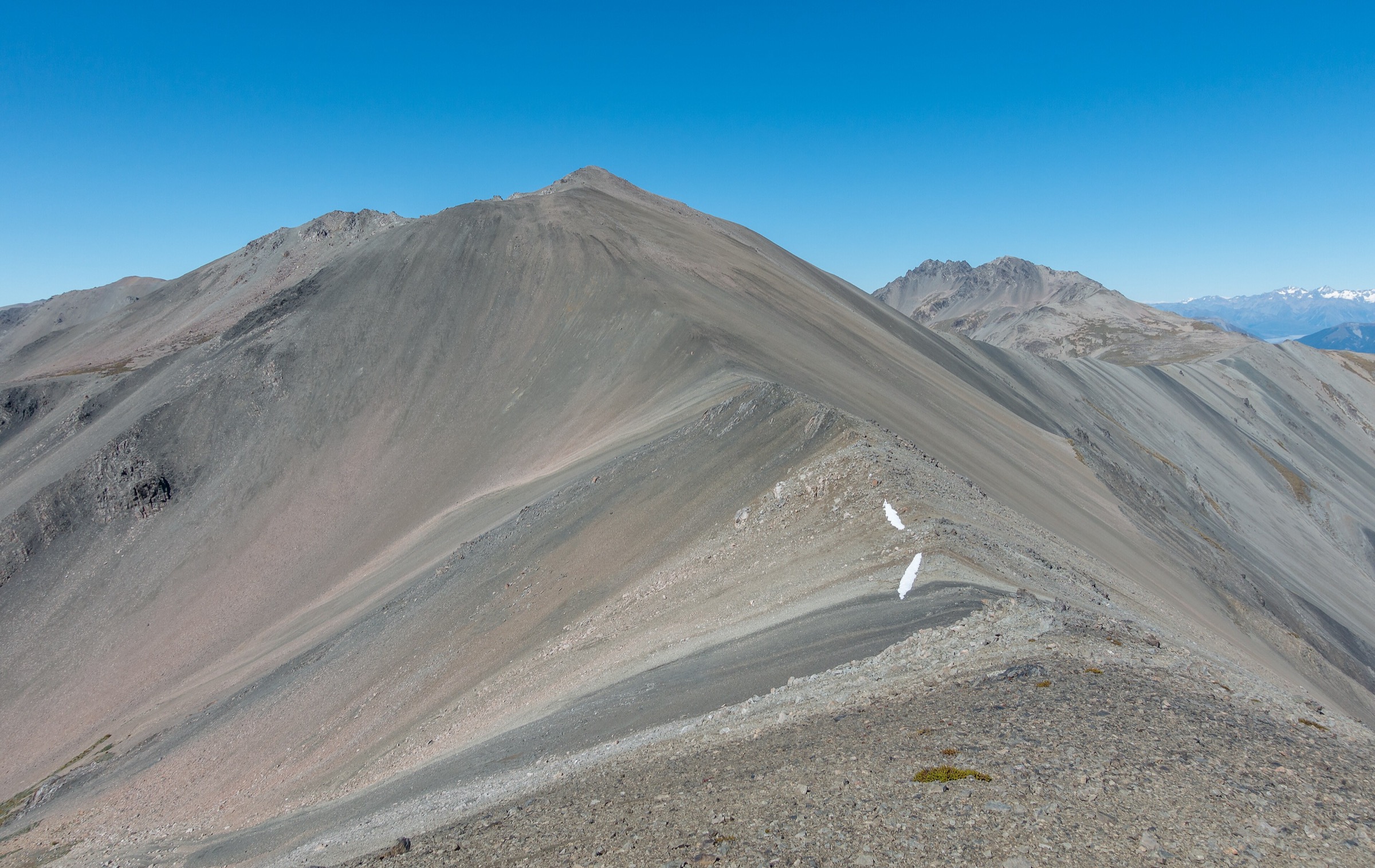
From Huxley Forks Hut the lower 4.5 km is the same line as Hike 3 — swing-bridge, true right of the North Branch through beech and river-bed, then the short climb to Brodrick Hut at ~1,000 m. Above the hut the marked track ends. A poled route crosses stream-gouged scrubland and the North Branch’s upper flats to the base of the climb. The cairn marking the start of the climb is critical to locate; the route then ascends through dense scrub (cairns at the base; condition variable year to year), then open tussock, and finally rock and old snow to the saddle of Brodrick Pass at 1,630 m, between Mt Strauchon (2,391 m) to the north and Mt Mackenzie (2,156 m) to the south. The pass looks west down into the Landsborough headwaters and across to the Hāwea Conservation Park ridges. Return is the same line in reverse.
Brodrick Pass is the only Main Divide saddle on the range that sits below the day-walk ascent envelope, and it carries the range’s one historical name: Te Tarahaka (“the thief’s path”), a pre-European pounamu-trail route surveyed in colonial times by Thomas Brodrick. The standard published framing of the pass is as a stage of a guided 5–7 day Huxley → Landsborough crossing (Alpine Guides Aoraki, Alpine Recreation); walked as a day-from-hut, it is the iconic objective of the range.
Equipment
- Mountain hiking equipment
- Trekking poles
- Gaiters (scrub and scree)
- Alpine sun protection, hat, gloves
- Headtorch (long day)
- Full lunch and emergency snacks
- 2–3 L water; carry from Brodrick Hut, the upper poled route is dry
- Personal Locator Beacon
- Microspikes or light alpine crampons if snow remains on the pass climb in early or late season
Hazards and notes
- Avalanche paths cross both the lower track and the upper pass climb from May through November; the upper route is unsafe in shoulder season without alpine experience.
- Route-finding above Brodrick Hut: Wilderness Magazine specifically warns “take care to locate a cairn (if it’s still there)” at the base of the climb.
- Nor’westers funnel hard through the pass; weather can change very fast.
- Mt Mackenzie from the pass is a serious alpine objective (long snow slopes, rock bands, short arête; published as a guided objective by Alpine Guides and Alpine Recreation) and is not part of this day-walk.
- First-come, first-served huts at Huxley Forks and Brodrick on the Backcountry Hut Pass system.
5. Huxley Forks Hut → South Huxley Bivouac return
Snapshot
Itinerary
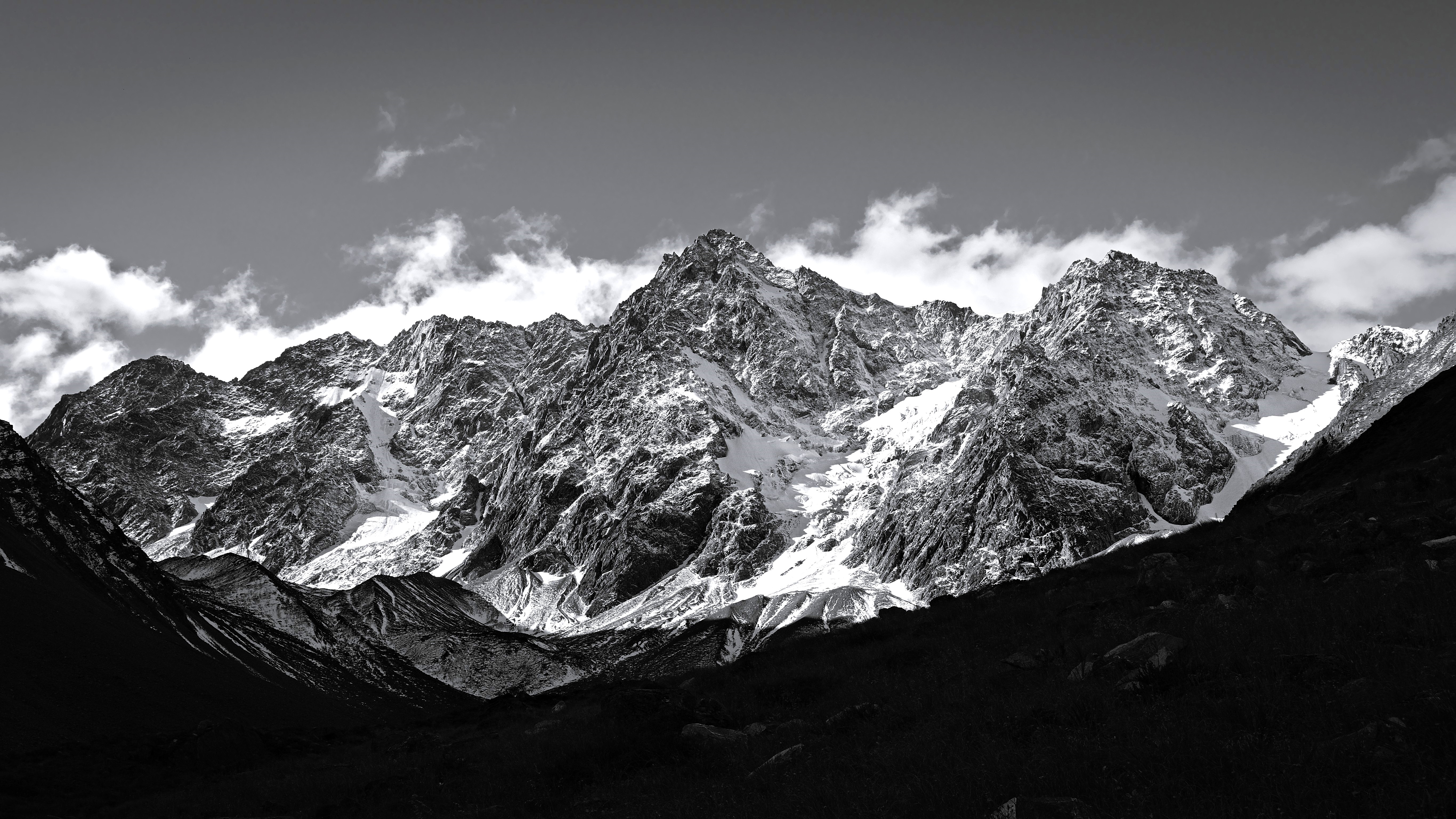
From Huxley Forks Hut, ford the South Branch Huxley at the forks (no bridge) and pick up the marked route up the true left of the South Branch valley. The track follows an old New Zealand Forest Service benched line, sidling at altitude above the river through beech and scrub, which DOC has not actively maintained in recent years. Big slips and washouts require negotiation or climbing-over; a deep ravine with recently-eroded sides and a “giant avalanche chute” are also reported. The line terminates at South Huxley Bivouac, a tiny two-bunk hut (door ~1.2 m high) on the valley floor at NZTM2000 E1338917, N5117752 on BZ14, directly beneath the 800 m east-facing cliffs and the small east-side glacier of Mt Huxley. From the biv there are direct sightlines to the upper South Huxley snowfield and the north-east rib on Mt Huxley. Return is the same route.
Why it is essential
It is the only walk in the range that puts a walker directly beneath Mt Huxley itself and the east-side glacier. As a landscape representative of what the high Huxley Range actually looks like up close, it is unmatched in the range’s day-walk repertoire — and it is the de facto base camp for the range’s east-side climbing routes.
Equipment
- Mountain hiking equipment; sturdy boots
- Trekking poles strongly recommended for the slip and ravine sections
- Helmet desirable for the slip-and-avalanche-chute crossings
- Weatherproof shell and warm layers
- Navigation (LINZ Topo50 sheet BZ14 — a different sheet from the Brodrick Pass route on BY14)
- 2 L water
- Personal Locator Beacon
- Ice axe and microspikes if any snow remains in chutes (variable into January)
Hazards and notes
- Track condition is the dominant hazard. The benched track is degrading; route-finding ability is required.
- South Branch Huxley flow rises rapidly in nor-west rain; the ford at the forks cannot be safely crossed in high flow.
- Avalanche-chute crossings can hold debris or hard snow well into summer.
- Hunting block country; check DOC roar-season restrictions in late March and April.
- Two-bunk biv; not a planned overnight option for a day party.
- Not appropriate for parties without backcountry tramping experience.
Routes excluded as out of scope
The following sit inside the range but fall outside a day-hike entry and are noted here so a reader can see the range has been searched fully.
- Mt Huxley (2,505 m). Graded mountaineering objective with 11 documented climbing routes per ClimbNZ; first ascent 1939 (NE Face), south face first climbed 1990. The south face has ~1,000 m of relief over 1 km horizontal. Not a hike under any reading.
- Mt Mackenzie (2,156 m), Mt Strauchon (2,391 m), Mt Maitland, Mt Brodrick, Boanerges. All alpine climbs from a base hut. Mt Mackenzie via Brodrick Pass is offered as a guided alpine objective by Alpine Guides and Alpine Recreation.
- Brodrick Hut → McKenzie Creek → Landsborough River descent. Unmarked alpine route on the western side of the Main Divide; multi-day, not a day-walk.
- V Notch Pass (South Huxley ↔ Top Hut, Ahuriri). A trans-range tramping-mountaineering pass; multi-day, exposed, snow-affected.
- Hunter Valley approach to the south face of Mt Huxley. Public access from the Dingle Burn car park is 13–14 hours / ~46.5 km one way to the Hāwea Conservation Park boundary; western (Hunter Valley Station) access requires written permission from a private station with 48 h notice. Out of scope.
- Dasler Pinnacles / Dasler Bivouac. On the Naumann Range east of the Hopkins, not on the Huxley Range.
External links
| Source | URL |
|---|---|
| DOC — Hopkins valley tracks (Ruataniwha Conservation Park) | doc.govt.nz |
| DOC — Huxley valley tracks | doc.govt.nz |
| DOC — Monument Hut | doc.govt.nz |
| DOC — Huxley Forks Hut | doc.govt.nz |
| DOC — Brodrick Hut | doc.govt.nz |
| DOC — South Huxley Bivouac | doc.govt.nz |
| DOC — Hopkins and Huxley hunting blocks | doc.govt.nz |
| DOC Open Spatial Data Portal (DOC Tracks layer, CC BY 3.0 NZ) | doc-deptconservation.opendata.arcgis.com |
| LINZ Data Service — NZ Topo50 Maps (CC BY 4.0) | data.linz.govt.nz |
| Wilderness Magazine — Brodrick Pass, Ruataniwha Conservation Park | wildernessmag.co.nz |
| Wilderness Magazine — Brodrick Hut | wildernessmag.co.nz |
| Wilderness Magazine — Huxley Forks Hut | wildernessmag.co.nz |
| Wilderness Magazine — Seeing Red (Red Hut feature) | wildernessmag.co.nz |
| NZ Route Guides — Huxley Forks Hut to Brodrick Hut | routeguides.co.nz |
| Tramping New Zealand — Hopkins/Huxley 2022 series | tramping.net.nz |
| Tramping New Zealand — Day 11, South Huxley Bivvy | tramping.net.nz |
| South Canterbury Tramping Club — Huxley Gorge trip report | sctrampingclub.org.nz |
| ClimbNZ — Huxley Range | climbnz.org.nz |
| ClimbNZ — Mt Huxley | climbnz.org.nz |
| Alpine Guides Aoraki — Brodrick Pass / Mt Mackenzie | alpineguides.co.nz |
| Alpine Recreation — Brodrick Pass / Landsborough trek | alpinerecreation.com |
| Wikipedia — Mount Huxley (New Zealand) | en.wikipedia.org |
| Wikipedia — Huxley River | en.wikipedia.org |
| Federated Mountain Clubs — Hunter Valley access | fmc.org.nz |
| OpenStreetMap (ODbL 1.0) | openstreetmap.org |