New Zealand — Fiordland, Milford Sound Area: Essential Day-Hikes
Five essential Milford Sound / Piopiotahi day-walks — the Milford Foreshore Walk, Milford Sound Lookout Track, The Chasm Walk.
By James Nicolas··
Updated
Regional overview
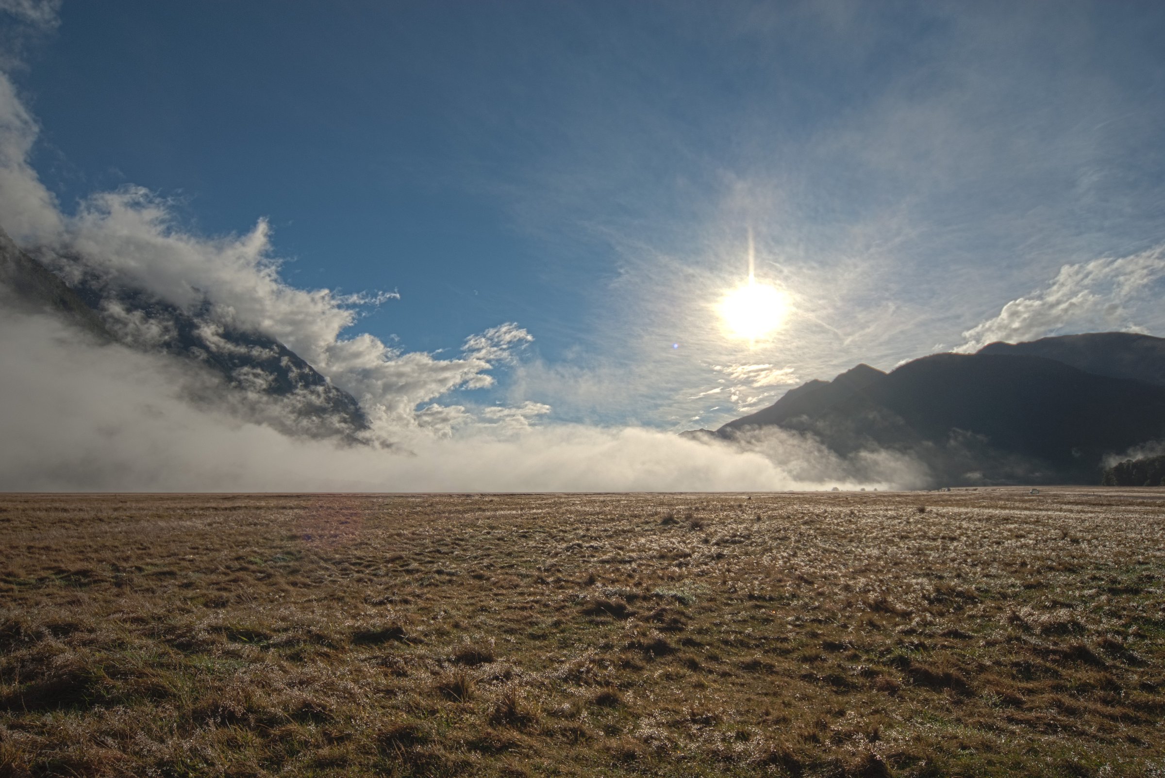
The Milford Sound / Piopiotahi area is Fiordland at sea level: sheer glacial walls, permanent waterfalls, temperate rainforest, the Cleddau and Arthur river mouths, and the northern end of the Milford Track. The walking character is unusually mixed: accessible foreshore and gorge walks beside the visitor hub, boat-assisted access to the Milford Track, and rough valley routes only minutes from the sound. Heavy rain, sandflies, tsunami/earthquake awareness, limited mobile coverage, and winter/spring avalanche conditions on surrounding slopes are defining planning issues.
Summary table
#
Hike
Country
Route type
Distance
Time
Difficulty
1
Milford Foreshore Walk
New Zealand
Short loop / interpretation walk
400 m loop
30 min
Easy short walk
2
Milford Sound Lookout Track
New Zealand
Out-and-back short walk
400 m return
20 min
Easy to intermediate walking track
3
The Chasm Walk
New Zealand
Short out-and-back walk
400 m return
20 min
Wheelchair-accessible short walk
4
Milford Track day walk: Sandfly Point to Giant Gate Falls
New Zealand
Boat-assisted out-and-back day walk on a Great Walk
11 km return
3–4 hr
Easy/moderate Great Walk surface
5
Bowen Falls Walk
New Zealand
Boat-assisted short out-and-back walk
30 min
Easy short walk; boat access required
1. Milford Foreshore Walk
Snapshot
CountryNew Zealand
Sub-regionMilford Sound village and foreshore
StartMain visitor car park at Milford Sound / Piopiotahi
FinishSame; loop
Route typeShort loop / interpretation walk
Distance400 m loop, verified by DOC day-walk PDF
Elevation gainNot stated by DOC; effectively low-level foreshore walking
Elevation lossNot stated
Maximum elevationNot stated
Estimated time30 min, verified by DOC day-walk PDF
DifficultyEasy short walk / accessible-style foreshore path; exact DOC grade not isolated on a route page
Seasonal notesYear-round subject to local weather and access; Milford Road can require chains in winter/spring
Hazards / exposureSandflies, wet boardwalk/path surfaces, tsunami/earthquake awareness in the Milford Sound basin
Public transport / accessMilford Sound is about 120 km from Te Anau on SH94; coaches run from Te Anau/Queenstown, but self-drive parking and road conditions need checking
Verification statusRoute name, distance, time, start area, and viewpoint value verified from DOC PDF; elevation and route-file unresolved
Itinerary
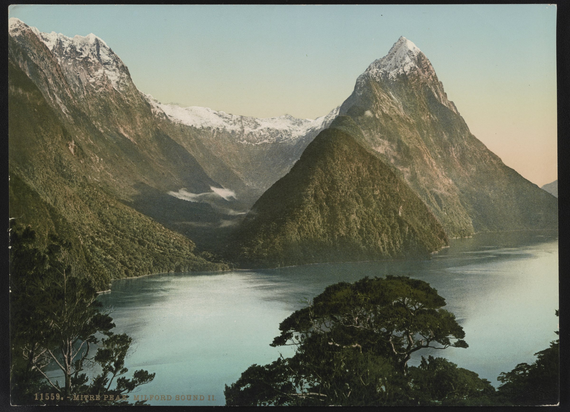
From the entry to the main Milford Sound visitor car park, follow the signed interpretation loop through foreshore vegetation and beside the sandy fiord edge. DOC’s day-walk PDF highlights this as one of the best Mitre Peak viewpoints.
Why it is essential
The simplest on-foot introduction to Milford Sound, with classic Mitre Peak and fiord views without needing a cruise.
Public transport / accessBegins in Milford Sound village, 120 km from Te Anau by Milford Road
Verification statusKey route facts verified by DOC; elevation and route-file unresolved
Itinerary
From behind the cafe, pass the brown buildings toward Donald Sutherland’s grave, continue around the hedge to the bush edge, and climb the stepped track to a lookout over Milford Sound.
Why it is essential
A compact elevated viewpoint over the fiord, complementing the low foreshore walk.
Sub-regionCleddau River, Milford Road near Milford Sound
StartThe Chasm car park on Milford Road
FinishCleddau River chasm viewpoint; return same way
Route typeShort out-and-back walk
Distance400 m return, verified by DOC
Elevation gainNot stated by DOC
Elevation lossNot stated
Maximum elevationNot stated
Estimated time20 min, verified by DOC
DifficultyWheelchair accessible short walk, verified by DOC
Required equipmentRain jacket, non-slip shoes
Seasonal notesYear-round when open; check current DOC alerts because the site has had staged storm-recovery works
Hazards / exposureWet surfaces, swift river, viewing limitations due to storm-damage recovery, no dogs
Public transport / accessWell-signposted car park about 109 km along Milford Road from Te Anau, between Milford Sound and Homer Tunnel
Verification statusRoute facts and storm-recovery context verified by DOC; elevation and route-file unresolved
Itinerary
Walk through native forest to the edge of the Cleddau River, where powerful water has carved basins and shapes into the rock. DOC notes the post-2020-storm modified experience and remnants of damaged viewing structures.
Why it is essential
The best short walk for feeling Milford’s rainfall and river force at close quarters.
Seasonal notesFiordland Outdoors lists water-taxi day-walk availability from 1 Oct to 31 May; DOC notes the Milford Track Great Walk season and avalanche/flood risks outside normal operation
Hazards / exposureBoat schedule dependency, sandflies, wet forest track, flood risk, didymo biosecurity, avalanche risk on parts of the Milford Track outside the low-end day-walk zone
Public transport / accessWater taxi is required between Deepwater Basin and Sandfly Point; bus add-ons from Te Anau are commercially available
Verification statusDistance, access mode, time, and season verified; elevation and GPX/KML unresolved
Itinerary
Take a short boat from Milford Sound to Sandfly Point, then walk the final forested section of the Milford Track beside the Arthur River to Giant Gate Falls and return the same way.
Why it is essential
The only practical day-walk sample of the world-famous Milford Track from Milford Sound itself.
Sub-regionMilford Sound village / Lady Bowen Falls
StartFreshwater Basin / Milford Sound boat transfer point
FinishLady Bowen Falls viewing area; return by the same short track and boat
Route typeBoat-assisted short out-and-back walk
DistanceNot resolved in this pass; source confirms short boat transfer plus short walk
Elevation gainNot stated
Elevation lossNot stated
Maximum elevationNot stated
Estimated time30 min, verified by DOC marine-reserve education material
DifficultyEasy short walk, but boat access is required; exact current operator arrangements should be checked locally
Required equipmentRain jacket, sandfly repellent, shoes with grip
Seasonal notesLikely visitor-season dependent because of boat operation; verify current availability before publication
Hazards / exposureBoat access, wet surfaces, waterfall spray, sandflies; previous shoreline access history includes closures, so current access must be reconfirmed
Public transport / accessStarts within Milford Sound visitor area; commercial boat transfer required
Verification statusRoute existence, rough access, and time partially verified; distance/elevation/current boat-operation details unresolved
Itinerary
Take the short boat transfer across the basin, then walk through native bush to the Lady Bowen Falls viewing area. DOC’s day-walk map labels “Bowen Falls Walk”; DOC marine-reserve education material describes a 30 min Lady Bowen Falls walk by short boat trip.
Why it is essential
Lady Bowen Falls is the nearest major permanent waterfall to the Milford Sound visitor hub and one of the sound’s defining landmarks.