Regional overview
The Southern Eyres are the northern-Southland side of the Eyre Mountains / Taka Ra Haka Conservation Park — heavily glaciated high country with cirque basins, scree, alpine tarns, wetlands, beech forest and snow tussock. The walking character on this side is beech-edge valley travel, 4WD access tracks, unbridged streams, small basic huts and open tops. DOC’s route page for the park is classified Expert, and DOC gives most of the route sections only as times rather than distances or elevations. Every objective below should be treated as an experienced-tramper day rather than a formed day walk.
Access is not automatic. DOC states that practical and legal access is available only through named catchments — the Irthing, Cromel, Acton, Oreti and Mataura corridors — while other approaches cross private roads or pastoral run land and require permission. Mount Bee in particular needs landowner approval with at least two days’ notice, and the Cromel Base Hut approach uses private property that must be pre-arranged.
The normal season is settled late spring to autumn. Snow, cold wind and rapidly changing weather can make travel serious outside midsummer, and river conditions demand conservative judgement.
Summary table
| # | Hike | Route type | Estimated time | Difficulty | Verification |
|---|---|---|---|---|---|
| 1 | Irthing Valley to The Mansion bivvy | Valley out-and-back | DOC: 1 h 30 (one way as listed) | Expert route context | DOC route page verified |
| 2 | Mount Bee ridge from Irthing Road | 4WD-road ridge out-and-back | DOC: 3 – 4 h | Expert; landowner permission required | DOC route page verified |
| 3 | Cromel Valley to Cromel Branch Hut | Point-to-point hut approach | DOC: 4 – 4 h 30 | Expert | DOC route page verified |
| 4 | Acton Valley to Cromel Base Hut | Point-to-point hut approach | DOC: 2 h 30 – 3 h | Expert | DOC route page verified |
| 5 | Acton Valley to Islands Hut | Unmarked tops crossing | DOC: 5 – 6 h | Expert; unmarked navigation | DOC route page verified |
Before you go
Access
All five entries depend on named catchment or private-property access. Mulholland Road serves the Irthing Valley picnic area and Mount Bee approach; the Cromel and Acton valley routes use farm roads and private forest that need arrangement in advance. Landowner permission for Mount Bee needs at least two days’ notice, and Cromel Base Hut access should be arranged a day ahead because of stock movements. No public transport reaches any of these trailheads.
Standard kit
- Full backcountry tramping kit: sturdy boots, waterproof and windproof shell, warm layers, hat and gloves outside midsummer.
- Map and compass, GPS with the route pre-loaded, and a paper backup — the tops route to Islands Hut is unmarked.
- Head torch, food and water treatment for a long day; a PLB is strongly recommended.
- Emergency shelter and enough spare kit to sit out a river or weather delay, since exit distances are long.
Common hazards
Weather can change dramatically with little warning. River and stream crossings are unbridged and can rise quickly. Above the bushline on the Acton–Islands route the ground is unmarked, and retreat may require reversing steep terrain in poor visibility. DOC states these routes are not recommended for inexperienced outdoor people.
1. Irthing Valley to The Mansion bivvy
Snapshot
Itinerary
From the Irthing Valley picnic area off Mulholland Road, follow the true left bank of the Irthing River, then cross to the true right after about an hour. About 20 minutes further on, The Mansion — a two-bunk bivvy — stands in a small clearing. Above this point the river enters steep gorged country and DOC describes travel as difficult.
Why it is essential
The most compact official day-sized route in the Southern Eyres — a direct introduction to the Irthing valley, beech clearings and river-travel character without committing to the higher Mount Bee or Acton–Cromel objectives.
Hazards and notes
- Unbridged streams, wet ground and river-bank travel throughout.
- Do not continue into the gorge above The Mansion without equipment and experience for harder river travel.
- Dogs require a DOC permit on the official Eyre Mountains route page.
Photo status
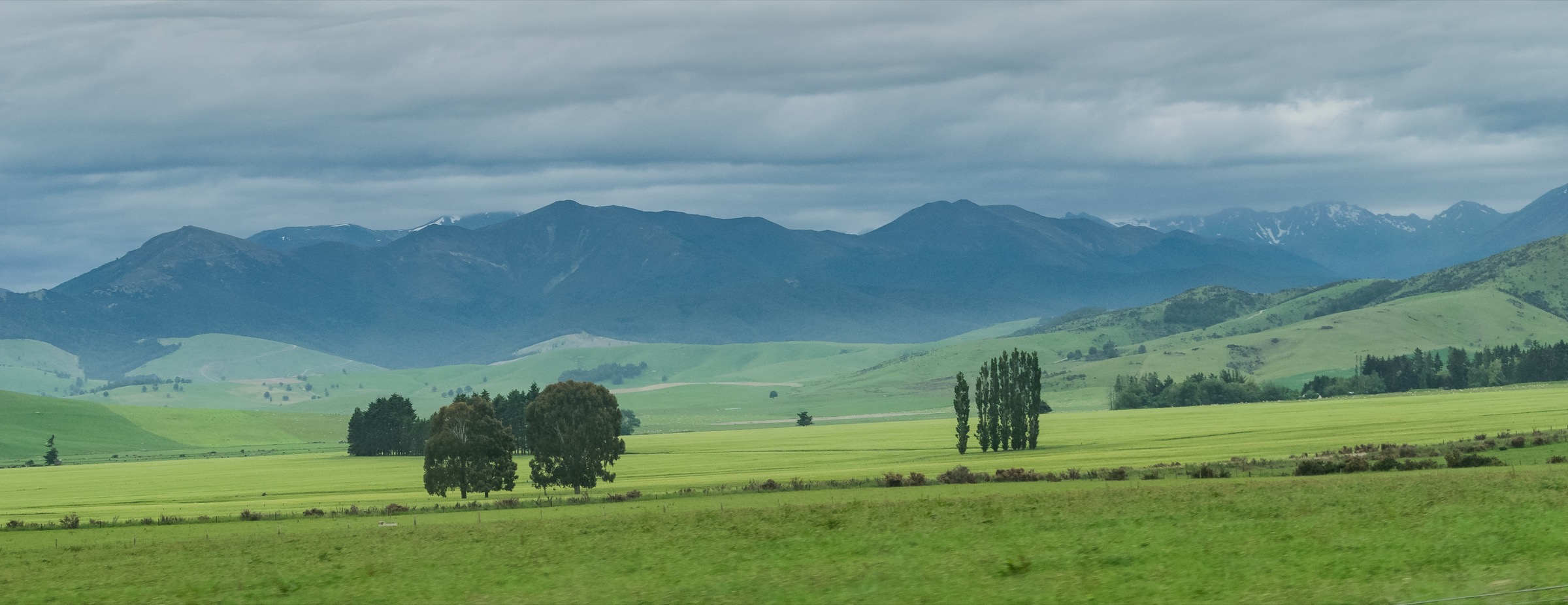
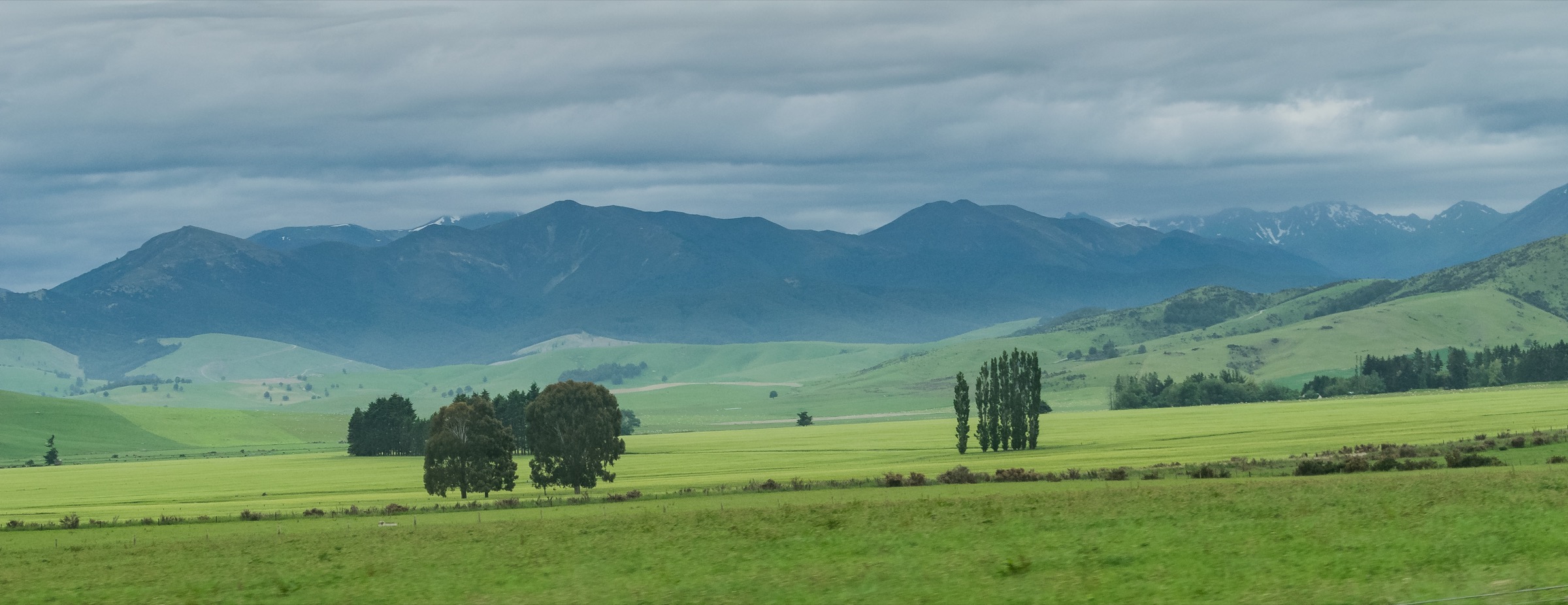
No route-specific licence-compatible image was located in this pass. The cover figure at the top of this article is the only Southern Eyres landscape found on Wikimedia Commons at the required resolution.
GPX / KML links
| Source | URL | Format | Notes |
|---|---|---|---|
| DOC — Eyre Mountains / Taka Ra Haka routes | doc.govt.nz | Official route description | DOC website terms; no GPX published |
| DOC — interactive map | doc.govt.nz | DOC map | Source-route cross-check only |
Further reading
2. Mount Bee ridge from Irthing Road
Snapshot
Itinerary
A 4WD road leaves the end of Irthing Road and climbs Mount Bee to a group of huts, reached in roughly 2 – 3 hours on foot. From the huts the road continues for another 6 km toward the upper Irthing and Cromel valleys. For a day objective the ridge huts make the natural turnaround unless a longer pre-planned traverse has been arranged.
Why it is essential
The main ridge access route published by DOC on the southern Irthing side — the most direct transition from valley margin to higher Southern Eyres terrain.
Hazards and notes
- Access is restricted: DOC requires landowner approval with at least two days’ notice for foot or vehicle access.
- Weather exposure increases sharply on the ridge; the upper road becomes committing in snow or poor visibility.
- No water on the higher ridge — carry enough for the full day.
Photo status
No route-specific licence-compatible image was located in this pass.
GPX / KML links
| Source | URL | Format | Notes |
|---|---|---|---|
| DOC — Eyre Mountains / Taka Ra Haka routes | doc.govt.nz | Official route description | DOC website terms; no GPX published |
| DOC — interactive map | doc.govt.nz | DOC map | Source-route cross-check only |
Further reading
3. Cromel Valley to Cromel Branch Hut
Snapshot
Itinerary
The Cromel Valley 4WD track passes through about 3 km of privately owned native forest before reaching public land. Cromel Base Hut is another 3 km along the track. The route then climbs to the saddle between the Acton and Cromel Branch valleys before descending to Cromel Branch Hut — a basic four-bunk hut with heating, mattresses, non-flush toilet and stream water.
Why it is essential
The main official route linking the Cromel Valley to a higher backcountry hut and to the Acton–Cromel divide, and one of the clearest sourceable day-sized hut approaches in the Southern Eyres.
Hazards and notes
- Private-property access must be resolved before travel.
- River and stream crossings, rough 4WD track, saddle weather and hut-approach navigation are the main issues.
- Overnight/emergency gear is prudent even on a day attempt because conditions can delay exit.
Photo status
DOC has a Cromel Branch Hut image on its hut page, but no reuse licence was verified in this pass. No route-specific licence-compatible Commons image was located.
GPX / KML links
| Source | URL | Format | Notes |
|---|---|---|---|
| DOC — Eyre Mountains / Taka Ra Haka routes | doc.govt.nz | Official route description | DOC website terms; no GPX published |
| DOC — Cromel Branch Hut | doc.govt.nz | Hut / source map page | DOC website terms; no GPX published |
Further reading
4. Acton Valley to Cromel Base Hut
Snapshot
Itinerary
The track enters the bush about 20 m north of the former Acton Hut site. It follows a ridge to a saddle, then descends to Cromel Stream, which is crossed about five minutes north of Cromel Base Hut.
Why it is essential
The shorter official Acton-to-Cromel crossing and a logical day objective for experienced trampers wanting a Southern Eyres forest-and-saddle route without committing to the longer Cromel Branch or Islands Hut objectives.
Hazards and notes
- Cromel Stream crossing near the hut can be an issue in high flows.
- Access to Cromel Base Hut is through private property; DOC requires owner contact a day before travel.
- Dogs require a DOC permit on the route page.
Photo status
No route-specific licence-compatible image was located in this pass.
GPX / KML links
| Source | URL | Format | Notes |
|---|---|---|---|
| DOC — Eyre Mountains / Taka Ra Haka routes | doc.govt.nz | Official route description | DOC website terms; no GPX published |
| DOC — Cromel Base Hut | doc.govt.nz | Hut / source map page | DOC website terms; no GPX published |
Further reading
5. Acton Valley to Islands Hut
Snapshot
Itinerary
From the Acton Valley, the route crosses to the true right bank and climbs to the ridge, then continues to open tops. From the tops the route is unmarked to Islands Hut. DOC notes that travel is also possible across the tops from Islands Hut to Windley, Ashton, Cromel Bivvy and Cromel Branch Hut, but those extensions are outside this day objective unless separately planned.
Why it is essential
The most committing official day-sized Southern Eyres objective in the DOC route list — it represents the area’s open-tops, navigation-dependent character better than the lower valley routes.
Hazards and notes
- The route becomes unmarked on the tops; visibility and navigation are the central hazards.
- Weather can change quickly, and retreat may require reversing steep or rough terrain.
- Islands Hut is a basic four-bunk hut with heating, mattresses, non-flush toilet and stream water — treat it as a route landmark, not guaranteed shelter.
- Snow or ice equipment may be required outside summer conditions.
Photo status
No route-specific licence-compatible image was located in this pass.
GPX / KML links
| Source | URL | Format | Notes |
|---|---|---|---|
| DOC — Eyre Mountains / Taka Ra Haka routes | doc.govt.nz | Official route description | DOC website terms; no GPX published |
| DOC — Islands Hut | doc.govt.nz | Hut / source map page | DOC website terms; no GPX published |
Further reading
Verification notes
- All five routes are verified against DOC’s Eyre Mountains / Taka Ra Haka routes page and the relevant hut pages; DOC treats the whole cluster as an expert route.
- DOC publishes only estimated times for these route sections; distance, elevation gain, elevation loss and maximum elevation are not stated and are recorded as unresolved rather than filled from secondary sources.
- No official DOC GPX or KML downloads were located in this pass; the DOC interactive map is listed as a source-route cross-check.
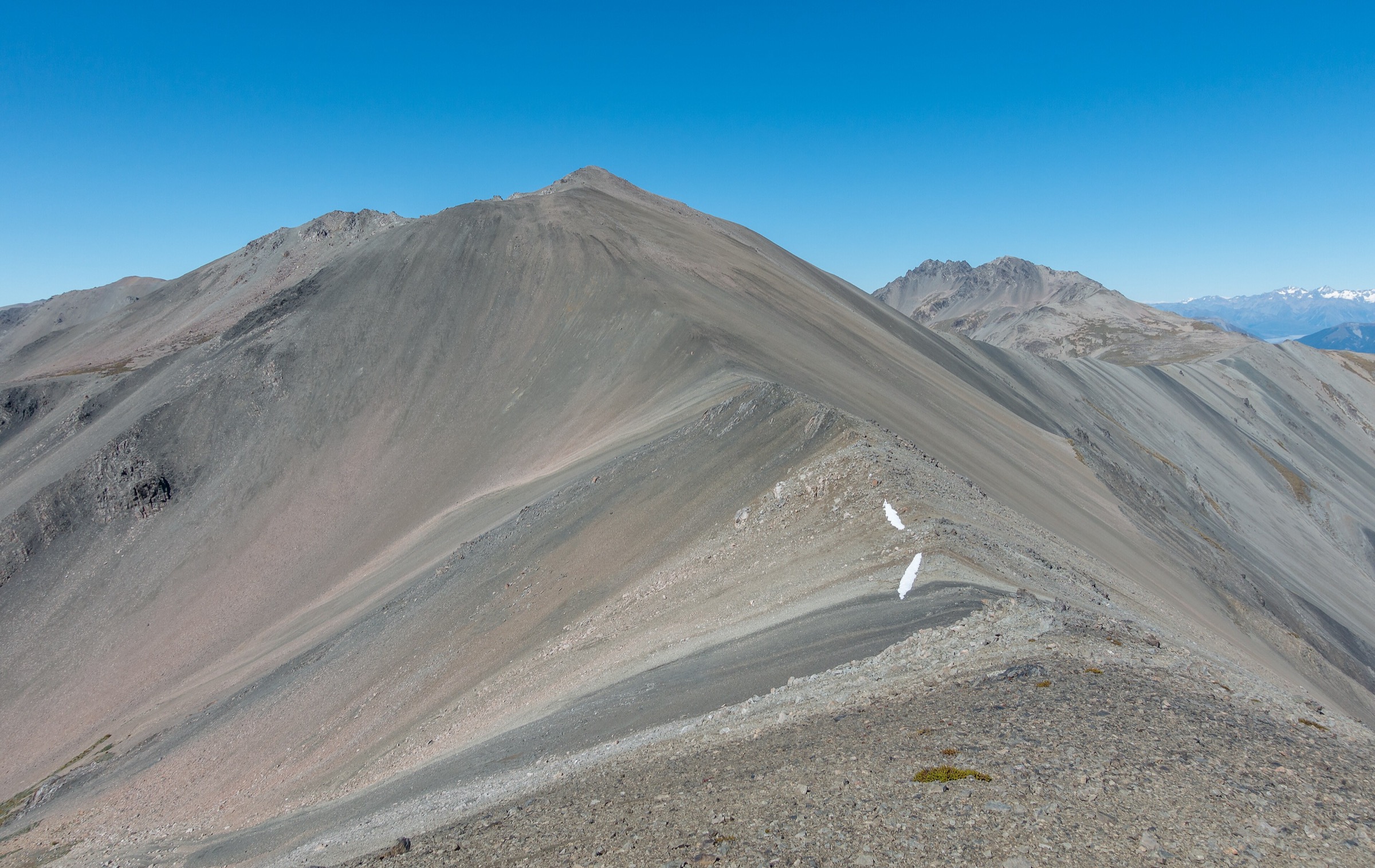
- Only one Southern Eyres landscape image was located at the site’s minimum shipped resolution (used as cover). No route-specific images were found for the five sections.
- Landowner permissions on the Mount Bee, Cromel and Acton corridors should be re-confirmed immediately before any trip; the Southern Eyres access pattern relies on private-road and pastoral-run consent that changes independently of the DOC page.
- DOC park alerts should be re-checked before use. On 2026-07-04 the wider park page carried access and predator-control alerts last reviewed in June 2026.
Further reading
| Source | URL |
|---|---|
| DOC — Eyre Mountains / Taka Ra Haka Conservation Park | doc.govt.nz |
| DOC — Eyre Mountains / Taka Ra Haka routes | doc.govt.nz |
| DOC — Cromel Base Hut | doc.govt.nz |
| DOC — Cromel Branch Hut | doc.govt.nz |
| DOC — Islands Hut | doc.govt.nz |
| Wikipedia — Eyre Mountains | en.wikipedia.org |