Regional overview
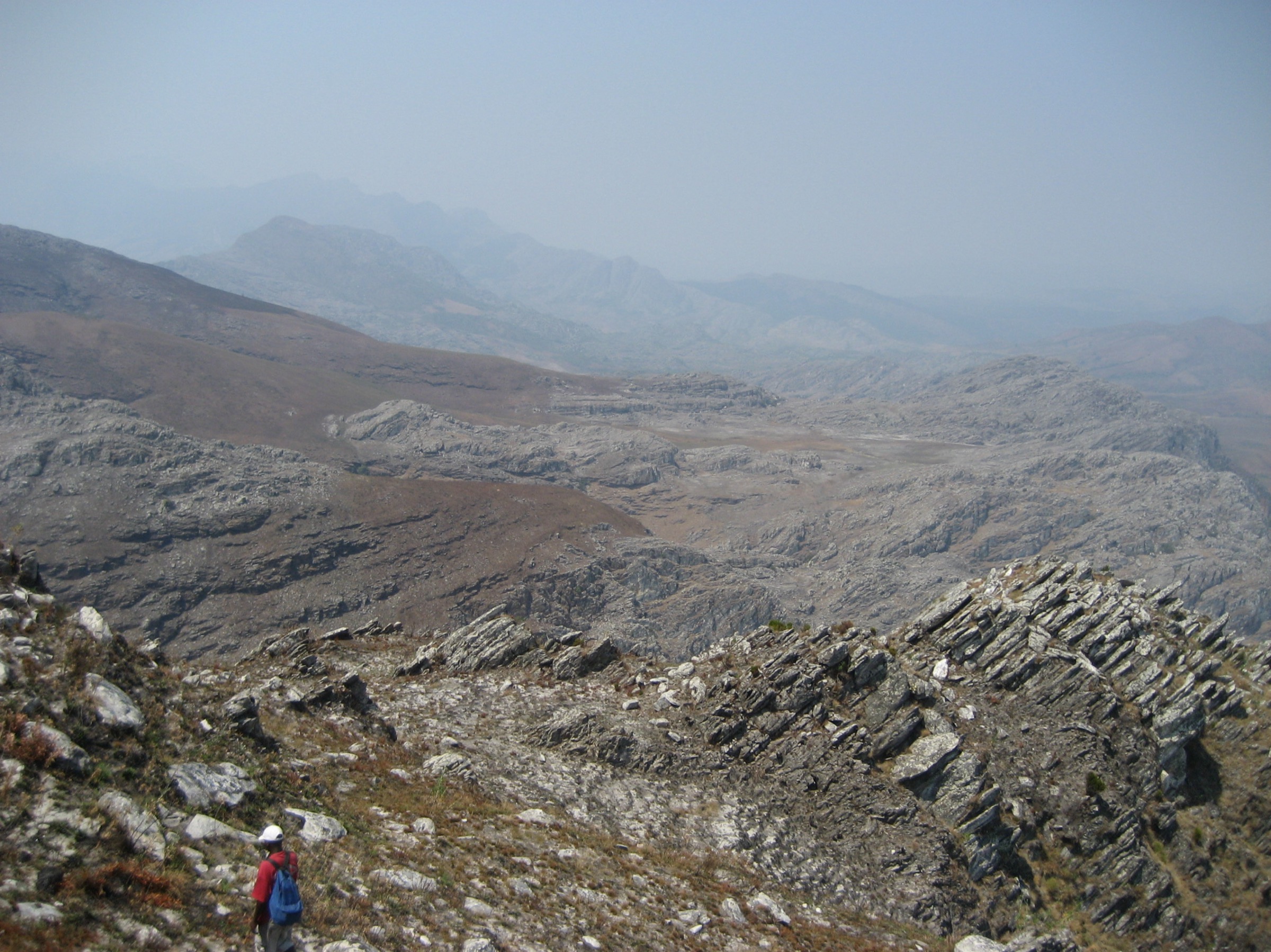
Mount Gorongosa (Monte Gorongosa) is an isolated granite-and-gabbro inselberg rising from the rift-valley floor of central Mozambique, in Gorongosa District of Sofala Province, roughly 200 km north-west of the port city of Beira. Geologically it is the eroded core of a Late Jurassic ring complex of Karoo affinity, some 30 km by 25 km in plan, with three main summits — a northern peak, a southern peak and Gogogo (1,863 m) in the south-west — separated by a central plateau drained by three deeply incised valleys. The massif is treated locally as an annex to the Bvumba-Chimanimani-Nyanga chain of the Eastern Highlands of Zimbabwe and Mozambique, although it is physically separate, isolated by lowland miombo woodland.
The upper part of the mountain (above approximately 700 m) was incorporated into Parque Nacional da Gorongosa in 2010 to protect what is the principal water tower of the Urema/Pungue catchment and the southernmost extent of true tropical Afromontane rainforest. Vegetation rises through miombo and dry forest on the lower slopes, dense mid-altitude evergreen forest, a narrow montane rainforest belt between roughly 1,100 m and 1,500 m, and short montane grassland and bare granite domes on the summit plateau. Endemic biota documented on the mountain include the Mount Gorongosa pygmy chameleon (Rhampholeon gorongosae), the green-headed oriole subspecies, the Gorongosa green-headed sunbird, the plant Streptocarpus brachynema and the recently described katydid Ovonotus aubreae.
The reliable walking season runs from May to October, the cool dry season; June to September offer the most stable mornings and the clearest summit views, while afternoon mist on the rainforest belt is common year-round. The wet season (November-April) brings heavy convective rainfall, frequent thunderstorms, slippery granite, leeches and flooded approaches; the official park visitor season is typically May to October. The mountain is sacred to the local Gorongosa community: one of the two traditional clans requires a ceremony with the chief (Samatendje) and medicine man before climbers are permitted on the upper slopes, and red clothing is prohibited.
All hiking on Mount Gorongosa requires a permit and an accredited guide arranged through the Gorongosa Project / Gorongosa National Park; independent hiking is not permitted. The standard logistics base is the Mount Gorongosa Community Camp, a private-use fly-camp at the foot of the rainforest belt run by the park in partnership with the local community, reached by 4x4 from the main park gate at Chitengo approximately three to four hours away on rough tracks. Public transport reaches the village of Vunduzi, but the last section to the trailhead is private 4x4 only. There is no entry from the Zimbabwean side; the mountain is in Mozambique.
Selection rationale
Mount Gorongosa is a single, relatively small massif with a constrained network of guided routes rather than a large public trail system. The five day-walks below cover all of the products that the Gorongosa Project currently offers from the Mount Gorongosa Community Camp and Chitengo areas, balanced between summit, waterfall, forest interpretation, culture and lower-elevation savanna: the Gogogo summit day is the iconic 1,863 m high-point; the Murombodzi Falls day-hike is the signature, internationally photographed waterfall walk; the rainforest birding loop is the essential biodiversity walk targeting the endemic green-headed oriole, Gorongosa pygmy chameleon and montane endemic flora; the Coffee Project and forest-restoration walk above Canda is the cultural and conservation route through the shade-grown coffee plots; and the Vinho community and Pungue River walk from Chitengo is the only standard guided walking activity in the lower part of the park, included here because the Pungue is sourced on Mount Gorongosa.
Because the park does not publish a marked, public trail catalogue, exact distances, gains and elevations below are based on operator descriptions and topographic estimates rather than official maps, and are flagged as approximate.
Summary table
| # | Hike | Country | Route type | Distance | Gain | Max elevation | Difficulty |
|---|---|---|---|---|---|---|---|
| 1 | Gogogo summit from Mount Gorongosa Community Camp | Mozambique | Out-and-back | ~12 km | ~900-1,000 m | 1,863 m | Strenuous |
| 2 | Murombodzi Falls hike | Mozambique | Out-and-back | ~6-8 km | ~300-400 m | ~1,250 m | Moderate |
| 3 | Upper-mountain rainforest birding loop | Mozambique | Loop | ~5-7 km | ~250-350 m | ~1,400 m | Easy-Moderate |
| 4 | Gorongosa Coffee Project walk (Canda) | Mozambique | Loop / point-to-point | ~5-8 km | ~200-300 m | ~900 m | Easy |
| 5 | Vinho community and Pungue River walk (Chitengo) | Mozambique | Out-and-back | ~3-4 km | <50 m | ~30 m | Easy |
1. Gogogo Summit from Mount Gorongosa Community Camp
Snapshot
Itinerary
From the Mount Gorongosa Community Camp at approximately 900-1,000 m on the south-eastern flank of the massif, the route follows old forest paths used historically for hunting and coffee cultivation. The trail climbs steeply through miombo and mid-altitude evergreen forest, then enters the misty montane rainforest belt where the green-headed oriole and lemon dove are commonly heard. Above the rainforest the path emerges onto open montane grassland and granite domes of the south-western summit ridge, traversing the broad shoulder before a final scramble up bare rock to the cairn on Gogogo (1,863 m). On a clear morning the view extends north to the Tete plains, east to the Urema floodplain and the Indian Ocean rift escarpment, and west toward the Zimbabwean border highlands. Descent retraces the line of ascent. Most operators schedule the full out-and-back as a two-day itinerary with an overnight fly-camp on the upper mountain; fit walkers occasionally complete it as a single very long day.
Why it is essential
Gogogo is the high point of Mount Gorongosa and Mozambique’s fourth-highest mountain. It is the only true summit objective in the Gorongosa Massif, and the only reliable way to combine the rainforest belt, the endemic-rich plateau and the iconic 360° rift-valley summit panorama in a single walk. The route is the headline product of the Gorongosa Project’s mountain operation.
Equipment
Mountain hiking equipment: sturdy boots with grip on wet granite and roots, trekking poles strongly recommended for the long descent, full waterproof shell (the rainforest belt is wet year-round), warm layer and hat for the summit, 2.5-3 L of water (no reliable refill points on the upper mountain), headtorch for pre-dawn starts, insect repellent and long sleeves, malaria prophylaxis for the wider park, a permit and accredited Gorongosa Project guide (mandatory), and no red clothing (cultural prohibition).
Hazards and notes
A Gorongosa Project guide and community permit are mandatory; independent ascent is not permitted. A traditional ceremony with the local chief and sangoma may be required depending on which clan controls the approach used. Granite slabs near the summit become very slippery in mist or rain. Afternoon thunderstorms are frequent even in the dry season; early starts and turn-around discipline are important. The rainforest is leech- and tick-prone after rain. Rifle guides are not used on the upper mountain, unlike the lowland walking safaris.
GPX / KML links
| Source | URL | Format / access | Reuse status |
|---|---|---|---|
| OpenStreetMap (no dedicated relation) | openstreetmap.org near Gogogo | OSM data (ODbL) | Geometry partial; no curated trail relation |
| SummitPost — Mount Gorongosa | summitpost.org | HTML description only | No GPX track published |
| Route-file status | Gorongosa National Park does not publish public GPX | Unresolved | Unresolved |
Suggested summit coordinates (approximate, from Wikipedia/OSM): Gogogo ≈ 18°27′S 34°02′E.
External links
2. Murombodzi Falls Hike
Snapshot
Itinerary
From the Mount Gorongosa Community Camp the trail follows an old hunters’ track up into the lower montane forest. The path crosses several small tributary streams before traversing onto the ridge above the Murombodzi gorge. A side spur drops to the foot of the principal cascade, where the Murombodzi (locally Morumbodzi) river spills more than 100 m down jagged granite in several tiers, with sheltered plunge pools used by operators for picnic lunches. Most groups continue a short distance further to a second viewpoint above the upper tier before returning to the camp on the same line.
Why it is essential
Murombodzi Falls is the single most photographed feature on Mount Gorongosa and the standard introductory walk of the entire park. It captures the rainforest belt, an endemic-rich birding zone, and the spectacle of one of the highest waterfalls in central Mozambique in a half-day round trip accessible to most fit visitors who cannot manage the full Gogogo ascent. It is the route that all Gorongosa Project operators recommend as the headline mountain experience.
Equipment
Standard to mountain hiking equipment: sturdy shoes with grip on wet rock and roots, light waterproof or pack cover, swimwear and quick-dry towel for the pools (subject to guide approval — some pools are subject to fady), 2 L of water (refill from streams not advised without treatment), insect repellent, and a permit and accredited guide.
Hazards and notes
A Gorongosa Project guide and community permit are mandatory. The falls path becomes very slippery after rain; the lower spur to the pools should be avoided when the river is in spate. Certain pools are sacred and bathing rules must be confirmed with the guide. Forest cobra and puff adder are present but rarely seen. The lower trail passes through tsetse-fly habitat.
GPX / KML links
| Source | URL | Format / access | Reuse status |
|---|---|---|---|
| OpenStreetMap (partial coverage of the side spur) | openstreetmap.org near Murombodzi | OSM data (ODbL) | Geometry partial; no curated relation |
| Route-file status | No published GPX located in this pass | Unresolved | Unresolved |
External links
3. Upper-Mountain Rainforest Birding Loop
Snapshot
Itinerary
From the community camp or upper fly-camp the guided loop drops into the dense moss-laden rainforest that drapes the south-eastern flank of Mount Gorongosa. The route follows informal forest paths between large fig and yellowwood trees, crossing clear cold streams that feed the Murombodzi catchment. Targeted stops are made at known territories of the endemic green-headed oriole (Mount Gorongosa subspecies) and the Gorongosa green-headed sunbird; east-coast akalat, lemon dove and green barbet are also possible. Reptile-focused groups spend time searching low vegetation for the Mount Gorongosa pygmy chameleon (Rhampholeon gorongosae) and for the recently described katydid Ovonotus aubreae on the endemic Streptocarpus brachynema. The loop returns to the camp without entering the open summit grassland.
Why it is essential
This is the only walk in the entire Eastern Highlands-Mozambique chain that gives reliable access to the Mount Gorongosa endemics inside their native habitat without the strenuous summit climb. It complements the Gogogo and Murombodzi routes by focusing on the rainforest’s biodiversity rather than its geography, and is the route most often used by birding and herpetology groups visiting through the Gorongosa Project and the E.O. Wilson Biodiversity Lab.
Equipment
Standard hiking equipment, plus a waterproof jacket and pack cover (the forest is humid year-round), quiet grippy footwear for wet roots, binoculars and field guide, insect repellent and long sleeves (leeches possible after rain), 1.5 L of water, and a permit and Gorongosa Project guide.
Hazards and notes
Permit, guide and Mount Gorongosa Community Camp logistics are required. Slippery roots and steep mud are the main hazards. Pace is slow; carry extra time for birding stops. Camera flash use on the pygmy chameleon is generally discouraged by the park’s research team.
GPX / KML links
| Source | URL | Format / access | Reuse status |
|---|---|---|---|
| OpenStreetMap (informal forest paths) | openstreetmap.org near Mount Gorongosa | OSM data (ODbL) | Geometry partial |
| Route-file status | Loop is informal and varies by guide; no published GPX | Unresolved | Unresolved |
External links
- Mozambique Travel — Gorongosa Birdwatching Guide
- E.O. Wilson Biodiversity Foundation — Gorongosa National Park
- Wikipedia — Rhampholeon gorongosae
4. Gorongosa Coffee Project and Forest-Restoration Walk (Canda)
Snapshot
Itinerary
From Canda, the route follows farm tracks up through the Gorongosa Coffee Project plots, where shade-grown arabica is interplanted with 90 native hardwood trees per hectare as part of the Carr Foundation’s forest-restoration model. Guides explain the planting, pulping, washing and drying process at the Coffee Project facility, and the link between coffee revenue, rainforest restoration and the protection of the upper-mountain water tower. Higher up, the track passes into restored secondary forest with patches of older retained rainforest; the upper turning point is a viewpoint over the Urema valley. A loop returns via a parallel village track to Canda; some itineraries continue uphill to link with the upper-mountain fly-camp and form the first half of a longer summit traverse.
Why it is essential
This route is the cultural and conservation counterpart to the natural-history walks above. It is the standard way of experiencing the Gorongosa Restoration Project — the international example of NGO-led integrated conservation and community development — on foot, while still gaining elevation onto the lower rainforest belt. It is the only walk in the massif that ties together the social, ecological and economic story of the mountain, and it serves as a gentler alternative for visitors who cannot manage the steeper Gogogo or Murombodzi routes.
Equipment
Standard hiking equipment: light footwear suitable for farm tracks, sun hat and sun protection (lower-altitude exposure), 1.5 L of water, a permit and accredited Gorongosa Project guide (mandatory inside the park boundary; community guides for the coffee plots), and cash for coffee purchase.
Hazards and notes
The route lies partly inside the park annex; permit and guide rules apply on the upper section. Tracks can be slippery and rutted after rain. This is a working farm landscape; respect for households and crops is expected. Photography of named individuals requires consent.
GPX / KML links
| Source | URL | Format / access | Reuse status |
|---|---|---|---|
| OpenStreetMap (farm tracks above Canda) | openstreetmap.org near Canda | OSM data (ODbL) | Geometry reusable; suggest verification against community-track requests from the Coffee Project office |
| Route-file status | No published GPX located in this pass | Unresolved | Unresolved |
External links
- Mozambique Travel — Coffee on Mount Gorongosa
- BioInteractive — Coffee and conservation: Mozambique tries both on a mountain
- Gorongosa Project
5. Vinho Community and Pungue River Walk (Chitengo)
Snapshot
Itinerary
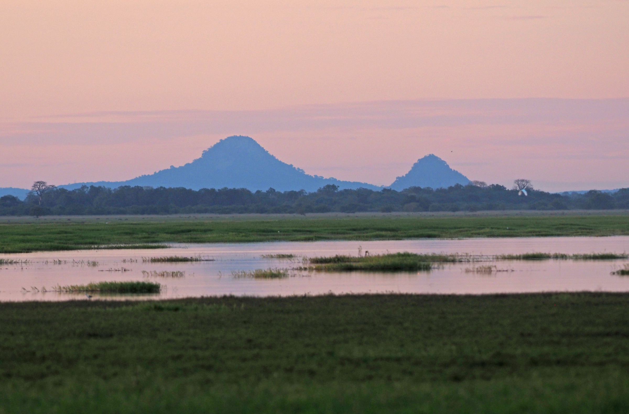
From Chitengo a guided walking route runs about 2 km on a sandy track along the southern park boundary to the bank of the Pungue River, the principal drainage of Mount Gorongosa. A small boat operated by the Vinho community ferries walkers across to the Comunidade Vinho on the far bank, where many of the park’s staff live. The community visit includes the school, clinic and freshwater pumps supported by the Carr Foundation, and the return is via the same boat and track. Birdwatching is excellent on both banks; tigerfish, crocodile and hippo are present in the river itself.
Why it is essential
Mount Gorongosa is the source of the Pungue, and this short walk is the only standard guided walking activity in the lowland sector of the park that connects the mountain ecologically and culturally with the rest of the protected area. It is also the most accessible walking activity from the main visitor base at Chitengo and serves as a useful acclimatisation walk on the day of arrival before the mountain transfer. It completes the picture of the Gorongosa Massif as the source of the entire park’s water and human story, even though the route itself is short and flat.
Equipment
Standard hiking equipment, plus sun hat and high-SPF sun protection (open savanna), 1 L of water, cash for the community contribution and boat fee, a park entry fee paid at Chitengo, and a walking-safari guide (a rifle-carrying guide is standard practice on lowland walks).
Hazards and notes
A park guide is mandatory and may be armed because of hippo and crocodile near the Pungue. The river crossing depends on river level; not run in high flood. Tsetse fly is present along the Pungue corridor. This is not a mountain walk; do not combine with the Gogogo or Murombodzi day-hikes on the same day.
GPX / KML links
| Source | URL | Format / access | Reuse status |
|---|---|---|---|
| OpenStreetMap (Chitengo-Pungue track, partial) | openstreetmap.org near Chitengo | OSM data (ODbL) | Geometry partial; route is short and unmarked publicly |
| Route-file status | No published GPX located in this pass | Unresolved | Unresolved |
External links
- Wikipedia — Gorongosa National Park
- Wikivoyage — Gorongosa National Park
- Gorongosa Project — Community
Missing data / follow-up work
- Gorongosa National Park does not publish a public trail catalogue, map or GPX downloads for any of the five hikes. All distances, gains and elevations above are estimates derived from operator descriptions, SummitPost notes, Wikipedia and topographic estimates. On-the-ground verification through the Mount Gorongosa Community Camp briefing material is required before publication.
- No licence-compatible high-resolution (≥2,400 px long edge) cover photograph has been confirmed for any of the five hikes. The Judy Gallagher Flickr feed contains likely candidates whose individual licence terms must still be checked.
- The “Nhandare” secondary summit name is not confirmed by name in any of the reviewed sources; Wikipedia describes three main peaks (northern, southern, Gogogo south-western) but does not name the northern and southern peaks. Local map confirmation is needed.
- The exact difference between the half-day Murombodzi Falls walk and the full Gogogo summit day in the Gorongosa Project’s current product list is variable and should be confirmed with the park.
- Cultural protocol (the ceremony with the chief / sangoma, the no-red-clothing rule, the two-clan division of the mountain) is reported consistently across third-party sources but should be confirmed with the Gorongosa Project’s community-camp guides for the season of use.
- Permit fees, guide rates and seasonal opening dates are not published consistently and must be confirmed directly with Gorongosa National Park before publication.
- The reusability of imagery from the official Gorongosa Project gallery and the E.O. Wilson Biodiversity Lab is not clarified on their websites and requires direct outreach.
- No verified GPX, KML or GeoJSON source has been located for any route on the mountain; OpenStreetMap coverage is partial and would need to be supplemented with field-survey tracks.
External links
| Resource | Link |
|---|---|
| Wikipedia — Mount Gorongosa | en.wikipedia.org |
| Wikipedia — Gorongosa National Park | en.wikipedia.org |
| Wikipedia — Rhampholeon gorongosae | en.wikipedia.org |
| Wikivoyage — Gorongosa National Park | en.wikivoyage.org |
| Gorongosa Project (official) | gorongosa.org |
| Gorongosa Safaris — Mount Gorongosa Community Camp | gorongosasafaris.com |
| SummitPost — Mount Gorongosa | summitpost.org |
| PeakVisor — Gogogo | peakvisor.com |
| E.O. Wilson Biodiversity Foundation — Gorongosa | eowilsonfoundation.org |
| Wikimedia Commons — Category: Gorongosa National Park | commons.wikimedia.org |