Regional overview
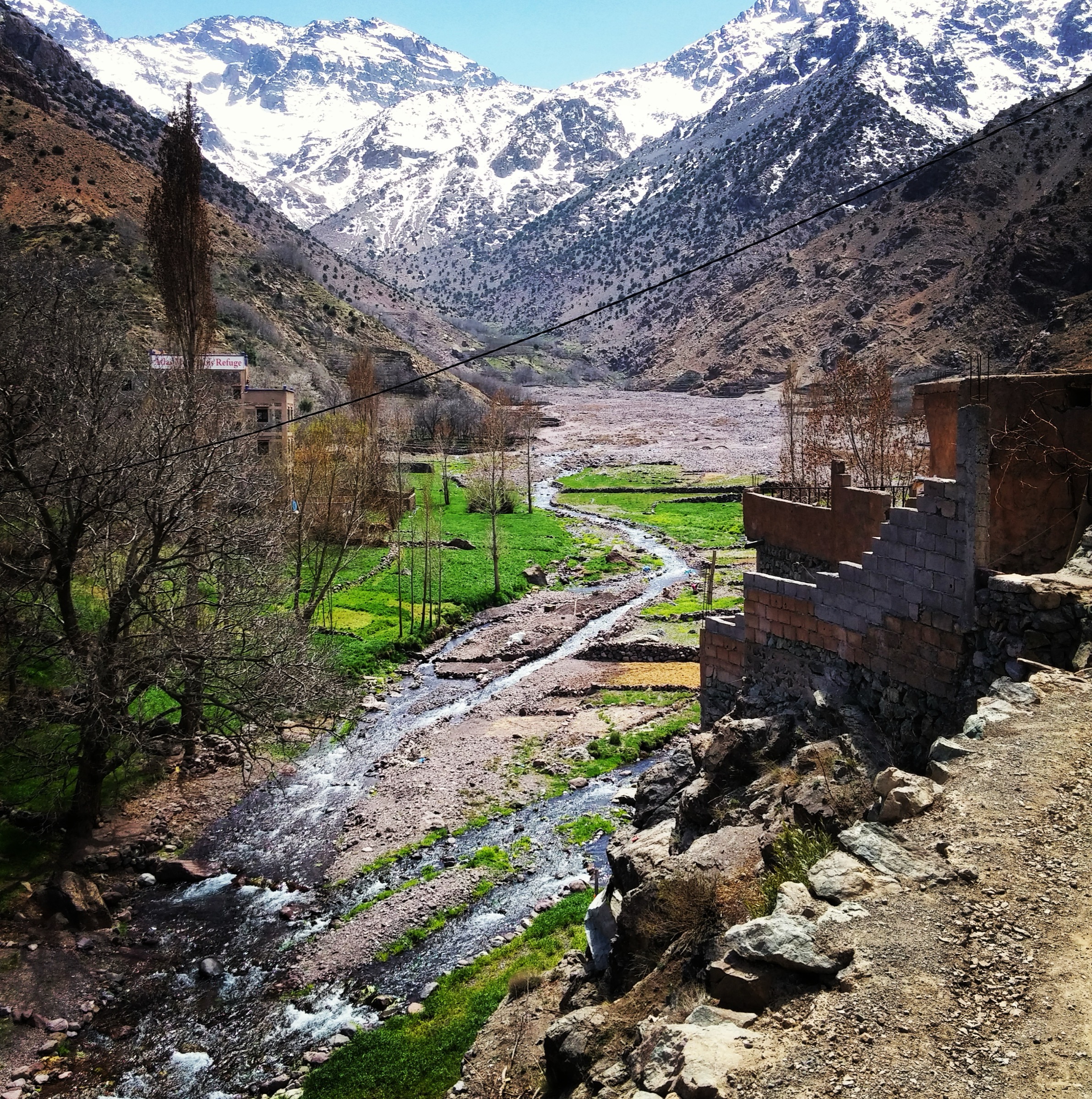
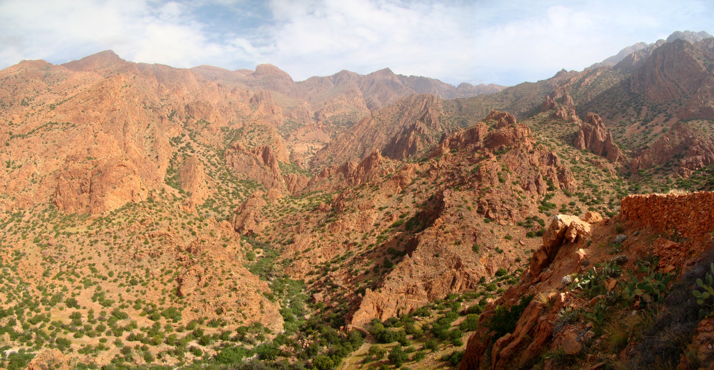
The Anti-Atlas is a dry, rugged range of quartzite ridges, granite boulder fields, palm gorges, village valleys, and volcanic-looking uplands south of the High Atlas. Tafraoute, the Ameln Valley, Jbel Lekst/Kest, Amtoudi, Ait Mansour, and the Sirwa/Taliouine area are the most useful walking bases.
The region is generally lower than the High Atlas but often hotter, drier, and more remote. Waymarking is limited, water is scarce away from villages and oases, and routes frequently use mule tracks, gorge paths, or open rocky slopes. The best walking season is roughly October to April; summer heat can make many routes unsafe.
Selection rationale
The five hikes cover the region’s main walking identities: Tafraoute granite and Ameln views, a major summit ridge, an oasis/granary gorge, a palm-valley gorge walk, and the Sirwa/Taliouine highland edge.
- Jbel Lekst / Jbel Kest from Tagdicht — a major Anti-Atlas summit day above the Ameln Valley.
- Tafraoute Painted Rocks and Granite Valley Walk — the iconic granite-landscape walk.
- Amtoudi and Agadir Id Aissa — a short gorge and fortified-granary route.
- Ait Mansour Gorge Palm Valley Walk — a lower palm-oasis gorge walk.
- Taliouine Ridge Folds Walk — the eastern/saffron-country edge of the Anti-Atlas.
Summary table
| # | Hike | Route type | Distance | Gain | Max elevation | Difficulty |
|---|---|---|---|---|---|---|
| 1 | Jbel Lekst / Jbel Kest from Tagdicht | Loop / out-and-back variant | ca. 10 km | 1,065 m | ca. 2,284–2,359 m | Hard |
| 2 | Tafraoute Painted Rocks and Granite Valley Walk | Loop / out-and-back | Easy–moderate | |||
| 3 | Amtoudi and Agadir Id Aissa | Loop | 5.4 km | 222 m | 980 m | Moderate |
| 4 | Ait Mansour Gorge Palm Valley Walk | Out-and-back | Approx. 8–12 km suggested variant | Low–moderate | Easy–moderate | |
| 5 | Taliouine Ridge Folds Walk | Loop / out-and-back variant | ca. 10 km | ca. 500 m | Moderate |
1. Jbel Lekst / Jbel Kest from Tagdicht
Snapshot
Itinerary
The route climbs from the Ameln/Tagdicht side toward the high ridge of Jbel Lekst, using steep mule paths and rocky slopes. Summit variants differ, and the route should be checked against a current GPX/map before departure.
Why it is essential
Jbel Lekst/Kest is one of the signature Anti-Atlas summits above Tafraoute, with broad views over the Ameln Valley and surrounding quartzite ridges.
Hazards and notes
- Heat and water scarcity.
- Loose rock and route-finding difficulties.
- High slopes are exposed in wind and sun.
GPX / KML links
| Source | URL | Format / access | Reuse status |
|---|---|---|---|
| Wikiloc: Jebel Kest 2359 m | wikiloc.com | Source route page / GPX via Wikiloc | Route source found; reuse not confirmed under Wikiloc terms |
External links
2. Tafraoute Painted Rocks and Granite Valley Walk
Snapshot
Itinerary
The candidate route explores the granite boulder landscape south of Tafraoute, including the painted-rocks area and nearby valley tracks. A definitive, licence-usable route line was not found in this pass.
Why it is essential
The Tafraoute granite landscape is one of the most recognisable Anti-Atlas walking scenes and contrasts with the higher quartzite ridges.
Hazards and notes
- Heat.
- Unclear tracks and vehicle tracks.
- Painted-rocks access and environmental condition should be checked locally.
GPX / KML links
| Source | URL | Format / access | Reuse status |
|---|---|---|---|
| Unresolved | — | — | No reliable walking route file found in this pass |
External links
3. Amtoudi and Agadir Id Aissa
Snapshot
Itinerary
The route climbs from Amtoudi toward the fortified agadir of Id Aissa, then returns by village and gorge-side paths. Variants can continue farther into the gorge if water and time allow.
Why it is essential
Amtoudi combines Anti-Atlas gorge scenery with one of the region’s most striking fortified granaries, giving a short but culturally important hike.
Hazards and notes
- Heat.
- Exposed rock steps.
- Local access arrangements should be respected; respect the granary site and village access rules.
GPX / KML links
| Source | URL | Format / access | Reuse status |
|---|---|---|---|
| Wikiloc: Amtoudi circular walk | wikiloc.com | Source route page / GPX via Wikiloc | Route source found; reuse not confirmed under Wikiloc terms |
External links
4. Ait Mansour Gorge Palm Valley Walk
Snapshot
Itinerary
The candidate day walk follows the palm-filled Ait Mansour gorge on foot, using road, village, and oasis tracks, then returns to the start or continues to a pre-arranged pickup. A legal, publishable route line needs confirmation.
Why it is essential
Ait Mansour is one of the Anti-Atlas’s best-known oasis gorges and provides a lower, greener contrast to the Tafraoute ridges.
Hazards and notes
- Traffic on narrow road sections.
- Heat.
- Flash-flood potential after storms.
- Private/agricultural access issues should be checked.
GPX / KML links
| Source | URL | Format / access | Reuse status |
|---|---|---|---|
| Unresolved | — | — | No reliable walking GPX found in this pass |
External links
5. Taliouine Ridge Folds Walk
Snapshot
Itinerary
The route explores folded ridge country in the Taliouine area, a transitional highland between the Anti-Atlas and Sirwa volcanic massif. The exact line should be checked on the downloadable source route before use.
Why it is essential
This hike adds the eastern/saffron-country edge of the Anti-Atlas to a list otherwise centred on Tafraoute and Amtoudi.
Hazards and notes
- Heat and dry conditions.
- Sparse waymarking.
- The route source and terms need deeper checking before publication.
GPX / KML links
| Source | URL | Format / access | Reuse status |
|---|---|---|---|
| Altituderando: Taliouine folds | altituderando.com | Route page with GPX download | Site terms not fully checked; GPX/source found; reuse not confirmed |
External links
External links
| Source | URL |
|---|---|
| Wikiloc — Jebel Kest 2359m | wikiloc.com |
| Wikiloc — Amtoudi circular 5.4km | wikiloc.com |
| Altituderando — Balade dans les plis de Taliouine | altituderando.com |
| Wikiloc | wikiloc.com |
| Altituderando | altituderando.com |
| Visit Morocco | visitmorocco.com |