Regional overview
The Gobi Altai is the dry southern counterpart to Mongolia’s glaciated western Altai: desert mountain ridges, narrow gorges, fossil cliffs, giant dunes, limestone and sandstone escarpments, and remote sacred summits. The best-known hiking access is in Gobi Gurvansaikhan National Park, especially Yolyn Am and the Khongoryn Els dunes. Farther west and north, the range includes more remote objectives such as Ikh Bogd, the highest mountain of the Gobi-Altai system.
Day-hiking infrastructure is sparse. Many routes are short walks from 4x4-accessed sites rather than signed mountain trails, and several essential landscapes are reached as part of multi-day Gobi vehicle journeys. Summer can be extremely hot on dunes and open cliffs, while winter and shoulder seasons can be cold and windy. Water is scarce, shade is limited, and navigation away from main visitor sites requires a reliable driver or guide.
This selection prioritises routeable day walks that represent the region’s character. Two are core Gobi Gurvansaikhan National Park objectives, two are iconic southern-Gobi rock and fossil escarpment walks often paired with Gobi Altai travel, and one is an unresolved but important Ikh Bogd foothill objective representing the strict mountain-core geography.
Selection rationale
The five hikes cover the Gobi Altai’s essential walking themes: a cool mountain gorge at Yolyn Am, a strenuous dune ascent at Khongoryn Els, the historic Bayanzag fossil cliffs, the coloured Tsagaan Suvarga escarpment, and a remote foothill walk below Ikh Bogd, the highest Gobi-Altai mountain.
Summary table
| # | Hike | Country | Route type | Distance | Gain | Max elevation | Difficulty |
|---|---|---|---|---|---|---|---|
| 1 | Yolyn Am Gorge | Mongolia | Out-and-back / traverse variants | 4-8 km | Minor | Easy-moderate | |
| 2 | Khongoryn Els High Dune Climb | Mongolia | Out-and-back | 2-4 km | Approx. 200-300 m | Dune crest up to approx. 300 m above base | Moderate-hard |
| 3 | Bayanzag / Flaming Cliffs Rim Walk | Mongolia | Loop / out-and-back variants | 2-5 km | Less than 100 m | Easy-moderate | |
| 4 | Tsagaan Suvarga Rim-to-Valley Walk | Mongolia | Loop / out-and-back variants | 1-3 km | 30-80 m | Cliff rim; exact elevation unresolved | Easy-moderate |
| 5 | Ikh Bogd Foothill / Oyut-Binderya Lakes View Walk | Mongolia | Local out-and-back variants | Approx. 5-12 km | Approx. 100-400 m | Below 3,957 m unless summiting | Moderate-hard |
1. Yolyn Am Gorge
Snapshot
Itinerary
The walk follows the valley floor into Yolyn Am, a narrow gorge cut into the Gurvan Saikhan Mountains. The trail begins near the visitor area and enters a cooler, shaded canyon environment with high rock walls, a seasonal or lingering ice field, and a streambed path. The standard short walk returns the same way; longer variants continue through more of the gorge if a driver can collect the party beyond the main visitor section.
The route is straightforward in dry conditions but can be slippery where ice, mud, or water remains.
Why it is essential
Yolyn Am is the best-known mountain gorge of the Gobi Altai and the most accessible way to experience a cool, narrow, wildlife-rich canyon within Gobi Gurvansaikhan National Park.
Equipment
- Grippy shoes
- Wind layer
- Sun protection
- Water
- Warm layer for the gorge if visiting early or when ice remains
Hazards and notes
- Ice, wet rock, loose stones, and animal traffic can make footing awkward.
- Do not rely on the ice field being present in all seasons.
- Stay within permitted visitor areas and avoid disturbing wildlife.
GPX / KML links
| Source | URL | Format / access | Reuse status |
|---|---|---|---|
| OpenStreetMap search: Yolyn Am | openstreetmap.org | Source map | OSM data is ODbL; geometry cross-check only |
| Lonely Planet: Yolyn Am Gorge | lonelyplanet.com | Source page | Site terms apply; no GPX found; distance and access context |
| Gobi Gurvansaikhan National Park overview | nationalparksassociation.org | Source page | Site terms apply; no GPX found; park and landscape context |
External links
- Lonely Planet — Yolyn Am Gorge
- National Parks Association — Gobi Gurvansaikhan National Park
- National-parks.org — Gobi Gurvansaikhan National Park
2. Khongoryn Els High Dune Climb
Snapshot
Itinerary
The route climbs directly from the dune base to a high crest of Khongoryn Els, the “Singing Dunes.” The ascent is slow because each step sinks into soft sand. From the crest, the view spans the long dune wall, desert plain, Khongoryn river/oasis area, and distant Gobi mountain ridges. The descent returns by the same slope or a neighbouring rib.
No single fixed line defines the hike; the exact distance and gain depend on which dune face is chosen.
Why it is essential
Khongoryn Els is one of the signature landscapes of southern Mongolia and a defining physical challenge of the Gobi Altai travel corridor: a short walk that feels much harder than its distance suggests.
Equipment
- Closed shoes or sandals suitable for hot sand
- Sun hat
- Sunglasses
- Sunscreen
- Wind layer
- Ample water
- Avoid midday heat
Hazards and notes
- Heat, dehydration, blowing sand, and steep soft slopes are the main hazards.
- High winds can make crest walking unpleasant or unsafe.
- Protect cameras and phones from sand.
GPX / KML links
| Source | URL | Format / access | Reuse status |
|---|---|---|---|
| OpenStreetMap search: Khongoryn Els | openstreetmap.org | Source map | OSM data is ODbL; area geometry only; no fixed route selected |
| View Mongolia: Khongoryn Els | viewmongolia.com | Source page | Site terms apply; no GPX found; landscape and access context |
External links
- View Mongolia — Khongoryn Els / Khongor Sand Dune
- National-parks.org — Gobi Gurvansaikhan National Park
3. Bayanzag / Flaming Cliffs Rim Walk
Snapshot
Itinerary
The walk follows the rim and side gullies of the red sandstone cliffs at Bayanzag, known internationally as the Flaming Cliffs. Short paths and informal lines lead along viewpoints over the fossil-bearing formations and nearby saxaul landscape. The route can be kept short near the main viewpoints or extended along the cliff edge where access is permitted.
Because Bayanzag is a sensitive palaeontological landscape, the walk should stay on existing visitor paths and avoid unstable edges or fossil-bearing surfaces.
Why it is essential
Bayanzag is one of Mongolia’s most famous natural and historical sites, associated with Roy Chapman Andrews and early dinosaur-egg discoveries. It gives the Gobi Altai entry a culturally important desert-cliff walk rather than only mountain and dune terrain.
Equipment
- Shoes with grip
- Sun protection
- Wind layer
- Water
- Headtorch if returning after sunset
Hazards and notes
- Cliff edges, crumbly sandstone, wind, heat, and site-protection rules are the key concerns.
- Do not collect fossils, rocks, or fragments.
GPX / KML links
| Source | URL | Format / access | Reuse status |
|---|---|---|---|
| OpenStreetMap search: Bayanzag Flaming Cliffs | openstreetmap.org | Source map | OSM data is ODbL; area geometry only; no fixed route selected |
| View Mongolia: Flaming Cliffs / Bayanzag | viewmongolia.com | Source page | Site terms apply; no GPX found; landscape, location, and history source |
| Mongolia Trips: Bayanzag | mongolia-trips.com | Source page | Site terms apply; no GPX found; historical context source |
External links
- View Mongolia — Flaming Cliffs / Bayanzag
- Mongolia Trips — Bayanzag
- Mongolian Dinosaurs — Flaming Cliffs protection leaflet (PDF)
4. Tsagaan Suvarga Rim-to-Valley Walk
Snapshot
Itinerary
The walk explores the rim, side slopes, and valley floor below Tsagaan Suvarga, a white, yellow, and purple limestone/sandstone escarpment formed from ancient seabed deposits. Short paths descend from the rim through eroded gullies to the base of the cliffs, then return to the viewpoint area.
Sources describe the cliffs as about 400 m long and roughly 30-60 m high. Exact walking lines are informal and depend on where vehicles park.
Why it is essential
Tsagaan Suvarga is not a high summit, but it is one of the most accessible and visually distinctive escarpment walks in the southern Gobi travel corridor. It represents the eroded desert-cliff side of the Gobi Altai landscape.
Equipment
- Grippy shoes
- Sun protection
- Water
- Wind layer
- Eye protection in blowing dust
Hazards and notes
- Loose rim edges and crumbly slopes require care.
- Avoid walking directly on fragile formations if a more established line is visible.
- The site has no reliable shade or water.
GPX / KML links
| Source | URL | Format / access | Reuse status |
|---|---|---|---|
| OpenStreetMap search: Tsagaan Suvarga | openstreetmap.org | Source map | OSM data is ODbL; area geometry only; no fixed route selected |
| Discover Altai: Tsagaan Suvarga | discoveraltai.com | Source page | Site terms apply; no GPX found; distance/time and geologic context |
| Western Mongolia: Tsagaan Suvarga | western-mongolia.com | Source page | Site terms apply; no GPX found; cliff dimensions and access context |
External links
5. Ikh Bogd Foothill / Oyut-Binderya Lakes View Walk
Snapshot
Itinerary
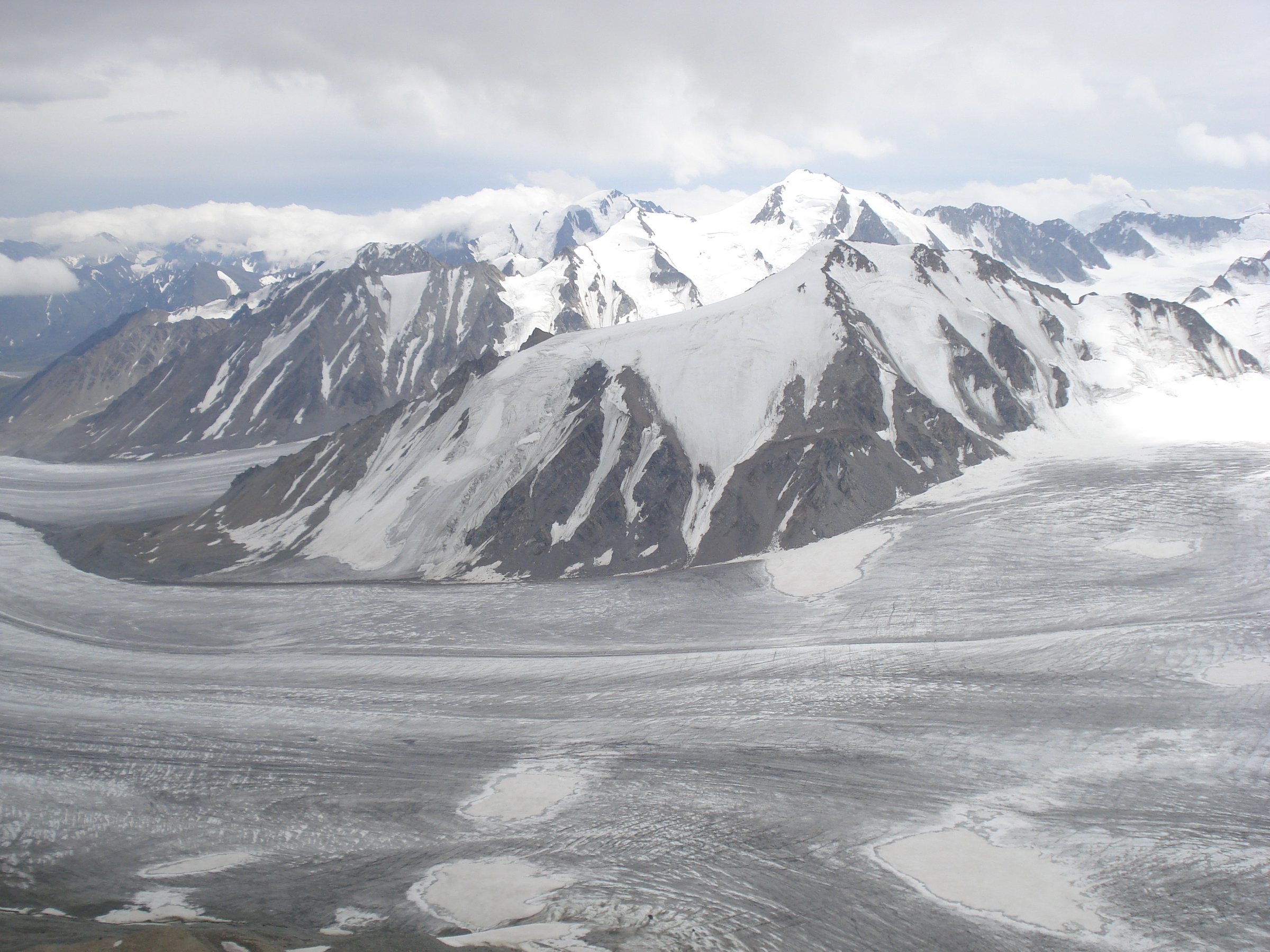
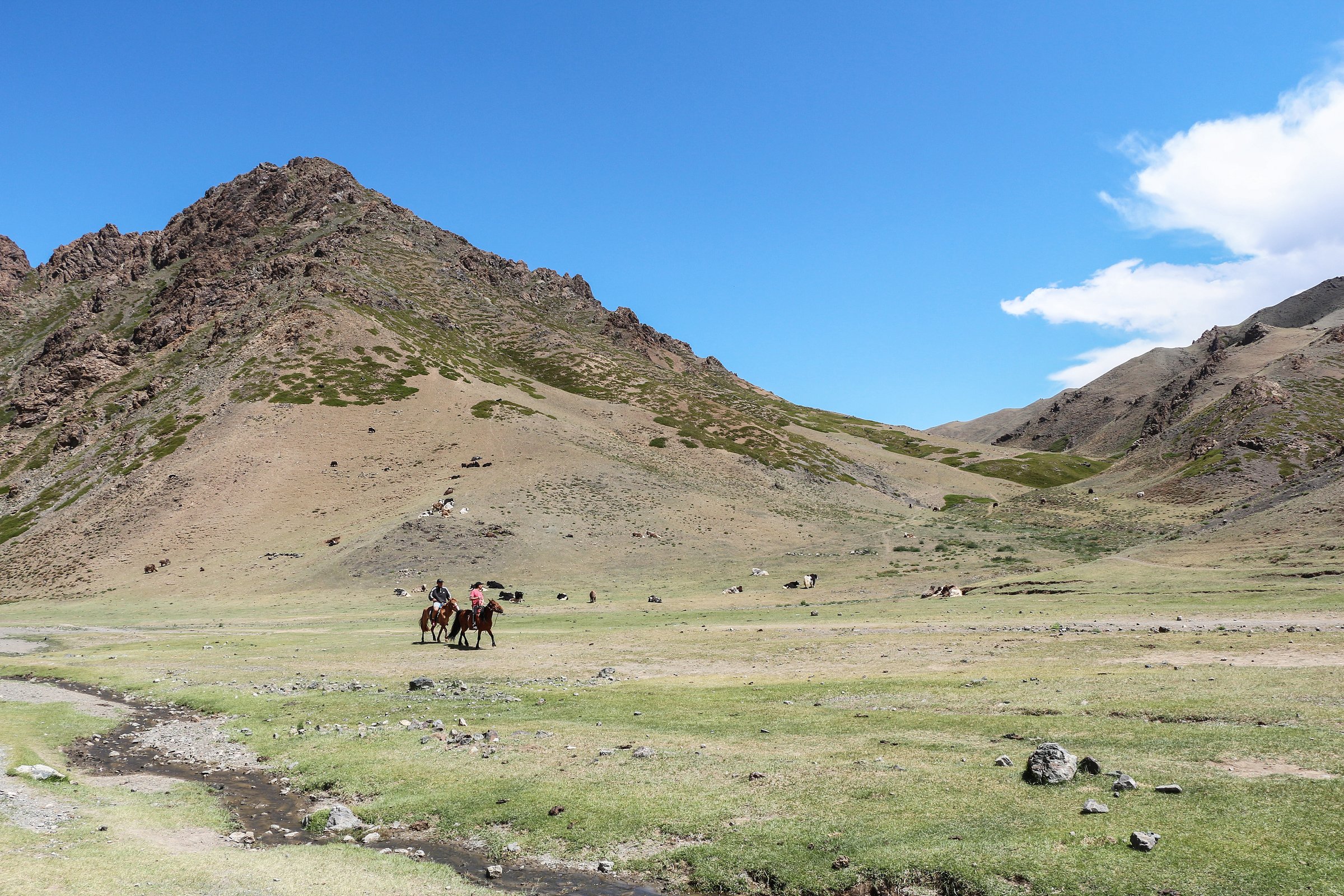
The proposed day-hike objective is a locally guided foothill walk below Ikh Bogd, the highest mountain of the Gobi-Altai system. Source descriptions identify the massif, associated earthquake landscape, small lakes, caves, and surrounding desert-steppe contrasts, but do not publish a standard day-hike line. A practical route would use a local vehicle drop to walk to a viewpoint, lake edge, cave area, or lower ridge without attempting the main summit.
The summit of Ikh Bogd is not presented here as a catalogue day hike because no reliable non-technical day-route statistics were verified in this pass.
Why it is essential
Ikh Bogd is the key mountain of the strict Gobi-Altai core. Even with incomplete route data, the entry needs one hike that represents the actual high range rather than only the more tourist-developed eastern Gobi sites.
Equipment
- Sturdy boots
- Sun protection
- Warm/windproof layer
- At least 2-3 litres of water
- Food
- Navigation backup
- Headtorch
- Satellite or emergency communication where practical
Hazards and notes
- Route ambiguity, lack of water, remoteness, heat, wind, and limited rescue access are the main hazards.
- A local guide/driver is strongly recommended.
- Current protected-area rules and any sacred-site restrictions should be checked before walking.
GPX / KML links
| Source | URL | Format / access | Reuse status |
|---|---|---|---|
| OpenStreetMap search: Ikh Bogd | openstreetmap.org | Source map | OSM data is ODbL; area geometry only; no fixed route selected |
| Mongolia Trips: Ikh Bogd Mountain | mongolia-trips.com | Source page | Site terms apply; no GPX found; landmark, geology, and access context |
| Mongol Gerege: Ikh Bogd Mountain | mongolgerege.com | Source page | Site terms apply; no GPX found; mountain-elevation and location context |
External links
Missing data / follow-up work
- No official GPX/KML files were found for these Gobi Altai walks in this pass.
- Yolyn Am exact elevation gain and current ice/gorge conditions require local confirmation.
- Khongoryn Els has no single fixed route; distance and gain depend on chosen dune face.
- Bayanzag and Tsagaan Suvarga are informal visitor walks with route variants rather than maintained trails.
- Ikh Bogd is the most unresolved entry: exact trailhead, route statistics, access rules, and licence-compatible photos require local or specialist follow-up.
- The inclusion of Bayanzag and Tsagaan Suvarga should be reviewed if the final catalogue defines “Gobi Altai” strictly as only the high Gobi-Altai mountain chain.
External links
| Source | URL |
|---|---|
| National Parks Association — Gobi Gurvansaikhan National Park | nationalparksassociation.org |
| National-parks.org — Gobi Gurvansaikhan National Park | national-parks.org |
| Lonely Planet — Yolyn Am Gorge | lonelyplanet.com |
| View Mongolia — Khongoryn Els / Khongor Sand Dune | viewmongolia.com |
| View Mongolia — Flaming Cliffs / Bayanzag | viewmongolia.com |
| Mongolia Trips — Bayanzag | mongolia-trips.com |
| Mongolian Dinosaurs — Flaming Cliffs protection leaflet (PDF) | mongoliandinosaurs.org |
| Discover Altai — Tsagaan Suvarga | discoveraltai.com |
| Western Mongolia — Tsagaan Suvarga | western-mongolia.com |
| Mongolia Trips — Ikh Bogd Mountain | mongolia-trips.com |
| Mongol Gerege — Ikh Bogd Mountain | mongolgerege.com |