Regional overview
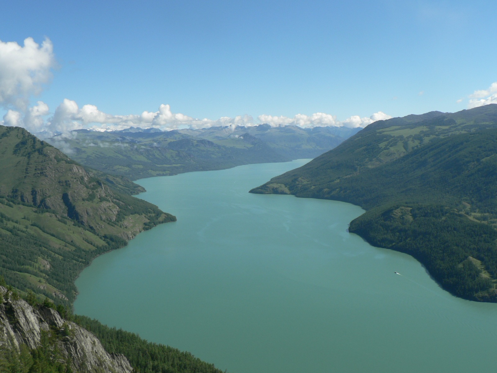
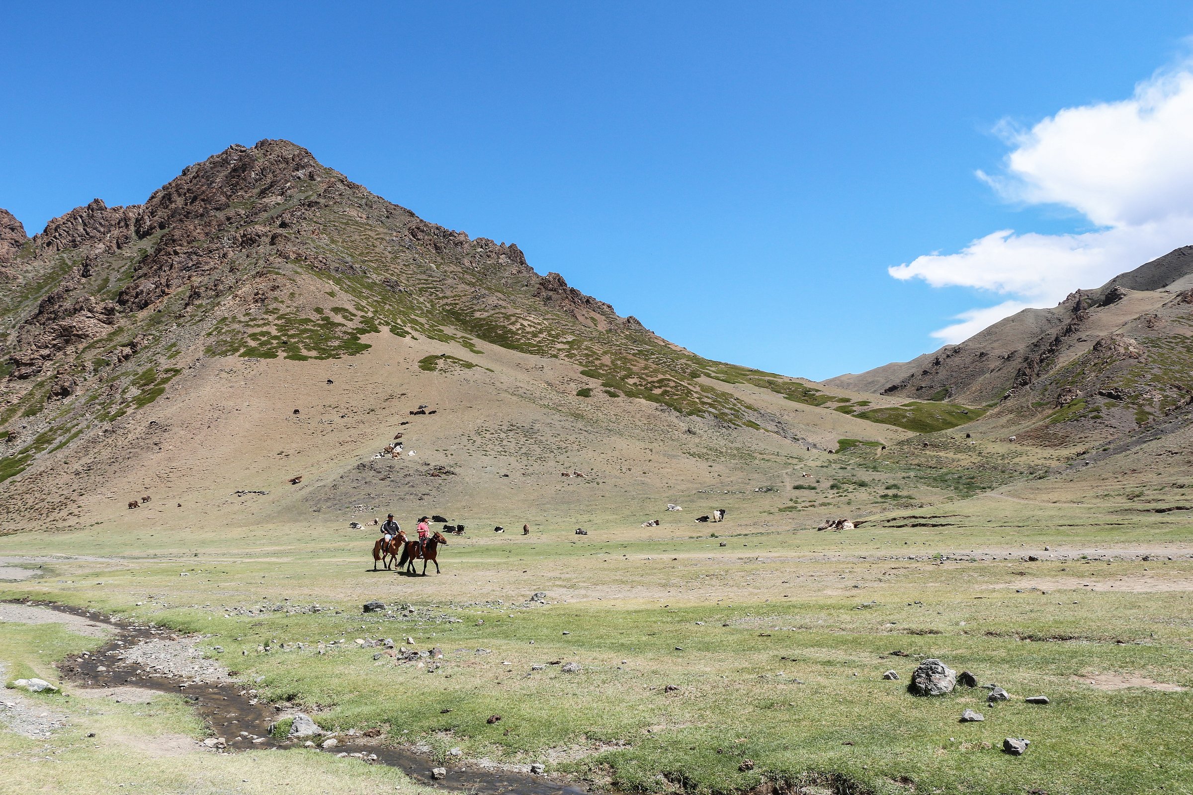
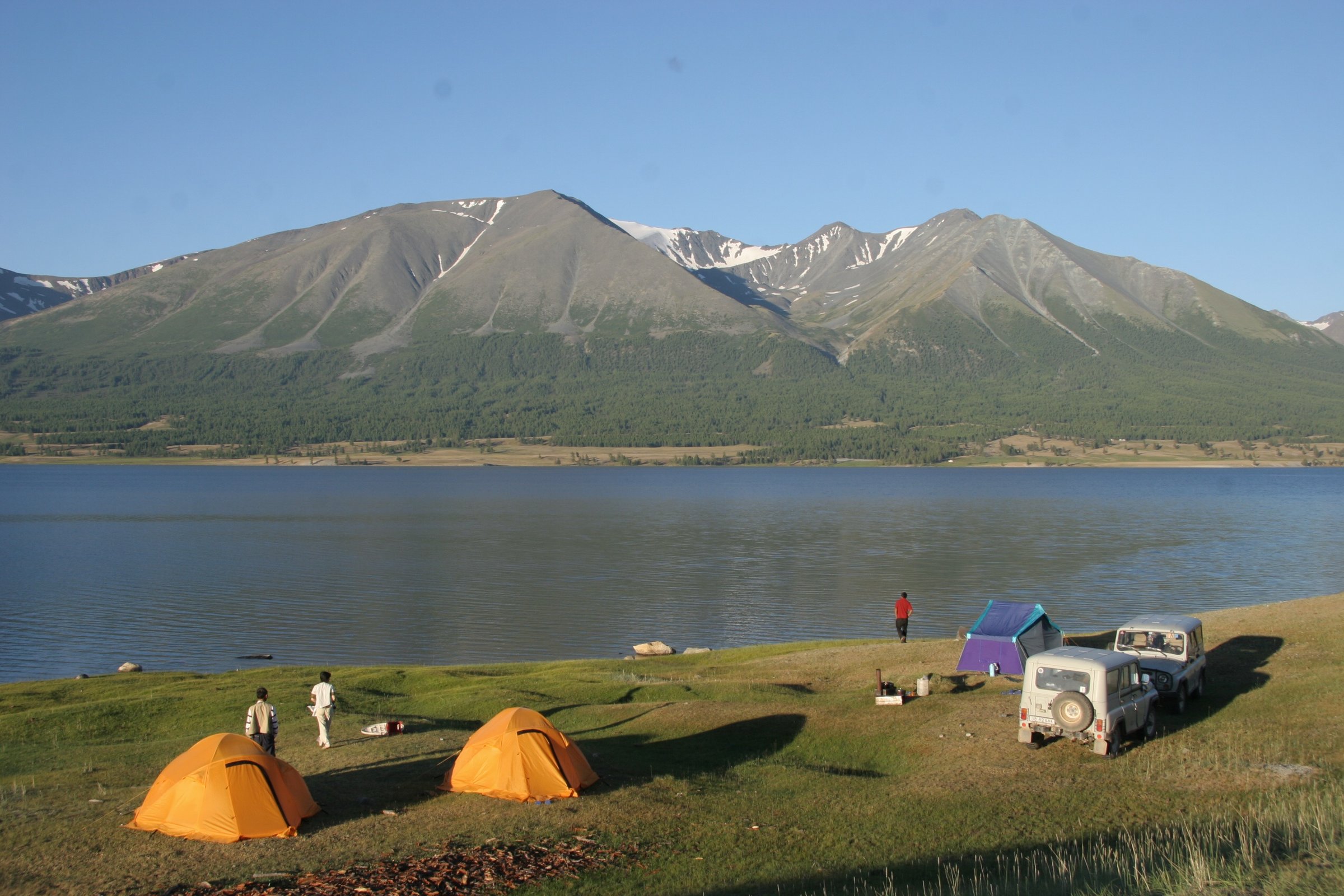
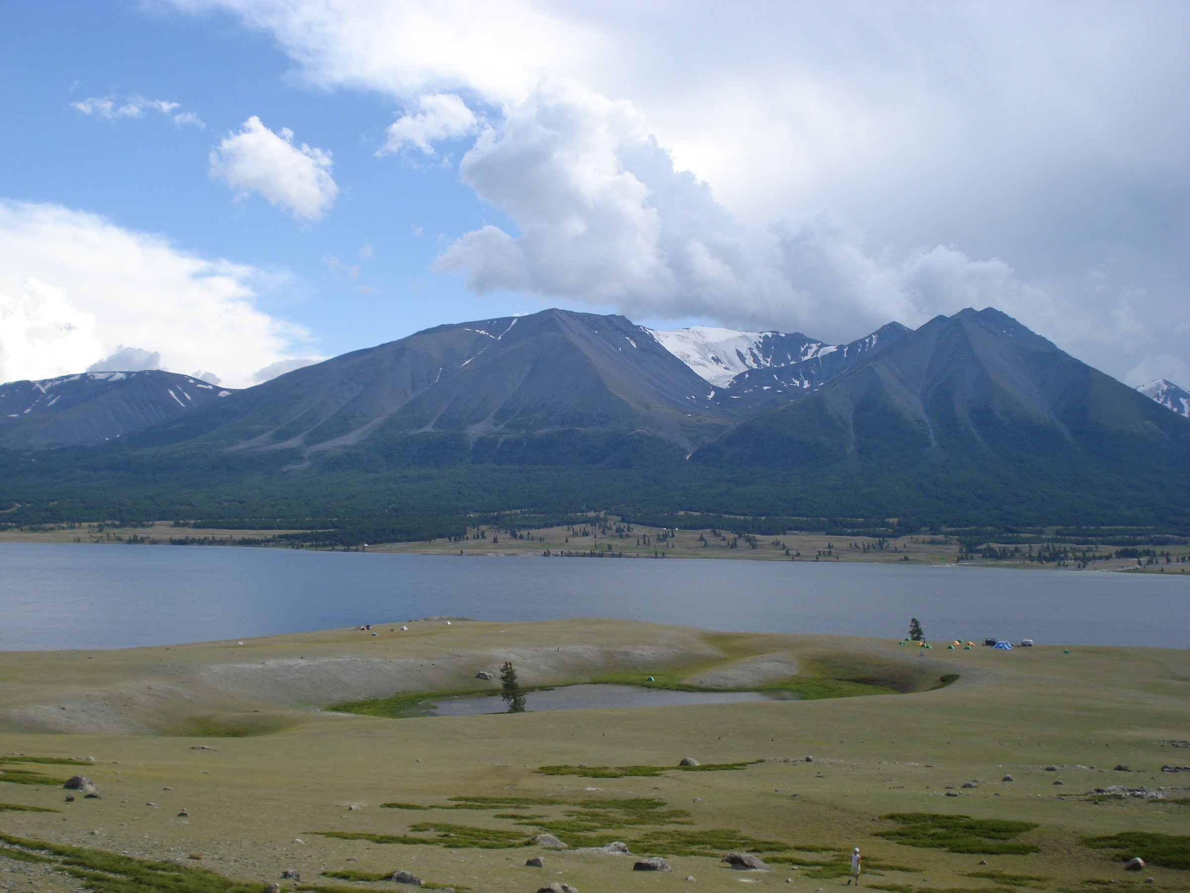
The Mongolian Altai is a remote high mountain region of glaciated border peaks, broad river valleys, alpine lakes, Kazakh and Tuvan pastoral landscapes, sacred mountains, and Bronze Age to Turkic rock art. The principal hiking centre is Bayan-Olgii Province, especially Altai Tavan Bogd National Park around the Tavan Bogd massif, Tsagaan Gol / White River valley, Shiveet Khairkhan, Khoton and Khurgan lakes, and Baga Turgen valley. Tsambagarav Uul National Park forms a second major mountain area between Bayan-Olgii and Khovd.
Most “day hikes” here are day objectives inside longer vehicle-supported or trekking journeys. The region is not a place for spontaneous trailhead day-hiking from a town: border-zone permits, national-park access, local guides, 4x4 travel, river conditions, and camp logistics are often necessary before the actual one-day walk begins. Summer from mid-June to September is the usual hiking window; snow can linger on high routes, and weather can shift quickly at altitude.
Route-stat evidence is mixed. Wikiloc provides several useful GPS-source routes, while official or park GPX files were not found in this pass. Several culturally important walks, especially Shiveet Khairkhan and Tsambagarav lower-valley routes, are verified as important destinations but have incomplete route statistics.
Selection rationale
The five hikes represent the core Mongolian Altai walking experience: the non-technical high summit of Malchin Peak, the Potanin Glacier landscape, the sacred rock-art mountain of Shiveet Khairkhan, the accessible alpine waterfall at Baga Turgen, and the separate snow-capped Tsambagarav massif.
Summary table
| # | Hike | Country | Route type | Distance | Gain | Max elevation | Difficulty |
|---|---|---|---|---|---|---|---|
| 1 | Malchin Peak from Tavan Bogd Base Camp | Mongolia | Out-and-back / loop variants | 12.2 km | 907 m | 4,030-4,050 m | Hard |
| 2 | Potanin Glacier Moraine and Lower Glacier View Walk | Mongolia | Out-and-back | Approx. 4-8 km; exact day route unresolved | Minor-300 m | Approx. 3,400 m near base camp | Moderate-hard |
| 3 | Shiveet Khairkhan Petroglyph Foothill Walk | Mongolia | Local loop / out-and-back variants | Approx. 4-8 km | Approx. 100-300 m | Below 3,281 m unless summiting; exact route unresolved | Moderate |
| 4 | Baga Turgen Waterfall | Mongolia | Loop | 6.5 km | 192 m | 2,373 m | Moderate |
| 5 | Tsambagarav Glacier-Valley / Tsast Uul Approach Walk | Mongolia | Out-and-back / summit-approach variants | Approx. 8-15 km depending objective | 400-1,300 m depending objective | 3,200-4,193 m depending objective | Hard |
1. Malchin Peak from Tavan Bogd Base Camp
Snapshot
Itinerary
From the Tavan Bogd base camp area near Potanin Glacier, the route climbs open alpine and rocky terrain toward Malchin Peak, the most accessible of the Tavan Bogd peaks. The ascent is not a glacier climb in normal summer conditions, but it is high, exposed, and loose underfoot. Views open over Potanin Glacier, the Tavan Bogd massif, and the Russia-Mongolia border area.
The descent normally returns to base camp. Snow patches may remain even in summer, and the line can be indistinct across scree or loose rock.
Why it is essential
Malchin Peak is the classic non-technical high summit of the Mongolian Altai. It gives fit walkers a realistic 4,000 m summit objective without the glacier and roped travel required for Khuiten Peak.
Equipment
- Mountain hiking equipment: sturdy boots, warm layers, windproof/waterproof shell, gloves/hat.
- Sun protection, trekking poles, navigation backup.
- Headtorch, food, and enough water.
- Microspikes may be useful if snow or hard morning ice remains.
Hazards and notes
- Altitude, loose rock, snow patches, wind, cold, and sudden weather are the main hazards.
- The wider trip requires border-zone permits and local logistics.
- Do not treat Malchin as a casual roadside hike.
GPX / KML links
| Source | URL | Format / access | Reuse status |
|---|---|---|---|
| Wikiloc: Malchin Peak, Altai Tavan Bogd National Park | wikiloc.com | Source route / downloadable GPS track | Wikiloc terms apply; reuse of file not confirmed |
| OpenStreetMap search: Malchin Peak | openstreetmap.org | Source map | OSM data is ODbL; geometry cross-check only |
| Discover Altai: Malchin Peak | discoveraltai.com | Source page | Site terms apply; no GPX found |
External links
- Wikiloc — Malchin Peak, Altai Tavan Bogd National Park
- Discover Altai — Malchin Peak
- Discover Altai — Altai Tavan Bogd trekking routes
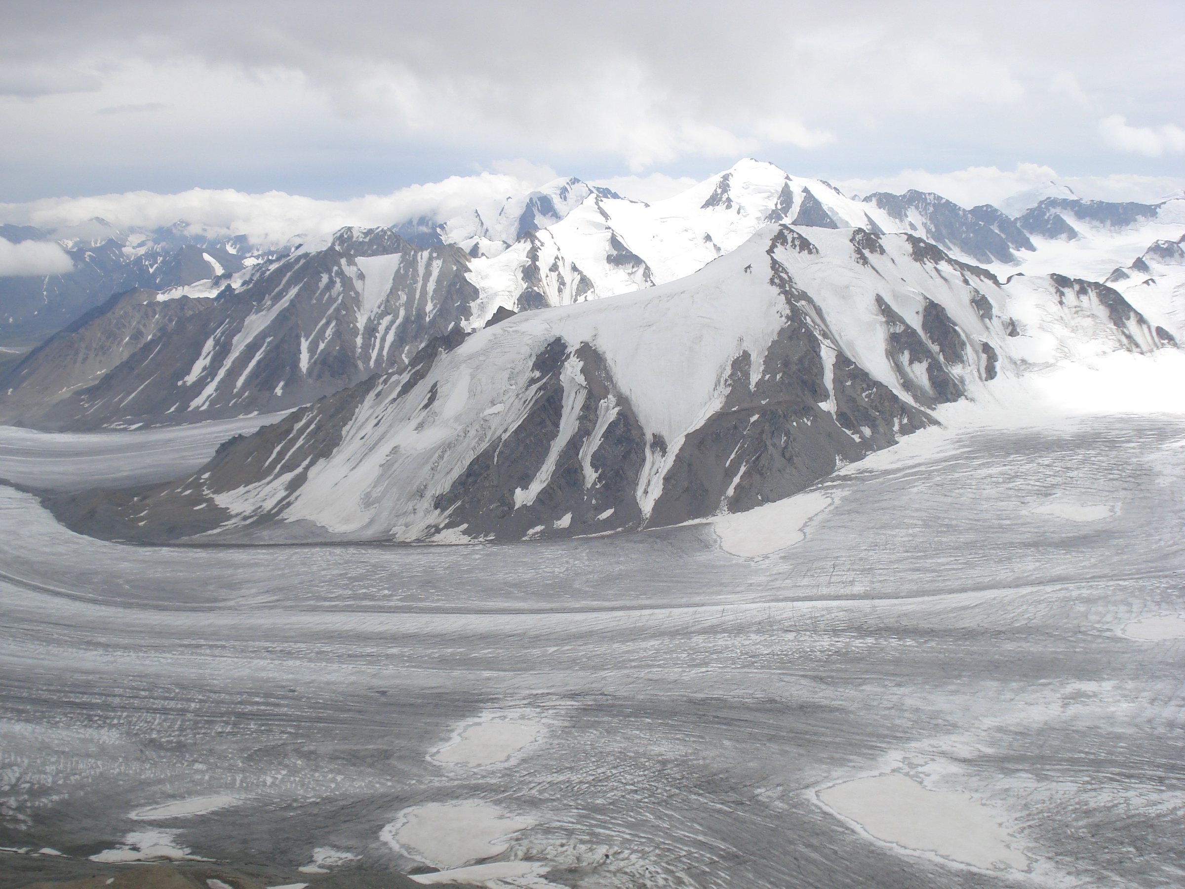
2. Potanin Glacier Moraine and Lower Glacier View Walk
Snapshot
Itinerary
From the base camp area, the walk approaches the moraine and lower viewpoints of Potanin Glacier, Mongolia’s longest glacier. The safest day-hike objective is to view the glacier, surrounding moraines, meltwater channels, and Tavan Bogd peaks without committing to crevassed glacier travel. Short acclimatisation walks around the lower glacier are a common part of Tavan Bogd trekking itineraries.
The route should be chosen with a local guide because glacier margins, meltwater streams, and loose moraine change over time.
Why it is essential
Potanin Glacier is the defining ice landscape of the Mongolian Altai. A glacier-view walk gives the catalogue a non-summit high-alpine objective and helps represent the region’s glaciated character.
Equipment
- Mountain hiking equipment: sturdy boots, warm/windproof layers, sun protection.
- Map/GPS, poles, food, water, headtorch.
- Do not step onto crevassed glacier ice without appropriate guide, equipment, and skills.
Hazards and notes
- Moraine slopes can be unstable, meltwater channels can rise or shift, and glacier ice may be crevassed.
- Weather can close visibility rapidly.
- This is a viewpoint and margin walk, not a glacier crossing.
GPX / KML links
| Source | URL | Format / access | Reuse status |
|---|---|---|---|
| Wikiloc: White River Ranger Station to Potanin Glacier base camp | wikiloc.com | Source route to base camp | Wikiloc terms apply; day-hike GPX not confirmed |
| OpenStreetMap search: Potanin Glacier | openstreetmap.org | Source map | OSM data is ODbL; geometry cross-check only |
| Discover Altai: Altai Tavan Bogd trekking routes | discoveraltai.com | Source page | Site terms apply; no GPX found |
External links
- Discover Altai — Altai Tavan Bogd trekking routes
- Koryo Tours — Potanin Glacier guide
- Wikiloc — White River Ranger Station to Potanin Glacier base camp
3. Shiveet Khairkhan Petroglyph Foothill Walk
Snapshot
Itinerary
The walk explores the lower slopes and cultural landscape around Shiveet Khairkhan, a sacred mountain known for extensive petroglyphs, Turkic stone figures, and views toward the Tavan Bogd area. Depending on camp location and local guidance, the route may visit rock-art panels, stone monuments, low ridges, and viewpoints over the Tsagaan Gol valley.
Because the rock art is culturally important and spread across a sensitive landscape, the exact walking line should be chosen with a local guide.
Why it is essential
This hike brings the Mongolian Altai’s cultural depth into the selection. Shiveet Khairkhan is one of the key sacred and archaeological landscapes of Altai Tavan Bogd, balancing the glacier and summit routes.
Equipment
- Standard to mountain hiking equipment: sturdy shoes, wind/rain layer, sun protection.
- Water, food, navigation backup.
- A local guide is recommended for cultural interpretation and site protection.
Hazards and notes
- Do not touch, mark, climb over, or damage rock-art surfaces.
- Weather, exposure, loose ground, and livestock/guard dogs around seasonal camps can be issues.
- Border-zone and park access rules still apply.
GPX / KML links
| Source | URL | Format / access | Reuse status |
|---|---|---|---|
| OpenStreetMap search: Shiveet Khairkhan | openstreetmap.org | Source map | OSM data is ODbL; geometry cross-check only |
| Koryo Tours: Shiveet Khairkhan Mountain | koryogroup.com | Source page | Site terms apply; no GPX found |
| Nomad’s Land: Shiveet Khairkhan Mountain | nomadsland.travel | Source page | Site terms apply; no GPX found |
External links
- Koryo Tours — Shiveet Khairkhan Mountain
- Nomad’s Land — Shiveet Khairkhan Mountain
- UNESCO — Petroglyphic Complexes of the Mongolian Altai
4. Baga Turgen Waterfall
Snapshot
Itinerary
The route follows alpine meadow and valley terrain toward Baga Turgen Waterfall, a two-stage waterfall near the Khoton and Khurgan lakes side of Altai Tavan Bogd National Park. The Wikiloc route visits multiple waterfall viewpoints and returns by a local loop through grazing country and rocky ground.
The route is generally less committing than the high Tavan Bogd summit walks, but footing near the waterfall can require care.
Why it is essential
Baga Turgen adds the lake-and-waterfall side of Altai Tavan Bogd to the selection. It is one of the region’s most accessible scenic day hikes once the remote approach logistics are solved.
Equipment
- Standard hiking equipment: hiking shoes, rain/wind layer, warm layer.
- Water, snacks, sun protection.
- Poles if desired.
Hazards and notes
- Rock near the falls can be slippery.
- Weather shifts quickly, and livestock or dogs may be encountered near summer camps.
- Use local access advice and avoid damaging pasture or camp areas.
GPX / KML links
| Source | URL | Format / access | Reuse status |
|---|---|---|---|
| Wikiloc: Baga Turgen waterfall, Altai Tavan Bogd National Park | wikiloc.com | Source route / downloadable GPS track | Wikiloc terms apply; reuse of file not confirmed |
| OpenStreetMap search: Baga Turgen Waterfall | openstreetmap.org | Source map | OSM data is ODbL; geometry cross-check only |
External links
- Wikiloc — Baga Turgen waterfall, Altai Tavan Bogd National Park
- Steppe Mongolia — Baga Turgen Waterfall
- Western Mongolia — Baga Turgen waterfall area
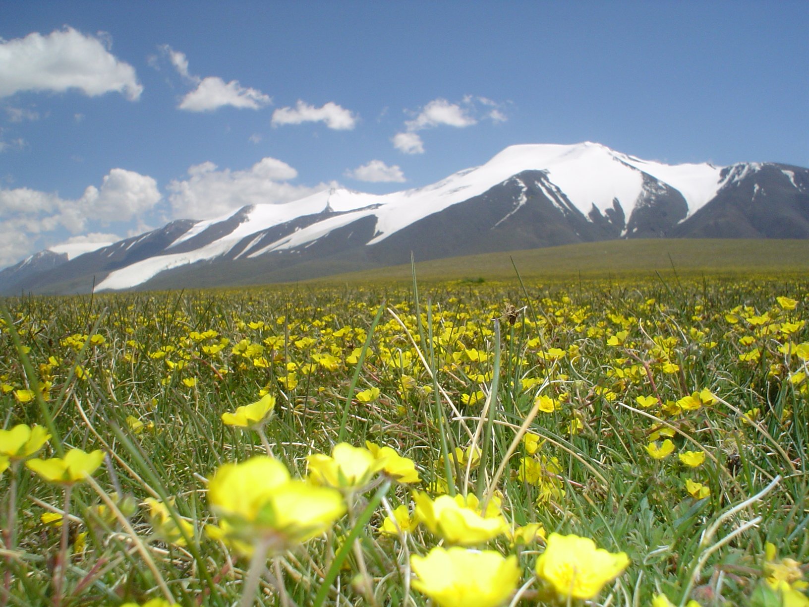
5. Tsambagarav Glacier-Valley / Tsast Uul Approach Walk
Snapshot
Itinerary
The catalogue objective is a day walk into the Tsambagarav alpine valley landscape for views of glaciers, waterfalls, meadows, and the snow-capped twin peaks. Strong, acclimatised parties may use a longer summit-approach variant toward Tsast Uul, but the summit should not be treated as a casual day hike without current snow, ice, and route information.
Exact start points vary with vehicle access, camp location, and local conditions. The source route gives one summit-approach line, but it is a mountaineering-style source rather than a universally suitable day-hike recommendation.
Why it is essential
Tsambagarav is the major stand-alone snow mountain of the western Mongolian Altai outside the Tavan Bogd core. It gives the region entry a second high-mountain area with different geography, culture, and access.
Equipment
- Mountain hiking equipment: boots, warm and waterproof layers, hat/gloves.
- Sun protection, water, food, navigation backup, poles, headtorch.
- Microspikes, crampons, or an ice axe may be necessary for snow or summit variants, depending current conditions.
Hazards and notes
- Altitude, snow, glacier margins, weather, remoteness, and lack of rescue infrastructure are serious considerations.
- Local guide advice is strongly recommended.
- The summit route should be separated from a lower valley day walk unless current conditions are known.
GPX / KML links
| Source | URL | Format / access | Reuse status |
|---|---|---|---|
| Wikiloc: Tsambagarav Tsast | wikiloc.com | Source route / downloadable GPS track | Wikiloc terms apply; reuse of file not confirmed |
| OpenStreetMap search: Tsambagarav | openstreetmap.org | Source map | OSM data is ODbL; geometry cross-check only |
| View Mongolia: Tsambagarav Mountain National Park | viewmongolia.com | Source page | Site terms apply; no GPX found |
External links
- Wikiloc — Tsambagarav Tsast
- Steppe Mongolia — Tsambagarav Mountain
- View Mongolia — Tsambagarav Mountain National Park
- Mongolia Trips — Tsambagarav National Park
External links
| Source | URL |
|---|---|
| Discover Altai — Malchin Peak | discoveraltai.com |
| Discover Altai — Altai Tavan Bogd trekking routes | discoveraltai.com |
| Koryo Tours — Potanin Glacier guide | koryogroup.com |
| Koryo Tours — Shiveet Khairkhan Mountain | koryogroup.com |
| Nomad’s Land — Shiveet Khairkhan Mountain | nomadsland.travel |
| Steppe Mongolia — Baga Turgen Waterfall | steppe-mongolia.com |
| Steppe Mongolia — Tsambagarav Mountain | steppe-mongolia.com |
| Western Mongolia — Baga Turgen waterfall area | western-mongolia.com |
| View Mongolia — Tsambagarav Mountain National Park | viewmongolia.com |
| Mongolia Trips — Tsambagarav National Park | mongolia-trips.com |
| UNESCO — Petroglyphic Complexes of the Mongolian Altai | whc.unesco.org |
| Wikiloc — Malchin Peak, Altai Tavan Bogd National Park | wikiloc.com |
| Wikiloc — White River Ranger Station to Potanin Glacier base camp | wikiloc.com |
| Wikiloc — Baga Turgen Waterfall, Altai Tavan Bogd National Park | wikiloc.com |
| Wikiloc — Tsambagarav Tsast | wikiloc.com |