Regional overview
The Kazakh Altai is a remote mountain region of forested valleys, high meadows, mineral springs, glacial rivers, waterfalls and long-distance routes toward Belukha. The main hiking focus in public sources is Katon-Karagay National Park and the broader East Kazakhstan / Ridder-Altai area. Compared with the Chinese side of the Altai, the Kazakh side is less managed as a short-boardwalk scenic area and more dependent on permits, local guides, vehicles and border-zone logistics.
Official and semi-official sources confirm Katon-Karagay National Park, Lake Yazevoye/Karakol, Rakhmanov Springs, Kokkol waterfall, Rakhmanov waterfall, the Orman Zholdary ecotrail and the Radon Lake route near Ridder/Poperechnoye. Exact day-hike statistics are sparse; route geometry often remains source-map or descriptive rather than GPX-grade.
The normal hiking season is summer to early autumn. Snow, river crossings, poor roads, border-zone controls, limited mobile signal, park registration and permit requirements can all affect access. Some famous Kazakh Altai objectives are really multi-day treks; entries below are framed as day-hike sections or local objectives where the open sources allow that.
Selection rationale
The five hikes cover the best Kazakh Altai day-walking characters: an official forest ecotrail, the Lake Yazevoye Belukha-view landscape, a Rakhmanov Springs waterfall walk, the Kokkol waterfall route as a strenuous source-route objective, and Radon Lake near Ridder for the western Altai/Ivanovsky side.
Summary table
| # | Hike | Country | Route type | Distance | Gain | Max elevation | Difficulty |
|---|---|---|---|---|---|---|---|
| 1 | Orman Zholdary Ecotrail | Kazakhstan | Ecotrail / local circuit | Easy-moderate | |||
| 2 | Lake Yazevoye / Karakol Belukha-view walk | Kazakhstan | Shore/viewpoint walk | Unresolved short walk unless extended | Lake area unresolved; source gives Belukha views | Easy-moderate | |
| 3 | Rakhmanov Waterfall from Rakhmanov Lake | Kazakhstan | Out-and-back waterfall walk | About 4 km return if starting at lake | Easy-moderate | ||
| 4 | Kokkol Waterfall / Sarymsakty route section | Kazakhstan | Long out-and-back or guided point route | About 22-23 km one-way to waterfall | Waterfall about 2,370 m | Difficult / candidate | |
| 5 | Radon Lake from Poperechnoye | Kazakhstan | Out-and-back mountain lake route | About 22 km return from village if using QazTravel 11 km distance | Lake near Voroshilov Peak; exact elevation unresolved | Moderate-hard |
1. Orman Zholdary Ecotrail
Snapshot
Itinerary
The Orman Zholdary ecotrail is an upgraded conceptual forest route in Katon-Karagay National Park. UNDP reports that the route includes entrance gates, art objects, thematic placards, navigation signs and biodiversity information. The exact walking distance and elevation profile were not found in this pass.
Why it is essential
This is the most clearly official short ecotrail source found for Katon-Karagay. It gives the Kazakh Altai entry a managed, educational forest-walk objective rather than only remote trekking routes.
Equipment
Standard hiking equipment: walking shoes, water, weather layer, warm layer, sun protection and insect protection. Carry a map/phone backup if leaving the signed route area.
Hazards and notes
Opening status, entrance fees, park registration and current route length should be checked with the national park before publication.
GPX / KML links
| Source | URL | Format / access | Reuse status |
|---|---|---|---|
| UNDP — Orman Zholdary route announcement | undp.org | Source page | UNDP page terms apply; route description only, no GPX found |
| Wikimedia Commons / OSM category link for Katon-Karagay | commons.wikimedia.org | Source map / media category | Commons/OSM terms apply; map cross-check only |
External links
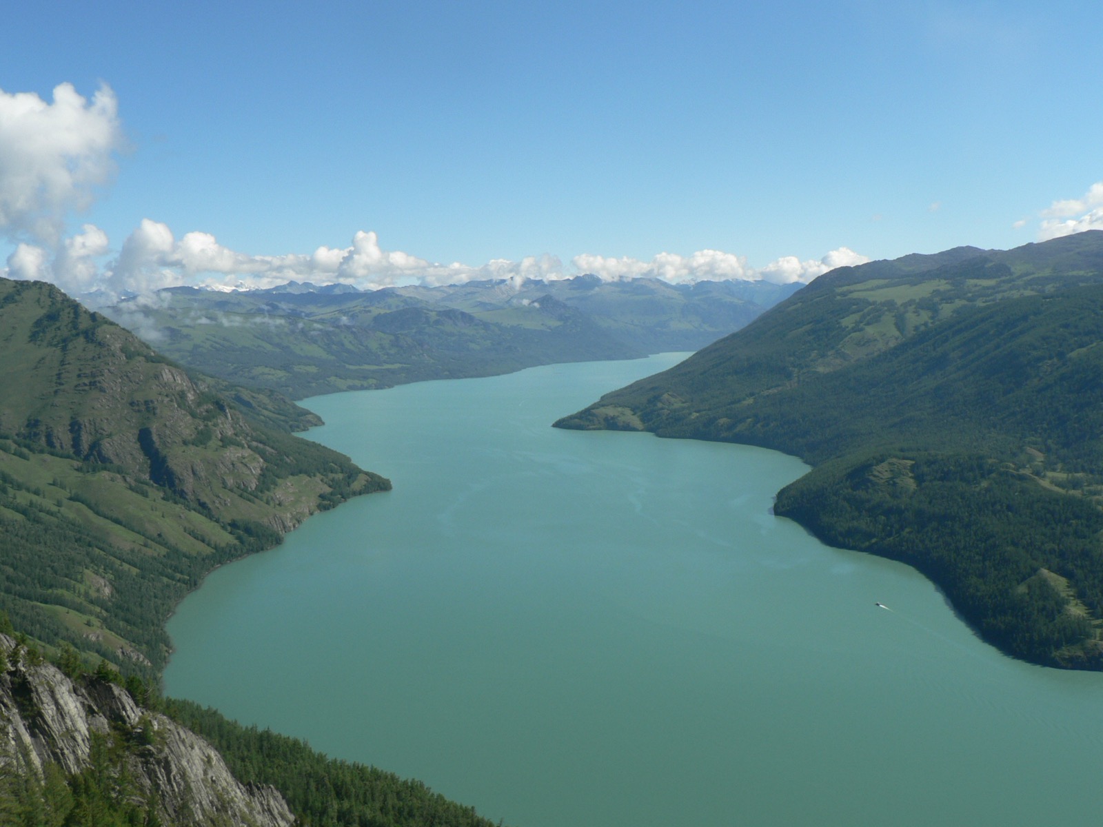
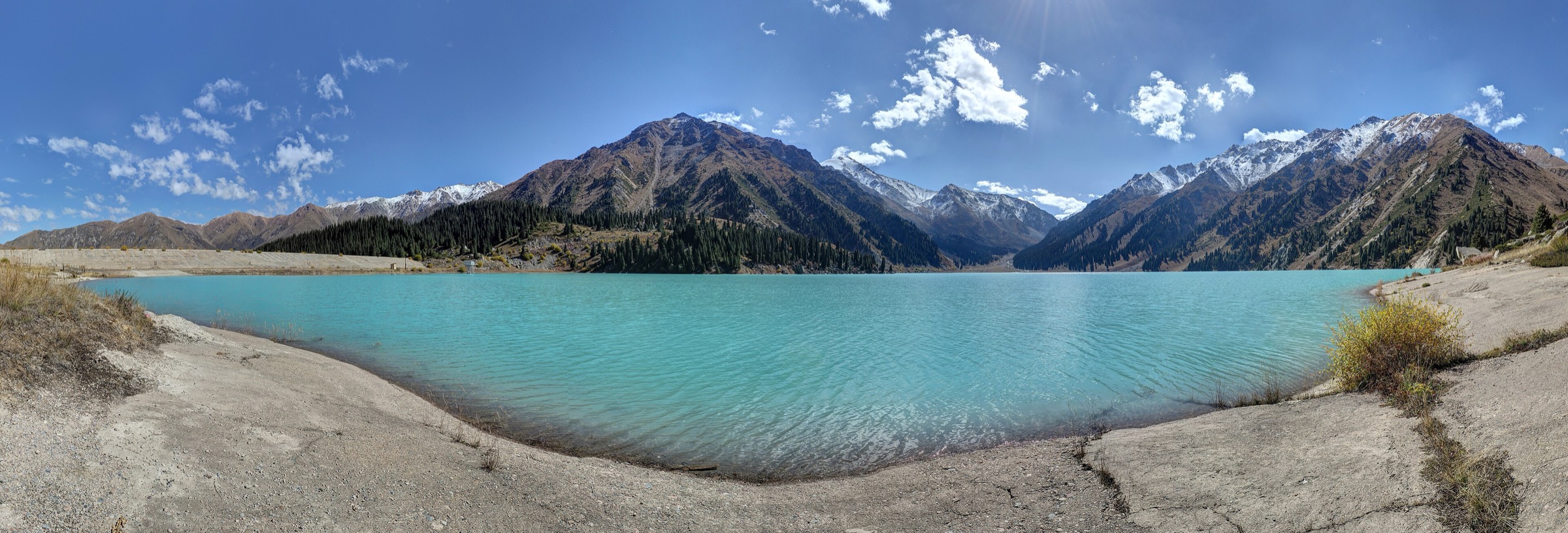
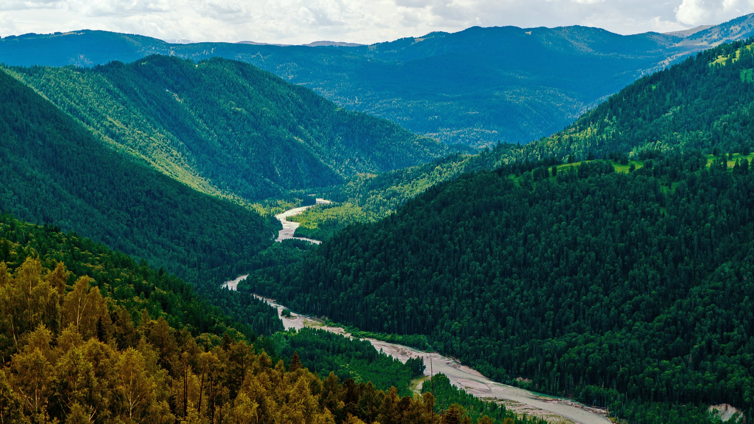
2. Lake Yazevoye / Karakol Belukha-view walk
Snapshot
Itinerary
The day objective is a local walk around Lake Yazevoye/Karakol and nearby viewpoints, using the lake as a Belukha-view destination rather than continuing onto the multi-day Belukha route. QazTravel notes that Belukha can be seen from Karakol/Yazevoe Lake, and Katon-Karagay local nature sources describe the lake as being on the main route toward Belukha, Kokkol waterfall and Kokkol mine.
Why it is essential
Lake Yazevoye is one of the iconic named lakes of Katon-Karagay and a practical Belukha-view landscape objective. It gives the region a classic Altai lake-and-snow-peak view without requiring a full expedition.
Equipment
Standard hiking equipment, warm layer, rain layer, water, food, sun protection, insect protection and navigation backup. Carry extra warm clothing even in summer.
Hazards and notes
Access roads, park permits and border-zone requirements should be checked locally. Longer routes from this area become multi-day trekking and should not be confused with the local day walk.
GPX / KML links
| Source | URL | Format / access | Reuse status |
|---|---|---|---|
| Katon-Karagay local nature page | katon-karagay.com | Source page | Site terms apply; place/route-context only |
| QazTravel — Land of waterfalls / Katon-Karagay | qaztravel.kz | Source page | Site terms apply; place/route-context only |
| Wikimedia Commons Yazevoye Lake category | commons.wikimedia.org | Source map / media category | Commons/OSM terms apply; source-map only |
External links
3. Rakhmanov Waterfall from Rakhmanov Lake
Snapshot
Itinerary
The walk starts near Rakhmanov Lake/Springs and follows the local route toward Rakhmanov Waterfall, which WildTicket places about 2 km from the lake. The route sits within the Rakhmanov Springs / Arasan valley landscape of Katon-Karagay National Park.
Why it is essential
Rakhmanov Springs is one of the best-known visitor bases in the Kazakh Altai. A short waterfall walk from the lake gives the catalogue a feasible day objective in an otherwise remote region.
Equipment
Standard hiking equipment: boots or grippy shoes, warm/rain layer, water, food, insect protection and navigation backup.
Hazards and notes
Check park permits, resort access, road conditions and current trail condition. Wet rocks and stream crossings may be slippery.
GPX / KML links
| Source | URL | Format / access | Reuse status |
|---|---|---|---|
| WildTicket Asia — Rakhmanov Waterfall | wildticketasia.com | Source page | Site terms apply; route description only, no GPX found |
| Central Asia Guide — Rakhmanov Springs | central-asia.guide | Source page | Site terms apply; place context only |
External links
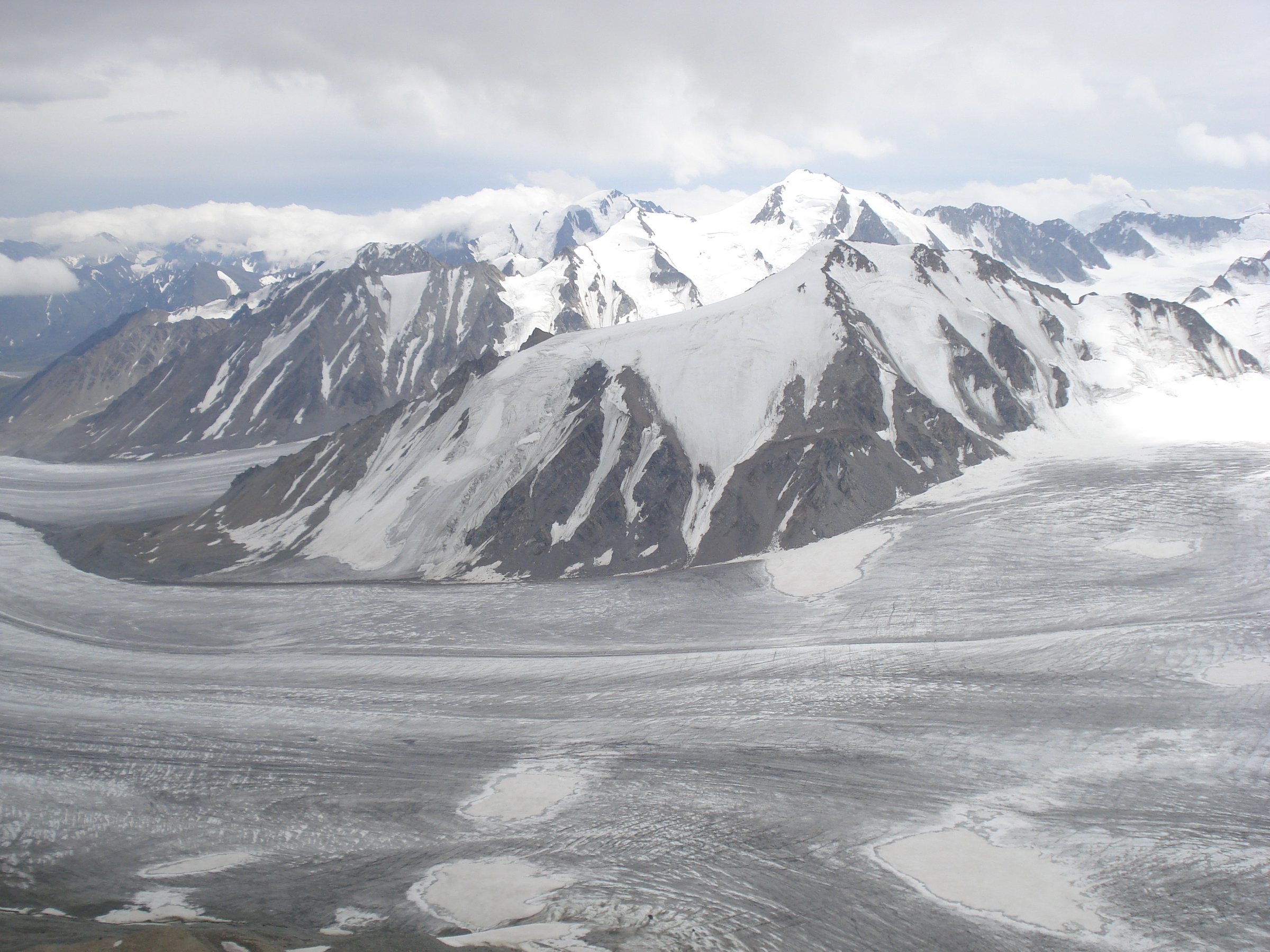
4. Kokkol Waterfall / Sarymsakty route section
Snapshot
Itinerary
Kokkol Waterfall is reached on the longer Sarymsakty/Belaya Berel route system from the Rakhmanov Springs area. QazTravel describes it as about 22 km one-way and says visitors should register with a tour group; WildTicket places Kokkol 23 km from Rakhmanovskie Klyuchi and notes the need for a national-park permit and route sheet. This is included as an essential Kazakh Altai waterfall objective but not as an easy independent day walk.
Why it is essential
Kokkol is repeatedly described as one of the major waterfalls of the Kazakh Altai and a key landmark on the Belukha-side route system. It is essential to the region, but the day-hike feasibility is conditional.
Equipment
Mountain hiking equipment: sturdy boots, trekking poles, warm/rain layers, headtorch, navigation backup, food and water. A guide, permit documents and possibly horse/vehicle logistics are recommended.
Hazards and notes
The route may be too long for a normal return day on foot. Border-zone/park permits, route-sheet requirements, remoteness, river conditions and weather must be confirmed locally. Mark as candidate until a verified day-hike variant is selected.
GPX / KML links
| Source | URL | Format / access | Reuse status |
|---|---|---|---|
| QazTravel — Land of waterfalls / Kokkol | qaztravel.kz | Source page | Site terms apply; route description only |
| WildTicket Asia — Kokkol Waterfall | wildticketasia.com | Source page | Site terms apply; route description/permit context only |
| KazMAB Katon-Karagay Biosphere Reserve brochure | kazmab.kz | PDF source | Publisher terms apply; route-complex context only |
External links
- QazTravel — Land of waterfalls
- WildTicket Asia — Kokkol Waterfall
- KazMAB — Katon-Karagay Biosphere Reserve brochure (PDF)
5. Radon Lake from Poperechnoye
Snapshot
Itinerary
The route begins from Poperechnoye and follows the old geologists’ road toward Radon Lake, also called Podbelkovoye Lake. QazTravel describes the lake as about 30 km from Ridder and 11 km from Poperechnoye. The lake’s colour and origin are linked to water flowing from an abandoned mining adit.
Why it is essential
Radon Lake provides a western Kazakh Altai/Ridder-area hike, extending the selection beyond Katon-Karagay. It is a recognised East Kazakhstan mountain-lake destination with a clear official tourism source.
Equipment
Mountain hiking equipment: sturdy boots, water, food, rain/warm layer, sun protection, insect protection and navigation backup. Trekking poles are useful on road and rough-track sections.
Hazards and notes
Exact elevation gain and walking statistics remain unresolved. Road access may shorten the walking distance, while a full village-to-lake return is a long day. Mining-adit water and radon/mineral claims should not be treated as a safe drinking-water source.
GPX / KML links
| Source | URL | Format / access | Reuse status |
|---|---|---|---|
| QazTravel — Radon Lake | qaztravel.kz | Source page | Site terms apply; route description only |
| Wikiloc — Poperechnoye loop | wikiloc.com | Source route / downloadable trail for users | Wikiloc terms apply; nearby Poperechnoye route, not verified as Radon Lake route |
| Visit East Kazakhstan — Rybnoye Lake | visiteast.kz | Source page | Site terms apply; area context for Ridder/Ivanovsky lake hikes |