.jpg)
.jpg)


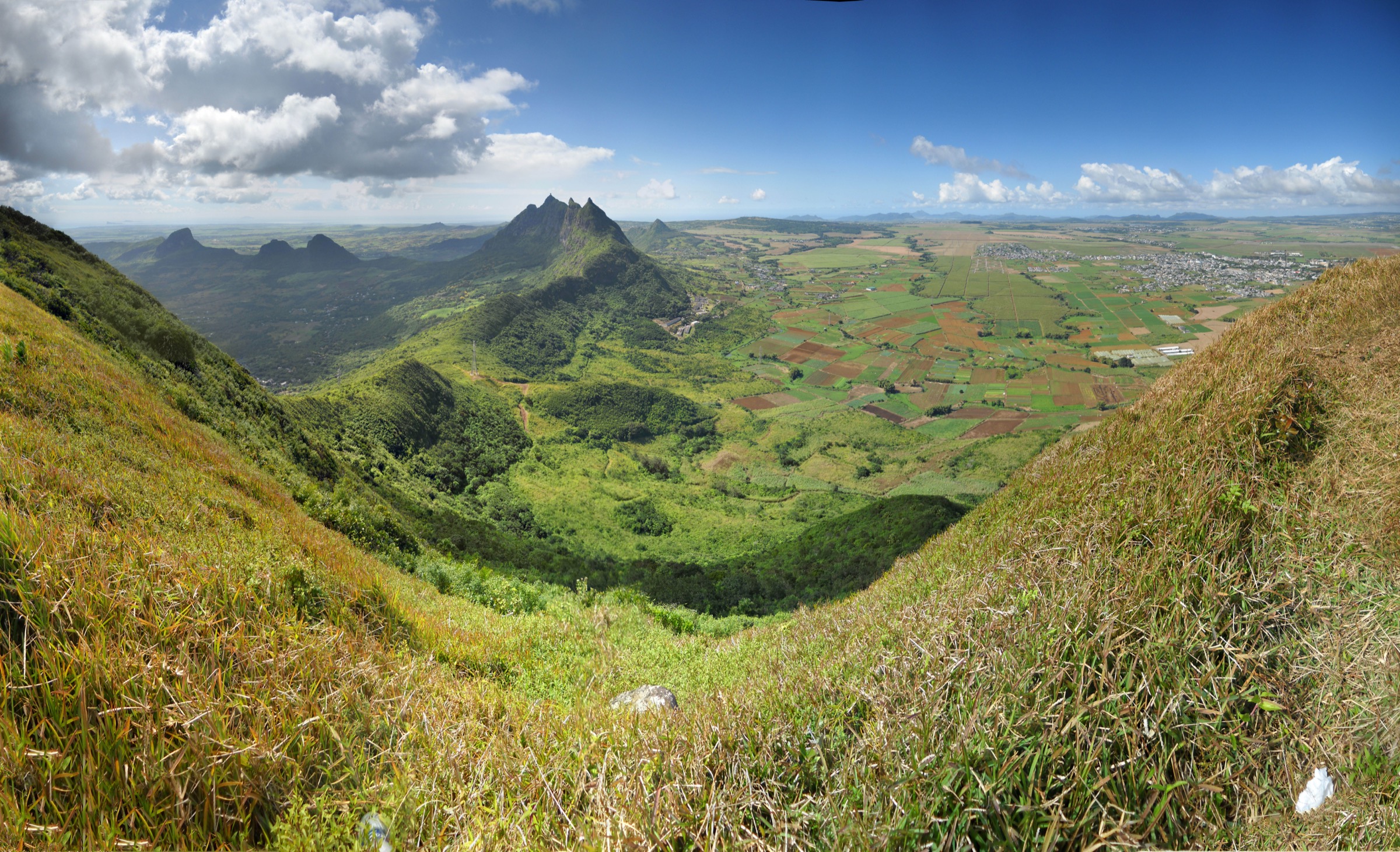
Regional overview
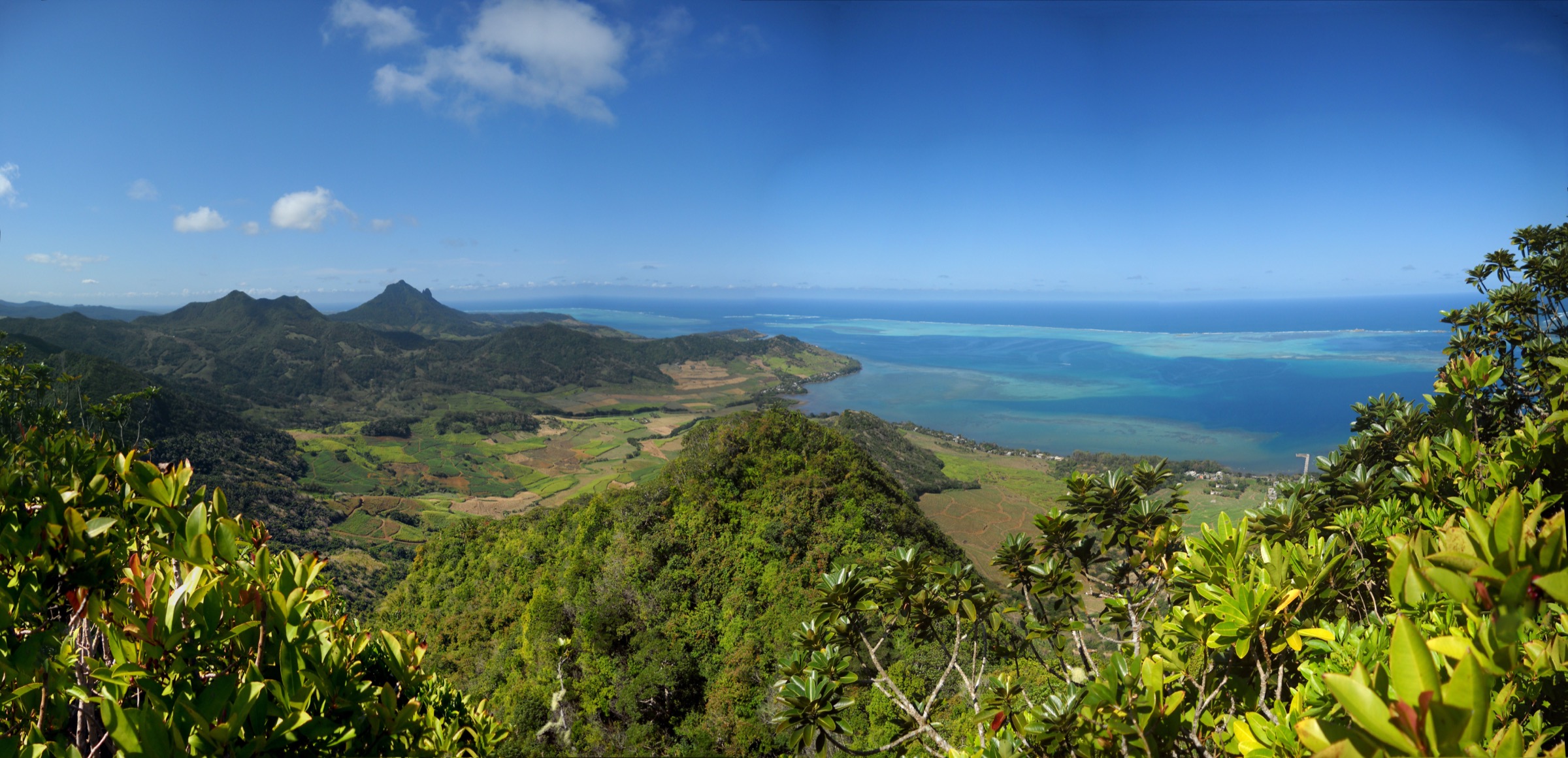
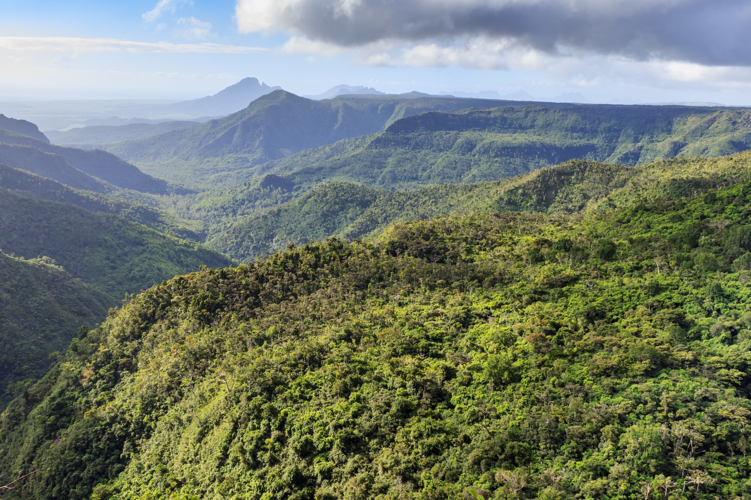
The Moka Range forms a curving line of basalt peaks across the centre-north of Mauritius, wrapped in a rough semicircle around the capital, Port Louis. It was raised from a basalt lava dome roughly ten million years ago and now carries two of the three highest summits on the island: Pieter Both at about 820 m and Le Pouce at 812 m, only narrowly shorter than Piton de la Petite Rivière Noire in the Black River range. Other named peaks of the chain include Junction Peak, Berthelot Peak, Guiby Peak, Mont Ory, Crève Coeur Mountain, and Mount Jacob. The terrain is volcanic, often steep, and densely vegetated on the lower slopes, with rocky knife-edged crests and pinnacles on the upper sections.
The main hiking bases sit at the foot of the range. Petit Verger near Saint-Pierre is the standard approach for Le Pouce; La Laura, on the southern flank, gives access to Pieter Both; the Bagatelle/Moka side carries the routes to Junction Peak and the inner ridges of the range; Port Louis itself is the start for the short walk-up to the Citadel (Fort Adelaide); and the village of Crève Coeur, north of Pieter Both, opens onto Mount Jacob, Virgin Peak and the Pamplemousses-side ridges. Most trailheads are reached by private vehicle or local transfer; public buses serve the main towns, with a short taxi or walk to the trailhead.
Best conditions are the cool, drier southern winter from around May to October. Cyclone season runs roughly November to April and can bring violent storms, sudden rainfall and dangerously slick rock on exposed sections. The Moka Range is small but exposed, with steep finishes, narrow ridges, and several routes that require short scrambles, ropes, or via-ferrata-style spikes. Pieter Both is the clearest example: the climb to the shoulder is a strenuous walk, but the final boulder requires technical climbing on fixed iron spikes and is not a hike.
Selection rationale
The five entries cover the regional icon (Le Pouce), the alternative iconic summit framed conservatively at the shoulder (Pieter Both), a third Moka summit with broader Moka ridge views (Junction Peak), the classic historic viewpoint above Port Louis (Citadel / Fort Adelaide), and a lower-mountain forest-ridge walk on the northern flank (Crève Coeur to Mount Jacob and Virgin Peak). They spread across five different trailheads and four character types: classic summit walk, scrambling approach to an iconic landmark, off-trail ridge summit, short urban viewpoint walk, and forest-ridge tour. Strict technical climbs (the Pieter Both summit boulder) are excluded.
Summary table
| # | Hike | Country | Route type | Distance | Gain | Max elevation | Difficulty |
|---|---|---|---|---|---|---|---|
| 1 | Le Pouce via Petit Verger | Mauritius | Out-and-back | 4.5 km | 412 m | 812 m | Moderate |
| 2 | Pieter Both to the shoulder from La Laura | Mauritius | Out-and-back | 5 km | 600 m | 750 m | Hard (scrambling) |
| 3 | Junction Peak from the Bagatelle/Moka side | Mauritius | Out-and-back | 4-6 km | 400-500 m | 691 m | Hard (route-finding) |
| 4 | Citadel (Fort Adelaide) walk-up | Mauritius | Out-and-back | 1.5 km | 80 m | 100 m | Easy |
| 5 | Crève Coeur to Mount Jacob and Virgin Peak | Mauritius | Out-and-back | 5-7 km | 300-400 m | 360 m | Moderate |
1. Le Pouce via Petit Verger
Snapshot
Itinerary
The route leaves the free Le Pouce Road car park above Petit Verger, follows a clearly marked path through sugar-cane fields and patches of forest onto open grassy slopes, and traces the upper ridge to the base of the distinctive thumb-shaped summit block. The last short pitch climbs the rocky pinnacle to the 812 m top; descent is on the same line. A longer alternative route approaches the same summit from Port Louis on the north side and is significantly more demanding.
Why it is essential
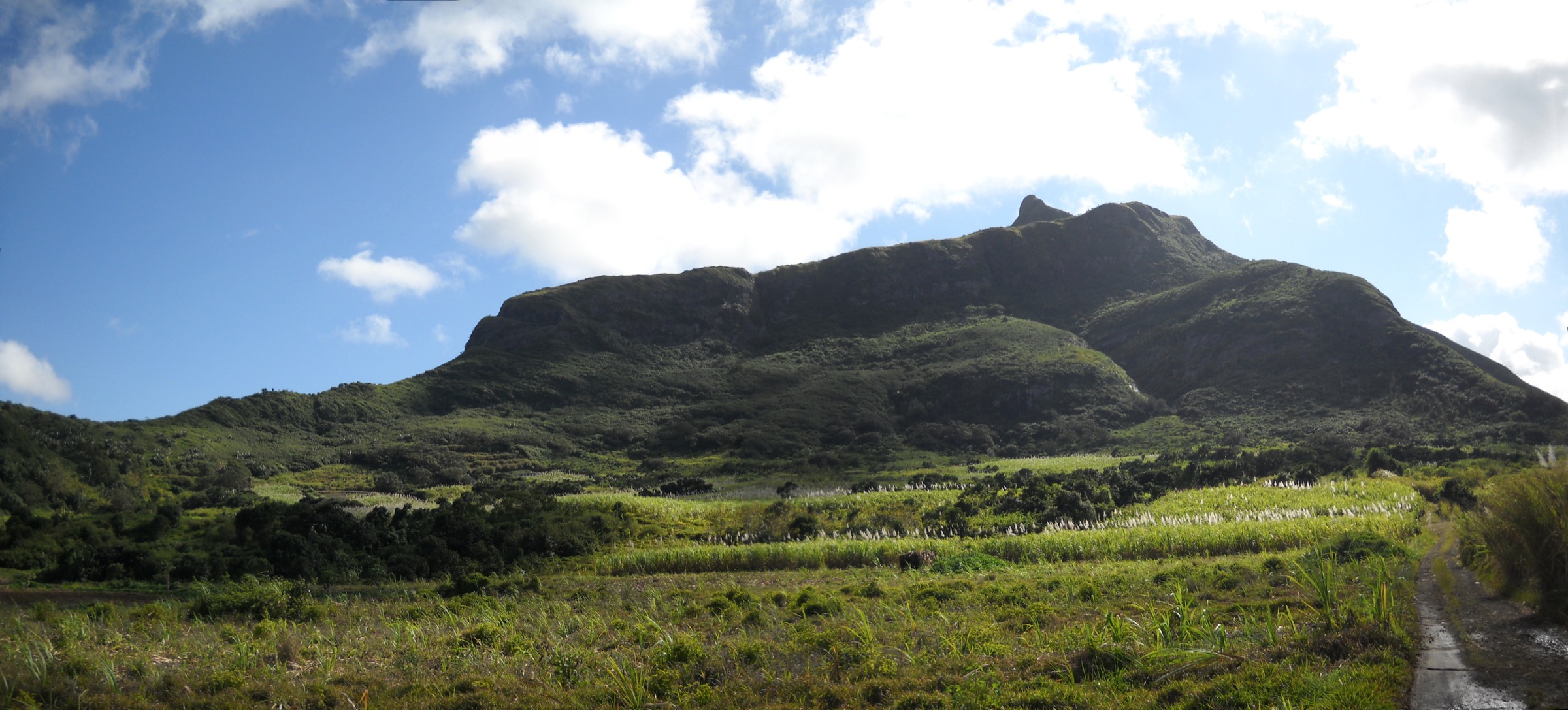
Le Pouce is the most recognisable peak in the Moka Range and the third highest in Mauritius, and gives the defining island panorama that takes in Port Louis, Pieter Both, Moka, Beau Bassin-Rose Hill, the central plateau and a long arc of coastline. Charles Darwin climbed it in May 1836 during the Beagle voyage.
Equipment
Standard hiking kit: sturdy shoes, warm and waterproof layers, sun protection, water, snacks. No technical equipment required for the Petit Verger route.
Hazards and notes
The final pitch onto the thumb is short but steep and exposed; it can be slick after rain and is unsafe in storm conditions. Sun exposure is significant on the upper ridge. The trailhead is not well signposted on the road network.
GPX / KML links
| Source | URL |
|---|---|
| AllTrails: Le Pouce Trail (Port Louis area) | alltrails.com |
| Wikiloc: Le Pouce Trail | wikiloc.com |
| Hiking Project: Le Pouce Southern Route | hikingproject.com |
External links
2. Pieter Both to the shoulder from La Laura
Snapshot
Itinerary
The trail starts at the La Laura Top Rank Sport and Environment Club, near a football ground at the southern foot of the mountain, and climbs through covered, gradually steepening forest to a first easy boulder. Beyond that, a second technical boulder, slick after rain, is normally aided by a fixed rope. The path continues up the steep flank to the shoulder, the broad rocky platform immediately below the summit pinnacle. The shoulder is the natural turn-around for hikers: the final dome above is a nine-metre boulder rigged with several iron spikes and is technical climbing terrain, not a walk, and requires ropes and supervision.
Why it is essential
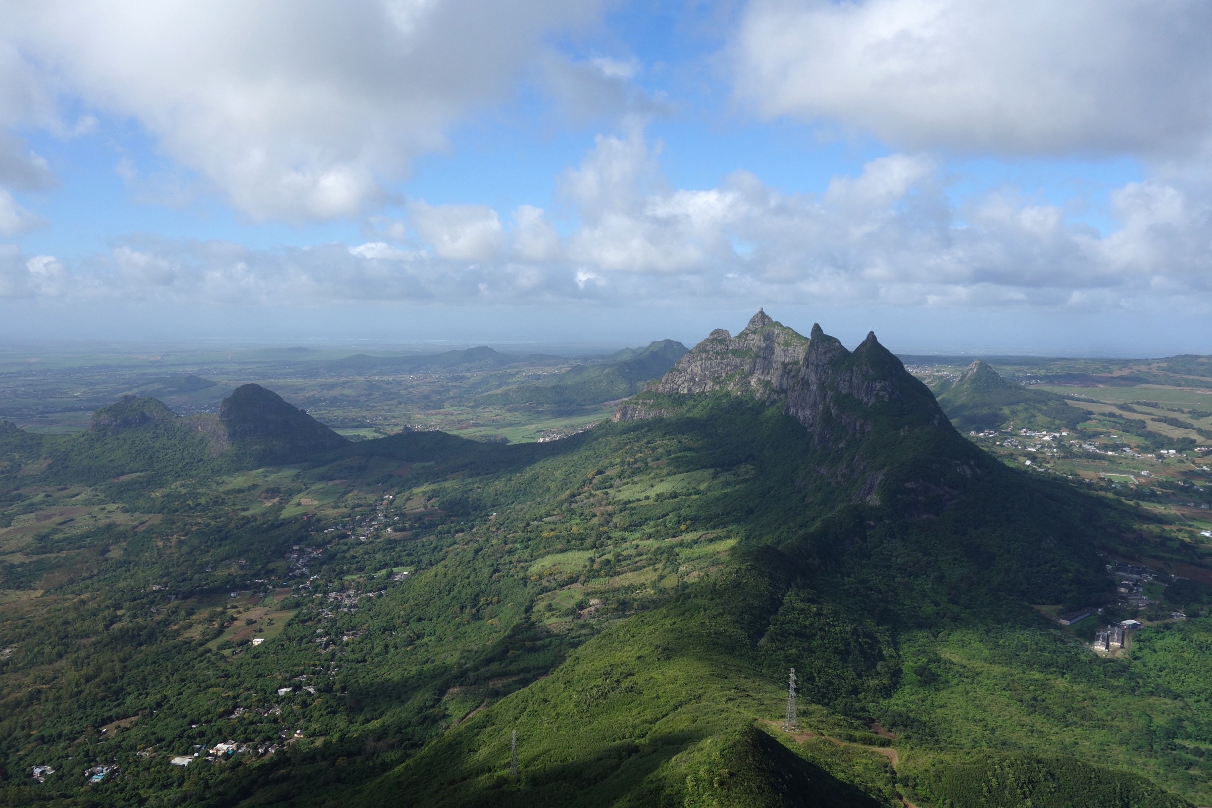
Pieter Both is the second-highest mountain in Mauritius and its most distinctive silhouette, recognisable across the central plateau by the round head-shaped boulder at the top. The walk to the shoulder gives the defining close view of that boulder, broad outlooks over Moka, Port Louis and the north coast, and a strong sense of the volcanic structure of the range.
Equipment
Mountain hiking gear with sturdy boots and trekking poles; gloves are useful for the rope-assisted boulder. A helmet is sensible. Do not attempt the final summit boulder without proper climbing equipment and a competent leader; that section is outside the scope of this catalogue entry.
Hazards and notes
The route is steep, exposed in places, and serious in wet conditions: the technical boulder partway up is described as extremely slippery in rain. The final summit pinnacle is a climbing objective, not a hike, and should not be confused with the shoulder turnaround. The mountain is in a public area with no formal permit, but a local guide is strongly advised for first-time visitors; several Mauritian operators run the route.
GPX / KML links
| Source | URL |
|---|---|
| Wikiloc: Pieter Both mountain track | wikiloc.com |
| Moka Smart City — Climbing Pieter Both Mountain | moka.mu |
External links
- Wikipedia — Pieter Both (mountain)
- Mauritius Attractions — Pieter Both Mountain Hiking Adventure
- Take Your Backpack — Pieter Both Hike Guide
3. Junction Peak from the Bagatelle/Moka side
Snapshot
Itinerary
The standard approach climbs from the Bagatelle/Moka side of the range onto the central Moka ridge, with route-finding through forest and dense vegetation onto open rock near the summit. There is no consistently clear waymarked path to the top; several local users have published variants on Wikiloc. The summit, the fifth-highest peak in the Moka cluster at 691 m, gives a broad panorama over the inner range, with Le Pouce and Pieter Both on either side and Berthelot Peak about 1.7 km away on the same ridge. A longer Moka Mountain Ridge Traverse links Guiby Peak, Berthelot Peak and Junction Peak in a single more demanding day for experienced parties.
Why it is essential
Junction Peak is the practical third Moka summit choice: less famous than Le Pouce or Pieter Both but giving the clearest interior view of the chain itself, including the ridge linking Guiby, Berthelot and Junction. It is the natural alternative summit for repeat visitors who have already done the two iconic peaks.
Equipment
Mountain hiking gear plus long trousers and sturdy boots for the bushwhack sections; trekking poles and gloves useful. Carry a phone-based GPS track from a recent Wikiloc upload and turn around in deteriorating weather.
Hazards and notes
The line is described in user trip reports as poorly marked with significant bushwhacking, lianas and short rocky steps near the summit. Hiring a local guide is strongly recommended for first-time visitors. Cell coverage is variable; avoid attempting in mist or after recent heavy rain.
GPX / KML links
| Source | URL |
|---|---|
| Wikiloc: Junction Peak Trail | wikiloc.com |
| Wikiloc: Moka Mountain Ridge Traverse (Guiby-Berthelot-Junction) | wikiloc.com |
| Gaia GPS: Junction peak trail | gaiagps.com |
External links
4. Citadel (Fort Adelaide) walk-up
Snapshot
Itinerary
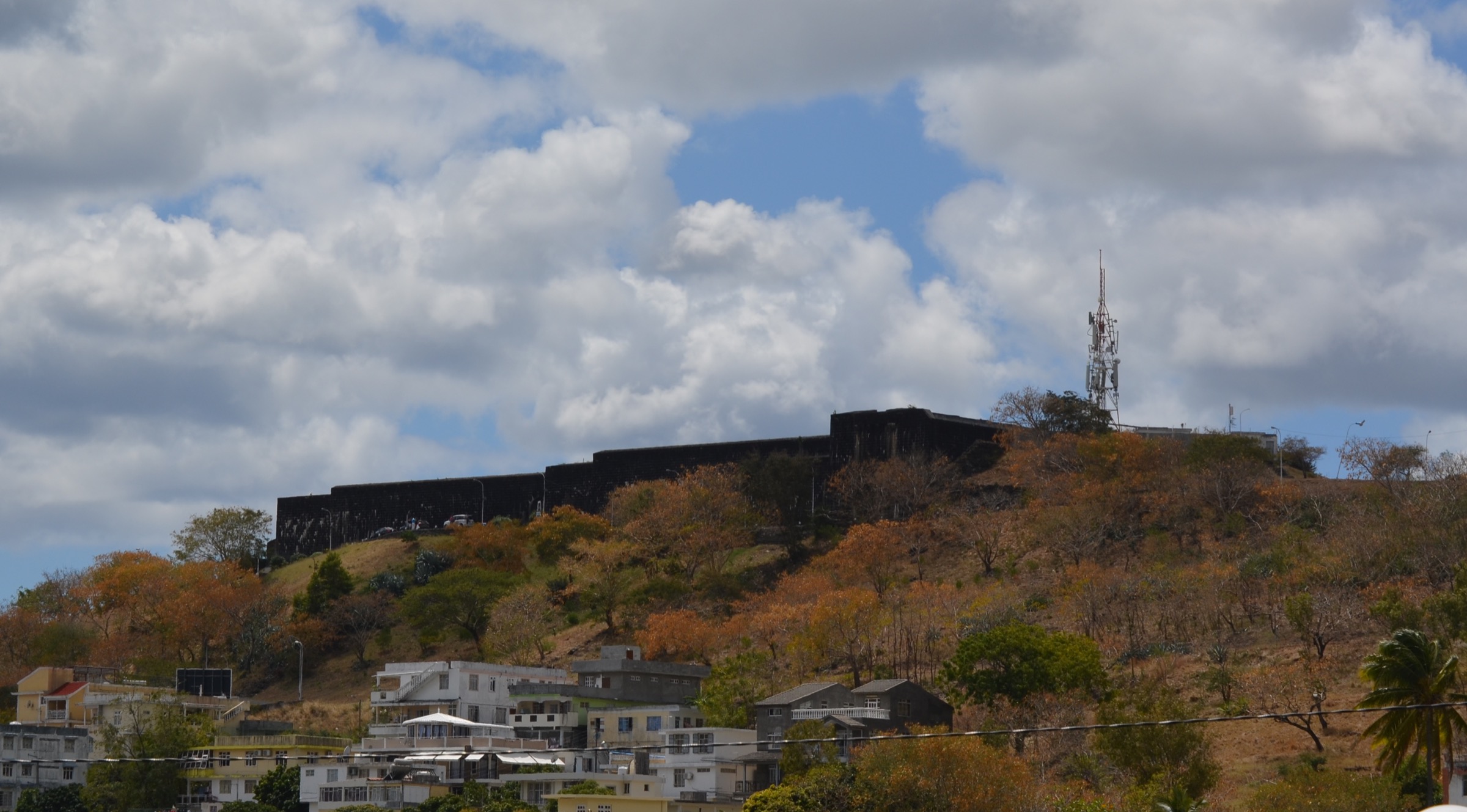
The walk leaves the Port Louis city centre and climbs the steep paved approach via Rue Sébastopol onto the Petite Montagne hill, reaching the gates of Fort Adelaide in around 20-30 minutes. From there, a tour of the ramparts, soldiers’ quarters and cannons gives an open 360-degree view over the harbour, the Champ de Mars racecourse, the city, the Moka Range to the south and the open Indian Ocean as far as Coin de Mire. The return is by the same route.
Why it is essential
The Citadel is the historic viewpoint of the Moka-Port Louis frontline and the most accessible high vantage in the whole range. Construction began in 1834 and was completed in 1840 under British colonial administration, and the fort takes its formal name from Queen Adelaide, wife of William IV. As a short, low-commitment leg-stretcher it complements the bigger summits in this catalogue and gives the standard orientation view of the chain.
Equipment
Light city walking gear: comfortable shoes, sun protection, water. The ramparts have uneven surfaces; flat shoes are sensible.
Hazards and notes
Heat is the main hazard on the uphill section; midday temperatures in summer are significant. The fort is free to visit but gates have published opening hours; check locally before travel. Take normal city-centre precautions for valuables.
GPX / KML links
| Source | URL |
|---|---|
| OpenStreetMap — Fort Adelaide (node) | openstreetmap.org |
External links
- Ile Maurice — Port-Louis: La Citadelle / Fort Adelaide
- Mauritius Attractions — Fort Adelaide
- Wikimedia Commons — Port Louis, Fort Adelaide
5. Crève Coeur to Mount Jacob and Virgin Peak
Snapshot
Itinerary
The route leaves the village of Crève Coeur on the northern flank of the Moka Range, follows a fairly clear track marked in red paint on tree trunks, and climbs through forest in about one hour to the small summit of Mount Jacob. From Mount Jacob the path continues a short distance to Virgin Peak (the second peak on the ridge) and, for stronger parties, beyond to Cantin Peak. The terrain is forested with dense vegetation in places and short technical steps on the extension.
Why it is essential
The Crève Coeur ridge is the easiest way to sample the lower, forested character of the Moka Range without committing to one of the high summits. It gives the closest views of the back side of Pieter Both, opens onto the Montagne Longue/Vallée des Prêtres area, and provides a balanced day for a party that does not want a steep, exposed summit walk.
Equipment
Standard hiking kit and sturdy boots; long trousers help with vegetation. Carry a recent GPS track from Wikiloc, as paint markings can fade between the named tops.
Hazards and notes
The first section to Mount Jacob is straightforward in dry conditions; the Virgin Peak/Cantin Peak extension is moderate to hard and has technical sections that become slippery after rain. Carry water; there are no reliable sources on route. Mobile coverage is patchy in the forest sections.
GPX / KML links
| Source | URL |
|---|---|
| Wikiloc: Crève Coeur - Mount Jacob - Virgin Peak | wikiloc.com |
| Wikiloc: Crève Coeur - Mount Jacob - Virgins Peak - Cantin Peak | wikiloc.com |
External links
External links
| Source | URL |
|---|---|
| Wikipedia — Moka Range | en.wikipedia.org |
| Wikipedia — Le Pouce | en.wikipedia.org |
| Wikipedia — Pieter Both (mountain) | en.wikipedia.org |
| Wikipedia — Creve Coeur, Mauritius | en.wikipedia.org |
| Moka Smart City — Climbing Pieter Both Mountain | moka.mu |
| Moka Smart City — Hike Moka Mountain Range | moka.mu |
| Ile Maurice — Port-Louis: Fort Adelaide / La Citadelle | ilemaurice.im |
| Mauritius Attractions — Pieter Both Mountain Hiking Adventure | mauritiusattractions.com |
| Mauritius Attractions — Fort Adelaide | mauritiusattractions.com |
| Mauritius Attractions — 10 Most Beautiful Mountains in Mauritius | mauritiusattractions.com |
| Heritage Resorts — Mountains of Mauritius | heritageresorts.mu |
| Heritage Resorts — Trails and Hiking | heritageresorts.mu |
| Explore Mauritius — Le Pouce | exploremauritius.org |
| Explore Mauritius — Pieter Both | exploremauritius.org |
| AllTrails — Le Pouce Trail | alltrails.com |
| AllTrails — Port-Louis to Le Pouce | alltrails.com |
| AllTrails — Best hikes and trails in Moka | alltrails.com |
| Wikiloc — Le Pouce Trail | wikiloc.com |
| Wikiloc — Pieter Both mountain track | wikiloc.com |
| Wikiloc — Junction Peak Trail | wikiloc.com |
| Wikiloc — Moka Mountain Ridge Traverse | wikiloc.com |
| Wikiloc — Crève Coeur - Mount Jacob - Virgin Peak | wikiloc.com |
| PeakVisor — Junction Peak | peakvisor.com |
| Peakery — Junction Peak | peakery.com |
| Peakery — Mount Jacob | peakery.com |