Regional overview
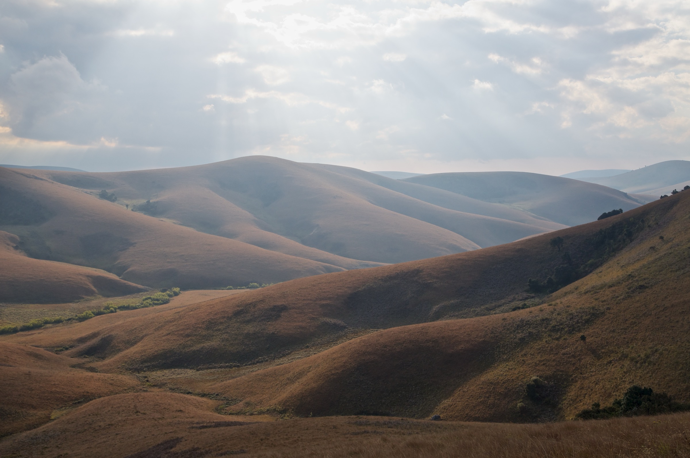
The Viphya Mountains (also Viphya Plateau or Viphya Highlands) form a long, granite-cored upland running roughly 210 km north-northeast along the western shore of Lake Malawi, between the towns of Kasungu in the south and the South Rukuru valley in the north. The range is split by a lower saddle of hills, on whose western slope the city of Mzuzu sits and across which the M5 highway connects to Nkhata Bay. The southern (or South Viphya) portion is a broad rolling plateau between roughly 1,500 m and 1,800 m, while the more dissected North Viphya culminates at Mount Chimaliro (2,050 m), Mount Uzumara (1,920 m) and Mount Champhila (1,768 m). The geology is dominated by ancient Precambrian basement gneiss and granite, weathered into long ridges, scattered inselbergs and steep eastern escarpments.
Most of the southern plateau lies inside the South Viphya Forest Reserve (gazetted 1948, ~1,148 km²) and the overlapping Viphya Plantation, a 53,000-hectare planted forest established from 1964 onwards as one of the largest single softwood plantings in Africa. The plantation is mostly Mexican weeping pine (Pinus patula) but encloses three small enclaves of native evergreen montane forest at Nthungwa, Chamambo and Kawandama (all between 1,600 m and 1,850 m), as well as extensive remnants of Brachystegia miombo woodland. Further north, the smaller Uzumara, Lunyangwa, Kaning’ina, Mtangatanga, Perekezi, Chimaliro and Dwambazi reserves protect montane rainforest patches and miombo on both flanks of the range.
The main hiking centre is Luwawa Forest Lodge, beside Luwawa Dam in the South Viphya Forest Reserve, about 65 km south of Mzuzu and 7 km off the M1. The lodge maintains the only marked day-trail network on the plateau, ranging from one to five hours, plus a multi-day Wilderness Trail descending the Rift Valley escarpment to Lake Malawi via Kawandama Mountain. Other hiking is informal and guide-led: the inselbergs of Elephant Rock and Mount Hora near Chikangawa and Mzimba, and the montane forest of Uzumara above the Rumphi road in the north. The reliable walking season runs from May to October, with June-August driest and coolest. The Viphya is malaria-suppressed at altitude but mosquitoes are present below about 1,500 m and at the lake shore. Signage is minimal away from Luwawa, and the plantation forest tracks form a dense maze in which navigation without a guide or GPX is difficult. Many of the most evocative hikes traverse working logging country, and visitors should be aware of timber traffic on the main forest tracks.
Access from the south is via the M1 from Kasungu (Kasungu-Luwawa turn-off about 2 h 30); from the north via Mzuzu (Mzuzu-Luwawa about 1 h 30; Mzuzu-Uzumara about 1 h via the Rumphi road, S85). Public transport along the M1 is plentiful in the form of minibuses and coaches, but reaching trailheads from the main road normally requires a private vehicle or a Luwawa Forest Lodge transfer. Lake Malawi escarpment routes ending at Kande Beach involve point-to-point logistics best arranged through the lodge.
Selection rationale
The five hikes below were chosen to represent the geographic and ecological breadth of the Viphya while remaining feasible as single days. The Luwawa Dam loop and forest trail is the standard short introductory walk from Luwawa Forest Lodge, the most accessible window on the planted pine and indigenous mosaic. The Luwawa Gorge Walk is the lodge’s marked “adventurous” option, with the only easily reached running-water gorge on the southern plateau. The Kawandama Mountain ascent is the highest accessible summit walked as a day from the Luwawa side, on the rim of the Rift Valley escarpment with panoramic Lake Malawi views. Elephant Rock at Chikangawa is the most iconic inselberg viewpoint of the Viphya, just off the M1 and the standard short adventure for travellers between Mzuzu and Kasungu. The Uzumara Forest Reserve walk is the only practical day-walk into intact North Viphya montane rainforest, the floristic counterweight to the planted southern plateau.
Manchewe Falls is in Livingstonia (Rumphi District, above the Lake Malawi escarpment) and outside the Viphya range, so it is not included. Mount Chimaliro at 2,050 m is the overall highest point of the range, but no published or reliably guided walking route to its summit was located in this research pass; it has therefore been left out in favour of Kawandama (~2,000 m), for which the route from Luwawa is well-documented as the first day of the four-day Kachere Kastle Trail.
Summary table
| # | Hike | Country | Route type | Distance | Gain | Max elevation | Difficulty |
|---|---|---|---|---|---|---|---|
| 1 | Luwawa Dam loop and forest trail | Malawi | Loop | ~6-8 km | ~150 m | ~1,720 m | Easy |
| 2 | Luwawa Gorge Walk | Malawi | Out-and-back / lollipop | ~10-12 km | ~300-400 m | ~1,750 m | Moderate |
| 3 | Kawandama Mountain ascent | Malawi | Out-and-back | ~16-20 km | ~500-600 m | ~2,000 m | Strenuous |
| 4 | Elephant Rock (Chikangawa) | Malawi | Out-and-back with summit scramble | ~3-5 km | ~80-120 m | ~1,610 m | Easy-Moderate |
| 5 | Uzumara Forest Reserve walk | Malawi | Out-and-back / loop | ~6-10 km | ~250-400 m | ~1,920 m | Moderate |
1. Luwawa Dam Loop and Forest Trail

Snapshot
Itinerary
From Luwawa Forest Lodge the route follows the marked path along the lodge frontage to the earth dam wall, then turns east around the southern shore of Luwawa Dam through a band of indigenous miombo woodland and high grassland. After roughly 1.5 km the loop crosses a small inflow stream on logs and stepping stones and climbs gently onto a low ridge of Pinus patula plantation that gives long views back across the water to the lodge. The northern arm of the dam is followed back through plantation forest interrupted by small clearings of grassland and wetland, before rejoining the lodge access track at the dam wall. Walkers who want a longer day commonly add the marked Luviri loop, a quiet plantation circuit which extends the day to about 8 km and shares its trailhead with the lodge mountain-bike network.
Why it is essential
This is the only signed, lodge-maintained short circuit on the entire South Viphya plateau, and it serves as the standard introduction to the Viphya for the great majority of overnight visitors. It packages together the three landscapes that define the southern range — open plantation, indigenous miombo, and the dam wetland — in a half-day from a single base. For travellers who cannot commit a full day to the plateau, this is the representative experience.
Equipment
Standard hiking equipment: light shoes are adequate (no boots required), insect repellent for mosquitoes near the dam after dusk, sun protection for the open dam wall and grassland sections, and light binoculars for birding.
Hazards and notes
The dam is used by lodge guests for swimming and canoeing; the eastern shore can be muddy after rain. Plantation tracks branch frequently; walkers without a guide should pick up the lodge’s printed route map at reception. Bilharzia status of Luwawa Dam is not confirmed in any cited source; lodge advice should be sought before swimming. The walk passes through actively managed plantation; occasional logging traffic on the access tracks.
GPX / KML links
| Source | URL | Format / access | Reuse status |
|---|---|---|---|
| OpenStreetMap (Luwawa Dam and lodge tracks) | openstreetmap.org near Luwawa | OSM data (ODbL) | Geometry usable; no curated trail relation |
| Route-file status | Luwawa Forest Lodge provides a printed map at reception; no downloadable GPX | Unresolved | Unresolved |
External links
- Luwawa Forest Lodge — Activities
- Malawi Tourism — Luwawa Forest Lodge
- Malawi Tourism — Viphya Plateau
2. Luwawa Gorge Walk
Snapshot
Itinerary
From Luwawa Forest Lodge the marked Gorge route runs westward across the dam outflow and climbs a low ridge of mixed plantation and miombo. After about an hour the path drops into the upper catchment of one of the small rivers that incises the plateau edge, with the marked descent steepening as the gorge tightens. The lodge identifies this section as the “seriously adventurous” option among its marked walks, with sections of scrambly path along rock outcrops and views down into a wooded gorge that holds remnant indigenous broadleaf forest. The route normally turns at a viewpoint above the gorge cliffs before retracing the line back to the lodge; some parties extend by descending to a small pool at the gorge base, which adds steep ground in both directions.
Why it is essential
This is the only formally marked Viphya day-walk that breaks out of the rolling plateau and into the broken terrain of the escarpment, giving a sense of the dramatic relief that elsewhere in the range is only reached on the multi-day Kachere Kastle wilderness trail. Among the marked routes from Luwawa it is also the only one to combine indigenous forest, exposed rock, and running water within a single day.
Equipment
Mountain hiking equipment: sturdy boots with good grip (rock can be slippery when damp), trekking poles recommended on the descent, long trousers for thick undergrowth in the gorge, 2 L of water (no treated water on route), and a headtorch for long days in shoulder season.
Hazards and notes
A lodge guide is strongly recommended; route-finding inside the gorge is not trivial. Slippery rock and steep ground near the gorge edge. Stream crossings can become impassable for short periods after storms in October-November. The marked terminus and any rope-assisted sections vary between seasons; check current conditions at reception.
GPX / KML links
| Source | URL | Format / access | Reuse status |
|---|---|---|---|
| OpenStreetMap (some forest tracks digitised) | openstreetmap.org near Luwawa | OSM data (ODbL) | Gorge path not represented |
| Route-file status | No published GPX located | Unresolved | Unresolved |
External links
3. Kawandama Mountain Ascent (from Luwawa)

Snapshot
Itinerary
The route starts on the same plantation tracks as the Dam loop, then turns south-east onto the line of the four-day Kachere Kastle Wilderness Trail. After a steady climb through mixed plantation and remnant indigenous forest the path emerges onto the open Kawandama ridge, which forms the eastern edge of the South Viphya plateau and the rim of the Great Rift Valley escarpment. The ridge gives wide views east over Lake Malawi and the descent route used by the multi-day trail, and west back across the planted plateau. The Kawandama summit at around 2,000 m is reached after a final pull through tall grass and montane vegetation. Day-walkers retrace the same line back to the lodge; through-walkers continue east, descending the escarpment by poachers’ paths over the next three days to Kande Beach on Lake Malawi.
Why it is essential
Kawandama is the highest point on the South Viphya plateau itself and the only summit on the southern plateau that can realistically be reached from Luwawa Forest Lodge in a single day. The ridge crest is also the only easily walked vantage on the entire 210 km Viphya range that combines an outlook over the planted plateau and a head-on view of the Rift Valley escarpment and Lake Malawi. The route is documented as the first day of the lodge’s signature multi-day trail, so its line is the best supported of any summit-day walk on the plateau.
Equipment
Mountain hiking equipment: sturdy boots with grip on grass and damp roots, trekking poles strongly recommended, extra warm and windproof layers (the open ridge above 1,900 m is exposed to cold wind even in winter), a headtorch (real risk of finishing in the dark in shoulder season), 2.5 L of water (no reliable refill above the plantation belt), sun protection for the open ridge, and a lodge guide.
Hazards and notes
A Luwawa Forest Lodge guide is recommended for any party not already familiar with the route; navigation off-line in the plantation maze is genuinely difficult. The eastern side of the ridge is steep and unguarded; care needed in mist. Tall grass on the upper ridge can hide trip hazards and snakes; gaiters useful in October. The lodge runs the route as either a guided day or as the first day of the four-day Kachere Kastle Trail; check trail status with the lodge before departure.
GPX / KML links
| Source | URL | Format / access | Reuse status |
|---|---|---|---|
| OpenStreetMap (plantation tracks only) | openstreetmap.org near Kawandama | OSM data (ODbL) | Summit-side path not currently mapped |
| Route-file status | Wikiloc Malawi index returned no published track for Kawandama | Unresolved | Unresolved |
External links
4. Elephant Rock (Chikangawa)
Snapshot
Itinerary
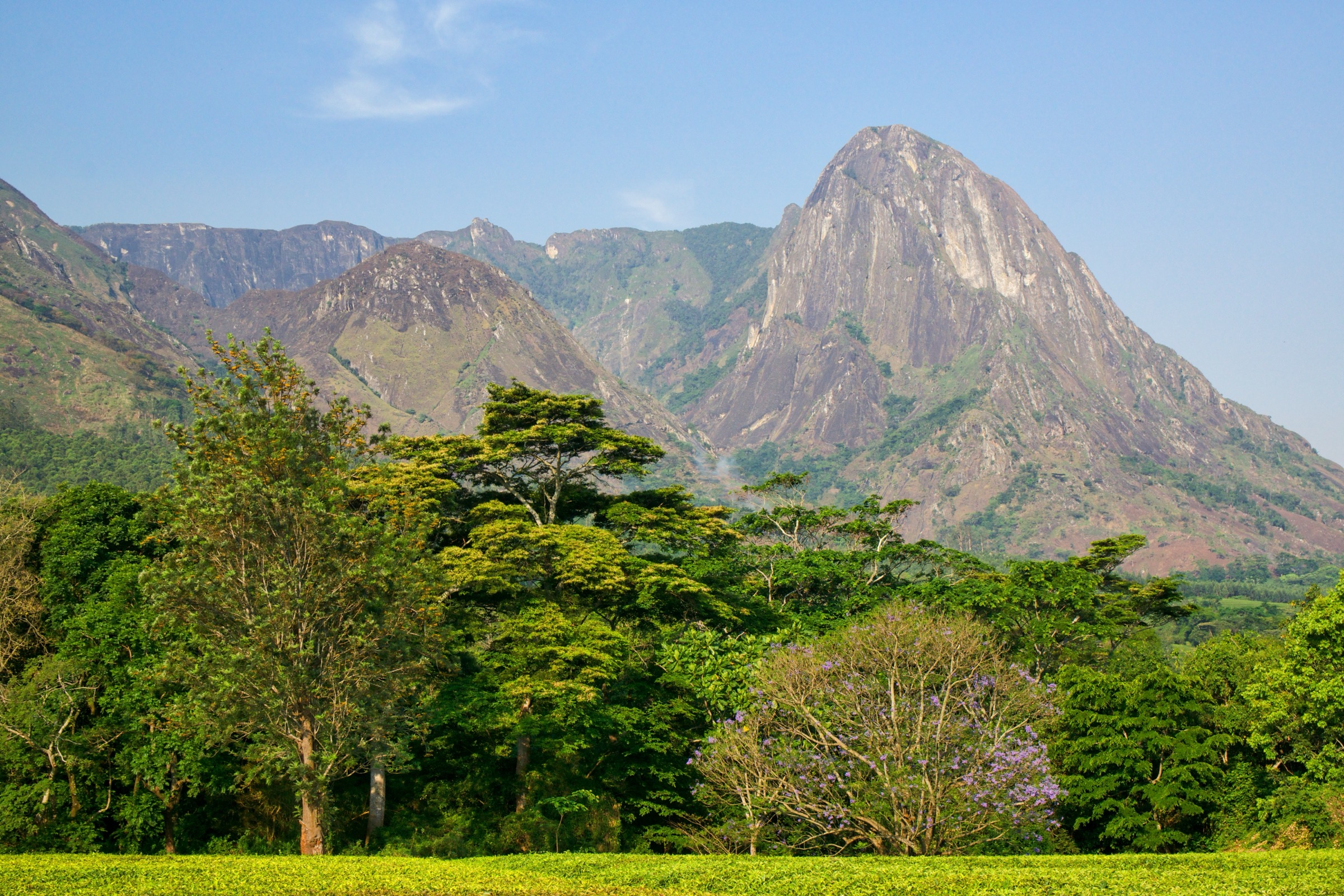
Elephant Rock sits a short distance west of the M1 inside the Viphya Plantation, near Samuel Mphepo trading centre about halfway between Mzuzu and Kasungu. From a layby on the M1 a clear path leads through young pine plantation and miombo woodland to the foot of the inselberg, a large granite outcrop whose rounded form resembles a recumbent elephant. The final climb to the top is a short scramble on bare rock with some exposed moves but no climbing equipment required. The summit gives a 360-degree panorama: north and west across the planted Chikangawa plateau toward Mzimba Plain, Mount Hora and the Zambian border ridges, and south-east back over the broken miombo country toward Lake Malawi. Descent retraces the same line.
Why it is essential
Elephant Rock is the most iconic single feature of the South Viphya outside Luwawa, and the only freely accessible day-walk on the plateau that does not require lodge logistics. Together with Mount Hora on the Mzimba Plain it anchors the Viphya in local culture — the Ngoni kingdom holds its annual Umthetho festival in the shadow of Mount Hora and within sight of Elephant Rock — and it gives the best overview of the planted plateau from a single point. Its short length and proximity to the M1 also make it the most realistic stop for travellers crossing the Viphya between Mzuzu and Lilongwe.
Equipment
Standard hiking equipment: shoes with sticky soles for the granite scramble, sun protection (the summit slab is fully exposed), 1.5 L of water (no resupply on the rock), and long trousers for plantation undergrowth and tall grass between the road and the rock.
Hazards and notes
The summit scramble is short but genuinely exposed in places; not advisable in wet weather and not for unaccompanied children. Tracks through the plantation are poorly signed; a local guide from the Samuel Mphepo trading centre is recommended for first-time visitors. The area is inside the working Viphya Plantation; respect logging operations and any temporary closures. Prehistoric rock art is reported around the wider plateau; do not touch any painted surfaces if found.
GPX / KML links
| Source | URL | Format / access | Reuse status |
|---|---|---|---|
| OpenStreetMap (approximate inselberg position) | openstreetmap.org near Samuel Mphepo | OSM data (ODbL) | Coordinates approximate; verify against field GPS |
| Route-file status | No published GPX located | Unresolved | Unresolved |
External links
- Atlas Obscura — Elephant Rock in Samuel Mphepo
- ProjectM — Hidden Gem: Elephant Rock in Chikangawa Forest
- Wikipedia — Viphya Mountains
5. Uzumara Forest Reserve Walk
Snapshot
Itinerary
The Uzumara walk is the only practical day-route into intact North Viphya rainforest. From the S85 a rough track climbs gently through Brachystegia miombo and small cultivated patches to the boundary of the Uzumara Forest Reserve, then enters tall Ficalhoa-Ocotea montane rainforest with a locally impenetrable Acanthaceae understorey. Faint paths used by foresters and birders climb steeply through the forest, with occasional clearings giving glimpses east toward the Lake Malawi escarpment and north-west toward the Nyika Plateau. Fitter parties continue to the open summit ridge at around 1,920 m, where the canopy gives way to short montane grassland and granite outcrops. Most walkers loop back through a different forest spur before rejoining the access track.
Why it is essential
Uzumara is the only Viphya day-walk that gives access to substantial intact montane rainforest. It is also one of the country’s most important Important Bird Areas (Key Biodiversity Areas factsheet 6665), supporting more than 100 bird species and a flora that overlaps with the adjacent Nyika Plateau. It complements the planted southern plateau by showing what the wider Viphya looked like before plantation, and it is the best wildlife-watching walk in the range.
Equipment
Mountain hiking equipment: waterproof jacket (the forest is humid year-round and afternoon showers are common), sturdy waterproof boots with grip on wet roots, insect repellent and long sleeves (mosquitoes and ticks present), binoculars for forest birding, headtorch for late finishes, and a local Forestry Department or community guide from Uzumara village.
Hazards and notes
Navigation is genuinely difficult; the dense Acanthaceae understorey hides side-paths. The reserve sits at the wet end of the Viphya climate gradient; routes can be impassable after heavy storms. Forestry Department permission may be required for organised groups; check at the Mzuzu Tourist Office. Limited mobile coverage; carry a paper map and GPS.
GPX / KML links
| Source | URL | Format / access | Reuse status |
|---|---|---|---|
| OpenStreetMap (reserve boundary and S85 access) | openstreetmap.org near Uzumara | OSM data (ODbL) | No curated trail relation |
| Route-file status | A community-built GPX from the Mzuzu Tourist Office or BirdLife / WESM network would be the most likely source | Unresolved | Unresolved |
External links
- BirdLife / Key Biodiversity Areas — Uzumara Forest Reserve factsheet 6665
- Flora of Malawi — Uzumara Forest Reserve
- Wikipedia — Viphya Mountains
Missing data / follow-up work
- No official GPX or KML files have been published by the Malawi Department of Forestry, Luwawa Forest Lodge, or the Mzuzu Tourist Office for any of the five hikes. All currently available geometry is either OSM track data (ODbL) or unmapped; new GPX would need to be built from OSM and lodge route maps and confirmed in the field.
- Distances and elevation gains for all five hikes are approximate. Only the cited summit elevations (Kawandama ~2,000 m, Uzumara 1,920 m) are taken from named sources; the rest are estimated from contour reading and operator narrative and should be replaced with measured values from a GPS track.
- No high-resolution licence-compatible cover photograph (≥2,000 px long edge) was found for any of the five hikes. The only Wikimedia Commons material located is two 1,024 × 682 px images by Dr Thomas Wagner (CC BY-SA 3.0) showing generic plantation and indigenous forest on the southern plateau. A targeted Flickr Creative Commons search and direct outreach to Luwawa Forest Lodge for original photography are recommended.
- The Luwawa Gorge Walk is described qualitatively by the lodge but has no published statistics; field measurement is required before this hike can move from Candidate to Verified status.
- The Kawandama day variant is constructed from the published first day of the four-day Kachere Kastle Wilderness Trail; the day turn-around point needs explicit confirmation from Luwawa Forest Lodge.
- The Elephant Rock layby coordinates are approximate; the trailhead position should be verified against OSM and a field GPS before publication.
- Uzumara Forest Reserve access procedure (Forestry Department permission, community guide arrangements) is not clearly documented online and should be confirmed with the Mzuzu Tourist Office and the Wildlife and Environmental Society of Malawi.
- Manchewe Falls, sometimes associated with the area, is in Livingstonia (Rumphi District) on the Nyika-Livingstonia escarpment, not in the Viphya range, and has been excluded.
- Mount Chimaliro (2,050 m), the overall highest point of the Viphya range, has no published day-hike route in the sources reviewed; a follow-up should investigate whether the Chimaliro Forest Reserve management has a maintained summit path.
- Bilharzia status of Luwawa Dam not explicitly addressed in cited sources; current local advice should be sought before recommending swimming.
External links
| Resource | Link |
|---|---|
| Luwawa Forest Lodge | luwawalodge.com |
| Luwawa Environmental Trust | luwawatrust.org |
| Malawi Tourism — Viphya Plateau | malawitourism.com |
| Malawi Department of Forestry — Viphya Plantations | dof.gov.mw |
| Wikipedia — Viphya Mountains | en.wikipedia.org |
| Wikipedia — Chikangawa Forest Reserve | en.wikipedia.org |
| Britannica — Viphya Mountains | britannica.com |
| Atlas Obscura — Elephant Rock in Samuel Mphepo | atlasobscura.com |
| BirdLife / KBA — Uzumara Forest Reserve | keybiodiversityareas.org |
| Flora of Malawi — Uzumara Forest Reserve | malawiflora.com |