
Regional overview
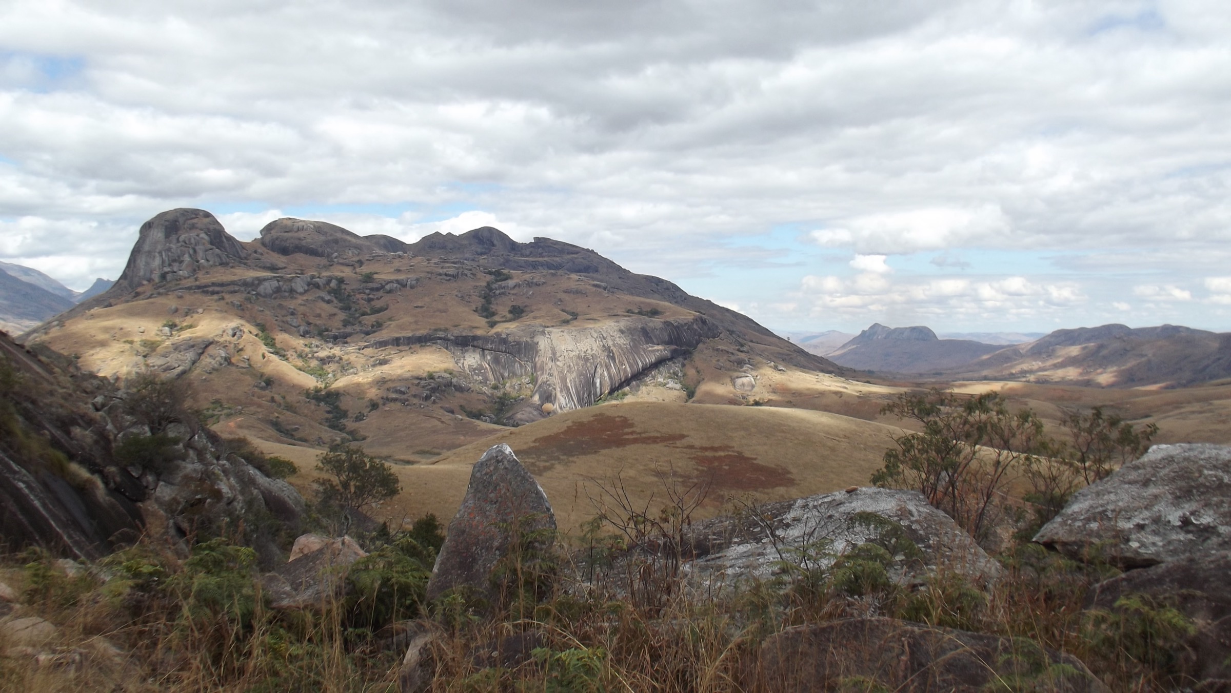
The Tsaratanana Massif rises in the far north of Madagascar, straddling the Diana and Sofia regions, and contains Maromokotro at 2,876 m (some sources 2,880 m), the highest point on the island. The range is volcanic in origin, deeply incised by the headwaters of the Sambirano, Ramena and Mahavavy rivers, and clothed in dense rainforest from the lowlands up through montane and ericoid belts to a narrow band of exposed summit heath. Rainfall on the windward slopes is among the highest in Madagascar.
Almost the entire massif lies within the Tsaratanana Strict Nature Reserve (Réserve Naturelle Intégrale de Tsaratanàna), gazetted in 1927 and managed under IUCN Category Ia by Madagascar National Parks within the wider Complexe des Aires Protégées d’Ambohimirahavavy-Marivorahona (CAPAM). Public tourism is not the intended use of this category: access is restricted to research and authorised expeditions, must be permitted in advance, and requires local guides, porters and (in recent years) security escorts because of illegal cannabis cultivation inside the reserve.
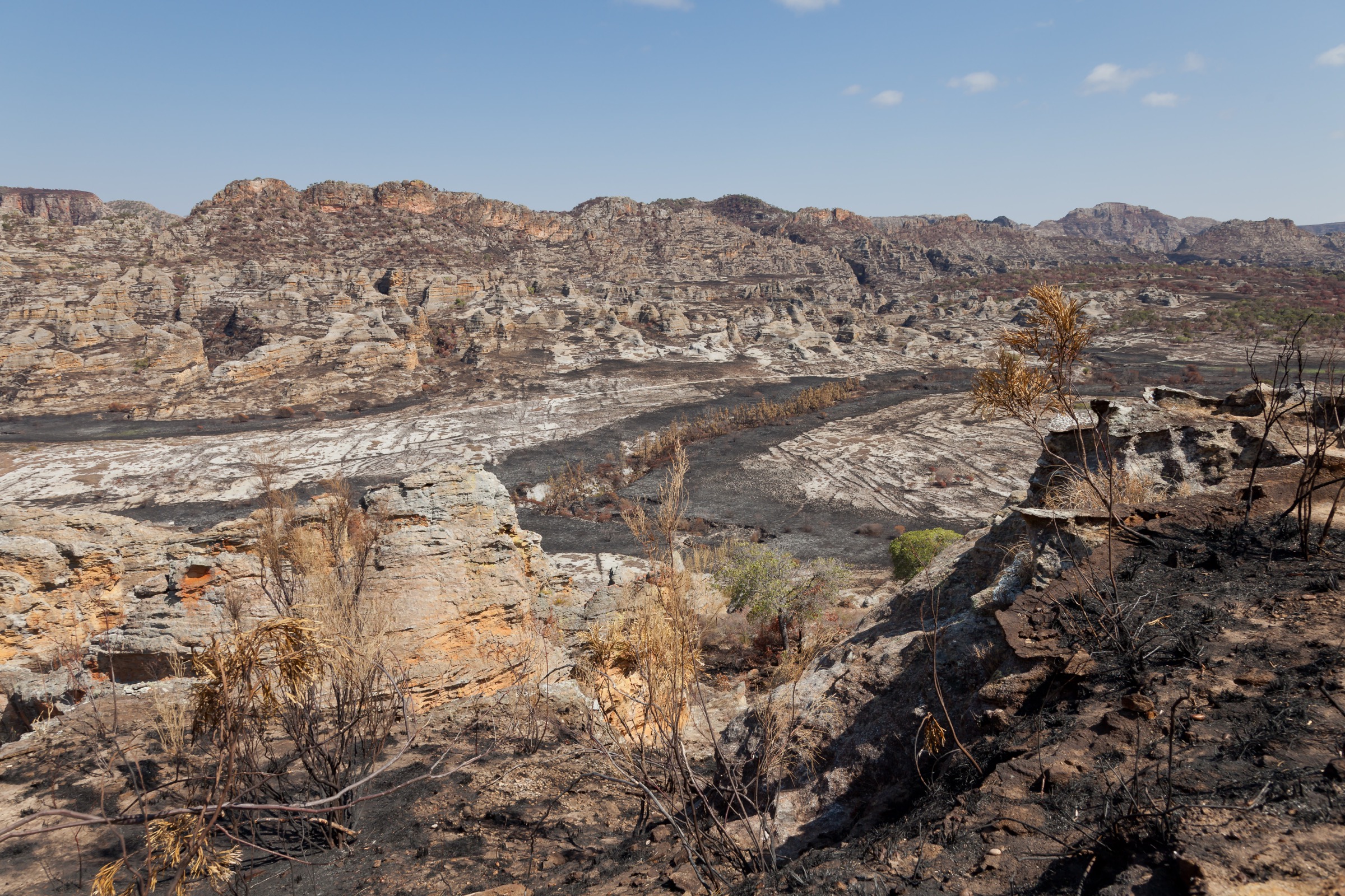
There is no road into the core zone and there are no waymarked, maintained paths. The two practical approach corridors are: from the south via Antsohihy-Bealanana-Mangindrano (a multi-day 4WD journey followed by foot porterage), and from the west via Ambanja-Marotalona-Beangona-Ambevy along the Sambirano valley. From either trailhead, reaching the heart of the massif typically takes three to five days each way, putting almost every documented itinerary in the multi-day expedition category. Best season is May to October; the rest of the year combines very heavy rainfall, leech pressure, fluvial hazards and impassable tracks.
Selection rationale
Tsaratanana does not support a balanced set of five published day-hikes in the same sense as an alpine region. The five entries below were chosen to represent the iconic summit objective in its only realistic day-scale framing, a forest-and-river day stage out of the southern trailhead, a single-day Sambirano approach leg from the western entry, a peripheral peak in the adjacent CAPAM landscape, and the obvious nearby substitute for visitors who cannot secure reserve permits. All five rely on secondary descriptions only; none is supported by an official trail standard, signed waymarking or published GPX track.
Summary table
| # | Hike | Country | Route type | Distance | Gain | Max elevation | Difficulty |
|---|---|---|---|---|---|---|---|
| 1 | Maromokotro summit day (final stage of expedition) | Madagascar | Out-and-back from high camp | ~10-14 km | ~700-1,000 m | 2,876 m | Strenuous, permit required |
| 2 | Mangindrano forest stage toward the reserve boundary | Madagascar | Point-to-point (porter-supported) | ~12-18 km | ~600-900 m | ~1,600 m | Strenuous, no path |
| 3 | Lower Sambirano valley approach from Beangona-Ambevy | Madagascar | Point-to-point with river crossings | ~10-15 km | ~400-700 m | ~900 m | Moderate, river fords |
| 4 | Ambohimirahavavy peripheral ridge day | Madagascar | Out-and-back | ~8-12 km | ~600-900 m | ~2,261 m | Strenuous, off-trail |
| 5 | Manongarivo Special Reserve foothill day from Antanambao-Ambahatra | Madagascar | Out-and-back | ~8-14 km | ~500-800 m | ~1,000 m | Moderate, guided |
1. Maromokotro Summit Day

Snapshot
Itinerary
The summit day is the culminating stage of a multi-day expedition from Mangindrano. Most published trip reports describe a five-day approach across successive forested ridges, with the final high camp pitched on or near the summit ridge between roughly 2,000 m and 2,200 m. From this camp the route climbs steep, often muddy forest, then crosses a band of mossy ericoid heath onto open summit grassland before reaching the small cairn marking the high point at 2,876 m. There is no constructed path; progress depends on porter-cut sightlines and local knowledge. Return is by the same line to high camp, with descent to lower camps spread over subsequent days.
Why it is essential
Maromokotro is the highest point in Madagascar and the entire western Indian Ocean island system. Any catalogue of Madagascan hiking has to acknowledge it, even though it is not a true day-hike in the European sense.
Equipment
Mountain hiking equipment plus expedition kit: sturdy boots, full waterproofs, warm and dry change of clothing, tent and sleeping bag rated for damp 5 °C nights, headtorch, GPS with offline maps, water treatment, leech protection, first-aid kit. Permit from Madagascar National Parks, local guide and porters obligatory.
Hazards and notes
Cloud-forest visibility is regularly under 30 m on the summit ridge. No rescue services. The reserve is IUCN Category Ia and entry without a permit is illegal. Illegal cannabis cultivation has been reported inside the reserve and security escorts have been advised by recent visitors. Local custom, reported in multiple accounts, requires the offering of a white rooster before approaching the summit; this should be discussed with the local guides in advance. Rainy-season access (November-April) is not recommended.
GPX / KML links
| Source | URL | Format / access | Reuse status |
|---|---|---|---|
| Route-file status | No public GPX track for the Maromokotro summit route was found | Unresolved | Unresolved |
| OSM node (Maromokotro) | openstreetmap.org node for Maromokotro | OSM (ODbL) | Geometry reusable; no curated route relation |
External links
- Wikipedia — Maromokotro
- Madagascar National Parks — Tsaratanana
- Royal Botanic Gardens, Kew — Climbing Madagascar’s highest mountain
2. Mangindrano Forest Stage
Snapshot
Itinerary
From Mangindrano, the trail leaves the village northward, follows cultivated terraces and rice paddies along the upper Mahavavy headwaters, then climbs into closed-canopy montane forest on a porter-trodden line. The first day of an organised Maromokotro expedition typically reaches a camp on the southern margin of the reserve at roughly 1,500-1,600 m. As a day stage, this is at the upper edge of what fit walkers can complete in daylight; many parties split it over a day and a half with a midway bivouac.
Why it is essential
This stage is the only widely documented foot route into the southern flank of the massif and provides a sample of the rainforest belt without requiring the full multi-day summit commitment.
Equipment
Mountain hiking equipment plus leech socks or repellent, full waterproofs, water treatment, headtorch, basic first-aid kit. Reserve permit, local guide and porters required if entering the protected area.
Hazards and notes
No waymarked path. Trail conditions deteriorate rapidly after rain. Drinking water sources are abundant but require treatment. The reserve boundary on this side is not signed in the field, so it is the responsibility of the guide to confirm whether the day stays in the peripheral zone or enters the strict reserve.
GPX / KML links
| Source | URL | Format / access | Reuse status |
|---|---|---|---|
| Route-file status | No GPX/KML/source-map found in this pass | Unresolved | Unresolved |
External links
3. Lower Sambirano Valley Approach
Snapshot
Itinerary
The frequently used western approach to the reserve leaves Ambanja along RN4-12 to Marotalona-Beangona-Ambevy. From the river bank the route is crossed by pirogue, after which the trail follows the lower Sambirano upstream through cocoa plantations, secondary forest and first-stand primary forest. A typical day-scale stage ends at the first organised bush camp roughly 10-15 km in, where the gradient steepens markedly and the multi-day expedition profile takes over.
Why it is essential
This is the only realistically day-scale framing on the wet, biodiverse western side of the massif, in a zone famous for endemic lemurs, amphibians and birds.
Equipment
Standard hiking equipment plus quick-drying footwear suitable for fords, water treatment, insect repellent, lightweight waterproof. Reserve permit and local guide required if proceeding beyond the buffer zone.
Hazards and notes
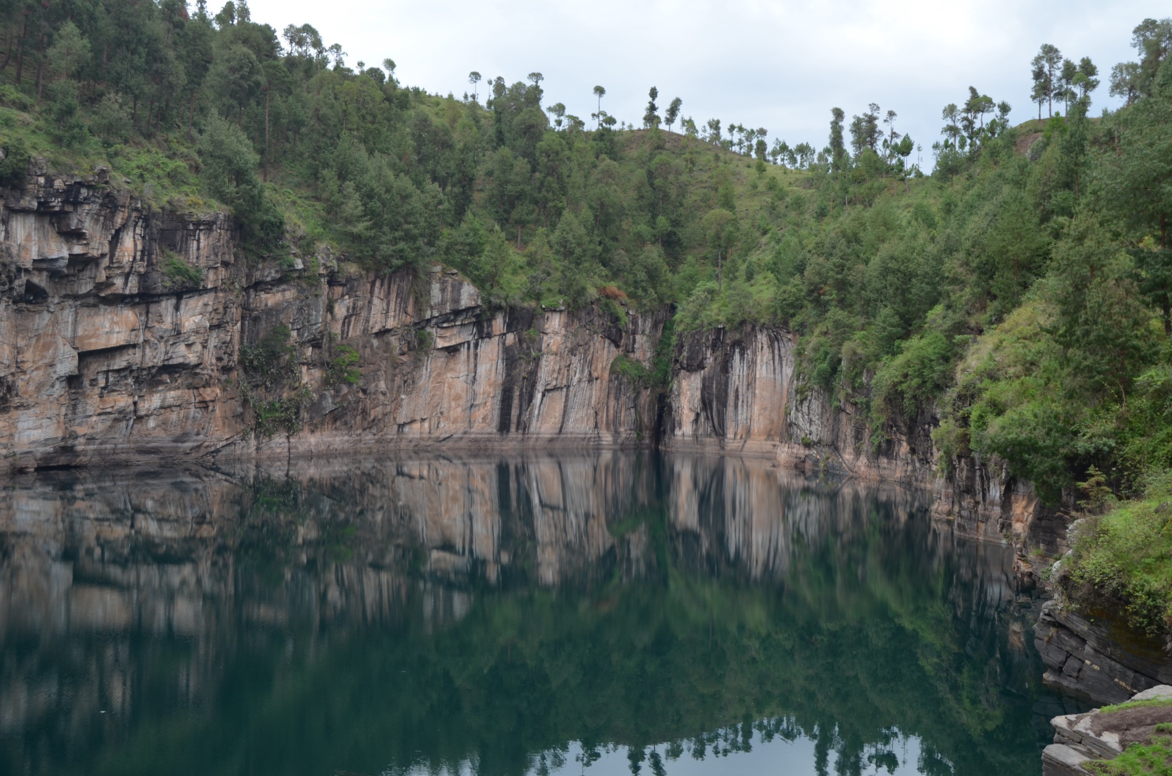
The Sambirano is dangerous in flood; even in the dry season pirogue crossings should be arranged with experienced local boatmen. Trail surfaces are slick and leeches are abundant. Cyclone-season tracks (December to March) are frequently impassable.
GPX / KML links
| Source | URL | Format / access | Reuse status |
|---|---|---|---|
| Route-file status | No GPX/KML/source-map found in this pass | Unresolved | Unresolved |
External links
4. Ambohimirahavavy Peripheral Ridge Day
Snapshot
Itinerary
Ambohimirahavavy is a peripheral peak of the wider CAPAM complex that surrounds the Tsaratanana strict reserve. A single visiting party has reported summiting from the south at approximately 2,301 m, in dense jungle with limited summit visibility. The route is unsigned, requires a guide cutting line through bamboo and ericoid scrub, and is suitable only for parties able to navigate by GPS in poor visibility.
Why it is essential
Of the named secondary peaks on the Tsaratanana skyline, Ambohimirahavavy is the most plausibly attainable in a long day from a low village camp without entering the strict reserve.
Equipment
Mountain hiking equipment, full waterproofs, GPS with offline mapping, machete-carrying guide, water treatment, headtorch, leech protection.
Hazards and notes
No path. Cloud cover and dense vegetation make GPS navigation essential. The peripheral zone is not under the strict-reserve regime but local protected-area rules still require a guide. Approach roads after rain may require 4WD.
GPX / KML links
| Source | URL | Format / access | Reuse status |
|---|---|---|---|
| Route-file status | No GPX/KML/source-map found in this pass | Unresolved | Unresolved |
External links
5. Manongarivo Special Reserve Foothill Day
Snapshot
Itinerary
The Manongarivo Special Reserve covers about 64,356 ha on the western shoulder of the same volcanic upland as Tsaratanana. The village of Antanambao-Ambahatra holds the only formal accommodation in the area and is the standard starting point for guided day walks into the reserve. Typical excursions climb from the village through cocoa-tree gardens into the lower rainforest belt, visit one of the reserve’s waterfalls, and return the same way.
Why it is essential
For travellers who cannot secure permits for the Tsaratanana strict reserve, Manongarivo is the closest publicly visitable substitute, lying on the same uplifted granitic and volcanic mass, sharing several endemic lemur species (including the Sambirano mouse lemur and Sambirano woolly lemur), and offering the most realistic single-day forest hike in the wider Tsaratanana hiking environment.
Equipment
Standard hiking equipment plus insect repellent, leech protection in wet conditions, water treatment, lightweight waterproof. Local guide required by reserve rules.
Hazards and notes
The reserve is administered as a Special Reserve and requires a guide. Tracks are unsigned and frequently muddy. No rescue infrastructure. Cyclone-season conditions (December-March) routinely close access.
GPX / KML links
| Source | URL | Format / access | Reuse status |
|---|---|---|---|
| Route-file status | No GPX/KML/source-map found in this pass | Unresolved | Unresolved |
External links
Missing data / follow-up work
- All five hikes are Candidate only. Tsaratanana has no published day-hike standards in the European/Alpine sense; statistics are derived from approach descriptions in expedition accounts rather than measured trail data.
- No public GPX, KML or OSM route relation was located for any of the five hikes.
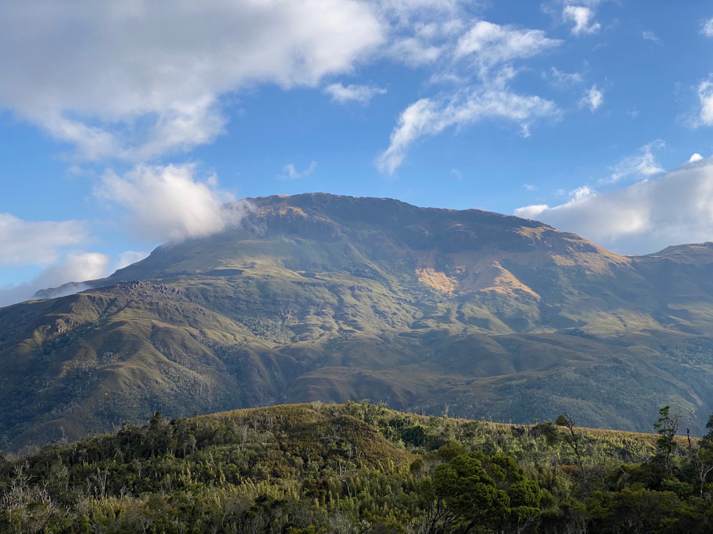
- Only one licence-compatible image was located (Maromokotro summit, CC BY-SA 4.0, by Yann Mayette). It is 2,016 px on the long edge — below the project’s preferred ≥2,400 px cover-photo threshold — so it serves only as an in-article figure. No licence-compatible cover photograph located in this pass.
- Permit and security conditions inside the Tsaratanana Strict Nature Reserve change year on year and must be confirmed directly with Madagascar National Parks before any visit.
- Trail distances and elevation gains for Hikes 2-5 are first-pass approximations from valley-floor and ridge-line elevations on standard topographic data; they should be replaced with measured tracks before publication.
External links
| Resource | Link |
|---|---|
| Wikipedia — Tsaratanana Massif | en.wikipedia.org |
| Wikipedia — Maromokotro | en.wikipedia.org |
| Wikipedia — Tsaratanana Reserve | en.wikipedia.org |
| Madagascar National Parks — Tsaratanana | parcs-madagascar.com |
| Madagascar National Parks — Manongarivo | parcs-madagascar.com |
| FAPBM — Tsaratanana Strict Nature Reserve | fapbm.org |
| Royal Botanic Gardens, Kew — Climbing Madagascar’s highest mountain | kew.org |