Regional overview
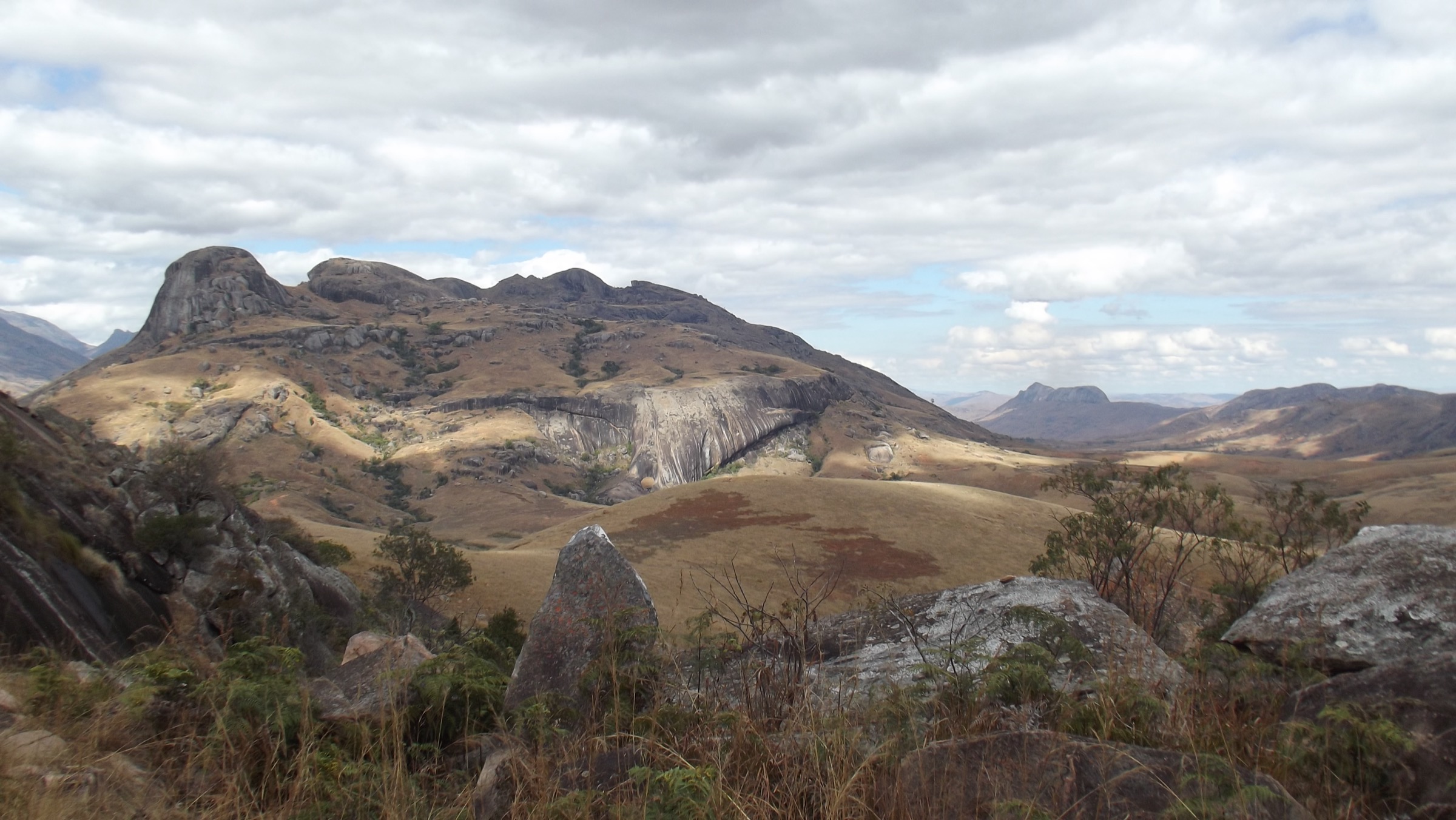
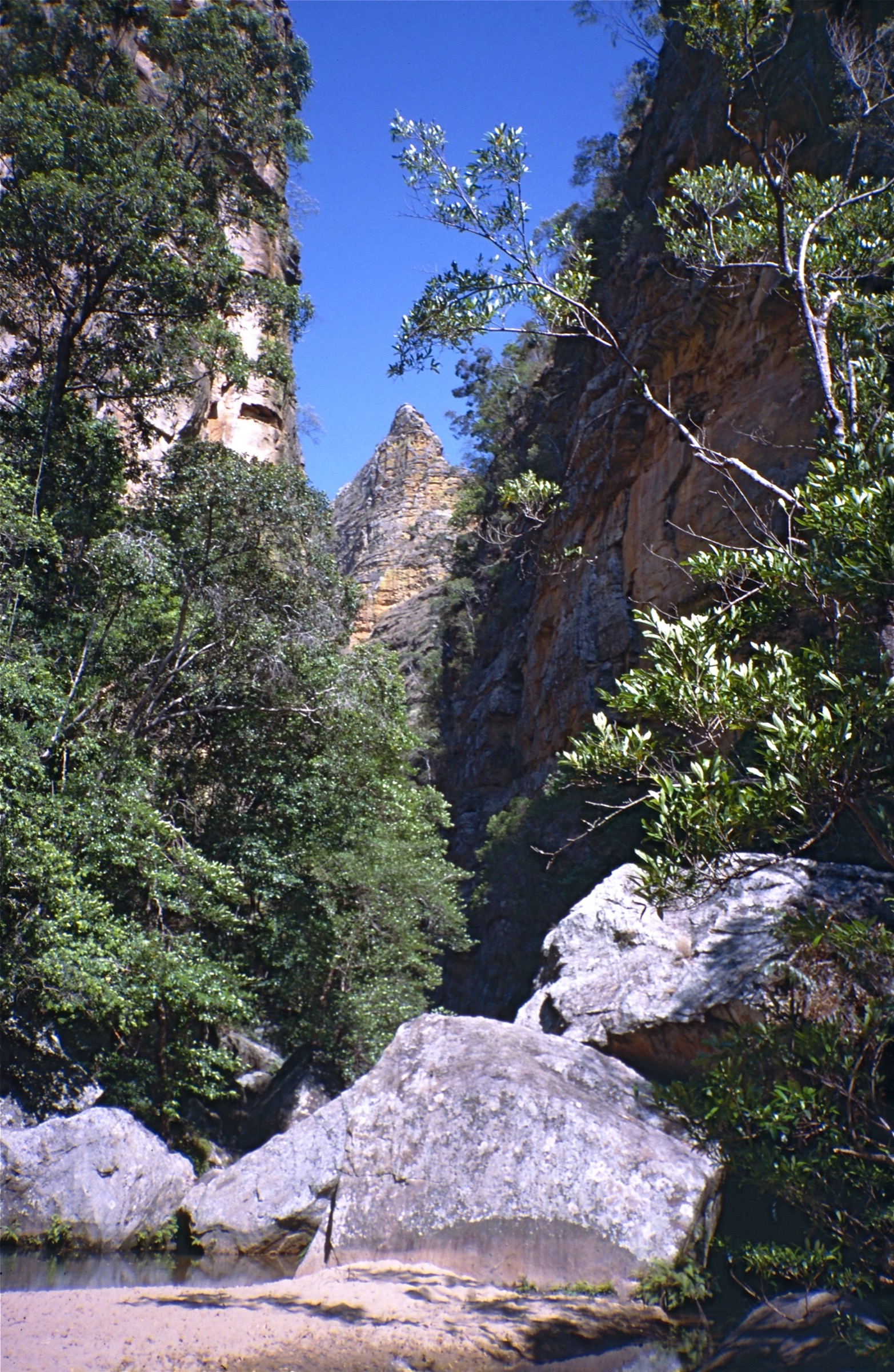
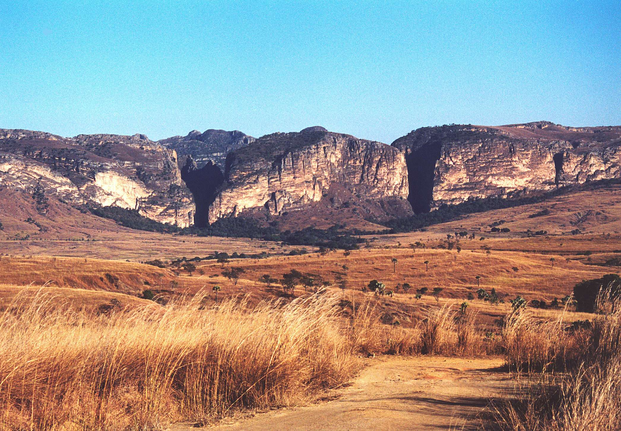
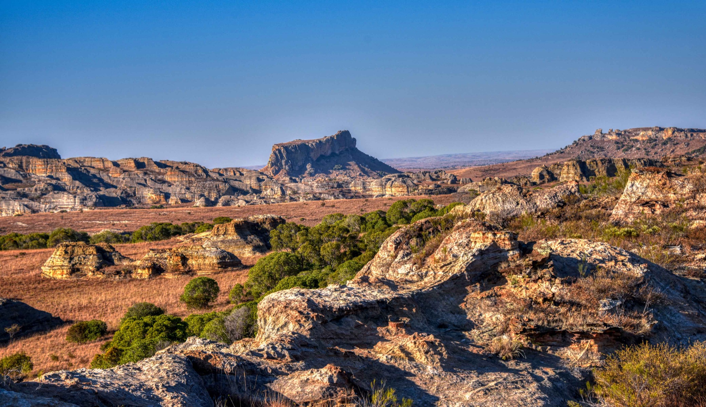
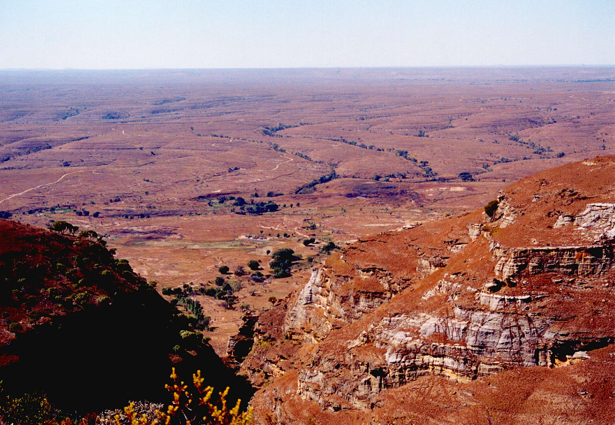
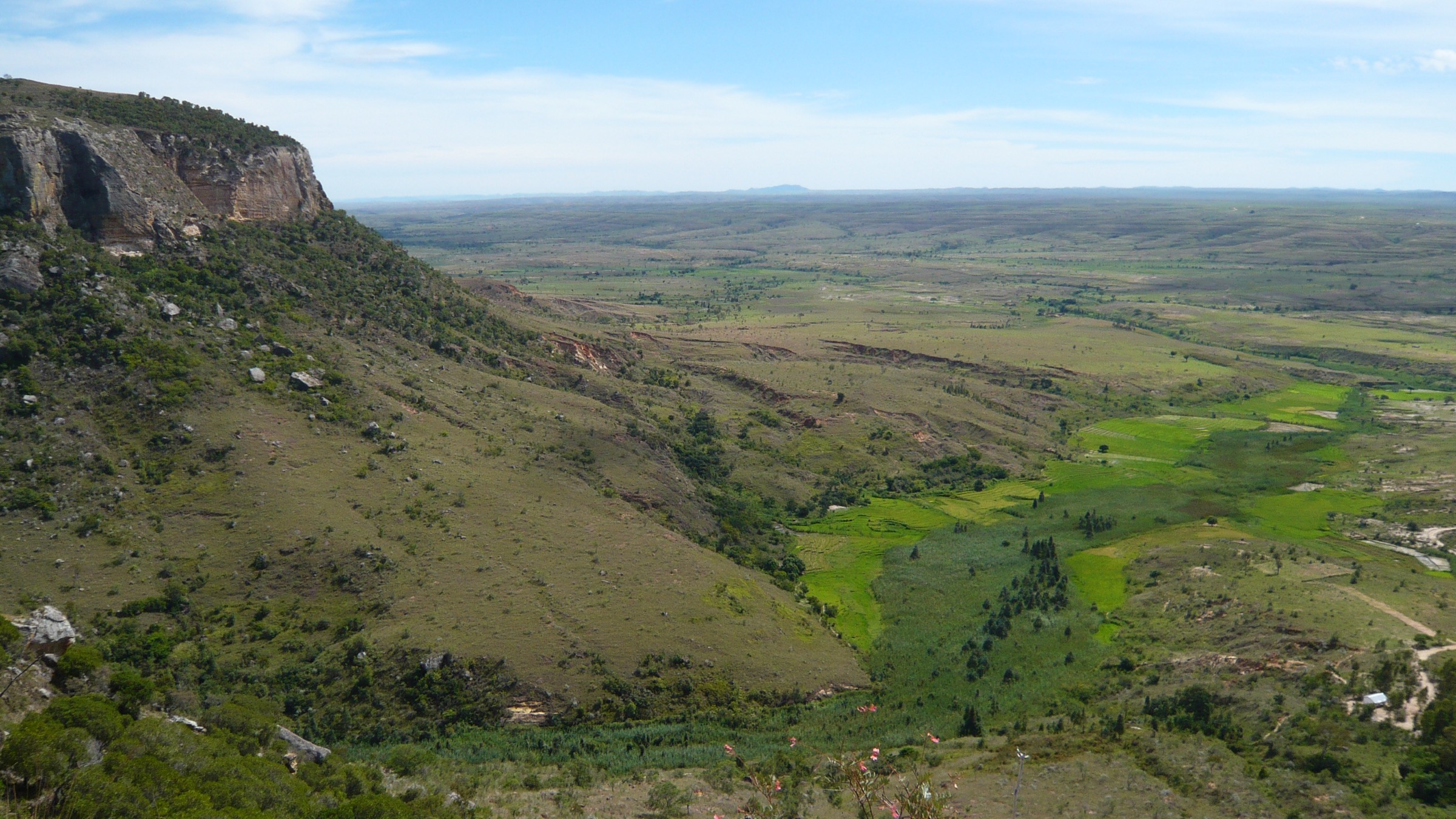
The Isalo Massif rises from the dry grass plains of the Ihorombe Region in south-central Madagascar, between Ihosy and Sakaraha on the RN7 highway. The range is an isolated, deeply dissected sandstone plateau formed from continental sediments of the Isalo Group, deposited as braided-river and delta sands in the Triassic to early Jurassic and subsequently uplifted and weathered into a ruiniform landscape of canyons, domes, flat-topped mesas, balancing boulders and natural rock windows. Elevations within Isalo National Park range from approximately 510 m on the plains to 1,268 m on the highest summits. The reddish-orange and ochre sandstone cliffs, lit by low sun, are the region’s defining visual signature and the reason the massif is widely described in tourism literature as “Madagascar’s Grand Canyon”.
The main hiking centre is Ranohira, a small village on the RN7 at the eastern edge of the massif, with the Madagascar National Parks (MNP) reception office and the main park entrance. Toliara is the closest international airport gateway (roughly 240 km to the south-west); Antananarivo is approximately 700 km north on the RN7. The massif is protected within Parc National de l’Isalo, which covers 815.40 km² of sandstone plateau, deep canyons, riparian gallery forest, savanna woodland and grassland. A local MNP-accredited guide is obligatory for all entries into the park; standard entry-fee and guide-fee ranges quoted by recent secondary sources are an MNP entrance fee of approximately 65,000-70,000 Ariary per person per day and guide fees from approximately 120,000 Ariary per day, but current rates must be checked at the MNP reception in Ranohira before publication.
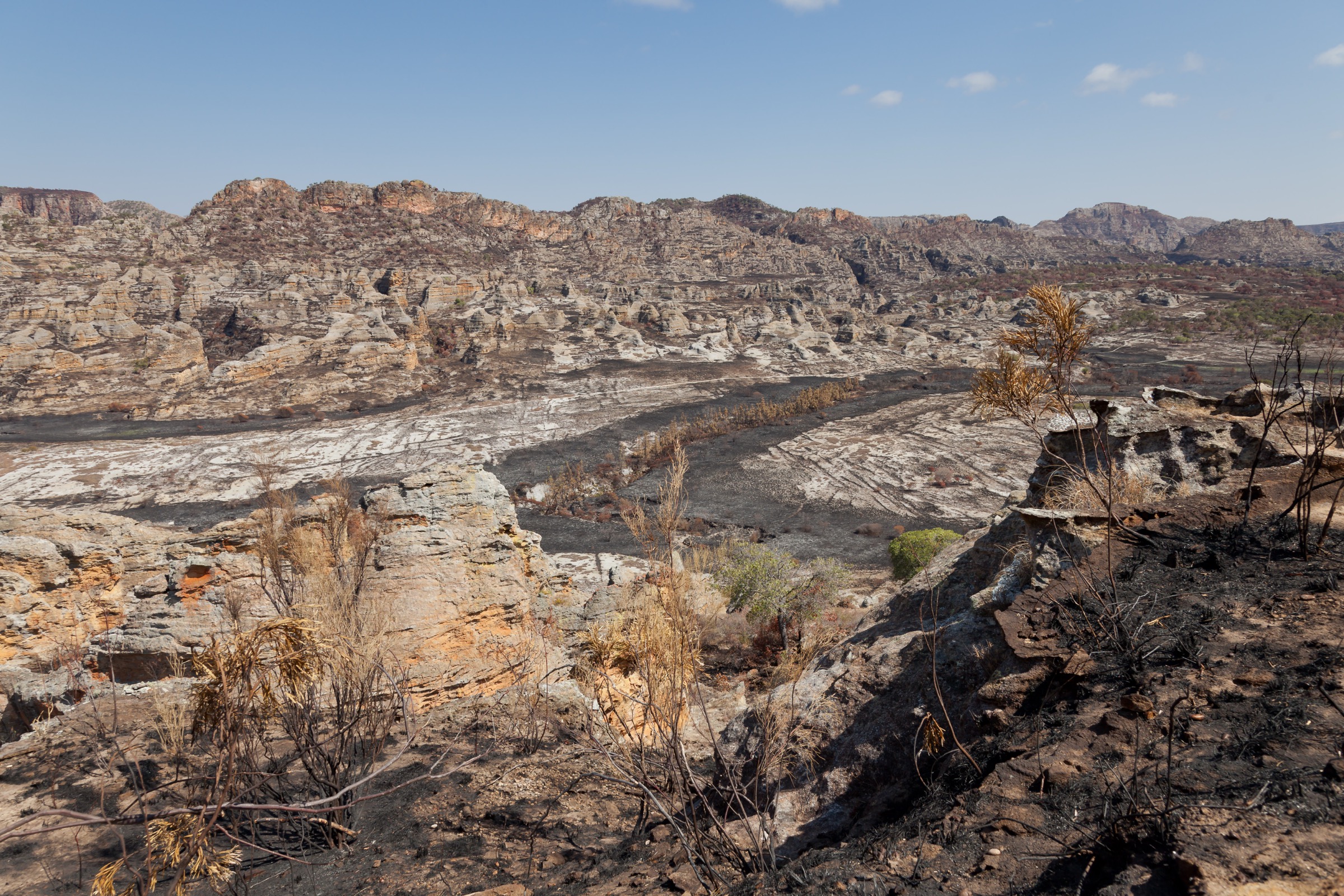
The hiking character is canyon-and-plateau: short scenic loops into shaded sandstone gorges with palm-fringed pools and waterfalls, combined with hot, open ridge sections across the dry plateau. Day hikes in Isalo are typically modest in distance (3-14 km) and elevation gain (often under 500 m), but heat exposure on the plateau, water sourcing and the obligation to retain a guide make logistics non-trivial. The dry, cooler season from April to October is the standard hiking window; the wet season from November to March brings heat, occasional severe storms and partial trail flooding. Cyclone risk is low in this part of the country but heavy rain can render the canyon floors and stream crossings hazardous. Wildlife encounters typically include ring-tailed lemur (Lemur catta) and Verreaux’s sifaka (Propithecus verreauxi) in the canyon-floor forest pockets, and Benson’s rock thrush on the plateau.
Isalo is not a UNESCO World Heritage Site. The closest Malagasy World Heritage natural site, the Tsingy de Bemaraha Strict Nature Reserve, lies far to the north-west; the Rainforests of the Atsinanana lie east and north-east of Isalo. The 2024 archaeological work at Teniky within the massif (rock-cut niches and dry-stone structures provisionally interpreted as a possible Zoroastrian necropolis of the 10th-12th centuries CE) is noted for context but the site is remote, requires multi-day access from the nearest village and is not currently a day-hike objective; it is flagged under follow-up work.
Selection rationale
The five hikes were chosen to span the canyon, pool, ridge and viewpoint character of the Isalo Massif while respecting the day-hike constraints of the catalogue:
- Circuit Piscine Naturelle - Namaza full-day combined loop - the defining full-day visit to the largest and most-photographed natural pool in the park, linked across the plateau to the Namaza canyon with its tunnel of palms, waterfalls (Cascade des Nymphes, Piscines Bleue and Noire) and the principal lemur-viewing zone.
- Canyon des Makis (Monkey Canyon) - the shorter, more accessible of the two great northern canyons, with vertical sandstone walls and the largest ring-tailed lemur troop on the trail network.
- Canyon des Rats (Rat Canyon) - the deeper northern slot canyon, often combined with Canyon des Makis from a shared trailhead at Ranohira Basse.
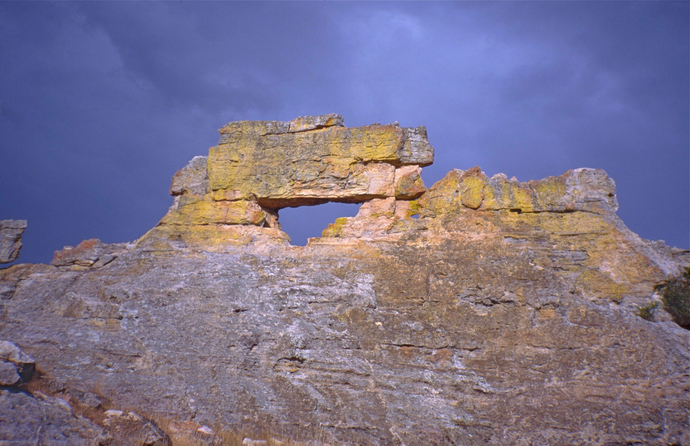
- Circuit Crête (Ridge / Crest circuit) - the short signature plateau loop showcasing the named sandstone formations Reine de l’Isalo, La Botte, Le Loup and Tsingy de l’Isalo above the park entrance.
- La Fenêtre de l’Isalo (sunset viewpoint walk) - the iconic sandstone window framing the western sunset, just outside the park boundary off the RN7; a short walk rather than a full day hike, but the region’s culturally and visually unmissable sunset objective.
Multi-day routes inside Isalo (the Travesía Clásica, the Malaso “zebu-thief” traverse, and treks to Teniky) are catalogued in tourism literature but exceed the day-hike scope; they are noted in follow-up work. The mountain-bike, equestrian and via-ferrata circuits referenced on official MNP material are also excluded as they fall outside the project’s walking-hike definition.
Summary table
| # | Hike | Country | Route type | Distance | Gain | Max elevation | Difficulty |
|---|---|---|---|---|---|---|---|
| 1 | Circuit Piscine Naturelle - Namaza full-day combined loop | Madagascar | Loop / linked circuit | ~12-14 km (secondary) | ~300-450 m (secondary; sources vary) | ~1,000 m (approx.) | Moderate; hot |
| 2 | Canyon des Makis | Madagascar | Out-and-back / spur | ~3-5 km depending on source | ~150-200 m | ~900 m (approx.) | Easy-Moderate |
| 3 | Canyon des Rats | Madagascar | Out-and-back / combined spur | ~4-6 km alone; ~8-11 km combined with Canyon des Makis | ~200-400 m (combined) | ~900-1,090 m (secondary, varies) | Moderate |
| 4 | Circuit Crête (ridge / crest) | Madagascar | Loop | ~4 km (official secondary) | Modest (not separated by source) | ~900 m (approx.) | Moderate; hot |
| 5 | La Fenêtre de l’Isalo (sunset viewpoint) | Madagascar | Short out-and-back | ~0.8-1.5 km (approx.) | Minimal | ~840 m (approx.) | Easy |
1. Circuit Piscine Naturelle - Namaza full-day combined loop
Snapshot
Itinerary
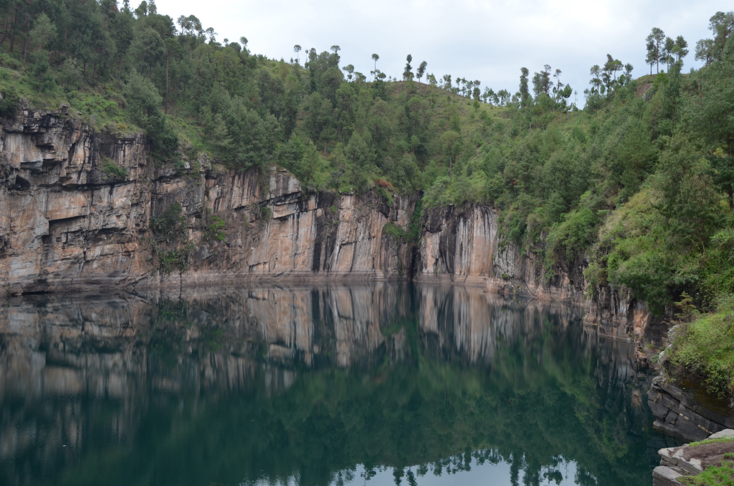
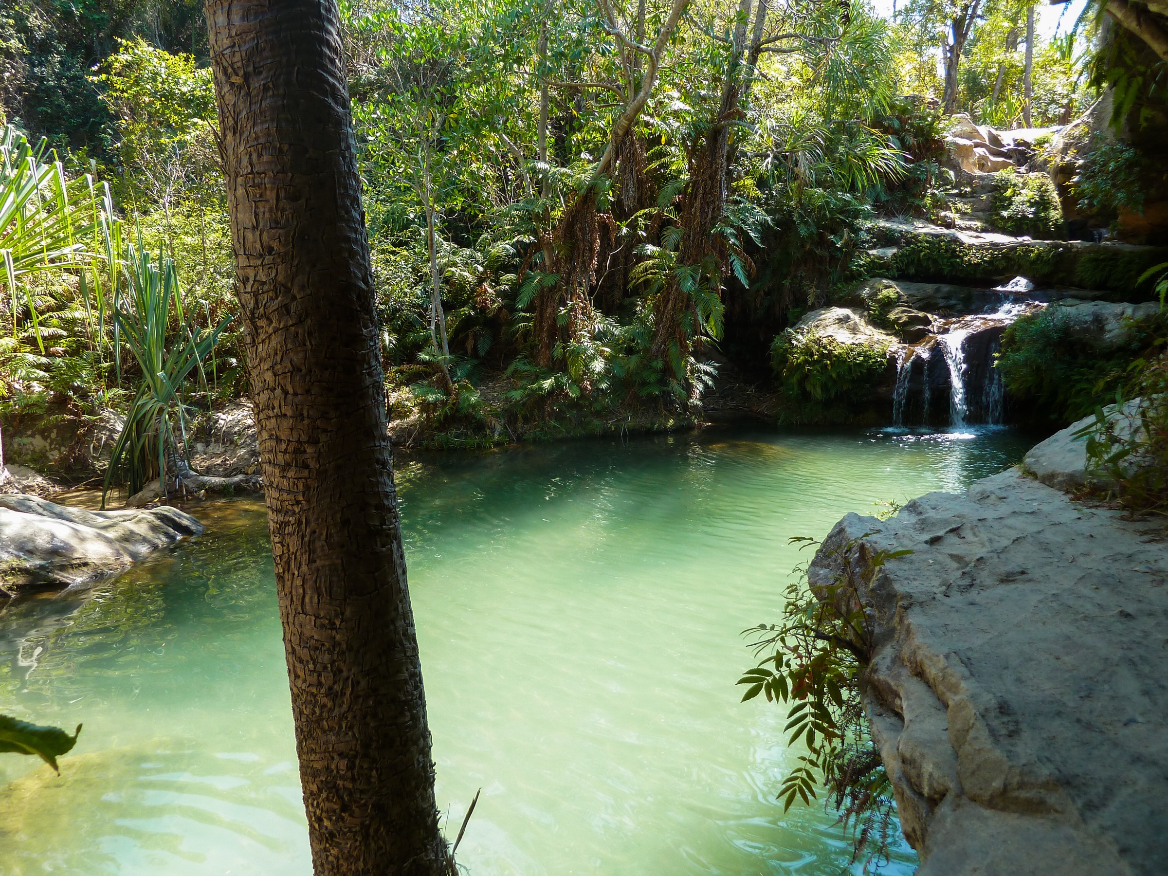
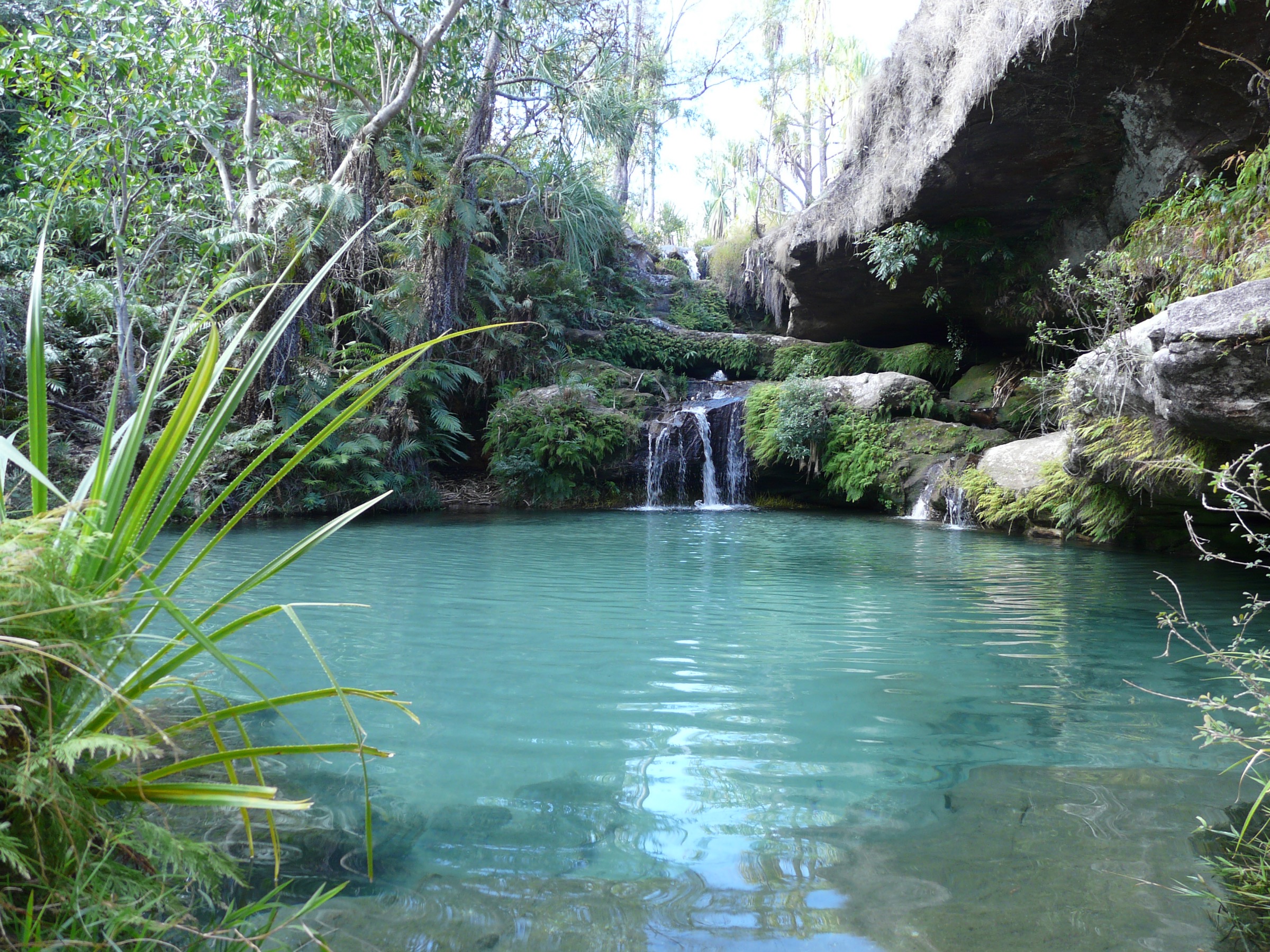
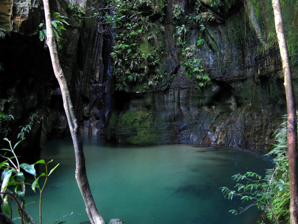
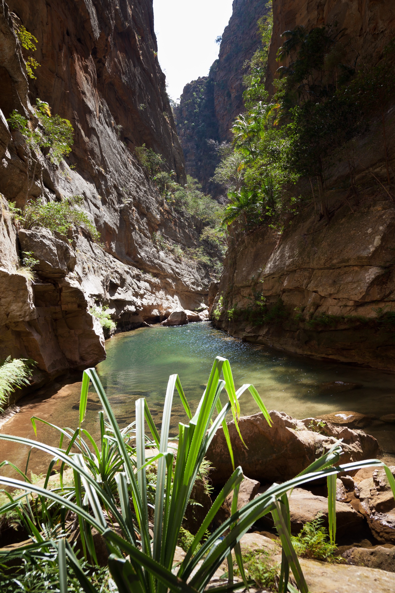
From the park entrance close to Ranohira, the route climbs onto the sandstone plateau and runs roughly 3 km westward across open rock and savanna with views of the massif’s interior. The plateau path then drops steeply to the Piscine Naturelle, a deep, palm-fringed pool inside a sandstone alcove fed by a small permanent waterfall and surrounded by Bismarck and pandanus palms - the largest and most-photographed natural pool in the park. From the pool, the standard combined day loops northwards on a 3 km plateau traverse, descending roughly 180 m into the Namaza valley.
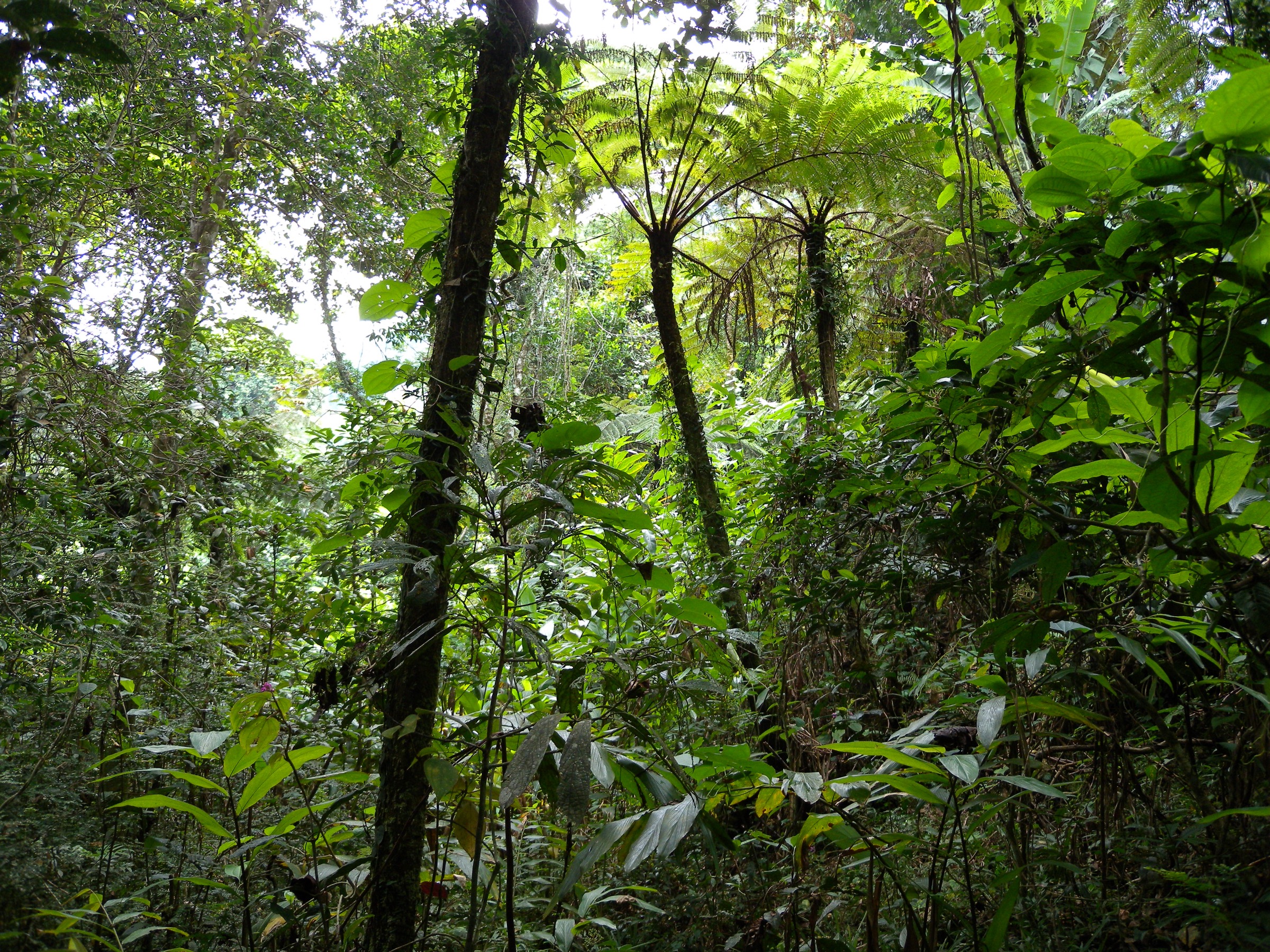
The Namaza canyon is walked downstream past gallery forest holding the principal ring-tailed lemur and Verreaux’s sifaka troops on the circuit. Short side-trails reach the Cascade des Nymphes (a tall cascade above a deep cool pool), the Piscine Bleue (blue pool) and the Piscine Noire (black pool). The route returns to Ranohira either through the Namaza valley to the Namaza campsite parking area, or back over the plateau, depending on how the guide structures the day.
Why it is essential
The Piscine Naturelle is the most internationally recognised single feature of Isalo and the photo-anchor of nearly all guidebook coverage of the park. Linking it to Namaza on the same day combines the canyon-pool aesthetic with the principal lemur and waterfall sequence and converts what would otherwise be two short circuits into a single representative full day in the massif.
Equipment
Standard hiking equipment with a strong emphasis on heat management: sun protection (hat, high-SPF sunscreen, long sleeves), at least 2-3 L of water per person, salts/electrolytes, swimwear and microfibre towel for the pools, sturdy trail shoes for sandy and slabby ground, dry-bag for camera and electronics for water crossings, headtorch for late returns. MNP entrance fee and obligatory MNP-accredited local guide are required.
Hazards and notes
The principal hazards are heat and sun exposure on the open plateau between Piscine Naturelle and the Namaza descent, dehydration, and slippery wet sandstone at the pool edges. Flash flooding in the Namaza gorge is a real risk during the November-March wet season after heavy rain; do not enter the canyon in active storm conditions. Swimming pools are unguarded; conditions at the Piscine Noire and Piscine Bleue change after rain. Wildlife encounters (lemurs, Madagascar boa) should be observed without feeding or contact.
GPX / KML links
| Source | URL | Format / access | Reuse status |
|---|---|---|---|
| AllTrails - Isalo swimming pools (Piscines de l’Isalo) | alltrails.com | Online route page / GPX login | AllTrails terms apply; secondary stats source; GPX reuse not confirmed |
| Wikiloc - Madagascar: Isalo Piscine Trail | wikiloc.com | GPX via Wikiloc | Wikiloc terms apply; secondary GPX source; reuse not confirmed |
| Wikiloc - Isalo: Piscine Naturelle Trail | wikiloc.com | GPX via Wikiloc | Wikiloc terms apply; secondary GPX source; reuse not confirmed |
| Komoot - Isalo National Park - Piscine Noire Waterfall loop (long-day variant, 19.5 km / 5 h 34) | komoot.com | Online route highlight / GPX in app | Komoot terms apply; secondary stats source; route file reuse not confirmed |
| Madagascar National Parks - Isalo park page | parcs-madagascar.com | Official park page | MNP / parcs-madagascar.com terms; authoritative route confirmation; no downloadable GPX found in this pass |
External links
- en.wikipedia.org — Wikipedia: Isalo National Park
- parcs-madagascar.com — Madagascar National Parks - Isalo
- alltrails.com — AllTrails - Isalo swimming pools
- komoot.com — Komoot - Isalo Piscine Noire Waterfall loop
- wikiloc.com — Wikiloc - Madagascar Isalo Piscine Trail
2. Canyon des Makis (Monkey Canyon)
Snapshot
Itinerary
A road and track from Ranohira on the RN7 leads west across the savanna to a parking area near a small village above the canyon mouth, marked for “Canyon des Makis, Canyon des Rats, Grotte des Portogais”. From the parking area the route crosses streams and small irrigation channels through cultivated land before entering Canyon des Makis on its sandy floor. The walls of the slot canyon rise vertically over 200 m, with patches of riparian gallery forest and a small terminal waterfall and pool. The largest resident troop of ring-tailed lemurs (Lemur catta) on the trail network is generally observed on or near the canyon floor; Verreaux’s sifaka is also resident.
Why it is essential
Canyon des Makis is the most accessible of the great northern canyons and is the principal day-walking objective for ring-tailed lemur observation in Isalo. The combination of vertical sandstone walls, a permanent shaded canyon floor, riparian forest and the resident lemur troop makes it a representative short canyon route and one of the most-cited day walks in MNP and tourism literature.
Equipment
Standard hiking equipment for hot, dry conditions: trail shoes with grip, sun and heat protection, 2 L of water per person, swimwear if the terminal pool is to be used, hat and sunscreen. Insect repellent for the canyon-floor forest. MNP entrance fee and obligatory MNP-accredited local guide are required.
Hazards and notes
The principal hazard is flash flooding inside the slot canyon during and after wet-season storms; the canyon must not be entered when storms are active or imminent. Sun and heat exposure on the approach across the savanna are significant. Wildlife observation (lemurs, occasional snake species including the Madagascar ground boa) should be conducted at a distance under guide direction. The trailhead access road is rough and requires high-clearance vehicles.
GPX / KML links
| Source | URL | Format / access | Reuse status |
|---|---|---|---|
| Wikiloc - Travesía clásica Isalo Etapa 2: Ranohira Basse - Canyon des Makis - Dabotandro - Cascada de Ninfas - Namaza | es.wikiloc.com | GPX via Wikiloc | Wikiloc terms apply; secondary GPX source; reuse not confirmed; longer linking variant |
| GPS-viewer.com - Parc Isalo - Canyon Maki / canyon rats - Ranohira | fr-fr.gps-viewer.com | Online GPS track | Source terms not fully checked; secondary route confirmation; reuse not confirmed |
| Madagascar National Parks - Isalo park page | parcs-madagascar.com | Official park page | MNP / parcs-madagascar.com terms; authoritative route confirmation; no downloadable GPX found in this pass |
External links
- en.wikipedia.org — Wikipedia: Isalo National Park
- parcs-madagascar.com — Madagascar National Parks - Isalo
- es.wikiloc.com — Wikiloc - Travesía clásica Isalo Etapa 2
- hikr.org — Hikr.org - Madagascar: Isalo Canyon des Makis and Rats Trail
3. Canyon des Rats (Rat Canyon)

Snapshot
Itinerary
Canyon des Rats lies approximately 700 m north of Canyon des Makis on the same massif edge and is typically walked from the same Ranohira Basse trailhead. The route follows a sandy approach across the savanna into the canyon mouth, then climbs the canyon floor between vertical sandstone walls. Compared to Canyon des Makis, Canyon des Rats is generally described as the longer and deeper of the two, with continuous gallery vegetation, ancient burial niches associated with the Bara and older Sakalava peoples on parts of the upper walls, and a terminal pool fed by a small waterfall. Many guided itineraries link Canyon des Rats and Canyon des Makis into a single half- to full-day visit from Ranohira Basse.
Why it is essential
Canyon des Rats is the deeper and more sustained of the two great northern canyons and provides the cultural dimension of the catalogue selection through the Bara-era burial niches visible on the canyon walls. As the natural counterpart to Canyon des Makis, it is the second pillar of Isalo’s signature canyon experience.
Equipment
Standard hiking equipment for hot, dry conditions: trail shoes, 2-3 L of water per person, sun protection, swimwear and dry-bag if the terminal pool is to be used, headtorch for shaded canyon sections. MNP entrance fee and obligatory MNP-accredited local guide are required.
Hazards and notes
Flash flooding inside the canyon during wet-season storms is the principal hazard. The trailhead access road requires 4x4. The Bara/Sakalava burial niches are culturally sensitive sites and must be respected; do not enter, touch or photograph close-up without specific guide consent.
GPX / KML links
| Source | URL | Format / access | Reuse status |
|---|---|---|---|
| Wikiloc - Travesía clásica Isalo Etapa 1: Ranohira Basse - Canyon des Rats - Canyon des Singes - Ranohira Basse | es.wikiloc.com | GPX via Wikiloc | Wikiloc terms apply; secondary GPX source; reuse not confirmed; combined loop variant |
| Wikiloc - Travesía Suroeste de Isalo Día 2: Ranohira - Canyon des Makis - Canyon des Rats - Shakamanatela | es.wikiloc.com | GPX via Wikiloc | Wikiloc terms apply; secondary GPX source; reuse not confirmed; longer linking variant |
| Madagascar National Parks - Isalo park page | parcs-madagascar.com | Official park page | MNP / parcs-madagascar.com terms; authoritative route confirmation; no downloadable GPX found in this pass |
External links
- en.wikipedia.org — Wikipedia: Isalo National Park
- parcs-madagascar.com — Madagascar National Parks - Isalo
- es.wikiloc.com — Wikiloc - Travesía clásica Isalo Etapa 1
- hikr.org — Hikr.org - Madagascar: Isalo Canyon des Makis and Rats Trail
4. Circuit Crête (Ridge / Crest circuit)
Snapshot
Itinerary
The Circuit Crête begins at the MNP ticket office close to Ranohira and climbs a short, steep ramp onto the western edge of the Isalo plateau. The plateau loop visits the most famous named sandstone formations of the massif’s eastern wall: the Reine de l’Isalo (Queen of Isalo profile rock), La Botte (the Boot), Le Loup (the Wolf) and the Tsingy de l’Isalo (a small zone of fluted sandstone needles), together with the eastern sclerophyll forest, a small botanical garden of Pachypodium and other endemic dry-forest species, the zebu park, and a viewing point over Bara tomb sites on the cliffs. The route returns to the ticket office.
Why it is essential
Circuit Crête is the only short walk that bundles the named photogenic sandstone formations of the massif’s eastern face with the cultural reference points (zebu park, botanical garden, Bara tombs) in a single loop. It is the most commonly walked half-day route by visitors with limited time and is consistently presented by MNP and tourism material as the orientation walk of the park.
Equipment
Standard hiking equipment with strong sun protection: hat, sunscreen, 2 L of water minimum, sturdy trail shoes with grip on slabby sandstone. Lightweight long sleeves help on the open plateau. MNP entrance fee and obligatory MNP-accredited local guide are required.
Hazards and notes
The principal hazard is heat exposure on the open plateau, particularly between 10:00 and 15:00 in the November-March hot season. Wet sandstone is slippery; care is required on the short steep plateau ramp. Some signposted viewpoints stand close to vertical cliff edges; supervision of children is essential. Bara tomb sites visible from the route are culturally sensitive and not to be approached.
GPX / KML links
| Source | URL | Format / access | Reuse status |
|---|---|---|---|
| Madagascar National Parks - Circuit Crête | parcs-madagascar.com | Official MNP circuit page | MNP / parcs-madagascar.com terms; authoritative route confirmation; no downloadable GPX found in this pass |
| Madagascar National Parks - Isalo park page | parcs-madagascar.com | Official park page | MNP / parcs-madagascar.com terms; authoritative route confirmation; no downloadable GPX found in this pass |
| Wikiloc - Isalo National Park trail | wikiloc.com | GPX via Wikiloc | Wikiloc terms apply; secondary GPX source; reuse not confirmed |
External links
- parcs-madagascar.com — Madagascar National Parks - Circuit Crête
- parcs-madagascar.com — Madagascar National Parks - Isalo park page
- petitfute.co.uk — Petit Futé - Les Circuits, Parc National de l’Isalo
5. La Fenêtre de l’Isalo (sunset viewpoint walk)
Snapshot
Itinerary
A short signposted track leaves the RN7 approximately 12 km south of Ranohira and runs roughly 800 m west to a parking area below a low sandstone ridge. From the parking area, a short path of a few hundred metres climbs onto the slab to reach the Fenêtre de l’Isalo - a natural sandstone arch in the ridge that frames the western horizon. The viewpoint is the standard end-of-day stop in the region: at sunset the low sun is framed inside the window, with the wider plain of the Ihorombe and the western face of the massif lit in red and orange.
Why it is essential
La Fenêtre de l’Isalo is the single most-photographed sunset viewpoint in southern Madagascar and a defining cultural-image of the Isalo region. Although it sits a few kilometres outside the formal MNP boundary, it is universally included in tourism circuits and is consistently described by guidebooks (Lonely Planet, Bradt) as the unmissable end-of-day stop. Its inclusion balances the day-walk catalogue with a short culturally and visually iconic viewpoint.
Equipment
Standard light walking gear: comfortable shoes, sun protection, headtorch (the return walk is in dusk or full darkness after sunset), camera with a wide-angle lens. The viewpoint is on community land outside the MNP boundary; a small access or community fee may apply at the parking area - verify on site.
Hazards and notes
The sandstone slab around the window has unprotected edges and a substantial drop on the western side; care is required, particularly with children and in low light. The site is busy at sunset; arriving 60-90 minutes early secures viewpoints. Driving the RN7 after dark presents general night-driving hazards in Madagascar (unlit vehicles, livestock, road condition); the return to Ranohira should be planned accordingly.
GPX / KML links
| Source | URL | Format / access | Reuse status |
|---|---|---|---|
| Lonely Planet - La Fenêtre de l’Isalo attraction page | lonelyplanet.com | Tourism reference page | Lonely Planet terms apply; background confirmation; no GPX needed for short access track |
| OpenStreetMap - La Fenêtre de l’Isalo node search | openstreetmap.org | OSM geometry search | ODbL; OSM geometry reusable under ODbL with attribution |
External links
- lonelyplanet.com — Lonely Planet - La Fenêtre de l’Isalo
- parcs-madagascar.com — Madagascar National Parks - Isalo park page
- en.wikipedia.org — Wikipedia: Isalo
Outstanding verification notes
- No official MNP GPX or KML downloads found in this pass. The MNP Isalo and Circuit Crête pages provide authoritative circuit listings and named formations but do not publish downloadable route geometry; all route-file leads in this entry are Wikiloc, Komoot, AllTrails or community GPS portals subject to those platforms’ terms of use. Verified open-licence GPX is still required before publication.
- Statistics vary between sources. Distance and elevation figures for the Piscine Naturelle - Namaza combined day, the Canyon des Makis / des Rats day, and the Crête circuit differ between MNP icon stats, AllTrails, Wikiloc and Komoot. The ranges given in this entry preserve the discrepancies rather than force a single invented value; final MNP-confirmed stats must be checked at the Ranohira reception before publication.
- Current MNP entrance and guide fees need on-the-ground verification. Secondary sources quote MNP entrance fees of approximately 65,000-70,000 Ariary per person per day and obligatory guide rates from approximately 120,000 Ariary per day, with porter rates around 20,000 Ariary per day. These figures must be reverified against the current MNP tariff schedule at the Ranohira reception office before publication.
- MNP-accredited local guide is obligatory for all park entries and was confirmed by Wikipedia and tourism sources; the guide structure (single-day vs multi-day, group size, languages available) is not standardised across sources and needs MNP reception confirmation.
- RN7 road access to Ranohira is the standard approach (from Tana in the north via Antsirabe/Fianarantsoa/Ihosy, or from Toliara/Tulear in the south-west). Long-distance taxi-brousse services use the RN7. Road condition on the RN7 around the Isalo section is generally drivable year-round but seasonal washouts, security stops and roadworks are recurrent and should be checked before travel.
- La Fenêtre de l’Isalo is outside the formal MNP boundary and may have a separate community access fee; confirm on site.
- La Reine de l’Isalo rock formation (the eroded “Queen” profile beside the RN7 ~12 km south of Ranohira, depicted on the 1,000 Ariary banknote) was considered as an alternative short cultural viewpoint to La Fenêtre. It is a roadside attraction rather than a walk and was passed over in this selection; future revisions may add a combined Reine + Fenêtre half-day cultural circuit if a clear walking line is documented.
- Teniky archaeological site within the Isalo Massif is an emerging cultural-history objective following the 2024 archaeological work but currently requires multi-day access from the nearest village and is not a day hike; flagged as a candidate for a separate Madagascar archaeological-heritage entry.
- Multi-day treks excluded. The classic 4-7 day Isalo traverses (Travesía Clásica, Malaso, Travesía Suroeste, Travesía Norte to Teniky) are widely available on Wikiloc and tourism operators but exceed the day-hike scope of this catalogue.
- Cover photo selection. The strongest high-resolution candidates for cover use are “Isalo - Massif” by Andrea Schieber (CC BY 2.0, 5,616 x 3,744 px) and “Canyon des Makis & Canyon des Rats - Isalo-Gebirge” by the same author (CC BY 2.0, 3,744 x 5,616 px), both above the 2,400 px long-edge target.
External links
| Source | URL |
|---|---|
| Madagascar National Parks (MNP) - Isalo | parcs-madagascar.com |
| Madagascar National Parks (MNP) - Circuit Crête | parcs-madagascar.com |
| Wikipedia: Isalo National Park | en.wikipedia.org |
| Wikipedia: Teniky (archaeological site in the Isalo Massif) | en.wikipedia.org |
| Lonely Planet - Parc National de l’Isalo | lonelyplanet.com |
| Lonely Planet - La Fenêtre de l’Isalo | lonelyplanet.com |
| AllTrails - Isalo National Park park page | alltrails.com |
| AllTrails - Piscines de l’Isalo trail | alltrails.com |
| Komoot - Hiking in Isalo National Park highlight | komoot.com |
| Komoot - Isalo Boa / Namaza / Piscine Noire highlights | komoot.com |
| Wikiloc - Isalo National Park trail | wikiloc.com |
| Wikiloc - Madagascar Isalo Piscine Trail | wikiloc.com |
| Wikiloc - Travesía clásica Isalo Etapa 1 | es.wikiloc.com |
| Wikiloc - Travesía clásica Isalo Etapa 2 | es.wikiloc.com |
| Petit Futé - Les Circuits, Parc National de l’Isalo | petitfute.co.uk |
| Hikr.org - Madagascar: Isalo Canyon des Makis and Rats Trail | hikr.org |
| OpenStreetMap - Isalo Massif region | openstreetmap.org |
| Wikimedia Commons - Category: Isalo National Park | commons.wikimedia.org |