Regional overview
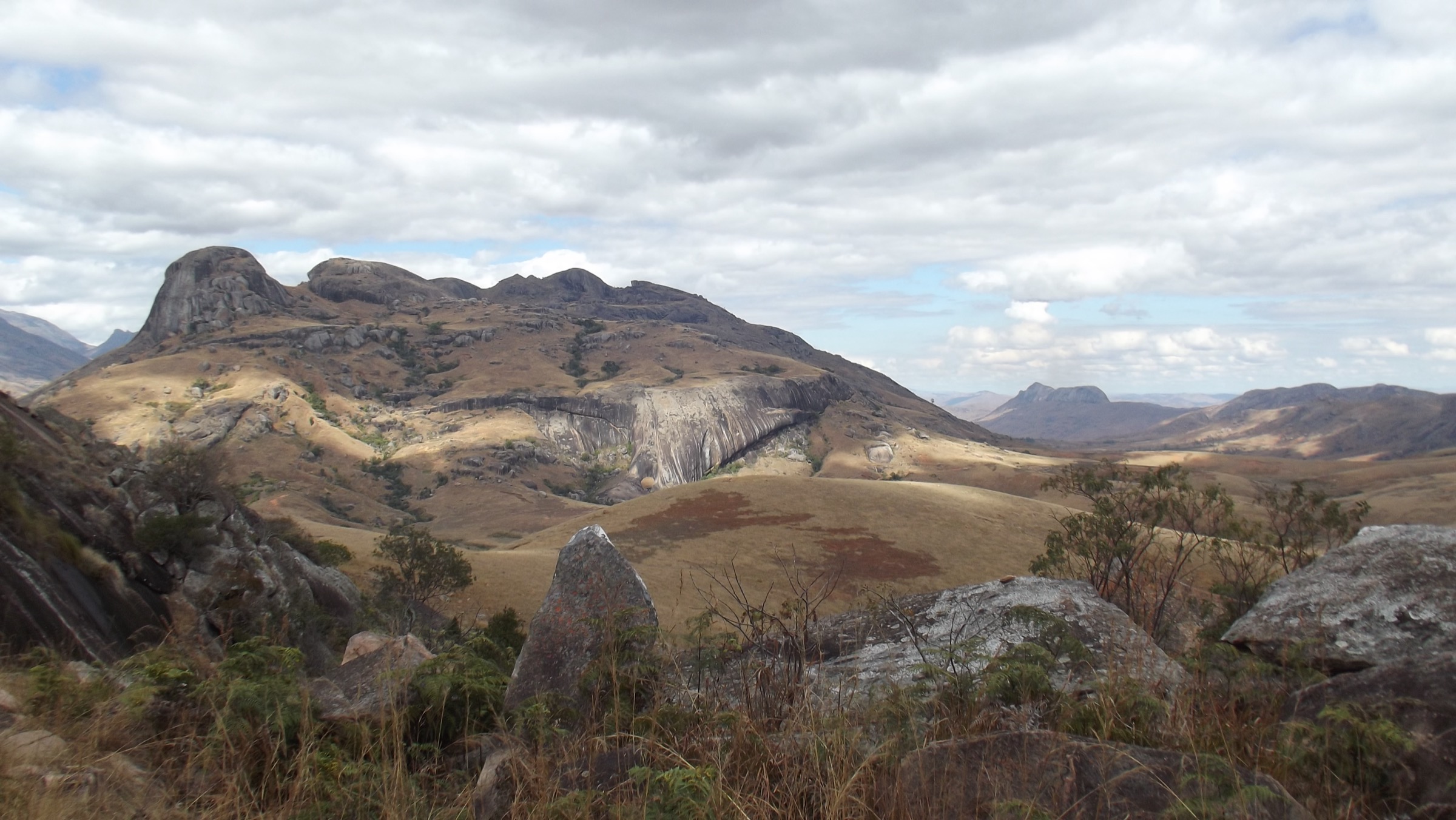
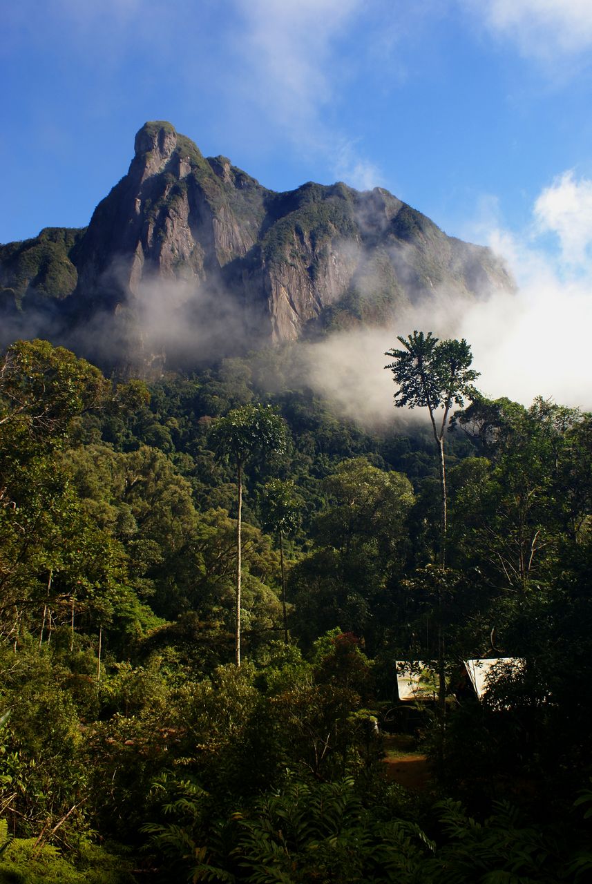
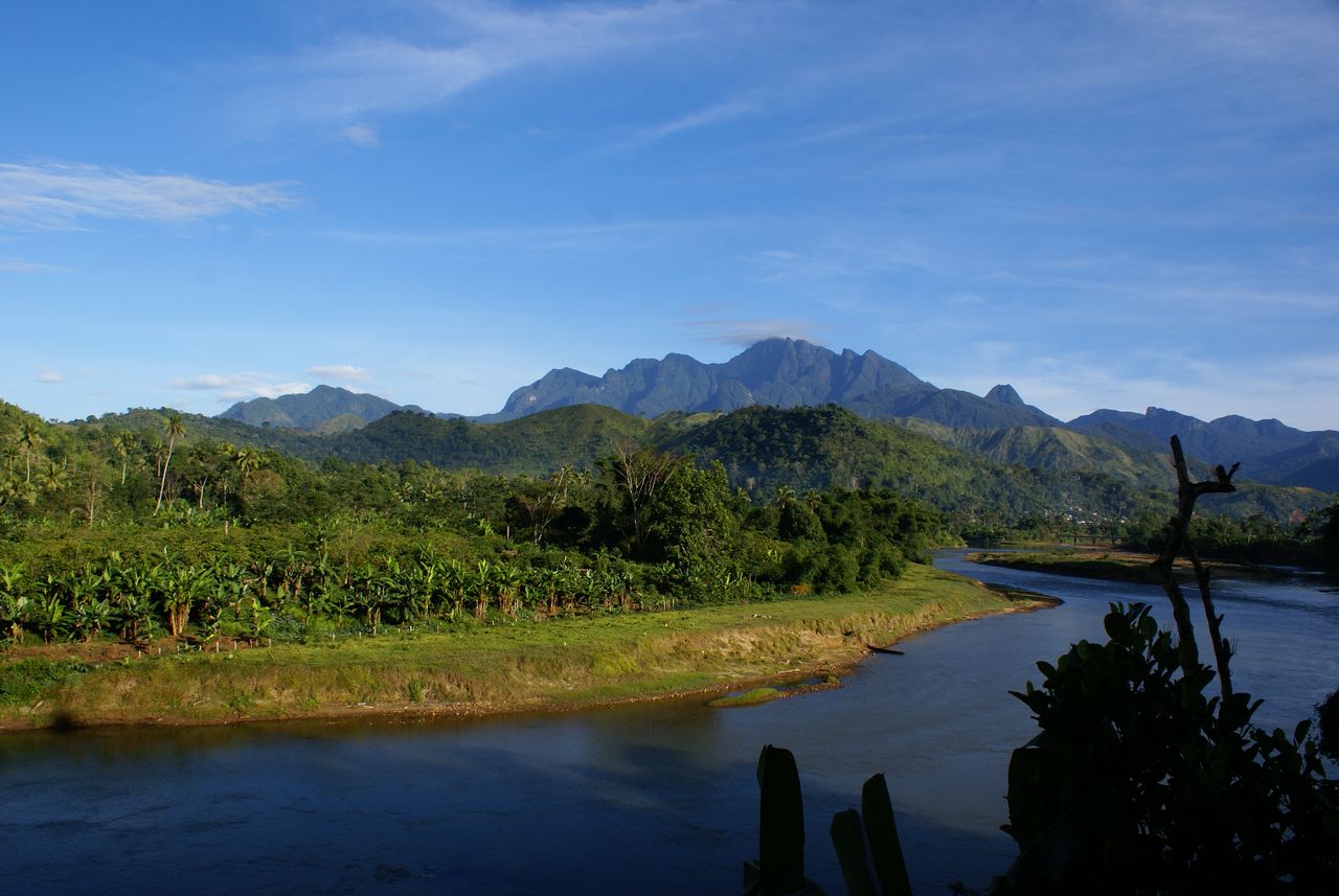
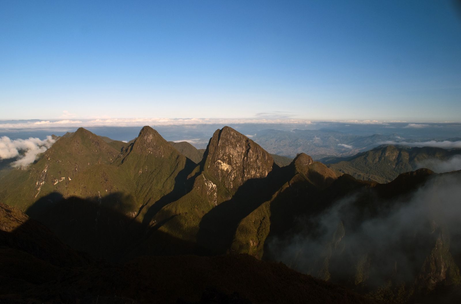
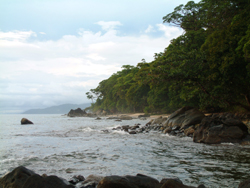
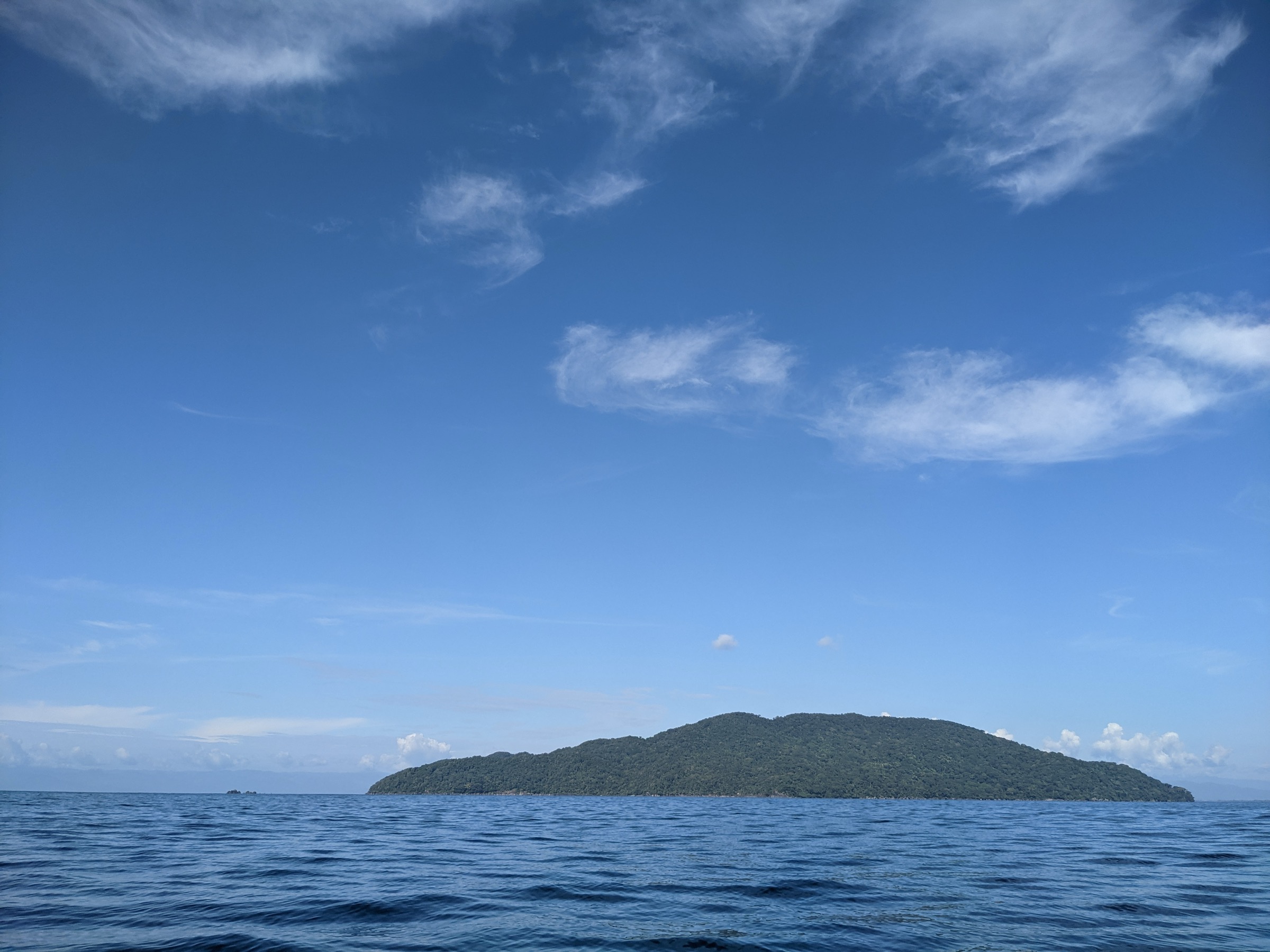
The Marojejy and Masoala highlands sit in the Sava and Analanjirofo regions of northeastern Madagascar and together form the largest contiguous block of humid evergreen rainforest left on the island. Both Marojejy National Park and Masoala National Park are core components of the Rainforests of the Atsinanana, inscribed on the UNESCO World Heritage List in 2007 and removed from the List of World Heritage in Danger in July 2025. The two parks bracket the Bay of Antongil: Marojejy is a sculpted granite massif inland from Sambava and Andapa, rising from about 75 m to the Marojejy summit at 2,132 m over roughly 8 horizontal kilometres; Masoala is the heavily forested peninsula east of Maroantsetra and south of Antalaha, with marine extensions at Tampolo, Ambodilaitry and Ifaho, and includes the Nosy Mangabe Special Reserve in Antongil Bay.
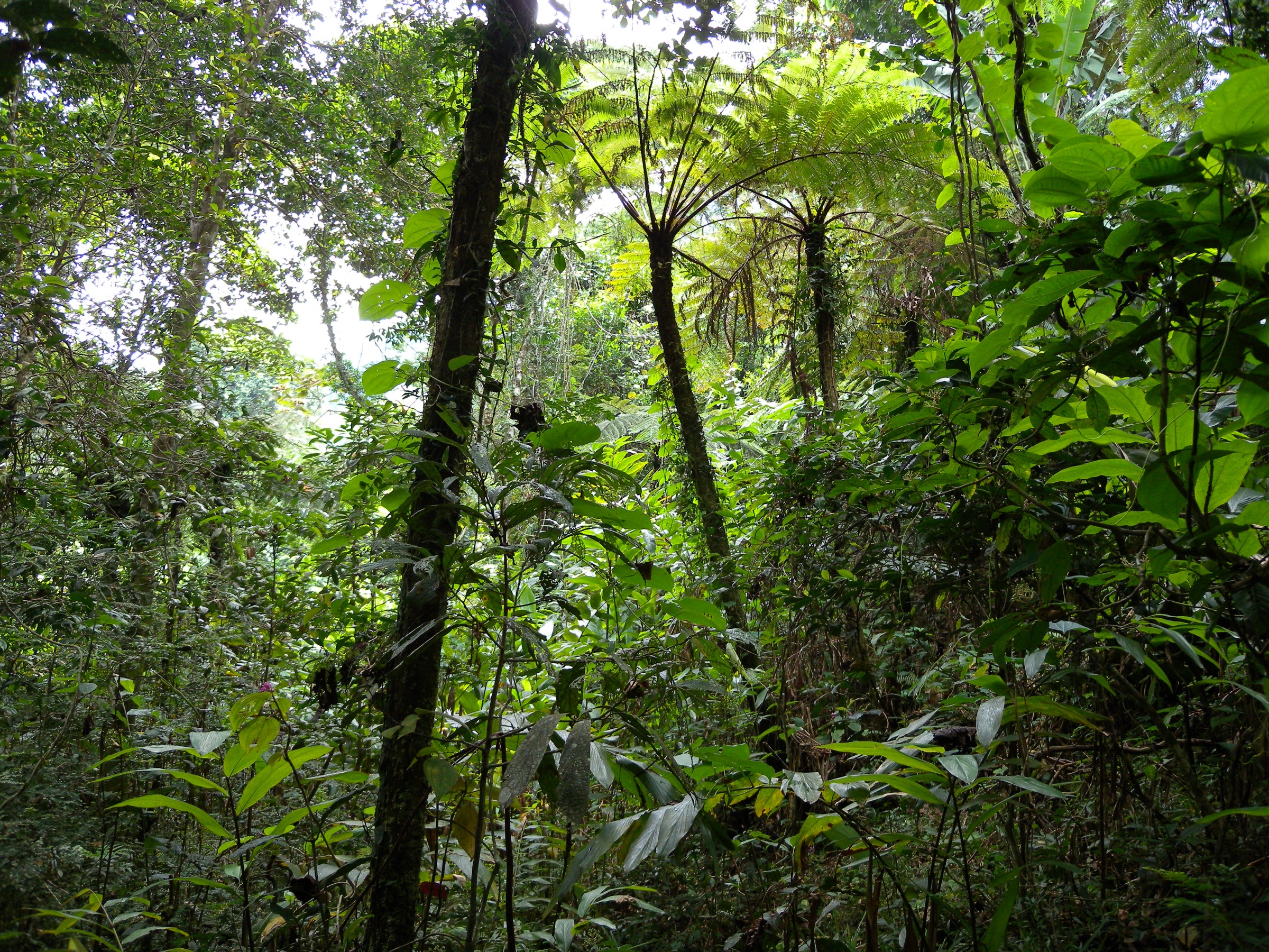
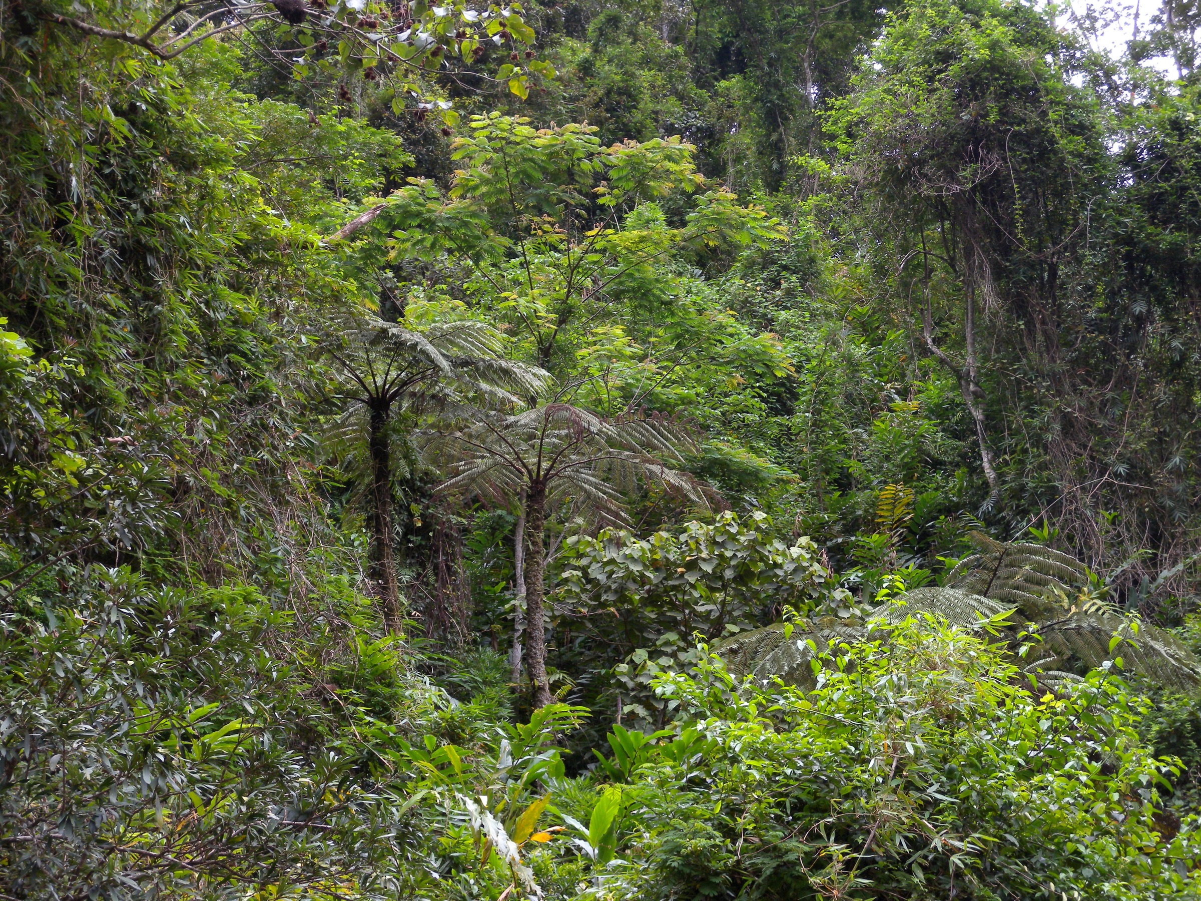
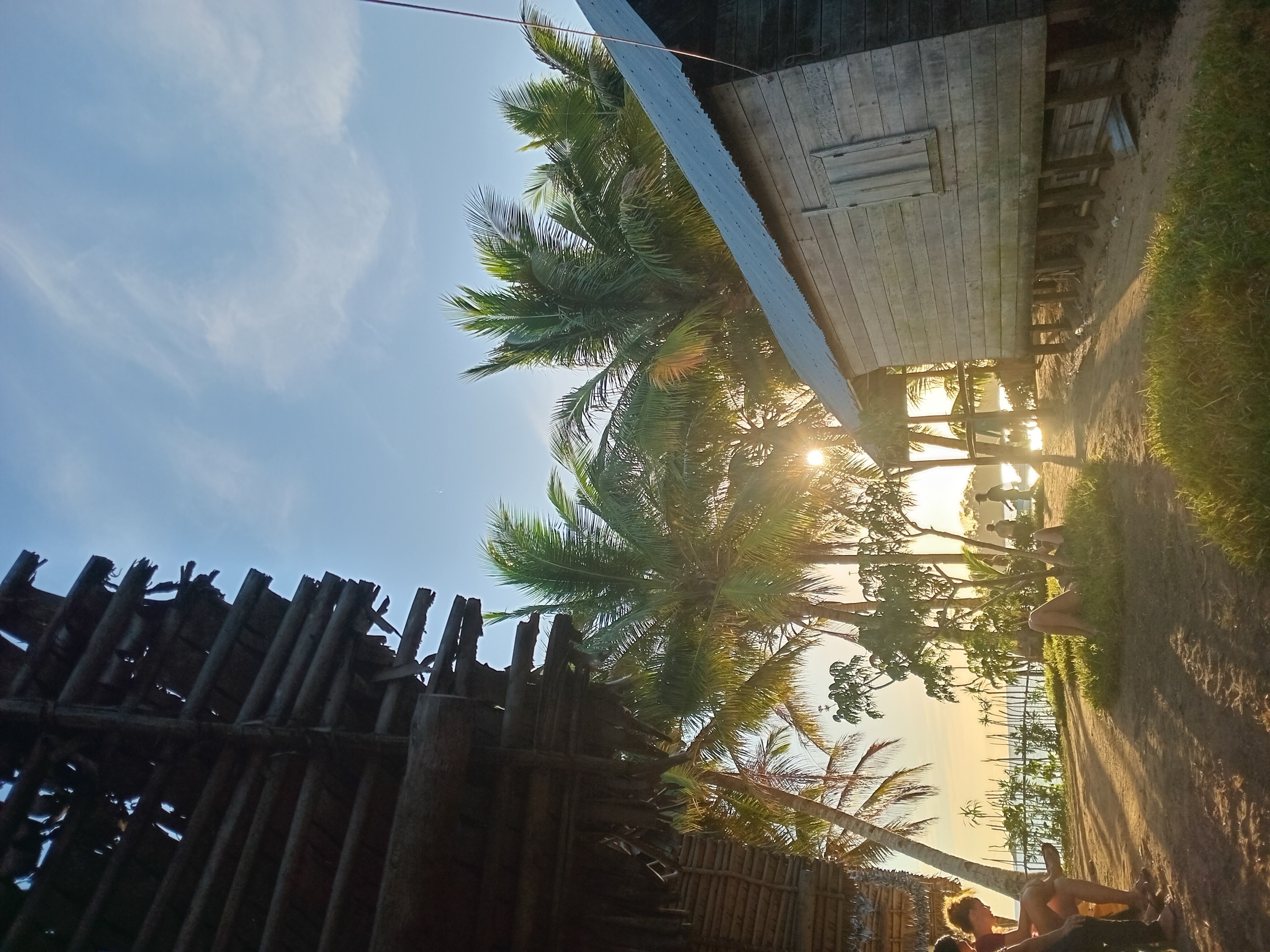
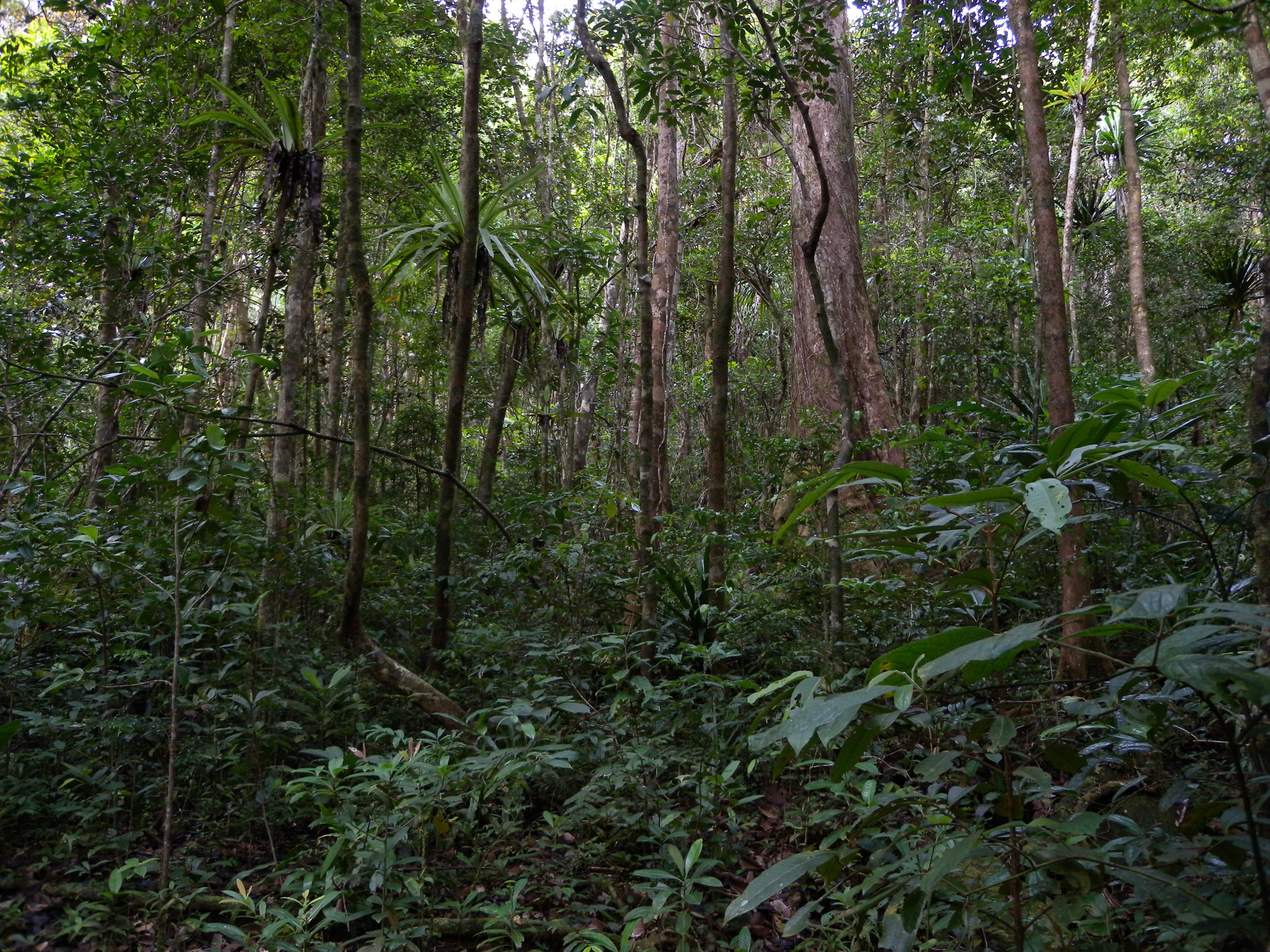
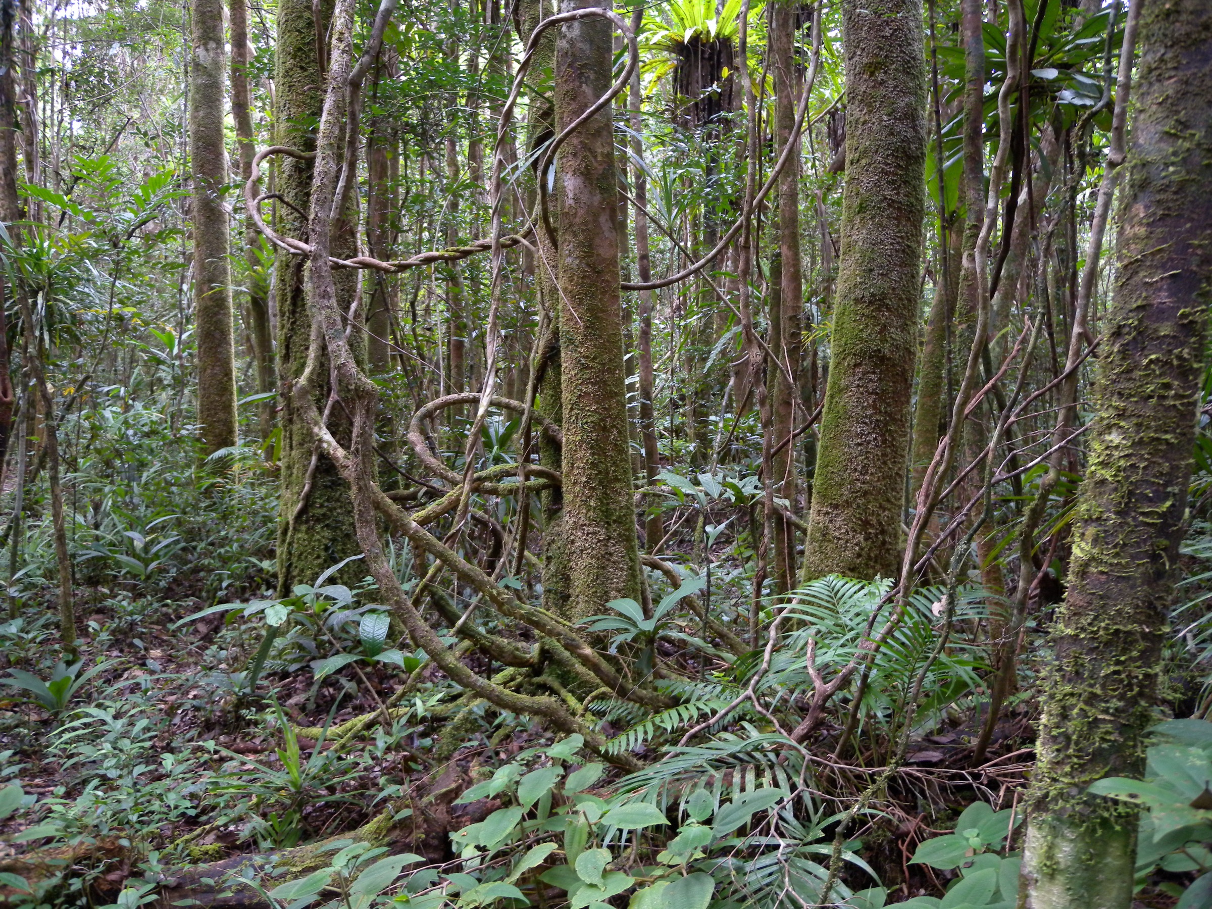
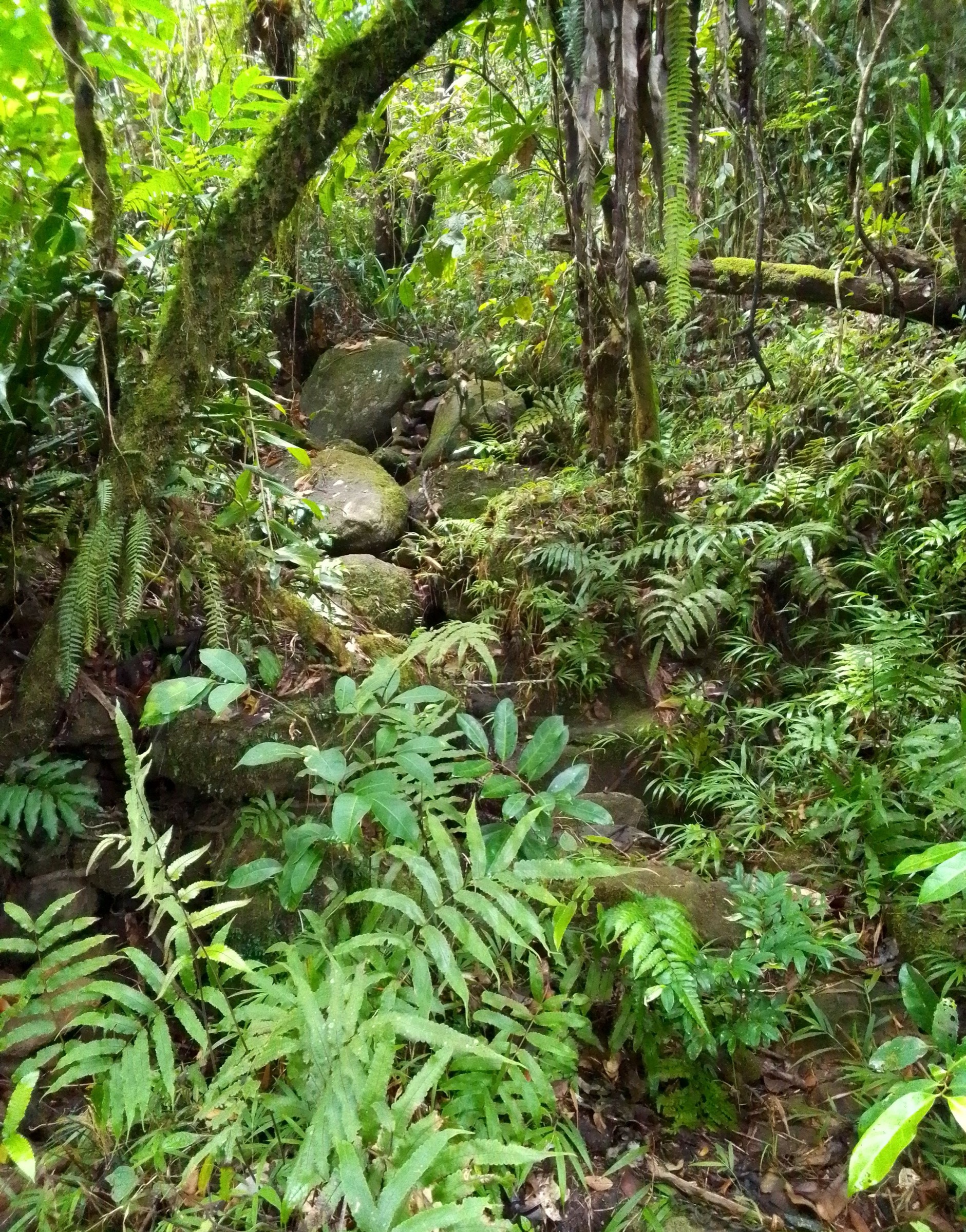
The walking character is wet tropical rainforest with steep, root-bound and frequently muddy trails, dense canopy, leeches in lowland sections, and very limited summit-level visibility. Camp infrastructure inside Marojejy follows three forest camps on a single ascent line — Camp Mantella (450 m), Camp Marojejia (775 m) and Camp Simpona (1,250 m) — rebuilt after Cyclone Enawo damage in 2017. Masoala’s main visitor trails radiate from Tampolo and Ambodiforaha on the western peninsula, with additional clusters at Cap Est and on Nosy Mangabe. Hiring an official Madagascar National Parks (MNP) guide is obligatory in both parks.
The climate is tropical and strongly seasonal. The drier hiking windows fall in September-November and again in some years in May-June. The cyclone season runs roughly January to mid-April; Marojejy is officially closed during this period, and Masoala access by boat or road becomes unreliable. Rainfall is high year-round on south-facing slopes (over 2,300 mm annually at Marojejy) and trails can be slippery and washed out at any season. Park entry fees and current opening status must be checked against Madagascar National Parks (parcs-madagascar.com) and the marojejy.com park visitor portal before publication, as the 2026 fee increase to 90,000 Ar per day for foreign visitors at Marojejy was postponed in early 2026 to November 2026.
Access logistics are demanding. Marojejy is reached from Sambava (about 66 km via the RN3b) or Andapa (about 40 km), with the park entry and information office located shortly before Manantenina village. Masoala is reached from Maroantsetra, normally by boat across Antongil Bay to Tampolo or Ambodiforaha, with onward dugout pirogue or 4x4 to other sectors. Antalaha provides road access to Cap Est on the eastern side. Public transport in the conventional sense is absent at trailhead level; visitors normally arrive by private 4x4, taxi-brousse to the gateway towns, or domestic flight (Tsaradia) to Sambava, Antalaha or Maroantsetra. All five hikes below should be treated as guided, permit-controlled, weather-dependent forest walks rather than open-mountain day hikes in the European or North American sense.
Selection rationale
The five hikes were chosen to balance the two parks and to satisfy the project’s day-hike rule while respecting that the classic Marojejy summit trek (4-6 days) and the integral Maroantsetra-Antalaha Masoala traverse (5-7 days) sit outside the day-hike constraint. Per the prompt’s “clear one-day section” rule, the Marojejy entries are presented as their one-day segments. The set covers:
- Marojejy: Manantenina to Camp Mantella with Cascade de Humbert side trip — the lowland rainforest day, the only Marojejy section many visitors complete, and the most cited single-day route in the park.
- Marojejy: Camp Mantella to Camp Marojejia (Ambatotsondrona viewpoint section) — the iconic granite-outcrop viewpoint and a clear one-day segment for visitors already overnighting in the park; included because it represents the silky-sifaka habitat and the park’s signature montane-rainforest panorama.
- Masoala: Tampolo coastal forest beach trail (Petit Relais to Tampolo Point area) — the most accessible short Masoala day walk, on the rainforest-meets-beach interface, representative of the peninsula’s coastal lowland forest.
- Masoala: Tampolo Cascades forest circuit — the standard Masoala half-day to full-day forest hike to a swimmable waterfall, used by Masoala Forest Lodge and independent guides; representative of Masoala’s primary rainforest interior.
- Masoala / Nosy Mangabe: Special Reserve forest circuit (day trip from Maroantsetra) — the rainforest-island day classic, the only Masoala-cluster site where night walks have been authorised since 2025, and the route most often run as a stand-alone day from Maroantsetra.
The Marojejy summit push from Camp Simpona, the full Maroantsetra-Antalaha traverse, the multi-day Cap Est routes and the Anjanaharibe-Sud sifaka extensions were excluded as multi-day. The Andranobe Forest Station, the Cap Est rainforest cluster and the Lohatrozona section are flagged in the missing-data section as future regional add-ons.
Summary table
| # | Hike | Country | Route type | Distance | Gain | Max elevation | Difficulty |
|---|---|---|---|---|---|---|---|
| 1 | Marojejy: Manantenina to Camp Mantella + Cascade de Humbert | Madagascar | Out-and-back (with side trip) | ~20-21 km round trip | ~350-450 m | ~450 m | Moderate / Hard (heat, mud) |
| 2 | Marojejy: Camp Mantella to Camp Marojejia (Ambatotsondrona section) | Madagascar | Out-and-back from Camp Mantella | ~4-5 km from camp base (one-day section) | ~325 m | 775 m | Hard (steep, slippery) |
| 3 | Masoala: Tampolo coastal forest beach trail | Madagascar | Out-and-back / point-to-point | ~6 km round trip on official short variant | Negligible (coastal) | <50 m | Easy / Moderate (sand, heat) |
| 4 | Masoala: Tampolo Cascades forest circuit | Madagascar | Loop / out-and-back | ~10-12 km on secondary sources | Approximately 200-400 m (unverified) | Approximately 250 m (unverified) | Moderate / Hard (mud, leeches) |
| 5 | Masoala / Nosy Mangabe: Special Reserve forest circuit | Madagascar | Loop / out-and-back | ~3-6 km depending on circuit chosen | Approximately 300 m (highest-point variant) | ~330 m | Moderate (humid, steep on the summit option) |
1. Marojejy: Manantenina to Camp Mantella with Cascade de Humbert side trip
Snapshot
Itinerary
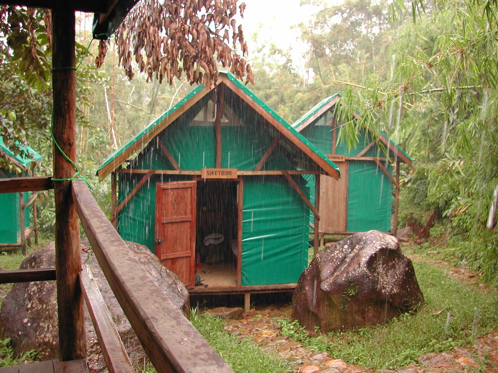
The route begins at the MNP park office in Manantenina, where the entry fee is paid and the obligatory MNP guide is allocated. From the office a flat track leads to the park boundary along farmland and secondary vegetation, with vehicles able to reduce this section by continuing to Mandena village. The trail enters primary lowland rainforest, crosses several small streams and climbs gently on a root- and mud-bound path through dense canopy. Mid-morning to early afternoon arrival at Camp Mantella (450 m) is standard for parties walking the full 9.5 km from Manantenina. The covered eating area and cabins were rebuilt after Cyclone Enawo in 2017.
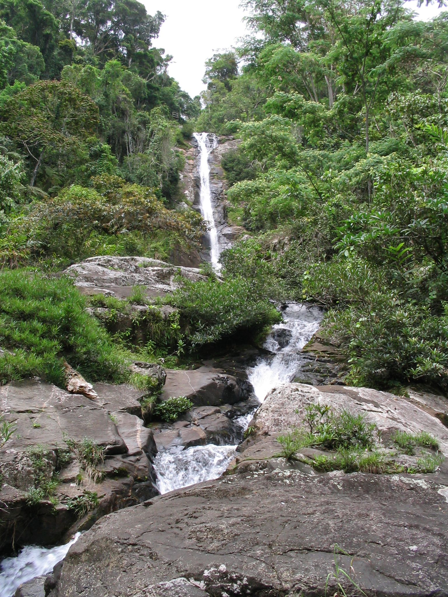
After lunch at the camp, the standard afternoon extension follows a separate 800 m path to the Cascade de Humbert, named after the French botanist Henri Humbert, who first explored the massif in 1948. Strong walkers can return to Manantenina the same day; most visitors overnight at Camp Mantella, which then opens the longer summit programme. Wildlife observed on the route includes white-fronted brown lemurs, helmet vangas, and a wide range of amphibians and reptiles — the camp takes its name from the Mantella frog (Mantella sp.) often seen on the wet forest floor.
Why it is essential
This is the only Marojejy section that can be completed in a single, fast day by very fit walkers, and it represents the park’s lowland rainforest character, its UNESCO-listed Atsinanana habitat type and its main waterfall. It is the route most commonly described in Madagascar trekking literature and on marojejy.com’s “Mantella Trek” page, and it is the obligatory first leg of any further programme deeper into the massif.
Equipment
Standard tropical-forest hiking equipment: closed walking boots or robust trail shoes with grip, long trousers tucked into socks to repel leeches, lightweight waterproof shell, sun and insect protection, water purification, headlamp, navigation backup. MNP guide and park entry permit obligatory; porter hire optional and standard. Carry cash in Ariary for fees, guide and porter.
Hazards and notes
The dominant hazards are heat, humidity, leeches, slippery roots and stream crossings after rain. The park is officially closed during the cyclone season. Independent hiking without a registered MNP guide is not permitted. Trail conditions can change significantly after cyclones or heavy rain; the marojejy.com news feed is the gatekeeping source for current camp and trail availability.
GPX / KML links
| Source | URL | Format / access | Reuse status |
|---|---|---|---|
| Wikiloc: Camp Mantella — Marojejy National Park | gl.wikiloc.com | GPX via Wikiloc | Wikiloc terms apply; secondary GPX source; reuse not confirmed; track verifies the Manantenina-Camp Mantella geometry |
| marojejy.com — Visiting Marojejy | marojejy.com | Official-style visitor portal page | Site terms not fully checked; primary statistics source; authoritative route confirmation; no GPX file |
| Madagascar National Parks — Marojejy | parcs-madagascar.com | Official MNP park page | MNP terms; no GPX download offered; authoritative park information; no GPX file found |
External links
- marojejy.com — Visiting Marojejy National Park
- marojejy.com — 2026 fees notice
- Madagascar National Parks — Marojejy
- Madacamp — Trekking to the Summit of Marojejy
- Wikipedia — Marojejy National Park
- UNESCO — Rainforests of the Atsinanana
2. Marojejy: Camp Mantella to Camp Marojejia (Ambatotsondrona viewpoint section)
Snapshot
Itinerary
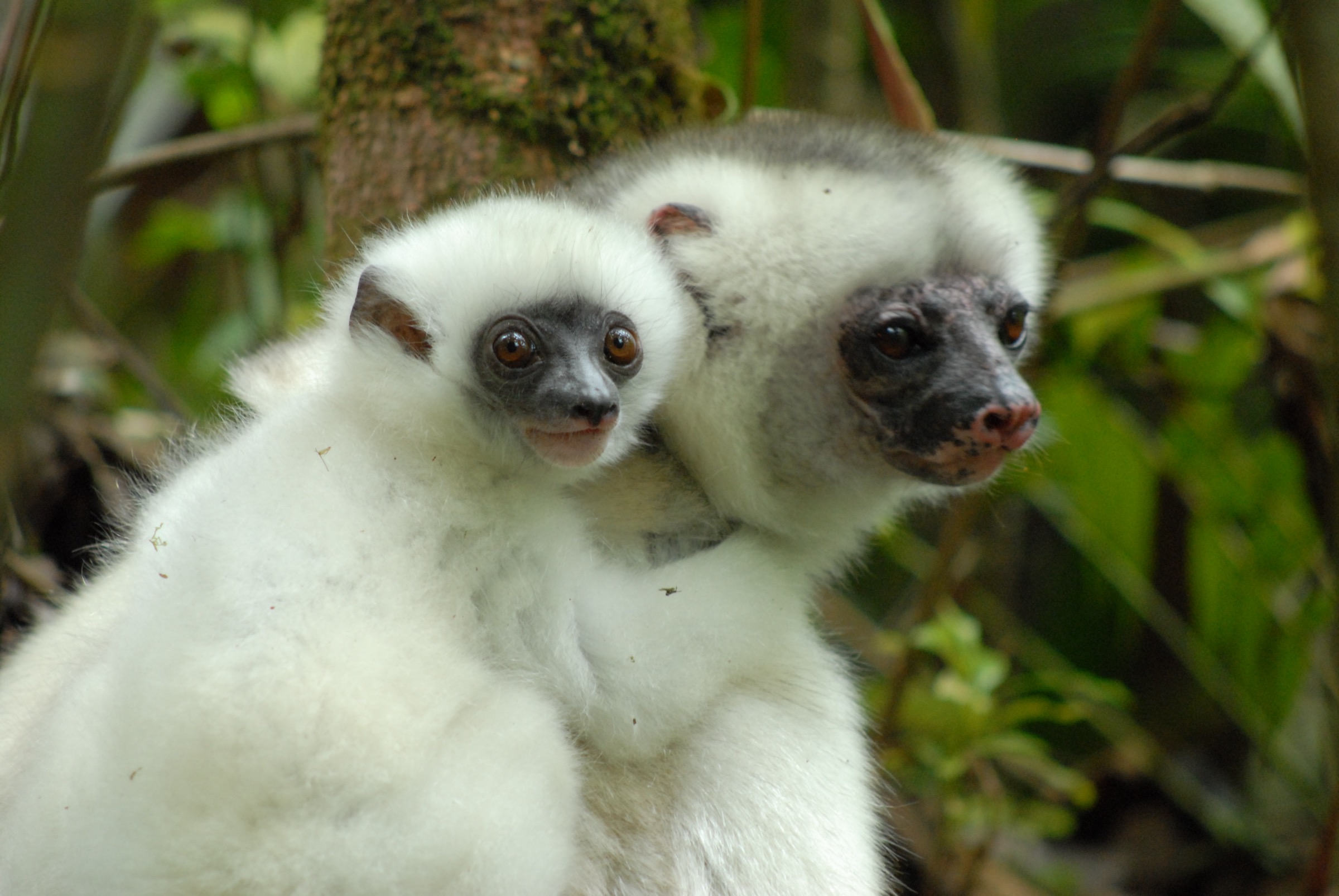
From Camp Mantella the trail climbs steeply through dense montane-transition rainforest, gaining approximately 325 m over a short distance and crossing several small streams. Camp Marojejia sits on a hillside at 775 m, with a covered dining and viewing platform reconstructed after Cyclone Enawo. The platform looks east across the valley to Ambatotsondrona, the “Leaning Rock” — a sheer granite outcrop that is one of Marojejy’s signature views. The forest in this transition belt is the principal habitat zone for silky sifakas (Propithecus candidus), and observation parties often spend several hours in the area before returning to Camp Mantella for the night.
Strong, acclimatised walkers can continue the same day past Camp Marojejia toward Camp Simpona (1,250 m) on the summit programme; that extension is normally split as a separate day in MNP itineraries and is not a day hike under this catalogue’s rules.
Why it is essential
The Camp Mantella-Camp Marojejia section is the most photographed mid-altitude segment of Marojejy and the segment where the granite-and-forest character of the massif — the feature that earned it UNESCO inscription — is most legible. It is the section most reliably associated with silky sifaka sightings and the best single viewpoint short of the summit. As a one-day forest section anchored to a fixed camp it satisfies the prompt’s “clear one-day section” rule.
Equipment
As Hike 1, with additional emphasis on leech protection and steep-trail traction. Trekking poles useful on descent. Headlamp essential for any wildlife observation after dusk or before dawn.
Hazards and notes
Steep wet ground is the main hazard. Mud and roots make slips and minor falls common. Visitors should not attempt to push to Camp Simpona on the same day without prior agreement with the MNP guide. The forest can be very dim under cloud and rain; navigation off-trail is not permitted and the registered MNP guide is required throughout.
GPX / KML links
| Source | URL | Format / access | Reuse status |
|---|---|---|---|
| marojejy.com — Visiting Marojejy | marojejy.com | Visitor portal page | Site terms not fully checked; authoritative route confirmation; no GPX file |
| marojejy.com — Summit trail | marojejy.com | Visitor portal page | Site terms not fully checked; authoritative route description; no GPX file |
| Madagascar National Parks — Marojejy | parcs-madagascar.com | Official MNP park page | MNP terms; no GPX download; authoritative park information; no GPX file. No reusable GPX file for the Camp Mantella - Camp Marojejia section was located in this pass; the Wikiloc Camp Mantella track ends at Camp Mantella |
External links
- marojejy.com — Visiting Marojejy National Park
- marojejy.com — Summit trail
- Madacamp — Marojejy National Park
- Wikipedia — Marojejy National Park
- Madagascar National Parks — Marojejy
3. Masoala: Tampolo coastal forest beach trail (Petit Relais to Tampolo Point)

Snapshot
Itinerary
From the Masoala Forest Lodge / Petit Relais area, a low coastal trail follows the rainforest-beach interface north (or south, depending on the chosen Tampolo trailhead) toward Tampolo Point. The path runs a few metres above the high-tide mark in shaded coastal forest; at low tide much of the route can be walked on the beach itself. The trail provides a typical Masoala coastal-lowland experience: pandanus, screw pine and tropical hardwood overhanging white-sand beach, with the Tampolo Marine Park’s reefs visible offshore. White-fronted brown lemurs, Madagascar pygmy kingfisher, helmet vanga and northern bamboo lemur are reported along this strip. The route returns by the same line.
Why it is essential
This is the most accessible Masoala day walk, the route that most clearly shows the peninsula’s rainforest-and-beach interface, and the standard introduction trail used by visitors staying near Tampolo. It also serves as the access route for boat-and-foot combinations into the Tampolo Marine Park sector.
Equipment
Standard hiking equipment: trail shoes or sandals with strap, sun protection, insect protection, dry-bag for cameras, drinking water. No rope, no climbing gear, no via-ferrata equipment relevant. MNP guide obligatory when entering the national park sectors of the trail.
Hazards and notes
Heat exposure on the sand sections, sun glare on water, occasional crocodile reports in nearby rivers (verify locally), and the unreliable boat connection across Antongil Bay are the main practical hazards. Tidal timing matters: a high tide can shorten the available beach line and force walkers onto the forest path. Cyclone-season weather closes this route in practice even if the park is not formally closed.
GPX / KML links
| Source | URL | Format / access | Reuse status |
|---|---|---|---|
| Madagascar National Parks — Masoala | parcs-madagascar.com | Official MNP park page | MNP terms; no GPX download; authoritative park information; no GPX file |
| Masoala Forest Lodge — Activity guide PDF | masoalaforestlodge.com | Lodge activity guide PDF | Lodge terms not fully checked; authoritative trail descriptions for the Tampolo sector; no GPX |
| Rough Guides — Northeastern Madagascar | roughguides.com | Secondary travel guide | Rough Guides terms apply; provides 3 km coast description; no GPX. No reusable GPX file was located in this pass; route geometry must be reconstructed from on-the-ground survey or OpenStreetMap |
External links
- Madagascar National Parks — Masoala
- Wikipedia — Masoala National Park
- Masoala Forest Lodge — Activity guide
- Masoalatour.com — Masoala Forest Lodge activity guide
- Rough Guides — Northeastern Madagascar
4. Masoala: Tampolo Cascades forest circuit
Snapshot
Itinerary
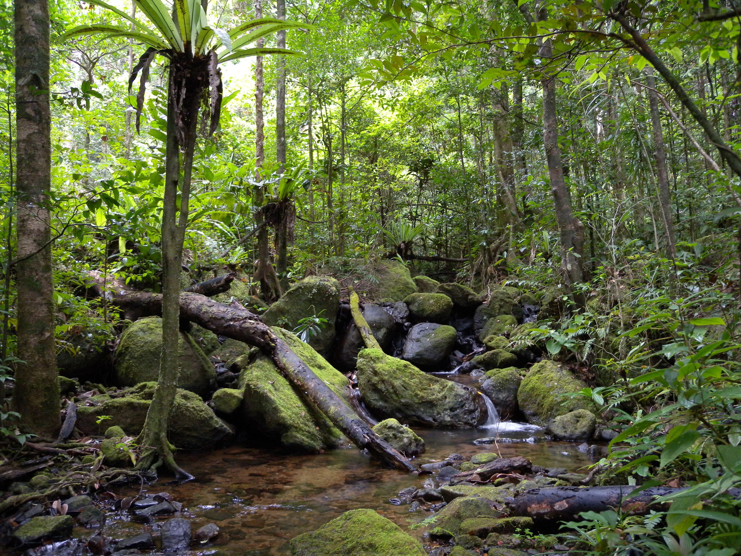
From the lodge area or Ambodiforaha trailhead the route follows the coastal forest north toward the mouth of the Tampolo River, then turns inland on a footpath through secondary and primary rainforest. The terrain is mostly flat but with a short climb over the inland ridge before descending to the Tampolo Cascades, a swimmable forest waterfall. The return route either retraces the inland section or loops back along the coast via a second trail close to the beach. Red-ruffed lemurs (Varecia rubra), the peninsula’s flagship endemic, and Madagascar fish eagle are among the species recorded on this circuit; the wider area also supports helmet vanga, Bernier’s vanga and several leaf-tailed gecko species.
Why it is essential
This is the standard Masoala “primary rainforest” day hike sold by lodges and registered MNP guides at Tampolo, and the route on which red-ruffed lemurs are most reliably seen on a single-day programme. The cascade itself is the standard mid-route objective and the only freshwater swim of any of the Masoala day routes.
Equipment
Standard tropical-forest hiking equipment, with strong emphasis on leech protection (long trousers tucked into socks, repellent treatment of clothing), waterproof shell, dry-bag for electronics, sandals or shoes that can get wet for the cascade. MNP guide and park entry permit obligatory.
Hazards and notes
Leeches are constant in the wetter sections, the cascade pool can be slippery, and stream crossings can become impassable after heavy rain. The route is run only with an MNP guide; independent walking deeper than the immediate lodge perimeter is not authorised. Sea-state cancellations of the Maroantsetra-Tampolo boat can cut visitors off from the trailhead at short notice.
GPX / KML links
| Source | URL | Format / access | Reuse status |
|---|---|---|---|
| Madagascar National Parks — Masoala | parcs-madagascar.com | Official MNP park page | MNP terms; no GPX download; authoritative park information; no GPX file |
| Masoala Forest Lodge — Activity guide PDF | masoalaforestlodge.com | Lodge activity guide PDF | Lodge terms not fully checked; authoritative trail descriptions; no GPX |
| Masoalatour.com — Forest Lodge activity guide | masoalatour.com | Secondary lodge page | Site terms apply; confirms 4-5 hour Tampolo Cascades duration. No reusable GPX file was located in this pass |
External links
- Madagascar National Parks — Masoala
- Wikipedia — Masoala National Park
- Masoala Forest Lodge — Activity guide
- Masoalatour.com — Masoala Forest Lodge activity guide
- WCS Madagascar — Red-ruffed lemur
5. Masoala / Nosy Mangabe Special Reserve forest circuit
Snapshot
Itinerary
From Maroantsetra a small motorboat crosses about 2 km of Antongil Bay to the western beach of Nosy Mangabe. The reserve’s circuit network branches at the beach: a flat coastal loop runs north past the historic Dutch tomb (graffiti carved into the rocks by 17th-century sailors) and the modern MNP campsite, while a separate inland loop climbs steeply on a wet root-bound trail to the island summit at approximately 330 m. The forest is closed-canopy lowland rainforest dominated by Canarium, Ravensara and other Atsinanana lowland species. Nosy Mangabe holds a translocated population of aye-aye (Daubentonia madagascariensis), white-fronted brown lemurs, black-and-white ruffed lemurs, the leaf-tailed gecko Uroplatus fimbriatus, Brookesia chameleons and the Madagascar tree boa. Since 2025 Nosy Mangabe is one of five MNP parks in which authorised night walks are possible, run from the campsite.
Why it is essential
Nosy Mangabe is the single most accessible Masoala-cluster site, the only protected-area circuit reliably reached as a day trip from Maroantsetra, and the standard introduction to the Masoala block. It is the only Masoala day route on which all three of aye-aye, ruffed lemur and leaf-tailed gecko can plausibly be seen, and it is the only Masoala day route in which authorised night walking is currently offered.
Equipment
Standard tropical-forest hiking equipment, headlamp essential if combining a day visit with an authorised night walk, dry-bag for the boat crossing, lifejacket recommended (provided by most boat operators — verify before boarding), insect protection, sun protection. MNP guide obligatory.
Hazards and notes
The dominant practical hazard is the bay crossing in poor sea state. The summit trail is steep and slippery and is sometimes shortened or omitted in heavy rain. The aye-aye is nocturnal and largely solitary; sightings are not guaranteed even on night walks. The reserve is small enough that off-trail wandering is unnecessary and not authorised.
GPX / KML links
| Source | URL | Format / access | Reuse status |
|---|---|---|---|
| Madagascar National Parks — Nosy Mangabe | parcs-madagascar.com | Official MNP park page | MNP terms; no GPX download; authoritative park information; no GPX file |
| Madagascar National Parks — Masoala | parcs-madagascar.com | Official MNP park page | MNP terms; no GPX download; authoritative park information; no GPX file |
| Wikiloc: Masoala to Nosy Mangabe to Maroantsetra (motorboat trail, day 9) | wikiloc.com | Wikiloc GPX of boat track | Wikiloc terms apply; boat geometry only; not a walking GPX. No reusable hiking GPX for the on-island circuits was located in this pass |
External links
- Madagascar National Parks — Nosy Mangabe
- Madagascar National Parks — Masoala
- Wikipedia — Nosy Mangabe
- Wikipedia — Masoala National Park
- Safaribookings — Nosy Mangabe Special Reserve
- MadaMagazine — Nosy Mangabe
Outstanding verification notes
- No official MNP GPX, KML or GeoJSON downloads were located in this pass for any of the five hikes. Walking-track geometry for the published catalogue will need to be sourced from OpenStreetMap relations cross-checked against the marojejy.com camp coordinates and the Masoala Forest Lodge trail map, or from a future on-the-ground survey.
- Marojejy Hike 2 (Camp Mantella - Camp Marojejia) lacks a public GPX. The Wikiloc Camp Mantella track ends at the camp; the section above is mapped only on lodge / operator materials.
- Masoala Hike 4 (Tampolo Cascades) distance and elevation are derived from lodge time estimates, not from a measured track. These figures must be re-checked before publication.
- Cap Est, Lohatrozona, the Andranobe Forest Station and Anjanaharibe-Sud (the silky-sifaka special reserve south of Andapa) were considered but not selected; they remain candidate add-ons for a future expanded regional unit.
- The marojejy.com 2026 entry-fee position is mid-transition (postponement of the 90,000 Ar foreign-visitor fee from January 2026 to November 2026); the fee table must be re-verified close to publication.
- Cyclone-season closure dates (Marojejy is normally closed January to mid-April) need annual reconfirmation against MNP and marojejy.com news feeds.
- Cover-image candidates for the regional article are flagged as: Frank Vassen’s “Marojejy National Park, Madagascar” (CC BY 2.0, 4,224 x 3,168 px) for the Marojejy side and Claudia Rahary Soa’s “NOSY MANGABE” (CC BY-SA 4.0, 4,032 x 3,024 px) for the Masoala side; both are above the 2,000 px hard-floor cover threshold and around or above the 2,400 px target. MantellaMan’s “Bamboo Grove on Nosy Mangabe” (CC BY-SA 4.0, 4,608 x 1,960 px) is panoramic and useful as a hero banner but its short edge is just below the cover hard floor.
- The Wikiloc “Camp Mantella - Marojejy National Park” track and the Wikiloc Masoala-Nosy Mangabe motorboat track both sit behind Wikiloc terms; reuse status of the raw GPX is not confirmed.
- Several official park pages (marojejy.com, parcs-madagascar.com, masoalaforestlodge.com PDF) could not be re-fetched directly in this pass. Their content was triangulated from independent search-engine extracts; direct re-verification against the live pages is required before publication.
External links
| Source | URL |
|---|---|
| marojejy.com — Visiting Marojejy National Park | marojejy.com |
| marojejy.com — Summit trail | marojejy.com |
| marojejy.com — Planning a Trip to Marojejy | marojejy.com |
| marojejy.com — 2026 entry fees | marojejy.com |
| marojejy.com — Camps and trail rehabilitation | marojejy.com |
| Madagascar National Parks — Marojejy | parcs-madagascar.com |
| Madagascar National Parks — Masoala | parcs-madagascar.com |
| Madagascar National Parks — Nosy Mangabe | parcs-madagascar.com |
| UNESCO World Heritage Centre — Rainforests of the Atsinanana | whc.unesco.org |
| IUCN press release — Rainforests of Atsinanana removed from List in Danger, July 2025 | iucn.org |
| WCS Madagascar — Masoala and red-ruffed lemur | madagascar.wcs.org |
| Wikipedia — Marojejy National Park | en.wikipedia.org |
| Wikipedia — Masoala National Park | en.wikipedia.org |
| Wikipedia — Nosy Mangabe | en.wikipedia.org |
| Wikipedia — Humbert Falls | en.wikipedia.org |
| Madacamp — Marojejy National Park | madacamp.com |
| Madacamp — Trekking to the Summit of Marojejy | madacamp.com |
| Madacamp — Trekking from Maroantsetra to Tampolo - Ambodiforaha | madacamp.com |
| Masoala Forest Lodge — Activity guide PDF | masoalaforestlodge.com |
| Masoalatour.com — Forest Lodge activity guide | masoalatour.com |
| Rough Guides — Northeastern Madagascar | roughguides.com |
| Safaribookings — Marojejy | safaribookings.com |
| Safaribookings — Nosy Mangabe | safaribookings.com |
| MadaMagazine — Nosy Mangabe | madamagazine.com |
| Wikiloc — Camp Mantella, Marojejy | gl.wikiloc.com |
| Wikiloc — Masoala to Nosy Mangabe (motorboat track) | wikiloc.com |