Regional overview
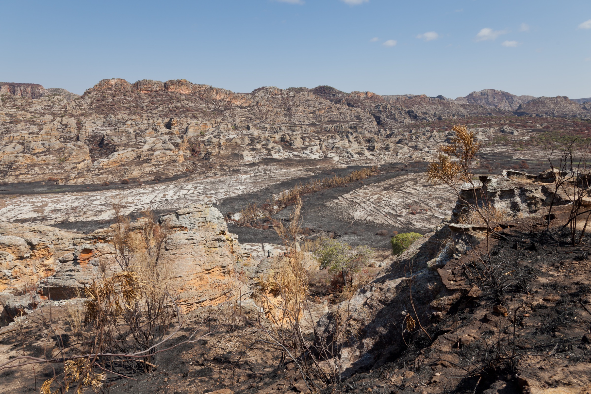
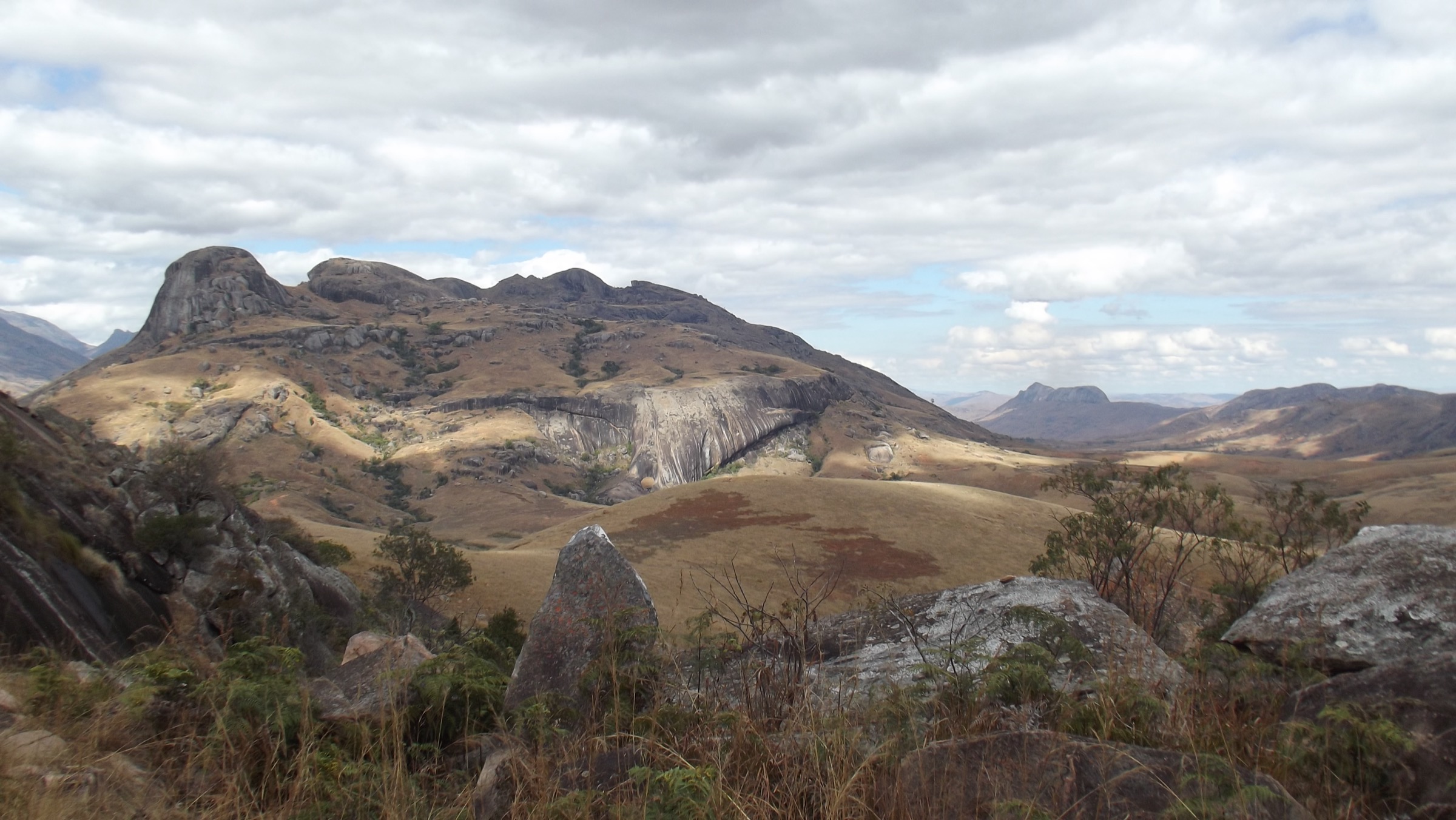
The Andringitra Massif rises in south-central Madagascar, in the Haute Matsiatra and Ihorombe regions of the former Fianarantsoa Province, roughly 47 km south-east of the town of Ambalavao on the RN7 highway. The range stretches some 64 km north-south and reaches about 10 km across at its widest. Its geology is dominated by Precambrian granite and metamorphic rock that has eroded into spectacular bare domes, cliffs and sculpted boulder fields, culminating at Pic Boby / Imarivolanitra (2,658 m), Madagascar’s second-highest summit and the highest point reachable by walkers.
Most hiking is concentrated inside Parc National d’Andringitra, a 31,160-hectare protected area established in 1999 and managed by Madagascar National Parks. The park has a marked circuit network radiating from the Namoly entrance (eastern side, accessed from Ambalavao) and the Morarano entrance (western side, near Tsaranoro). Trails climb through five distinct vegetation belts: lowland rainforest at around 700 m, dense montane forest, ericoid heath, the high-altitude Andohariana plateau prairies near 2,000 m (described by the park as the only altimontane grasslands on the African continent), and bare granite summit terrain above. The Tsaranoro valley immediately to the west, although outside the park boundary, is part of the same massif and provides further day-walks among iconic granite walls.
The reliable hiking season runs from April to early November, with July to September the driest and clearest months. Above 2,000 m, overnight temperatures regularly fall below freezing in the dry-season winter, and frost is common on the plateau. Rain, mist and slippery granite are the main hazards outside the dry season; the eastern slopes are particularly storm-prone. Park entry, a certified Madagascar National Parks guide and (for the longer circuits) porters are mandatory; all bookings and guides are arranged at the Namoly or Morarano park offices. The two entrances are not connected by road, so traverses require logistics.
Access is by RN7 from Antananarivo, Antsirabe or Fianarantsoa to Ambalavao; from there a rough 43 km piste leads east to Namoly (about two hours, 4x4 recommended), or a separate piste leads west to the Tsaranoro valley and Morarano gate. There is no public transport into the park; almost all visitors arrive by hired 4x4 or organised tour.
Selection rationale
The five hikes below cover the main day-walkable products inside and around the massif. The Asaramanitra circuit is the short signature waterfall walk and the most accessible introduction to the park. The Diavolana circuit is a full-day balcony loop across the high cliffs and the Andohariana plateau, taken in by far the largest share of single-day visitors. The Imaitso forest circuit is a full-day primary-rainforest loop on the wetter eastern flank, the best lemur and bird walk. The summit day of Pic Boby from Andriampotsy base camp is the highest accessible peak in Madagascar; clearly described in every park itinerary as a self-contained day from camp. The Pic Caméléon loop from Tsaranoro is the iconic granite-dome viewpoint walk that represents the western face of the massif. The Isahavato circuit, frequently described in park literature, is in practice the final descent day of a multi-day traverse to Morarano rather than a stand-alone day-hike and has therefore been omitted in favour of the Tsaranoro option.
Summary table
| # | Hike | Country | Route type | Distance | Gain | Max elevation | Difficulty |
|---|---|---|---|---|---|---|---|
| 1 | Asaramanitra circuit (Riambavy and Riandahy falls) | Madagascar | Loop with access spur | ~10 km | ~300 m | ~1,500 m | Easy |
| 2 | Diavolana circuit | Madagascar | Loop | ~13 km | ~600-800 m | ~2,050 m | Strenuous |
| 3 | Imaitso forest circuit | Madagascar | Loop with access spur | ~14 km | ~500 m | ~1,600 m | Moderate-Strenuous |
| 4 | Pic Boby (Imarivolanitra) summit day | Madagascar | Out-and-back | ~8-10 km | ~600 m | 2,658 m | Strenuous |
| 5 | Pic Caméléon loop (Tsaranoro) | Madagascar | Loop | ~9-10 km | ~500-600 m | ~1,540 m | Moderate |
1. Asaramanitra Circuit (Riambavy and Riandahy Falls)

Snapshot
Itinerary
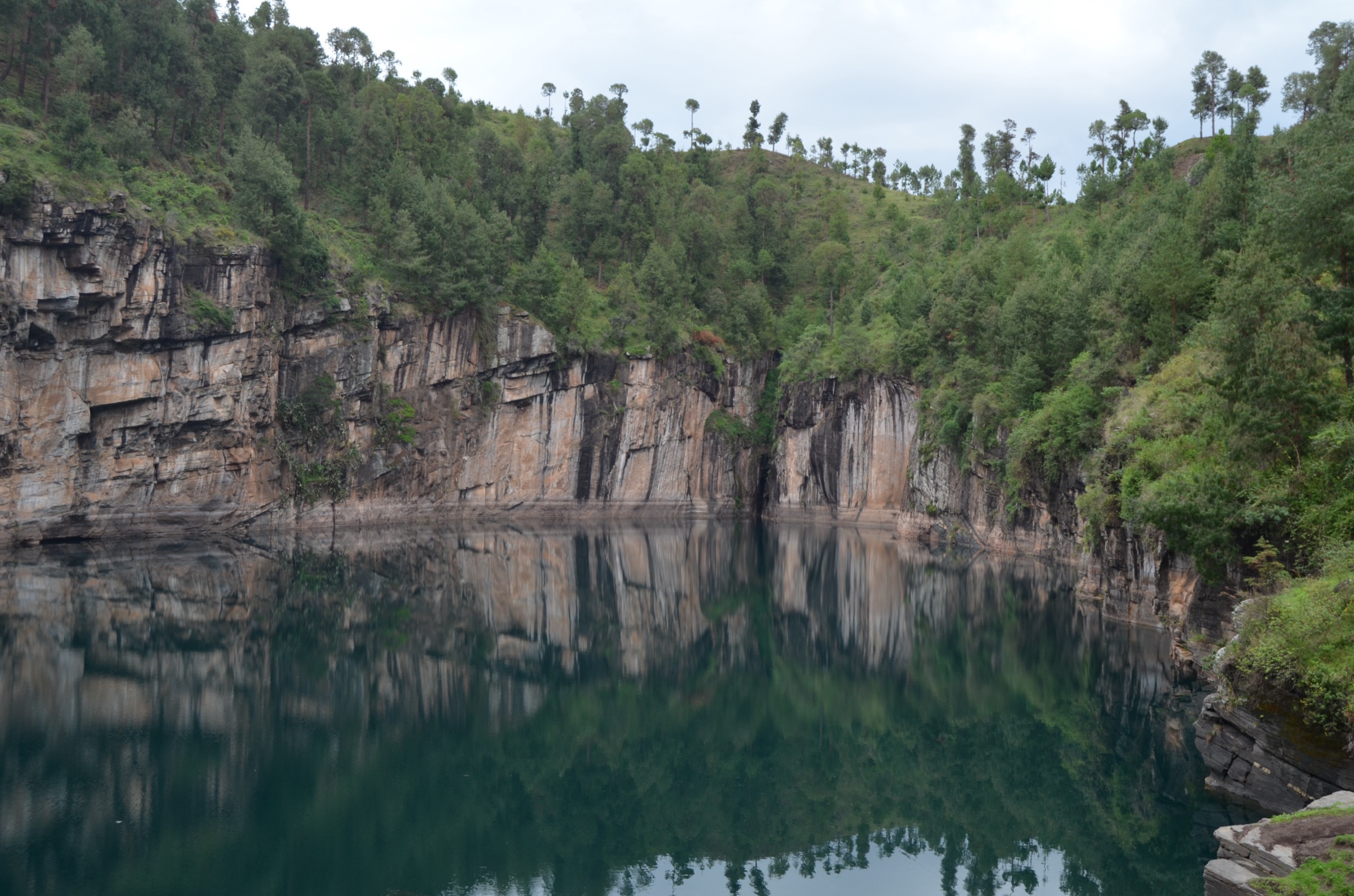
From the Namoly park office at roughly 1,150 m, an access track leads through cultivated land and gallery forest to the start of the loop. The circuit climbs gently through dense humid forest, passing terrestrial orchids and medicinal plants documented in the park interpretation. After about half of the loop the trail reaches a granite cirque dominated by two parallel waterfalls: the Riandahy (“the king”), a single sacred drop of around 300 m, and the Riambavy (“the queen”), a thinner 250 m cascade, separated by roughly 500 m of granite wall. The path then loops back through forest to the gate, traversing a historical rock shelter and a viewpoint over the Namoly basin before rejoining the access spur.
Why it is essential
Asaramanitra is the introductory walk used by the park itself and is the only Andringitra circuit short enough to leave room for a same-day return drive to Ambalavao. It packs in the massif’s two best-known waterfalls, both of which carry strong local fady (taboo) and mythological significance as the petrified royal couple of Andringitra folklore. For visitors who cannot commit to a strenuous full day, this is the representative experience.
Equipment
Standard hiking equipment, plus light footwear suitable for wet, rooty forest paths, long sleeves for biting insects, and swimwear if planning to enter pools at the base of the falls (check current fady restrictions with the guide).
Hazards and notes
A Madagascar National Parks guide is mandatory and arranged at the Namoly office. The forest section becomes very slippery after rain. The falls are sacred; bathing and behaviour rules should be confirmed with the guide before approaching the base. No drinking-water sources are treated; carry filtered or bottled water.
GPX / KML links
| Source | URL | Format / access | Reuse status |
|---|---|---|---|
| OpenStreetMap (no dedicated relation found) | openstreetmap.org near Namoly | OSM data (ODbL) | Geometry reusable; no curated route relation |
| Route-file status | No downloadable GPX published by Madagascar National Parks | Unresolved | Unresolved |
External links
- Madagascar National Parks — Parc National d’Andringitra
- Wikipedia — Riandahy Falls
- Wikipedia — Rianbavy Falls
2. Diavolana Circuit

Snapshot
Itinerary
From the Namoly gate the trail climbs steadily through humid forest then ericoid heath, gaining the base of the great granite cliffs above the Riambavy and Riandahy falls. The route runs as a balcony along the foot of the cliffs and then steeply up to the rim of the Andohariana plateau at around 2,000 m, where altimontane grassland, dwarf endemic flora and granite domes replace the forest. After a high traverse the trail descends along a parallel valley with multiple cascades and pools, reaching a natural granite swimming pool that is the standard rest stop, before continuing back to Namoly. Park literature notes that the modern Diavolana loop is also used as the first day of the multi-day trek to Pic Boby, in which case walkers continue from the plateau to Iantaranomby camp rather than returning to the gate.
Why it is essential
Diavolana is the single best day-route in the park because it crosses every major vegetation zone and visits the Andohariana plateau — the high-altitude grassland celebrated in park documentation as a unique African ecosystem — without requiring an overnight at altitude. It also exposes the two great waterfalls from above rather than below, giving the most spectacular cliff scenery in the massif.
Equipment
Mountain hiking equipment: sturdy boots with good grip on wet granite, trekking poles strongly recommended for the long descent, extra warm layer and windproof for sharp plateau temperature drops, headtorch (long day, real risk of finishing in the dark), sun protection on the open plateau, and at least 2.5 L of water as refill points are limited.
Hazards and notes
A park guide is mandatory. Plateau weather changes very quickly; afternoon mist and electrical storms can make navigation hazardous. Some cliff-edge sections are exposed. The route is long enough that fitness is a real factor; walkers unsure of their pace should split the day with an overnight at Iantaranomby camp.
GPX / KML links
| Source | URL | Format / access | Reuse status |
|---|---|---|---|
| Wikiloc — Andringitra loop trail to Pic Boby (3 days; first day overlaps Diavolana) | wikiloc.com | GPX (user-submitted) | Reference only; Wikiloc terms restrict redistribution |
| OpenStreetMap | openstreetmap.org near Andohariana plateau | OSM data (ODbL) | Geometry reusable under ODbL with attribution |
External links
- Madagascar National Parks — Parc National d’Andringitra
- Wikipedia — Andringitra National Park
- Wikipedia — Andringitra Massif
3. Imaitso Forest Circuit
Snapshot
Itinerary
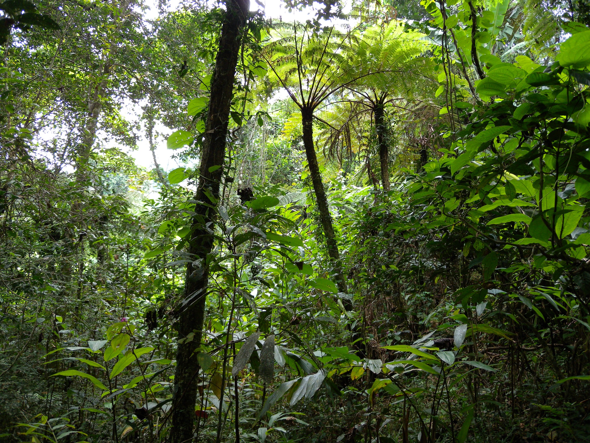
Imaitso (meaning “verdant” or “greenery”) is the wet-forest circuit of Andringitra, plunging into the dense humid primary forest that forms the park’s eastern corridor toward the rainforest belt of central Madagascar. From Namoly the access trail descends and traverses to the forest edge, where the loop proper enters tall, mossy primary rainforest. The path winds among small endemic hardwoods, palms and the local “aloe of Andringitra,” crossing several streams. Park material identifies it as the best route for sightings of forest birds, ring-tailed lemurs and small nocturnal mouse lemurs, and from January to March for terrestrial orchids in bloom. The loop returns to the access trail and back to the Namoly gate.
Why it is essential
Imaitso is the only Andringitra day-circuit that gives walkers a substantial experience of the humid eastern rainforest, the wettest of the park’s five vegetation zones and the most biodiverse. It complements the high-altitude Diavolana loop and is the wildlife-watching counterpart to the geological focus of the other circuits.
Equipment
Mountain hiking equipment, plus waterproof jacket and pack cover for the year-round humidity, insect repellent and long sleeves for mosquitoes and leeches after rain, sturdy waterproof boots with good grip on wet roots, and a headtorch (essential for spotting nocturnal lemurs near dusk).
Hazards and notes
A park guide is mandatory and adds significant wildlife-spotting value. Trails can be very muddy; some sections include steep, slick descents over roots. Leech protection is useful in the wet season. This loop is rarely closed but can become unsafe after heavy storms; check at the Namoly office.
GPX / KML links
| Source | URL | Format / access | Reuse status |
|---|---|---|---|
| OpenStreetMap (no curated trail relation located) | openstreetmap.org near Namoly | OSM data (ODbL) | Geometry reusable; suggest digitising from the park map at the Namoly office |
| Route-file status | No official park GPX published | Unresolved | Unresolved |
External links
4. Pic Boby (Imarivolanitra) Summit Day from Andriampotsy

Snapshot
Itinerary
The summit segment begins at Andriampotsy camp on the western edge of the Andohariana plateau, normally before dawn so that walkers reach the top for sunrise. The route crosses an hour of gentle plateau prairie at around 2,000 m to the foot of the granite cliffs of Imarivolanitra. From there a steep, marked path zig-zags up bare granite slabs and short rocky steps, with the gradient easing on the final summit ridge. The top is a broad granite dome marked with a cairn and a small concrete plinth; on a clear morning the view extends north across the entire Andringitra plateau, west to the Isalo massif and south toward the Tsaranoro valley. Descent follows the same line back to Andriampotsy.
Why it is essential
Pic Boby is the second-highest mountain in Madagascar at 2,658 m and the highest peak in the country that does not require any technical climbing. It is the headline objective of the entire massif and one of the most celebrated single summits in sub-Saharan Africa. The summit day from Andriampotsy is the section that fits the day-hike definition, even though the broader trek to reach the camp is multi-day.
Equipment
Mountain hiking equipment: sturdy boots with stiff soles for granite slabs, trekking poles strongly recommended on descent, headtorch (essential for the pre-dawn start), warm hat, gloves and insulated jacket as pre-dawn temperatures are often below freezing in winter, sun protection at altitude, 2 L of water and high-energy food (no resupply between camp and summit), and a hut/camp booking arranged in advance through Madagascar National Parks.
Hazards and notes
A certified Madagascar National Parks guide is mandatory and porters strongly recommended for the supporting trek. Granite becomes treacherous when wet; avoid the summit attempt in storm conditions. Sub-zero overnight temperatures and frost are normal at Andriampotsy from May to September. Imarivolanitra is a sacred peak; the local name replaces the colonial-era “Pic Boby” and should be used by preference. Altitude is modest (2,658 m) and acute altitude sickness is unlikely, but pace must allow for early-morning cold.
GPX / KML links
| Source | URL | Format / access | Reuse status |
|---|---|---|---|
| Wikiloc — Andringitra loop trail to Pic Boby (3 days; covers the summit segment) | wikiloc.com | GPX (user-submitted) | Reference only; Wikiloc terms restrict redistribution |
| OpenStreetMap | openstreetmap.org near Pic Boby | OSM data (ODbL) | Geometry reusable under ODbL with attribution |
The summit pinpoint coordinates from Wikipedia/OSM are approximately 22°11.7′S 46°53.1′E.
External links
- Wikipedia — Andringitra Massif
- Wikipedia — Andringitra National Park
- Madagascar National Parks — Parc National d’Andringitra
5. Pic Caméléon Loop (Tsaranoro)
Snapshot
Itinerary
From a camp in the Tsaranoro valley the path crosses small streams and rice fields before entering the so-called “sacred forest” — a remnant patch of dry forest preserved by local Betsileo custom around ancestral tombs and mossy granite boulders. The route then climbs steadily through dry woodland and ring-tailed lemur habitat onto the flank of the small granite dome locally called Pic Caméléon for its silhouette resembling a chameleon’s head. The final approach combines steep dirt paths with short scrambling sections on bare granite to the broad summit. From the top the view spans the great Tsaranoro wall to the north-east, the high western escarpment of Andringitra including Pic Boby beyond it, and the Tsaranoro valley with its rice terraces directly below. Descent follows a different valley line, completing the loop back at the camp.
Why it is essential
Although it lies just outside the national park boundary, the Tsaranoro valley is geologically and culturally part of the Andringitra Massif and is by far the most visited western approach. The Pic Caméléon loop is the standard half-to-full-day walk from the valley camps, packaging together sacred-forest lemur viewing, granite-dome scenery, and the only easily accessible summit view of the Andringitra escarpment from the west — a perspective that the park-side circuits cannot provide.
Equipment
Standard hiking equipment: sturdy boots with grip on granite slabs, sun protection for the exposed dry terrain, hat and 2 L of water (little shade above the sacred forest), and a small day-pack.
Hazards and notes
A local guide from the valley community is strongly recommended (and sometimes mandatory under village arrangements); the sacred forest contains tombs subject to fady and must not be entered without one. Some short scrambling sections require care, especially in the wet. The Tsaranoro valley is much hotter than the high massif; carry adequate water. The trailhead is not inside the national park, so park entry fees are not required, but a community fee may be charged.
GPX / KML links
| Source | URL | Format / access | Reuse status |
|---|---|---|---|
| OpenStreetMap (Tsaranoro valley tracks) | openstreetmap.org near Tsaranoro | OSM data (ODbL) | Geometry reusable; suggest verification against local operator tracks |
| Route-file status | No official GPX published | Unresolved | Unresolved |
External links
Missing data / follow-up work
- No official GPX or KML files are published by Madagascar National Parks for any of the five hikes. All currently available GPX tracks (Wikiloc, AllTrails) are user-submitted and need to be redrawn from OSM and field-verified before legal reuse.
- Distances and elevations for Asaramanitra, Imaitso and the Pic Boby summit segment are approximate; sources differ by a kilometre or more. On-the-ground confirmation, or a high-resolution park map from the Namoly office, is needed.
- No high-resolution licence-compatible image was found for the Imaitso forest circuit or for Pic Caméléon. A targeted search of Flickr Creative Commons and direct outreach to operators in Tsaranoro is recommended.
- Riambavy/Riandahy water-pool culture and fady rules vary by season and should be confirmed with the guide on arrival.
- Access by 4x4 is described consistently in all sources but road condition varies sharply with the rains; up-to-date local advice from Ambalavao is essential between November and March.
- The Tsaranoro Pic Caméléon loop is included as a Candidate only hike because its statistics rest on tour-operator descriptions rather than an authoritative park document.
- No licence-compatible cover photograph located in this pass at the ≥2,400 px threshold.
External links
| Resource | Link |
|---|---|
| Madagascar National Parks — Parc National d’Andringitra | parcs-madagascar.com |
| Wikipedia — Andringitra National Park | en.wikipedia.org |
| Wikipedia — Andringitra Massif | en.wikipedia.org |
| Wikipedia — Riandahy Falls | en.wikipedia.org |
| Wikipedia — Rianbavy Falls | en.wikipedia.org |
| Wikivoyage (FR) — Parc national d’Andringitra | fr.wikivoyage.org |
| Wikimedia Commons — Category: Andringitra National Park | commons.wikimedia.org |
| Wikiloc — Andringitra loop trail to Pic Boby (3 days) | wikiloc.com |