Regional overview
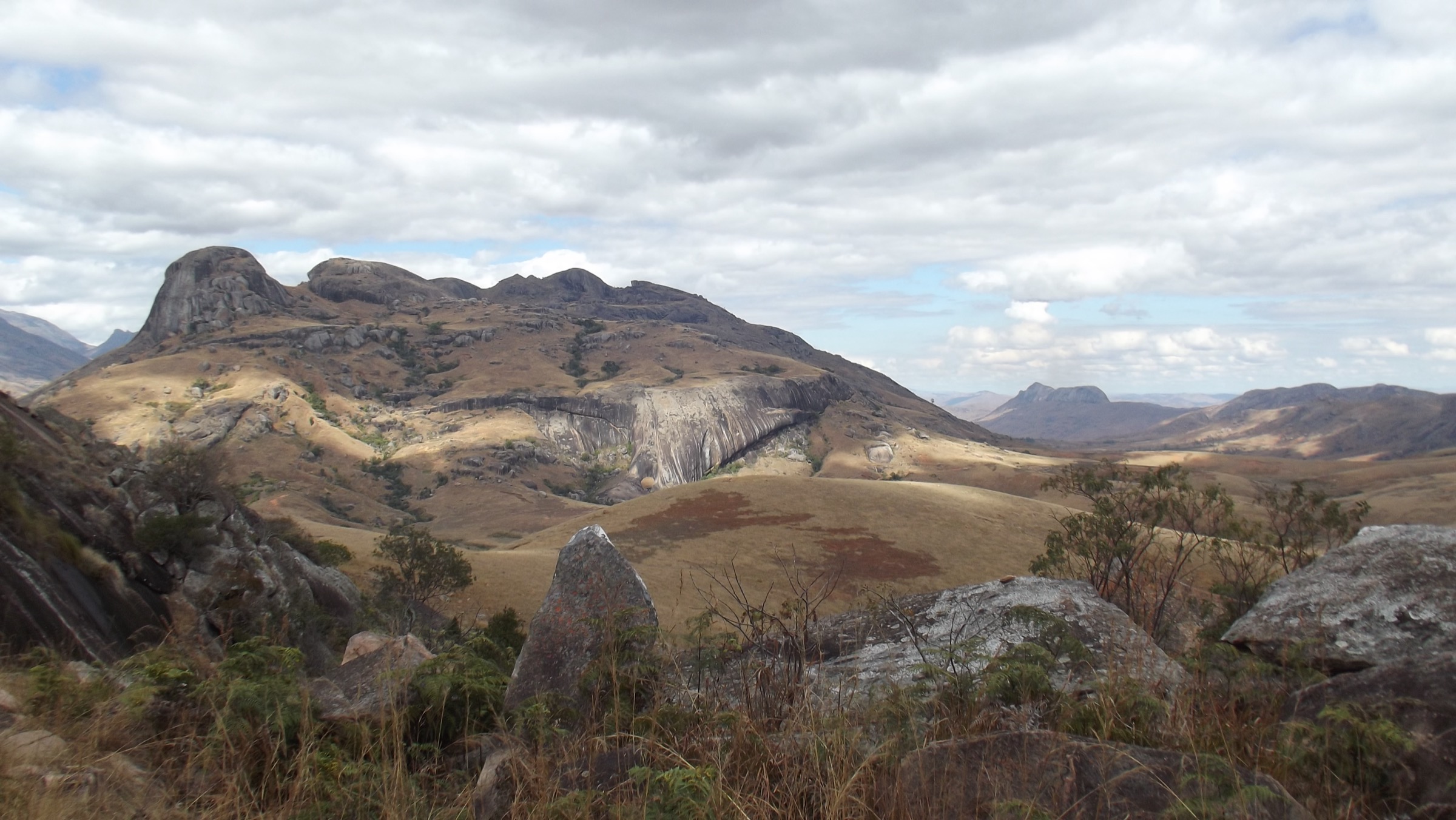
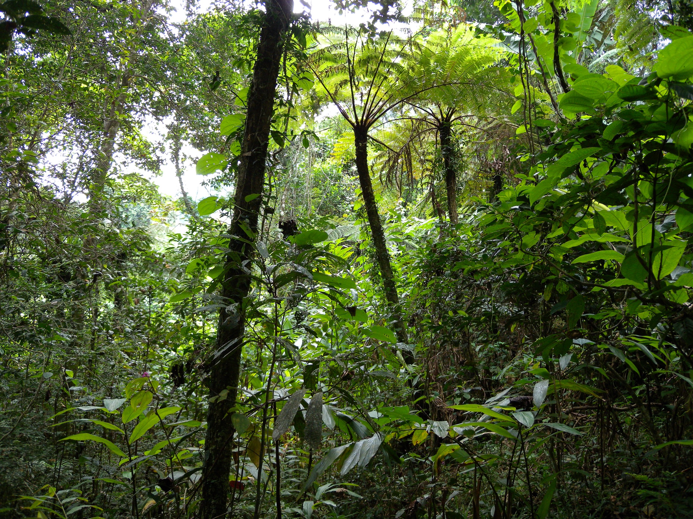
The Ankaratra Massif is a Quaternary volcanic range in central Madagascar, lying roughly 50 km south-west of Antananarivo between the towns of Arivonimamo, Ambatolampy, Faratsiho and Betafo. It is a deeply dissected complex of trachytic lava domes, basanitic cinder cones and maars, capped by Tsiafajavona at 2,643 m — Madagascar’s third-highest peak. The high crests, in the range 2,000-2,643 m, form the most extensive sub-alpine landscape in the country, with frost-tolerant heaths, tree ferns, residual montane forest, wild orchids and large mossy boulder fields. To the south the massif tails into the cooler Vakinankaratra plateau around Antsirabe, where a string of crater lakes — Tritriva and Andraikiba most prominent — records more recent volcanic activity.
The principal hiking base on the north flank is the Manjakatompo Forest Station, reached by a 17 km secondary road climbing west from Ambatolampy off the RN7. Manjakatompo sits inside the New Protected Area “Manjakatompo-Ankaratra” (Natural Resources Reserve, IUCN VI, c. 9,000 ha gazetted area within a wider Key Biodiversity Area), administered locally with permits issued at the station gate. From a car park at the orientation table near the Anosiarivo Arboretum (c. 2,111 m), four tourist circuits radiate to fish ponds, the Mimosas Arboretum, Lac aux Dames and Lac Froid, the Faravohitra crest, the Petite Cascade, and the Tsiafajavona summit. Southern access is from Antsirabe, served by frequent taxi-brousse from Antananarivo on the RN7 and within easy reach of Tritriva (c. 15 km west on the RN34) and Andraikiba (c. 7 km west on the RN7).
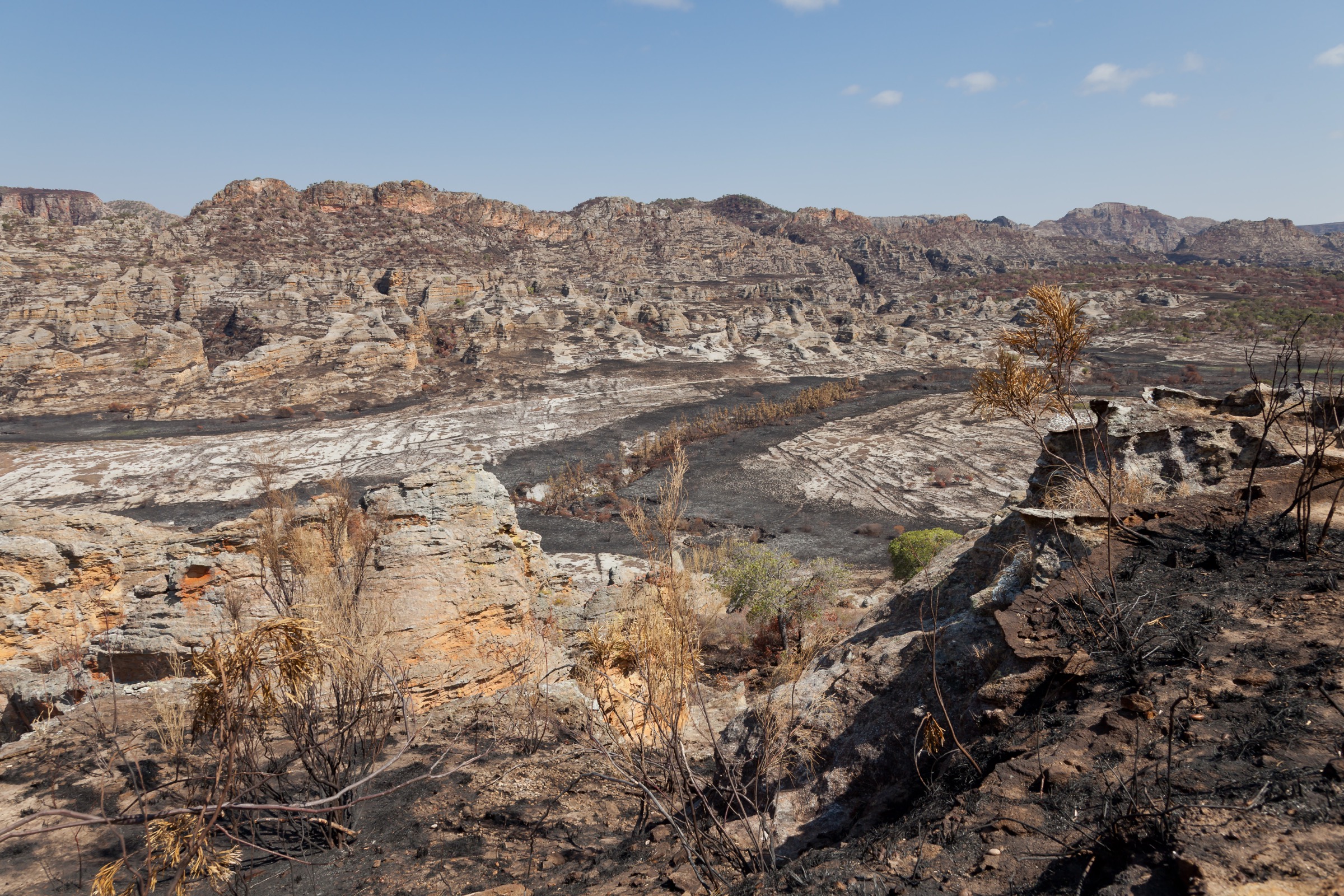
The reliable walking season runs from May to October — the cool dry austral winter, with daytime temperatures of 10-20 °C and clear mornings, but with hard frosts on the summits and occasional sleet above 2,200 m in June and July. The wet season brings heavy afternoon thunderstorms, very slippery clay paths, leech activity in the gully forests and dense fog that gives Tsiafajavona its Malagasy name (“never out of the fog”). Cyclone-edge rainfall can affect the highlands into early May. Sun exposure at altitude is intense; UV protection is required year-round.
Way-marking is sparse and most paths are minor herders’ or fuelwood tracks; a local guide is normal practice for the summit routes and is mandatory at Tritriva. Many summits and the Tritriva crater carry fady (taboos) — most commonly against pointing, swimming, pork or red items — that should be respected. There is no mountain rescue service; mobile coverage is patchy above 2,000 m. Stream water should be treated. Entry fees apply at Manjakatompo and Tritriva; rates are set locally and change frequently.
Selection rationale
The five hikes below cover the breadth of the massif. Tsiafajavona is the indispensable summit and the only routinely walked 2,600 m peak in Madagascar; the Manjakatompo Lakes circuit covers the most accessible forest and crater-lake landscape inside the protected area; the Faravohitra ridge gives the only well-established sub-alpine balcony route; Lac Tritriva is the iconic and culturally loaded volcanic crater lake of the highlands; and Lac Andraikiba completes the set as the gentle, lower-elevation cultural-landscape walk that links the massif’s volcanism to the spa town of Antsirabe.
Summary table
| # | Hike | Country | Route type | Distance | Gain | Max elevation | Difficulty |
|---|---|---|---|---|---|---|---|
| 1 | Tsiafajavona summit from Manjakatompo | Madagascar | Out-and-back | ~14 km | ~700 m | 2,643 m | Strenuous |
| 2 | Manjakatompo Lakes Circuit | Madagascar | Loop | ~10-12 km | ~350 m | ~2,100 m | Moderate |
| 3 | Faravohitra ridge via Ambatomalama | Madagascar | Loop | ~12-14 km | ~500 m | ~2,250 m | Moderate |
| 4 | Lac Tritriva crater loop | Madagascar | Loop | ~2.5-3 km | ~120 m | ~2,000 m | Easy-Moderate |
| 5 | Lac Andraikiba shore walk | Madagascar | Loop | ~5-6 km | ~80 m | ~1,580 m | Easy |
1. Tsiafajavona Summit from Manjakatompo

Snapshot
Itinerary
From the orientation table next to the Anosiarivo Arboretum the route follows a forestry track south-west through plantation pine and remnant tapia forest, passing the upper fish ponds and an interpretation panel. After about 1 km the track narrows to a foot path that climbs steadily across open ericaceous heath, with occasional tree ferns in the gullies. The path swings west onto a broad sub-alpine ridge studded with moss-covered trachyte blocks; cairns mark the line where the trail crosses bare rock. The final approach skirts a shallow saddle below the summit pyramid, then turns south for the last 150 m of ascent on a stony footpath to the trig pillar and small cairn that mark the top. Return is by the same line; navigation in the upper section is straightforward in clear weather but the plateau loses obvious landmarks in mist.
Why it is essential
Tsiafajavona is the highest point of the Ankaratra Massif and Madagascar’s third-highest mountain. It is the only Malagasy peak above 2,600 m that can be walked from a road head in a long day without porters or technical equipment, and the summit gives a unique panorama north towards the Tana plateau, south across the Vakinankaratra crater lakes and west to the rim of the central plateau. The hike crosses the best-preserved sub-alpine vegetation belt in the country, recognised as a Key Biodiversity Area.
Equipment
Mountain hiking equipment: sturdy boots, trekking poles recommended, weatherproof shell, warm mid-layer, hat and gloves outside midsummer, paper map and GPS (the upper plateau is featureless in cloud), headtorch, 2-3 L water, food. A local guide is strongly recommended; arrange at the Manjakatompo station gate. Permit/entry fee payable at the station.
Hazards and notes
Exposure to wind and rapid temperature drops is the main hazard; sub-zero conditions are routine on winter mornings and frost can persist in shaded gullies until midday. Fog forms quickly on the summit ridge and route-finding becomes serious. No surface water above the fish ponds. The summit and several boulders en route carry fady — pointing at the peak, bringing pork, and wearing red items are commonly cited prohibitions; a guide will brief on current local observances. Protected-area status restricts firewood collection and off-track travel.
GPX / KML links
| Source | URL | Format / access | Reuse status |
|---|---|---|---|
| OpenStreetMap (base path data only — no curated route relation) | openstreetmap.org near Tsiafajavona | OSM data (ODbL) | Geometry reusable; no curated route to download |
| Route-file status | No official GPX has been located on Komoot, Wikiloc, Outdooractive, Madagascar National Parks or Manjakatompo NPA sites | Unresolved | Unresolved |
External links
- Wikipedia — Ankaratra
- Wikipedia — Mount Tsiafajavona
- Wikipedia — Manjakatompo
- Protected Areas of Madagascar — Manjakatompo Ankaratra
2. Manjakatompo Lakes Circuit
Snapshot
Itinerary
The circuit begins at the fish breeding station (piscicole) at the foot of the forest station. A wide forestry track contours north-west through plantation pine and mimosa, passing the Mimosas Arboretum after about 1.5 km. The track continues through eucalyptus and tapia stands towards the upper basin where it splits at a signposted junction. The right-hand branch climbs to Lac aux Dames, a small dammed reservoir set among open pasture and used historically for swimming. The path then traces the marshy outflow north to Lac Froid, a colder spring-fed pond ringed by ericaceous scrub. From Lac Froid the route doubles back south and joins the Faravohitra trail descending through forest. A short signed spur drops to the Petite Cascade, a 10-15 m fall on a tributary of the Onive headwaters. The trail rejoins the main forestry track near the Anosiarivo Arboretum and returns past the orientation table to the station gate.
Why it is essential
This is the most representative one-day route inside the Manjakatompo-Ankaratra protected area: it crosses three of the four signed tourist circuits, includes both lakes, the principal waterfall and the arboretums, and gives a complete cross-section of the massif’s planted forest, native sub-alpine heath and stream habitats.
Equipment
Standard hiking equipment: hiking boots (waterproof preferred), weatherproof layer, warm layer, 2 L water, food, sun protection, map/GPS. Insect repellent useful in the lower forest. Cash for the station entry fee.
Hazards and notes
Trails are unmarked beyond the main signed junctions and a guide arranged at the station is normal practice. Some bridges over the fish-pond outflows are makeshift. Swimming is permitted in Lac aux Dames but the water is cold year-round; Lac Froid is not used for swimming. The area is a Natural Resources Reserve — collection of plants, firewood and bushmeat is prohibited.
GPX / KML links
| Source | URL | Format / access | Reuse status |
|---|---|---|---|
| OpenStreetMap (forestry tracks within Manjakatompo) | openstreetmap.org near Manjakatompo | OSM data (ODbL) | Geometry reusable; no curated route relation |
| Route-file status | No published GPX located on Komoot, Wikiloc or Outdooractive in this pass | Unresolved | Unresolved |
External links
- Protected Areas of Madagascar — Manjakatompo Ankaratra
- Maison de Madagascar — Manjakatompo Ankaratra reserve
3. Faravohitra Ridge via Ambatomalama
Snapshot
Itinerary
The route starts at the piscicole and climbs north-east on the signed Ambatomalama circuit, a path that contours above the fish ponds through plantation pine. After about 2.5 km — roughly the end of the 2.5-hour standalone Ambatomalama loop — the path forks left up a forested ridge towards Anosiarivo. The track passes the upper arboretum and joins the longer Anosiarivo-Faravohitra link, which gains the open eastern crest of the massif at the Faravohitra viewpoint. The crest gives the best mid-elevation views in the protected area, with Tsiafajavona visible to the west and the Tana plateau falling away east. The return descends the signed Faravohitra trail past Lac Froid and the Petite Cascade, then re-joins the main forestry track at the orientation table before returning to the gate.
Why it is essential
This is the only documented mid-altitude balcony route in the Ankaratra: it combines the two longer signed circuits inside the protected area into a single loop that takes in viewpoints, two arboretums, the Petite Cascade and one of the higher waterless ridges of the massif. It complements the summit route by sampling the ridge landscape without committing to the full Tsiafajavona ascent.
Equipment
Standard to mountain hiking equipment: sturdy boots, weatherproof shell, warm layer, sun protection, 2 L water, food, map/GPS, headtorch for shorter winter days. Trekking poles useful on the rocky ridge.
Hazards and notes
Path-finding is the main difficulty: the linking sections between Ambatomalama, Anosiarivo and Faravohitra are not continuously waymarked, and a guide is recommended. Frost is common on the crest before mid-morning in winter; afternoon thunderstorms can break suddenly in the shoulder season. No reliable water along the upper ridge.
GPX / KML links
| Source | URL | Format / access | Reuse status |
|---|---|---|---|
| OpenStreetMap (forestry tracks within Manjakatompo NPA) | openstreetmap.org near Faravohitra | OSM data (ODbL) | Reusable under ODbL; no curated relation |
| Route-file status | Protected-area documentation describes the Ambatomalama-Anosiarivo-Faravohitra circuit but does not publish track files | Unresolved | Unresolved |
External links
- Protected Areas of Madagascar — Manjakatompo Ankaratra
- Botanical Society of South Africa — Tracking flora up a Madagascan massif
4. Lac Tritriva Crater Loop

Snapshot
Itinerary
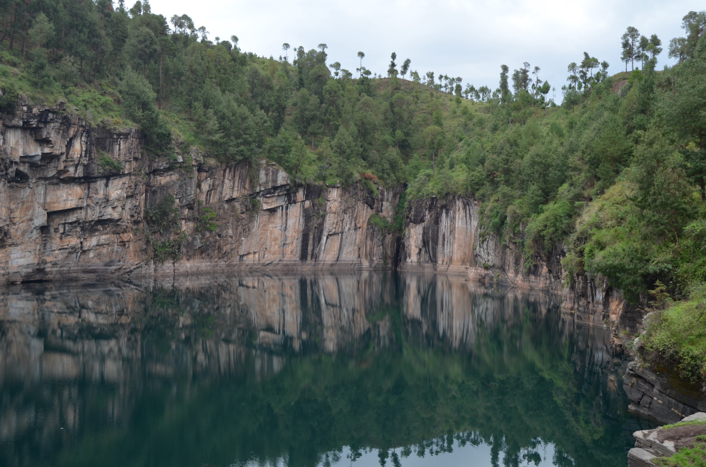
From the ticket office on the north-east rim, the marked path descends through pine plantation to the lakeshore platform, where the gneiss cliffs that ring the crater rise vertically from the water. The path then climbs the south-east rim past several signed viewpoints, including the cliffs associated with the local legend of Rabeniomby and Ravolahanta. The trail circles anticlockwise around the rim, with two short scrambly sections on bare rock and a steeper descent on the west side. A spur leads to a panoramic point over the surrounding pine-clad hills and out to the Ankaratra crest in the north. The loop closes at the ticket office. Guides are obligatory and are assigned at the gate.
Why it is essential
Lac Tritriva is the iconic crater lake of the Madagascar highlands: at 160 m it is the country’s deepest lake, the most geologically distinctive site on the southern flank of the Ankaratra volcanism, and the central sacred site of the Vakinankaratra plateau. The combination of vertical gneiss cliffs, deep turquoise water, the fady that forbids swimming, and the legend recited at each viewpoint make this the cultural-and-landscape counterpart to the summit walk on the same massif.
Equipment
Standard hiking equipment: walking shoes or light boots with grip (the rim path is slippery), water, sun protection, light layer for the breezy rim. Cash for the entry fee and obligatory guide.
Hazards and notes
The cliff edges are unfenced and drops to the water are sheer; supervise children. The path becomes treacherous after rain. Swimming is forbidden by fady and by management. Photographs of certain rock features may be discouraged; the guide will brief on current observances.
GPX / KML links
| Source | URL | Format / access | Reuse status |
|---|---|---|---|
| OpenStreetMap (crater rim path) | openstreetmap.org near Tritriva | OSM data (ODbL) | Geometry reusable; no curated relation |
| Route-file status | AllTrails carries a short user track for the rim but it is not openly licensed | Reference only | Unresolved |
External links
5. Lac Andraikiba Shore Walk
Snapshot
Itinerary
The walk starts at the car park where the RN7 leaves Antsirabe west towards Betafo. A wide path drops gently to the lakeshore, then traces the perimeter clockwise through scattered eucalyptus and pasture used for grazing zebu. The west and south sides have rougher cattle tracks crossing small inflow streams; a short detour climbs the gentle ridge that separates the crater from the road for a panoramic view of the lake, the Ankaratra crest to the north and the rolling Vakinankaratra plateau to the south. The loop closes at the car park, where pedal boats and pirogues are available for hire.
Why it is essential
Andraikiba is the gentle, accessible counterpart to Tritriva on the same southern flank of the Ankaratra volcanic system. It is the only Ankaratra-area lake that supports an easy half-day walk reachable on foot or by bicycle from Antsirabe and is woven into Vakinankaratra cultural history (Merina royal recreation site, water supply for Antsirabe, and the legend of the pregnant princess that gives the lake its name).
Equipment
Standard hiking equipment: walking shoes, sun protection, water, light layer, sun hat. Insect repellent useful near the lakeshore. Cash for boat hire if desired.
Hazards and notes
No significant hazards. The route crosses private grazing land in places; keep to obvious paths and ask permission if redirected. The lake is part of Antsirabe’s water supply and swimming is not encouraged. Local guides can be hired at the entrance but are not required.
GPX / KML links
| Source | URL | Format / access | Reuse status |
|---|---|---|---|
| OpenStreetMap (lake perimeter tracks) | openstreetmap.org near Andraikiba | OSM data (ODbL) | Geometry reusable under ODbL; no curated route |
| Route-file status | No published GPX located in this pass | Unresolved | Unresolved |
External links
Missing data / follow-up work
- No official GPX exists for any of the five hikes. OpenStreetMap holds usable path geometry but no curated route relation. New GPX files should be derived from OSM (ODbL) and field-checked with a local guide before publication.
- Statistics for Hikes 1, 2 and 3 are approximate. Distances and elevation gains are reconstructed from protected-area documentation, OSM, and the published 2,111 m car-park elevation and 2,643 m summit elevation. They need confirmation against a recorded track.
- Photo licensing is incomplete for three of five hikes. No licence-compatible image was located for the Manjakatompo Lakes circuit, the Faravohitra ridge or Lac Andraikiba in this pass.
- Manjakatompo Forest Station fees, permit rules and the status of obligatory guides should be reconfirmed locally — the most recent figures available online are several years old.
- Tritriva entry and guide fees change frequently and should be confirmed at the gate or via the Antsirabe ORTV before publication.
- Public transport details (taxi-brousse schedules, Ambatolampy-Manjakatompo charter rates) need a local check.
- Hike 5 (Andraikiba) is Candidate only. The perimeter trail is widely walked but no waymarked, route-described version appears in print.
- Fady (taboos) on the summit, on Tritriva and on certain Manjakatompo features change between communities and should be reconfirmed with the on-site fokontany or guide before publication.
- No licence-compatible cover photograph located in this pass.
External links
| Resource | Link |
|---|---|
| Wikipedia — Ankaratra | en.wikipedia.org |
| Wikipedia — Mount Tsiafajavona | en.wikipedia.org |
| Wikipedia — Manjakatompo | en.wikipedia.org |
| Wikipedia — Lake Tritriva | en.wikipedia.org |
| Protected Areas of Madagascar — Manjakatompo Ankaratra | protectedareas.mg |
| Key Biodiversity Areas — Manjakatompo-Ankaratra Massif | keybiodiversityareas.org |
| Madagascar Tourisme — Antsirabe | madagascar-tourisme.com |
| Smithsonian Global Volcanism Program — Ankaratra | volcano.si.edu |