

Regional overview
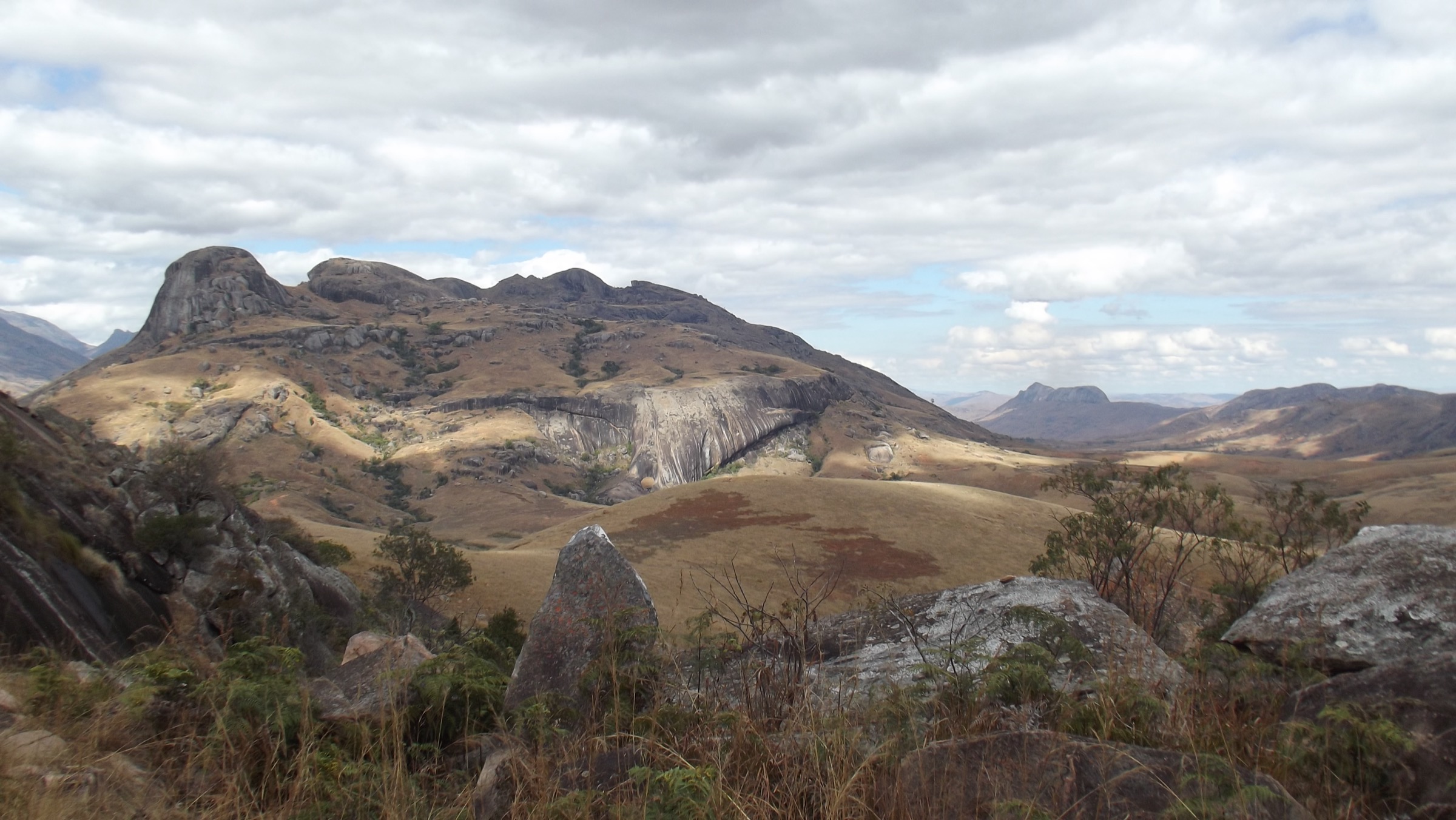
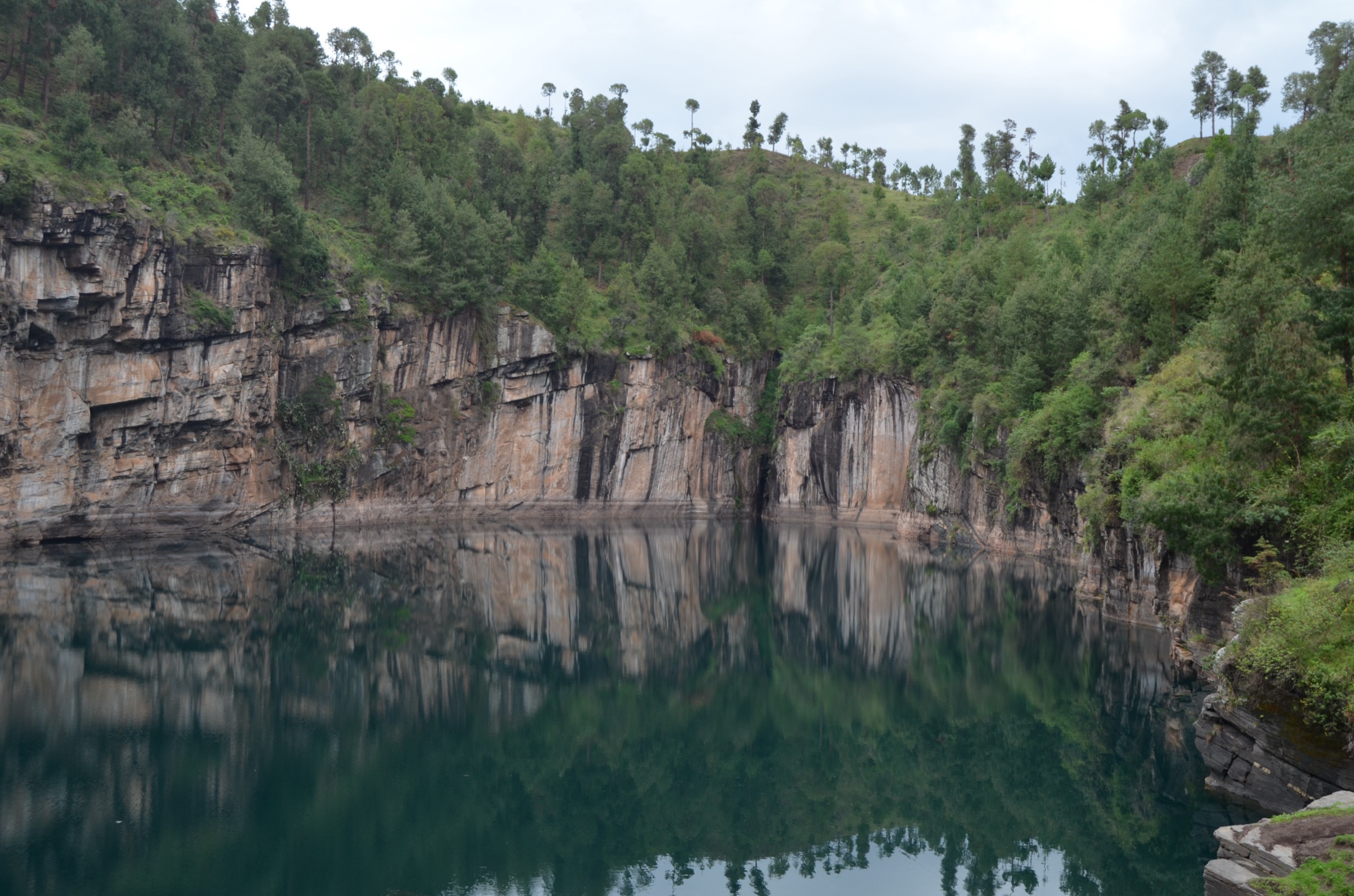
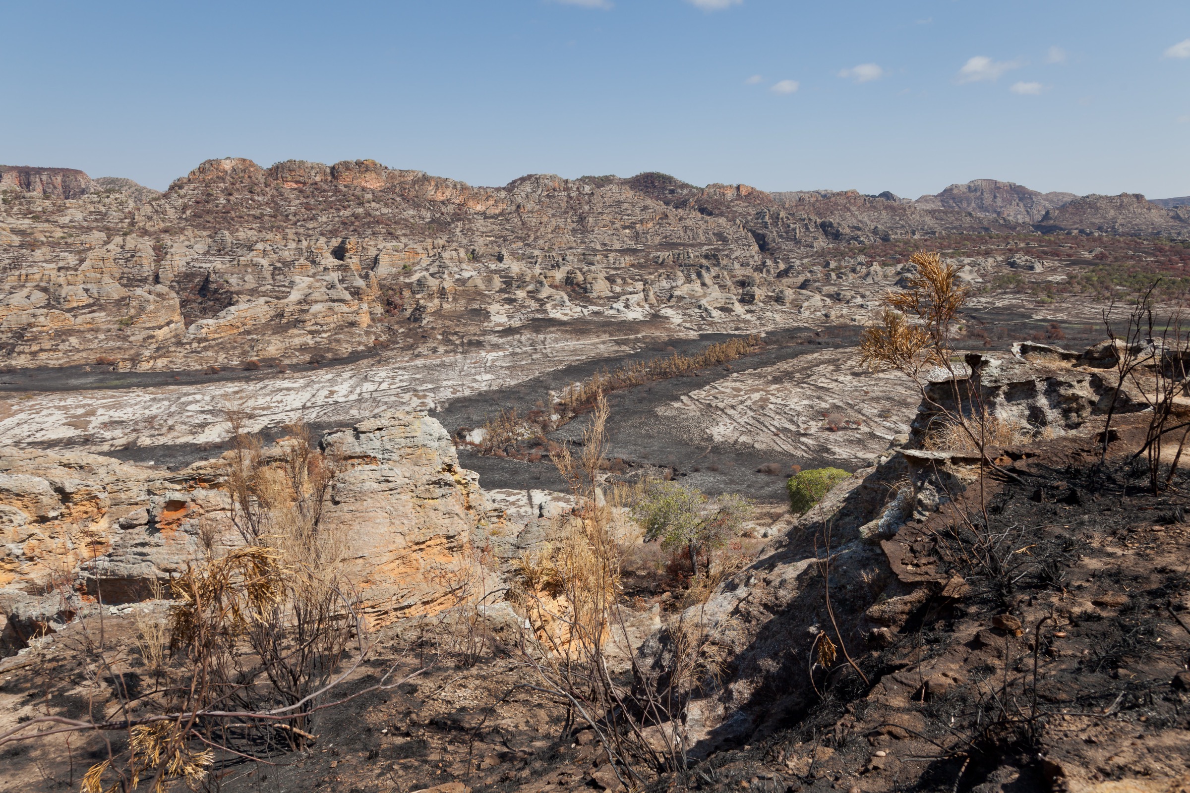
The Massif du Makay is a Jurassic-age sandstone (Isalo II Formation, also called the Makay Formation) labyrinth in south-western Madagascar, straddling the Atsimo-Andrefana and Menabe regions in the districts of Beroroha (south) and Malaimbandy (north). The Wikipedia entry gives the range as approximately 150 km north-northeast to south-southwest, up to 50 km wide, covering approximately 4,000 km2, with a maximum elevation of approximately 1,000 m. Naturevolution and tour-operator material commonly describe the massif as extending to about 175 km between the Tsiribihina River to the north and the Mangoky River to the south. The relief is a dissected plateau of ruiniform sandstone, cut by hundreds of narrow canyons with shaded gallery forest, perennial pools (vasques), and rare summits or belvederes that emerge above the canyon maze.
The Makay was declared a New Protected Area in 2017 by interministerial decree (the Reserve de Ressources Naturelles du Makay / Aire Protegee du Makay). The Malagasy association Naturevolution Madagasikara, founded by French explorer Evrard Wendenbaum after his 2007 expedition, was named delegated manager by the Ministry of Environment, Ecology and Forests and the Ministry of Culture. The site is not managed by Madagascar National Parks. The Makay Protected Area is not part of the MNP network; access, entry fees and visitor rules are administered by Naturevolution Makay through its protected-area portal (makay.org).
Critical access context: the Makay has no independent walking infrastructure — no marked trails, no signposted trailheads, no ranger huts on a network, and no resident-park-staff entry points. Every visit is, in practice, a supported multi-day expedition with a Malagasy guide team and porters carrying tents, food, cooking gear and filtered water. Wild camps are pitched in a new sand-bank or canyon-floor location each night, often on the Sakapaly, Menapanda, Manampanda or Makay Rivers. Naturevolution maintains a semi-permanent hut and kitchen on the right bank of the Menapanda River, about 4 hours walk from Tsivoko village, used as a “Makay Sud” base. There is no road access into the massif itself; the eastern gateway is Beroroha (south) and the western/northern gateway is Malaimbandy or Tsivoko-side, reached over the unpaved RN 15 from Antananarivo via Antsirabe-Mahabo. The Mangoky River crossing to Beronono is by motorised pirogue. There is no scheduled public transport into the massif. For these reasons the “essential day-hikes” framing in this region must be interpreted as one-day stages or one-day excursions executed from named base camps or fixed bivouac points on an expedition itinerary; standalone day visits are not realistic.
The standard season is the austral dry season, generally May to October-November, with the cold-dry months of June-August giving the safest river levels and dry canyon floors. The wet season from December to March/April makes canyon floors and rivers impassable, the access tracks unusable, and operators routinely refuse departures. Important on-the-ground constraints: heat and sun on the plateaus, sustained sand and water walking, sacred-lake fady (especially Lac Sariaka with sacred crocodiles), strict prohibition on pork in the massif (a regional fady), drinking water from porter-filtered river supplies only, sustained isolation from any evacuation network, and the need for satellite communication. The Petzl Foundation and Naturevolution have supported scientific expeditions since 2007 and have documented over 500 cave paintings (with the Mahatiny Cave being the most-cited rock-art site) and several hundred new species, including new diving-beetle species described in 2023. Visitors are governed by Naturevolution Makay rules and contribute an entry fee that funds local conservation and community programmes.
Selection rationale
A traditional independent day-hike catalogue cannot be built for the Makay. The five entries below are the five most consistently named one-day stages or one-day camp excursions on documented operator and Naturevolution itineraries. Each is presented as a recognised day section of a supported expedition, not as a stand-alone walk.
- Beronono — Lac Sariaka and Lac Anosilahy — Mont Anosilahy loop — the standard first-day southern-gateway loop with the iconic sacred-lake panorama from Beronono village.
- Sakapaly canyon and tributary loop from Beroa camp — the canyon-and-vasque day from the Naturevolution-supported northern bivouac, with natural pools.
- Andasy Be Rivotsy plateau crossing and Manampanda canyon descent — the classic plateau-to-canyon day from the upper Sakapaly drainage, with a recorded 10 km plateau ascent and a 7 km canyon segment.
- Menapanda forest day excursion from Naturevolution Makay Sud base camp — the gallery-forest and lemur-observation day from the Naturevolution Menapanda hut towards Tsivoko village.
- Ambanitelo canyon and Lac Nosilahy belvedere — the narrow-canyon and panoramic plateau day on northern-Makay itineraries.
A sixth candidate, a day excursion to the Mahatiny Cave rock-art site from the southern Makay River bivouac, is noted in the missing-data section: it appears in cultural itineraries but distance and elevation data could not be verified in this pass.
Summary table
| # | Hike | Country | Route type | Distance | Gain | Max elevation | Difficulty |
|---|---|---|---|---|---|---|---|
| 1 | Beronono — Lac Sariaka and Lac Anosilahy — Mont Anosilahy loop | Madagascar | Loop from village/bivouac | ~10-14 km secondary estimate; not separately published | ~300 m secondary; descent ~350 m on one operator profile | Not separately published; massif ceiling ~1,000 m | Moderate; ~7 h walking |
| 2 | Sakapaly canyon and tributary loop from Beroa camp | Madagascar | Loop from bivouac | 3-4 km canyon ascent plus return loop; full-day variant 10-15 km secondary | Not separately published | Not separately published; massif ceiling ~1,000 m | Moderate; sustained water walking |
| 3 | Andasy Be Rivotsy plateau and Manampanda canyon | Madagascar | Point-to-point or long loop | ~10 km plateau ascent plus ~7 km canyon (~17 km combined per operator descriptions) | Not separately published | Not separately published; plateau approaches massif ceiling ~1,000 m | Hard; 7-8 h with sustained sand and water |
| 4 | Menapanda forest day excursion from Naturevolution Makay Sud base | Madagascar | Out-and-back or one-way to Tsivoko | ~14-20 km secondary band; 4 h hut-to-Tsivoko and 6-7 h river-route variants reported | Not separately published; low net change | Not separately published | Moderate; gallery forest walking |
| 5 | Ambanitelo canyon and Lac Nosilahy belvedere | Madagascar | Loop or point-to-point | Not separately published; ~6-7 h walking band | Not separately published | Not separately published; belvedere approaches massif ceiling ~1,000 m | Moderate-hard; narrow canyon and water |
1. Beronono — Lac Sariaka and Lac Anosilahy — Mont Anosilahy loop
Snapshot
Itinerary
The day starts from Beronono at the southern gateway of the protected area, on the right bank of the Mangoky River. The route follows the shores of Lac Sariaka through gallery vegetation, passes the smaller Lac Anosilahy (also spelt Lac Nosilahy), then ascends a sandstone shoulder to the local summit referenced as Mont Anosilahy (or Pic Manintsinila on some operator profiles), which gives a panoramic view over both lakes and the Behetaheta plateau to the east. Descent is through the narrow Mavokavitsy ravine back to Beronono. The lakes lie on the southern edge of the massif and are bounded by sandstone cliffs; Lac Sariaka is sacred and inhabited by crocodiles, with strict local fady observed throughout the visit.
Why it is essential
This is the recognised “introduction to the Makay” day used by virtually every southern-gateway expedition operator (cactus-madagascar.com, makaytour.com, voyagemadagascar.com, tourhq.com) and is the only day that gives a low-effort but representative cross-section of the massif: sandstone cliffs, two named lakes, a summit panorama and a return through a working canyon. It is also the most consistently published day stage in the Makay where any kind of elevation/time figure exists in the public record.
Equipment
Mountain hiking equipment as a baseline: sturdy boots tolerant of sand and water, weatherproof shell, warm layer for cold dawns, full sun protection (wide hat, high-SPF, sunglasses), a minimum of 3 L water capacity, and trekking poles for the descent. Conditional: Naturevolution-administered entry fee (Aire Protegee du Makay), supported expedition logistics with porters and a Malagasy guide, satellite communication device, and respect for the Lac Sariaka fady (no swimming, no pork brought into the massif).
Hazards and notes
Sacred-lake fady — swimming in Lac Sariaka is prohibited and the lake hosts crocodiles. Heat and exposure on the open shoulders. The Mavokavitsy ravine can hold water in the early dry season and is impassable in the wet season. The Makay has no evacuation network: any incident requires a porter-supported retreat to Beronono and onward 4WD or pirogue extraction. The Naturevolution Makay portal (makay.org) and Naturevolution publish updated visitor rules; the entry fee structure and current access status must be re-verified with Naturevolution Makay before any publication.
GPX / KML links
| Source | URL | Format / access | Reuse status |
|---|---|---|---|
| Naturevolution Makay portal | makay.org | Protected-area portal | Site terms apply; no GPX found in this pass; authoritative manager; no public GPX for this route |
| Naturevolution Madagascar pages | naturevolution.org | NGO programme page | Site terms apply; no GPX found in this pass; programme background; no public GPX |
| Operator route description (Cactus Madagascar) | cactus-madagascar.com | Commercial trip page | Site terms apply; descriptive only; no GPX |
| Operator route description (makaytour.com) | makaytour.com | Commercial trip page | Site terms apply; descriptive only; no GPX |
External links
- en.wikipedia.org — Makay Massif
- naturevolution.org — Makay programme
- makay.org — Aire Protegee du Makay
- cactus-madagascar.com — Makay trekking
- makaytour.com — 5-Day Discover Makay
- tourhq.com — Makay Massif tour day-by-day
- voyagemadagascar.com — Decouverte et Immersion dans le Massif du Makay
2. Sakapaly canyon and tributary loop from Beroa camp
Snapshot
Itinerary
The day starts from the Beroa bivouac on the sand bank of the Sakapaly River, a site referenced in Naturevolution’s 2017 expedition report and routinely used by current operators. A short approach (typically 1.5-2 h from earlier camps to Beroa) opens onto an ascending tributary canyon (operator descriptions cite 3-4 km of narrow canyon walking, partly in shallow water, with sandstone walls of approximately 50 m). The route exits over a low saddle into a second canyon that connects back to the Sakapaly River and the bivouac. The full-day variant adds a sunrise climb to a nearby rim viewpoint for panoramas over the Menapanda and Sakapaly drainages before the canyon work. The day’s signature features are perennial natural pools (vasques) used for refreshment stops in the dry season.
Why it is essential
This loop is the recognised “Makay canyon day” in published operator material, and was a working route during the Naturevolution Makay 2017 scientific mission (Mahasoha and Beroha base camps). It is the day that gives the closest match to the project’s “essential day-hike” criterion — a tight, named, single-day loop with a clear start, clear circuit, and a clear landscape signature — while still being inside an expedition envelope.
Equipment
Mountain hiking equipment as a baseline. Conditional: footwear that tolerates sustained shallow-water walking (light boots with drainage, or sturdy trail shoes plus camp sandals), trekking poles, dry-bag for the pack, sun protection, 3 L water capacity, supported porter logistics, and the Naturevolution Makay entry fee.
Hazards and notes
Sustained wading in canyons of 50 m height: rising water from upstream rain is the principal hazard and is the reason the wet season is operationally closed. The narrow canyon sections have no usable evacuation route. Flash flooding can occur even in shoulder season. The Sakapaly River canyons are part of the protected area and are visited only under supported expedition with a Naturevolution-recognised local team. Pork is forbidden in the massif per local fady.
GPX / KML links
| Source | URL | Format / access | Reuse status |
|---|---|---|---|
| Naturevolution — Makay expedition 2017 (base-camp record) | naturevolution.org | NGO mission page | Site terms apply; no GPX; authoritative base-camp record; no public GPX |
| Operator route description (madagascartouring.com Makay Nord) | madagascartouring.com | Commercial trip page | Site terms apply; descriptive only; no GPX |
| Operator route description (Allibert Trekking) | allibert-trekking.com | Commercial trip page | Site terms apply; descriptive only; no GPX |
| Operator route description (Atalante) | atalante.fr | Commercial trip page | Site terms apply; descriptive only; no GPX |
External links
- naturevolution.org — Makay expedition 2017
- madagascartouring.com — Massif du Makay Nord
- allibert-trekking.com — La grande traversee du Makay
- atalante.fr — La traversee du Makay l’expe
- tamera.fr — La decouverte du Makay
3. Andasy Be Rivotsy plateau and Manampanda canyon
Snapshot
Itinerary
The day starts from a camp on a Sakapaly tributary at the base of the Andasy Be Rivotsy plateau. The route climbs gradually onto the sandstone plateau and follows it for approximately 10 km, with 360-degree panoramas over the canyon labyrinth of the central-northern Makay. A descent off the plateau enters the upper Manampanda canyon, where a meander-cut sandstone gorge gives a 7 km riverbed walk through gallery forest of pandanus, palms and ferns. The canyon walk is largely “feet in the water” in narrow sections and ends at a downstream Manampanda bivouac. The cited operator material notes the route crosses the Andranomanga pass on the Manampanda-Sakapaly watershed.
Why it is essential
This day stage is the canonical “plateau-to-canyon” transition that defines the Makay landscape. It is the single day in published operator material that gives both the panoramic plateau view used in promotional imagery and the long enclosed canyon experience for which the massif is named. It is the most likely “iconic photograph” day on a northern-Makay traverse.
Equipment
Mountain hiking equipment as a baseline. Conditional: stiff trail shoes or light boots, trekking poles, full sun protection for the long exposed plateau crossing, 3+ L water capacity for the plateau leg, dry-bag for the canyon section, supported porter logistics, Naturevolution Makay entry fee. Lemur and bird observation is described in the canyon — lightweight binoculars optional.
Hazards and notes
Long sun-exposed sand walking on the plateau (heat, dehydration risk). Sustained water walking in the Manampanda canyon (flash-flood risk, slippery rock, footwear failure). No evacuation network. The Manampanda canyon is in the protected area and is visited only under supported expedition. Local fady — no pork — applies throughout.
GPX / KML links
| Source | URL | Format / access | Reuse status |
|---|---|---|---|
| Operator route description (Taste 2 Madagascar) | taste2madagascartours.com | Commercial trip page | Site terms apply; descriptive only; no GPX |
| Operator route description (Detours Madagascar) | madagascartravel.com | Commercial trip page | Site terms apply; descriptive only; no GPX |
| Operator route description (Tirawa) | tirawa.com | Commercial trip page | Site terms apply; descriptive only; no GPX |
External links
- taste2madagascartours.com — Trek Makay
- madagascartravel.com — Grandes randonnees Andringitra, Isalo and Makay
- tirawa.com — Exploration dans le Makay
- nomade-aventure.com — Trek Makay Tsingy
4. Menapanda forest day excursion from Naturevolution Makay Sud base camp
Snapshot
Itinerary
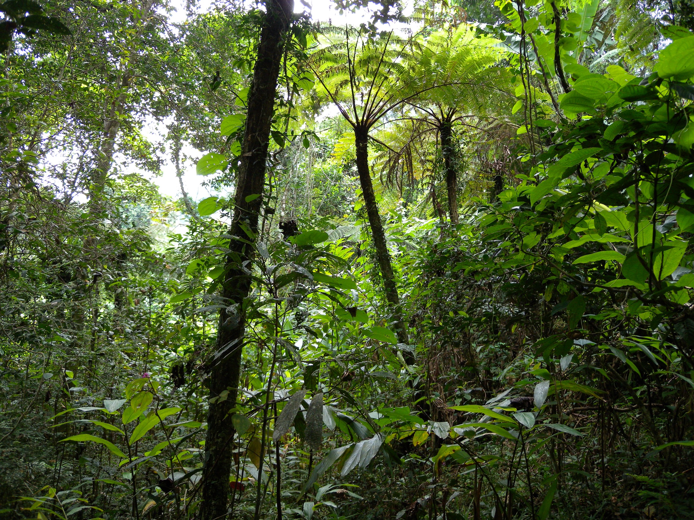
The Naturevolution Makay Sud base camp is on the right bank of the Menapanda River, in the largest forest area of the southern massif, with semi-permanent hut and kitchen infrastructure built and maintained with local communities. The standard day excursion follows either the land route through Menapanda forest towards Tsivoko village (the support-village at the southern edge of the massif), taking approximately 4 hours of walking, or the river route along the Menapanda for approximately 6-7 hours. The forest is described in Naturevolution material as the principal large forest of the Makay and supports a community of lemurs (red-fronted lemur, Verreaux’s sifaka and other species documented in expedition reports), with fossa and several endemic birds. The route ends at Tsivoko, where the local school and dispensary — which Naturevolution helped to develop — can be visited and where a bivouac is set on the southern slope below the massif.
Why it is essential
This is the only day in the published Makay catalogue that combines (a) the conservation-and-community dimension that defines the protected area, (b) gallery-forest walking representative of the southern Makay biotope, and (c) the only semi-permanent visitor infrastructure in the massif (the Naturevolution hut). It is the day stage most likely to be retained as a “standard” introductory excursion as Naturevolution-led ecotourism programmes develop.
Equipment
Mountain hiking equipment as a baseline. Conditional: footwear suited to mixed forest, sand and shallow water; insect protection; binoculars for lemurs; respect for Naturevolution camp rules; Aire Protegee du Makay entry fee.
Hazards and notes
Lower technical and water risk than the canyon days, but the same isolation and evacuation considerations apply. Naturevolution publishes camp etiquette and the local fady. Pork is forbidden in the massif. Lemur observation is opportunistic; no chasing, baiting or close approach is permitted.
GPX / KML links
| Source | URL | Format / access | Reuse status |
|---|---|---|---|
| Naturevolution — Makay programme | naturevolution.org | NGO programme page | Site terms apply; no GPX; authoritative description; no public GPX |
| Naturevolution — eco-volunteer missions | naturevolution.org | NGO programme page | Site terms apply; no GPX; day-stage description; no public GPX |
| Operator route description (madagascartouring.com Makay Sud) | madagascartouring.com | Commercial trip page | Site terms apply; descriptive only; no GPX |
External links
- naturevolution.org — The Makay massif
- naturevolution.org — Back on the summer eco-volunteer missions in Makay
- madagascartouring.com — Best of Makay South
- eng.cameleoncenterconservation.org — Makay 2025 mission
5. Ambanitelo canyon and Lac Nosilahy belvedere
Snapshot
Itinerary
The day starts from a canyon-floor bivouac with a walk into the narrow Ambanitelo canyon, described in operator material as a tight sandstone passage sculpted by water and partly walked in shallow flow. The route ascends out of the canyon onto the upper sandstone plateau to a belvedere giving a panoramic view of the central Makay maze, with the Nosilahy lakes (Lac Nosilahy / Lac Anosilahy) and the Sariaka basin visible to the south. Descent is either back through the same canyon (loop) or onwards to a different drainage and bivouac (point-to-point). The Mahatiny rock-art cave is on some itineraries that combine the Ambanitelo day with a cultural visit, but the cave is generally cited as a separate sub-route from the Makay River bivouac and is flagged for follow-up below.
Why it is essential
The Ambanitelo canyon is the most commonly named “narrow canyon” day in southern-Makay tour material, paired with the Lac Nosilahy panorama. It complements the Beronono day (Hike 1) by giving the canyon-and-summit experience from within the massif itself rather than from the southern gateway, and it is the most likely upper-plateau viewpoint day for any traveller approaching from the south.
Equipment
Mountain hiking equipment as a baseline. Conditional: footwear that tolerates shallow water walking, trekking poles, sun protection, 3 L water capacity, supported porter logistics, Naturevolution Makay entry fee.
Hazards and notes
Narrow canyon walking in shallow water (flash-flood risk, slippery rock). Plateau exposure on the belvedere leg. No evacuation network. Sacred-lake fady visible from the belvedere but rules are observed at lake level — swimming in Lac Sariaka is not permitted. Pork is forbidden in the massif.
GPX / KML links
| Source | URL | Format / access | Reuse status |
|---|---|---|---|
| Operator route description (Taste 2 Madagascar) | taste2madagascartours.com | Commercial trip page | Site terms apply; descriptive only; no GPX |
| Operator route description (TourHQ) | tourhq.com | Commercial trip page | Site terms apply; descriptive only; no GPX |
| Operator route description (makaytour.com 9-day Makay South) | makaytour.com | Commercial trip page | Site terms apply; descriptive only; no GPX |
External links
- taste2madagascartours.com — Trek Makay
- tourhq.com — The Makay Massif Madagascar Tour
- makaytour.com — 9-Day Makay South Hiking Expedition
- vivytravel.com — Makay Massif guide
Outstanding verification notes
The Makay is structurally the most data-poor mountain region in this catalogue. The points below summarise what must still be resolved before any of the five entries can move from Candidate only to Verified, and before a publishable article can be built from this spec.
- All five hikes are Candidate only. None has an official route page, a published distance/gain/time table, a public GPX, or a licence-verified scenic photograph.
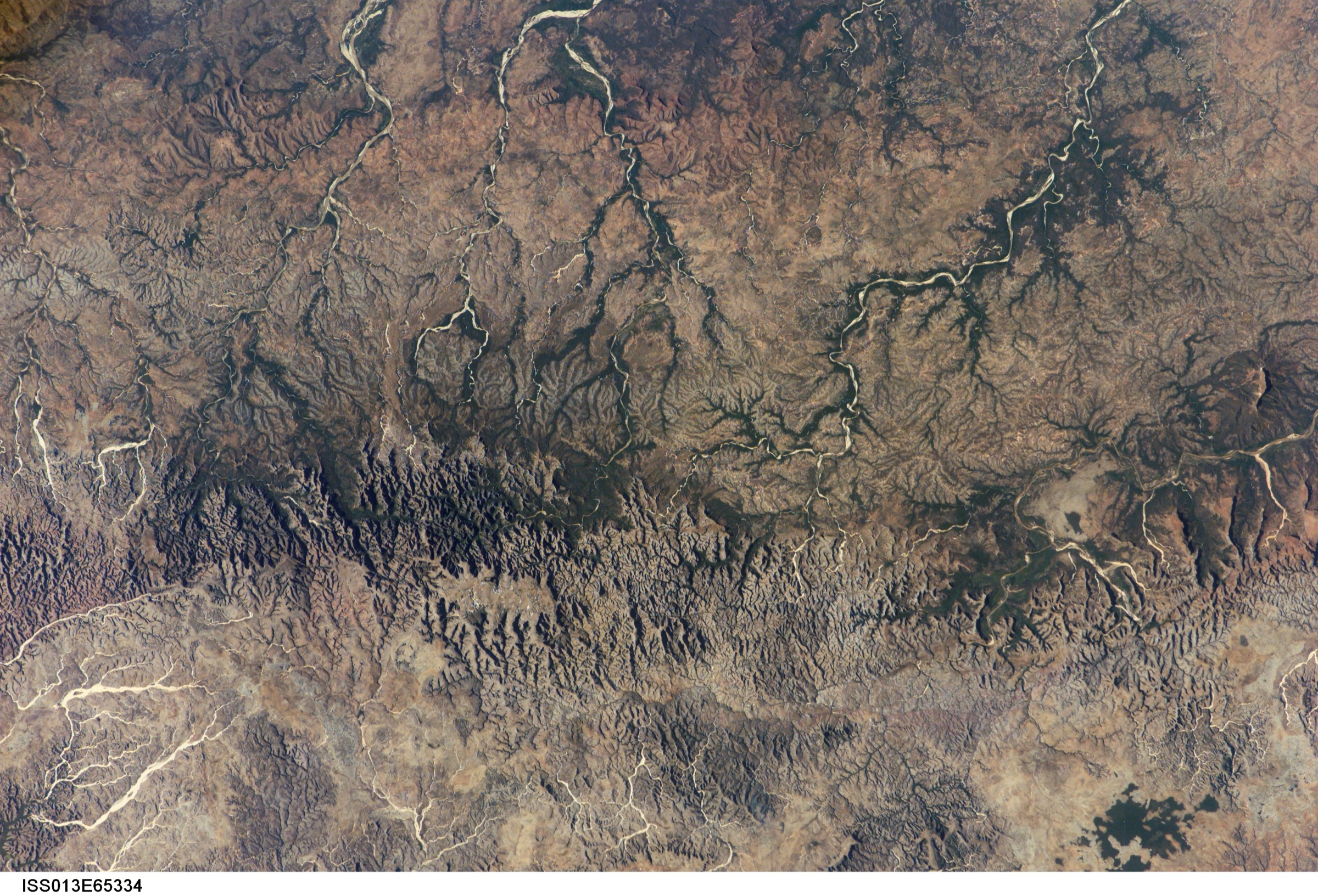
- Cover photo — no high-resolution (greater than or equal to 2,000 px) Wikimedia Commons photograph of a Makay landscape was found. The two Madamax images are 237-238 px wide. The NASA ISS satellite view of Madagascar (ISS013-E-65334, 3,032 x 2,064 px, public domain) is the only Commons file above the resolution floor that depicts the Makay region, and it is satellite rather than ground-level; it is used here as the cover under flag. Potential next step is to contact Naturevolution and/or Evrard Wendenbaum to ask whether any portfolio image can be released under CC BY-SA 4.0 for the article.
- Photographs for individual hikes — all five have “Photo status: No licence-compatible image found in this pass.” This is a systemic gap rather than a per-hike one. Flickr Creative Commons should be searched per route in a future pass. No figure blocks have been included in any of the five hike sections in this pass.
- Hike 1 (Beronono — Lac Sariaka and Lac Anosilahy — Mont Anosilahy loop): Candidate only — no licence-compatible Sariaka or Anosilahy photo verified; no GPX found in this pass.
- Hike 2 (Sakapaly canyon and tributary loop from Beroa camp): Candidate only — no Sakapaly-specific licence-compatible photo verified; no GPX found in this pass.
- Hike 3 (Andasy Be Rivotsy plateau and Manampanda canyon): Candidate only — no Andasy Be/Manampanda licence-compatible photo verified; no GPX found in this pass.
- Hike 4 (Menapanda forest day excursion from Naturevolution Makay Sud base): Candidate only — no Menapanda-specific licence-compatible photo verified; no GPX found in this pass.
- Hike 5 (Ambanitelo canyon and Lac Nosilahy belvedere): Candidate only — no Ambanitelo/Nosilahy licence-compatible photo verified; no GPX found in this pass.
- GPX — no public GPX file was located for any Makay route. The Naturevolution Makay programme does not publish GPX. Wikiloc, AllTrails and Komoot do not appear to host published Makay tracks. Operators may have private GPX; a request to Naturevolution Makay would be the right next step.
- Route statistics — operator-published statistics are partial and inconsistent. Specifically: (a) no operator gives distinct distance, gain, loss and max elevation for the Beronono / Lac Sariaka loop beyond the +300 m / -350 m / 7 h profile of one published itinerary; (b) operators give “10 km plateau, 7 km canyon” for the Andasy Be Rivotsy day without naming a single distance; (c) Sakapaly canyon loop, Menapanda forest day and Ambanitelo canyon and belvedere day are described only narratively. All numbers in this spec should be treated as working estimates.
- Permit and entry fees — the Aire Protegee du Makay entry-fee structure is administered by Naturevolution Makay and should be verified against makay.org before publication, as is the current per-visitor cost and the procedure for operators to enrol clients.
- Access infrastructure — the road status of RN 15 between Antsirabe-Mahabo-Malaimbandy and the road to Beroroha is seasonal and changes year to year; the Mangoky pirogue crossing at Beronono is also seasonally affected. All access details must be re-verified with a current operator or with Naturevolution Makay before publication.
- Local rules — the fady on pork in the massif, and on swimming in Lac Sariaka, are confirmed by multiple operator and tourism sources; a Naturevolution-published visitor code should be cited as the authoritative source once located.
- Mahatiny Cave rock-art day — cited in operator material as a half-day or day excursion from the Makay River bivouac, but distance/elevation/time data were not found in this pass. This is the strongest candidate for a sixth Makay hike if expansion is ever permitted.
- Mount Loolmalasin-equivalent summit — the published Makay material does not name a true “highest peak” route; “Mont Anosilahy” and “Pic Manintsinila” are local belvedere names rather than a documented massif summit. Confirmation of the highest accessible summit on a Naturevolution-recognised day route is outstanding.
- Naturevolution publication request — the cleanest single follow-up step would be a direct request to Naturevolution Makay for: (a) the visitor code and current fee structure, (b) GPX of the standard expedition stages, (c) reuse terms for the existing Naturevolution photo library. All five hike entries in this spec would graduate from Candidate only to at least Partially verified on receipt of those items.
External links
| Source | URL |
|---|---|
| Aire Protegee du Makay (Naturevolution Makay) | makay.org |
| Naturevolution — Makay Madagascar programme | naturevolution.org |
| Naturevolution — The Makay massif geography page | naturevolution.org |
| Naturevolution — Makay expedition 2017 | naturevolution.org |
| Naturevolution — Summer eco-volunteer missions in Makay | naturevolution.org |
| Petzl Foundation — Madagascar: exploring the last Eden of the Makay | petzl.com |
| Wikipedia (English) — Makay Massif | en.wikipedia.org |
| Wikipedia (French) — Massif du Makay | fr.wikipedia.org |
| Wikipedia — Evrard Wendenbaum | en.wikipedia.org |
| Wikipedia — Beroroha District | en.wikipedia.org |
| Cactus Madagascar — Makay trekking | cactus-madagascar.com |
| Makaytour — 5/6/9/10/12/15-day Makay tours | makaytour.com |
| Madagascar Touring — Massif du Makay Nord; Best of Makay South | madagascartouring.com |
| Allibert Trekking — La grande traversee du Makay | allibert-trekking.com |
| Atalante — La traversee du Makay l’expe | atalante.fr |
| Tirawa — Exploration dans le Makay | tirawa.com |
| Tamera — La decouverte du Makay | tamera.fr |
| Nomade Aventure — Trek Makay Tsingy / Makay Traversee Wendenbaum | nomade-aventure.com |
| Detours Madagascar — Decouverte et Immersion dans le Massif du Makay | voyagemadagascar.com |
| Taste 2 Madagascar — Trek Makay | taste2madagascartours.com |
| VivyTravel — Makay Massif guide | vivytravel.com |
| Travelers of Madagascar — Makay | travelersofmadagascar.com |
| Wikimedia Commons — Category:Makay Massif | commons.wikimedia.org |
| Aquatic Adephaga of the Makay (2023, ZooKeys / PMC) | pmc.ncbi.nlm.nih.gov |