Regional overview
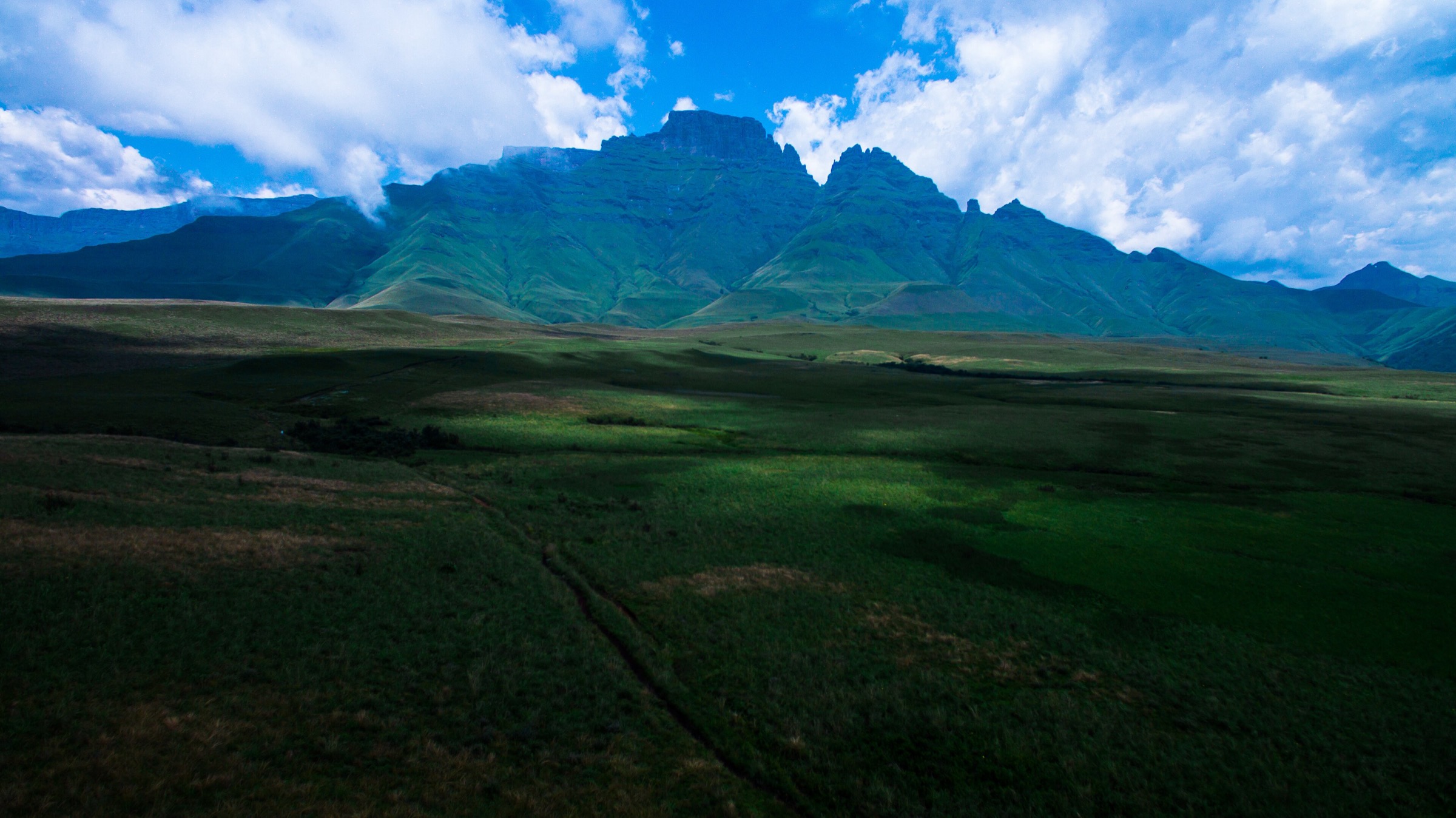
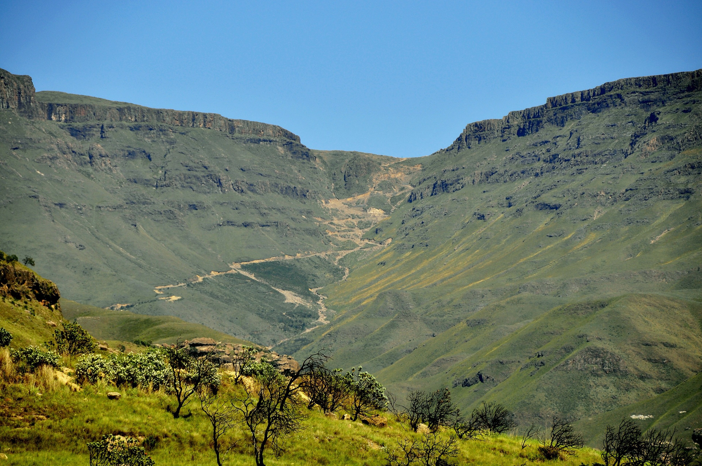
The Lesotho Highlands form the high interior side of the uKhahlamba-Maloti system: open basalt plateaux, deeply cut river valleys, pass roads, high villages, and broad ridges above 2,000 m. Unlike the KwaZulu-Natal Drakensberg, many routes are less formally marked, and local access, guide arrangements, livestock paths, and weather exposure matter as much as trail signage.
The region’s day hikes are dispersed. Sani Top and Thabana Ntlenyana represent the high escarpment and summit plateau; Maletsunyane Falls gives the best-known waterfall objective; Bokong Nature Reserve represents highland wetland and waterfall scenery; Tsehlanyane / Black Pools gives a more enclosed river-and-forest contrast.
Seasonality is severe by southern African standards. Summer brings storms and swollen streams; winter brings snow, ice, closed or difficult pass roads, and very cold wind. Many routes require private vehicle access, lodge transfer, or local guide arrangements, and public transport information is not reliable enough for publication in this pass.
Selection rationale
The selection keeps the rough file’s main highland icons but replaces the AfriSki / Mahlasela Pass candidate with the better-sourced Tsehlanyane Black Pools loop. Thabana Ntlenyana and Bokong remain included because they are essential Lesotho Highlands objectives, but their route statistics and route-file status remain unresolved rather than forced.
- Thabana Ntlenyana from Sani Top candidate route — the country’s highest summit as a candidate day from the Sani Top plateau.
- Sani Top escarpment walk — a shorter highland-gateway viewpoint route above the pass.
- Maletsunyane Falls Overlook Trail — the best-known waterfall objective in the central highlands.
- Bokong Nature Reserve / Lepaqoa Falls viewpoint walk — a protected highland-plateau and waterfall candidate.
- Tsehlanyane Black Pools Loop — an enclosed river-and-pool loop in the Tsehlanyane / Leribe highlands.
Summary table
| # | Hike | Route type | Distance | Gain | Max elevation | Difficulty |
|---|---|---|---|---|---|---|
| 1 | Thabana Ntlenyana from Sani Top candidate route | Out-and-back candidate | 3,482 m summit | Hard | ||
| 2 | Sani Top escarpment walk | Out-and-back / short loop candidate | Approx. 2,875-3,000 m | Moderate | ||
| 3 | Maletsunyane Falls Overlook Trail | Out-and-back | 7.4 km | 207 m | Moderate | |
| 4 | Bokong Nature Reserve / Lepaqoa Falls viewpoint walk | Out-and-back candidate | Candidate only | |||
| 5 | Tsehlanyane Black Pools Loop | Loop | 6.3 km | 264 m | Moderate |
1. Thabana Ntlenyana from Sani Top candidate route
Snapshot
Itinerary
The candidate day route starts from the Sani Top area and crosses the open Lesotho plateau towards Thabana Ntlenyana, the country’s highest summit. The terrain is broad, grassy, and exposed rather than technically steep, but the distance, altitude, and navigation make it a serious mountain day.
A publication-ready itinerary needs a confirmed route line, trailhead, local access permission, and route statistics. The summit objective is verified as essential, but this specific day-hike line remains candidate-only until a legally usable source route is selected.
Why it is essential
Thabana Ntlenyana is the highest point in Lesotho and the highest summit in southern Africa south of Kilimanjaro’s region. It is the natural high-point objective for the Lesotho Highlands catalogue.
Hazards and notes
Navigation is the central issue: the plateau can be featureless in mist, and weather can deteriorate quickly. Altitude, cold wind, lightning, snow, and long distance increase seriousness. Local guide support is strongly advisable unless the route line and access conditions are already known. Border, road, and lodge-access arrangements at Sani Top must be checked before travel.
GPX / KML links
| Source | URL | Format / access | Reuse status |
|---|---|---|---|
| OpenStreetMap search | openstreetmap.org | OSM map/search | OSM data is ODbL; candidate geometry cross-check only, no route relation selected |
| Wikiloc search target | wikiloc.com | Search page only; access blocked in this pass | Wikiloc terms apply if a route is selected later; no GPX selected |
External links
2. Sani Top escarpment walk
Snapshot
Itinerary
This candidate route uses a short walk from the Sani Top area to escarpment viewpoints above the pass and surrounding Lesotho highlands. The precise route line is not yet publication-ready: several local viewpoint options exist, and the selected line must avoid border-control complications and private-access issues.
Why it is essential
Sani Top is the most recognised highland gateway between KwaZulu-Natal and Lesotho. A short escarpment walk here gives the catalogue a high-pass viewpoint route distinct from the longer Thabana Ntlenyana day.
Hazards and notes
Weather at Sani Top can be severe even when the lower valleys are mild. Mist, lightning, high wind, snow, ice, road closures, border formalities, and lodge/private-land access all need current confirmation. This route should remain candidate-only until a specific legal line and route statistics are selected.
GPX / KML links
| Source | URL | Format / access | Reuse status |
|---|---|---|---|
| OpenStreetMap search | openstreetmap.org | OSM map/search | OSM data is ODbL; candidate geometry cross-check only |
| Wikiloc search target | wikiloc.com | Search page only; access blocked in this pass | Wikiloc terms apply if a route is selected later; no GPX selected |
External links
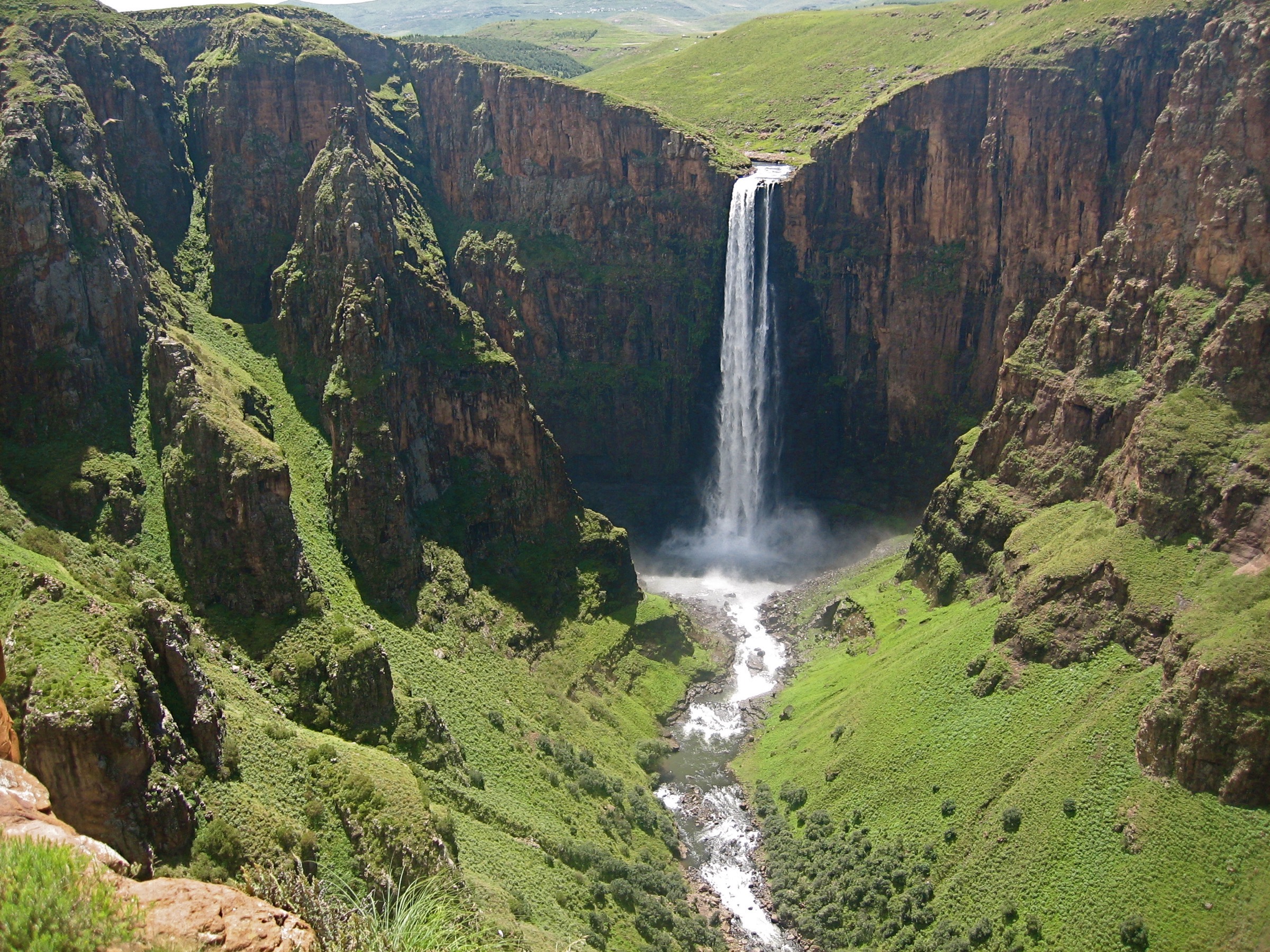
3. Maletsunyane Falls Overlook Trail
Snapshot
Itinerary
The route leaves the Semonkong / Maletsunyane access area and follows open highland tracks to the waterfall overlook. The main objective is the viewpoint across the gorge to Maletsunyane Falls. The return follows the same general line.
Why it is essential
Maletsunyane Falls is one of Lesotho’s best-known natural landmarks. The overlook route is the clearest day-hike way to include the waterfall, gorge, and Semonkong highland landscape in the catalogue.
Hazards and notes
The gorge edge is exposed and should be treated cautiously. Mist, lightning, heat, and high wind are possible. Any abseiling or adventure activity at the falls is separate from this hiking route and requires specialist operators and equipment.
GPX / KML links
| Source | URL | Format / access | Reuse status |
|---|---|---|---|
| AllTrails: Maletsunyane Falls Overlook Trail | alltrails.com | Route page / app map | AllTrails terms apply; GPX export terms not verified; source-map only, do not reuse geometry without separate export-rights check |
| OpenStreetMap search | openstreetmap.org | OSM map/search | OSM data is ODbL; candidate geometry cross-check only |
External links
4. Bokong Nature Reserve / Lepaqoa Falls viewpoint walk
Snapshot
Itinerary
The candidate objective is the Bokong Nature Reserve waterfall / Lepaqoa Falls viewpoint walk from the reserve visitor area. The route is expected to use a short highland path to a waterfall or gorge viewpoint, but a specific line, distance, elevation profile, access rule, and route-file source were not verified in this pass.
Why it is essential
Bokong Nature Reserve represents the high, wet, open plateau side of the Lesotho Highlands. A waterfall viewpoint route here would add protected highland scenery that is distinct from both Sani Top and Maletsunyane Falls.
Hazards and notes
Exposure to cold wind, lightning, mist, and winter snow is the main issue. Current reserve access, fees, permitted walking routes, guide requirements, and conservation restrictions must be confirmed before publication.
GPX / KML links
| Source | URL | Format / access | Reuse status |
|---|---|---|---|
| OpenStreetMap search | openstreetmap.org | OSM map/search | OSM data is ODbL; candidate geometry cross-check only |
| Wikiloc search target | wikiloc.com | Search page only; access blocked in this pass | Wikiloc terms apply if a route is selected later; no GPX selected |
External links
5. Tsehlanyane Black Pools Loop
Snapshot
Itinerary
The Black Pools loop follows a river-and-pool route in the Tsehlanyane / Leribe highland area. It provides a shorter, lower-commitment walk than Thabana Ntlenyana or Sani Top, with enclosed river scenery and pools rather than open escarpment plateau.
Why it is essential
Tsehlanyane adds a forested and riverine highland contrast to the more open Lesotho plateau routes. The AllTrails record gives this catalogue unit one well-sourced moderate loop in addition to the better-known waterfall and summit objectives.
Hazards and notes
Wet rock around pools can be slippery, and streams may rise after storms. Local access, fees, route marking, swimming rules, and dog restrictions need confirmation before publication.
GPX / KML links
| Source | URL | Format / access | Reuse status |
|---|---|---|---|
| AllTrails: Black Pools | alltrails.com | Route page / app map | AllTrails terms apply; GPX export terms not verified; source-map only, do not reuse geometry without separate export-rights check |
| OpenStreetMap search | openstreetmap.org | OSM map/search | OSM data is ODbL; candidate geometry cross-check only |
External links
External links
| Source | URL |
|---|---|
| AllTrails — Maletsunyane Falls Overlook Trail | alltrails.com |
| AllTrails — Black Pools | alltrails.com |