Regional overview
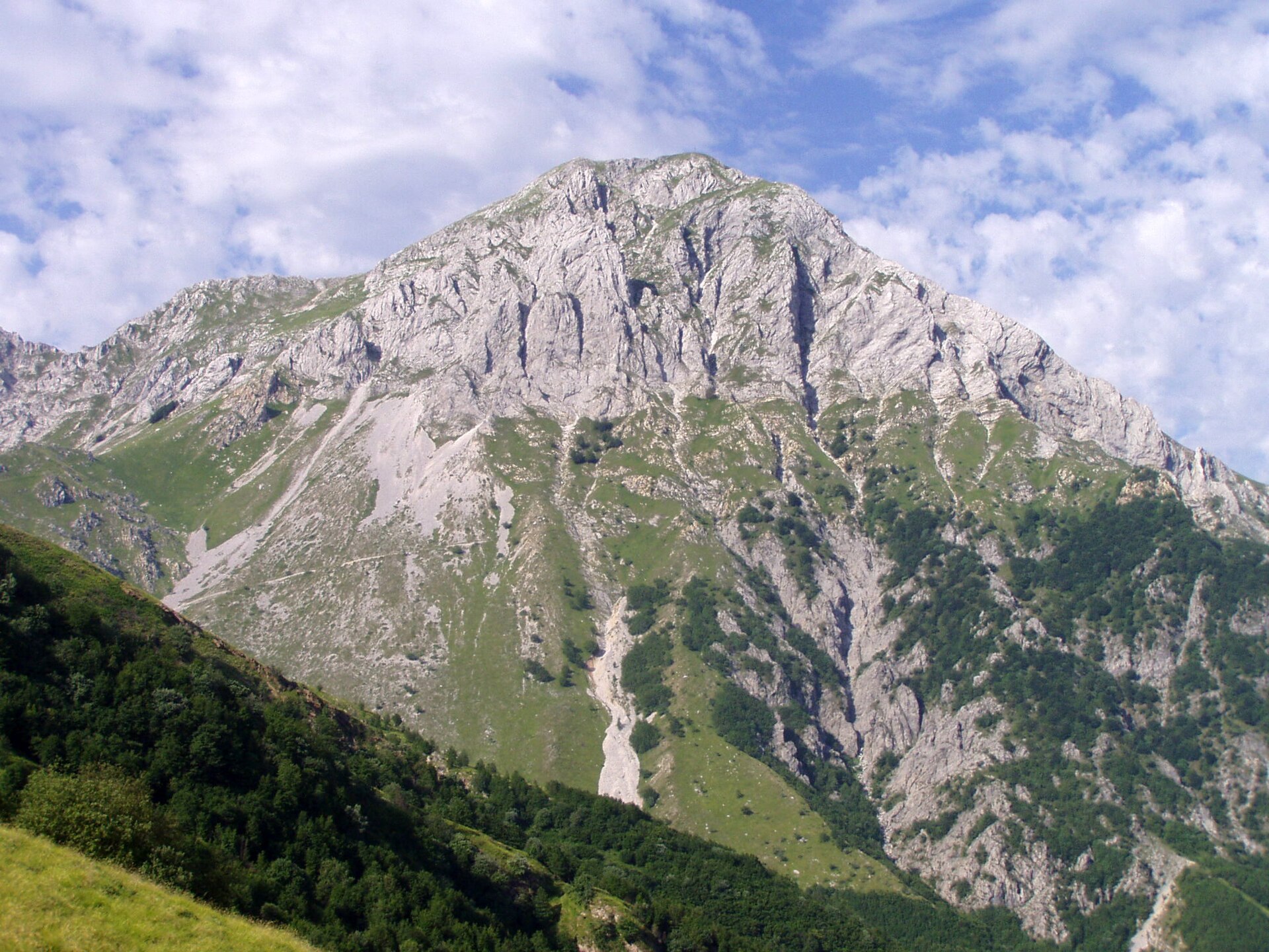
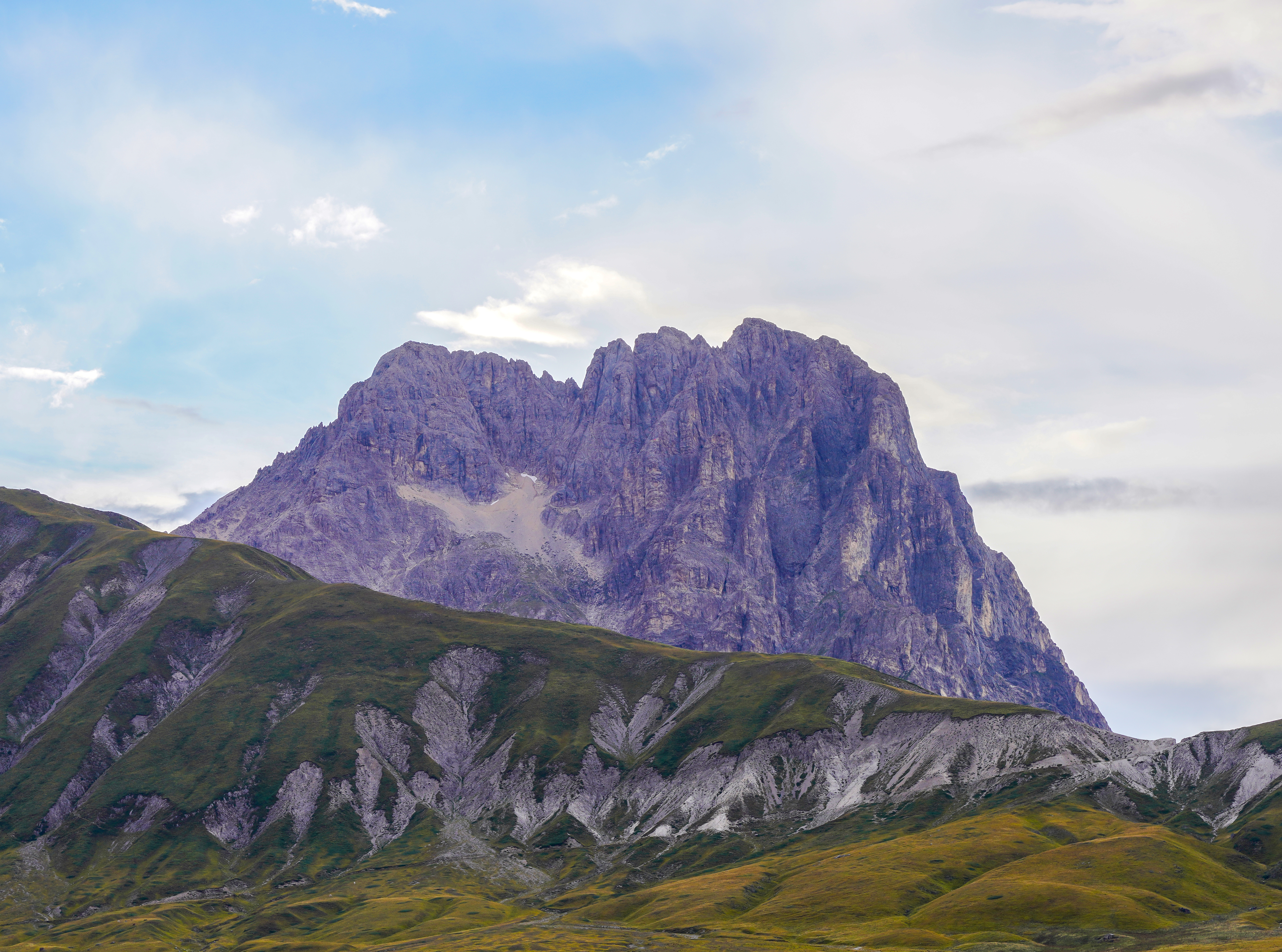
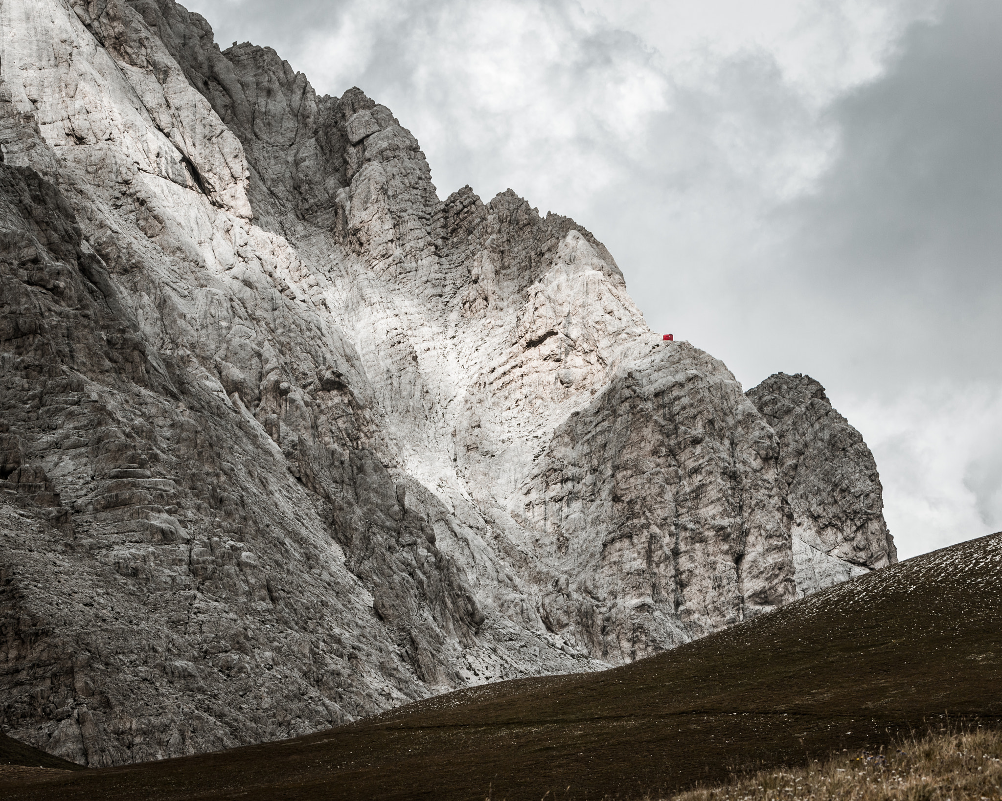
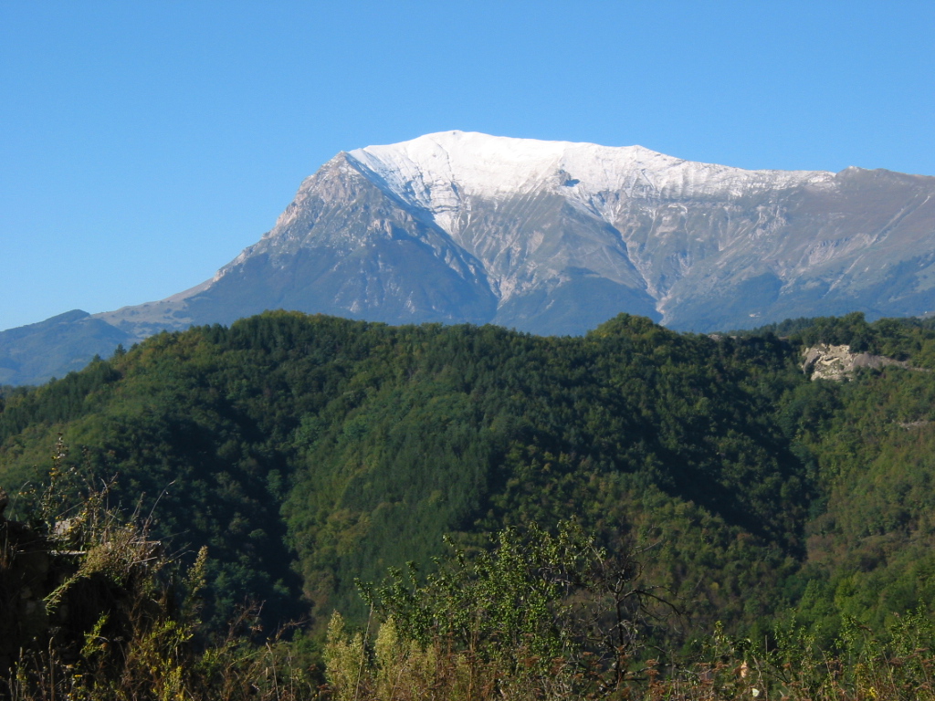
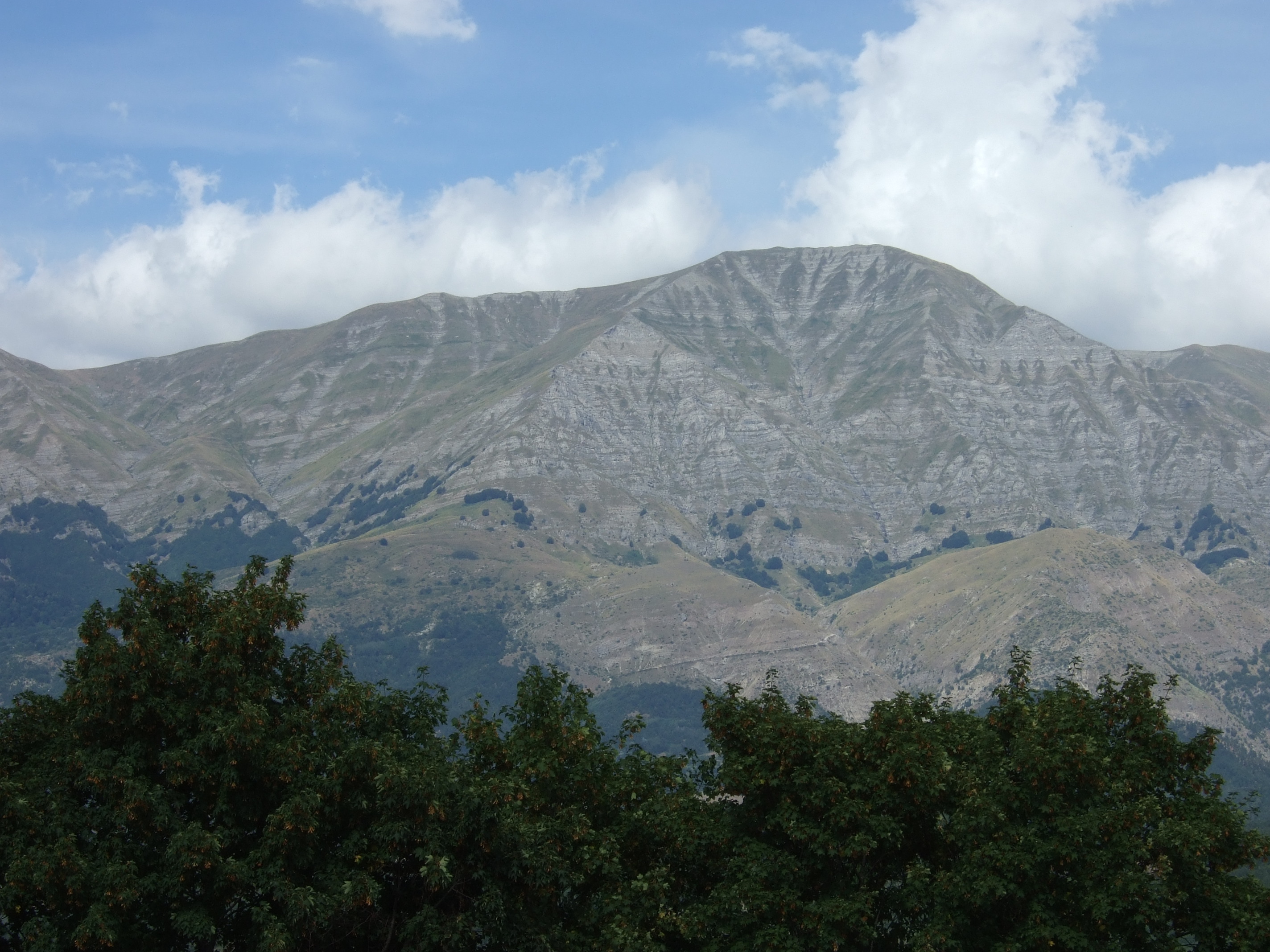
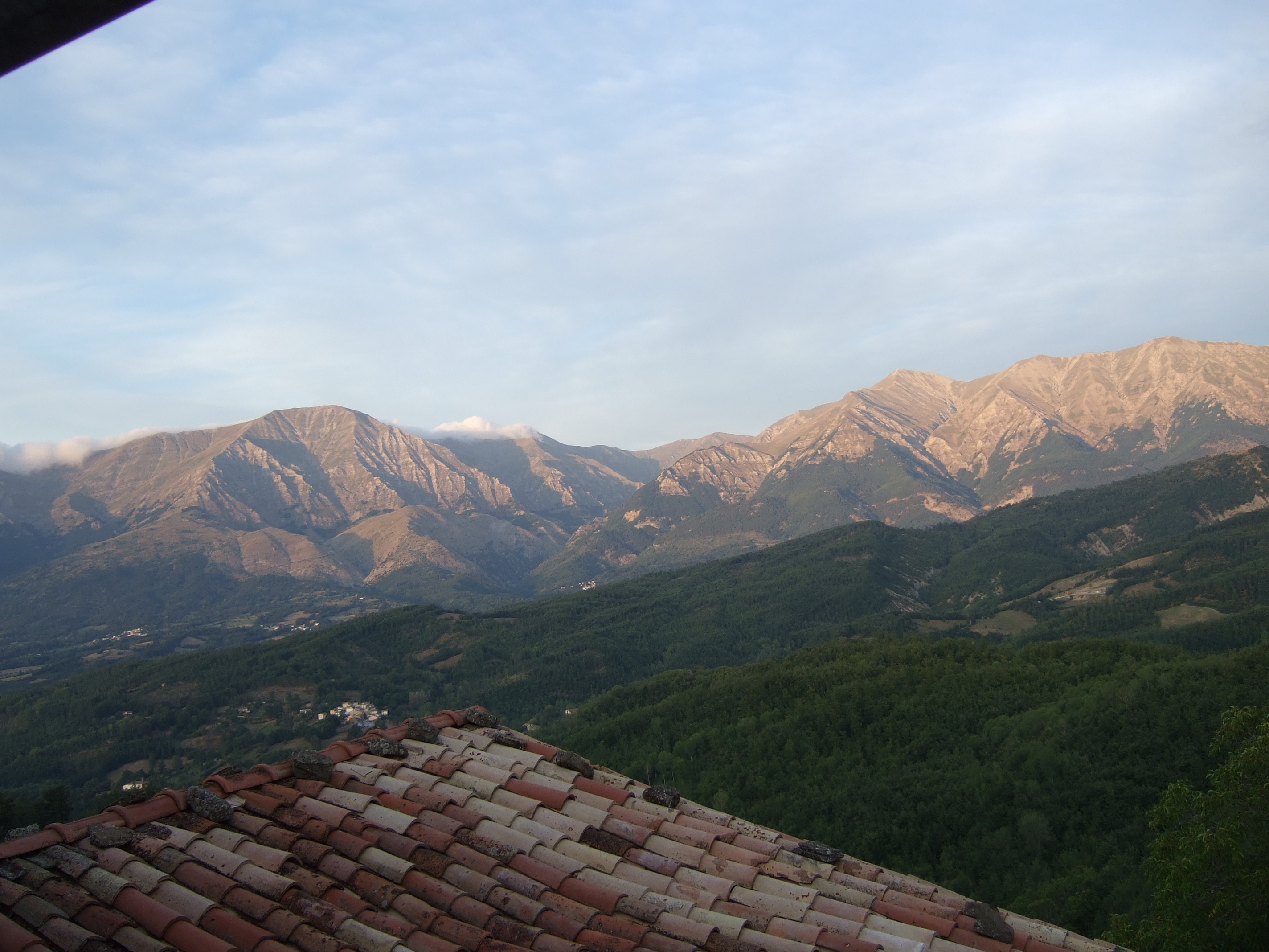
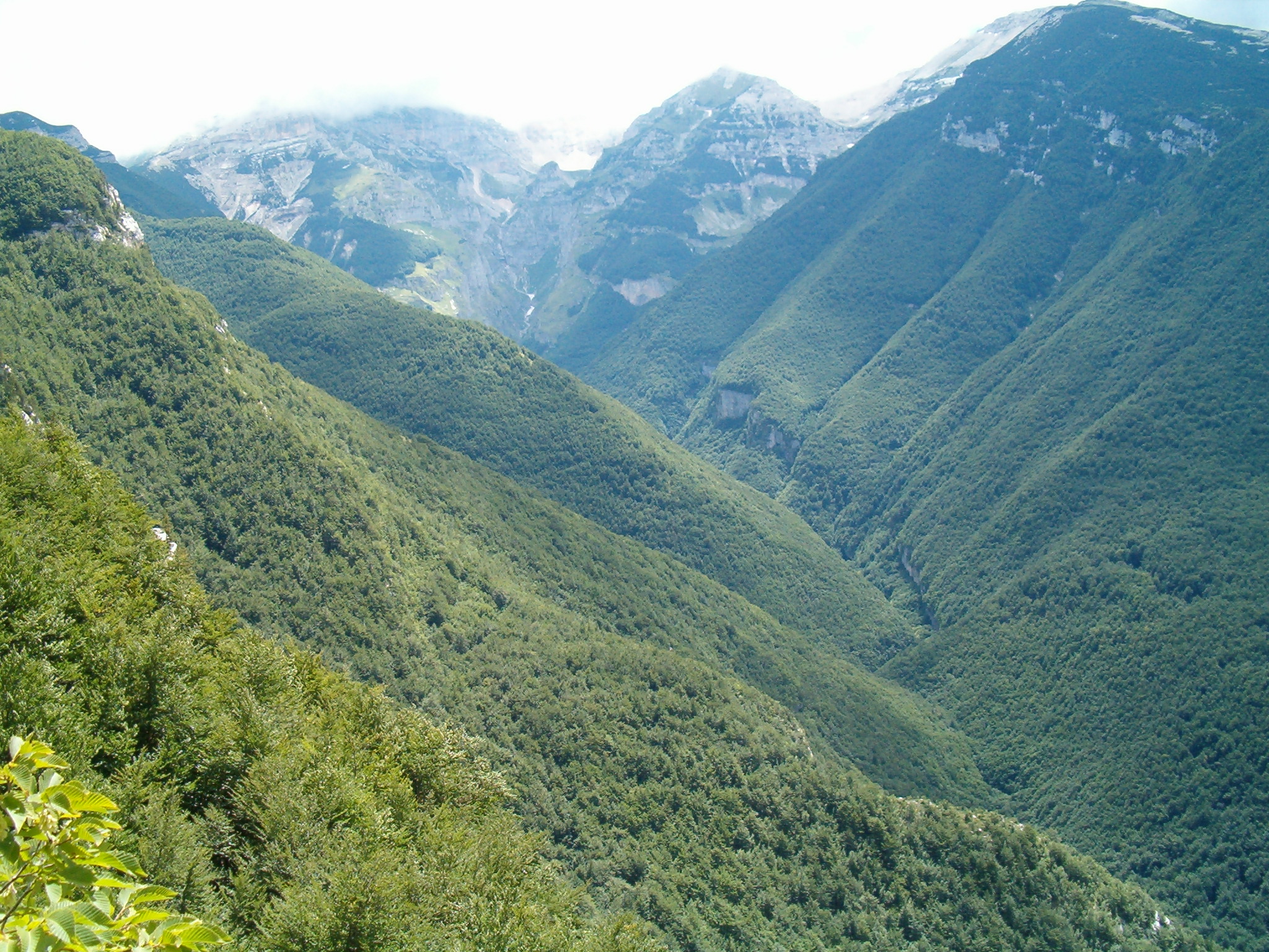
The Central Apennines form the most alpine-feeling section of the Italian Apennine chain. The region combines the limestone summits and karst plateaux of the Sibillini, Gran Sasso and Majella with the water-rich sandstone terrain of the Monti della Laga. The high summits are serious mountain terrain despite their central-Italian latitude: Corno Grande reaches 2,912 m, Monte Amaro reaches about 2,793 m, and Monte Vettore reaches 2,476 m. Official park sources classify several of the selected routes as EE or harder, with long sections above the treeline.
The main hiking centres for this selection are Campo Imperatore for Gran Sasso, Forca di Presta for the Sibillini, Cesacastina for the Laga, Rifugio Bruno Pomilio / Blockhaus for Majella’s high ridge, and Caramanico Terme for the Orfento gorge. Public transport is limited for several trailheads, so final access planning usually requires checking seasonal buses, road openings, parking rules and, where relevant, visitor-centre instructions.
The usual walking season is late spring to autumn, but high routes often remain snow-affected into early summer. Weather changes rapidly on the exposed ridges and plateaux. The Majella and Sibillini parks also contain sensitive protected zones, where dogs, off-trail walking, bathing, cycling or access to particular paths may be restricted. The Orfento valley needs special care because official pages mention access registration and temporary closures affecting sections of the gorge.
Selection rationale
These five hikes were selected to represent the region’s main walking characters: the highest and most iconic Gran Sasso summit route, the classic Sibillini high summit, the water-and-waterfall landscape of the Laga, Majella’s long high-altitude ridge to Monte Amaro, and Majella’s gorge-and-hermitage terrain in the Valle dell’Orfento. Lago di Pilato was not selected as a standalone hike because the Sibillini park’s own material treats the area as sensitive and does not promote unofficial access routes to the lake.
Summary table
| # | Hike | Country | Route type | Distance | Gain | Max elevation | Difficulty |
|---|---|---|---|---|---|---|---|
| 1 | Corno Grande via the normal route from Campo Imperatore | Italy | Out-and-back / partial loop | 9.9–10.1 km | 800–900 m | 2,912 m | EE / difficult |
| 2 | Monte Vettore from Forca di Presta | Italy | Out-and-back | 9.7–10.2 km | 925–970 m | 2,476 m | E to hard mountain hike |
| 3 | Monte Gorzano via the Valle delle Cento Fonti / Cento Cascate | Italy | Loop / semi-loop | 14.4–16.0 km | 1,188–1,250 m | 2,458 m | EE |
| 4 | Monte Amaro from Rifugio Bruno Pomilio / Blockhaus | Italy | Out-and-back | 25–26 km | 1,150–1,500 m | 2,793 m | EE / very strenuous |
| 5 | Valle dell’Orfento: Ponte della Pietra / Sant’Onofrio loop | Italy | Loop | 15.2 km | 300 m on official loop variant | E / EEA section depending on variant |
1. Corno Grande via the normal route from Campo Imperatore
Snapshot
Itinerary
The route begins at Campo Imperatore and climbs towards Sella di Monte Aquila before following the normal approach towards Sella del Brecciaio and the upper limestone slopes of Corno Grande. The final section passes rocky ground below the summit and may require the use of hands in places. Descent is normally by the same general line, with variants around Rifugio Duca degli Abruzzi depending on conditions and route choice.
Why it is essential
Corno Grande is the highest summit of both Gran Sasso and the Apennines. The normal route from Campo Imperatore is the classic non-alpinistic way to reach the summit in summer conditions, combining high limestone scenery, broad views over the Campo Imperatore plateau and a short but serious rocky summit section.
Equipment
- Sturdy boots
- Windproof and waterproof layer
- Warm layer
- Sun protection
- Map / GPS
- Food and sufficient water
- Trekking poles useful on scree and descent
- Helmet recommended for the rocky upper section and required by some guided operators
- Early-season snow may require winter equipment and experience
Hazards and notes
- The final rocky section is exposed to slips, loose rock and sudden weather changes.
- Snow or ice can remain in gullies and shaded areas after the surrounding plateau appears clear.
- The route is not a via ferrata, but it is more serious than a normal hill walk.
- Avoid the route in thunderstorms, strong wind, poor visibility or lingering snow unless equipped and experienced.
GPX / KML links
| Source | URL | Format | Notes |
|---|---|---|---|
| Wikiloc | wikiloc.com | Source map / GPX download source | Route source found; reuse unresolved |
| Komoot | komoot.com | Source map | Route source found; no clear legally reusable GPX confirmed |
Further reading
- Parco Nazionale del Gran Sasso e Monti della Laga — Corno Grande event
- Wikiloc — Corno Grande da Campo Imperatore via normale
- Wikiloc — Corno Grande via normale
- Komoot — Corno Grande from Campo Imperatore
2. Monte Vettore from Forca di Presta
Snapshot
Itinerary
From Forca di Presta the route follows the official Sibillini E15 line towards Monte Vettore. The path climbs the open ridge system above the pass, reaches the higher saddle area below the summit ridge, and then continues to the top of Monte Vettore. Descent is normally by the same route. The route is exposed to wind and weather but is not technical in normal summer conditions.
Why it is essential
Monte Vettore is the highest summit of the Sibillini. The Forca di Presta ascent is the most direct classic day-hike to the summit and gives wide views over the Piano Grande, the Sibillini crest and the Central Apennines.
Equipment
- Sturdy boots
- Warm and weatherproof layers
- Sun protection
- Water
- Food
- Map / GPS and navigation backup
- Trekking poles useful on the descent
- In spring or early summer, lingering snow can make the upper route significantly more serious
Hazards and notes
- The route is exposed to wind, storms and low cloud.
- There is little shade and water should not be assumed on the ridge.
- The Lago di Pilato basin is environmentally sensitive: the park states that only certain historical Foce–Lago routes are recognised and that other traces are unsigned and may be dangerous, so this catalogue entry treats Monte Vettore as the primary hike rather than promoting an unofficial lake variant.
GPX / KML links
| Source | URL | Format | Notes |
|---|---|---|---|
| Monti Sibillini official E15 route page | sibillini.net | Official route page | Official route source found; no official GPX confirmed |
| Outdooractive | outdooractive.com | Source map / route page | Route source found; reuse unresolved |
| Wikiloc | fr.wikiloc.com | Source map / GPX download source | Route source found; reuse unresolved |
Further reading
- Monti Sibillini — E15 route description
- Monti Sibillini — E15 route page
- Monti Sibillini — FAQ
- Outdooractive — Forca di Presta–Monte Vettore
- Wikiloc — Monte Vettore da Forca di Presta
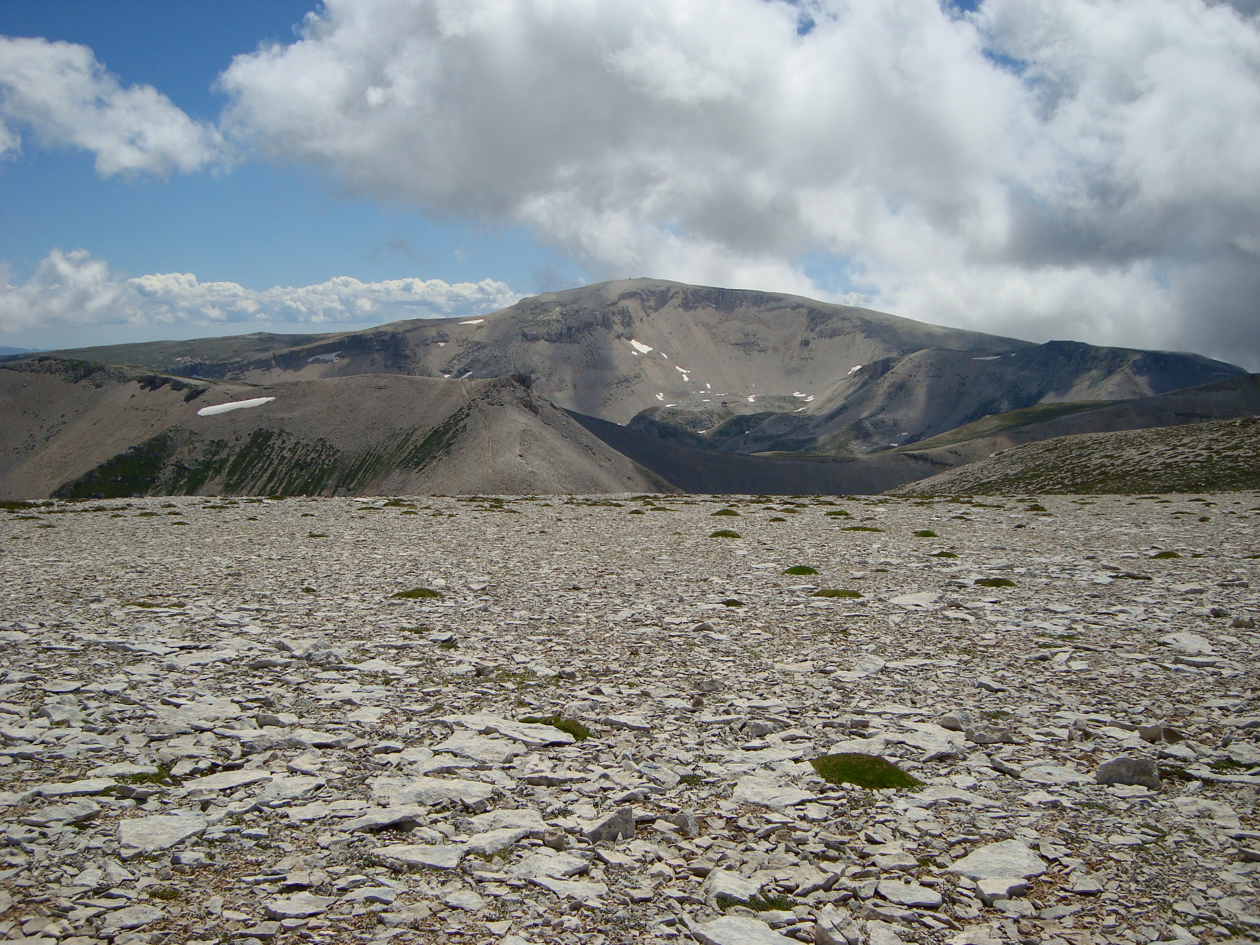
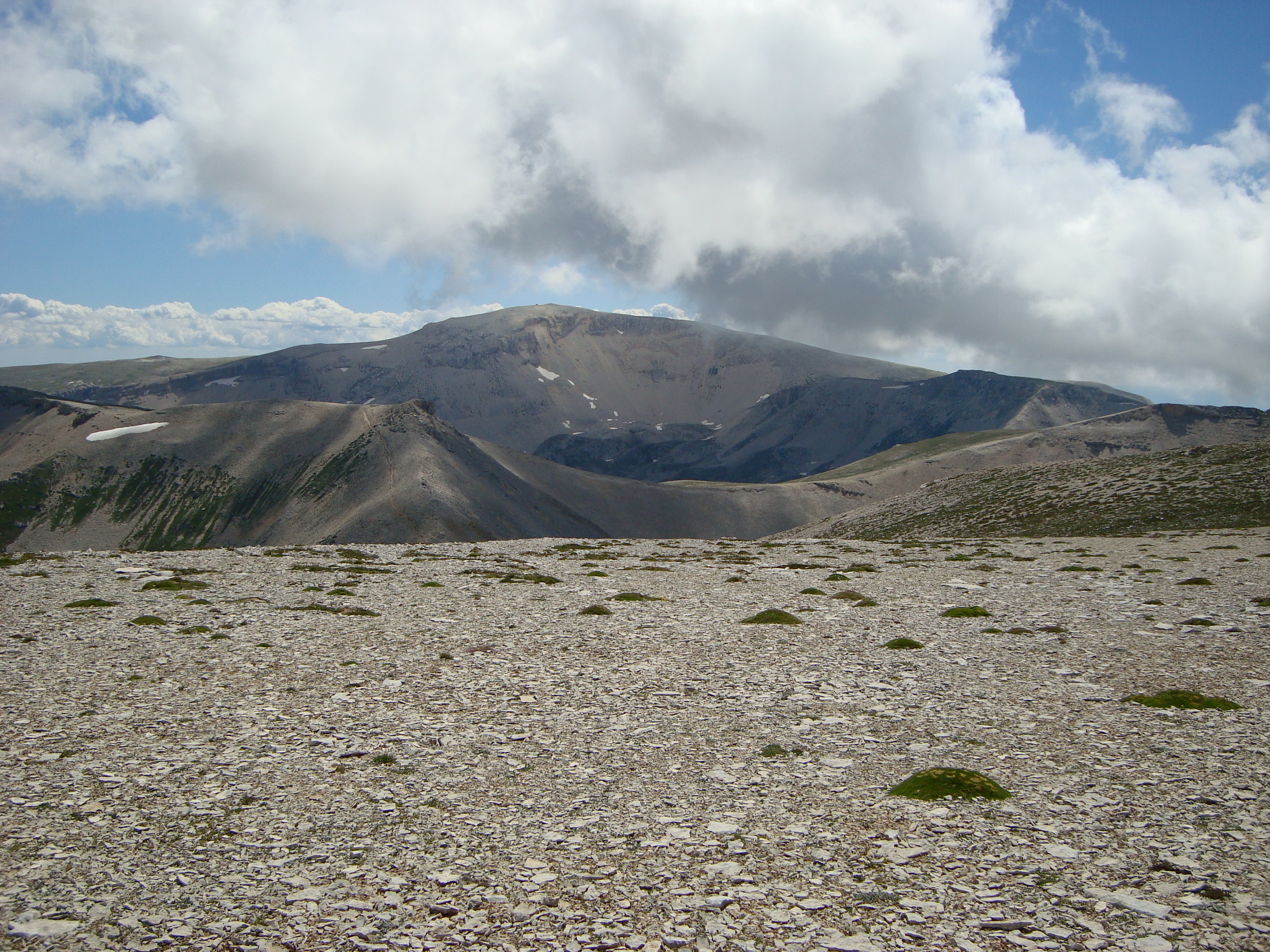
3. Monte Gorzano via the Valle delle Cento Fonti / Cento Cascate
Snapshot
Itinerary
From Cesacastina or the Le Piane area, the route climbs into the Fosso dell’Acero and the beech-wood lower valley, then follows the water-rich amphitheatre of the Cento Fonti / Cento Cascate. Above the woods, the path enters open high pasture and reaches the Sella di Monte Gorzano area before the final ascent to Monte Gorzano. Descent is by the ascent line or by a loop variant, depending on conditions and route-finding.
Why it is essential
The Laga differs strongly from the neighbouring limestone massifs. Its sandstone terrain carries surface water, producing streams, pools and waterfalls. The Cento Fonti / Cento Cascate approach to Monte Gorzano is the classic way to experience that landscape while also reaching the highest summit of the Laga group.
Equipment
- Sturdy boots
- Waterproof layer
- Warm layer
- Map / GPS
- Food
- Water
- Trekking poles
- Gaiters or waterproof footwear useful when the upper valley is wet
- Navigation backup recommended for less obvious upper sections and descent variants
Hazards and notes
- The route is long and has a large height gain.
- Wet grass, stream crossings, slippery rock and snowmelt can slow progress.
- In fog, the broad upper slopes can be confusing.
- Avoid the route during storms or when streams are in spate.
GPX / KML links
| Source | URL | Format | Notes |
|---|---|---|---|
| Wikiloc — Monte Gorzano e Cento Fonti | it.wikiloc.com | Source map / GPX download source | Route source found; reuse unresolved |
| Wikiloc — Monte Gorzano da Cesacastina per 100 Fonti | it.wikiloc.com | Source map / GPX download source | Route source found; reuse unresolved |
| Gran Sasso e Monti della Laga National Park | gransassolagapark.it | Route description | Official route context found; no official route file confirmed |
Further reading
- Gran Sasso e Monti della Laga National Park — route context
- Wikiloc — Monte Gorzano e Cento Fonti
- Wikiloc — Monte Gorzano da Cesacastina per 100 Fonti
4. Monte Amaro from Rifugio Bruno Pomilio / Blockhaus
Snapshot
Itinerary
The route follows Majella’s Sentiero P from Rifugio Pomilio towards the Blockhaus area and then along the long high ridge system. It passes the Montanelli–Porreca road area, Cima Cavallo, the Fontanino near Selletta di Monte Cavallo, the Anfiteatro delle Murelle, Bivacco Fusco, Monte Focalone, the Tre Portoni area, Cima Pomilio and Monte Rotondo before the final climb to Monte Amaro and Bivacco Pelino. Return is normally by the same high route or by a guided / variant return where conditions permit.
Why it is essential
Monte Amaro is Majella’s highest summit and one of the great high-level day objectives of the Central Apennines. The route is long, exposed and physically demanding, but it gives the most complete day-hike experience of Majella’s high plateau, ridge and summit environment.
Equipment
- Sturdy boots
- Warm layer
- Waterproof and windproof shell
- Hat and gloves outside midsummer
- Headtorch
- Navigation backup
- First-aid kit
- Sun protection
- Food and substantial water
- Trekking poles strongly recommended
- Early-season snow may require ice axe, crampons or microspikes and the skills to use them
Hazards and notes
- This is a very long, committing high-level route with limited escape options, strong weather exposure and long dry sections.
- Snowfields, fog and storms can make navigation serious.
- The park’s Outdooractive partner page notes restrictions including no dogs on the route because it crosses Zone A, and also notes restrictions on fires and drones.
GPX / KML links
| Source | URL | Format | Notes |
|---|---|---|---|
| Majella National Park — Sentiero P partial KML | parcomajella.it | KML, partial route only | Partial official KML found, but not a full Monte Amaro return GPX/KML |
| Majella National Park — Sentiero P page | parcomajella.it | Official route page | Official route source |
| Outdooractive / GAL Terre Pescaresi | outdooractive.com | Source map; page exposes GPX/KML/FIT controls | Route source found; reuse unresolved |
| Wikiloc / BornToTrek | wikiloc.com | Source map / GPX download source | Route source found; reuse unresolved |
Further reading
- Majella National Park — Sentiero P / Tappa 3
- Majella National Park — Sentiero P partial KML
- Outdooractive — Monte Amaro from Blokhaus
- Wikiloc — Monte Amaro dal Rifugio Bruno Pomilio / Blockhouse
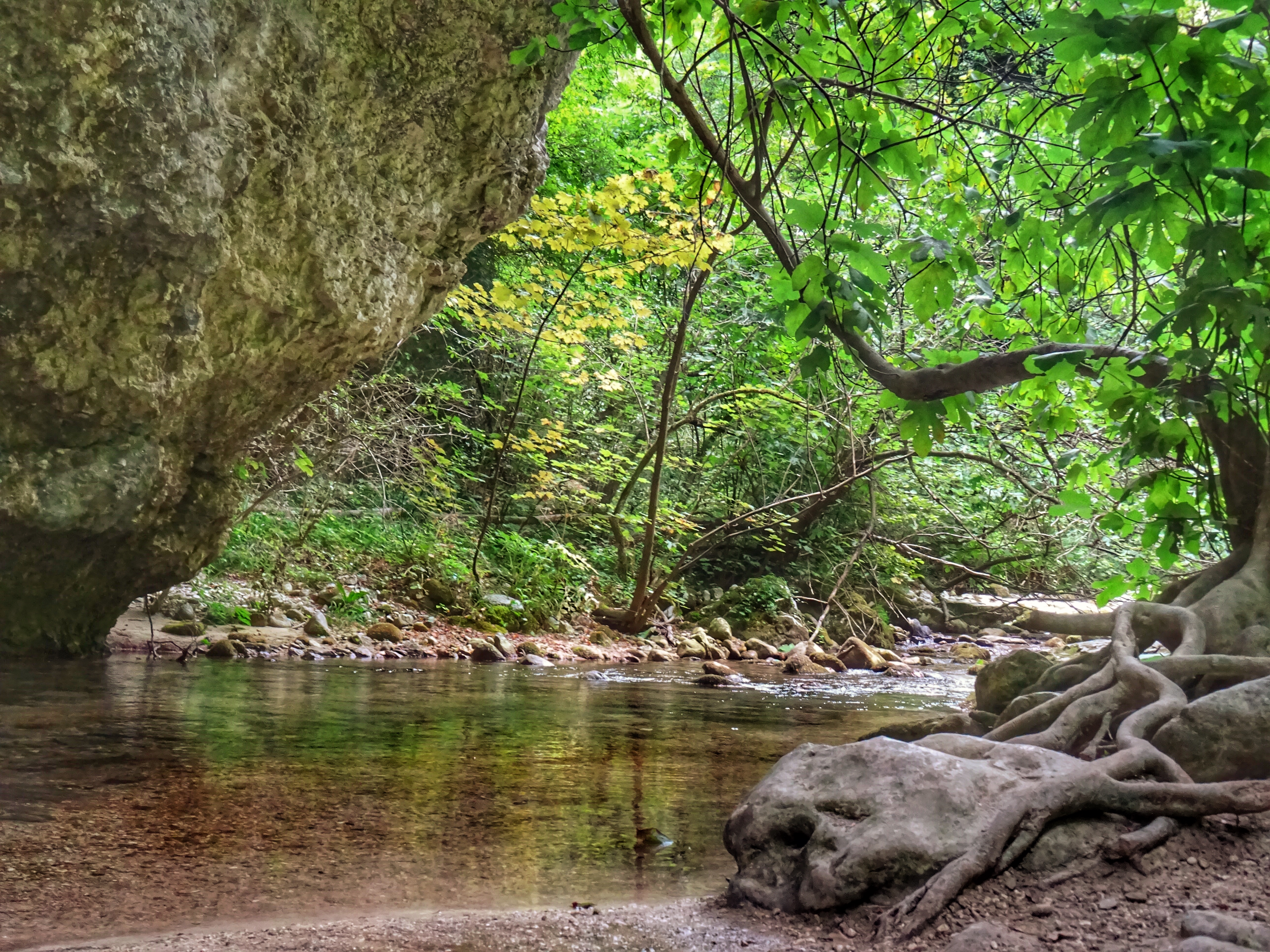
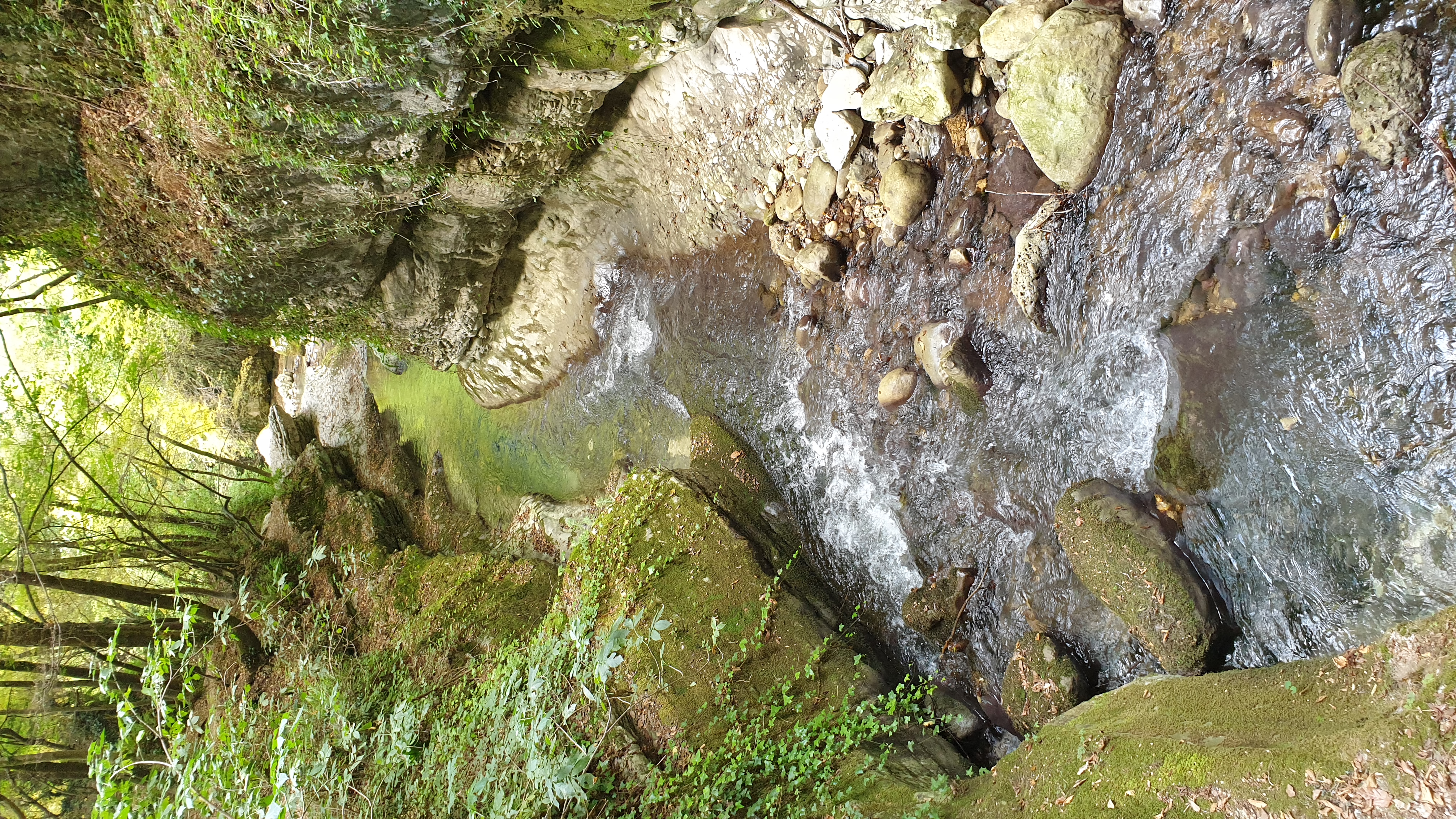
5. Valle dell’Orfento: Ponte della Pietra / Sant’Onofrio loop
Snapshot
Itinerary
The selected loop uses the Orfento gorge paths around Santa Croce, Ponte della Pietra and the Sant’Onofrio return line. The route follows the B2 direction into the gorge, passing bridges and narrow valley sections, with the official B2 description mentioning Ponte del Vallone, Ponte San Benedetto, the Piscia Giumenta cable-protected section and Ponte della Pietra. The official loop event describes a return via the S path and Eremo di Sant’Onofrio all’Orfento.
Why it is essential
The Orfento is the key gorge landscape of the Majella area, contrasting sharply with the high Monte Amaro plateau. This route adds a lower-altitude, forested, cultural and geomorphological hike to the catalogue, with bridges, hermitage terrain and limestone-gorge scenery.
Equipment
- Hiking boots with good grip
- Waterproof layer
- Warm layer
- Food
- Water
- Map / GPS
- Sun protection
- Because the official B2 page rates the route as EEA and mentions a steel-cable section, current local advice should be checked before treating the loop as an ordinary hiking route. If the cable section is open and still classed EEA, additional equipment or a guide may be required.
Hazards and notes
- This entry is marked Unverified because current access must be checked before travel.
- The park’s Orfento registration page states that registration is required, trekking shoes are obligatory, water access is prohibited, and dogs are not allowed except on specified routes.
- The same official page also records partial reopening information and temporary closures affecting parts of the valley; the B2 page specifically notes that the Piscia Giumenta and B2 section towards Guado Sant’Antonio were temporarily interdicted.
GPX / KML links
| Source | URL | Format | Notes |
|---|---|---|---|
| Majella National Park — B2 KML | parcomajella.it | Official KML for B2 | Official route file found for B2, but current access/closures must be checked before use |
| Majella National Park — Ponte della Pietra loop page | parcomajella.it | Official route / event description | Official loop statistics found; route-file gap remains |
| Wikiloc — Orfento loop source | it.wikiloc.com | Source map / GPX download source | Source route found, but variant appears longer / harder than the catalogue route; manual checking required |
Further reading
- Majella National Park — B2 da Caramanico Terme a San Nicolao
- Majella National Park — B2 KML
- Majella National Park — Ponte della Pietra loop
- Valle dell’Orfento registration
- Wikiloc — Valle dell’Orfento anello B2 / S
Further reading
| Source | URL |
|---|---|
| Parco Nazionale del Gran Sasso e Monti della Laga — Corno Grande event | gransassolagapark.it |
| Parco Nazionale del Gran Sasso e Monti della Laga — Laga / Cento Fonti context | gransassolagapark.it |
| Parco Nazionale dei Monti Sibillini — E15 route description | sibillini.net |
| Parco Nazionale dei Monti Sibillini — E15 route page | sibillini.net |
| Parco Nazionale dei Monti Sibillini — FAQ | sibillini.net |
| Parco Nazionale della Maiella — Sentiero P / Tappa 3 | parcomajella.it |
| Parco Nazionale della Maiella — B2 da Caramanico Terme a San Nicolao | parcomajella.it |
| Parco Nazionale della Maiella — Ponte della Pietra loop | parcomajella.it |
| Parco Nazionale della Maiella — Sentiero P partial KML | parcomajella.it |
| Parco Nazionale della Maiella — B2 KML | parcomajella.it |
| Valle dell’Orfento — registration | valledellorfento.info |
| Wikiloc — Corno Grande via normale | wikiloc.com |
| Wikiloc — Corno Grande da Campo Imperatore via normale | it.wikiloc.com |
| Komoot — Corno Grande from Campo Imperatore | komoot.com |
| Outdooractive — Forca di Presta–Monte Vettore | outdooractive.com |
| Wikiloc — Monte Vettore da Forca di Presta | fr.wikiloc.com |
| Wikiloc — Monte Gorzano e Cento Fonti | it.wikiloc.com |
| Wikiloc — Monte Gorzano da Cesacastina per 100 Fonti | it.wikiloc.com |
| Outdooractive — Monte Amaro from Blokhaus | outdooractive.com |
| Wikiloc — Monte Amaro dal Rifugio Bruno Pomilio / Blockhouse | wikiloc.com |
| Wikiloc — Valle dell’Orfento anello B2 / S | it.wikiloc.com |