Verification date: 2026-06-06.
Regional overview
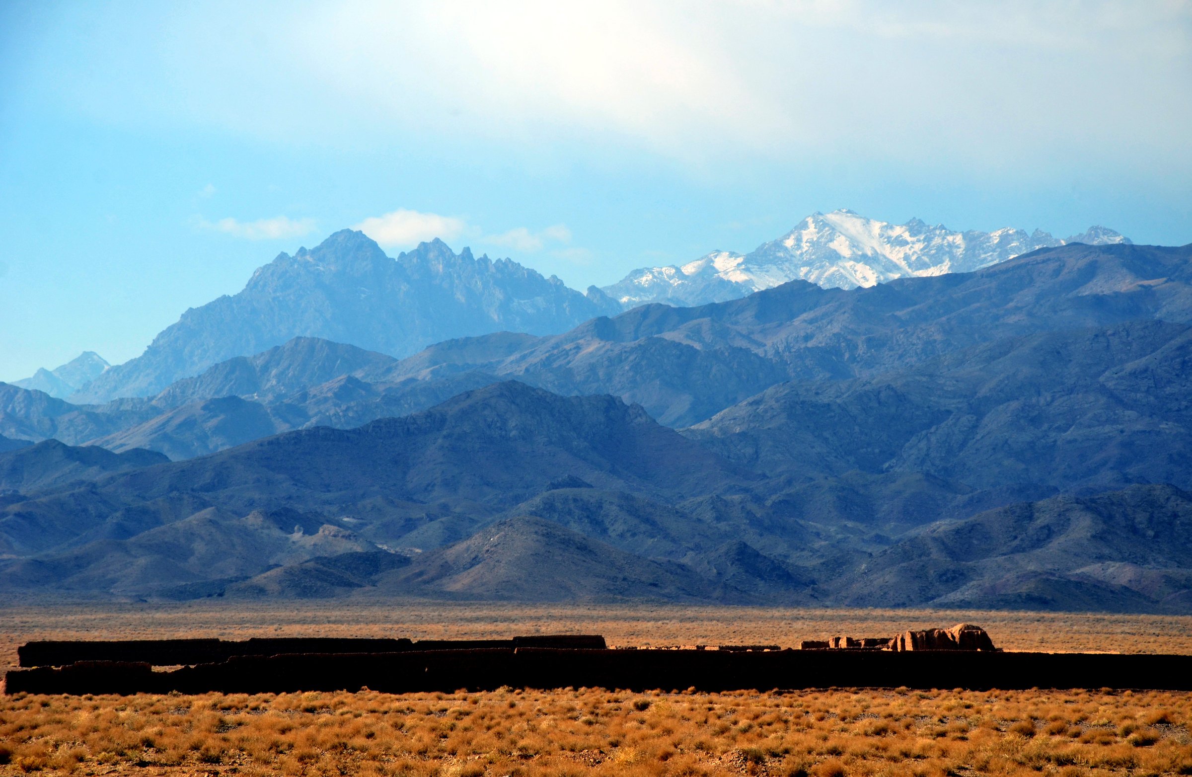
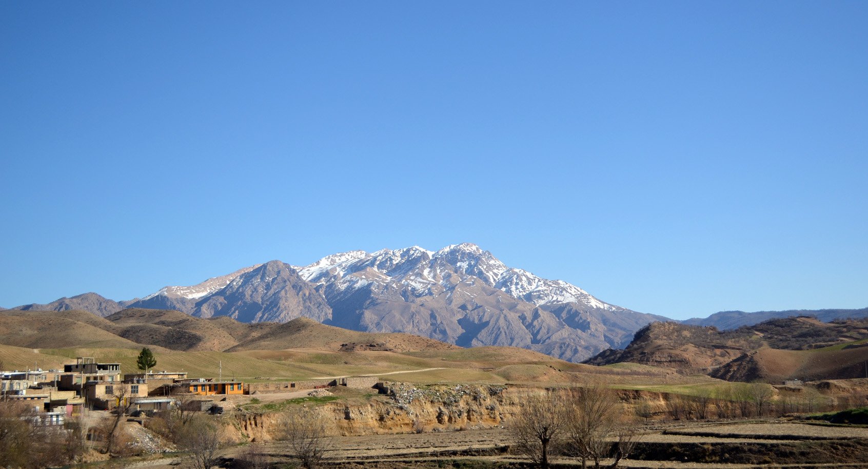
The Zagros is Iran’s great folded mountain system, running from the north-west toward the south-east and containing high limestone ranges, oak-covered foothills, nomadic Bakhtiari landscapes, deep valleys, waterfalls, archaeological routes and 4,000 m summits. The selected hikes focus on day objectives across this broad region: Dena/Qash Mastan, Oshtorankuh/Gahar Lake, Zard Kuh/Kolonchin, Bisheh waterfall country, and Shapur Cave above Bishapur.
Route documentation is uneven. Some objectives are famous and well represented in tourism or heritage sources, but exact official walking statistics are rare. source routes provide most GPX-style geometry; tourism and Wikimedia/UNESCO-linked sources verify the places and landscape context.
The normal hiking season is spring to autumn, but the high summits hold snow, receive severe weather and can require winter mountaineering judgement outside summer. Lower waterfall and cave routes can be hot, slippery, or flood-sensitive. Local restrictions, protected-area rules and access roads should be checked before travel.
Selection rationale
The selection balances a highest-summit route (Qash Mastan/Dena), a classic alpine lake route (Gahar), a major Bakhtiari high summit (Kolonchin/Zard Kuh), a Lorestan waterfall walk, and a cultural-historical cave hike in the southern Zagros.
Summary
| # | Hike | Country | Route type | Distance | Gain | Max elevation | Difficulty | GPX status | Photo status |
|---|---|---|---|---|---|---|---|---|---|
| 1 | Qash Mastan, Dena | Iran | Loop / summit route | 19.3–21.1 km depending source | 2,185–2,189 m | 4,389–4,407 m | Difficult / very difficult | source route | Commons category found |
| 2 | Gahar Lake from Dorud / Haft Cheshmeh | Iran | Out-and-back / mountain-lake approach | Approx. 15–18 km depending route | Unresolved; source variants differ | 2,350–2,400 m lake | Moderate–hard | source route | Commons image candidate found |
| 3 | Kolonchin, Zard Kuh | Iran | Point-to-point / summit route | 31.8 km source route; shorter variants likely | 2,404 m | 4,181–4,221 m | Difficult | source route | Commons category found |
| 4 | Bisheh to Ab Garmeh / Cham Chit waterfalls | Iran | Out-and-back / linear waterfall route | 13.5 km | 491 m | Unresolved | Moderate | source route | No verified open image |
| 5 | Shapur Cave from Tang-e Chogan / Bishapur | Iran | Out-and-back or loop cave climb | 2.9–6.5 km depending source | 476–579 m | 1,307–1,508 m | Moderate | source route | Commons category found |
Hike 1: Qash Mastan, Dena
Snapshot
Itinerary
The Khafr-side route climbs from the village into the central Dena massif and gains the high Qash Mastan summit, the highest point of the Dena range. Public GPS records show a strenuous loop with more than 2,100 m of ascent. The route should be treated as a serious high-mountain day for fit, acclimatised walkers.
Why it is essential
Qash Mastan is the highest point of Dena, one of the defining subranges of the Zagros. It is the most obvious high-summit entry for a Zagros day-hike catalogue, even though it exceeds the normal ascent guideline and needs a clear difficulty warning.
Equipment
Mountain hiking equipment plus extra food, water, headtorch, warm layers and navigation backup. Snow/ice equipment may be required outside the dry summer window. A local guide is recommended unless the route is well known to the party.
Hazards and notes
The ascent is long and high, with large elevation gain, altitude exposure, weather sensitivity and potential snow. This is not a casual tourist walk. Conditions on Dena can change quickly; check current local mountain conditions before departure.
Photos
Photo status: Dena Commons category found; an individual file was not fully licence-checked in this pass.
| Image | Source | Author | Licence | Reuse notes | Attribution |
|---|---|---|---|---|---|
| Dena category image candidate | commons.wikimedia.org | — | File-specific licence not checked | Do not reuse until a file page is selected and verified | — |
GPX / route file
| Source | URL | Format | Licence / terms | Reuse status |
|---|---|---|---|---|
| Wikiloc — Qash Mastan summit, Central Dena | wikiloc.com | Source route / downloadable trail for users | Wikiloc terms apply | Route-file download possible through Wikiloc; reuse terms unresolved |
| Wikiloc — Qash Mastan Dena 2025 | wikiloc.com | Source route / downloadable trail for users | Wikiloc terms apply | Secondary route cross-check |
Hike 2: Gahar Lake from Dorud / Haft Cheshmeh
Snapshot
Itinerary
The standard objective is the mountain-lake approach from the Dorud side into the Oshtorankuh Protected Area. From the ranger hut/car park area near Haft Cheshmeh, the route skirts mountain flanks toward Gahar Lake, a high freshwater lake below the Oshtorankuh walls. Several GPS routes include higher or longer variants, so the final catalogue should define the exact Dorud/Haft Cheshmeh approach line.
Why it is essential
Gahar is one of the most famous alpine lakes in the Zagros and the signature walking destination of Oshtorankuh. It provides the lake/cirque-style route in the Zagros set.
Equipment
Mountain hiking equipment: sturdy boots, warm layer, weatherproof layer, sun protection, water, food, map/GPS and headtorch. Carry water treatment if relying on lake/stream water.
Hazards and notes
Protected-area pressure, road/access changes and seasonal restrictions should be checked locally. Snow, storms and heat on lower approaches are possible. The exact route statistics remain unresolved because published GPS tracks use different starts and variants.
Photos
| Image | Source | Author | Licence | Reuse notes | Attribution |
|---|---|---|---|---|---|
| Gahar Lake image candidate | commons.wikimedia.org | Safa.daneshvar | Licence not fully checked in this pass | Source page identifies own work, but licence lines were not verified before publication | Do not reuse until licence is checked on the file page |
GPX / route file
| Source | URL | Format | Licence / terms | Reuse status |
|---|---|---|---|---|
| Wikiloc — Oshtoran Kuh / Gahar Lake | wikiloc.com | Source route / downloadable trail for users | Wikiloc terms apply | Long one-way variant; reuse terms unresolved |
| Wikiloc — Gahar Lake from Dorud | wikiloc.com | Source route / downloadable trail for users | Wikiloc terms apply | Source route found; stats need extraction/recheck |
Hike 3: Kolonchin, Zard Kuh
Snapshot
Itinerary
The available source route climbs the Zard Kuh/Kolonchin high country, passing a shelter/camp area and nearby summits before reaching the Kolonchin summit. The Wikiloc description says the route goes via Chalmishan shelter, passes near Chalmishan and Dozardeh, then below Shah Shahidan toward Kolonchin. Guide sources state that Kolonchin is the highest Zard Kuh summit and that a beaten south-face route exists, but this pass did not verify a shorter day-route GPX.
Why it is essential
Zard Kuh is one of the great Zagros massifs, central to Bakhtiari landscapes and the headwaters of major rivers. Kolonchin gives the catalogue a high Bakhtiari/Zard Kuh summit objective, but the route remains candidate-only until a day-hike variant is verified.
Equipment
Mountain hiking equipment plus headtorch, extra food/water, warm layers and navigation backup. Snow equipment and avalanche judgement are required outside normal summer conditions.
Hazards and notes
The cited route is longer than the normal day-hike constraint and may reflect multi-stage or extended stopped-time travel. Snowfields, avalanche terrain, loose rock, altitude and rapid weather change are important hazards. A local guide/source should refine the final route.
Photos
Photo status: Zard Kuh Commons category found; individual file licence not checked in this pass.
| Image | Source | Author | Licence | Reuse notes | Attribution |
|---|---|---|---|---|---|
| Kolunchin Zardkuh image candidate | commons.wikimedia.org | File page not fully checked | Licence not checked | Do not reuse until file-page licence is verified | — |
GPX / route file
| Source | URL | Format | Licence / terms | Reuse status |
|---|---|---|---|---|
| Wikiloc — Kolonchin | wikiloc.com | Source route / downloadable trail for users | Wikiloc terms apply | Candidate route only; reuse terms unresolved |
| Wikiloc — Kolonchin Zardkuh | wikiloc.com | Source route / downloadable trail for users | Wikiloc terms apply | Secondary source-route candidate |
Hike 4: Bisheh to Ab Garmeh / Cham Chit waterfalls
Snapshot
Itinerary
The source hiking route goes from the Bisheh area toward Ab Garmeh / Cham Chit waterfall, mostly on dirt-road terrain according to the Wikiloc snippet. It connects two waterfall landscapes in oak-forest Zagros foothills rather than climbing a high summit.
Why it is essential
Bisheh is one of Lorestan’s best-known waterfall destinations and gives the Zagros entry a lower, forested waterfall walk. It also balances the high-summit objectives with a route closer to railway village and valley culture.
Equipment
Standard hiking equipment: hiking shoes, water, sun protection, weather layer, food and map/GPS. Carry extra water in warm weather because the route note says reliable water was not seen except around villages.
Hazards and notes
Heat, water scarcity, slippery waterfall edges and flood-prone gullies are the main hazards. The route source notes a dirt-road character; confirm whether the full line is worthwhile as a hike rather than a vehicle track.
Photos
Photo status: No licence-compatible image found in this pass.
GPX / route file
| Source | URL | Format | Licence / terms | Reuse status |
|---|---|---|---|---|
| Wikiloc — Bisheh to Ab Garmeh / Cham Chit | wikiloc.com | Source route listing / downloadable trail for users | Wikiloc terms apply | Route-file available via individual Wikiloc trail; reuse terms unresolved |
Hike 5: Shapur Cave from Tang-e Chogan / Bishapur
Snapshot
Itinerary
The route climbs from the Tang-e Chogan / Bishapur side to Shapur Cave, a limestone cave in the Zagros that contains the famous Sasanian statue of Shapur I. One source records a short one-way climb, while a newer route records a loop of about 6.5 km. The cave approach is steep enough to count as a mountain walk, though the primary value is cultural and geological.
Why it is essential
Shapur Cave adds the cultural-historical Zagros dimension: Sasanian heritage, limestone cave terrain and the Bishapur landscape. It prevents the Zagros selection from being only high summits and lakes.
Equipment
Standard hiking equipment plus grippy shoes, water, sun protection and a headtorch for cave interior sections where access is permitted. Avoid entering unsafe or closed cave sections.
Hazards and notes
Heat, loose steps/trail, cave darkness and possible site restrictions are the main issues. Respect heritage-site rules and do not touch or climb on archaeological features.
Photos
Photo status: Shapur Cave Commons category found; individual file licence not checked in this pass.
| Image | Source | Author | Licence | Reuse notes | Attribution |
|---|---|---|---|---|---|
| Shapur Cave category candidate | commons.wikimedia.org | — | File-specific licence not checked | Do not reuse until a file page is selected and verified | — |
GPX / route file
| Source | URL | Format | Licence / terms | Reuse status |
|---|---|---|---|---|
| Wikiloc — Bishapour Cave | wikiloc.com | Source route / downloadable trail for users | Wikiloc terms apply | One-way source route; reuse terms unresolved |
| Wikiloc — Gharshapur / Bishapur loop | wikiloc.com | Source route / downloadable trail for users | Wikiloc terms apply | Loop/cave source route; reuse terms unresolved |
Missing data / follow-up work
- Official GPX/KML downloads were not found.
- Qash Mastan and Zard Kuh exceed normal day-hike ascent/distance guidelines; publish only with clear strenuous labels.
- Gahar Lake needs exact official route statistics for the Dorud/Haft Cheshmeh approach.
- Individual image file licences need verification for Dena, Gahar, Zard Kuh and Shapur Cave candidates.
- Protected-area, cave and heritage-site access rules need local confirmation.
External links
| Source | URL |
|---|---|
| Lonely Planet — Lake Gahar | lonelyplanet.com |
| EavarTravel — Gahar Lake overview | eavartravel.com |
| EavarTravel — Bisheh Waterfall | eavartravel.com |
| Iran Discovery — Bisheh Waterfall | irandiscovery.com |
| Irun2Iran — Mount Zard-Kuh | irun2iran.com |
| Iran on Adventure — Zard Kuh guide | iranonadventure.com |
| Damavand Guide — Zard Kuh | damavandguide.com |
| Wikipedia — Dena | en.wikipedia.org |
| Wikipedia — Gahar Lake | en.wikipedia.org |
| Wikipedia — Bisheh Waterfall | en.wikipedia.org |
| Wikipedia — Shapur Cave | en.wikipedia.org |
| Wikipedia — Bishapur | en.wikipedia.org |
| Wikiloc — Qash Mastan summit, Central Dena | wikiloc.com |
| Wikiloc — Qash Mastan Dena 2025 | wikiloc.com |
| Wikiloc — Oshtoran Kuh / Gahar Lake | wikiloc.com |
| Wikiloc — Gahar Lake from Dorud | wikiloc.com |
| Wikiloc — Kolonchin | wikiloc.com |
| Wikiloc — Kolonchin Zardkuh | wikiloc.com |
| Wikiloc — Bisheh hiking trails listing | wikiloc.com |
| Wikiloc — Bishapour Cave | wikiloc.com |
| Wikiloc — Gharshapur / Bishapur | wikiloc.com |