Regional overview
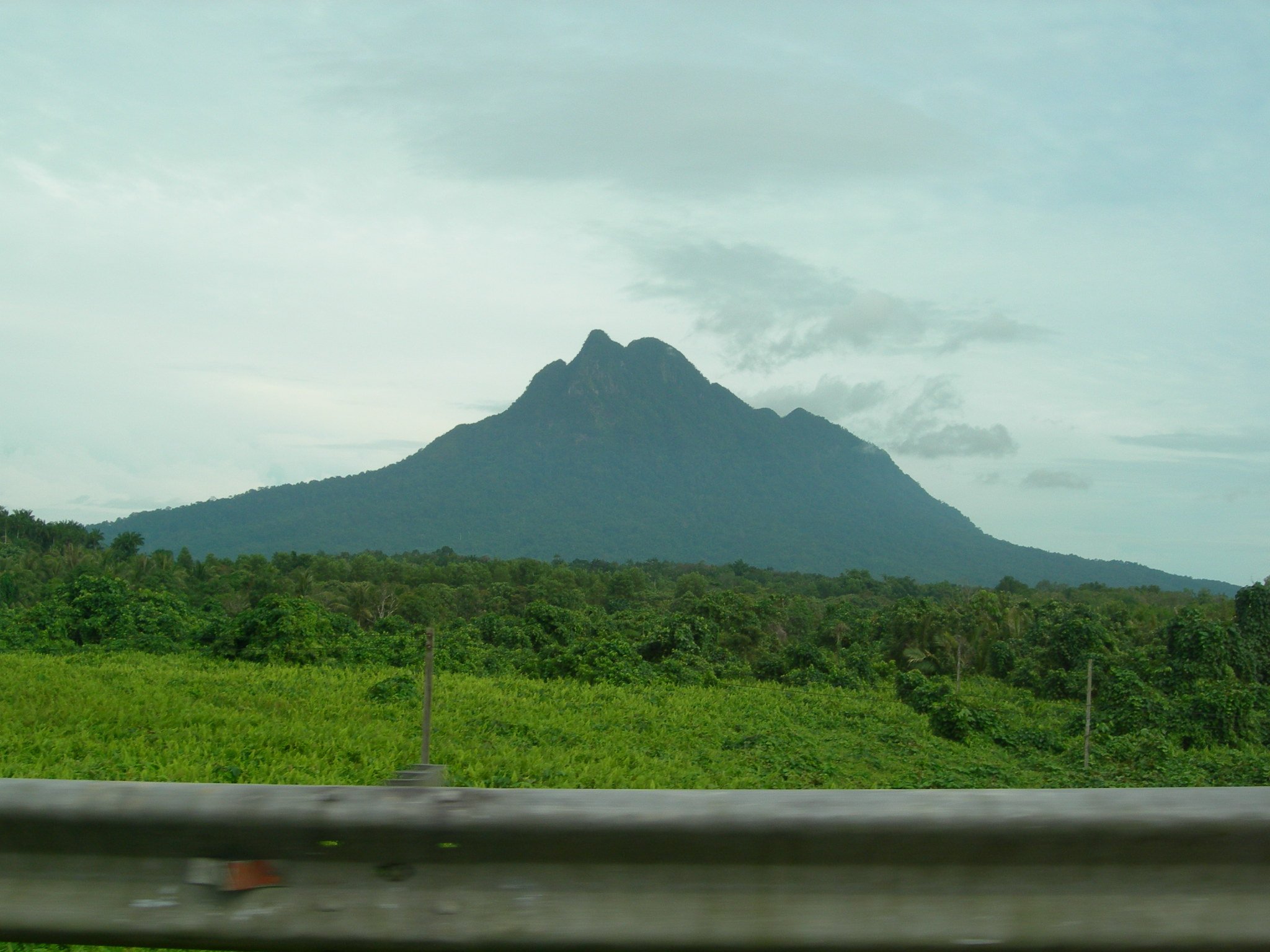
The Lesser Sunda Islands form a volcanic island arc running east from Bali through Lombok, Sumbawa, Flores, Sumba, Komodo and Timor. Day hiking here is shaped by steep young volcanoes, crater rims, dry-season savanna islands, caldera lakes and rainforest approaches. The most established hiking centres are Bali’s Kintamani and Karangasem highlands, Lombok’s Rinjani gateways at Senaru and Sembalun, Flores around Moni and Kelimutu, and Labuan Bajo for Komodo National Park.
The normal hiking season is the drier part of the year, roughly April to October, though short low-altitude walks can be possible year-round. Volcanic ash, loose scoria, hot exposed slopes, sudden cloud, heavy rain and official closures are recurring issues. Rinjani, Agung and Batur require particular attention to guide rules, local religious restrictions, permits and current Indonesian volcanic-alert information.
Access is usually by road transfer from tourist centres, with boat logistics for Padar Island. Public transport is limited for early starts and remote trailheads; practical day hiking often depends on a driver, guide, park boat, or licensed trekking operator.
Selection rationale
These five hikes cover the region’s core day-hiking identities: a famous sunrise volcano on Bali, Bali’s sacred high volcano, Lombok’s classic Rinjani crater-rim approach, Flores’ crater-lake national park, and Komodo’s dry-island viewpoint walk.
Summary table
| # | Hike | Country | Route type | Distance | Gain | Max elevation | Difficulty |
|---|---|---|---|---|---|---|---|
| 1 | Mount Batur (Gunung Batur) | Indonesia | Out-and-back | 9.0 km | 676 m | 1,684 m | Hard |
| 2 | Mount Agung via Pasar Agung Temple | Indonesia | Out-and-back | 6.9 km | 1,232 m | 2,782 m | Hard |
| 3 | Mount Rinjani from Senaru to crater rim | Indonesia | Out-and-back | 20.4 km | 2,042 m | 2,631 m | Very hard |
| 4 | Mount Kelimutu via Pemo | Indonesia | Out-and-back | 9.3 km | 654 m | 1,605 m | Hard |
| 5 | Padar Island viewpoint | Indonesia | Out-and-back | 1.8 km | 177 m | 192 m | Moderate |
1. Mount Batur (Gunung Batur)

Snapshot
Itinerary
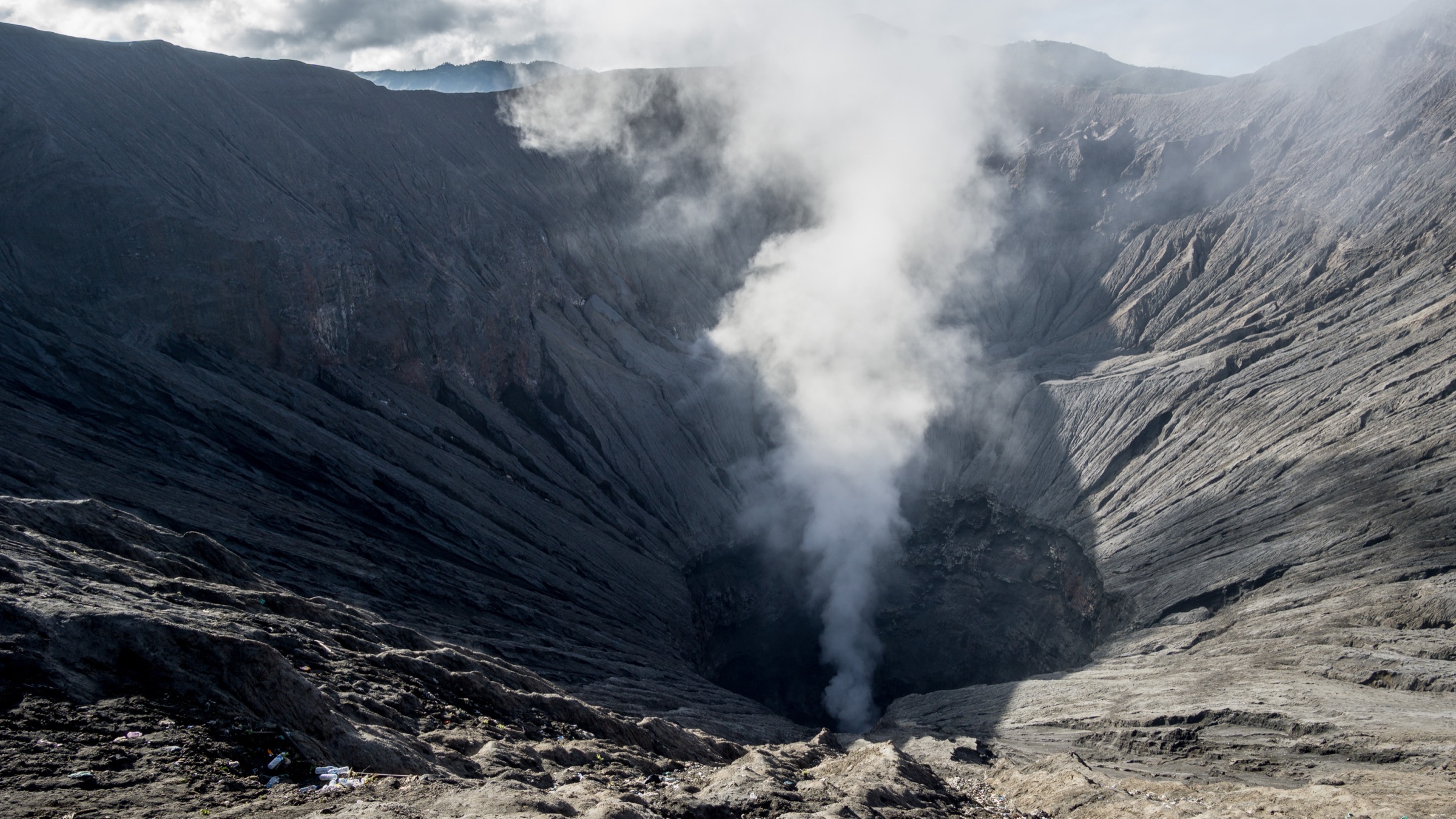
The route climbs from the Kintamani side through lower farm and scrub terrain onto increasingly loose volcanic ground. The upper cone is open and exposed, with summit and crater-rim viewpoints over Lake Batur, the Batur caldera and the wider Bali volcanic chain. Descent returns by the same general route, often on loose gravel or ash.
Why it is essential
Mount Batur is the region’s most famous compact sunrise volcano hike. It gives a direct introduction to the Lesser Sunda volcanic arc without the length or altitude of Agung or Rinjani.
Equipment
Standard to mountain hiking equipment: hiking shoes or boots, warm layer for pre-dawn starts, windproof or rain layer, headtorch, water, snacks, sun protection and map/GPS. Trekking poles help on loose descent.
Hazards and notes
Loose gravel, crowded sunrise conditions, fast weather change and heat after sunrise are common. AllTrails notes that climbers are required to use a local road guide. Check current local access, guide rules and volcanic-alert information before departure.
GPX / KML links
| Source | URL | Format / access | Reuse status |
|---|---|---|---|
| AllTrails — Mount Batur (Gunung Batur) | alltrails.com | Source route page / app track | AllTrails terms apply; route-file reuse not confirmed |
| OpenStreetMap search | openstreetmap.org | Map data / search | OSM data is ODbL; geometry cross-check target |
External links
2. Mount Agung via Pasar Agung Temple

Snapshot
Itinerary
The Pasar Agung route begins at the temple and climbs immediately through stairs and forest. The path steepens above the treeline onto volcanic rock, scree and rough lava terrain before reaching the crater-rim area below Agung’s true high point. The same route is normally used for descent.
Why it is essential
Agung is Bali’s highest and most culturally significant mountain. The Pasar Agung route is the shorter classic day route and gives a serious volcanic mountain day without committing to the longer Besakih ascent.
Equipment
Mountain hiking equipment: sturdy boots, headtorch, warm layer, waterproof/windproof layer, gloves for rough rock if desired, water, food, sun protection, map/GPS and trekking poles. A local guide is strongly recommended and may be required locally.
Hazards and notes
The upper route has loose volcanic rock, steep scrambling steps and serious descent footing. Religious ceremonies, local access rules and volcanic activity can close routes. Check PVMBG/MAGMA Indonesia and local guide information before departure.
GPX / KML links
| Source | URL | Format / access | Reuse status |
|---|---|---|---|
| AllTrails — Pasar Agung Temple / Mount Agung | alltrails.com | Source route page / app track | AllTrails terms apply; route-file reuse not confirmed |
| OpenStreetMap search | openstreetmap.org | Map data / search | OSM data is ODbL; geometry cross-check target |
External links
3. Mount Rinjani from Senaru to crater rim

Snapshot
Itinerary
The Senaru route climbs steadily from the north side through humid forest and rest posts. Above Pos 3 the vegetation opens into scrub and steeper volcanic ground before the crater-rim viewpoint. The rim overlooks Segara Anak, the Barujari cone and Rinjani’s interior caldera. The day-hike version returns by the same route, though many operators split the climb over two days.
Why it is essential
The Senaru crater rim is the most direct day-hike expression of Rinjani’s caldera landscape. It avoids the full summit route but still reaches one of Indonesia’s defining volcanic viewpoints.
Equipment
Mountain hiking equipment plus headtorch, warm layer for the rim, rain protection, gloves/hat, substantial water and food, navigation backup and trekking poles. Use a licensed guide/operator and carry only what park rules allow.
Hazards and notes
This is a long, steep, high-humidity climb with cold conditions at the rim. Landslide, fall, exhaustion and weather incidents have occurred on Rinjani. Official permit, guide, route-opening and volcanic-status checks are essential. Treat as a strenuous day only for very fit walkers; otherwise use a legal overnight itinerary.
GPX / KML links
| Source | URL | Format / access | Reuse status |
|---|---|---|---|
| AllTrails — Mount Rinjani (from Senaru) | alltrails.com | Source route page / app track | AllTrails terms apply; route-file reuse not confirmed |
| Mount Rinjani National Park | rinjaninationalpark.id | Official park / permit context | Website terms not checked; no GPX found |
External links
- AllTrails — Mount Rinjani (from Senaru)
- Mount Rinjani National Park
- Global Volcanism Program — Rinjani
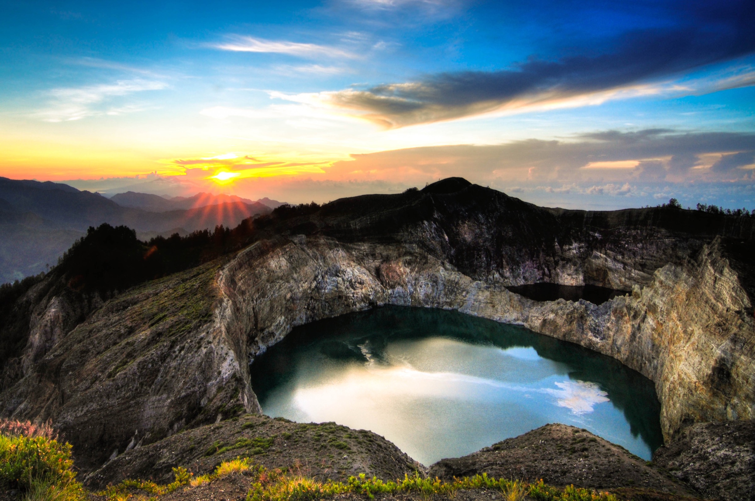
4. Mount Kelimutu via Pemo

Snapshot
Itinerary
The route approaches Kelimutu from the Pemo side, climbing through forest and partly paved sections toward the crater-lake viewpoint area. The main objective is the cluster of Kelimutu’s three crater lakes, including Tiwu Nuwa Muri Koo Fai, Tiwu Ata Polo and Tiwu Ata Mbupu. Descent returns to the start by the same route.
Why it is essential
Kelimutu is the defining mountain-landscape hike of Flores: short enough for a day but distinctive for its crater lakes, changing colours and national-park setting.
Equipment
Standard hiking equipment: hiking shoes, rain layer, warm layer for sunrise, water, snacks, sun protection and map/GPS. A headtorch is needed for pre-dawn starts.
Hazards and notes
Stay on legal paths and behind barriers around crater rims. The lake walls are steep and unstable. Fog can remove visibility quickly, and wet paved sections can be slippery.
GPX / KML links
| Source | URL | Format / access | Reuse status |
|---|---|---|---|
| AllTrails — Gunung Kelimutu via Pemo | alltrails.com | Source route page / app track | AllTrails terms apply; route-file reuse not confirmed |
| OpenStreetMap search | openstreetmap.org | Map data / search | OSM data is ODbL; geometry cross-check target |
External links
5. Padar Island viewpoint

Snapshot
Itinerary
The trail climbs directly from the Padar Island landing area by maintained steps and exposed hillside path to the famous multi-bay viewpoint. The ascent is short but steep, with open views across Padar’s dry ridges, beaches and surrounding sea. Descent follows the same stair-and-path line to the landing.
Why it is essential
Padar is the signature dry-island viewpoint of Komodo National Park and provides a landscape contrast to the region’s forested volcanoes and crater lakes.
Equipment
Standard hiking equipment for hot exposed terrain: grippy shoes, sun hat, sun protection, water and light rain layer in unsettled weather.
Hazards and notes
Heat exposure, crowded steps, loose dust and boat logistics are the main issues. Follow Komodo National Park rules, stay on the marked trail and confirm park fees, guide requirements and boat safety with the operator.
GPX / KML links
| Source | URL | Format / access | Reuse status |
|---|---|---|---|
| AllTrails — Padar Island | alltrails.com | Source route page / app track | AllTrails terms apply; route-file reuse not confirmed |
| Komodo National Park | komodonationalpark.org | Official park context | Website terms not checked; GPX not found |
External links
External links
| Source | URL |
|---|---|
| AllTrails — Mount Batur (Gunung Batur) | alltrails.com |
| AllTrails — Pasar Agung Temple / Mount Agung | alltrails.com |
| AllTrails — Mount Rinjani (from Senaru) | alltrails.com |
| AllTrails — Gunung Kelimutu via Pemo | alltrails.com |
| AllTrails — Padar Island | alltrails.com |
| Mount Rinjani National Park | rinjaninationalpark.id |
| Komodo National Park | komodonationalpark.org |
| Indonesia Travel — Kelimutu / Flores | indonesia.travel |
| Smithsonian Global Volcanism Program | volcano.si.edu |