Regional overview
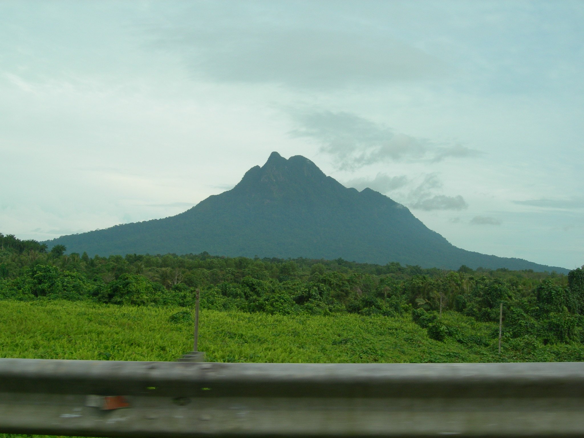
Java’s volcanic arc is one of the world’s densest hiking landscapes: active craters, calderas, high grassland ridges, sulfur lakes, managed national parks, and community basecamp systems. Many routes are not wilderness in the European sense; they are regulated volcano walks with entry tickets, basecamp registration, local guides, health checks, seasonal closures, and eruption exclusion zones.
The best day-hike options are not always the highest volcanoes. Semeru, Raung and some Merapi routes are excluded here because normal ascents are multi-day, technical, closed, or too access-sensitive for a general day-hike catalogue. The selected routes focus on iconic non-technical volcano walking that can reasonably be done in one day by fit walkers when open.
The best general season is the drier period, commonly May to October, but weather, volcanic gas, ash, forest-fire closures and national-park rules override season. Current MAGMA Indonesia/PVMBG status and local basecamp rules should be checked immediately before hiking.
Selection rationale
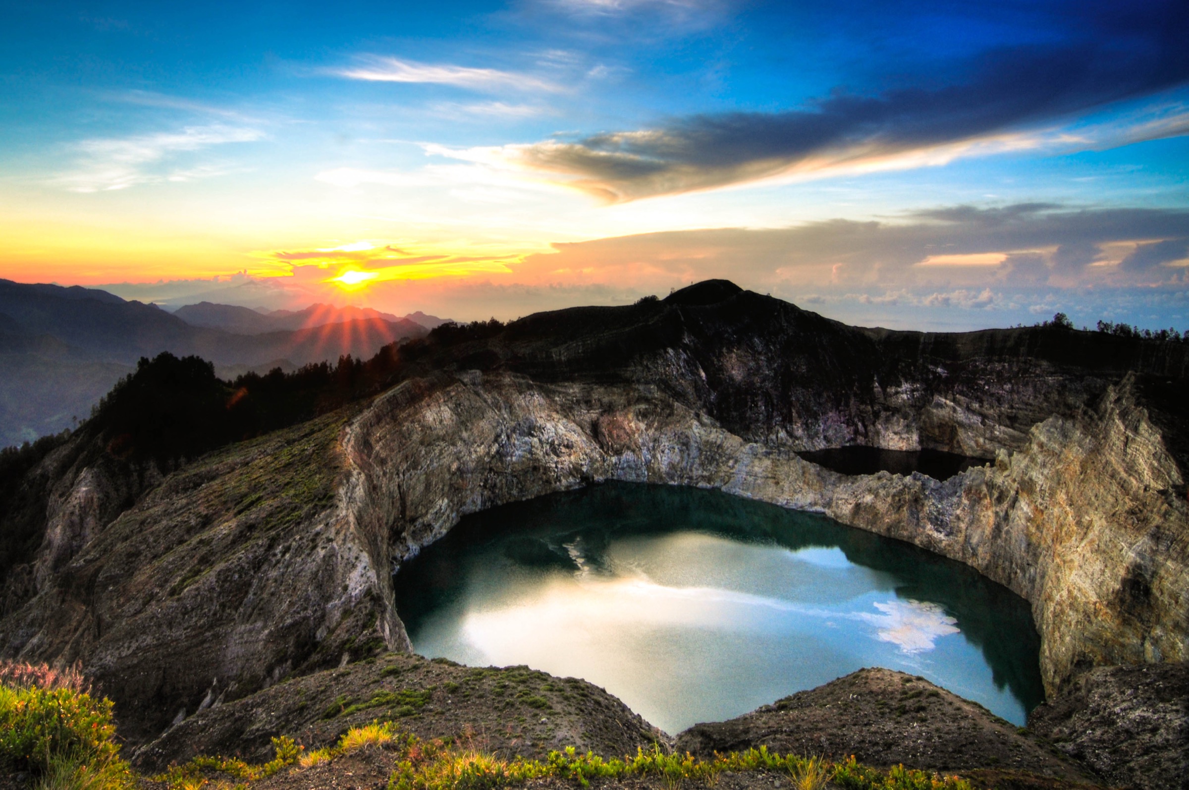
These five hikes represent Java’s core volcanic walking identities: the Bromo caldera and crater, Ijen’s sulfur crater lake, Papandayan’s fumarole-and-edelweiss landscape, Prau’s Dieng sunrise ridge, and Merbabu’s high Central Java volcano summit.
Summary table
| # | Hike | Country | Route type | Distance | Gain | Max elevation | Difficulty |
|---|---|---|---|---|---|---|---|
| 1 | Bromo — Cemoro Lawang, Sea of Sand and crater rim | Indonesia | Out-and-back / loop variant | 5.5 km (AllTrails crater route) | 248 m | ca. 2,329 m Bromo rim | Moderate |
| 2 | Kawah Ijen from Paltuding | Indonesia | Out-and-back | 9.5 km | 592 m | ca. 2,386 m crater rim | Hard |
| 3 | Gunung Papandayan crater, Hutan Mati and Pondok Salada | Indonesia | Out-and-back / circuit | 6-16.7 km depending on variant | 250-871 m depending on variant | ca. 2,300 m on common day circuit | Moderate-hard |
| 4 | Gunung Prau via Patak Banteng | Indonesia | Out-and-back | 3.9 km direct; 5.8-8.7 km variants | 554 m direct; 646 m loop variant | ca. 2,565 m | Hard short hike |
| 5 | Gunung Merbabu via Selo / summit route | Indonesia | Out-and-back | ca. 12-16 km depending on summit/variant | ca. 1,250-1,400 m from Selo | 3,145 m | Very hard day hike |
1. Bromo — Cemoro Lawang, Sea of Sand and crater rim

Snapshot
Itinerary
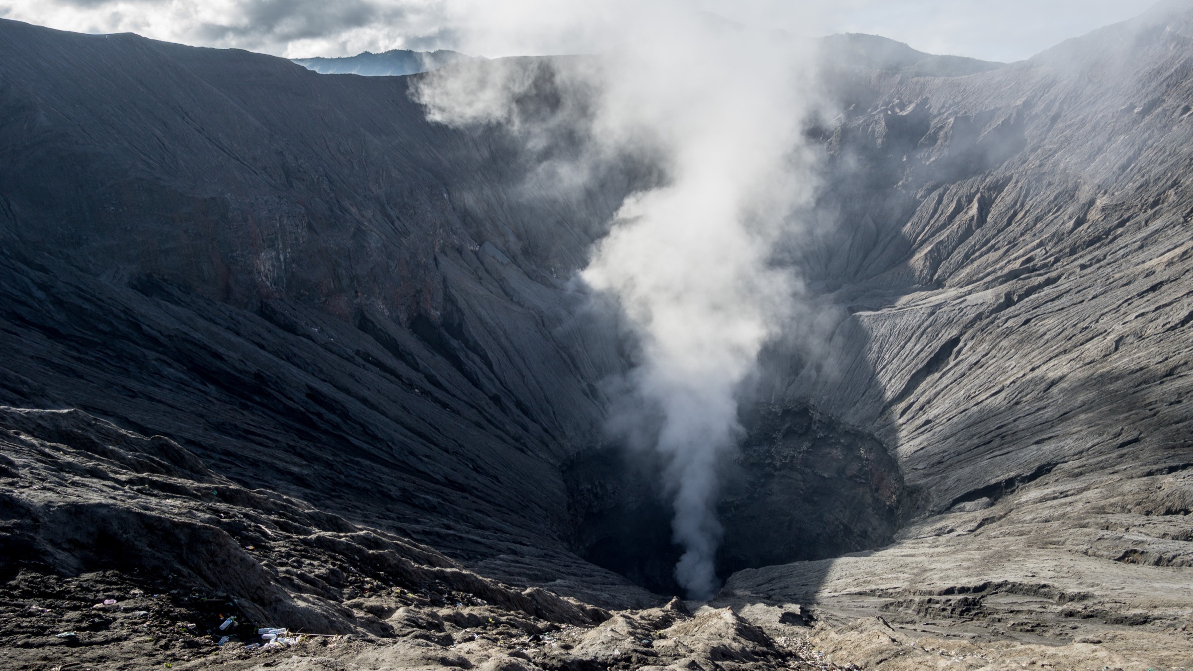
From Cemoro Lawang, the route drops to the Tengger Sea of Sand, crosses the ash plain past the Hindu temple area, and climbs the steps to the active Bromo crater rim. The return follows the same line or a short variant across the sand. A separate early-morning walk to Seruni / Pananjakan viewpoints can be added, but the core day-hike here is the crater walk.
Why it is essential
Bromo is Java’s most famous accessible volcanic landscape: caldera, Sea of Sand, Tengger culture, active crater and views to Batok and Semeru.
Equipment
Sturdy shoes, windproof/warm layer for dawn, sun protection, dust mask or buff for ash, water, and headtorch for pre-dawn starts.
Hazards and notes
Bromo is active. Obey exclusion zones and crater-step closures. Ash, volcanic gas, horse/jeep traffic, crowds, cold dawn temperatures and poor visibility are the main issues. Do not continue along narrow crumbly crater rims beyond the managed viewpoint.
GPX / KML links
| Source | URL | Format / access | Reuse status |
|---|---|---|---|
| AllTrails — Mount Bromo | alltrails.com | Recorded track | AllTrails terms apply; route-file reuse not confirmed |
| Gunung Bagging — Bromo / Pananjakan | gunungbagging.com | Route page and source map | Website terms apply; PDF/GPS pack terms not fully checked |
| OpenStreetMap search | openstreetmap.org | Map/search | OSM data is ODbL; geometry cross-check only |
External links
2. Kawah Ijen from Paltuding

Snapshot
Itinerary
The route climbs from Paltuding on the managed track to the rim of Kawah Ijen, then follows the rim viewpoint area above the turquoise acidic lake and sulfur-mining zone. Some tours descend into the crater to see blue flames; this catalogue treats crater-floor descent as conditional and not required for the hike.
Why it is essential
Kawah Ijen is one of Java’s defining volcano walks because of its acidic crater lake, fumaroles, sulfur-mining landscape and internationally recognised blue-fire phenomenon.
Equipment
Sturdy shoes, warm layer for night/dawn, rain layer, headtorch, water, and respiratory protection if gas is present. Use only legal/approved gas-mask arrangements if descending into the crater.
Hazards and notes
Sulfur dioxide and acidic gases are serious hazards. The crater-floor descent is more hazardous than the rim walk and may be closed. Stay clear of miners’ working paths unless guided. Check current health-certificate, ticketing, rest-day and closure rules before travel.
GPX / KML links
| Source | URL | Format / access | Reuse status |
|---|---|---|---|
| AllTrails — Ijen Volcano Crater | alltrails.com | Recorded track | AllTrails terms apply; route-file reuse not confirmed |
| Gunung Bagging — Ijen | gunungbagging.com | Route page and source map | Website terms apply; PDF/GPS pack terms not fully checked |
| OpenStreetMap search | openstreetmap.org | Map/search | OSM data is ODbL; geometry cross-check only |
External links
3. Gunung Papandayan crater, Hutan Mati and Pondok Salada

Snapshot
Itinerary
The common day route starts at the Papandayan visitor area and follows the managed volcanic landscape through active fumarole/crater zones, then towards Hutan Mati and the Pondok Salada / edelweiss meadow area if open. Longer routes or summit variants should only be used if explicitly permitted.
Why it is essential
Papandayan is one of West Java’s most accessible volcanic walking landscapes, combining active fumaroles, dead forest scenery, meadows and views without requiring a very high summit ascent.
Equipment
Sturdy shoes, rain layer, water, sun protection, headtorch if starting early, and mask/buff for sulfurous areas.
Hazards and notes
Stay on open marked routes in fumarole zones. Gas, unstable ground, sudden weather and local closure rules are the main issues. Camping zones and edelweiss areas are regulated.
GPX / KML links
| Source | URL | Format / access | Reuse status |
|---|---|---|---|
| AllTrails — Mount Papandayan via Neglawangi | alltrails.com | Recorded track | AllTrails terms apply; route-file reuse not confirmed |
| Gunung Bagging — Papandayan | gunungbagging.com | Route page and source map | Website terms apply; PDF/GPS pack terms not fully checked |
| OpenStreetMap search | openstreetmap.org | Map/search | OSM data is ODbL; geometry cross-check only |
External links
4. Gunung Prau via Patak Banteng
Snapshot
Itinerary
The route climbs steeply from Patak Banteng through village-edge paths and open slopes to the broad summit ridge of Gunung Prau. The summit area is famous for sunrise views over the Dieng Plateau and the surrounding Central Java volcanoes. The descent follows the same route or an established local variant if arranged through a basecamp.
Why it is essential
Prau is one of Central Java’s most famous short sunrise hikes. It adds the Dieng Plateau and a lower, non-crater high-ridge viewpoint to the Java volcanic selection.
Equipment
Sturdy shoes, warm layer, windproof/rain layer, headtorch for sunrise, water, food, and map/GPS. Carry extra warmth for long summit waits.
Hazards and notes
The route is short but steep and can be muddy. Crowding, cold dawn wind, erosion, and basecamp registration rules are the main issues. Stay on marked paths to reduce erosion.
GPX / KML links
| Source | URL | Format / access | Reuse status |
|---|---|---|---|
| AllTrails — Mount Prau via Patak Banteng | alltrails.com | Recorded track | AllTrails terms apply; route-file reuse not confirmed |
| AllTrails — Gunung Prau via Dwarawati | alltrails.com | Recorded track variant | AllTrails terms apply |
| OpenStreetMap search | openstreetmap.org | Map/search | OSM data is ODbL; geometry cross-check only |
External links
5. Gunung Merbabu via Selo / summit route
Snapshot
Itinerary
From Selo, the route climbs through lower forest and open savanna slopes to the high summit ridge. Gunung Bagging describes the Selo descent/ascent line through Pos 1, Pos 2, Pos 3 and the Savana camps to the Kenteng Songo and Triangulasi summit area. The day-hike version requires an early start, strong fitness and confirmed park/basecamp registration.
Why it is essential
Merbabu is one of Central Java’s great high volcano hikes, with extensive views to Merapi and the surrounding volcanic arc. It gives the catalogue one strenuous high-summit day route.
Equipment
Boots, warm layer, waterproof/windproof shell, sun protection, 2-3 litres water, food, headtorch, navigation backup and first-aid kit. Local guide support is recommended for a day push.
Hazards and notes
This route is long and often treated as an overnight. Heat on open slopes, cold wind on the ridge, thunderstorms, erosion, steep descent, and crowding at sunrise/camps are common. Register at an official basecamp and follow national-park closure rules.
GPX / KML links
| Source | URL | Format / access | Reuse status |
|---|---|---|---|
| Gunung Bagging — Merbabu | gunungbagging.com | Route page and source map | Website terms apply; PDF/GPS pack terms not fully checked |
| OpenStreetMap search | openstreetmap.org | Map/search | OSM data is ODbL; geometry cross-check only |
External links
Missing data / follow-up work
- Current PVMBG/MAGMA status and local closure notices must be checked immediately before publication for Bromo, Ijen, Papandayan and Merbabu.
- Prau and Merbabu need licence-compatible image candidates with clean metadata.
- Merbabu distance/gain needs a verified Selo GPX trace; current stats are approximate from route descriptions.
- Ijen current rules on health certificates, crater-floor access, night hiking and rest days need official confirmation close to travel date.
External links
| Source | URL |
|---|---|
| AllTrails — Mount Bromo | alltrails.com |
| Gunung Bagging — Bromo | gunungbagging.com |
| AllTrails — Kawah Ijen | alltrails.com |
| Gunung Bagging — Ijen | gunungbagging.com |
| AllTrails — Gunung Papandayan via Neglawangi | alltrails.com |
| Gunung Bagging — Papandayan | gunungbagging.com |
| AllTrails — Gunung Prau via Patak Banteng | alltrails.com |
| AllTrails — Gunung Prau via Dwarawati | alltrails.com |
| Gunung Bagging — Merbabu | gunungbagging.com |
| MAGMA Indonesia / PVMBG | magma.esdm.go.id |
| Bromo Tengger Semeru National Park booking | bookingbromo.bromotenggersemeru.org |