Regional overview
The Barisan Range runs along Sumatra as a chain of volcanoes, forested calderas, crater lakes, high ridges and protected national-park landscapes. Day hiking is less formalised than in many European or North American mountain regions: many routes rely on local guides, basecamp registration, informal transport, volcano-status checks and community-managed access.
The strongest day-hike options are active or dormant volcanic landscapes that can be completed from roadheads or base villages in one long day. Several famous Barisan summits, including Kerinci and Leuser routes, are normally multi-day and are therefore excluded from this day-hike selection.
The best season is generally the drier months, but Sumatra remains humid and weather can change rapidly. Main hazards include volcanic gas and eruption restrictions, jungle navigation, heat, heavy rain, leeches, poor mobile signal, and variable trail maintenance. Current PVMBG/MAGMA Indonesia volcano status and local basecamp rules should be checked before any active-volcano hike.
Selection rationale
These five hikes give a north-to-south spread: Sibayak near Berastagi, Talang in West Sumatra, Gunung Tujuh’s high caldera lake in Kerinci Seblat, Kaba’s crater-rim circuit in Bengkulu, and Dempo above Pagar Alam. Marapi is deliberately excluded because of recent serious volcanic activity and access uncertainty.
Summary table
| # | Hike | Country | Route type | Distance | Gain | Max elevation | Difficulty |
|---|---|---|---|---|---|---|---|
| 1 | Gunung Sibayak crater from Jaranguda | Indonesia | Out-and-back / short traverse | 5.1 km (AllTrails short route) | 371 m | 2,057-2,101 m crater-rim objectives | Moderate-hard |
| 2 | Gunung Talang via Nagari Batu | Indonesia | Out-and-back | 9.2 km | 1,108 m | 2,597 m | Hard |
| 3 | Danau Gunung Tujuh / Seven Mountain Lake | Indonesia | Out-and-back | 8.5 km | 785 m | ca. 2,112 m rim; lake 2,005 m | Hard |
| 4 | Bukit Kaba crater rim circuit | Indonesia | Out-and-back + rim circuit | 5-8 km depending start | 150-700 m depending start | ca. 1,950-1,952 m | Moderate |
| 5 | Gunung Dempo from Pagar Alam side | Indonesia | Out-and-back | ca. 13-18 km depending trailhead | ca. 1,300-1,700 m | 3,142-3,173 m | Very hard |
1. Gunung Sibayak crater from Jaranguda

Snapshot
Itinerary
The usual day route starts at Jaranguda and climbs a road/path into Sibayak’s crater area. The track reaches fumaroles, sulfur-stained ground, the crater lake area and the outer rim. Many hikers continue to Puncak Antene or Tapal Kuda for sunrise views, then return to Jaranguda or descend the steeper route to Semangat Gunung hot springs.
Why it is essential
Sibayak is one of Sumatra’s most accessible active-volcano day hikes, giving a clear crater, fumarole and Berastagi highland experience without the multi-day commitment required by bigger Barisan volcanoes.
Equipment
Sturdy shoes, water, rain layer, warm layer for dawn, headtorch for sunrise starts, sun protection, and map/GPS. A local guide is strongly recommended for dawn starts, poor weather or non-standard descents.
Hazards and notes
Volcanic gas, poor visibility, crater holes, steep rim drops, and getting lost on side paths are the main hazards. Do not approach fumaroles closely. Solo hiking is discouraged.
GPX / KML links
| Source | URL | Format / access | Reuse status |
|---|---|---|---|
| AllTrails — Gunung Sibayak | alltrails.com | Recorded track | AllTrails terms apply; route-file reuse not confirmed |
| Gunung Bagging — Sibayak | gunungbagging.com | Route page and source map | Website terms apply; PDF/GPS pack terms not fully checked |
| OpenStreetMap search | openstreetmap.org | Map/search | OSM data is ODbL; geometry cross-check only |
External links
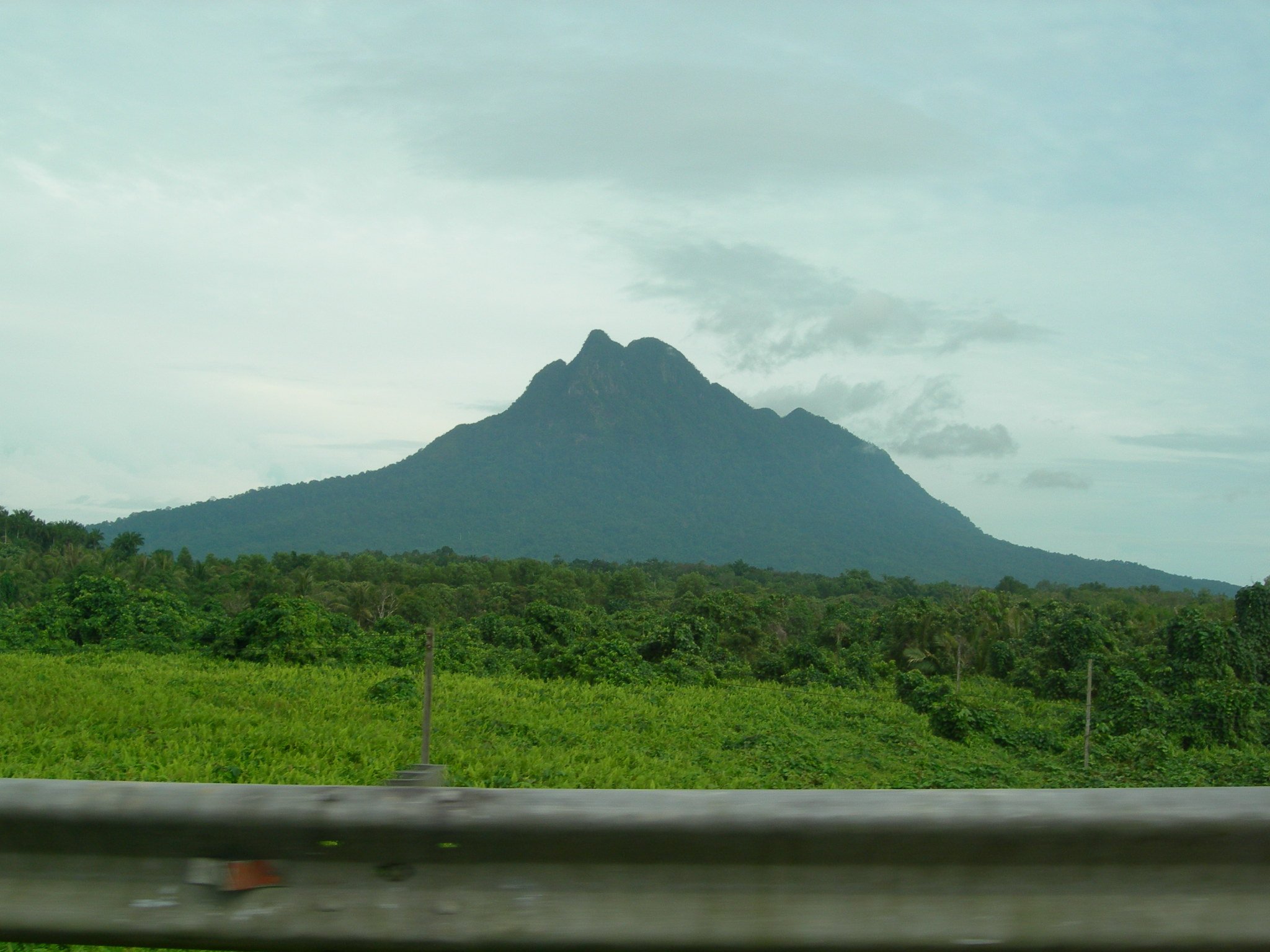
2. Gunung Talang via Nagari Batu
Snapshot
Itinerary
The Nagari Batu route climbs through lower vegetation and forest towards the upper volcanic slopes of Talang. The route reaches the summit area with views toward the Solok lakes and surrounding Barisan highlands in good weather. The descent follows the same path unless a locally arranged variant is used.
Why it is essential
Talang is a major West Sumatra volcano and a recognised day objective with strong lake-and-volcano scenery. It fills the central Barisan volcanic-summit role while avoiding Marapi’s current access concerns.
Equipment
Boots, water, food, rain layer, warm layer, headtorch, map/GPS, and local guide/basecamp registration.
Hazards and notes
Talang is an active volcano. Check MAGMA Indonesia/PVMBG status and local basecamp rules before departure. Fog, mud, steep trail, thunderstorms and volcanic gas are key hazards.
GPX / KML links
| Source | URL | Format / access | Reuse status |
|---|---|---|---|
| AllTrails — Gunung Talang via Nagari Batu | alltrails.com | Recorded track | AllTrails terms apply; route-file reuse not confirmed |
| Gunung Bagging — Talang | gunungbagging.com | Route page and source map | Website terms apply; PDF/GPS pack terms not fully checked |
| OpenStreetMap search | openstreetmap.org | Map/search | OSM data is ODbL; geometry cross-check only |
External links
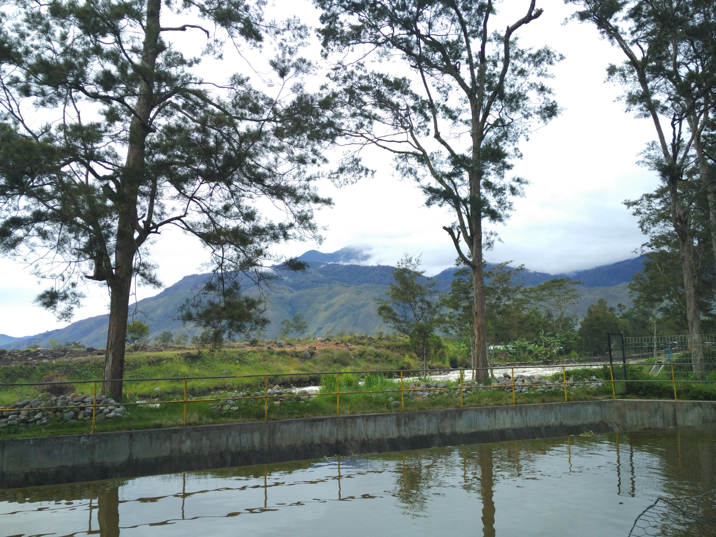
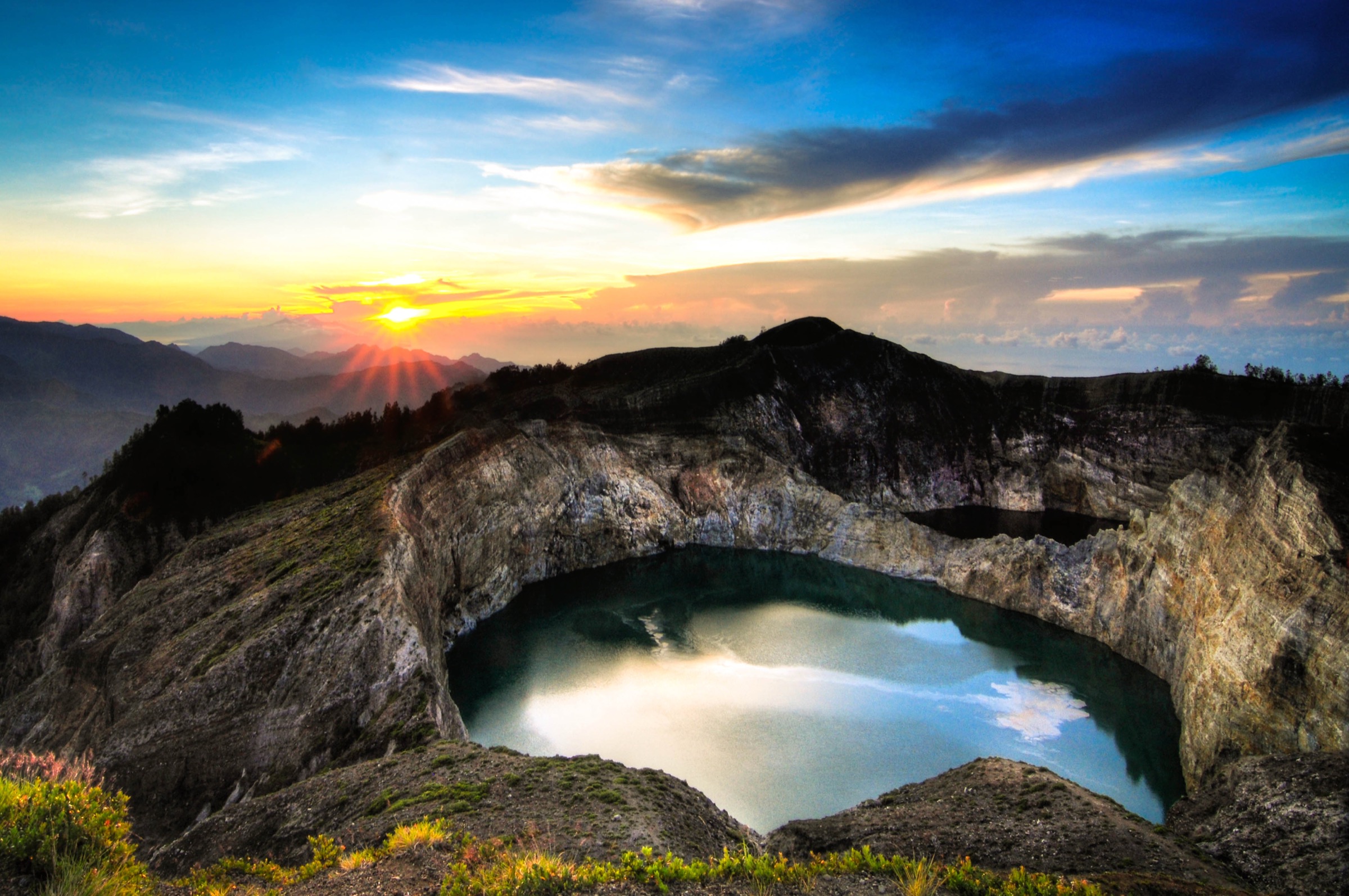
3. Danau Gunung Tujuh / Seven Mountain Lake

Snapshot
Itinerary
The route climbs forested slopes through Kerinci Seblat National Park to the rim of the Gunung Tujuh caldera, then drops steeply to the shore of Danau Gunung Tujuh. The return reclimbs to the rim and descends by the same forest path.
Why it is essential
Danau Gunung Tujuh is one of Sumatra’s great high volcanic-lake walks and provides a day-hike alternative to the normally multi-day Mount Kerinci ascent nearby.
Equipment
Boots, rain layer, water, food, leech protection in wet conditions, map/GPS, and local guide/permit arrangements.
Hazards and notes
Steep wet forest, leeches, poor signal, heavy rain, and protected-area rules are the main issues. The lake shore is remote; weather can make the rim descent/return slippery.
GPX / KML links
| Source | URL | Format / access | Reuse status |
|---|---|---|---|
| AllTrails — Seven Mountain Lake | alltrails.com | Recorded track | AllTrails terms apply; route-file reuse not confirmed |
| Gunung Bagging — Gunung Tujuh | gunungbagging.com | Route page and source map | Website terms apply; PDF/GPS pack terms not fully checked |
| OpenStreetMap search | openstreetmap.org | Map/search | OSM data is ODbL; geometry cross-check only |
External links
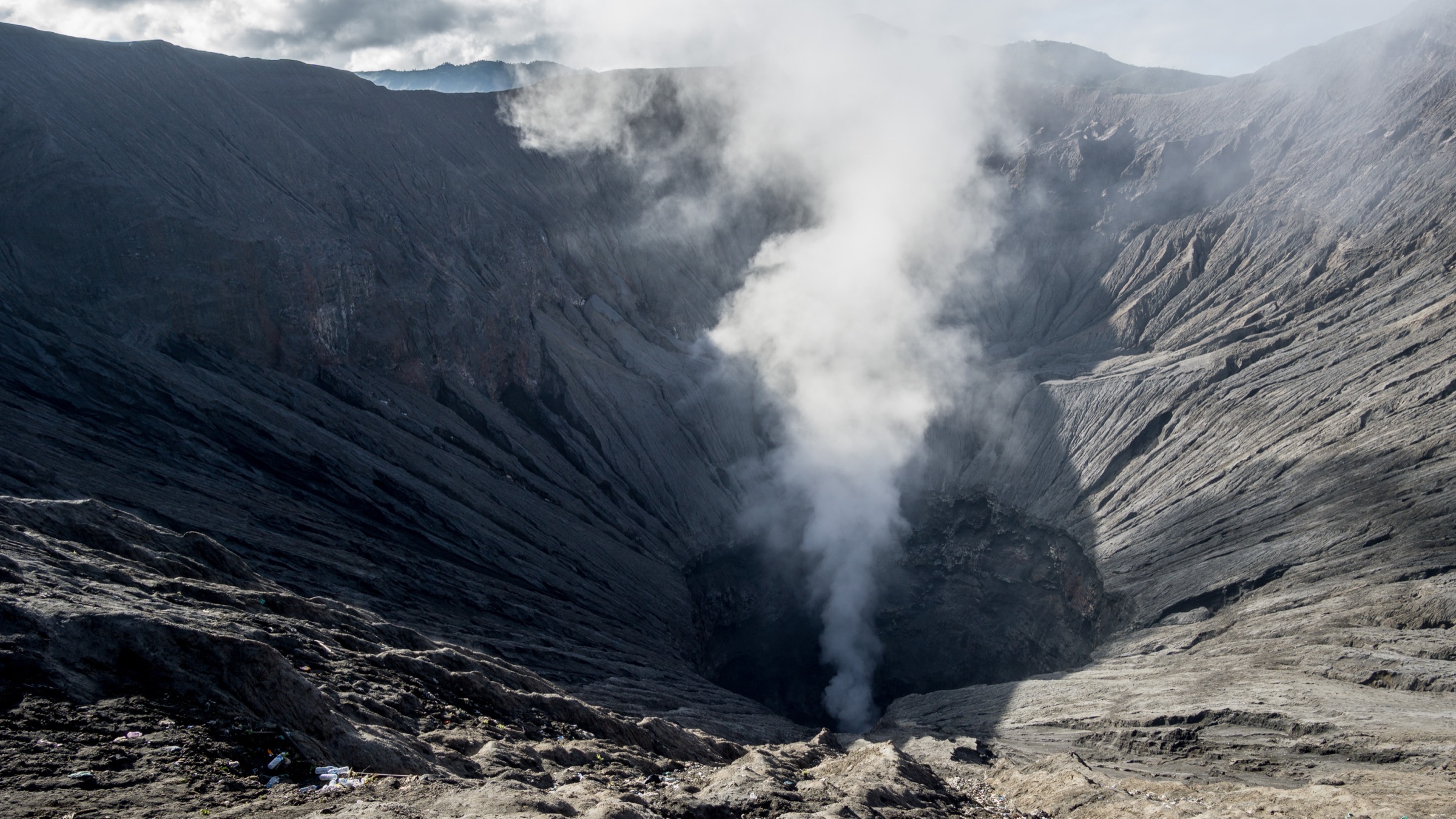
4. Bukit Kaba crater rim circuit

Snapshot
Itinerary
The route reaches the large active crater area by road/track or jungle path, then climbs steps to the crater rim. A circuit around the main crater rim and neighbouring crater viewpoints is possible in good weather, with views into fumaroles, crater lakes and forested volcanic slopes. The route returns to the same access point.
Why it is essential
Bukit Kaba offers one of Sumatra’s most accessible and visually dramatic crater-rim walks, with a strong effort-to-scenery ratio and a distinct Bengkulu Barisan landscape.
Equipment
Sturdy shoes, water, sun protection, rain layer, hat, and map/GPS. A local guide is recommended for the rim circuit.
Hazards and notes
Crater edges are steep and unstable. Fumaroles and volcanic gases are hazardous. Do not descend into active vents. Morning dew and wet grass can soak clothing and make edges slippery.
GPX / KML links
| Source | URL | Format / access | Reuse status |
|---|---|---|---|
| Gunung Bagging — Bukit Kaba | gunungbagging.com | Route page and source map | Website terms apply; PDF/GPS pack terms not fully checked |
| OpenStreetMap search | openstreetmap.org | Map/search | OSM data is ODbL; geometry cross-check only |
External links
5. Gunung Dempo from Pagar Alam side
Snapshot
Itinerary
The Pagar Alam side route climbs from tea-country and forested lower slopes towards the summit-crater complex of Dempo. Gunung Bagging describes Dempo as a major high Ribu with several route options and a crater-lake summit area. The day-hike version is only for very fit walkers with a local guide, early start and confirmed access.
Why it is essential
Dempo is South Sumatra’s dominant high volcano and one of the major Barisan summits. It is included as an essential candidate because of its prominence and regional importance, but it requires stronger current-access and GPS verification before publication.
Equipment
Boots, rain layer, warm summit layer, water, food, headtorch, navigation backup, first-aid kit, and local guide/basecamp registration. Trekking poles are useful on descent.
Hazards and notes
Dempo had recent reported phreatic activity in 2026. Check MAGMA Indonesia/PVMBG status and local closure rules immediately before any attempt. The route is long, high, exposed to weather, and often better treated as an overnight trek.
GPX / KML links
| Source | URL | Format / access | Reuse status |
|---|---|---|---|
| Gunung Bagging — Dempo | gunungbagging.com | Route page and source map | Website terms apply; PDF/GPS pack terms not fully checked |
| OpenStreetMap search | openstreetmap.org | Map/search | OSM data is ODbL; geometry cross-check only |
External links
Missing data / follow-up work
- Current PVMBG/MAGMA status should be checked manually immediately before publication for Sibayak, Talang, Kaba and Dempo.
- Talang and Dempo need licence-compatible image candidates with clean metadata.
- Dempo remains a candidate only because current access and day-hike feasibility need stronger confirmation after recent volcanic activity.
- Kaba statistics vary sharply depending on whether the access road/motorbike approach is used; final geometry should specify one start point.
- Gunung Bagging GPS packs/source maps exist, but direct GPX/KML reuse terms remain unresolved.
External links
| Source | URL |
|---|---|
| AllTrails — Gunung Sibayak | alltrails.com |
| Gunung Bagging — Sibayak | gunungbagging.com |
| AllTrails — Gunung Talang via Nagari Batu | alltrails.com |
| Gunung Bagging — Talang | gunungbagging.com |
| AllTrails — Seven Mountain Lake | alltrails.com |
| Gunung Bagging — Gunung Tujuh | gunungbagging.com |
| Gunung Bagging — Bukit Kaba | gunungbagging.com |
| Gunung Bagging — Dempo | gunungbagging.com |
| MAGMA Indonesia / PVMBG | magma.esdm.go.id |