Regional overview
The Vosges are a compact but varied mountain range in north-eastern France, with rounded high summits known as ballons, forested valleys, granite ridges, glacial lakes, peat bogs, and open summit pastures known locally as hautes chaumes. The southern Hautes Vosges contain the highest ground, including the Grand Ballon at 1,424 m, while the northern and central Vosges are more sandstone, forested, and historically rich.
Hiking is strongly shaped by the Club Vosgien network. The massif has a dense, colour-and-symbol waymarked trail system, and the GR5 crosses major summits including the Donon, Grand Ballon, and Ballon d’Alsace. The terrain is generally non-alpine, but several paths have steep rocky sections, ladders, footbridges, wet slabs, or exposed ledges.
The normal walking season is late spring to autumn, with June to October the most reliable period for the higher crests. Snow, ice, fog, thunderstorms, and wet rock can make otherwise moderate routes significantly more serious. The Sentier des Roches is a special case: it is exposed, partly engineered into rock, and should not be treated as a normal forest path.
Access is usually by car to cols, lake car parks, or villages, with some public-transport options in valley towns such as Munster, Metzeral, Saint-Maurice-sur-Moselle, Wisches, and Orbey. Current bus, train, and seasonal shuttle details need to be checked locally before travel.
Selection rationale
These five hikes were selected to represent the essential Vosges themes:
- The exposed rocky trail of the Hautes Vosges.
- The highest summit of the massif.
- The glacial lake and high-pasture landscape around Lac Blanc and Gazon du Faing.
- The southern panoramic summit of Ballon d’Alsace.
- The historic sandstone and war-memory landscape of the Donon area.
Summary table
| # | Hike | Country | Route type | Distance | Gain | Max elevation | Difficulty |
|---|---|---|---|---|---|---|---|
| 1 | La Schlucht — Sentier des Roches | France | Loop | 5.9–8.4 km | 389–436 m | 1,244–1,290 m | Hard |
| 2 | Geishouse — Grand Ballon — Bessayfels | France | Loop | 12.7 km | 762 m | c. 1,412 m / summit 1,424 m | Moderate to hard |
| 3 | Lac Noir — Lac Blanc — Col du Calvaire — Gazon du Faing | France | Loop | 9.8 km | 432 m | c. 1,306 m | Moderate |
| 4 | Ballon d’Alsace — Wissgrut Loop | France | Loop | 10.5 km | 451 m | c. 1,250 m | Moderate |
| 5 | Petit Donon — Sanctuary of the Great War | France | Loop | 6.9 km | 344 m | c. 1,000 m | Moderate |
Note on route files. Route links are source references and may be replaced with project-owned GPX/KML files later.
1. La Schlucht — Sentier des Roches
Snapshot
Itinerary
The route starts at Col de la Schlucht and follows the famous Sentier des Roches towards Frankenthal. The path is partly cut into the rock and includes stairs, footbridges, cables, and steep traverses above the Munster valley.
The catalogue route should use the official Club Vosgien circuit as the base version. A longer loop variant continues towards Hohneck or returns by crest paths, which explains the 5.9–8.4 km distance range.
Why it is essential
This is the classic exposed path of the Hautes Vosges. It is not the longest route in the region, but it is among the most distinctive: rock-cut passages, protected traverses, mountain atmosphere, and access from one of the best-known Vosges passes.
Equipment
- Mountain hiking equipment
- Sturdy boots
- Weatherproof layer
- Warm layer
- Water and food
- Map/GPS
- Navigation backup
- Headtorch
- Trekking poles useful on approach and return paths, but awkward on ladders or cabled passages
Hazards and notes
- Exposed rocky passages
- Ladders, cables, stairs, and narrow traverses
- Wet rock can be dangerous
- Avoid snow and ice
- Not suitable in thunderstorms or poor visibility
- Dogs are not suitable for this route
GPX / KML links
| Source | URL | Format | Notes |
|---|---|---|---|
| Club Vosgien / Outdooractive GPX download | outdooractive.com | GPX | Direct GPX download link found. Replace later with original project GPX. |
| Club Vosgien / Outdooractive KML download | outdooractive.com | KML | Direct KML download link found. Replace later with original project KML. |
| Club Vosgien source page | club-vosgien.eu | Route page | Official route source. |
| AllTrails route page | alltrails.com | Source route/map | Secondary route source. |
Further reading
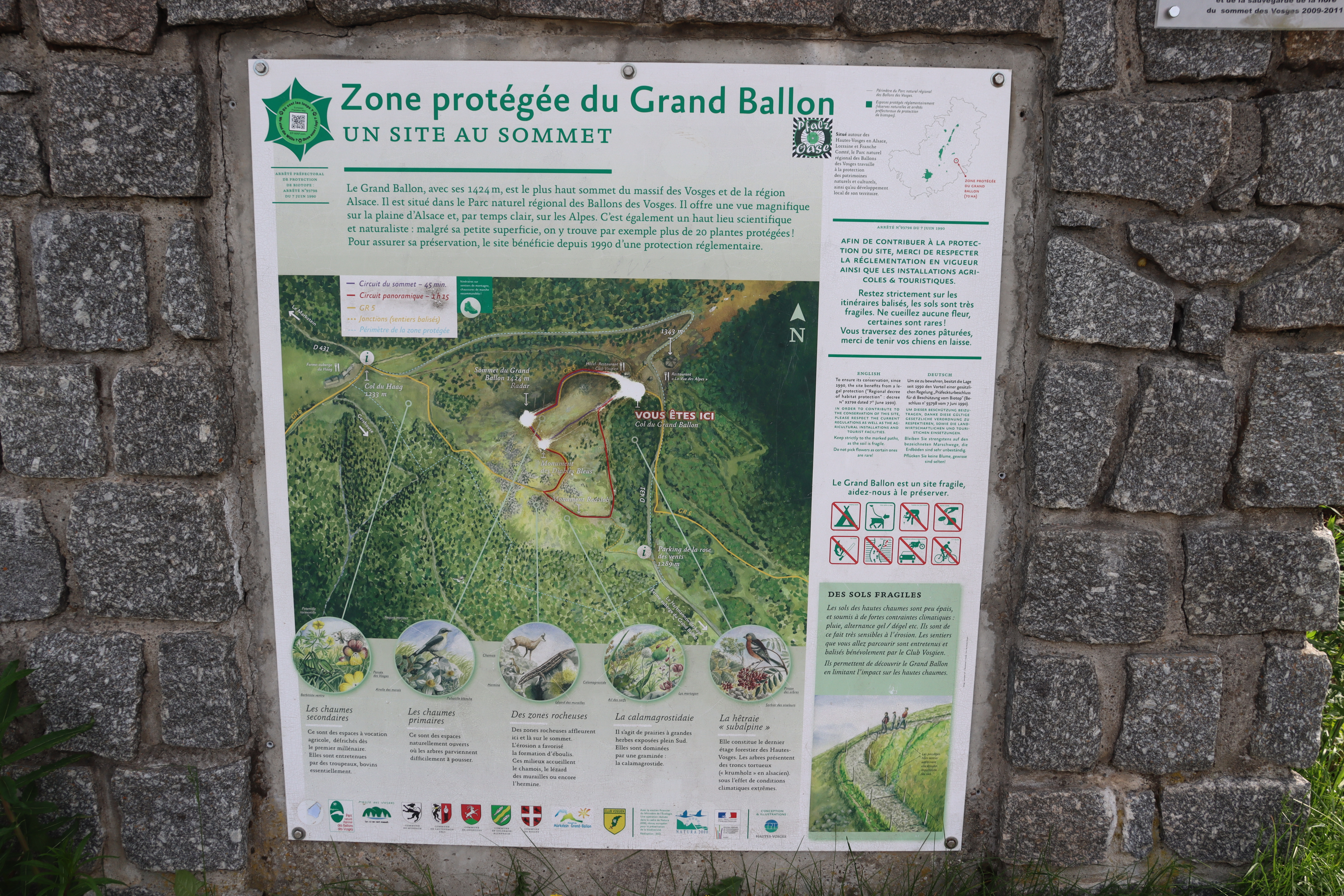
2. Geishouse — Grand Ballon — Bessayfels
Snapshot
Itinerary
The loop starts in Geishouse, climbs through forest and open ground towards the Grand Ballon, then returns via Bessayfels and forest paths. The route gives a substantial ascent from a village base rather than a short summit stroll from the Route des Crêtes area.
Why it is essential
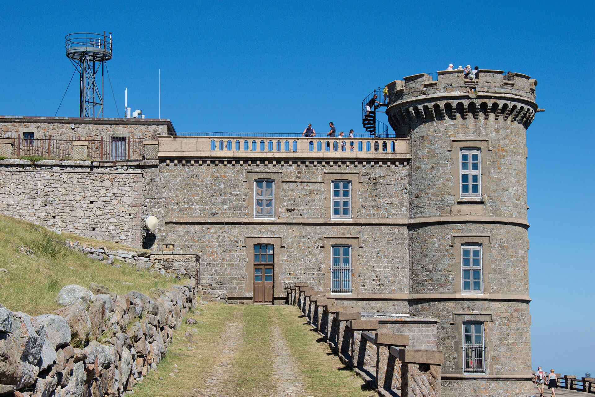
Grand Ballon is the highest summit of the Vosges, listed at 1,424 m. A village-to-summit loop gives a more complete mountain day than the short road-access summit walk.
Equipment
- Mountain hiking equipment
- Sturdy boots
- Weatherproof layer
- Warm layer
- Water and food
- Map/GPS
- Sun protection
- Navigation backup
- Trekking poles recommended for the descent
Hazards and notes
- Upper summit area exposed to wind, fog, storms, and lingering snow or ice outside the main season
- Navigation across open ground can be confusing in poor visibility
- Water availability on the ridge should not be assumed
- Restaurant or farm-inn availability near the summit should be checked before relying on it
GPX / KML links
| Source | URL | Format | Notes |
|---|---|---|---|
| AllTrails route page | alltrails.com | Source route/map | Source route link only. Replace later with original project GPX/KML. |
| Wikimedia Commons / Grand Ballon reference | commons.wikimedia.org | Reference | Summit reference only, not a route file. |
Further reading
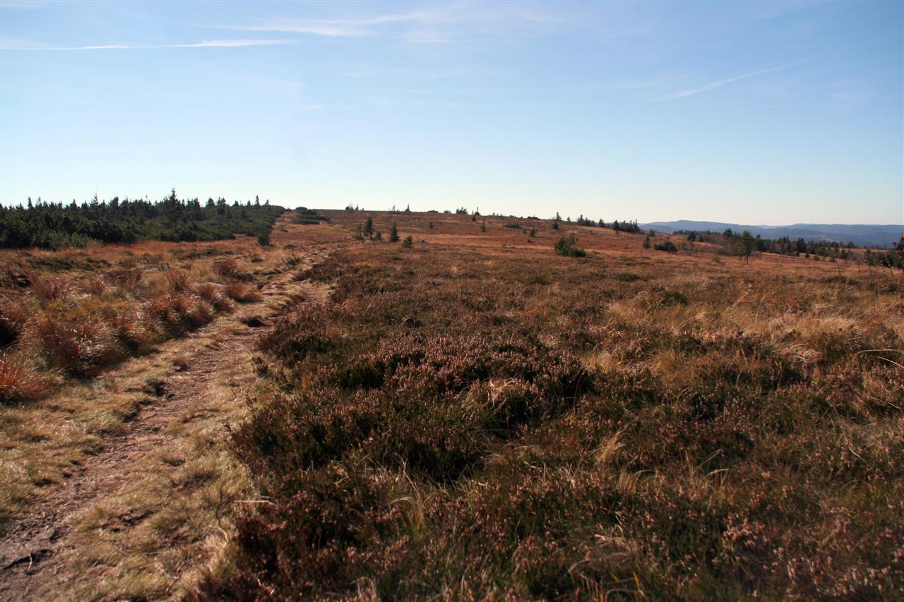
3. Lac Noir — Lac Blanc — Col du Calvaire — Gazon du Faing
Snapshot
Itinerary
The route begins at Lac Noir, climbs through forest above the lake, reaches Lac Blanc, then follows ridge and high-pasture terrain via Col du Calvaire towards Gazon du Faing. It descends back towards Lac Noir after the high viewpoint section.
Why it is essential
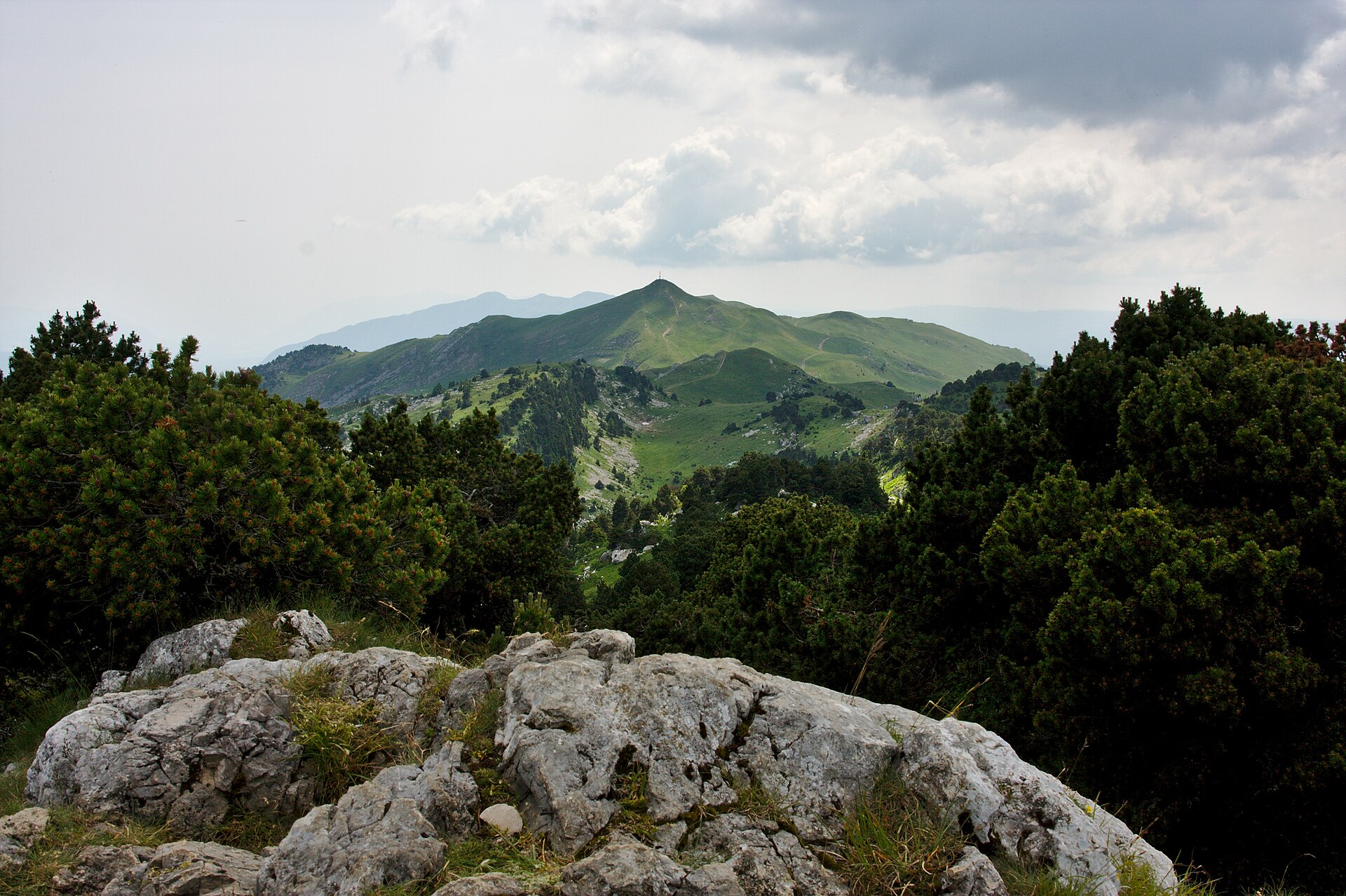
This hike represents the glacial-lake and high-chaume landscape of the Hautes Vosges: Lac Noir, Lac Blanc, forest climbs, ridge paths, and open summit pasture. Gazon du Faing is part of the classic high Vosges crest landscape.
Equipment
- Standard to mountain hiking equipment
- Hiking shoes or boots
- Weatherproof layer
- Warm layer
- Water and food
- Map/GPS
- Sun protection
- Navigation backup
- Trekking poles useful on the climb and descent
Hazards and notes
- Ridge can be windy and foggy
- Rocky or rooty forest sections may be slippery after rain
- Snow and ice can persist on shaded sections in winter or early spring
- Route crosses sensitive high-pasture and reserve landscapes
- Local reserve and dog rules should be checked before travel
GPX / KML links
| Source | URL | Format | Notes |
|---|---|---|---|
| AllTrails route page | alltrails.com | Source route/map | Source route link only. Replace later with original project GPX/KML. |
| Wikimedia Commons / Gazon du Faing reference | commons.wikimedia.org | Reference | Summit reference only, not a route file. |
Further reading
4. Ballon d’Alsace — Wissgrut Loop
Snapshot
Itinerary
The loop starts near the Ballon d’Alsace visitor area and first reaches the Ballon d’Alsace summit before continuing towards Le Wissgrut. The route combines open summit terrain, views, and historic features around one of the best-known southern Vosges summits.
Why it is essential
Ballon d’Alsace is a major southern Vosges landmark at the meeting area of the Vosges, Haut-Rhin, and Territoire de Belfort. The route gives a fuller day out than the very short summit loop.
Equipment
- Standard hiking equipment
- Hiking shoes or boots
- Weatherproof layer
- Warm layer
- Water and food
- Map/GPS
- Sun protection
- Trekking poles useful but not essential
- In winter, snowshoes or traction may be needed depending on conditions
Hazards and notes
- Summit and open pasture sections can be windy and exposed
- Visibility can deteriorate quickly in cloud or snowfall
- Wet footbridges, pasture paths, and forest sections may be slippery
- Local protected-area rules should be checked before travel
GPX / KML links
| Source | URL | Format | Notes |
|---|---|---|---|
| AllTrails route page | alltrails.com | Source route/map | Source route link only. Replace later with original project GPX/KML. |
| Wikimedia Commons / Ballon d’Alsace reference | commons.wikimedia.org | Reference | Summit reference only, not a route file. |
Further reading
5. Petit Donon — Sanctuary of the Great War
Snapshot
Itinerary
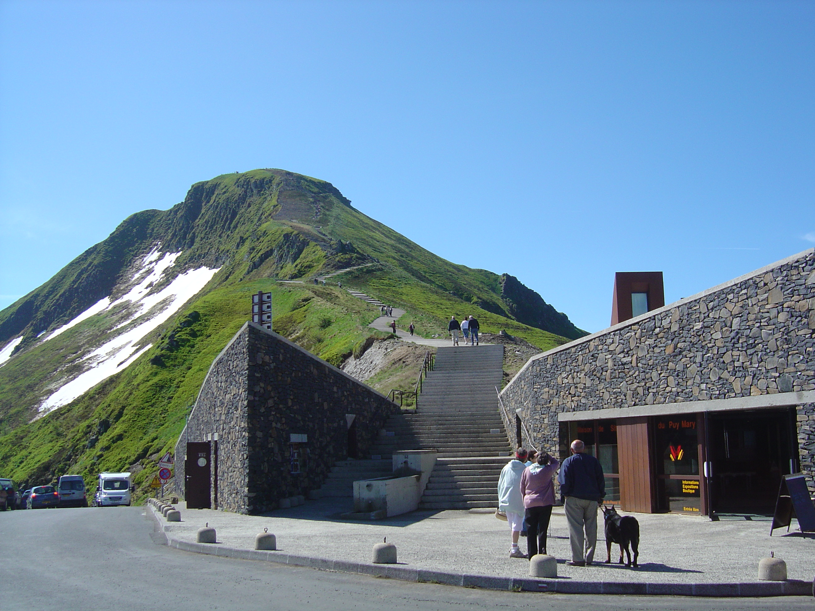
The route explores Petit Donon and the First World War sanctuary landscape. The wider Donon area is historically significant: Mont Donon is the highest peak of the northern Vosges, with Gallo-Roman sanctuary remains and First World War fighting in August 1914.
Why it is essential
This route adds the sandstone, forest, and historical character of the northern and central Vosges to a selection otherwise focused on the high southern crest. The Petit Donon memorial landscape gives a strong cultural and historical counterpoint to the high-chaume and glacial-lake walks.
Equipment
- Standard hiking equipment
- Hiking shoes or boots
- Weatherproof layer
- Warm layer
- Water and food
- Map/GPS
- Sun protection
- Navigation backup
- Tick protection recommended in forested terrain
Hazards and notes
- Slippery forest paths in wet weather, snow, or leaf fall
- Forest navigation should not be underestimated
- Memorial and sanctuary areas should be treated respectfully
- Protected heritage restrictions should be checked locally before travel
GPX / KML links
| Source | URL | Format | Notes |
|---|---|---|---|
| AllTrails route page | alltrails.com | Source route/map | Source route link only. Replace later with original project GPX/KML. |
| Mont Donon reference page | en.wikipedia.org | Context reference | Context only, not a route file. |
Further reading
Further reading
| Source | URL |
|---|---|
| Club Vosgien — Sentier des Roches | club-vosgien.eu |
| AllTrails — La Schlucht, Sentier des Roches | alltrails.com |
| AllTrails — Geishouse, Grand Ballon, Bessayfels | alltrails.com |
| AllTrails — Lac Noir, Lac Blanc, Col du Calvaire, Gazon du Faing | alltrails.com |
| AllTrails — Ballon d’Alsace et le Wissgrut | alltrails.com |
| AllTrails — Le Petit Donon, Sanctuaire de la Grande Guerre | alltrails.com |
| Wikipedia — Mont Donon | en.wikipedia.org |