Regional overview
This region covers the volcanic heart of the Massif Central: the Chaîne des Puys and Monts Dômes around Clermont-Ferrand, the Monts Dore and Massif du Sancy around Le Mont-Dore and Chambon-sur-Lac, and the older, larger Cantal volcanic massif around Le Lioran, Mandailles-Saint-Julien and Puy Mary. The Parc naturel régional des Volcans d’Auvergne is France’s largest metropolitan regional natural park, extending from about 400 m to 1,886 m and covering the Monts Dômes, Monts Dore, Cézallier, Artense and Monts du Cantal.
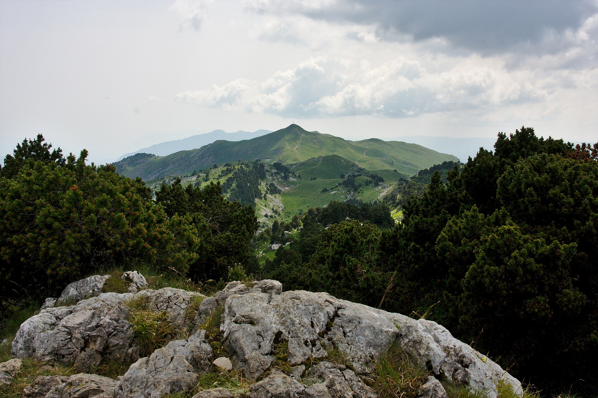
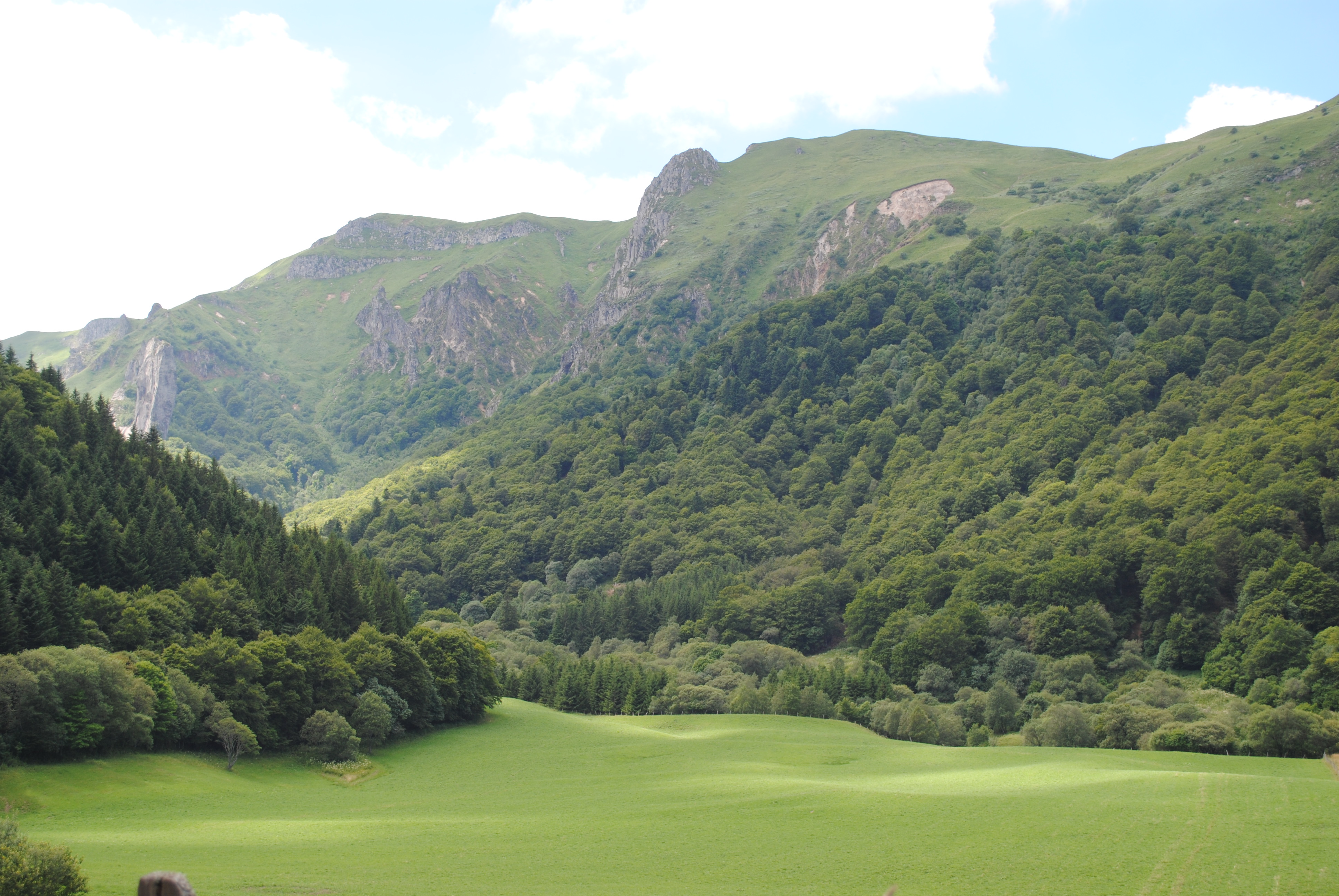
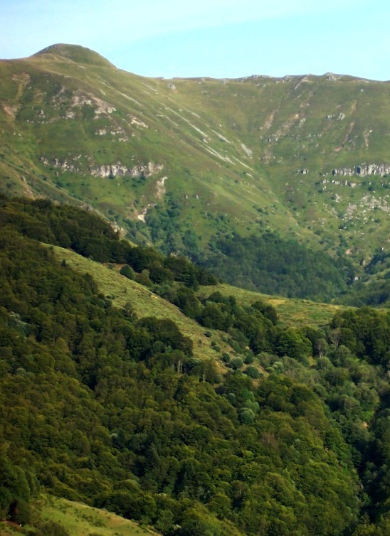
The walking character is volcanic rather than alpine: rounded domes, ancient craters, high grassy ridges, glacial valleys, waterfalls, peatlands and panoramic summits. The Chaîne des Puys–Faille de Limagne has been UNESCO-listed since 2 July 2018 and contains around 80 volcanoes over roughly 35 km. The Sancy sector provides the highest summit in the Massif Central and more rugged mountain terrain, while the Cantal routes are longer, more open and more exposed to wind and weather.
The usual hiking season is late spring to autumn, with the most reliable snow-free conditions from June to October. Winter and early spring snow, freeze-thaw damage, fog, high winds and thunderstorms can make the exposed upper sections more serious. Access to the Pas de Peyrol / Puy Mary road network is closed each winter from the first snow until spring melt, and parking at Pas de Peyrol is regulated in season.
Selection rationale
These five hikes were selected to represent the region’s core hiking landscapes: the highest summit of the Massif Central, a protected Sancy glacial valley, the UNESCO Chaîne des Puys’ most famous dome, the major Cantal / Puy Mary ridge circuit, and the highest point of the Cantal department. The set balances iconic summits, ridges, volcanic geology, protected reserves and practical day-hike feasibility.
Summary table
| # | Hike | Country | Route type | Distance | Gain | Max elevation | Difficulty |
|---|---|---|---|---|---|---|---|
| 1 | Puy de Sancy via Val d’Enfer and Val de Courre | France | Loop | 7 km | 560 m | 1,885 m | Difficult |
| 2 | Vallée de Chaudefour by the Crêtes | France | Loop | 13.5–15.5 km | 900–935 m | c. 1,820–1,854 m depending on variant | Very difficult |
| 3 | Puy de Dôme by the Chemin des Chèvres | France | One-way ascent / out-and-back variant | 5 km ascent; c. 10 km return on foot | 526 m | 1,465 m | Moderate mountain walk |
| 4 | Puy Mary and Brèche de Rolland from Mandailles | France | Loop | 20.6 km | 1,110 m | 1,777 m | Strenuous |
| 5 | Tour du Plomb du Cantal from Le Lioran | France | Loop | 11.9 km | 650 m | 1,855 m | Difficult / expert |
1. Puy de Sancy via Val d’Enfer and Val de Courre
Snapshot
Itinerary
From the Sancy ski-station base above Le Mont-Dore, the route climbs towards the crest above the Val d’Enfer. The official route description leads via the Pan de la Grange and Col de la Cabane to the summit of the Puy de Sancy, then descends by the western side and wooden steps before traversing above the Fontaine Salée side towards the Col de Courre. The descent follows the Val de Courre back towards the station buildings and the starting point.
Why it is essential
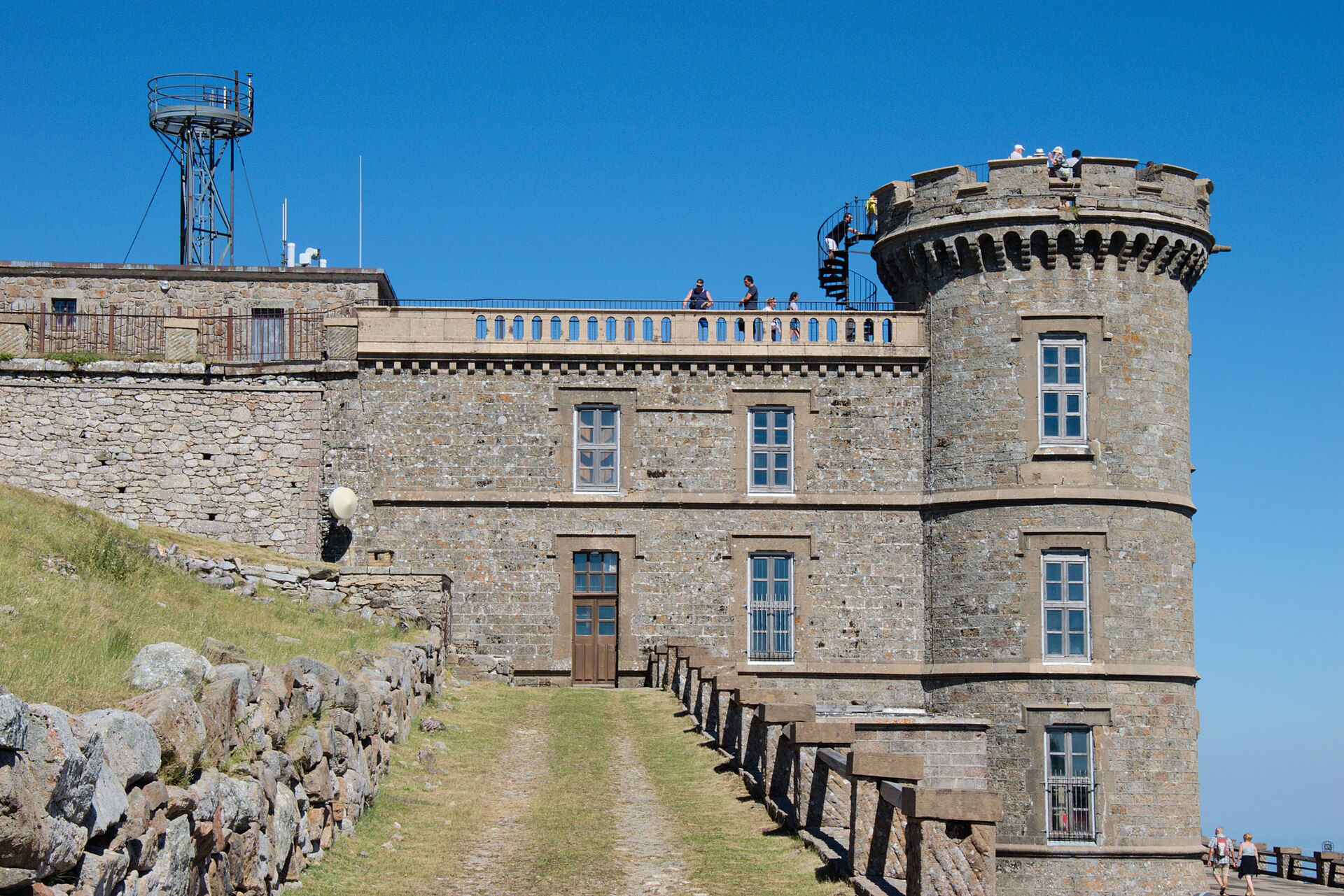
The Puy de Sancy is the highest summit of the Massif Central and the defining objective of the Monts Dore. The route is short but steep, with a compact sample of the Sancy’s characteristic terrain: volcanic ridges, steep couloirs, high grassland, waterfalls and broad views from the summit.
Equipment
- Sturdy boots
- Weatherproof layer
- Warm layer
- Water
- Food
- Map or GPS
- Sun protection
- Trekking poles recommended
- Microspikes or crampons may be needed if snow or refrozen snow remains on the summit slopes or steps
Hazards and notes
- The official Sancy route page marks dogs as forbidden on this route.
- The upper route is exposed to wind, fog and thunderstorms.
- Early-season snow can make the summit steps and couloirs more serious.
- The route should not be treated as a casual cable-car stroll despite its modest distance.
- Photo candidates on Wikimedia Commons have unresolved author or licence details; reuse pending final Commons-page check.
GPX / KML links
| Source | URL | Format | Notes |
|---|---|---|---|
| Sancy official route download | static.apidae-tourisme.com | GPX | Route file located; reuse terms unresolved |
| Sancy route page | sancy.com | Source route page | Route proposed and managed by the Conseil départemental du Puy-de-Dôme / PDIPR; route-file reuse still unresolved |
Further reading
2. Vallée de Chaudefour by the Crêtes
Snapshot
Itinerary
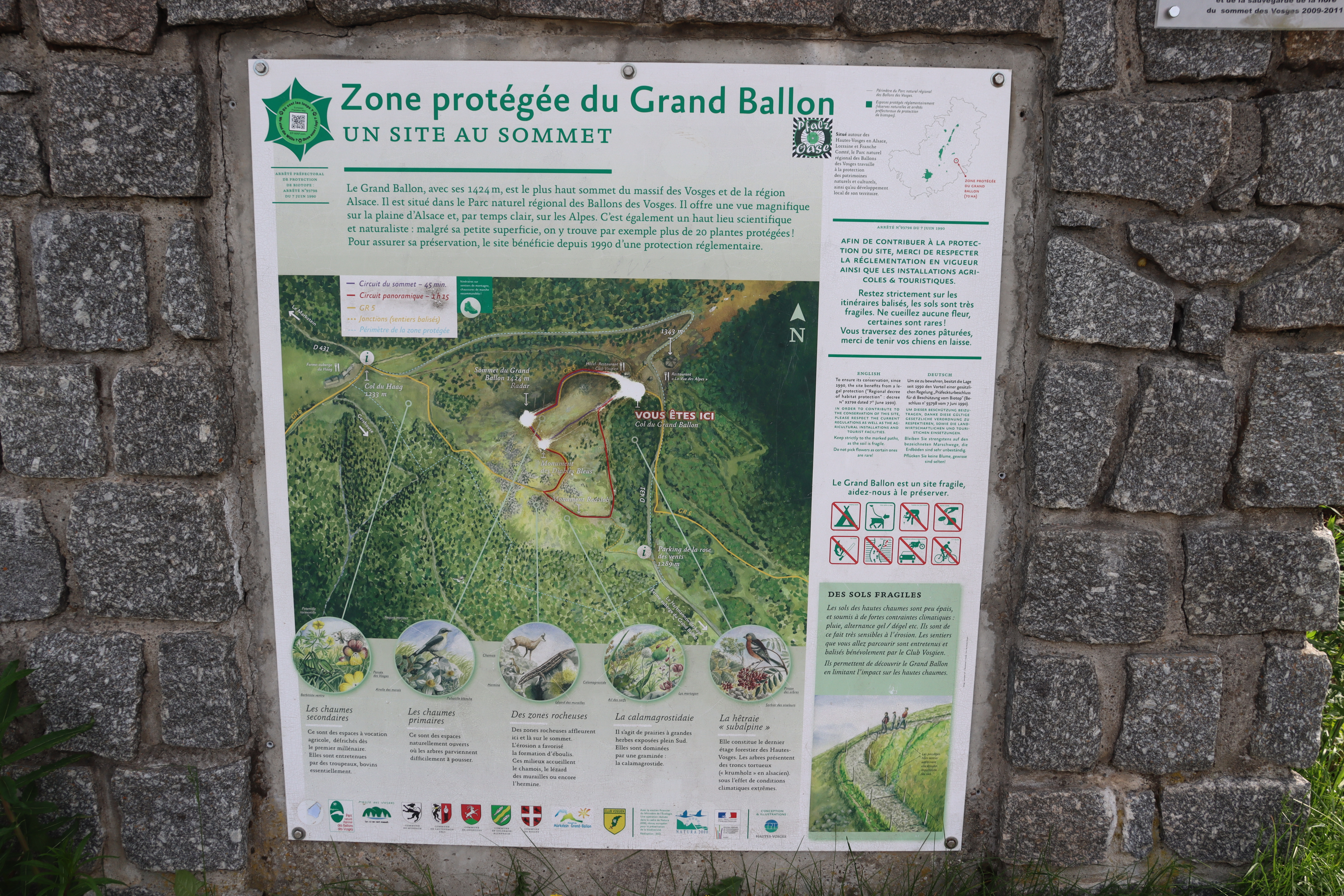
From Chambon-des-Neiges, the route enters the Vallée de Chaudefour and climbs through forest and reserve terrain towards the higher plateau and crête system. The Sancy official route describes a circuit using the Cascade de la Biche area, steep switchbacks, plateau terrain and the valley’s high volcanic rim before returning to the starting area.
The reserve’s own description identifies “le tour de la vallée par les crêtes” as a difficult 13.5 km loop with about ±900 m of height difference, reserved for good walkers. This explains the distance discrepancy: the published route card and the reserve’s crête-loop description appear to use slightly different measurements or variants.
Why it is essential
Chaudefour is one of the Sancy massif’s signature glacial valleys and has been protected as a national nature reserve since 1991. The crête circuit gives a more complete mountain version of the valley than the short family walk, combining waterfalls, reserve landscapes, volcanic rock forms and high Sancy views.
Equipment
- Sturdy boots
- Waterproof and warm layers
- Water
- Food
- Map / GPS and navigation backup
- Trekking poles recommended
- Headtorch if starting late
- Microspikes may be needed in early season if snow remains on shaded upper slopes or crêtes
Hazards and notes
- Dogs are not allowed in the Vallée de Chaudefour reserve, even on a lead, according to the reserve page.
- Visitors are also asked to stay on marked paths to limit erosion and protect flora and fauna.
- The route is long for its distance because of steep climbing, possible mud, exposed upper ground and navigation challenges in cloud.
GPX / KML links
| Source | URL | Format | Notes |
|---|---|---|---|
| Sancy official route download | static.apidae-tourisme.com | GPX | Route file located; reuse terms unresolved |
| Sancy route page | sancy.com | Source route page | Suitable as route-stat verification source |
| Réserve naturelle de la Vallée de Chaudefour | parcdesvolcans.fr | Source description / map page | Useful for variant cross-checking; route-file reuse not applicable |
Further reading
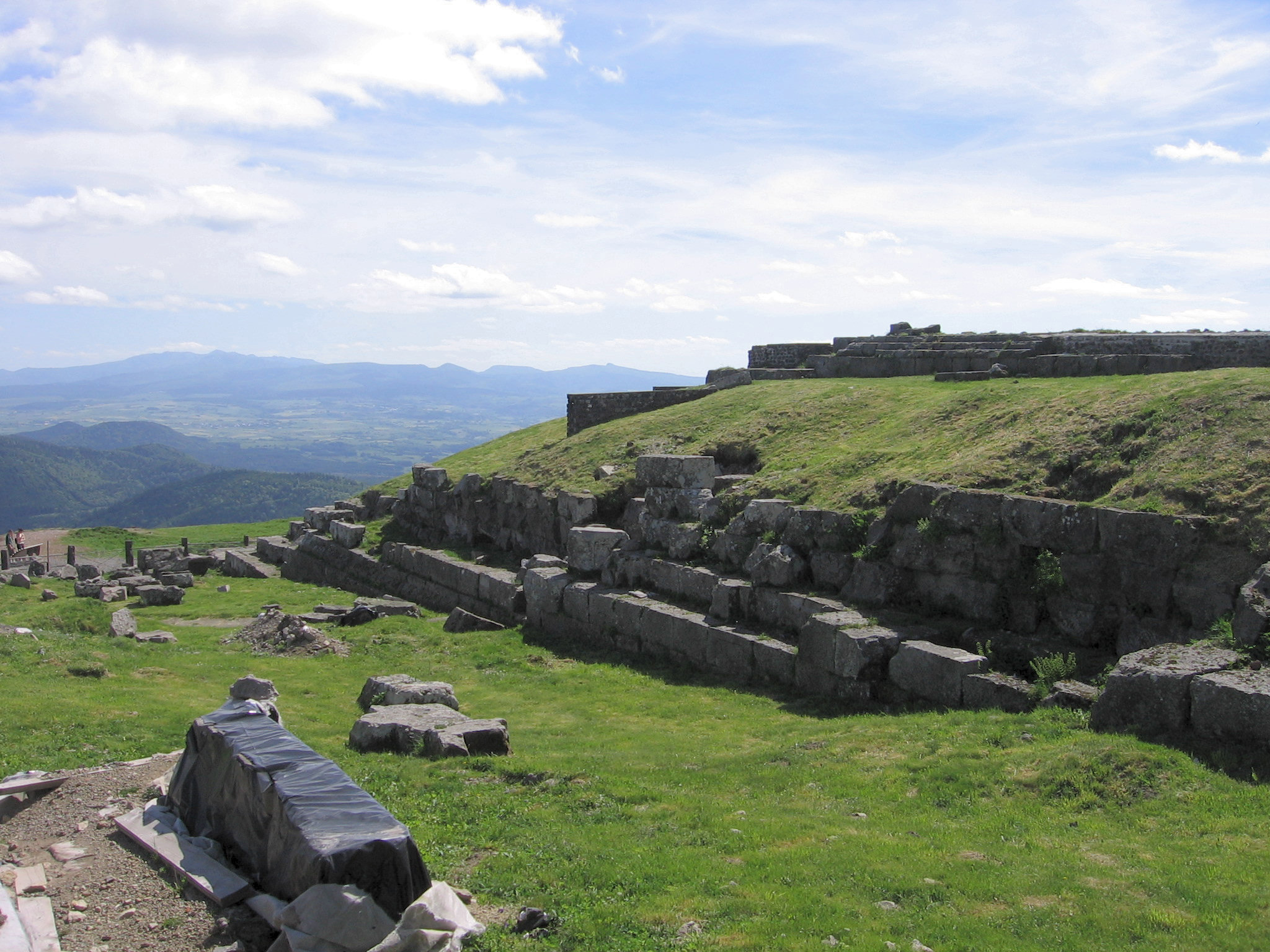
3. Puy de Dôme by the Chemin des Chèvres
Snapshot
Itinerary
The route starts from the Panoramique des Dômes / Maison de Site area. It first follows broad tracks and the PR “Tour du Puy de Dôme” markings, then turns onto the GR 441 section known as the Chemin des Chèvres. The final approach reaches the summit by a stair section and then a short service-road section.
For a full day-hike entry, the descent can either retrace the ascent route or use the Panoramique des Dômes train. The traditional Chemin des Muletiers is not used as the primary route here because the Fédération Française de la Randonnée reported a temporary closure in March 2026 for safety works, describing the route as fragile and prone to rockfall due to friable volcanic rock and freeze-thaw effects.
Why it is essential
The Puy de Dôme is the emblematic summit of the UNESCO-listed Chaîne des Puys. It gives one of the clearest views over the volcanic alignment and also contains the remains of the Temple of Mercury. The Chemin des Chèvres offers a current official walking route to the summit while avoiding reliance on the more closure-prone Chemin des Muletiers.
Equipment
- Hiking shoes or boots
- Weatherproof layer
- Warm layer
- Water
- Sun protection
- Map / GPS
- Microspikes may be appropriate in winter or after refreezing
Hazards and notes
- Dogs are accepted on a lead on the Chemin des Chèvres route card.
- The Chaîne des Puys guidance asks walkers to stay on marked paths, keep dogs on a lead near herds, avoid shortcuts and respect private-property closures.
- The route includes stairs near the summit and should still be treated as a real hike.
- The Chemin des Muletiers requires a fresh closure check before travel or use.
GPX / KML links
| Source | URL | Format | Notes |
|---|---|---|---|
| Clermont Auvergne Volcans official route download | static.apidae-tourisme.com | GPX | Route file located; reuse terms unresolved |
| Clermont Auvergne Volcans official route download | static.apidae-tourisme.com | KML | Route file located; reuse terms unresolved |
| Official route page | clermontauvergnevolcans.com | Source route page | Suitable as primary route-stat source |
Further reading
- Clermont Auvergne Volcans official route page
- Fédération Française de la Randonnée — Chemin des Muletiers closure notice
- Chaîne des Puys UNESCO tourism page
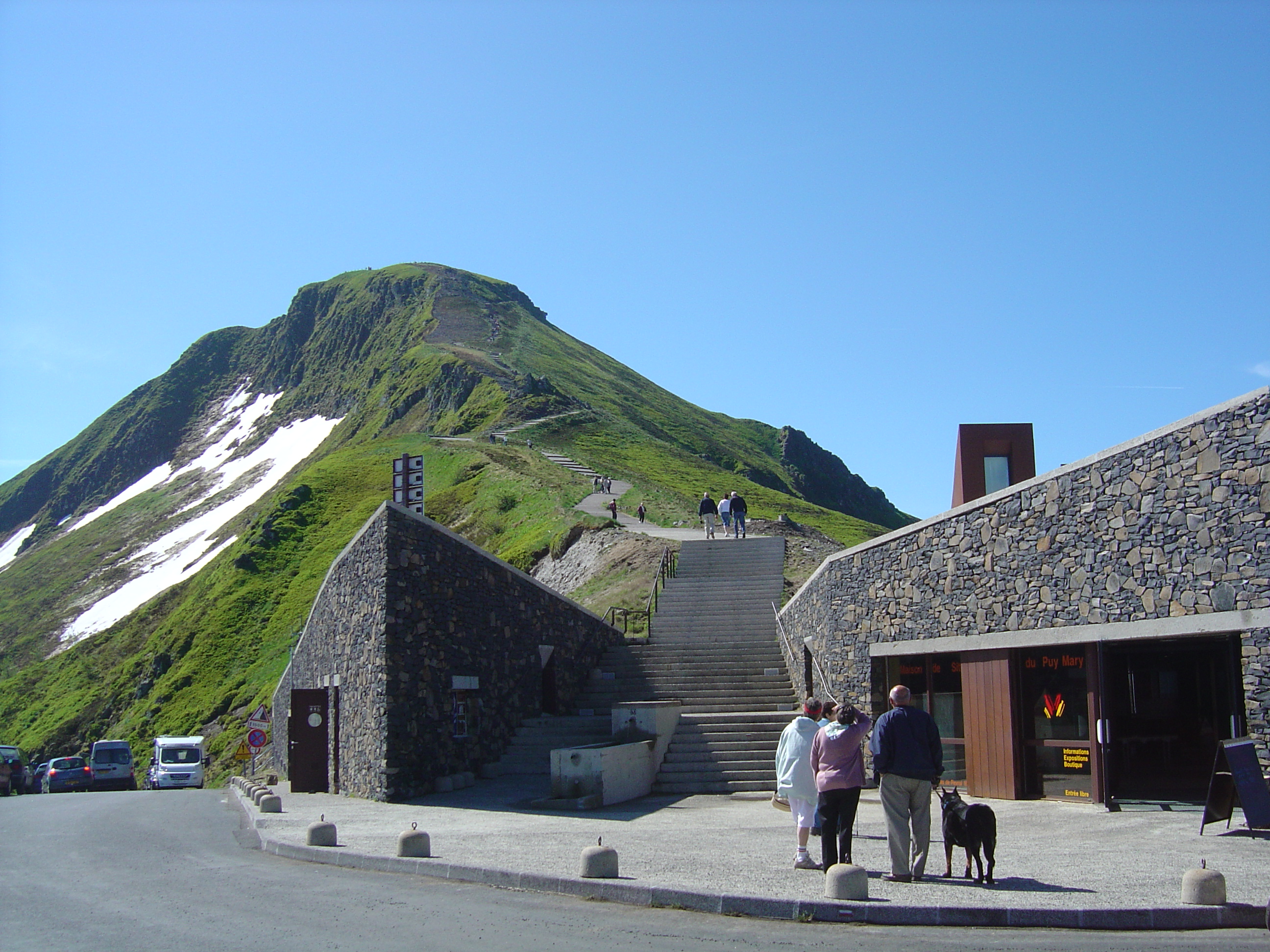
4. Puy Mary and Brèche de Rolland from Mandailles-Saint-Julien
Snapshot
Itinerary
This long loop starts in Mandailles-Saint-Julien and makes a major circuit of the Cantal volcanic ridge system. The Espace Nature Puy Mary route passes the village, Col de Cabre, Brèche de Rolland, Puy Mary, Pas de Peyrol and Col de Redondet before returning to the Jordanne valley. The official route page gives 20.6 km, 1,110 m of ascent and descent, a minimum elevation of 919 m, maximum elevation of 1,777 m, 8 h duration and green waymarking.
Why it is essential
This is the most complete Cantal ridge day in the selection. It includes the iconic Puy Mary area, the Brèche de Rolland, multiple cols and changing views over the old Cantal volcano. It is longer and more committing than the short Pas de Peyrol summit path, making it a better representative day-hike for fit walkers.
Equipment
- Sturdy boots
- Trekking poles
- Waterproof layer
- Warm layer
- Windproof layer
- Food
- 1.5–2 litres of water minimum
- Map / GPS and navigation backup
- Headtorch
- Microspikes may be needed if snow remains on the ridge
Hazards and notes
- This is a long exposed ridge walk with high elevation gain.
- Fog can make navigation difficult and thunderstorms are a serious hazard on the open ridges.
- The Brèche de Rolland section may feel more serious than the rest of the route in poor weather.
- Roads to Pas de Peyrol / Puy Mary are closed each winter from the first snows until the spring melt, and the Pas de Peyrol parking system is regulated in season.
- Dog and herd-management rules should be checked locally before travel.
GPX / KML links
| Source | URL | Format | Notes |
|---|---|---|---|
| Espace Nature Puy Mary route page | espacenature-puymary.fr | Source route page with GPX file link | GPX availability verified on the page; direct static file URL not captured |
| Espace Trail trace page | espacestrail.run | Interactive trace / GPX source page | Route geometry source found; reuse terms unresolved |
Further reading
5. Tour du Plomb du Cantal from Le Lioran
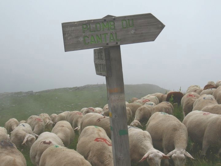
Snapshot
Itinerary
From the centre of Le Lioran, the route starts near the Prairie des Sagnes and the Gardes chairlift. It climbs through open grazing land and mountain terrain towards the Plomb du Cantal, the high point of the Cantal department, then completes a loop back to the resort. The Hautes Terres Tourisme route card gives 11.9 km, 650 m of ascent, 4 h, green waymarking and a loop format.
A related Le Lioran route page confirms the same 11.9 km loop with +650 m and -650 m, and notes that the route passes estive areas and that the Plomb du Cantal cable car may be used in summer.
Why it is essential
The Plomb du Cantal is the highest summit of the Cantal massif and one of the major volcanic viewpoints of the Massif Central. This loop is more substantial than a lift-assisted summit visit but remains feasible as a day hike for fit walkers, with direct access from Le Lioran.
Equipment
- Sturdy boots
- Waterproof and windproof layer
- Warm layer
- Food
- Water
- Sun protection
- Map / GPS
- Trekking poles useful on the descent
- Microspikes if snow or ice may be encountered in early or late season
Hazards and notes
- The route is open and weather-sensitive.
- Hautes Terres Tourisme advises checking the weather, carrying suitable hiking equipment and notes that the route is not available during the winter ski-practice period, with access subject to snow and weather conditions.
- In winter, this should be treated as a snow / mountain route rather than a normal hike.
- Summer cable-car operation is mentioned, but schedules and prices require a current check before travel.
GPX / KML links
| Source | URL | Format | Notes |
|---|---|---|---|
| Hautes Terres Tourisme official route download | static.apidae-tourisme.com | GPX | Route file located; reuse terms unresolved |
| Hautes Terres Tourisme route page | hautesterrestourisme.fr | Source route page | Suitable as primary route-stat source |
Further reading
Further reading
| Source | URL |
|---|---|
| Parc naturel régional des Volcans d’Auvergne / Auvergne VolcanSancy overview | auvergnevolcansancy.com |
| Sancy / Volcans d’Auvergne overview | sancy.com |
| Chaîne des Puys UNESCO tourism page | auvergnevolcansancy.com |
| Sancy official — Puy de Sancy route | sancy.com |
| Sancy official — Vallée de Chaudefour route | sancy.com |
| Parc des Volcans — Vallée de Chaudefour reserve | parcdesvolcans.fr |
| Clermont Auvergne Volcans — Puy de Dôme / Chemin des Chèvres | clermontauvergnevolcans.com |
| Fédération Française de la Randonnée — Chemin des Muletiers closure | ffrandonnee.fr |
| Espace Nature Puy Mary route | espacenature-puymary.fr |
| Espace Trail — Puy Mary trace | espacestrail.run |
| Puy Mary official access page | puymary.fr |
| Hautes Terres Tourisme — Tour du Plomb du Cantal | hautesterrestourisme.fr |
| Le Lioran — Tour du Plomb du Cantal | explore.lelioran.com |