.jpg)


.JPG)


Regional overview
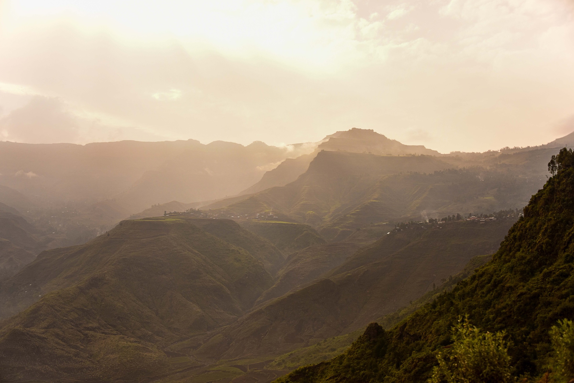
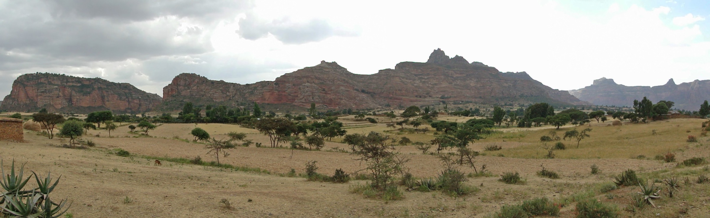
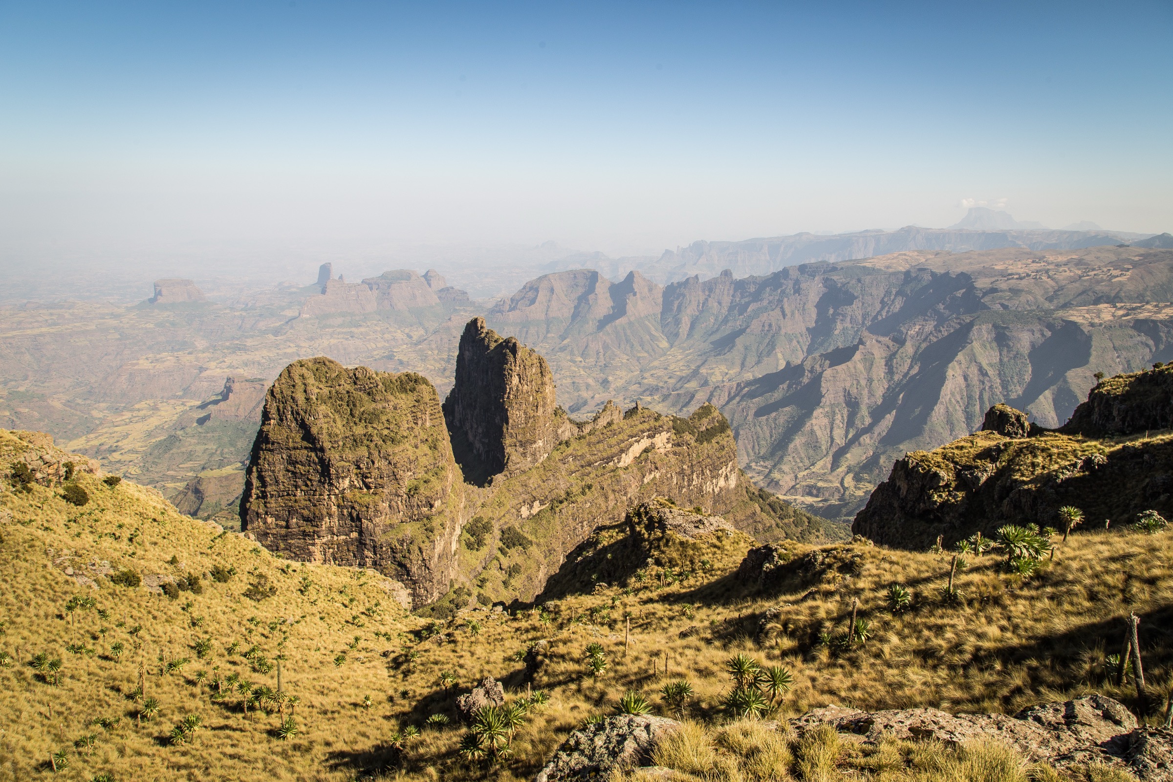
The Simien Mountains are a high volcanic massif in northern Ethiopia, protected by Simien Mountains National Park and recognised by UNESCO for jagged peaks, deep valleys, escarpments dropping up to about 1,500 m, and globally important Afro-alpine biodiversity. The main hiking axis follows the escarpment east from the Debark/Buit Ras side towards Sankaber, Gich/Geech, Imet Gogo, Chennek and Bwahit, with the higher Ras Dashen / Ras Dejen sector farther east.
The walking is mostly high-altitude mountain trekking rather than technical climbing. Typical routes cross open grassland, cliff-edge paths, giant-lobelia slopes and viewpoints over the lowlands. Gelada, Walia ibex and Ethiopian wolf are key wildlife interests. The usual access town is Debark, reached from Gondar; guides, permits and an armed scout are normally arranged there before entering the park.
The best trekking period is generally October to March, with December to February the clearest and busiest months. Rain commonly affects June to August and may extend into September. Altitude, strong sun, cold nights, exposed cliff edges, long road transfers and limited emergency access are the main safety issues.
Selection rationale
The five hikes below represent the classic Simien day-hike set: the first escarpment approach, the Gich/Imet Gogo viewpoint, the Gich-to-Chennek high traverse via Inatye, the Bwahit high summit from Chennek, and the Ras Dashen summit day from Ambiko for fit trekkers already positioned in the eastern park.
Summary table
| # | Hike | Country | Route type | Distance | Gain | Max elevation | Difficulty |
|---|---|---|---|---|---|---|---|
| 1 | Buit Ras to Sankaber and Jinbar Falls | Ethiopia | Point-to-point / vehicle-shortenable | About 3 h to Jinbar Falls | Not verified | c. 3,250 m | Moderate |
| 2 | Gich Camp to Imet Gogo | Ethiopia | Out-and-back | 5-6 h round trip | Not verified | 3,926 m | Moderate-hard |
| 3 | Gich to Chennek via Inatye | Ethiopia | Point-to-point | About 3 h Inatye to Chennek | Not verified | 4,070 m | Hard |
| 4 | Chennek to Bwahit Peak | Ethiopia | Out-and-back | 4 h round trip | Not verified | 4,430 m | Hard |
| 5 | Ambiko to Ras Dashen / Ras Dejen | Ethiopia | Out-and-back | Up to 12 h round trip | Not verified | 4,533-4,550 m | Very hard |
1. Buit Ras to Sankaber and Jinbar Falls

Snapshot
Itinerary
The route starts near Buit Ras, a common drop-off point for classic Simien treks, and follows relatively even terrain along the escarpment edge towards Sankaber. The walk gives early views into the Gich Abyss and passes areas where gelada troops are commonly seen. A key objective is the Jinbar Falls viewpoint, where the Jinbar River drops into the gorge; flow is seasonal and strongest around and after the rainy season.
Why it is essential
This is the standard first walking stage of the classic Simien escarpment trek and introduces the region’s signature combination of cliff-edge walking, deep gorges and gelada habitat without immediately committing to the highest terrain.
Equipment
Mountain hiking equipment: sturdy boots, weatherproof layer, warm layer, water, food, sun protection, hat, map/GPS backup, headtorch if linking to a longer camp-to-camp day.
Hazards and notes
An armed scout is mandatory in the park according to the trekking source. Cliff edges, sudden weather, altitude and limited emergency access require caution. The waterfall is seasonal; dry-season flow may be reduced. Follow park rules and scout/guide instructions.
GPX / KML links
| Source | URL | Format / access | Reuse status |
|---|---|---|---|
| Brilliant Ethiopia — Simien trekking guide | brilliant-ethiopia.com | Web route description | Copyrighted website content; route facts only; no downloadable GPX |
| OpenStreetMap map area | openstreetmap.org | Source map | ODbL; manual GPX creation required; OSM attribution required if data reused |
External links
2. Gich Camp to Imet Gogo

Snapshot
Itinerary
From Gich, the route descends into the Jinbar River valley, climbs towards Imet Gogo, and finishes along a ridge to one of the best-known Simien viewpoints. The summit area gives broad views across the escarpments and towards Ras Dashen in clear weather.
Why it is essential
Imet Gogo is one of the most recognised viewpoints in the Simien Mountains and is a classic objective for trekkers spending a night at Gich.
Equipment
Mountain hiking equipment, plus warm windproof clothing for the exposed ridge. Trekking poles are useful for the descent and re-ascent from the valley.
Hazards and notes
Expect exposed viewpoints, high-altitude effort and weather changes. Navigation should be handled with a guide/scout. Early starts are preferable for clear views.
GPX / KML links
| Source | URL | Format / access | Reuse status |
|---|---|---|---|
| Brilliant Ethiopia — Simien trekking guide | brilliant-ethiopia.com | Web route description | Copyrighted website content; route facts only; no downloadable GPX |
| OpenStreetMap map area | openstreetmap.org | Source map | ODbL; manual GPX creation required |
External links
- Brilliant Ethiopia — Trekking in the Simien Mountains
- Wikimedia Commons — Imet Gogo im Nebel (Judisa, CC BY-SA 3.0)
3. Gich to Chennek via Inatye

Snapshot
Itinerary
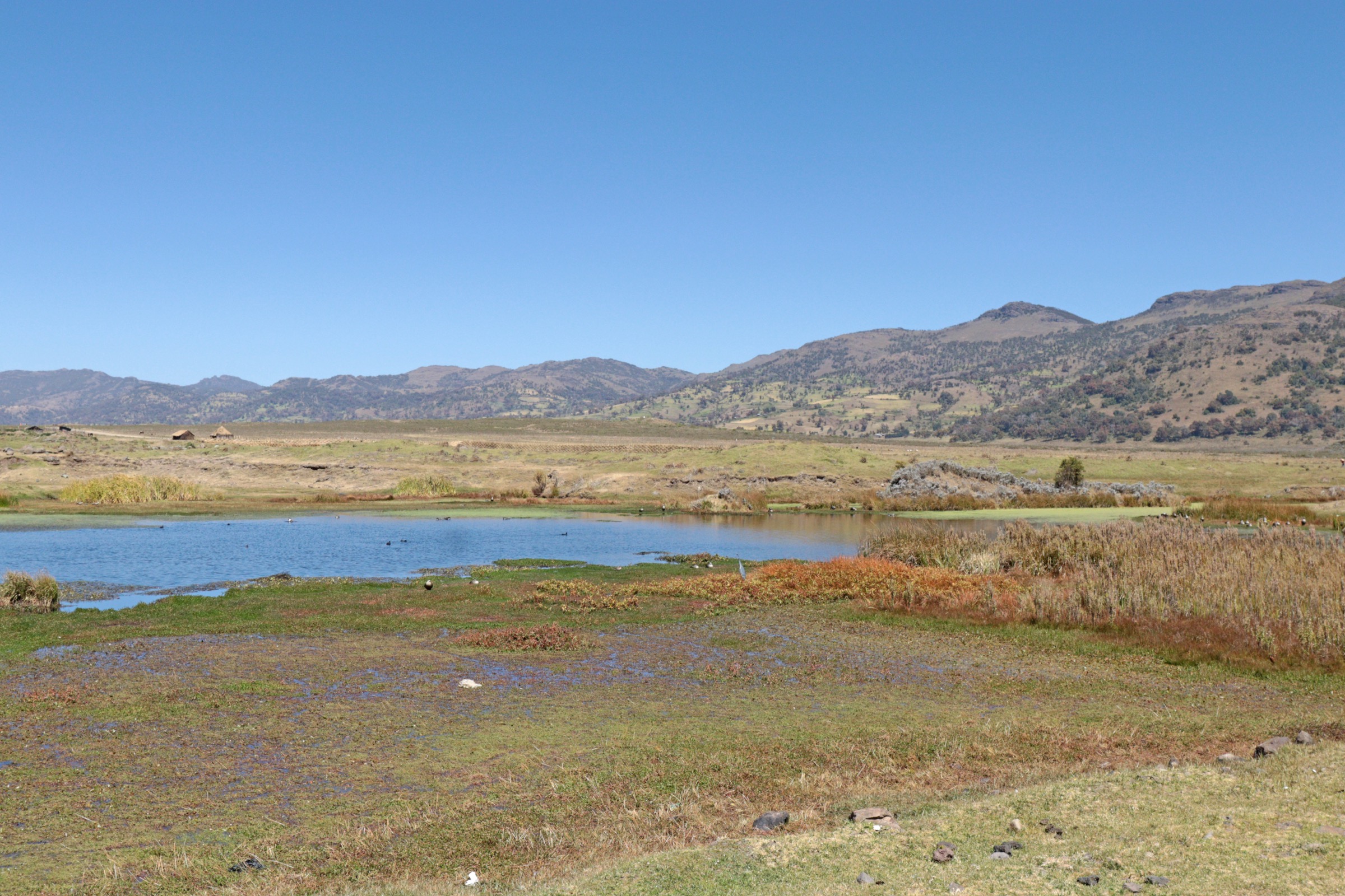
The route leaves Gich and follows the high escarpment towards Inatye, a 4,070 m viewpoint above the cliffs. From Inatye, the trail continues east towards Chennek, crossing open highland and giant-lobelia country. Chennek is a major campsite and one of the best-known areas for Walia ibex sightings.
Why it is essential
This is the core high-level traverse of the classic Simien escarpment route and links the Gich viewpoint country with the wildlife-rich Chennek basin.
Equipment
Mountain hiking equipment, extra warm layer, windproof shell, sun protection, water treatment or sufficient carried water, and navigation backup.
Hazards and notes
The day is exposed, high and remote. Fog or storm conditions can make navigation and cliff proximity more serious. Confirm camp/vehicle logistics in Debark before departure.
GPX / KML links
| Source | URL | Format / access | Reuse status |
|---|---|---|---|
| Brilliant Ethiopia — Simien trekking guide | brilliant-ethiopia.com | Web route description | Copyrighted website content; route facts only; no downloadable GPX |
| OpenStreetMap map area | openstreetmap.org | Source map | ODbL; manual GPX creation required |
External links
4. Chennek to Bwahit Peak

Snapshot
Itinerary
From Chennek, the route climbs through giant-lobelia slopes towards Bwahit, the highest peak on the western side of the Simien Mountains. The summit area gives views towards Kidus Yared, Ras Dashen and the surrounding escarpments.
Why it is essential
Bwahit is the natural high-summit objective from Chennek and combines the best Walia ibex habitat area with one of the major 4,000 m summits of the range.
Equipment
Mountain hiking equipment, warm windproof clothing, sun protection, trekking poles, sufficient water, and navigation backup.
Hazards and notes
Altitude is the main difficulty despite the relatively short time. Mist can cover the upper slopes. Stay with the guide/scout and avoid cliff-edge shortcuts.
GPX / KML links
| Source | URL | Format / access | Reuse status |
|---|---|---|---|
| Brilliant Ethiopia — Simien trekking guide | brilliant-ethiopia.com | Web route description | Copyrighted website content; route facts only; no downloadable GPX |
| OpenStreetMap map area | openstreetmap.org | Source map | ODbL; manual GPX creation required |
External links
5. Ambiko to Ras Dashen / Ras Dejen

Snapshot
Itinerary
From Ambiko, the summit day climbs steadily towards Ras Dashen / Ras Dejen, Ethiopia’s highest mountain. The route is described as mostly a steady ascent with some steeper gradients, but the altitude and duration make it a serious mountain day. Standard treks start and end at Ambiko.
Why it is essential
Ras Dashen is the highest point in Ethiopia and the symbolic summit of the Simien Mountains. It is not a casual day walk from a roadhead, but it is the essential summit day for parties already trekking in the eastern sector.
Equipment
Mountain hiking equipment plus headtorch, extra food and water, warm gloves/hat, full windproof/rain layer, navigation backup and emergency plan. Trekking poles recommended.
Hazards and notes
This hike requires fitness, acclimatisation, an early start and established camp logistics. It is not suitable as a quick sortie from lodges or Debark. Weather, altitude illness and remoteness are the major risks.
GPX / KML links
| Source | URL | Format / access | Reuse status |
|---|---|---|---|
| Brilliant Ethiopia — Simien trekking guide | brilliant-ethiopia.com | Web route description | Copyrighted website content; route facts only; no downloadable GPX |
| OpenStreetMap map area | openstreetmap.org | Source map | ODbL; manual GPX creation required |
External links
- Brilliant Ethiopia — Trekking in the Simien Mountains
- Wikimedia Commons — Ras Dashen, Ethiopia (Yonas Kidane, CC BY-SA 2.0)
Missing data / follow-up work
- No official Simien GPX/KML downloads found in this pass.
- Exact distances, ascent and descent for the selected Simien day hikes remain unresolved.
- Local permit/scout pricing and current access rules require confirmation in Debark before publication.
- Road access to Chennek and eastern trailheads may change with weather and park management.
External links
| Resource | Link |
|---|---|
| UNESCO — Simien National Park | whc.unesco.org |
| Brilliant Ethiopia — Trekking in the Simien Mountains | brilliant-ethiopia.com |