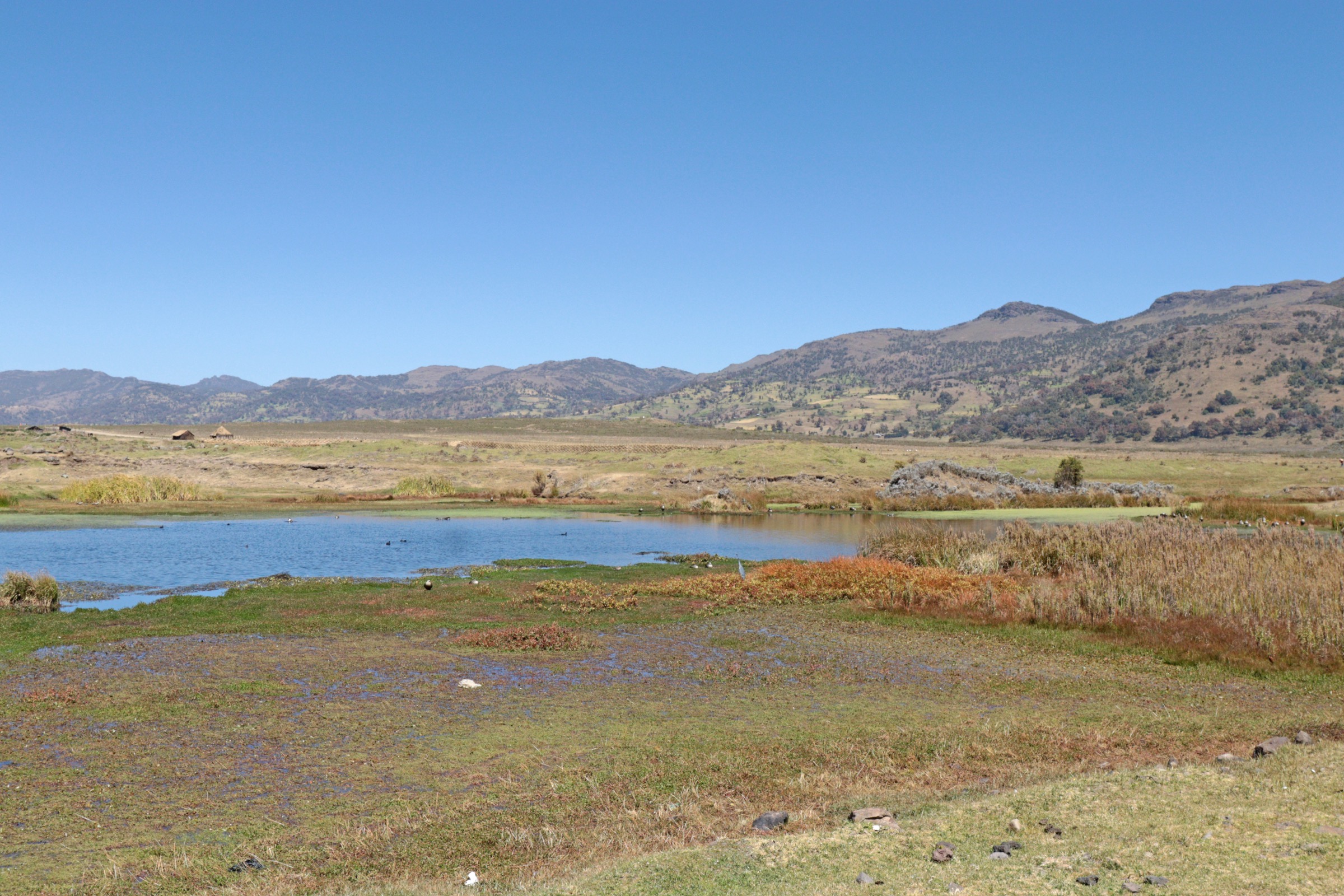


Regional overview
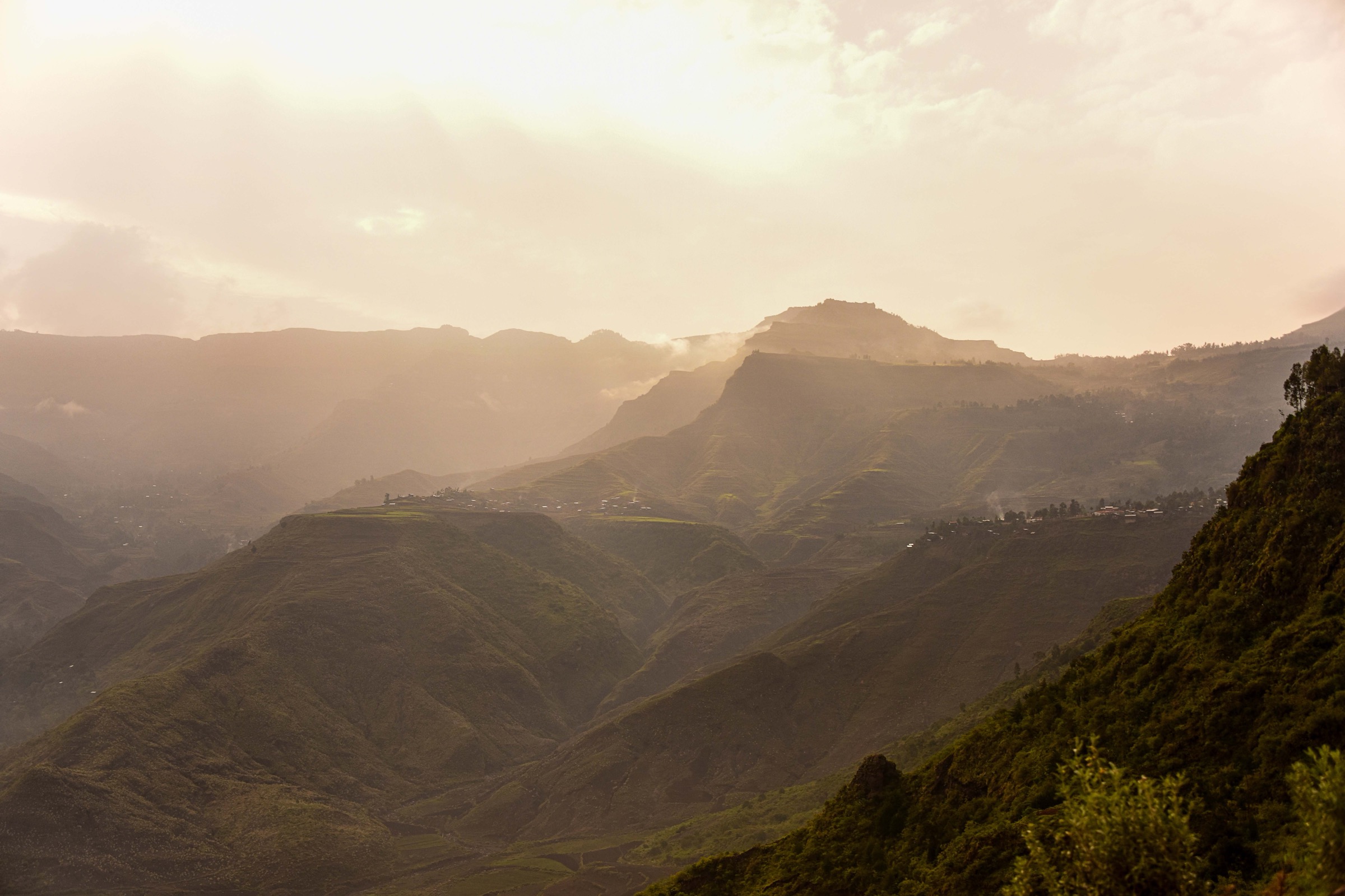
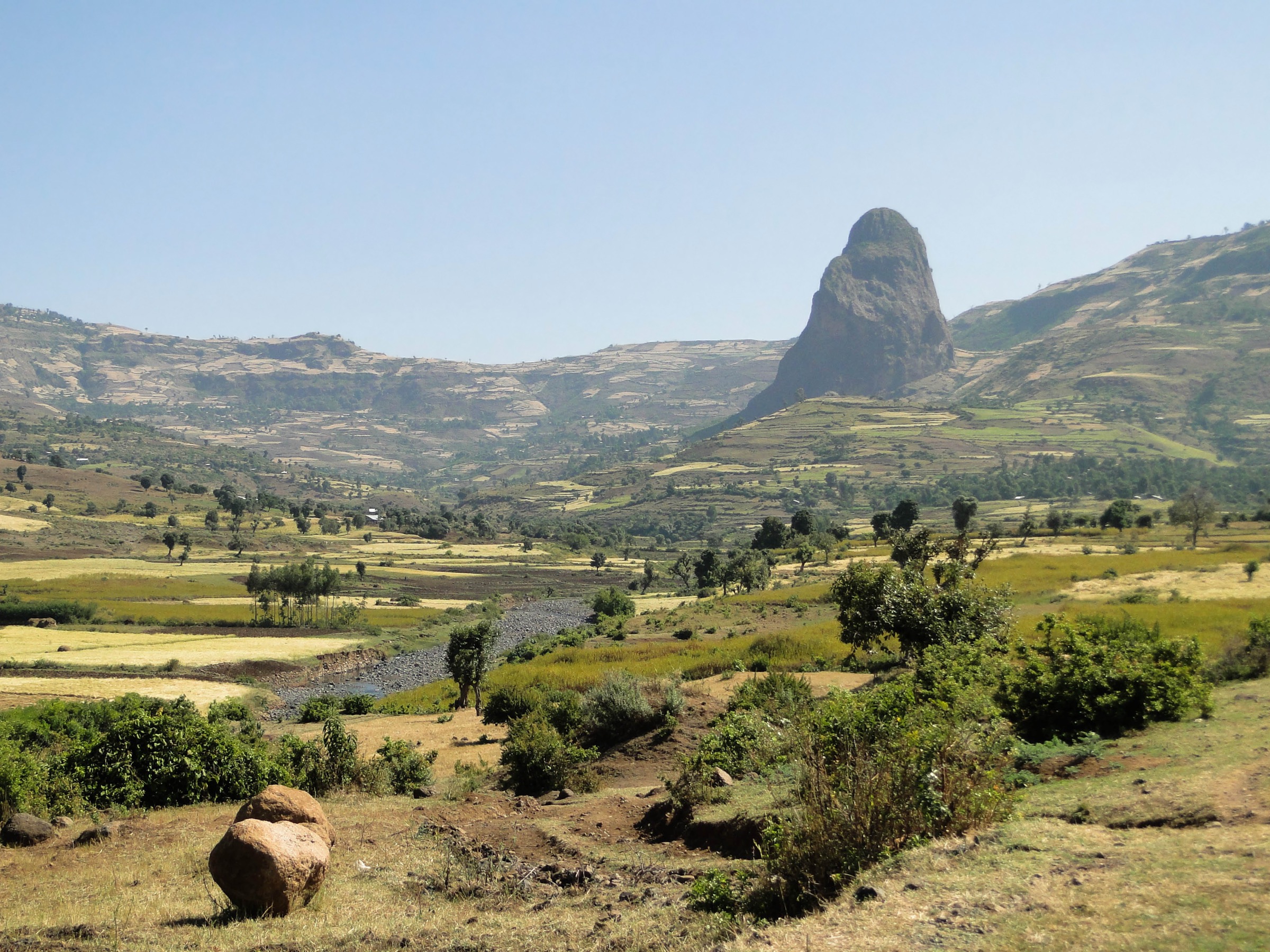
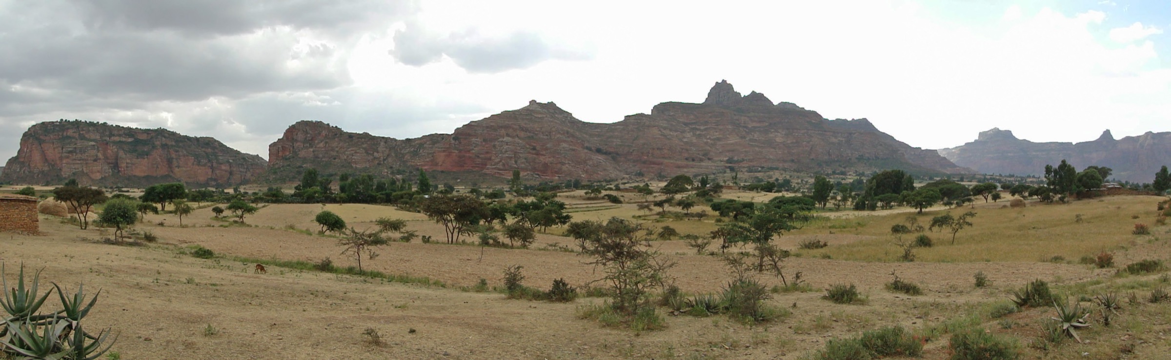
The Gheralta and eastern Tigray escarpment landscape is a sandstone mountain country of isolated towers, cliff faces, dry valleys, ledges, and rock-hewn churches. The best-known walks are not long alpine traverses: they are short, steep cultural-mountain approaches to churches, hermitages, and plateau viewpoints, often involving hands-on rock steps, ladders, exposed ledges, or local guides.
The main walking centres for this entry are Hawzen, Megab, the Gheralta lodge area, and the Teka Tesfai / Saesi Tsaedaemba side of the wider Tigray escarpment. Abuna Yemata Guh and Maryam Korkor are the most internationally recognised objectives; Yohannes Maequddi, Abuna Gebre Mikael, and Petros and Paulos provide a broader sample of the escarpment-church terrain.
The best walking season is normally the dry season, with early starts to avoid heat and afternoon instability. Current access is a major constraint: as of the U.S. Department of State advisory dated 1 April 2026, Tigray Region is listed as “Do Not Travel” due to armed conflict, unrest, and crime. This catalogue entry is therefore a sourceability draft, not a current travel recommendation.
Selection rationale
The five hikes were selected because they represent the core Gheralta/Tigray escarpment walking character: a famous exposed cliff church, a classic plateau church pair, a painted sandstone outcrop church, a gully approach to a major Gheralta church, and a ledge-and-ladder church on the wider eastern Tigray escarpment. Public route geometry remains weak, so most entries are marked partially verified or candidate-only.
Summary table
| # | Hike | Country | Route type | Distance | Gain | Max elevation | Difficulty |
|---|---|---|---|---|---|---|---|
| 1 | Abuna Yemata Guh cliff-church approach | Ethiopia | Out-and-back approach; geometry unresolved | Unresolved | At least about 200 m above surrounding terrain | 2,580 m | Hard / exposed |
| 2 | Maryam Korkor and Daniel Korkor plateau walk | Ethiopia | Out-and-back approach; geometry unresolved | Unresolved | Unresolved | Unresolved | Moderate-hard / exposed |
| 3 | Yohannes Maequddi sandstone-outcrop approach | Ethiopia | Out-and-back approach; geometry unresolved | Unresolved | Outcrop rises about 230 m from valley floor | Unresolved | Moderate-hard |
| 4 | Abuna Gebre Mikael gully approach | Ethiopia | Out-and-back approach; geometry unresolved | Unresolved | Unresolved | Unresolved | Moderate-hard |
| 5 | Petros and Paulos, Teka Tesfai ledge approach | Ethiopia | Out-and-back approach; geometry unresolved | Unresolved | Includes short vertical step/ladders | Unresolved | Hard / exposed |
1. Abuna Yemata Guh Cliff-Church Approach
Snapshot
Itinerary
The route climbs from the valley below Guh toward the sandstone pinnacle containing Abuna Yemata Guh. The approach becomes steep and exposed, using hand- and footholds in the rock before crossing a natural stone bridge and a final narrow wooden bridge to reach the church entrance. The descent reverses the same exposed ground.
Why it is essential
Abuna Yemata Guh is the iconic Gheralta hike: a rock-hewn church set roughly 200 m above the surrounding terrain, known for its dramatic cliff position, monolithic sandstone setting, and wall paintings. It is the clearest example of the region’s blend of mountain exposure and active religious heritage.
Equipment
Mountain hiking equipment: sturdy footwear with good friction, sun protection, water, weatherproof layer, warm layer for exposed waiting time, and navigation backup. A local guide is strongly recommended and may be required in practice. Do not carry a large pack through the exposed upper section.
Hazards and notes
The upper approach is steep and hazardous, with severe exposure. Anyone uncomfortable with unprotected rock steps, narrow ledges, and drops should not attempt the final section. Current Tigray security conditions must be checked against official advice; as of the U.S. advisory of 1 April 2026, Tigray Region is “Do Not Travel”.
GPX / KML links
| Source | URL | Format / access | Reuse status |
|---|---|---|---|
| OpenStreetMap point/map | openstreetmap.org | Source map, not a route file | OSM data is ODbL; useful for location cross-checking only; no route geometry selected |
| Wikiloc search | wikiloc.com | Search page | Wikiloc terms apply if a track is later selected; no GPX selected in this pass |
External links
- Wikipedia — Abuna Yemata Guh
- BBC Travel — In Ethiopia, an adrenaline-filled act of faith
- The Guardian — Ethiopia’s living churches, in pictures
- U.S. Department of State — Ethiopia Travel Advisory (1 April 2026)
2. Maryam Korkor and Daniel Korkor Plateau Walk

Snapshot
Itinerary
The approach climbs a steep path from the Megab side to the sandstone plateau holding Debre Maryam Qorqor. From the plateau, a short continuation leads to the small Daniel Korkor church/hermitage on a dramatic cliff edge. The return normally reverses the approach path. The exact public route line, distance, and total ascent were not verified in this pass.
Why it is essential
Maryam Korkor is one of the major Gheralta churches, valued for its scale, plateau position, and mural cycle. Daniel Korkor adds one of the region’s strongest cliff-edge viewpoints, reported as sitting above a roughly 300 m precipice.
Equipment
Mountain hiking equipment, including sturdy footwear, water, sun protection, warm/weatherproof layer, and navigation backup. A local guide is recommended because route signage and access rules are not confirmed.
Hazards and notes
The route includes steep ground and exposed terrain near Daniel Korkor. Early starts are advisable in hot dry-season conditions. Current Tigray security restrictions are a major unresolved access issue.
GPX / KML links
| Source | URL | Format / access | Reuse status |
|---|---|---|---|
| OpenStreetMap point/map | openstreetmap.org | Source map, not a route file | OSM data is ODbL; useful for location cross-checking only; no route geometry selected |
| Wikiloc search | wikiloc.com | Search page | Wikiloc terms apply if a track is later selected; no GPX selected in this pass |
External links
- Wikipedia — Debre Maryam Qorqor
- The Guardian — Ethiopia’s living churches, in pictures
- U.S. Department of State — Ethiopia Travel Advisory (1 April 2026)
3. Yohannes Maequddi Sandstone-Outcrop Approach
Snapshot
Itinerary
The route objective is the sandstone outcrop church of Yohannes Maequddi, one of the painted basilica-style churches of the Gheralta mountains. Public sources identify the church and its outcrop setting, but this pass did not verify a publication-ready path line, trailhead, distance, or total ascent.
Why it is essential
Yohannes Maequddi is included because it broadens the selection beyond the two most famous Gheralta climbs and represents the painted cliff/outcrop churches south-east of the main Hawzen-Megab cluster.
Equipment
Mountain hiking equipment: sturdy footwear, water, sun protection, weatherproof layer, and navigation backup. Local guiding is recommended.
Hazards and notes
Exposure and route-finding difficulty are unresolved. The route should remain candidate-only until a specific local trailhead and mapped route are verified.
GPX / KML links
| Source | URL | Format / access | Reuse status |
|---|---|---|---|
| OpenStreetMap point/map | openstreetmap.org | Source map, not a route file | OSM data is ODbL; useful for location cross-checking only; no route geometry selected |
| Wikiloc search | wikiloc.com | Search page | Wikiloc terms apply if a track is later selected; no GPX selected in this pass |
External links
- Wikipedia (French) — Yohannes Maequddi
- The Guardian — Ethiopia’s living churches, in pictures
- U.S. Department of State — Ethiopia Travel Advisory (1 April 2026)
4. Abuna Gebre Mikael Gully Approach
Snapshot
Itinerary
The published description available in this pass identifies Abuna Gebre Mikael as a Gheralta church reached through a mountain gully where the approach involves moving from slab to slab. A complete guidebook itinerary, measured distance, ascent, and route file were not verified.
Why it is essential
Abuna Gebre Mikael is included as a distinct gully-and-church objective within the Gheralta range, giving the selection more variety than five cliff-edge church approaches from the same trailhead.
Equipment
Mountain hiking equipment, with grippy footwear and enough water. A local guide is recommended because the route line and access rules are unresolved.
Hazards and notes
The approach may involve rock slabs, awkward footing, and route-finding in a gully. It should remain candidate-only until local access, current conditions, and route statistics are verified.
GPX / KML links
| Source | URL | Format / access | Reuse status |
|---|---|---|---|
| Wikiloc search | wikiloc.com | Search page | Wikiloc terms apply if a track is later selected; no GPX selected in this pass |
| OpenStreetMap search | openstreetmap.org | Source map/search | OSM data is ODbL; candidate geometry cross-check only |
External links
- The Guardian — Ethiopia’s living churches, in pictures
- U.S. Department of State — Ethiopia Travel Advisory (1 April 2026)
5. Petros and Paulos, Teka Tesfai Ledge Approach
Snapshot
Itinerary
The objective is the ledge church of Petros and Paulos near Teka Tesfai on the wider eastern Tigray escarpment. Available description places the church on a narrow ledge under an overhanging cliff and notes that historical access involved a short vertical rock climb, with a ladder now reported. The full route line, trailhead, and route statistics were not verified.
Why it is essential
This hike represents the wider Tigray escarpment beyond the core Hawzen-Megab cluster, while keeping the same defining character: short mountain approaches to cliff and rock-hewn church sites.
Equipment
Mountain hiking equipment, with grippy footwear and enough water. A helmet may be worth considering if local guides report rockfall risk near the cliff. Local guidance is essential before attempting ladder or ledge access.
Hazards and notes
The approach may involve a ladder, narrow ledge, overhanging cliff, and severe exposure. The route is not publication-ready without current local confirmation of the ladder/approach condition and access rules.
GPX / KML links
| Source | URL | Format / access | Reuse status |
|---|---|---|---|
| OpenStreetMap search | openstreetmap.org | Source map/search | OSM data is ODbL; candidate geometry cross-check only |
| Wikiloc search | wikiloc.com | Search page | Wikiloc terms apply if a track is later selected; no GPX selected in this pass |
External links
- The Guardian — Ethiopia’s living churches, in pictures
- Wikipedia — Saesi Tsaedaemba
- U.S. Department of State — Ethiopia Travel Advisory (1 April 2026)
External links
| Source | URL |
|---|---|
| UNESCO World Heritage Centre — Sacred Landscapes of Tigray (tentative list) | whc.unesco.org |
| Wikipedia — Abuna Yemata Guh | en.wikipedia.org |
| Wikipedia — Debre Maryam Qorqor | en.wikipedia.org |
| Wikipedia (French) — Yohannes Maequddi | fr.wikipedia.org |
| Wikipedia — Saesi Tsaedaemba | en.wikipedia.org |
| The Guardian — Ethiopia’s living churches, in pictures | theguardian.com |
| BBC Travel — In Ethiopia, an adrenaline-filled act of faith | bbc.com |
| U.S. Department of State — Ethiopia Travel Advisory (1 April 2026) | travel.state.gov |