.jpg)


.jpg)

_(28664897084).jpg)
Regional overview
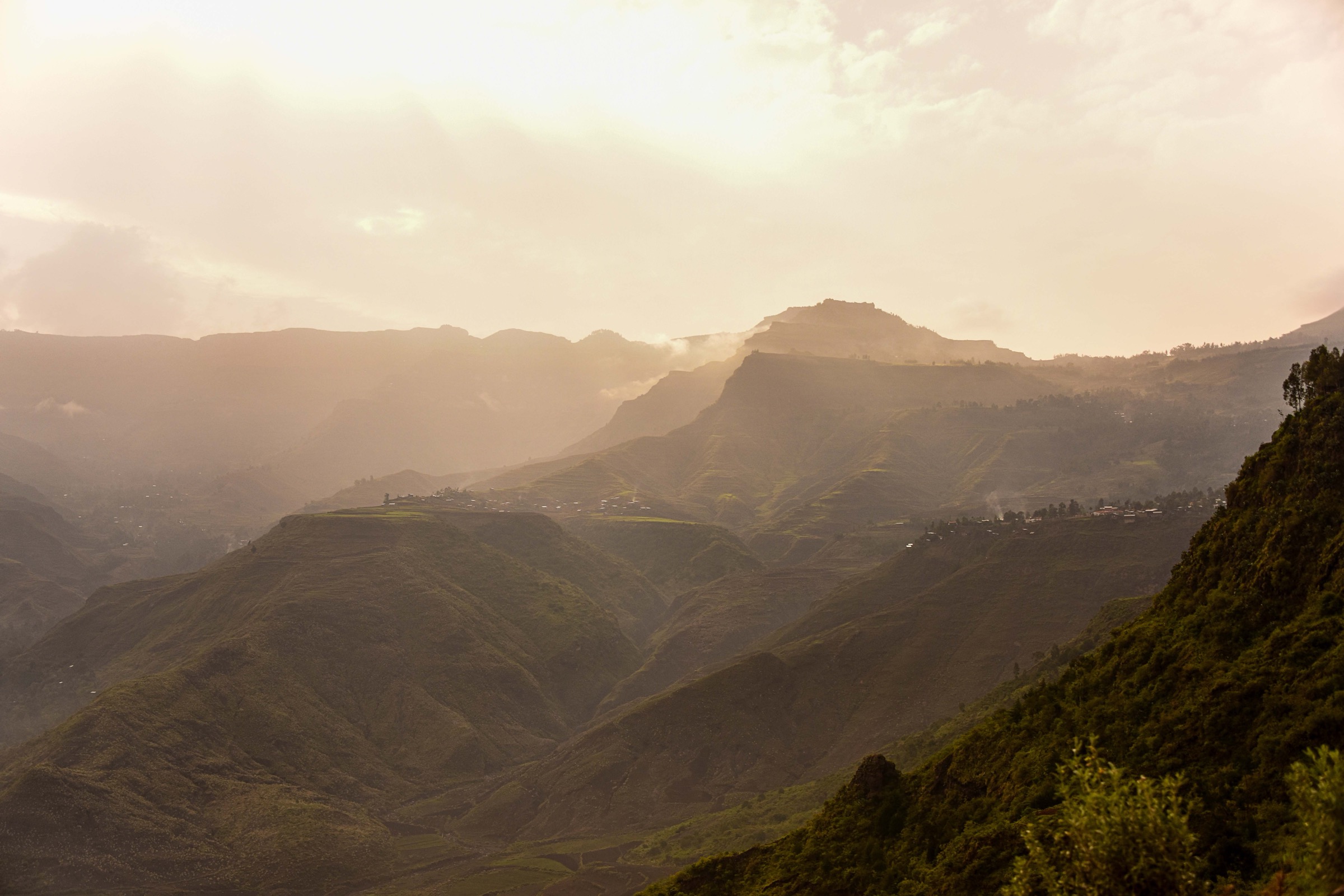
Bale Mountains National Park protects a large south-eastern Ethiopian highland massif of volcanic peaks, Sanetti Plateau Afro-alpine moorland, Gaysay grasslands, Web Valley, Harenna escarpment and Harenna Forest. UNESCO describes the park as a mosaic of volcanic peaks, ridges, escarpments, valleys, glacial lakes, forests, gorges and waterfalls with exceptional biodiversity.
The main hiking centres are Dinsho park headquarters, Goba/Robe for Sanetti access, the Web Valley track, Rira and the Harenna Forest / Bale Mountain Lodge area. Hiking ranges from short forest loops and wildlife grassland walks to high-altitude summit walks on the Sanetti Plateau. Local registered guides are required or strongly expected for park trekking and excursions.
The Bale guidebook gives October to April as the best trekking season. May to September is wetter, with frequent rain and mist; trails can be muddy from June to October. The plateau is cold, windy and often near freezing at night, while the Harenna Forest is warmer but still remote.
Selection rationale
The five hikes below cover the essential Bale day-walking environments: Web Valley waterfall and Afro-alpine wildlife, Gaysay grassland mammals, Tullu Dimtu high summit, Harenna bamboo-waterfall forest, and Gushuralle Peak forest overlook.
Summary table
| # | Hike | Country | Route type | Distance | Gain | Max elevation | Difficulty |
|---|---|---|---|---|---|---|---|
| 1 | Web Valley Walk to Finch Habera | Ethiopia | Out-and-back / point-to-point | 18 km road, 3.5-4 h walk one-way | Not verified | c. 3,500-4,000 m | Moderate-hard |
| 2 | Gaysay Grasslands and Web River Waterfall | Ethiopia | Short loop / out-and-back | 7 km drive + sub-1 h waterfall walk | Not verified | c. 3,000 m | Easy-moderate |
| 3 | Tullu Dimtu from Sanetti Plateau Road | Ethiopia | Out-and-back | About 4 km spur | Not verified | 4,377 m | Moderate-hard due altitude |
| 4 | Harenna Bamboo and Waterfall Trail | Ethiopia | Loop / one-way variant | 2 h sub-HQ loop; 5-6 h lodge variant | Not verified | c. 2,200 m at Rira area | Moderate |
| 5 | Gushuralle Peak Forest Trail | Ethiopia | Out-and-back | 2-3 h return | Not verified | Not verified | Moderate |
1. Web Valley Walk to Finch Habera

Snapshot
Itinerary
The hike starts from park headquarters and follows the Web Valley road/track into the park. The route passes farmland on the park edge, follows the Web River gorge, crosses the river, rises into open Afro-alpine habitat and reaches Finch Habera waterfall, a picnic/camping point. Wildlife along the route may include mountain nyala, Menelik’s bushbuck, warthog, rock hyrax and birds of prey.
Why it is essential
This is the most direct day-walk introduction to the Web Valley and the Afro-alpine landscape that makes Bale distinctive.
Equipment
Mountain hiking equipment, water treatment, sun protection, warm layer and rain shell. Trekking poles useful in wet conditions.
Hazards and notes
The road is rough and can be impassable to vehicles after heavy rain. The waterfall varies seasonally. Water should be treated. Guides are arranged through the park/guide association.
GPX / KML links
| Source | URL | Format / access | Reuse status |
|---|---|---|---|
| Bale Mountains National Park travel guide | balemountains.org PDF | PDF route description | Copyrighted guide; facts only; no GPX |
| OpenStreetMap map area | openstreetmap.org | Source map | ODbL; manual GPX creation required |
External links
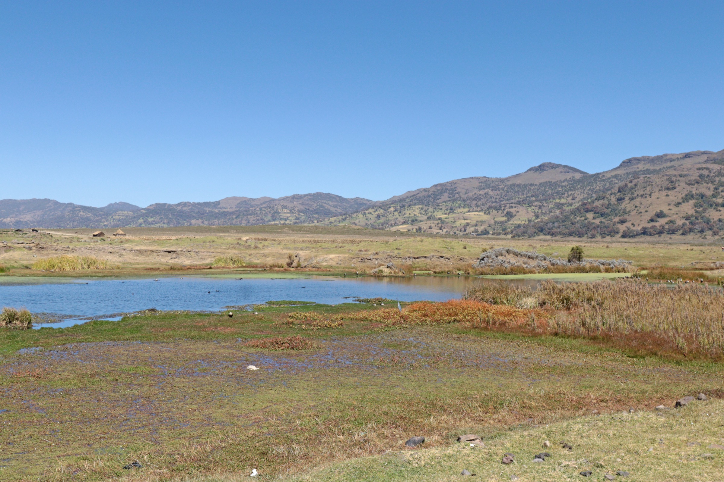
2. Gaysay Grasslands and Web River Waterfall

Snapshot
Itinerary
From the Gaysay grasslands area, short walks cross waist-high grasses and wildflowers where mountain nyala, Menelik’s bushbuck, warthog, duiker and reedbuck may be seen. The route can be extended to the Web River waterfall, reached on foot in under an hour from the main road according to the guidebook.
Why it is essential
Gaysay is the easiest day-hike environment for Bale’s endemic mammal viewing and contrasts strongly with the high plateau and Harenna Forest routes.
Equipment
Standard hiking equipment, sun protection, water, binoculars recommended, waterproof shoes in wet months.
Hazards and notes
Stay on designated areas and follow guide instructions around wildlife. Trails can be muddy in the wet season.
GPX / KML links
| Source | URL | Format / access | Reuse status |
|---|---|---|---|
| Bale Mountains National Park travel guide | balemountains.org PDF | PDF route description | Copyrighted guide; facts only; no GPX |
| OpenStreetMap map area | openstreetmap.org | Source map | ODbL; manual GPX creation required |
External links
3. Tullu Dimtu from Sanetti Plateau Road

Snapshot
Itinerary
From the Sanetti Plateau road, the route leaves the main road on the Tullu Dimtu spur and climbs to the summit of the “Red Mountain”. The walk is short but very high, crossing open Afro-alpine plateau with broad views when clear.
Why it is essential
Tullu Dimtu is the highest point of the Bale Mountains and the most accessible high summit in the region.
Equipment
Mountain hiking equipment, warm windproof layer, sun protection, water and navigation backup.
Hazards and notes
Altitude, wind, cold and fast-changing weather are the main risks. The guidebook notes the summit can also be reached by vehicle; walking parties should avoid relying on the road in poor weather.
GPX / KML links
| Source | URL | Format / access | Reuse status |
|---|---|---|---|
| Bale Mountains National Park travel guide | balemountains.org PDF | PDF route description | Copyrighted guide; facts only; no GPX |
| OpenStreetMap map area | openstreetmap.org | Source map | ODbL; manual GPX creation required |
External links
- Bale Mountains National Park Travel Guide PDF
- Wikimedia Commons — Sanetti Plateau (Rod Waddington, CC BY-SA 2.0)
4. Harenna Bamboo and Waterfall Trail

Snapshot
Itinerary
The trail visits two waterfalls in a narrow bamboo-filled canyon less than an hour from central Rira. From the sub-headquarters loop, the route descends through forest and open range, crosses the river by a natural land bridge, climbs around the first waterfall to the second waterfall and returns via a loop with views over the canyon. A longer one-way option links Bale Mountain Lodge with the falls.
Why it is essential
This is the most accessible Harenna Forest waterfall walk and represents Bale’s lower, wetter forest ecosystem.
Equipment
Standard to mountain hiking equipment depending on variant, waterproof footwear, rain shell, water, insect/tick awareness, and navigation with local guide.
Hazards and notes
The canyon and waterfall area may be slippery. Avoid river crossings in heavy rain. Wildlife sightings are possible but not guaranteed.
GPX / KML links
| Source | URL | Format / access | Reuse status |
|---|---|---|---|
| Bale Mountains National Park travel guide | balemountains.org PDF | PDF route description | Copyrighted guide; facts only; no GPX |
| OpenStreetMap map area | openstreetmap.org | Source map | ODbL; manual GPX creation required |
External links
5. Gushuralle Peak Forest Trail

Snapshot
Itinerary
Beginning at Bale Mountain Lodge in the Katcha clearing, the trail enters dense bamboo forest and climbs to the apex of Gushuralle Mountain. The summit provides views across the Harenna Forest. Possible wildlife includes Bale monkey, colobus monkey, Menelik’s bushbuck, warthog, mountain nyala and giant forest hog.
Why it is essential
This is the compact forest-overlook hike for the Harenna side of Bale and complements the waterfall walk with a higher forest viewpoint.
Equipment
Standard hiking equipment, rain shell, sturdy footwear, water and guide/navigation support.
Hazards and notes
Forest trails can be muddy and slippery. Wildlife is present but sightings are uncertain. Confirm access with the lodge or park staff.
GPX / KML links
| Source | URL | Format / access | Reuse status |
|---|---|---|---|
| Bale Mountains National Park travel guide | balemountains.org PDF | PDF route description | Copyrighted guide; facts only; no GPX |
| OpenStreetMap map area | openstreetmap.org | Source map | ODbL; manual GPX creation required |
External links
Missing data / follow-up work
- No official GPX/KML downloads found in this pass.
- Exact distances, elevation gain/loss and maximum elevations for several Bale day walks remain unresolved.
- Current guide fees, park entry fees and road conditions need local confirmation.
- Wet-season trail and vehicle access can change quickly, especially Web Valley and Harenna tracks.
External links
| Resource | Link |
|---|---|
| UNESCO — Bale Mountains National Park | whc.unesco.org |
| Bale Mountains National Park Travel Guide PDF | balemountains.org |