

Regional overview
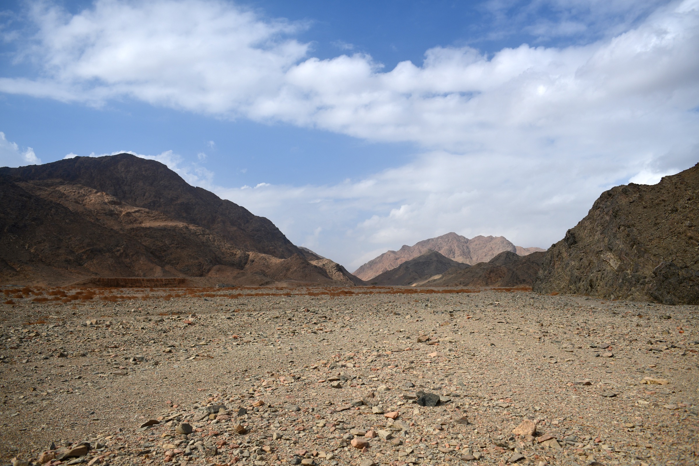
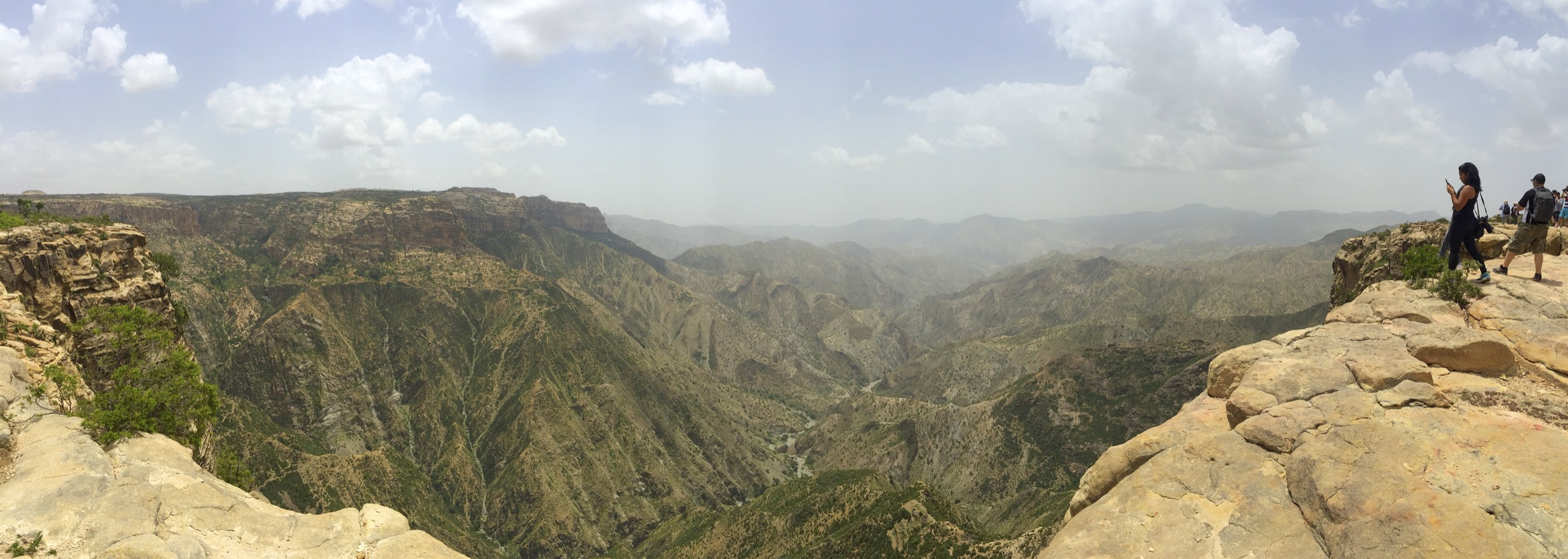
The Eritrean Highlands rise between the Red Sea escarpment and the interior plateau, with granite basins, high villages, ancient monasteries, archaeological plateaus, and steep forested escarpments. The best documented walking objectives are not modern waymarked trails; they are highland cultural sites, national high points, pilgrimage approaches, and protected landscape areas.
This catalogue entry is therefore a candidate research entry, not a publication-ready route guide. The strongest objectives found in this pass are Emba Soira, Qohaito, Debre Bizen, Semenawi Bahri / Filfil-Solomuna, and Debre Sina near Keren. For all five, a reputable public route line with distance, ascent, descent, and GPX/KML was not found.
The U.S. State Department travel advisory for Eritrea was checked on 12 June 2026. It advises increased caution because of travel restrictions, limited consular assistance, landmines, and wrongful detention risk; it also specifically advises caution when walking or hiking in remote areas or off main roads. Special attention is needed around Keren, Massawa, Ghinda, and other remote areas where landmine risk is noted.
Selection rationale
The five candidates cover the main essential highland themes: Eritrea’s national high point, a major archaeological plateau, a historic monastery mountain, a cloud-forest/escarpment landscape, and a living pilgrimage site. All are kept as candidate only because no reliable day-hike route files or complete route statistics were verified.
Summary table
| # | Hike | Country | Route type | Distance | Gain | Max elevation | Difficulty |
|---|---|---|---|---|---|---|---|
| 1 | Emba Soira summit candidate | Eritrea | Out-and-back/traverse unresolved | Unresolved | Unresolved | 3,018 m | Candidate only |
| 2 | Qohaito plateau archaeological walk | Eritrea | Local circuit unresolved | Unresolved | Unresolved | Over 2,500 m plateau | Candidate only |
| 3 | Debre Bizen monastery approach | Eritrea | Mountain approach unresolved | Unresolved | Unresolved | 2,460 m | Candidate only |
| 4 | Semenawi Bahri / Filfil-Solomuna forest walk | Eritrea | Forest road/trail walk unresolved | Unresolved | Unresolved | 900-2,400 m area range | Candidate only |
| 5 | Debre Sina pilgrimage approach | Eritrea | Pilgrimage approach unresolved | Unresolved | Unresolved | Unresolved | Candidate only |
1. Emba Soira summit candidate
Snapshot
Itinerary
A publication-ready itinerary was not verified. Emba Soira is documented as Eritrea’s highest mountain, rising to 3,018 m in the Eritrean Highlands. A hiking route, trailhead, access permission, distance, ascent, and descent were not verified in public sources during this pass.
Why it is essential
As the national high point and a major feature of the Eritrean Highlands, Emba Soira is the natural summit candidate for any Eritrean Highlands day-hike catalogue. It remains a research target until a legal and locally supported day-hike line is confirmed.
Equipment
Mountain hiking equipment: sturdy boots, warm layer, weatherproof layer, sun protection, water, food, map/GPS, navigation backup, and headtorch. A local guide and current travel authorisation should be assumed necessary until disproved.
Hazards and notes
Route access, land access, military/security sensitivity, landmine risk in remote Eritrean areas, and rescue options are unresolved. Do not publish an independent GPX or trailhead without local verification.
GPX / KML links
| Source | URL | Format / access | Reuse status |
|---|---|---|---|
| OpenStreetMap search: Emba Soira | openstreetmap.org | Source map/search | OSM data is ODbL; geometry cross-check only |
| Wikiloc search: Emba Soira | wikiloc.com | Search page | Wikiloc terms apply if a track is later selected; candidate source only |
External links
- Wikipedia — Emba Soira
- U.S. State Department — Eritrea travel advisory
- Wikimedia Commons search — Emba Soira
2. Qohaito plateau archaeological walk

Snapshot
Itinerary
A publication-ready walking line was not verified. The candidate is a low-impact circuit or out-and-back among the Qohaito plateau ruins, including the Sahira Dam, the Mariam Wakino temple/church area, columns, tombs, rock art areas, and escarpment views where access is permitted. UNESCO and secondary sources describe Qohaito as a major high-plateau archaeological landscape, but do not provide hiking statistics.
Why it is essential
Qohaito is one of the most important cultural landscapes in the Eritrean Highlands and gives the catalogue a highland archaeology route rather than a purely summit-focused selection.
Equipment
Standard hiking equipment: sturdy shoes, sun protection, water, food, weather layer, and navigation. Respect archaeological-site rules; do not walk on fragile remains or disturb rock art.
Hazards and notes
Access permissions, site conservation rules, local guiding, and exact route geometry are unresolved. Cliffs and ravines around the plateau require caution. The U.S. advisory’s cautions on remote-area walking and travel restrictions apply.
GPX / KML links
| Source | URL | Format / access | Reuse status |
|---|---|---|---|
| OpenStreetMap search: Qohaito | openstreetmap.org | Source map/search | OSM data is ODbL; geometry cross-check only |
| UNESCO tentative listing/search context | whc.unesco.org | Heritage source, not a route file | UNESCO page terms apply; context only |
| Wikiloc search: Qohaito | wikiloc.com | Search page | Wikiloc terms apply if a track is later selected; candidate source only |
External links
- Wikipedia — Qohaito
- UNESCO World Heritage Centre — tentative list search
- U.S. State Department — Eritrea travel advisory
- Wikimedia Commons — Kohaito, paesaggio sull’altipiano 01
3. Debre Bizen monastery approach

Snapshot
Itinerary
A publication-ready itinerary was not verified. The candidate is the traditional mountain approach to Debre Bizen above Nefasit. Sources identify Debre Bizen as an Eritrean Orthodox monastery on a 2,460 m mountain near Nefasit, with an important manuscript tradition. A legal visitor route, access restrictions, distance, and elevation gain were not verified.
Why it is essential
Debre Bizen is one of Eritrea’s defining monastery mountains and gives the catalogue a highland religious-history route close to the Red Sea escarpment.
Equipment
Mountain hiking equipment: sturdy footwear, water, sun protection, warm/weather layer, map/GPS, and modest clothing appropriate for a religious site.
Hazards and notes
Religious-site access, gender/visitor restrictions, local permissions, and current route conditions need confirmation. The U.S. advisory notes landmine risk near Massawa and Ghinda, so off-road walking should not be assumed safe without local clearance.
GPX / KML links
| Source | URL | Format / access | Reuse status |
|---|---|---|---|
| OpenStreetMap search: Debre Bizen | openstreetmap.org | Source map/search | OSM data is ODbL; geometry cross-check only |
| Wikiloc search: Debre Bizen | wikiloc.com | Search page | Wikiloc terms apply if a track is later selected; candidate source only |
External links
- Wikipedia — Debre Bizen
- Wikipedia — Nefasit
- U.S. State Department — Eritrea travel advisory
- Wikimedia Commons — Debre Bizen
4. Semenawi Bahri / Filfil-Solomuna forest walk
Snapshot
Itinerary
A publication-ready itinerary was not verified. Semenawi Bahri is described as a mountainous, forested national-park or proposed/protected landscape with an asphalt road crossing the area and recreation centres at Meguo, Medhanit and Sabur. A future day hike should use a locally approved forest or viewpoint section between Filfil and Solomuna rather than an invented off-road line.
Why it is essential
This is the strongest forest-and-escarpment candidate in the Eritrean Highlands, representing the green belt, birding, and steep Red Sea escarpment landscape.
Equipment
Standard to mountain hiking equipment: sturdy footwear, rain/wind layer, water, food, sun protection, map/GPS, and navigation backup. Binoculars are useful for birding.
Hazards and notes
Route legality, protected-area status, guide requirements, landmine risk near remote roads, and current road/security conditions are unresolved. Fog and steep escarpment terrain can complicate navigation.
GPX / KML links
| Source | URL | Format / access | Reuse status |
|---|---|---|---|
| OpenStreetMap search: Semenawi Bahri | openstreetmap.org | Source map/search | OSM data is ODbL; geometry cross-check only |
| Wikiloc search: Semenawi Bahri | wikiloc.com | Search page | Wikiloc terms apply if a track is later selected; candidate source only |
External links
- Wikipedia — Semenawi Bahri National Park
- Wikipedia (Spanish) — Áreas protegidas de Eritrea
- U.S. State Department — Eritrea travel advisory
- Wikimedia Commons search — Semenawi Bahri Filfil Eritrea
5. Debre Sina pilgrimage approach
Snapshot
Itinerary
A publication-ready route was not verified. The candidate is the pilgrimage approach to Debre Sina near Keren, centred on the monastery/church site and its associated boulder/cave tradition. Sources identify Debre Sina as an old Eritrean Orthodox monastery and an annual pilgrimage destination.
Why it is essential
Debre Sina adds a living pilgrimage landscape to the selection and gives the Eritrean Highlands entry a route rooted in local religious practice rather than scenery alone.
Equipment
Standard hiking equipment: sturdy shoes, water, sun protection, weather layer, food, and modest clothing appropriate for a religious site.
Hazards and notes
The U.S. advisory specifically notes landmine risk in areas north and west of Keren. Any off-road route or pilgrimage approach must be locally confirmed as safe and permitted. Event crowding, religious protocols, and visitor restrictions need confirmation.
GPX / KML links
| Source | URL | Format / access | Reuse status |
|---|---|---|---|
| OpenStreetMap search: Debre Sina | openstreetmap.org | Source map/search | OSM data is ODbL; geometry cross-check only |
| Wikiloc search: Debre Sina | wikiloc.com | Search page | Wikiloc terms apply if a track is later selected; candidate source only |
External links
- Wikipedia — Debre Sina monastery
- Wikipedia — Keren, Eritrea
- U.S. State Department — Eritrea travel advisory
- Wikimedia Commons search — Debre Sina Eritrea
Missing data / follow-up work
- No official or reusable GPX/KML route files found for the selected Eritrean Highlands candidates.
- No verified route distances, ascent/descent, or walking times found.
- Emba Soira, Semenawi Bahri, and Debre Sina need licence-compatible route-specific images.
- Religious-site access rules, visitor restrictions, guide requirements, and current travel-permit rules need local confirmation.
- Landmine and remote-area safety checks are essential before publishing any off-road route.
External links
| Source | URL |
|---|---|
| Wikipedia — Emba Soira | en.wikipedia.org |
| Wikipedia — Qohaito | en.wikipedia.org |
| Wikipedia — Debre Bizen | en.wikipedia.org |
| Wikipedia — Semenawi Bahri National Park | en.wikipedia.org |
| Wikipedia — Debre Sina monastery | en.wikipedia.org |
| Wikipedia — Keren, Eritrea | en.wikipedia.org |
| U.S. State Department — Eritrea travel advisory | travel.state.gov |
| OpenStreetMap | openstreetmap.org |
| Wikiloc search | wikiloc.com |
| AllTrails search | alltrails.com |