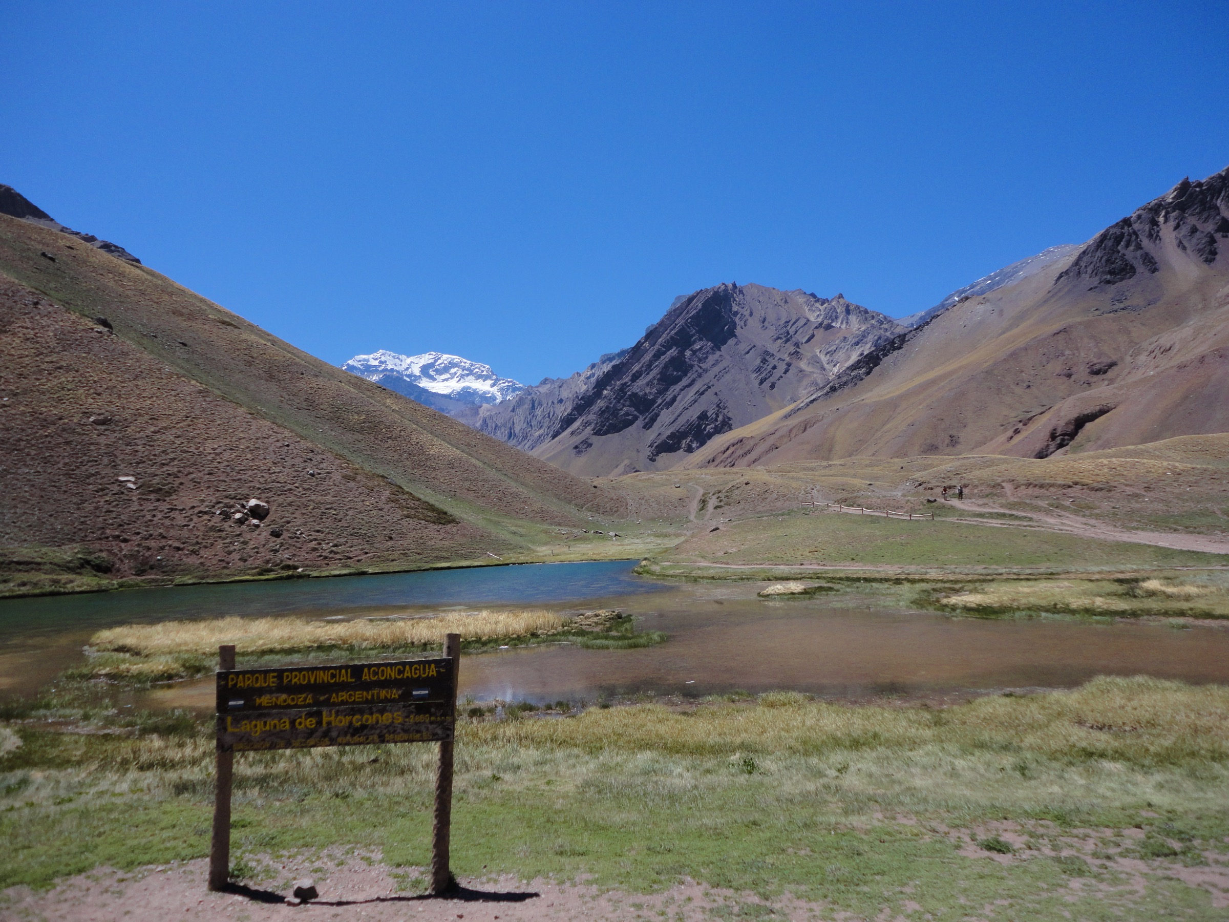
Regional overview
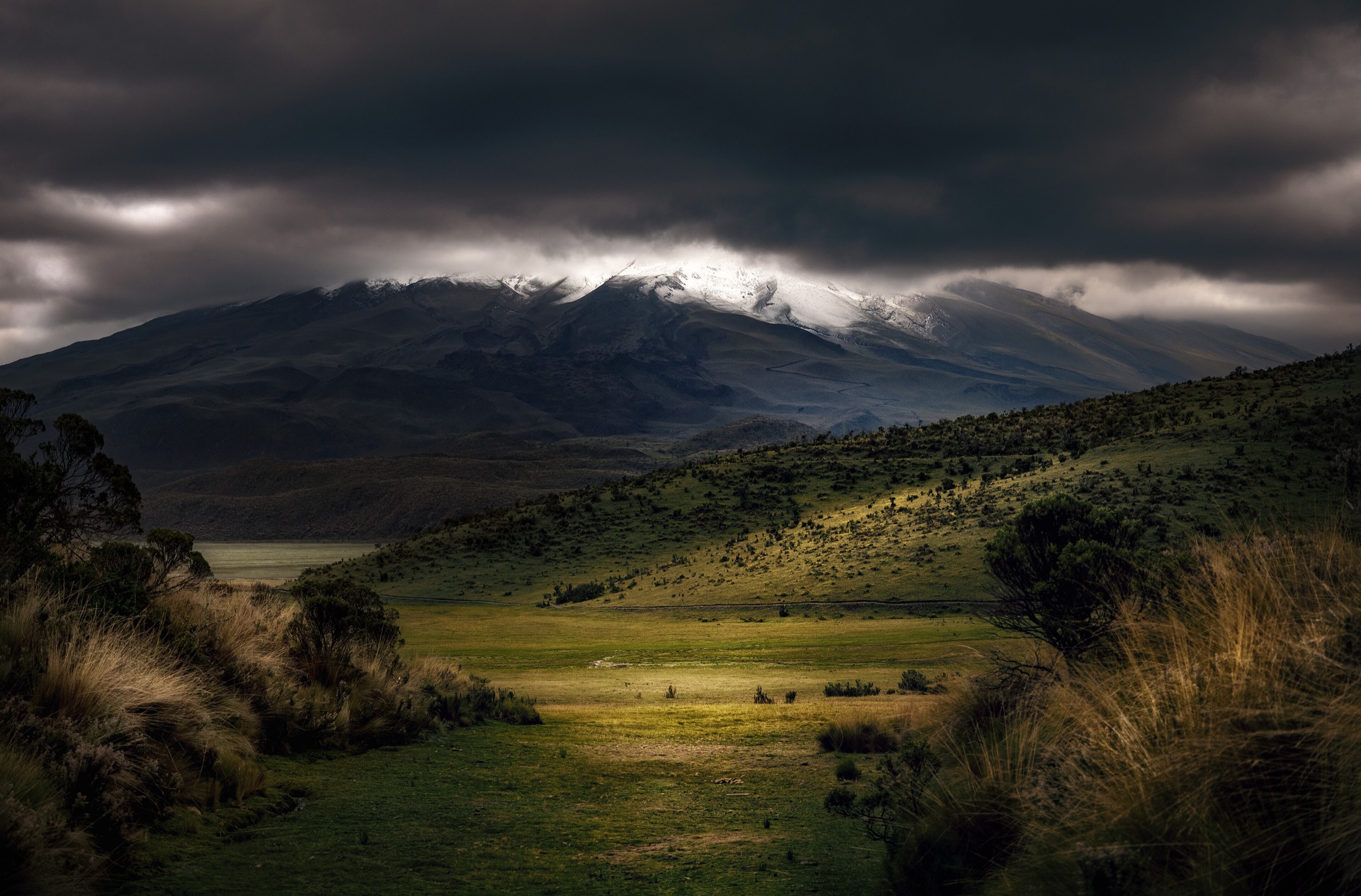
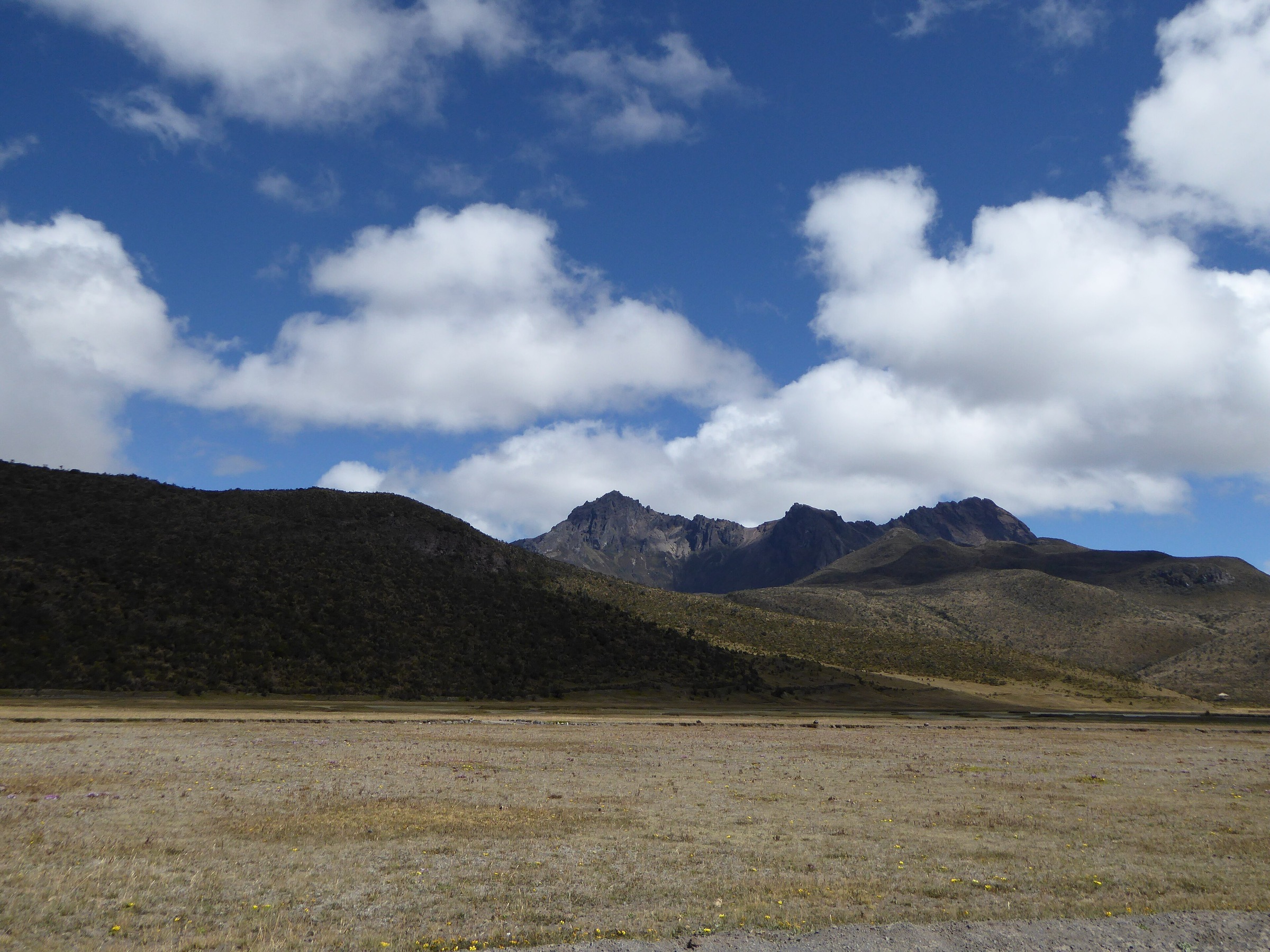
The Cotopaxi / Avenue of Volcanoes region is high, open páramo and big-cone volcano country south of Quito. Classic day hikes include short high-altitude refuge approaches, crater rims, acclimatisation summits and non-technical high passes. Weather, altitude and volcanic access updates are central planning issues.
Selection rationale
The selection covers the defining experiences of the Cotopaxi / Avenue of Volcanoes corridor: the iconic Cotopaxi refuge and glacier-viewpoint walk, the classic Cotopaxi-view summit of Rumiñahui, the Quilotoa crater rim, the non-technical Ilinizas high pass, and the Cerro El Corazón acclimatisation summit. Technical glaciated ascents of Cotopaxi, Iliniza Sur and other roped routes are excluded.
Summary table
| # | Hike | Country | Route type | Distance | Gain | Max elevation | Difficulty |
|---|---|---|---|---|---|---|---|
| 1 | Cotopaxi José Rivas Refuge and Glacier Viewpoint | Ecuador | Out-and-back / short loop | Approx. 2.4 km | Approx. 221 m | Approx. 4,800-5,000 m | Moderate by terrain, hard by altitude |
| 2 | Rumiñahui from Laguna Limpiopungo | Ecuador | Out-and-back | 11.3 km | 865 m | Approx. 4,722 m | Hard |
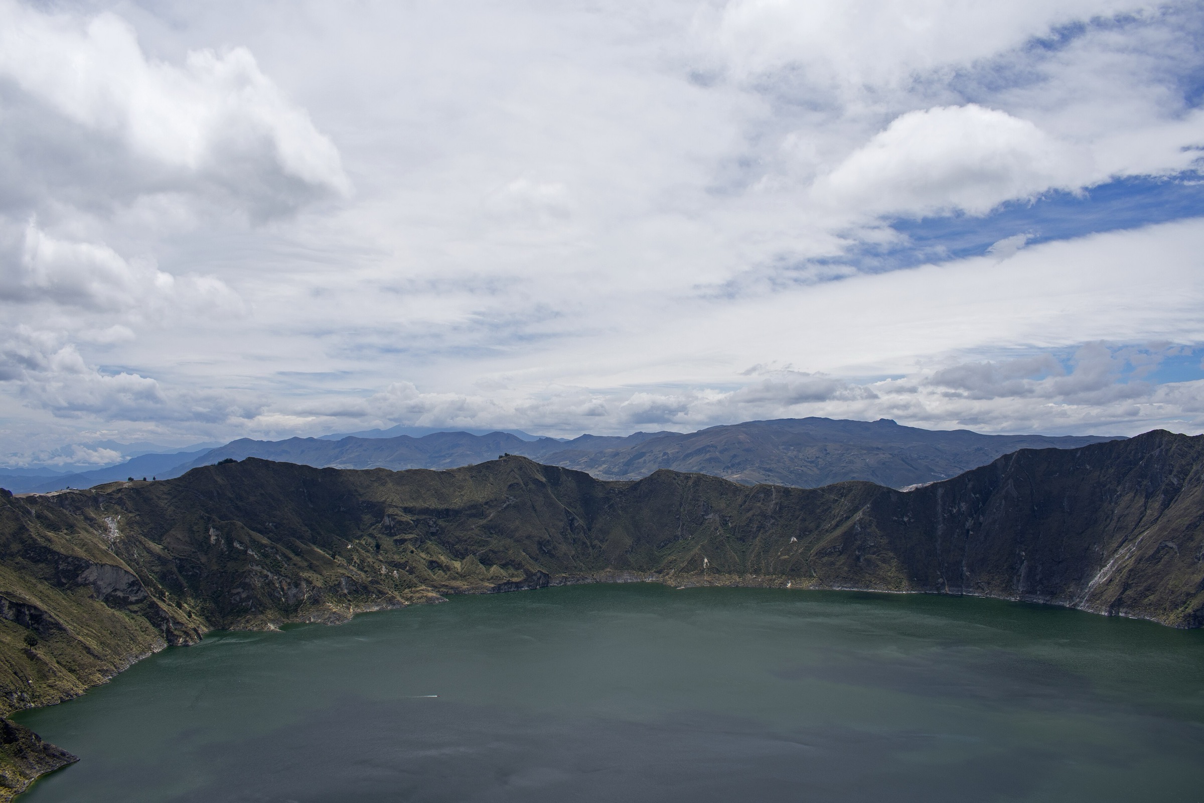
| 3 | Quilotoa Crater Rim Circuit | Ecuador | Loop | 10.8 km | 795 m | Approx. 3,914 m | Hard |
| 4 | Ilinizas Refuge / Laguna de los Ilinizas | Ecuador | Out-and-back | 10.9 km | 968 m | Approx. 4,700 m | Strenuous |
| 5 | Cerro El Corazón via El Chaupi | Ecuador | Out-and-back | 14.3 km | 1,124 m | Approx. 4,788-4,800 m | Strenuous |
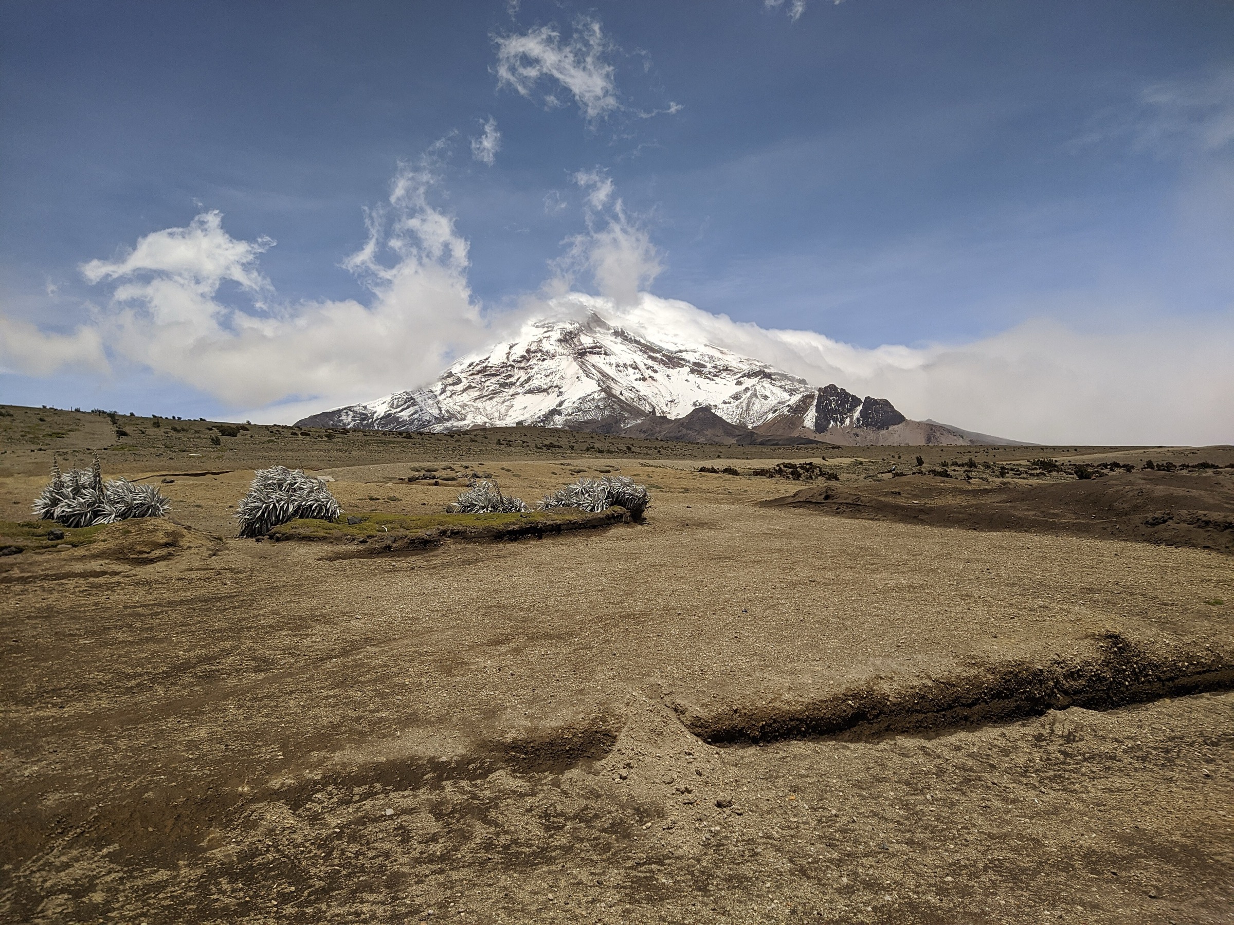
1. Cotopaxi José Rivas Refuge and Glacier Viewpoint
Snapshot
Itinerary
Short but high volcanic-scree ascent to José Rivas Refuge, with optional continuation toward the glacier edge when conditions and access allow. No glacier travel included.
Why it is essential
The iconic non-technical Cotopaxi experience and one of the highest simple day walks in Ecuador.
Equipment
- Warm/windproof clothing
- Gloves
- Hat
- Sunglasses
- Sun protection
- Water
Hazards and notes
- Severe altitude effect.
- Wind and cold.
- Volcanic ash/scree.
- Access closures.
- Do not enter glacier terrain without appropriate guide/equipment.
GPX / KML links
| Source | URL | Format / access | Reuse status |
|---|---|---|---|
| AllTrails: Refugio José Rivas | alltrails.com | Source map; AllTrails terms apply | Platform terms not verified; treat as non-reusable |
| Outdooractive: Refugio José Rivas | outdooractive.com | Source map; Outdooractive terms apply | Platform terms not verified; treat as non-reusable |
External links
2. Rumiñahui from Laguna Limpiopungo
Snapshot
Itinerary
Páramo ascent from the Limpiopungo area toward Rumiñahui’s ridge/summit viewpoints, with major views of Cotopaxi.
Why it is essential
The classic Cotopaxi viewpoint hike and one of the best non-glaciated high routes in the park.
Equipment
- Full mountain day kit
- Waterproofs
- Warm layers
- Navigation
- Poles
Hazards and notes
- Altitude.
- Loose rock.
- Cold wind.
- Fog/navigation issues.
GPX / KML links
| Source | URL | Format / access | Reuse status |
|---|---|---|---|
| AllTrails: Cerro Rumiñahui | alltrails.com | Source map; AllTrails terms apply | Platform terms not verified; treat as non-reusable |
| Andes Handbook: Normal desde el Norte | andeshandbook.org | Mountain route reference; no GPX | Context only |
External links
3. Quilotoa Crater Rim Circuit
Snapshot
Itinerary
Full rim walk around the turquoise Quilotoa crater lake on an irregular sandy and eroded rim path.
Why it is essential
Ecuador’s most famous crater-lake hike and a defining Avenue of Volcanoes landscape.
Equipment
- Hiking shoes
- Windproof layer
- Sun protection
- Water
- Poles useful
Hazards and notes
- Exposed rim.
- Eroded sandy trail.
- Altitude.
- Steep drop-offs in places.
GPX / KML links
| Source | URL | Format / access | Reuse status |
|---|---|---|---|
| AllTrails: Laguna Quilotoa | alltrails.com | Source map; AllTrails terms apply | Platform terms not verified; treat as non-reusable |
External links
4. Ilinizas Refuge / Laguna de los Ilinizas
Snapshot
Itinerary
Páramo ascent to the high refuge and saddle/lagoon area between Iliniza Norte and Iliniza Sur, without committing to either summit.
Why it is essential
The classic non-technical high-pass experience between the Ilinizas twin peaks.
Equipment
- Warm/waterproof layers
- Gloves
- Hat
- Navigation
- Poles
Hazards and notes
- Altitude.
- Fog/navigation.
- Loose ground.
- Iliniza Norte and especially Iliniza Sur require additional skill, conditions and equipment.
GPX / KML links
| Source | URL | Format / access | Reuse status |
|---|---|---|---|
| AllTrails: Laguna de los Ilinizas | alltrails.com | Source map; AllTrails terms apply | Platform terms not verified; treat as non-reusable |
| AllTrails: Illiniza Norte (related summit) | alltrails.com | Related summit reference; AllTrails terms apply | Platform terms not verified; treat as non-reusable |
External links
5. Cerro El Corazón via El Chaupi
Snapshot
Itinerary
Long grass-and-páramo ascent to the summit of Cerro El Corazón, with broad views toward Ilinizas, Cotopaxi and Rumiñahui.
Why it is essential
A major acclimatisation summit and representative non-glaciated volcano of the Avenue of Volcanoes.
Equipment
- Full mountain day kit
- Waterproofs
- Warm layers
- Poles
- Navigation
Hazards and notes
- Altitude.
- Wind.
- Fog.
- Steep grass and loose final ground.
GPX / KML links
| Source | URL | Format / access | Reuse status |
|---|---|---|---|
| AllTrails: Cerro El Corazón vía El Chaupi | alltrails.com | Source map; AllTrails terms apply | Platform terms not verified; treat as non-reusable |
External links
External links
| Source | URL |
|---|---|
| AllTrails — Refugio José Rivas | alltrails.com |
| Outdooractive — Refugio José Rivas | outdooractive.com |
| AllTrails — Cerro Rumiñahui | alltrails.com |
| Andes Handbook — Rumiñahui, Normal desde el Norte | andeshandbook.org |
| AllTrails — Laguna Quilotoa | alltrails.com |
| AllTrails — Laguna de los Ilinizas | alltrails.com |
| AllTrails — Illiniza Norte | alltrails.com |
| AllTrails — Cerro El Corazón vía El Chaupi | alltrails.com |