Regional overview
Vallecitos is the main mountain gateway into the Cordón del Plata, a high Central Andes range west of Mendoza and Potrerillos. The area is often used as an acclimatisation ground before Aconcagua because it gives rapid access from Mendoza to trailheads around 2800-3000 m and to non-technical summits above 3300 m, 3700 m and 4200 m.
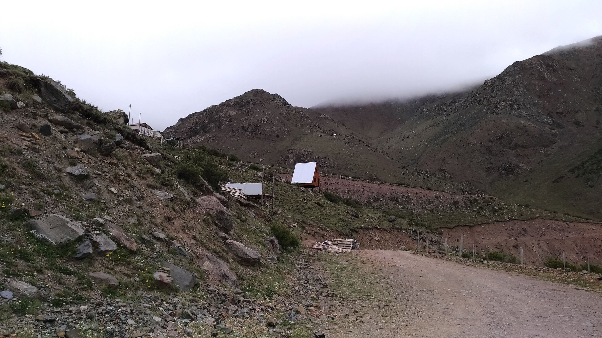
The walking character is dry high-Andean terrain: ski-area tracks, arroyos, moraines, scree slopes, ridges, small camps such as Veguitas and Piedra Grande, and broad views toward Potrerillos, the Mendoza plain and the higher Cordón del Plata summits. Refugio San Bernardo is a key local base and the Vallecitos road reaches the former ski area, but public transport is limited and most walkers use private transfers or guided trips.
The normal hiking season is spring through autumn, with snow, ice and high wind changing the character of the routes outside summer. Even the easier objectives are high enough for altitude symptoms, and the 4000 m summits should be treated as mountain days rather than ordinary hill walks.
Selection rationale
The five hikes provide a progression through the Vallecitos walking system: a low acclimatisation camp approach, two accessible introductory summits, the classic Lomas Blancas viewpoint, and the Adolfo Calle / Stepanek 4000 m circuit. Higher objectives such as Cerro Vallecitos, Cerro Rincón and Cerro El Plata are not selected as ordinary day-hikes because they are better treated as multi-day high-mountain ascents or require stronger snow/rockfall judgement.
Summary table
| # | Hike | Country | Route type | Distance | Gain | Max elevation | Difficulty |
|---|---|---|---|---|---|---|---|
| 1 | Vallecitos to Veguitas and Piedra Grande | Argentina | Out-and-back | Approx. 8.5 km to Piedra Grande return | Approx. 600-800 m | Approx. 3,580 m | Moderate |
| 2 | Cerro Arenales / Andresito Acclimatisation Ridge | Argentina | Out-and-back / ridge candidate | Approx. 4-7 km depending on variant | 3,300-3,400 m | Moderate | |
| 3 | Cerro Lomas Blancas | Argentina | Loop / out-and-back depending on variant | 7.4 km | 759 m | 3,614-3,700 m | Moderate |
| 4 | Cerro San Bernardo | Argentina | Out-and-back | Approx. 8-10 km; exact route stats unresolved | Approx. 4,100 m | Hard | |
| 5 | Cerros Adolfo Calle and Stepanek | Argentina | Loop | 10.3-12.2 km depending on source | 1,140-1,360 m | 4,235-4,296 m | Hard |
1. Vallecitos to Veguitas and Piedra Grande
Snapshot
Itinerary
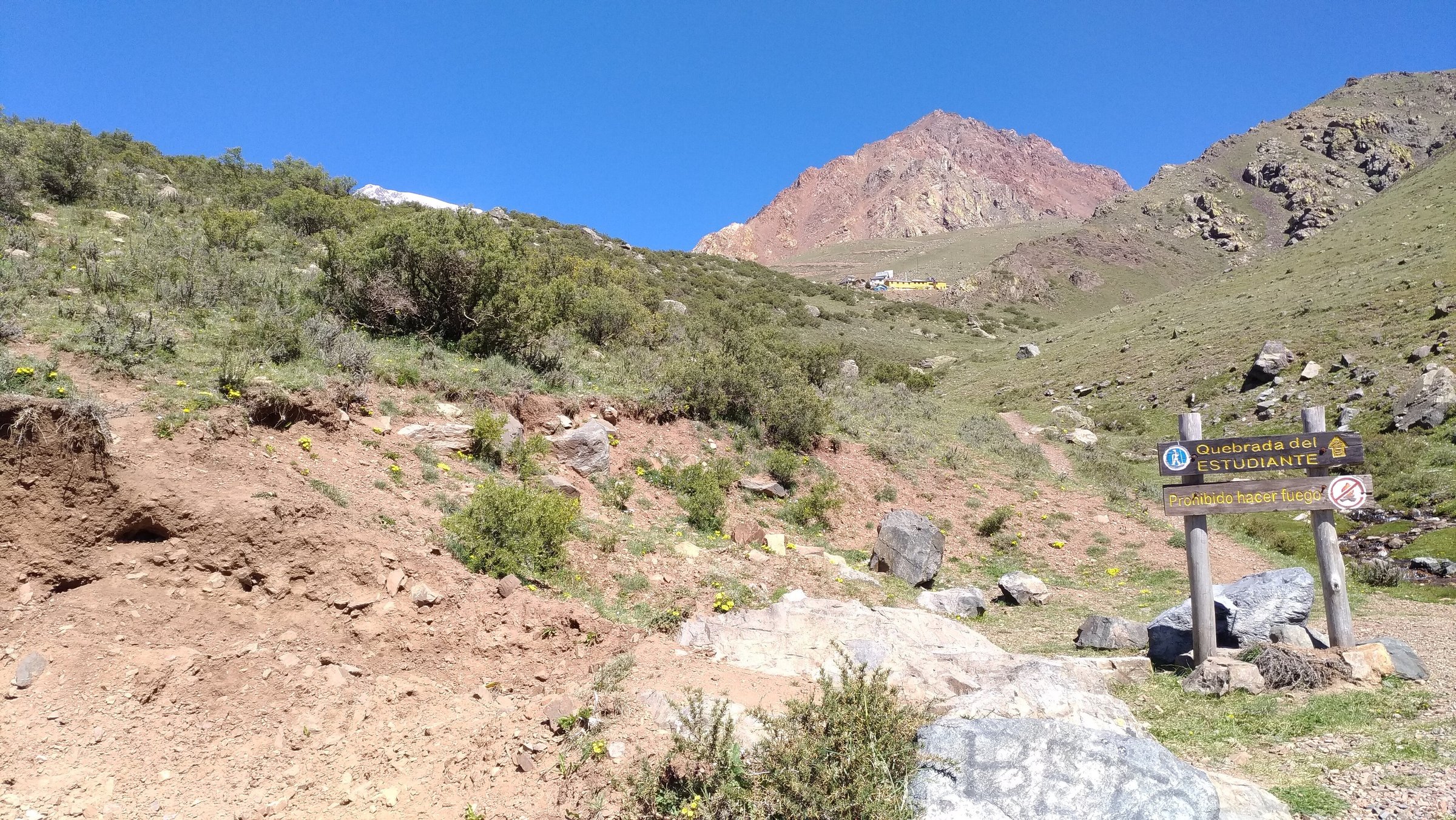
From Vallecitos, the approach follows the lower Cordón del Plata access route toward the first camps. Veguitas is the easier endpoint, while Piedra Grande continues farther up the valley on the normal approach toward Cerro El Plata. Wikiloc records and route notes describe Veguitas as roughly two hours from Vallecitos and place Piedra Grande at about 3,580 m.
This is the best day-hike for understanding the geography of the range without committing to a summit. It also provides a practical acclimatisation walk for hikers planning Lomas Blancas, San Bernardo or Adolfo Calle.
Why it is essential
Veguitas and Piedra Grande are the gateway camps of Vallecitos. The walk links the refuge/roadhead area to the high-mountain approach system and explains why the Cordón del Plata is used as a training ground for larger Central Andes objectives.
Equipment
- Standard mountain hiking equipment: boots or grippy shoes
- Trekking poles
- Windproof layer and warm layer
- Sun protection
- Water and food
- Map/GPS
- Headtorch if starting late
Hazards and notes
- Altitude, wind, sun exposure, dehydration and unclear side tracks are the main issues.
- Do not camp or cross delicate wetland/vega areas except where permitted.
- Water sources should be treated.
GPX / KML links
| Source | URL | Format / access | Reuse status |
|---|---|---|---|
| Wikiloc: Vallecitos - Piedra Grande - Veguitas superior | es.wikiloc.com | Source map / GPX availability via Wikiloc | Wikiloc terms apply; account may be required; GPX not downloaded |
| Refugio San Bernardo | sanbernardorefugio.com | Local refuge/access source | No route-file terms stated; context only |
External links
- Wikiloc — Vallecitos - Piedra Grande - Veguitas superior
- Refugio San Bernardo
- Andeshandbook — Cerro El Plata normal route
2. Cerro Arenales / Andresito Acclimatisation Ridge
Snapshot
Itinerary
The Arenales / Andresito ridge is the short acclimatisation objective above Vallecitos. Guide sources describe the first part of the “Cadenita” as gaining height progressively over Lomas Blancas, Arenales and Andresito, with Arenales around 3,400 m and Andresito around 3,100 m. The route generally uses open slopes above the Vallecitos roadhead rather than committing to the higher camps.
The exact day-hike line varies between local operators and community GPS records, so this entry remains candidate-only until a single route line is selected.
Why it is essential
This is the shortest summit-style acclimatisation option in Vallecitos. It provides a stepping stone between the valley/camp approach and the harder Lomas Blancas or 4000 m objectives.
Equipment
- Standard hiking equipment
- Warm layer and windproof shell
- Sun protection
- Water
- Navigation
- Trekking poles are useful on loose ground
Hazards and notes
- Route ambiguity, loose slopes, sudden wind and altitude symptoms are the main hazards.
- Do not confuse this Vallecitos Arenales with the major glaciated Cerro Arenales in Chilean Patagonia.
GPX / KML links
| Source | URL | Format / access | Reuse status |
|---|---|---|---|
| Wikiloc Cerro Arenales Vallecitos search/result | fi.wikiloc.com | Source map / GPX availability via Wikiloc | Wikiloc terms apply; account may be required; GPX not downloaded |
| Andes Extreme Adventures Vallecitos programme | andesxtadventures.com | Commercial itinerary / route context | No route-file terms stated; context only |
External links
3. Cerro Lomas Blancas
Snapshot
Itinerary
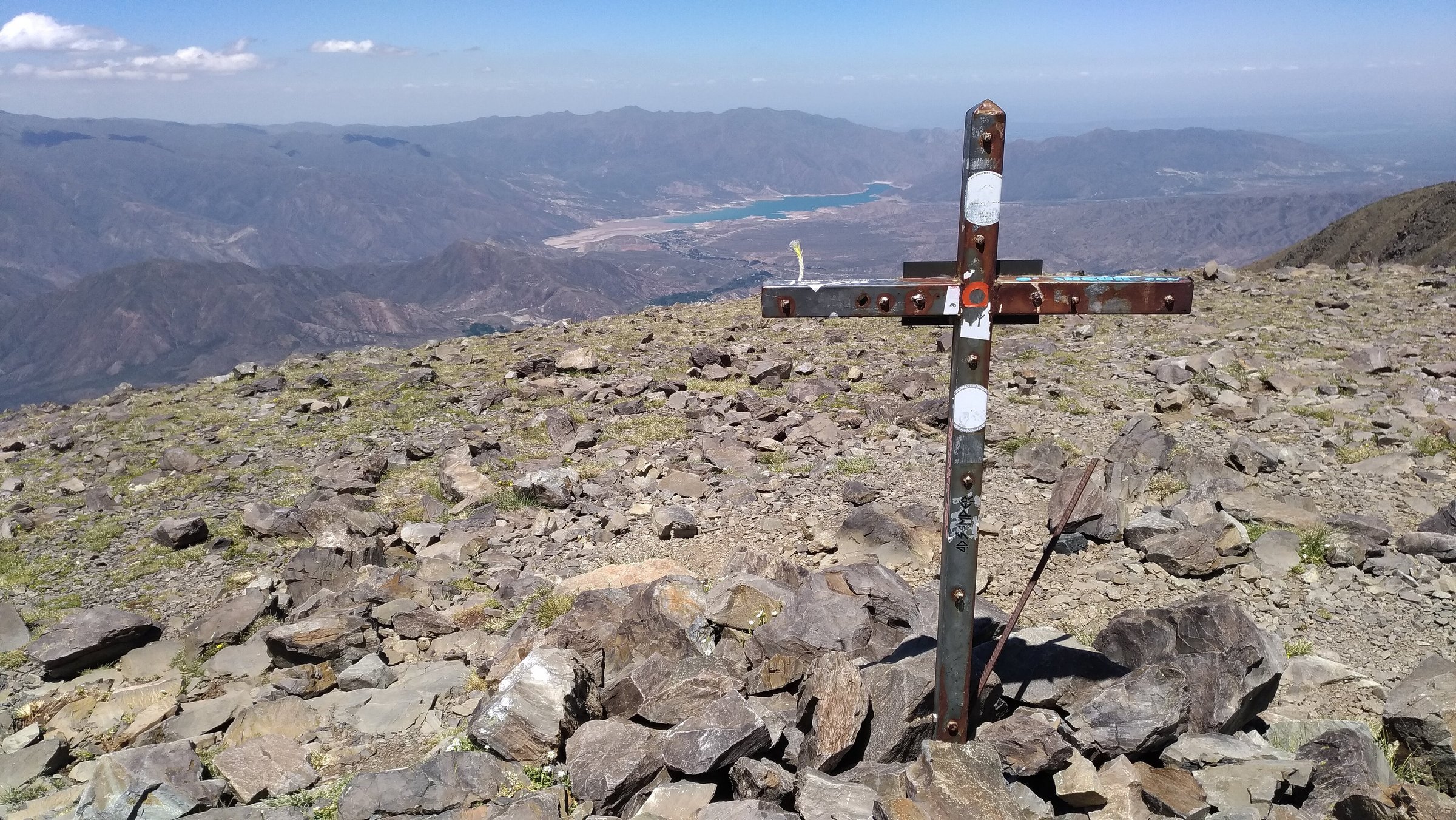
The route climbs from Vallecitos toward the broad slopes of Cerro Lomas Blancas, one of the most accessible named summits in the Cordón del Plata. A Wikiloc loop gives 7.4 km, 759 m of ascent and a maximum GPS elevation of 3,614 m. Local guiding pages describe Lomas Blancas as a one-day, non-technical mountain walk reaching around 3,700 m.
The route is usually used as a first real Cordón del Plata summit. It gives broad views of the higher range while remaining below the more serious 4000 m and 5000 m objectives.
Why it is essential
Lomas Blancas is the classic introductory summit of Vallecitos: high enough to feel like an Andean peak, but short enough for a fit acclimatised walker in a day.
Equipment
- Mountain hiking equipment: boots, trekking poles
- Windproof shell and warm layer
- Hat/gloves outside warm midsummer
- Sunglasses and sunscreen
- Water and food
- Map/GPS
- Headtorch
Hazards and notes
- Altitude, wind, strong UV and loose ground are the principal hazards.
- Early or late season snow can make the route more serious.
- The elevation discrepancy between sources should be preserved unless a survey-quality source is found.
GPX / KML links
| Source | URL | Format / access | Reuse status |
|---|---|---|---|
| Wikiloc: Vallecitos - Subida al Lomas Blancas | wikiloc.com | Source map / GPX availability via Wikiloc | Wikiloc terms apply; account may be required; GPX not downloaded |
| Aconcagua Experiences: Cerro Lomas Blancas | aconcaguaexperiences.com.ar | Commercial itinerary / route context | No route-file terms stated; context only |
External links
- Wikiloc — Vallecitos - Subida al Lomas Blancas
- Aconcagua Experiences — Cerro Lomas Blancas
- Antis Outdoor — Trekking Lomas Blancas
4. Cerro San Bernardo
Snapshot
Itinerary
Cerro San Bernardo rises above the Vallecitos refuge sector and is commonly used as a first 4000 m objective in the area. Local operator material describes the ascent as a progressive acclimatisation outing, often combined with a refuge night and an easier preliminary ascent such as Cerro Arenales.
The route line and statistics need a stronger single source before publication. It is included because it is locally recognised, accessible from the main Vallecitos base, and gives a more demanding summit day than Lomas Blancas without entering the multi-day Cerro El Plata category.
Why it is essential
San Bernardo represents the 4000 m acclimatisation step in Vallecitos. It is harder than Lomas Blancas but more attainable than the major 5000 m and 6000 m peaks.
Equipment
- Mountain hiking equipment with extra warm layer
- Gloves and hat
- Trekking poles
- Sun protection
- Navigation backup
- Water and food
- Headtorch
- Snow or hard morning ice may require traction
Hazards and notes
- Altitude symptoms, wind, loose scree and late descent are the main hazards.
- Because the exact route data is unresolved, this should be planned with local refuge advice or a qualified guide.
GPX / KML links
| Source | URL | Format / access | Reuse status |
|---|---|---|---|
| Wikiloc: Trekking al Cerro San Bernardo - Vallecitos | wikiloc.com | Source map / GPX availability via Wikiloc | Wikiloc terms apply; account may be required; GPX not downloaded |
| Aconcagua Experiences: Cerro San Bernardo | aconcaguaexperiences.com.ar | Commercial itinerary / route context | No route-file terms stated; context only |
External links
- Wikiloc — Trekking al Cerro San Bernardo - Vallecitos
- Aconcagua Experiences — Cerro San Bernardo
- Refugio San Bernardo
5. Cerros Adolfo Calle and Stepanek
Snapshot
Itinerary
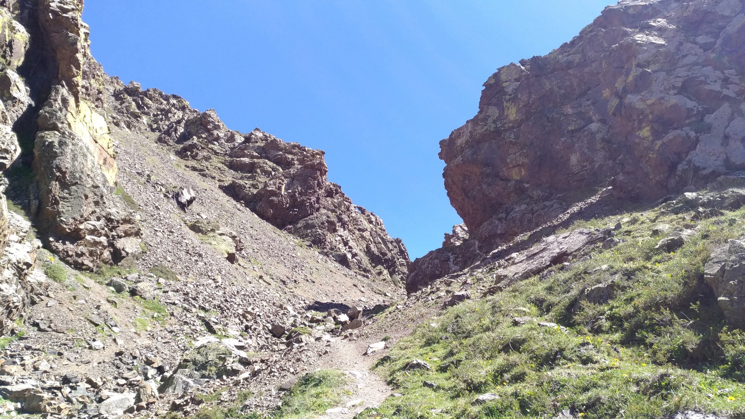
The route climbs from the Vallecitos camp system toward the col and scree slopes between Adolfo Calle and Stepanek, then links the two summits where conditions and timing allow. Wikiloc route records give common loop variants between 10.3 km and 12.2 km, with 1,140-1,360 m of gain and maximum elevations around 4,235-4,296 m. Andeshandbook identifies Cerro Adolfo Calle’s normal route and describes the access through the quebrada between Adolfo Calle and Stepanek.
This is a serious high-altitude day, often more suitable from a camp such as Veguitas than from the lowest roadhead.
Why it is essential
Adolfo Calle and Stepanek are among the classic 4000 m objectives of the Cordón del Plata. The paired summit route gives a full high-Andes day while staying below the multi-day scale of El Plata, Vallecitos and Rincón.
Equipment
- Mountain hiking equipment
- Helmet where rockfall or loose gullies are present
- Trekking poles
- Warm layers, gloves, windproof shell
- Sun protection
- Water and food
- Navigation backup
- Headtorch
- Snow conditions may require microspikes, crampons or an ice axe
Hazards and notes
- Loose scree, rockfall, altitude, wind and long descent are the main concerns.
- Some community route descriptions specifically mention helmet use.
- Start early and turn around if wind or altitude symptoms become significant.
GPX / KML links
| Source | URL | Format / access | Reuse status |
|---|---|---|---|
| Wikiloc: Trekking al Cerro Adolfo Calle y Cerro Stepanek | wikiloc.com | Source map / GPX availability via Wikiloc | Wikiloc terms apply; account may be required; GPX not downloaded |
| Wikiloc: Cerros Adolfo Calle y Stepanek, Vallecitos | wikiloc.com | Source map / GPX availability via Wikiloc | Wikiloc terms apply; account may be required; GPX not downloaded |
| Andeshandbook: Cerro Adolfo Calle normal route | andeshandbook.org | Route description / map context | Andeshandbook terms; GPX availability not checked |
External links
- Andeshandbook — Cerro Adolfo Calle normal route
- Wikiloc — Trekking al Cerro Adolfo Calle y Cerro Stepanek
- Wikiloc — Cerros Adolfo Calle y Stepanek, Vallecitos
External links
| Source | URL |
|---|---|
| Refugio San Bernardo | sanbernardorefugio.com |
| Andeshandbook — Cerro El Plata normal route | andeshandbook.org |
| Andeshandbook — Cerro Adolfo Calle normal route | andeshandbook.org |
| Aconcagua Experiences — Cerro Lomas Blancas | aconcaguaexperiences.com.ar |
| Aconcagua Experiences — Cerro San Bernardo | aconcaguaexperiences.com.ar |
| Andes Extreme Adventures — Cerro Vallecitos programme | andesxtadventures.com |
| Antis Outdoor — Trekking Lomas Blancas | antisoutdoor.com |
| Wikiloc — Vallecitos - Piedra Grande - Veguitas superior | es.wikiloc.com |
| Wikiloc — Cerro Arenales Vallecitos | fi.wikiloc.com |
| Wikiloc — Vallecitos - Subida al Lomas Blancas | wikiloc.com |
| Wikiloc — Trekking al Cerro San Bernardo - Vallecitos | wikiloc.com |
| Wikiloc — Trekking al Cerro Adolfo Calle y Cerro Stepanek | wikiloc.com |
| Wikiloc — Cerros Adolfo Calle y Stepanek, Vallecitos | wikiloc.com |