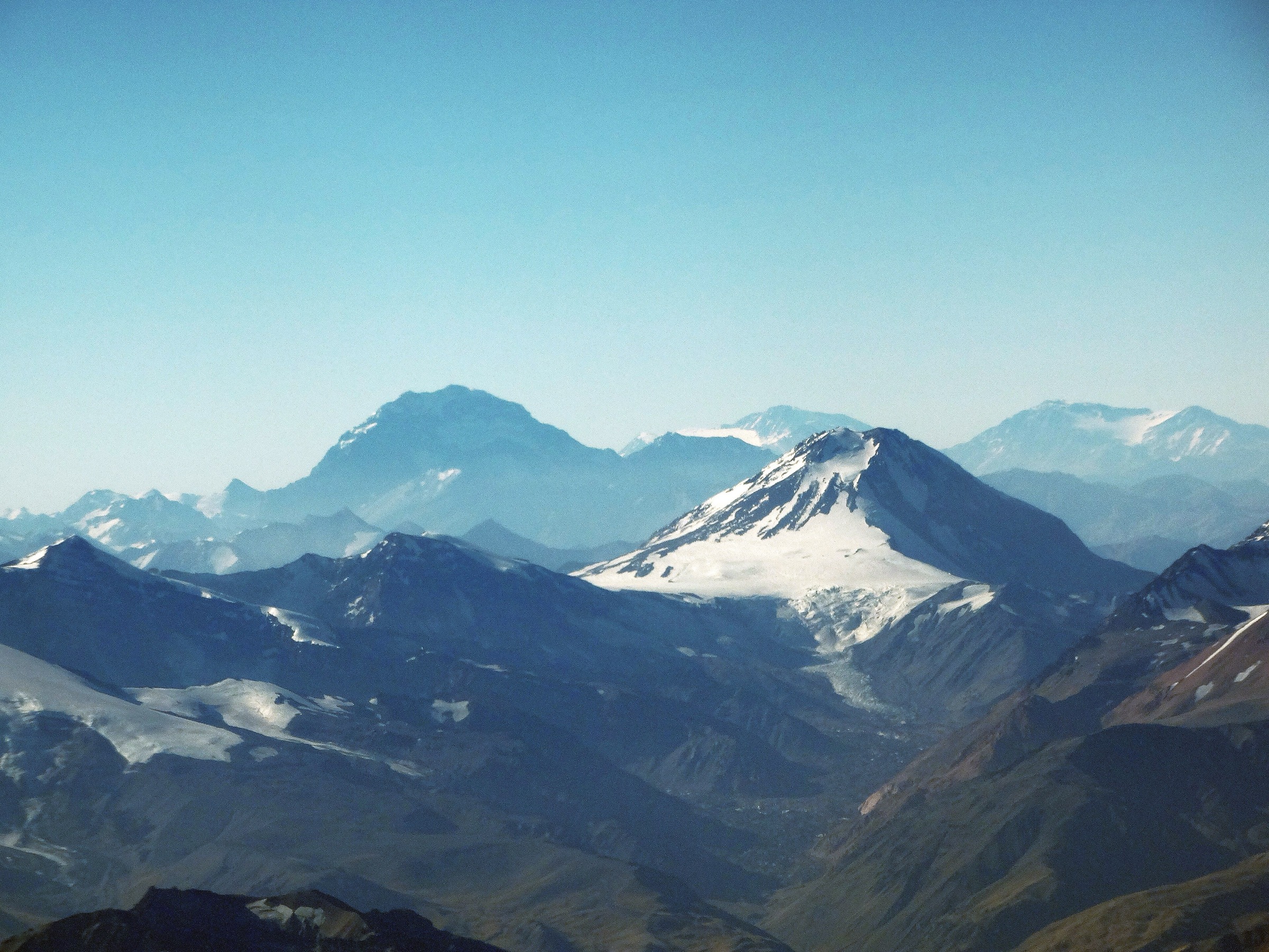
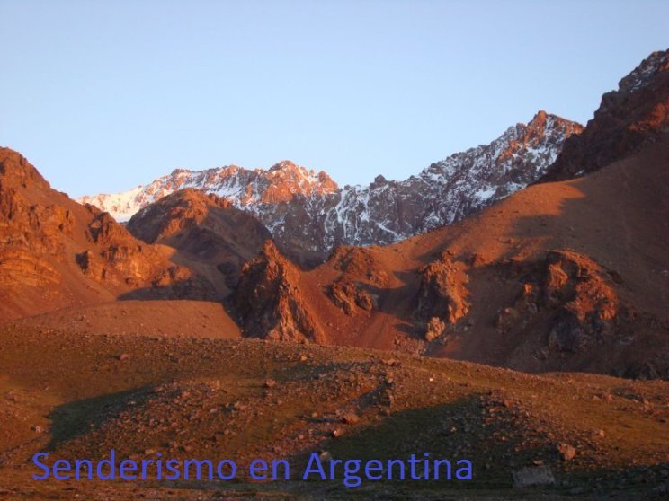
Regional overview
The Mendoza Andes combine city-edge foothills, the Cordón del Plata, the international Route 7 corridor, and the Aconcagua Provincial Park high valley. Day hiking ranges from dry precordillera walks above Mendoza city to strenuous 3,000–4,000 m acclimatisation summits and permit-controlled Aconcagua approaches.
The main bases are Mendoza/Las Heras for Cerro Arco, Potrerillos and Vallecitos for Cordón del Plata routes, and Uspallata–Puente del Inca–Los Penitentes for Aconcagua and the high border corridor. Summer and early autumn are the normal hiking season for high routes; winter/spring conditions can introduce snow, avalanche risk, closures, and very cold wind.
Public route data is good for Cerro Arco, Confluencia, Lomas Blancas, and Cerro Penitentes. A fifth representative route is included as a conservative candidate for the Vallecitos/Las Veguitas acclimatisation area because it is important locally, but clean route statistics still need verification.
Selection rationale
The selection covers the Mendoza foothills, Aconcagua’s legal day-trek limit, the Cordón del Plata acclimatisation terrain, a classic high Route 7 summit, and a lower Vallecitos acclimatisation walk. It avoids the full Aconcagua, Plata, and Vallecitos summit expeditions because those are multi-day mountaineering objectives.
Summary table
| # | Hike | Country | Route type | Distance | Gain | Max elevation | Difficulty |
|---|---|---|---|---|---|---|---|
| 1 | Horcones to Confluencia, Aconcagua Provincial Park | Argentina | Loop / out-and-back variant | 17.4–19.0 km depending on source | 607–640 m | 3,430–3,460 m | Moderate–hard |
| 2 | Cerro Arco from Puerta de la Quebrada | Argentina | Out-and-back | 9.0 km | 539 m | ca. 1,668 m | Moderate |
| 3 | Lomas Blancas, Vallecitos | Argentina | Loop | 8.68 km | 876 m | 3,825 m | Moderate–hard |
| 4 | Cerro Penitentes from Route 7 / Quebrada de Vargas side | Argentina | One-way source route / return required | 11.18 km one way | 1,741 m | 4,335 m | Hard |
| 5 | Las Veguitas / Vallecitos acclimatisation walk | Argentina | Out-and-back candidate | ca. 3,200 m for Las Veguitas camp | Easy–moderate |
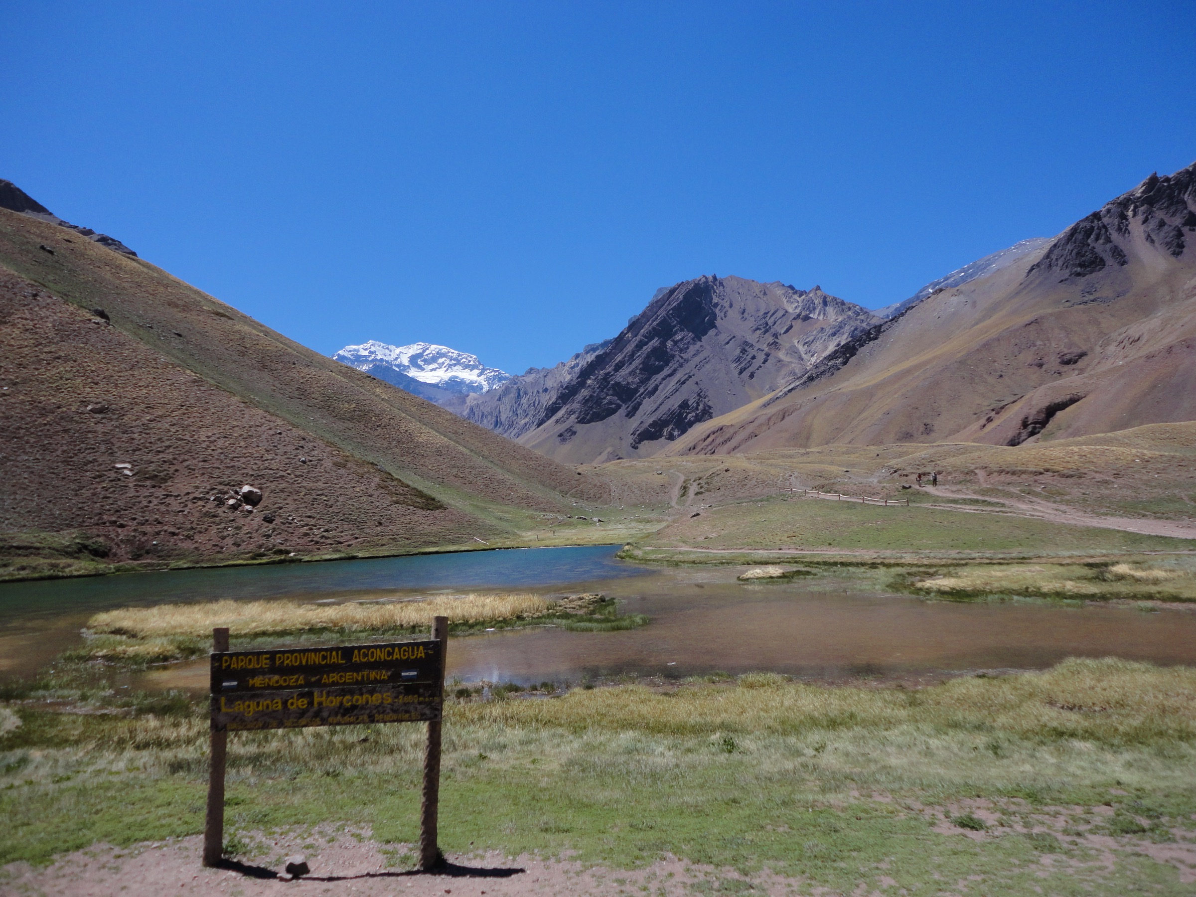
1. Horcones to Confluencia, Aconcagua Provincial Park
Snapshot
Itinerary
The day route follows the Horcones valley from the park entrance area toward Confluencia, the first camp on the normal Aconcagua route. It passes dry valley terrain, bridges, alluvial channels, and high views toward the Aconcagua massif before returning the same day under park rules.
Why it is essential
Confluencia is the most important legal day-trek objective in Aconcagua Provincial Park and gives non-climbers a serious high-Andes walk without entering the multi-day ascent system.
Equipment
- Mountain hiking equipment: boots, windproof and warm layers, sun protection, water, food, navigation, and headtorch.
- Park permit/ticket and identification as required by current regulations.
Hazards and notes
- Aconcagua park rules and weather closures are strict.
- Mendoza official material identifies day trekking to Confluencia as a regulated activity and storms/snow can suspend trekking.
- Do not continue to Plaza Francia or higher without the correct permit.
GPX / KML links
| Source | URL | Format / access | Reuse status |
|---|---|---|---|
| Wikiloc: Quebrada Horcones hasta Confluencia | wikiloc.com | Source route / GPX via Wikiloc | Wikiloc terms apply; stats verified, direct reuse unresolved |
| Wikiloc: Aconcagua Horcones–Confluencia | wikiloc.com | Source route / GPX via Wikiloc | Wikiloc terms apply; secondary route-stat comparison |
External links
- Mendoza Government — Aconcagua official page
- Wikiloc — Quebrada Horcones hasta Confluencia
- Wikiloc — Aconcagua Horcones–Confluencia
- Pixabay — Aconcagua Confluencia Base Camp
2. Cerro Arco from Puerta de la Quebrada
Snapshot
Itinerary
The route climbs the broad dirt road/trail from the Challao side to Cerro Arco, a prominent precordillera summit with antennas and wide views over Mendoza city, the plains, and the first Andean ranges. It is a common hiking, running, mountain-bike, and paragliding hill.
Why it is essential
Cerro Arco is Mendoza’s classic city-edge hike and the best representative of the dry foothill terrain immediately above the urban area.
Equipment
- Standard hiking equipment with strong sun protection and water.
- Wind layer for the summit ridge.
Hazards and notes
- Heat, dust, shared use with bikes/vehicles, and lack of shade are the main hazards.
- The summit infrastructure reduces wilderness character but makes the hill locally iconic.
GPX / KML links
| Source | URL | Format / access | Reuse status |
|---|---|---|---|
| AllTrails: Cerro Arco | alltrails.com | Source route/map | AllTrails terms apply; stats verified from public page; GPX reuse unresolved |
External links
3. Lomas Blancas, Vallecitos
Snapshot
Itinerary
The loop climbs from Vallecitos into the lower Cordón del Plata summit terrain, reaching Lomas Blancas and returning to the refuge/roadhead area. The route is often used as an acclimatisation hike for higher Mendoza objectives.
Why it is essential
Lomas Blancas is one of the most practical day summits in the Vallecitos area, giving a high-Andes feel without the multi-day commitment of Cerro Plata or Vallecitos.
Equipment
- Mountain hiking equipment, warm/windproof layers, sun protection, navigation, water, and headtorch.
- Snow traction may be required outside dry summer conditions.
Hazards and notes
- Altitude, loose rock, weather changes, and difficult road access to Vallecitos are the main issues.
- Check refuge/road conditions locally.
GPX / KML links
| Source | URL | Format / access | Reuse status |
|---|---|---|---|
| Wikiloc: Lomas Blancas – Vallecitos – Mendoza | ca.wikiloc.com | Source route / GPX via Wikiloc | Wikiloc terms apply; stats verified, direct reuse unresolved |
External links
4. Cerro Penitentes from Route 7 / Quebrada de Vargas side
Snapshot
Itinerary
The source route climbs from the Route 7 corridor into the Quebrada de Vargas side of Cerro Penitentes, gaining more than 1,700 m to a high summit above the Mendoza river corridor. It is a strenuous acclimatisation or standalone objective for strong walkers.
Why it is essential
Cerro Penitentes is a classic high mountain immediately above the Puente del Inca–Los Penitentes corridor and provides a serious day-summit option short of expedition peaks.
Equipment
- Full mountain hiking kit, warm layers, wind shell, gloves, hat, navigation, headtorch, food, and substantial water.
- Snow traction/ice axe may be needed with snow.
Hazards and notes
- The source track is ascent-heavy and may have been completed over two days.
- Descent statistics and true single-day feasibility need local verification.
- Water is limited and altitude gain is large.
GPX / KML links
| Source | URL | Format / access | Reuse status |
|---|---|---|---|
| Wikiloc: Cerro Penitentes – Mendoza | es.wikiloc.com | Source route / GPX via Wikiloc | Wikiloc terms apply; ascent stats verified, descent/day timing unresolved |
External links
5. Las Veguitas / Vallecitos acclimatisation walk
Snapshot
Itinerary
The Las Veguitas walk is the lower acclimatisation approach into the Vallecitos high-valley system, commonly used before longer Cordón del Plata objectives. The route should follow the established Vallecitos access paths toward the meadow/camp area, then return to the roadhead.
Why it is essential
It represents the gentler acclimatisation side of Vallecitos and gives walkers a high-Andes setting without committing to a summit.
Equipment
- Standard-to-mountain hiking equipment: boots or sturdy shoes, warm/wind layer, sun protection, water, food, and navigation.
Hazards and notes
- Clean route statistics and a route-file source were not resolved in this pass.
- This entry should be backfilled with a confirmed GPX before publication.
GPX / KML links
| Source | URL | Format / access | Reuse status |
|---|---|---|---|
| Unresolved | Unresolved | Unresolved | Clean GPX/source route not found in this pass |
External links
Missing data and follow-up
- Confirm current Aconcagua day-trekking permits, season dates, and route limits.
- Resolve a clean GPX and statistics for Las Veguitas.
- Backfill exact file-level reusable images for Cerro Arco, Confluencia, Lomas Blancas, and Cerro Penitentes.
- Confirm Cerro Penitentes single-day feasibility and descent statistics.
External links
| Source | URL |
|---|---|
| Mendoza Government — Aconcagua official page | informacionoficial.mendoza.gob.ar |
| AllTrails — Cerro Arco | alltrails.com |
| Mendoza tourism chamber — Cerro Arco overview | mendoza-camara.org |
| Wikipedia — Cerro Arco | en.wikipedia.org |
| Andeshandbook — Cerro Penitentes | andeshandbook.org |
| Wikiloc — Quebrada Horcones hasta Confluencia | wikiloc.com |
| Wikiloc — Aconcagua Horcones–Confluencia | wikiloc.com |
| Wikiloc — Lomas Blancas loop | ca.wikiloc.com |
| Wikiloc — Cerro Penitentes | es.wikiloc.com |
| Pixabay — Aconcagua Confluencia Base Camp | pixabay.com |