Regional overview
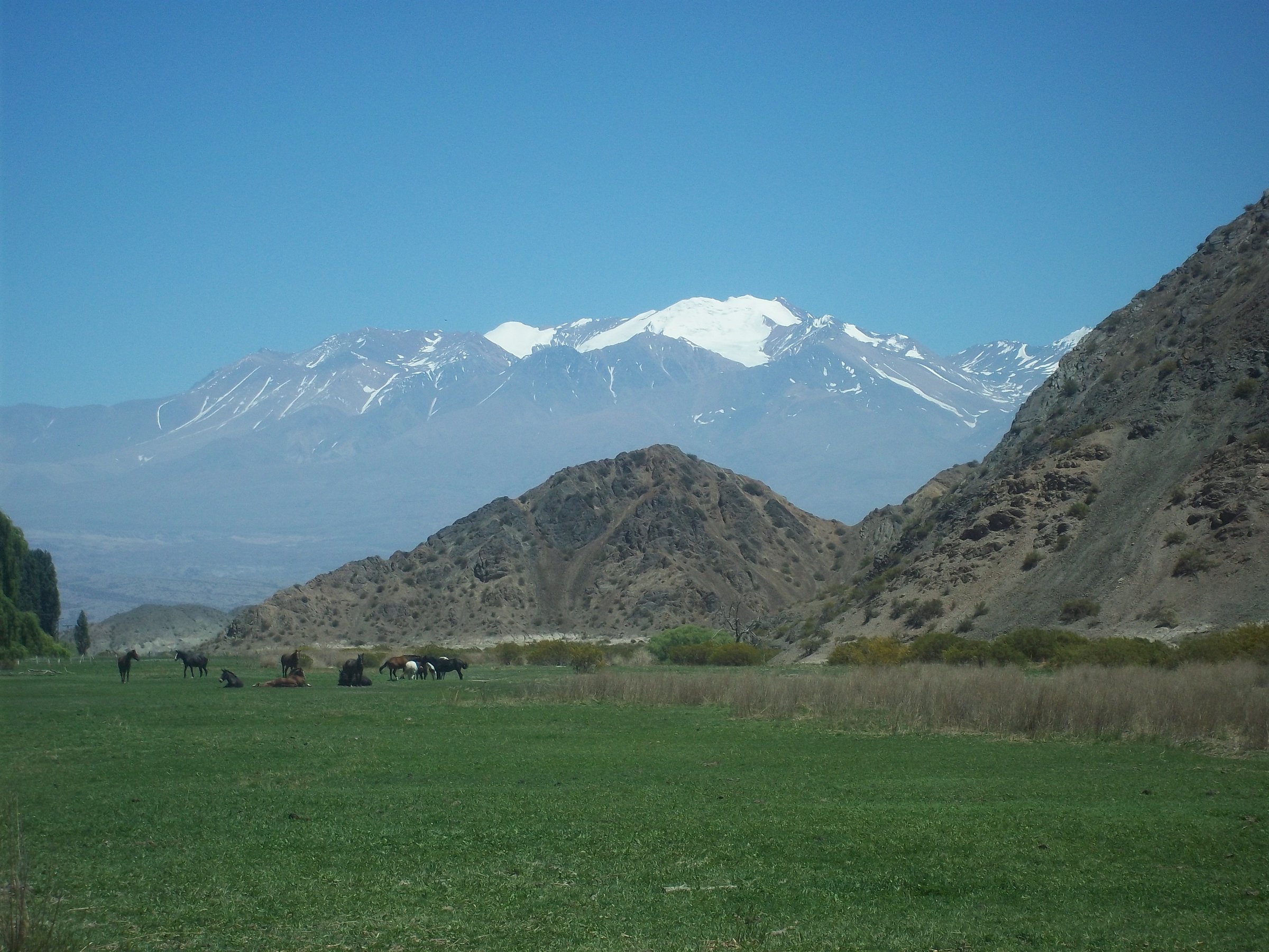
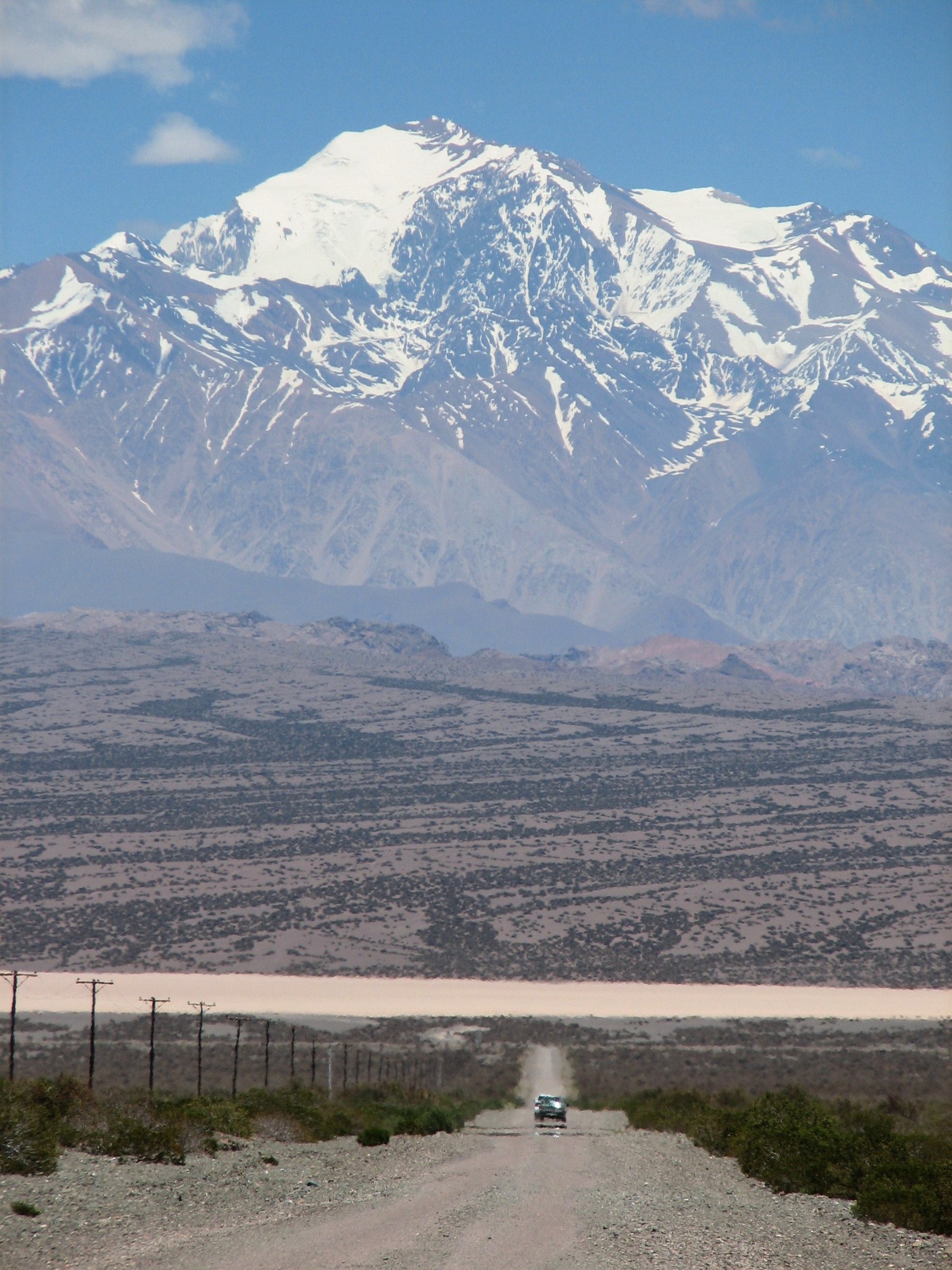
The San Juan high Andes are drier, quieter and less formalised than the Mendoza Aconcagua corridor. The main hiking bases are Barreal and Calingasta for the Ansilta / Mercedario sector, Iglesia for the Agua Negra side, and Parque Nacional El Leoncito on the Tontal / Calingasta transition. Landscapes range from desert foothills and eroded coloured badlands to high glacial valleys below Mercedario and the Ansilta peaks.
Published day-hike information is uneven. El Leoncito has official national-park trails; Cerro Alcázar has a guidebook-style walking route and tourism recognition; Laguna Blanca and Ansilta/Mercedario routes are often arranged with local guides and rely more on community GPS tracks or expedition itineraries. The region’s higher routes can be remote, unmarked and vehicle-access dependent.
The walking season is generally spring to autumn, with summer heat at lower elevations and snow/ice at higher elevations. Wind, water scarcity, loose rock, intense sun, altitude and long access roads are the main safety concerns. For Ansilta and Mercedario approaches, guide support and local road-condition checks are often part of the route rather than optional extras.
Selection rationale
The selection balances official low-to-mid elevation trails with the essential high-Andes objectives around Barreal: Cerro El Leoncito, the El Rincón / water trail system, Cerro Alcázar, Laguna Blanca below Mercedario, and an Ansilta Pico 4 day-section candidate. Full Mercedario and the main Ansilta summits are not selected as normal day-hikes because they are expedition objectives; only their lower or guided day-access sections are included.
Summary table
| # | Hike | Country | Route type | Distance | Gain | Max elevation | Difficulty |
|---|---|---|---|---|---|---|---|
| 1 | Cerro El Leoncito Trail | Argentina | Out-and-back | Approx. 4 hr; distance unresolved | 300 m | 2,527 m | Moderate |
| 2 | Cascada El Rincón and Senderos de Agua | Argentina | Out-and-back / short interpretive trails | Short trails; exact distance unresolved | Low | Easy | |
| 3 | Cerro Alcázar Walking Route | Argentina | Out-and-back / short loop candidate | Short official route; Wikiloc variants 17–32 km include driving/wider traverses | Approx. 1,650 m | Easy–moderate | |
| 4 | Laguna Blanca / Mercedario Approach Day | Argentina | Out-and-back guided day route | Approx. 3,500 m | Moderate–hard | ||
| 5 | Ansilta Pico 4 High-Altitude Day Section | Argentina | Out-and-back from camp / candidate | summit tracks vary | Approx. 5,095 m | Hard / high-altitude candidate |
1. Cerro El Leoncito Trail
Snapshot
Itinerary
The Cerro El Leoncito trail starts close to the park’s operational area and climbs through quebrada and ridge terrain to the summit of the hill that gives the park its name. Argentina’s national parks activities page describes a 300 m elevation gain and a ridge leading to the summit. Andeshandbook identifies Cerro El Leoncito as one of the principal attractions of the national park and notes the marked trail from the administration area.
The route gives views across the astronomical observatories, the Barreal Blanco and the higher Andean skyline, including Mercedario in clear weather.
Why it is essential
This is the official summit walk of Parque Nacional El Leoncito and the most reliable day-hike in the San Juan high-Andes catalogue set. It links protected-area access, desert foothill ecology, geology and the region’s astronomical identity.
Equipment
- Hiking shoes
- Weatherproof/windproof layer, warm layer
- Water (extra in warm weather)
- Food
- Map/GPS
- Sun hat, sunglasses and sunscreen
Hazards and notes
- The trail is exposed to sun and wind with little shade.
- Desert conditions can dehydrate walkers quickly.
- Check with park staff for current trail status and opening hours.
GPX / KML links
| Source | URL | Format / access | Reuse status |
|---|---|---|---|
| Argentina National Parks: El Leoncito activities | argentina.gob.ar | Official route description | Government page; no downloadable route file found |
| Andeshandbook: Cerro El Leoncito | andeshandbook.org | Mountain/route context | Andeshandbook terms; no GPX checked |
External links
- Argentina National Parks — El Leoncito activities
- Andeshandbook — Cerro El Leoncito
- ParquesNacionales.com.ar — El Leoncito
2. Cascada El Rincón and Senderos de Agua
Snapshot
Itinerary
This short trail group explores the water features near the El Leoncito visitor area. The official activities page describes a route connected to the El Leoncito stream and interpretive information about water in arid/desert environments. Local San Juan tourism material describes one easy 40 minute trail to a waterfall and another longer, more demanding trail in the park.
It is best treated as the easy interpretive walk of the national park, either as a standalone short hike or as a complement to Cerro El Leoncito.
Why it is essential
San Juan high-Andes walking is often dry, exposed and remote. This route adds the park’s water and riparian ecology story, making it an important contrast to the higher ridges and desert badlands.
Equipment
- Walking shoes
- Water
- Sun protection
- Light wind/rain layer
- Camera/binoculars
Hazards and notes
- Heat, sun exposure and slippery wet rock near the waterfall are the main issues.
- Stay on official trails and check park staff guidance before combining routes.
GPX / KML links
| Source | URL | Format / access | Reuse status |
|---|---|---|---|
| Argentina National Parks: El Leoncito activities | argentina.gob.ar | Official route description | Government page; no downloadable route file found |
| Andeshandbook: Cascada El Rincón y Senderos de Agua | andeshandbook.org | Route description / source map | Andeshandbook terms; GPX availability not checked |
External links
- Argentina National Parks — El Leoncito activities
- Andeshandbook — Cascada El Rincón y Senderos de Agua
- San Juan Turismo — Parque Nacional El Leoncito
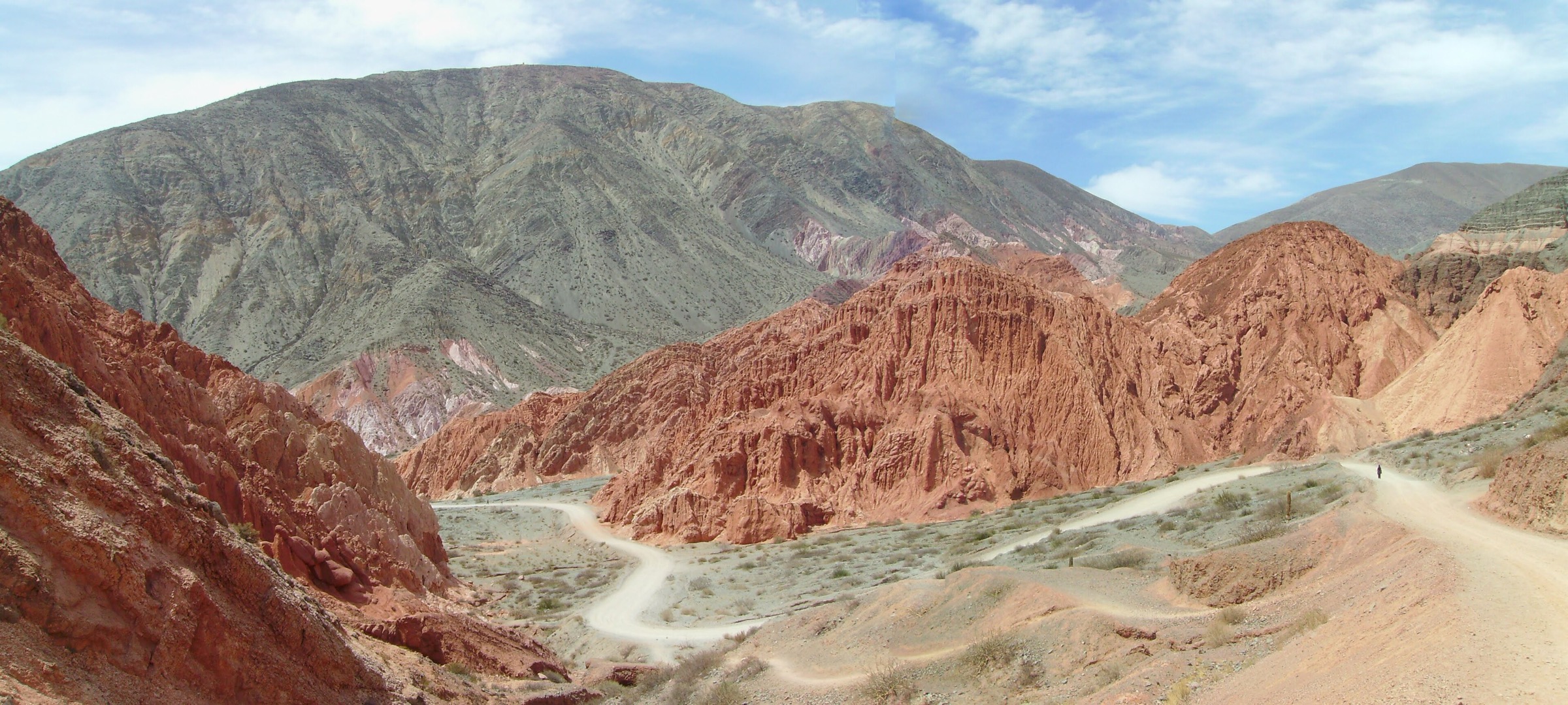
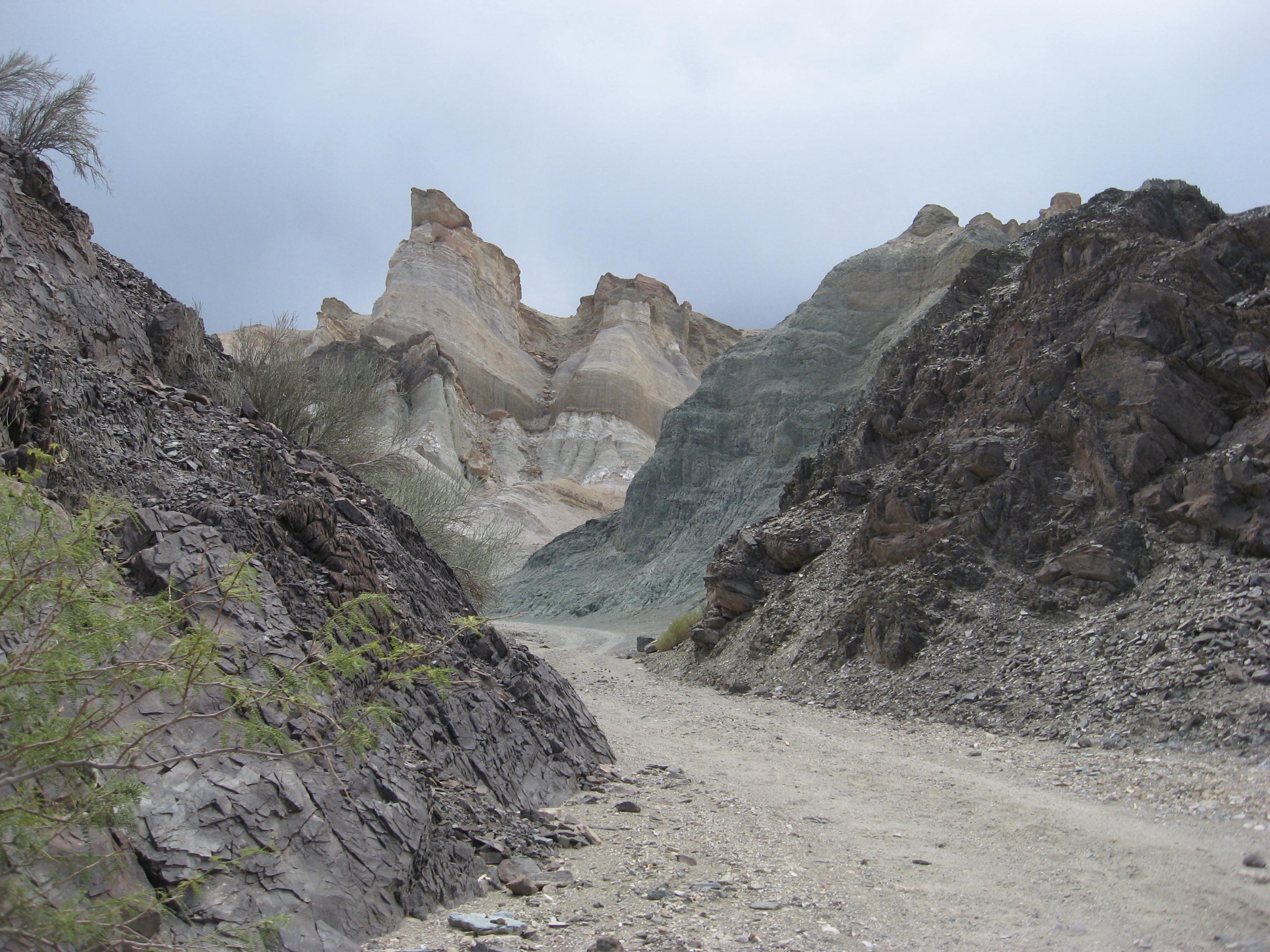
3. Cerro Alcázar Walking Route
Snapshot
Itinerary
Cerro Alcázar is a coloured, eroded formation near Barreal/Calingasta, close to Ruta 149. Argentina Turismo describes it as a natural landmark about 200 m from the provincial road, while Andeshandbook lists a trekking route for Cerro Alcázar. Community route records sometimes combine Cerro Alcázar with Cerro 7 Colores and longer one-way traverses; those are not used as the core statistics because they mix broader route variants.
For catalogue purposes, the essential route is the short walk/viewpoint route around the formation, pending exact official distance and access confirmation.
Why it is essential
Cerro Alcázar is one of the most recognisable natural landmarks on the Barreal / Calingasta approach. It represents the coloured foothill geology of San Juan and provides a lower-elevation walking day when high routes are snowbound or too windy.
Equipment
- Hiking shoes with good grip
- Strong sun protection
- Water
- Trekking poles can help on loose badland slopes
Hazards and notes
- Fragile eroded slopes, heat, lack of shade and unclear informal tracks are the main issues.
- Avoid climbing unstable clay formations or damaging the natural monument.
GPX / KML links
| Source | URL | Format / access | Reuse status |
|---|---|---|---|
| Andeshandbook: Cerro Alcázar | andeshandbook.org | Route description / source map | Andeshandbook terms; GPX availability not checked |
| Wikiloc: Cerro 7 Colores and Cerro Alcázar, Calingasta | wikiloc.com | Wider source map / GPX availability via Wikiloc | Wikiloc terms apply; account may be required |
External links
- Andeshandbook — Cerro Alcázar
- Argentina Turismo — Cerro El Alcazar, Barreal
- Wikiloc — Cerro 7 Colores and Cerro Alcázar
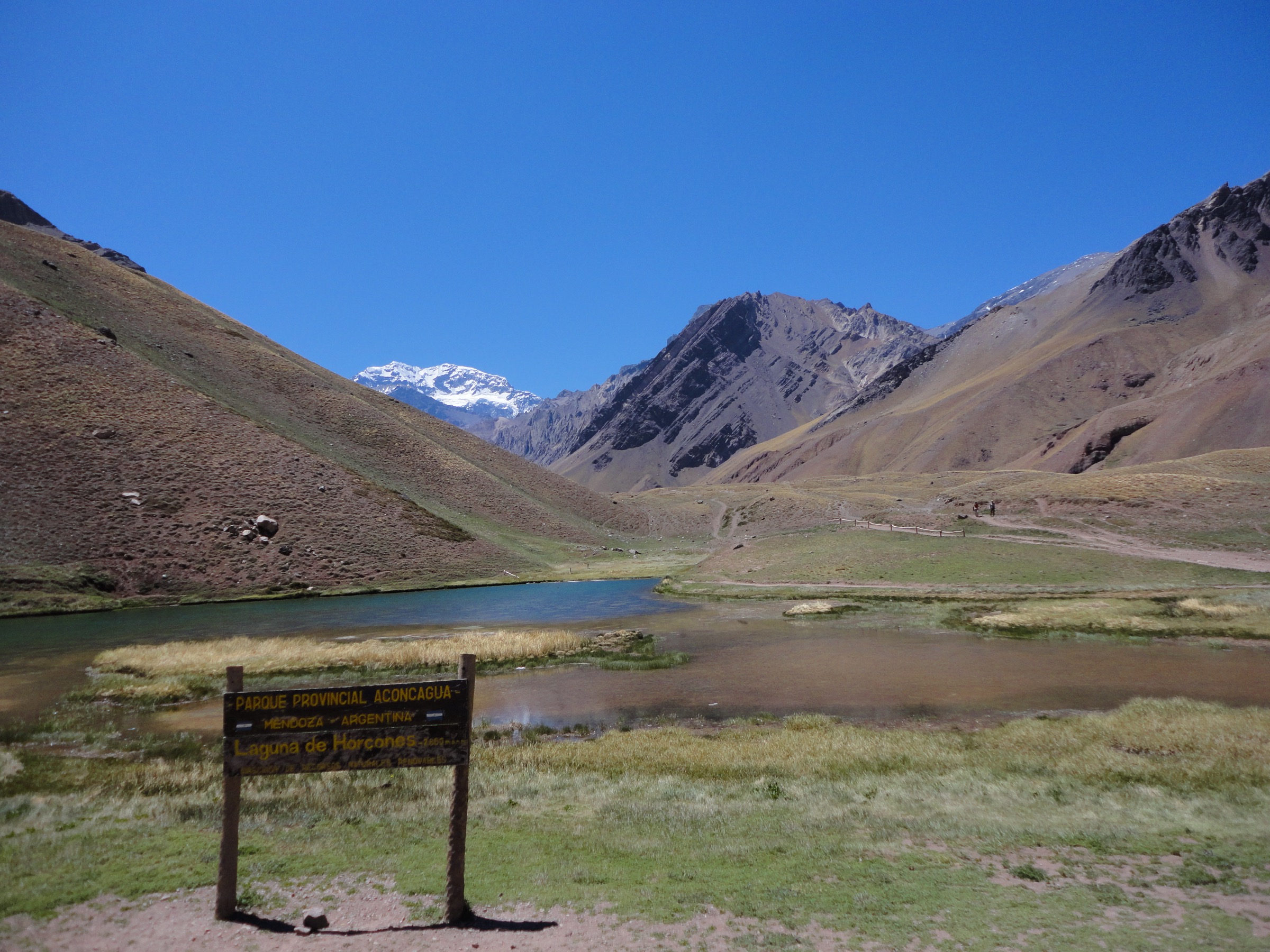
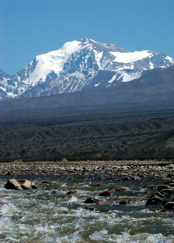
4. Laguna Blanca / Mercedario Approach Day
Snapshot
Itinerary
La Ruta Natural identifies Laguna Blanca as a one-day guided trekking itinerary in the Ansilta / Mercedario sector from Barreal. Community GPS sources place the Laguna Blanca / Club Andino Mercedario refuge area on the approach to Mercedario, and local accounts describe it as the access point for further trekking toward Arroyo Turquesa or the Mercedario normal-route camps.
The exact day-walk line remains unresolved. It should be treated as a guided or locally arranged high-Andes outing rather than a self-guided public trail.
Why it is essential
Laguna Blanca is the most accessible named high-Andes objective associated with Mercedario, San Juan’s highest mountain. It gives the catalogue a route connected to the Cordillera de la Ramada without selecting the full Mercedario expedition.
Equipment
- Mountain hiking equipment
- Warm layers, windproof shell
- Sun protection
- Water and food
- Navigation, headtorch and emergency communication
- Vehicle recovery gear may be relevant for the access road
Hazards and notes
- Remote access, altitude, wind, lack of services, rough roads and water scarcity are the main hazards.
- Confirm guide requirements, road conditions and refuge status in Barreal before planning.
GPX / KML links
| Source | URL | Format / access | Reuse status |
|---|---|---|---|
| Wikiloc: Laguna Blanca, Camp Base Mercedario | wikiloc.com | Source map / GPX availability via Wikiloc | Wikiloc terms apply; account may be required |
| Wikiloc: Refugio Laguna Blanca – Arroyo Turquesa | wikiloc.com | Source map / GPX availability via Wikiloc | Wikiloc terms apply; account may be required |
External links
- La Ruta Natural — Ansilta Mountain Range and Mercedario Mountain
- Visit Argentina — Cerro Mercedario and High Mountains of San Juan
- Wikiloc — Laguna Blanca, Camp Base Mercedario
5. Ansilta Pico 4 High-Altitude Day Section
Snapshot
Itinerary
The Cordillera de Ansilta has seven summits above 5,000 m and is one of the core high-Andes landscapes reached from Barreal. La Ruta Natural identifies the range as a trekking and mountaineering area, and Wikiloc records include Pico 4 summit routes. For a day-hike catalogue, only a high-camp day section toward Pico 4 or a non-technical viewpoint should be considered; the full Ansilta expeditions are outside normal day-hike scope.
No publication-ready single route line was verified in this pass.
Why it is essential
Ansilta is one of San Juan’s defining mountain ranges. Even as a candidate-only entry, it marks the region’s high-altitude trekking character more accurately than selecting only low desert walks.
Equipment
- Mountain hiking boots
- Warm layers, windproof/waterproof shell, gloves, hat
- Sunglasses, sunscreen
- Trekking poles
- Navigation backup, headtorch, emergency communication
- Enough water and food
- Snow/ice conditions may require crampons, ice axe and helmet
Hazards and notes
- This is remote high-altitude terrain.
- Altitude illness, wind, snow, rockfall, lack of water, navigation uncertainty and difficult access can make it serious.
- It should remain candidate-only until a guide-verified day route or official track is selected.
GPX / KML links
| Source | URL | Format / access | Reuse status |
|---|---|---|---|
| Wikiloc: Cumbre Pico 4 – Cordillera Ansilta | wikiloc.com | Source map / GPX availability via Wikiloc | Wikiloc terms apply; account may be required |
| Wikiloc: Pico 4 Cordillera de Ansilta | wikiloc.com | Source map / GPX availability via Wikiloc | Wikiloc terms apply; account may be required |
External links
- La Ruta Natural — Ansilta Mountain Range and Mercedario Mountain
- Wikiloc — Cumbre Pico 4 – Cordillera Ansilta
- Wikiloc — Pico 4 Cordillera de Ansilta
Missing data and follow-up
- Confirm official distances for Cerro El Leoncito and the El Rincón / water trails from current park signage or a downloadable park map.
- Confirm Cerro Alcázar protected-area access rules and exact walking-route distance.
- Verify Laguna Blanca and Ansilta guide requirements, road conditions, trailheads and exact day-hike lines.
- Find open-licence route-specific images for Cerro Alcázar, Laguna Blanca and Ansilta.
- Retrieve GPX/KML only where permitted by source access; Wikiloc route sources were identified but no files were downloaded.
External links
| Source | URL |
|---|---|
| Argentina National Parks — El Leoncito activities | argentina.gob.ar |
| Argentina National Parks — El Leoncito visit planning | argentina.gob.ar |
| La Ruta Natural — Ansilta Mountain Range and Mercedario Mountain | larutanatural.gob.ar |
| Visit Argentina — Cerro Mercedario and High Mountains of San Juan | argentina.travel |
| Andeshandbook — Cerro El Leoncito | andeshandbook.org |
| Andeshandbook — Cascada El Rincón y Senderos de Agua | andeshandbook.org |
| Andeshandbook — Cerro Alcázar | andeshandbook.org |
| San Juan Turismo — Barreal | sanjuanturismo.com.ar |
| San Juan Turismo — Parque Nacional El Leoncito | sanjuanturismo.com.ar |
| Argentina Turismo — Cerro El Alcazar, Barreal | argentinaturismo.com.ar |
| Wikiloc — Laguna Blanca, Camp Base Mercedario | wikiloc.com |
| Wikiloc — Refugio Laguna Blanca – Arroyo Turquesa | wikiloc.com |
| Wikiloc — Cerro 7 Colores and Cerro Alcázar | wikiloc.com |
| Wikiloc — Cumbre Pico 4 – Cordillera Ansilta | wikiloc.com |
| Wikiloc — Pico 4 Cordillera de Ansilta | wikiloc.com |