Regional overview
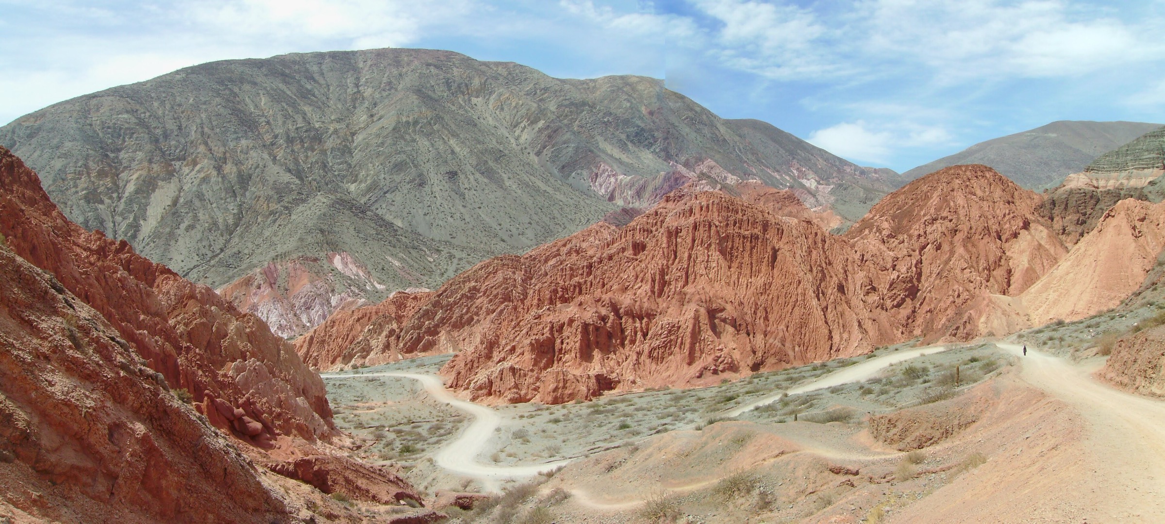
Aconcagua / Horcones covers the high, arid Central Andes around Parque Provincial Aconcagua, Puente del Inca, Los Penitentes and the Horcones valley on Argentina’s RN7 corridor. The walking character is open high-desert mountain terrain: glacial valleys, coloured sedimentary slopes, braided streams, moraine, dry puna vegetation and long views to the south face of Aconcagua.
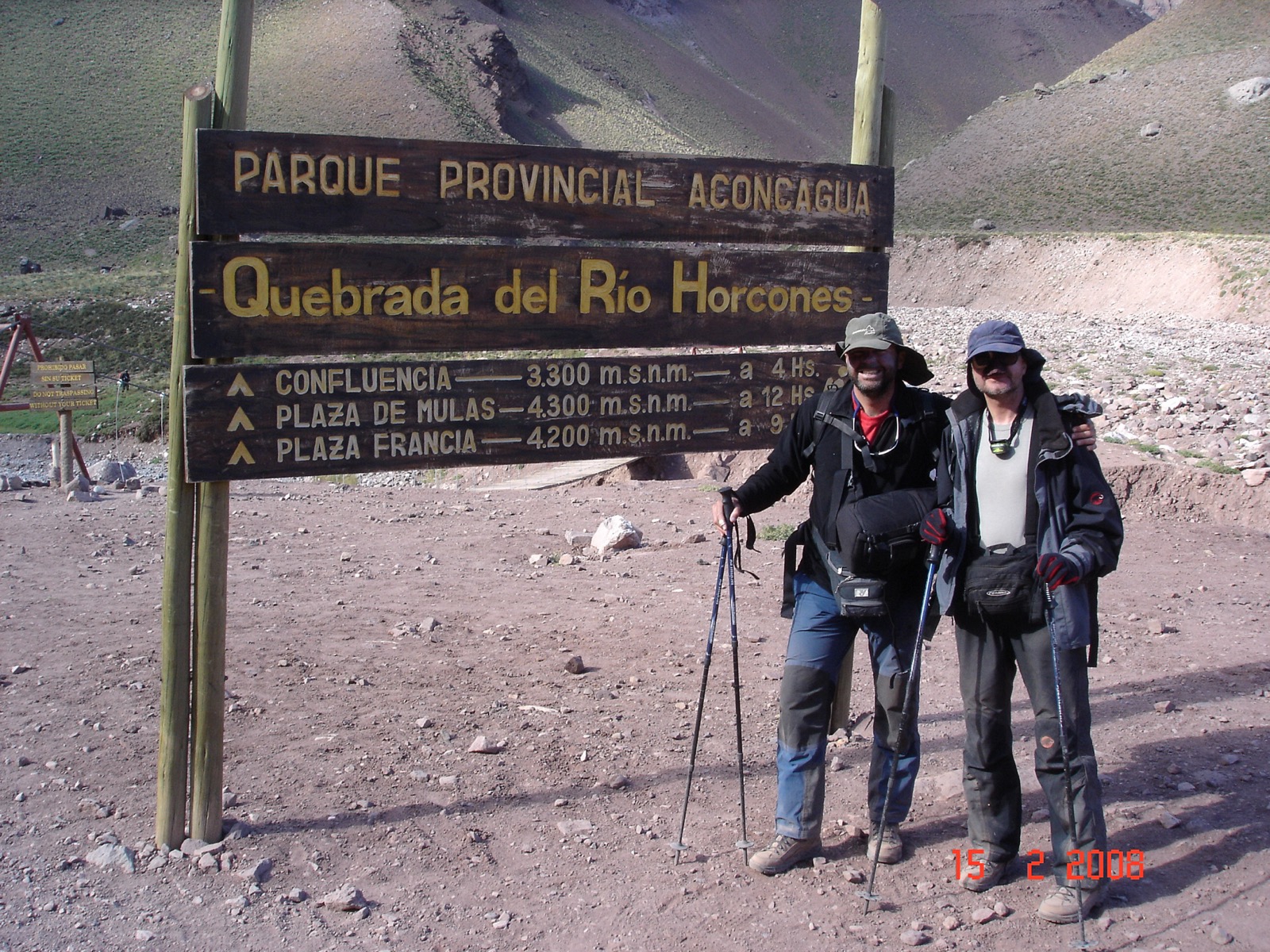
The core hiking centre is the Horcones park entrance, 2 km from Puente del Inca and roughly 180–185 km from Mendoza city. The official park system distinguishes the low Horcones interpretive trail from one-day trekking and longer/short trekking permits. Confluencia, Plaza Francia and the higher camps are part of the mountaineering approach system, so access, permit category, season and medical-control rules matter more than on an ordinary day-walk.
The normal trekking season is roughly November to March or April, depending on the route and annual park opening dates. Altitude is the main safety issue even on moderate distances: the trailhead is around 2,900–3,000 m, Confluencia is above 3,300 m, and Plaza Francia is near 4,000–4,225 m depending on the stopping point used. Wind, intense sun, dehydration, cold changes, storms, snow and permit controls should be expected.
Selection rationale
The selection keeps to the Horcones / Aconcagua approach area: the official Horcones lagoon walk, a longer Horcones bridge variant, the classic Confluencia approach, the Plaza Francia south-face viewpoint as a permit-dependent day section, and Cerro Penitentes / Los Puquios as the adjacent high-Andes summit alternative outside the strict park approach corridor. Plaza de Mulas is not selected as a day-hike because the out-and-back distance is better treated as multi-day mountaineering access.
Summary table
| # | Hike | Route type | Distance | Elevation gain | Max elevation | Difficulty |
|---|---|---|---|---|---|---|
| 1 | Laguna de Horcones Interpretive Trail | Loop / interpretive circuit | about 1.5 hr | About 3,000 m | Easy–moderate altitude walk | |
| 2 | Quebrada de los Horcones Bridge and Horcones Lagoon | Out-and-back | 6.0 km | 143 m | 3,054 m | Moderate–hard because of altitude |
| 3 | Horcones to Confluencia | Out-and-back using point-to-point leg | 14.2 km return | 504 m ascent one-way | 3,420 m | Hard |
| 4 | Confluencia to Plaza Francia Viewpoint | Out-and-back day section | About 15 km from Confluencia; 37.8 km from Horcones | About 590 m from Confluencia; 1,546 m from Horcones | 3,980–4,225 m | Hard |
| 5 | Cerro Penitentes / Los Puquios Summit Route | Out-and-back / loop candidate | About 10–12 km depending on source | About 1,000–1,300 m | About 4,350 m | Hard |
Before you go
Permits and access
Four of the five hikes sit inside Parque Provincial Aconcagua and depend on the official park system. The Horcones interpretive trail is treated separately from the one-day trekking and short/long trekking permit categories that cover Confluencia and Plaza Francia. The park is normally open roughly November to April depending on the route and annual opening dates; permit category, ranger authority, medical-control rules and waste rules apply on the higher approaches. Cerro Penitentes / Los Puquios is the adjacent non-park alternative around Puente del Inca and Los Penitentes, with land access, parking and best current line still requiring local verification. Public transport to Horcones is reported by La Ruta Natural, but current schedules need confirmation.
Standard Aconcagua day-hiking kit
For all five routes, carry:
- Standard hiking equipment: hiking shoes or sturdy boots, windproof/waterproof shell, warm layer, gloves and hat outside midsummer, sun hat, sunglasses, high-SPF sunscreen, food, water, headtorch, first-aid kit and navigation backup.
- Trekking poles, especially for the Confluencia and Plaza Francia approaches.
- 2–3 litres of water from the start; do not rely on untreated stream water.
- Water treatment if using natural water on longer approaches.
- Emergency communication for the higher routes.
- Microspikes, crampons or an ice axe in early season or snow conditions on Cerro Penitentes; a helmet if loose rock or crowded scree is present.
Common hazards
Altitude is the main safety issue even on moderate distances. Wind, intense UV, dehydration, rapid cold changes, storms, snow and permit controls should be expected. Loose or eroded trail edges, navigation difficulty in poor visibility, and unclear non-park access on Cerro Penitentes are realistic concerns. Dogs are listed as not allowed by AllTrails on the Horcones, Confluencia and Plaza Francia routes. Food is not sold in Horcones. Do not continue beyond the permitted route category.
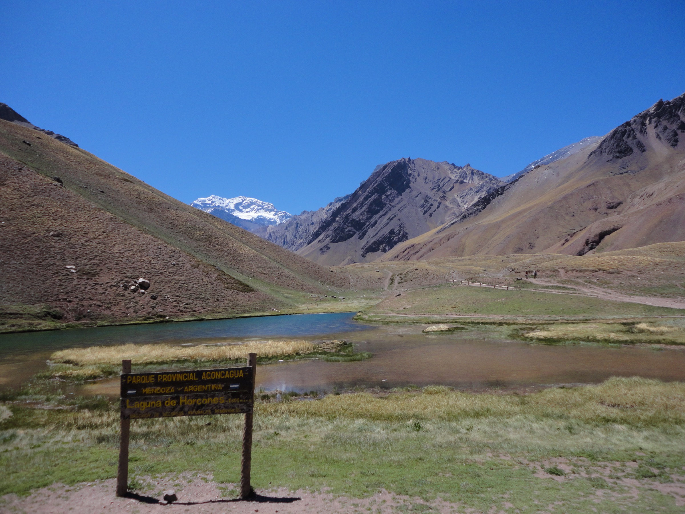
1. Laguna de Horcones Interpretive Trail
Snapshot
Itinerary
The trail starts at the Horcones visitor area and follows the marked interpretive circuit around Laguna de Horcones. The route gives one of the shortest legal approaches to the Aconcagua landscape, with views across the lagoon toward the south wall and the Horcones valley. It is the main low-commitment walk for visitors who do not have a Confluencia or longer trekking permit.
The official park material treats this as a separate interpretive route rather than part of the mountaineering approach. Stay on the marked trail because the wetland and high-Andean vegetation around the lagoon are fragile.
Why it is essential
This is the introductory Aconcagua day walk: short, official, accessible from the park entrance and directly tied to the iconic view of the highest mountain in the Americas. It gives the catalogue a low-risk acclimatisation option before the longer Horcones valley routes.
Hazards and notes
- Altitude, wind, sun exposure and rapid cold changes are the main issues.
- Dogs are not allowed on the longer AllTrails-listed Horcones routes and should not be assumed permitted here.
- Check the official park site for the current season, ticket/permit category and opening status before travel.
GPX / KML links
| Source | URL | Format | Notes |
|---|---|---|---|
| Mendoza government Horcones trail PDF | mendoza.gov.ar | Official PDF / interpretive trail source | Government PDF; reuse terms for geometry not stated; no GPX found |
| La Ruta Natural: Aconcagua Provincial Park | larutanatural.gob.ar | Official national tourism description | No route-file terms stated; context only |
External links
2. Quebrada de los Horcones Bridge and Horcones Lagoon
Snapshot
Itinerary
This route starts at Horcones, passes the Aconcagua viewpoint and Horcones lagoon area, then continues up the Quebrada de los Horcones to the bridge over the ravine before returning by the same line. AllTrails records a 6.0 km out-and-back with 143 m of ascent and a maximum elevation just above 3,050 m.
The walk is short but gives a clearer sense of the Horcones valley than the lagoon circuit alone. It follows the lower approach terrain used by trekkers and expedition parties, with dry slopes, wind-scoured valley floor and broad views back toward the park entrance.
Why it is essential
It is the best short extension of the official Horcones visit: still a half-day walk, but with enough distance to experience the valley, bridge and high-Andean scale without committing to Confluencia.
Hazards and notes
- Wind, intense UV, dehydration and loose or eroded trail edges are the main concerns.
- Ticket-purchase logistics and park entry categories are frequently mentioned by visitors and should be settled before arrival.
- Dogs are listed as not allowed by AllTrails.
GPX / KML links
| Source | URL | Format | Notes |
|---|---|---|---|
| AllTrails: Quebrada de Los Horcones Bridge – Horcones Lagoon | alltrails.com | Source map | AllTrails terms apply; direct GPX not retrieved |
| OpenStreetMap search | openstreetmap.org | Map search | OSM data is ODbL; geometry cross-check target only |
External links
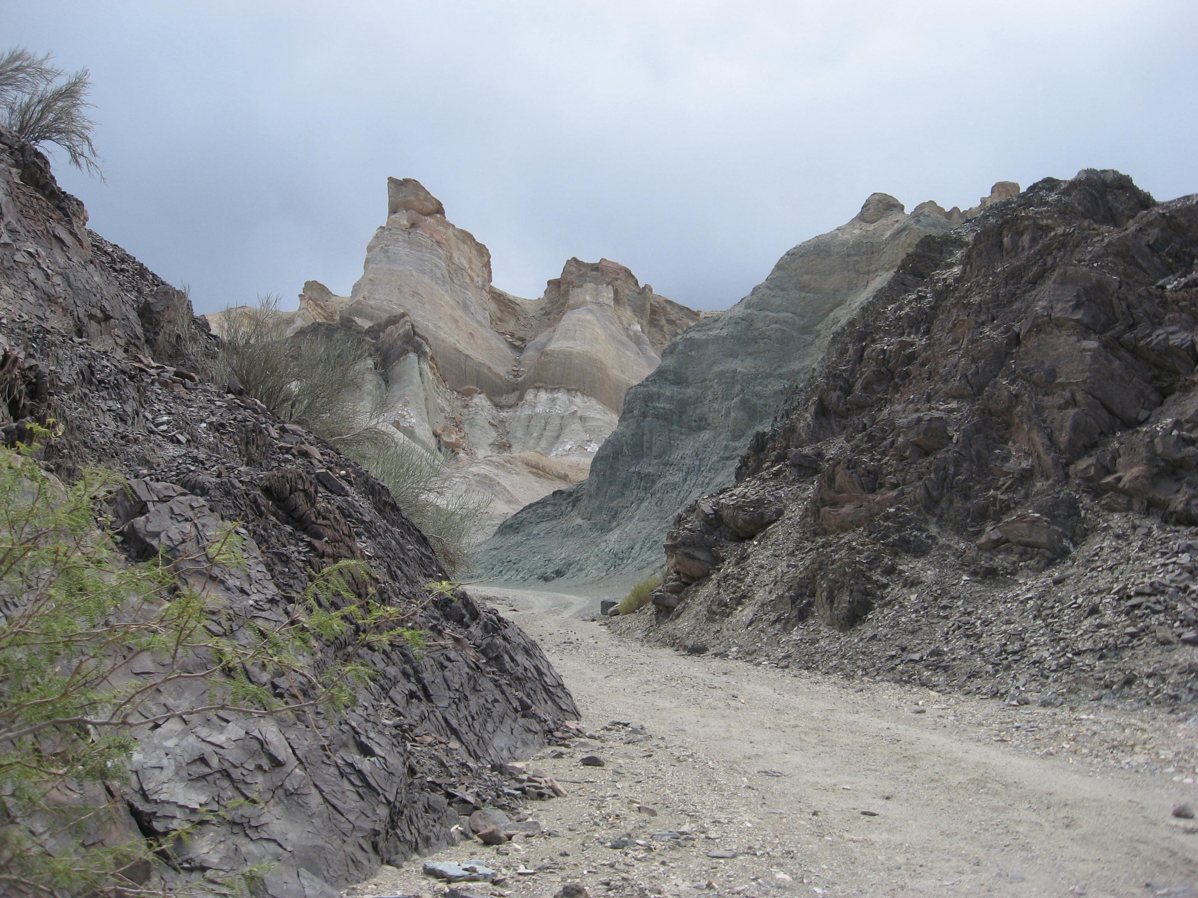
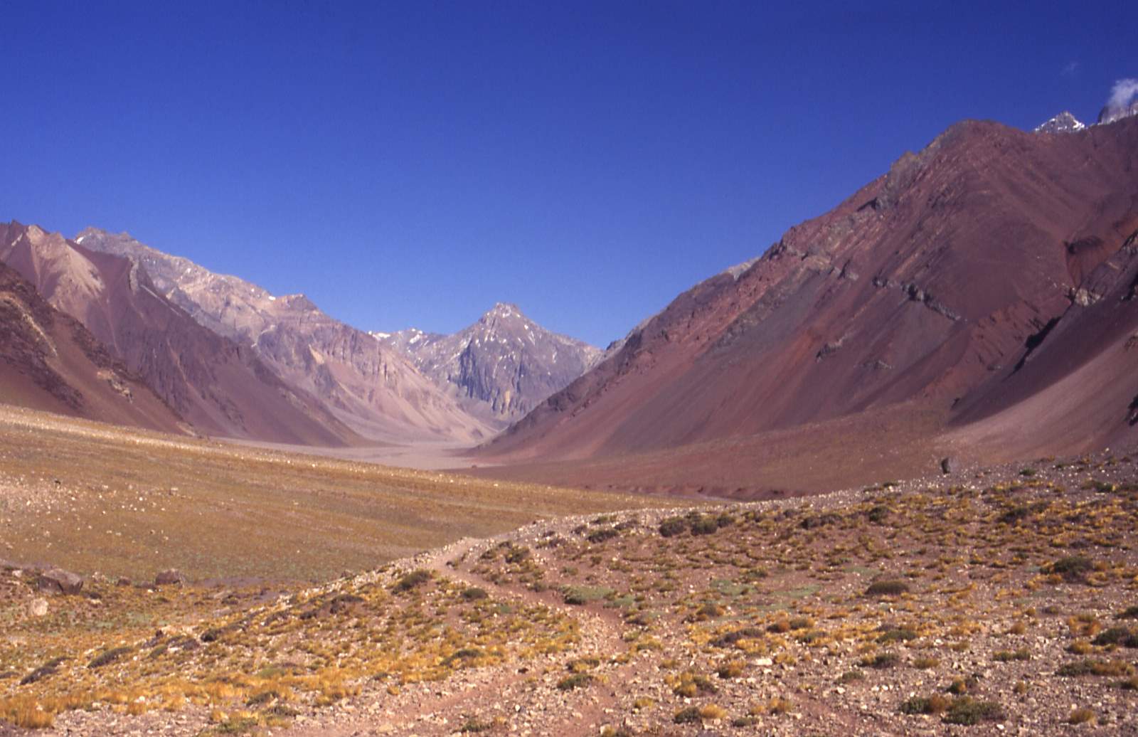
3. Horcones to Confluencia
Snapshot
Itinerary
From the Horcones entrance, the trail follows the main Aconcagua normal-route approach up the Horcones valley. It passes the lagoon/viewpoint sector and continues through dry, open terrain toward Confluencia, the first organised camp on the Aconcagua approach. AllTrails records the one-way leg as 7.1 km with about 504 m of gain and a maximum elevation near 3,420 m.
For a day-hike, the route returns to Horcones by the same path. The longer Aconcagua expedition continues onward to Plaza de Mulas, but that continuation is not treated here as a day-hike.
Why it is essential
Confluencia is the classic first real trekking objective in the Horcones valley. It reaches the operational world of Aconcagua without requiring glacier travel or high-camp mountaineering, and it is the natural step up from the Horcones lagoon walks.
Hazards and notes
- Altitude illness is a real risk.
- The park has permit controls, ranger authority, medical assistance during season and waste rules.
- Food is not sold in Horcones according to AllTrails’ park notes.
- Do not continue beyond the permitted route category. Dogs are not listed as allowed.
GPX / KML links
| Source | URL | Format | Notes |
|---|---|---|---|
| AllTrails: Aconcagua – Horcones – Confluencia | alltrails.com | Source map | AllTrails terms apply; direct GPX not retrieved |
| Mendoza government trekking PDF | mendoza.gov.ar | Official trekking PDF | Government PDF; route-file terms not stated; context / official permit-route source |
External links
- AllTrails Aconcagua – Horcones – Confluencia
- Mendoza government Aconcagua trekking PDF
- Patagonia-Argentina Aconcagua Provincial Park
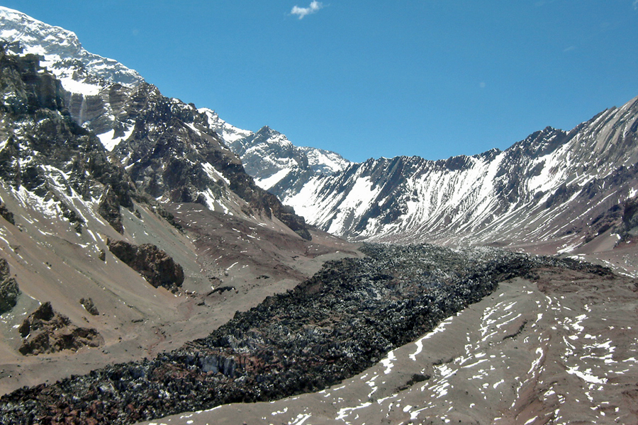
4. Confluencia to Plaza Francia Viewpoint
Snapshot
Itinerary
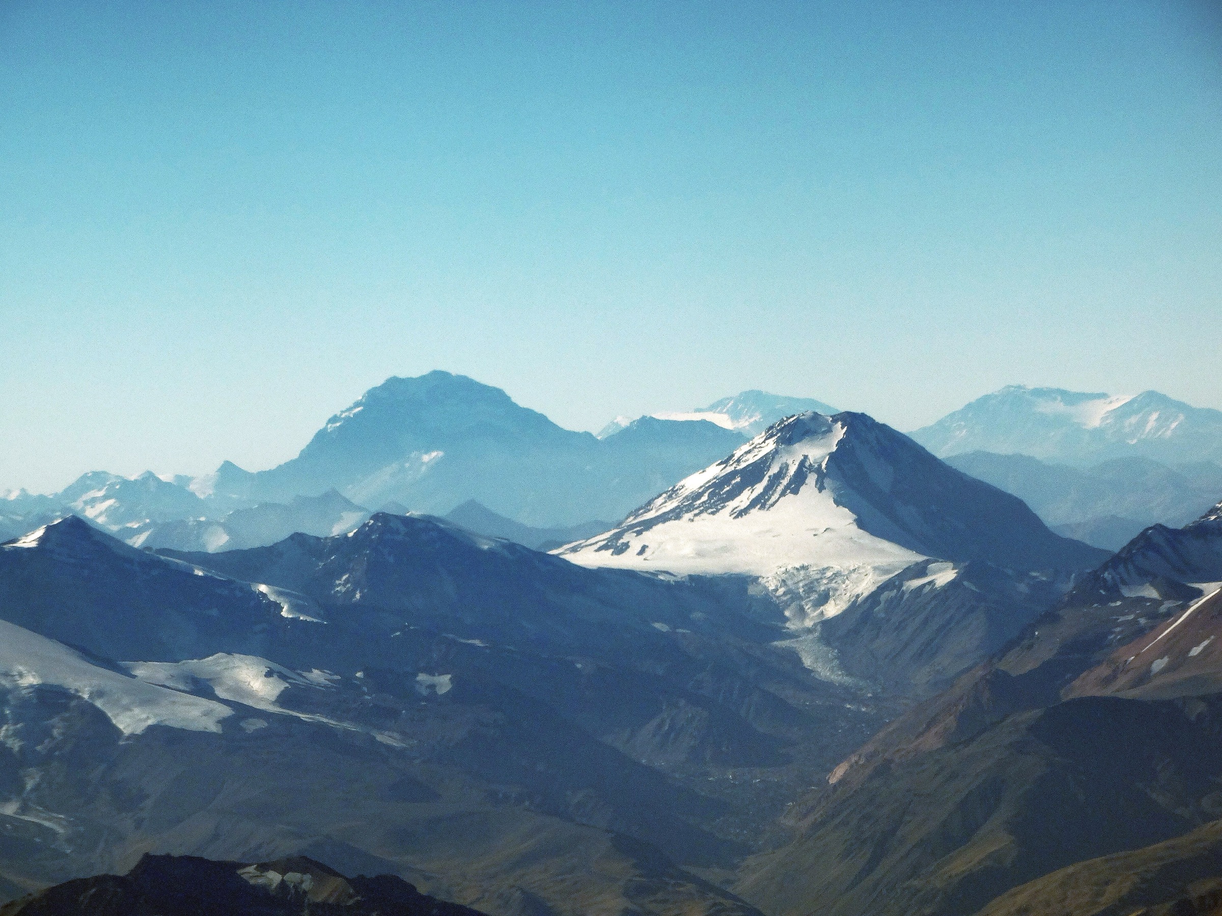
From Confluencia, the route turns toward the Horcones Inferior glacier and climbs the valley to Plaza Francia, the famous viewpoint below Aconcagua’s south face. Guide and route sources describe it as the acclimatisation day normally made from Confluencia before returning to camp. AllTrails maps the full Horcones–Plaza Francia–Horcones route as 37.8 km with 1,546 m of ascent; day-hike use is more realistic as the Confluencia–Plaza Francia–Confluencia section within a permitted short-trek itinerary.
This is not a casual day walk from the highway. A short-trekking or multi-day permit may be required, and park rules must be checked before planning.
Why it is essential
Plaza Francia is the defining viewpoint of the Aconcagua south wall, with the Horcones Inferior glacier and hanging ice above the valley. It is the essential scenic objective beyond Confluencia.
Hazards and notes
- Altitude, long distance, cold wind, storms, navigation in poor visibility and strict permit controls are the main issues.
- Do not attempt this as a single-day highway-to-highway outing unless current park rules explicitly allow it and fitness/acclimatisation are appropriate.
- Early-season snow or icy ground may require additional traction.
- Dogs are not allowed on the AllTrails-listed route.
GPX / KML links
| Source | URL | Format | Notes |
|---|---|---|---|
| AllTrails: Plaza Francia Viewpoint | alltrails.com | Source map | AllTrails terms apply; direct GPX not retrieved |
| Aconcagua Adventures: Trekking to Plaza Francia | aconcaguaadventures.com | Commercial itinerary / route context | No reusable route-file terms stated; context only |
External links
- AllTrails Plaza Francia Viewpoint
- Aconcagua Adventures Trekking to Plaza Francia
- JTreks Aconcagua normal route stage notes
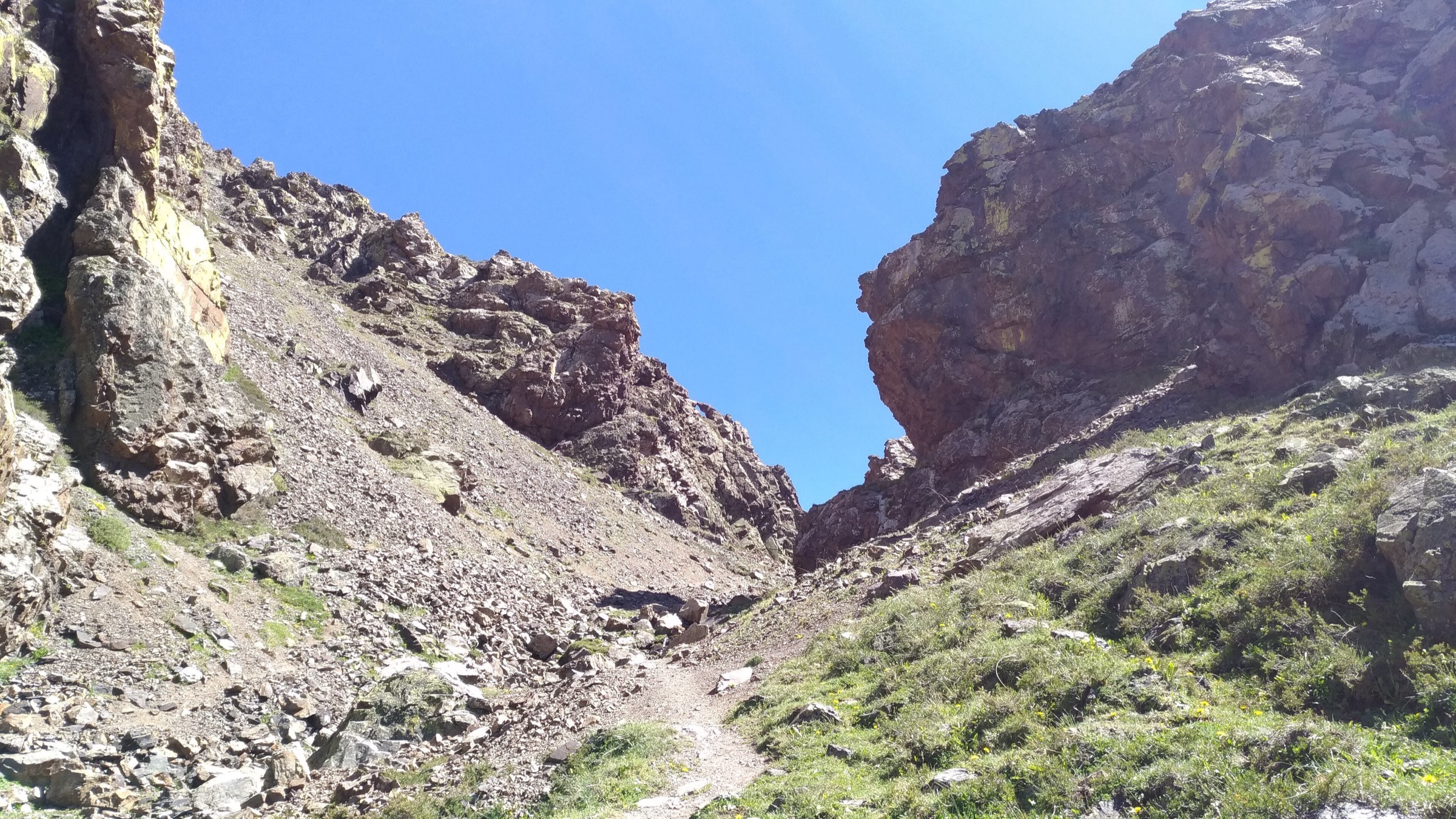
5. Cerro Penitentes / Los Puquios Summit Route
Snapshot
Itinerary
The Cerro Penitentes / Los Puquios route is the adjacent high-Andes summit alternative to the Horcones park walks. Community route records commonly start near Puente del Inca, Los Puquios or Penitentes, cross the valley side and climb dry scree and ridge terrain toward the summit area. Wikiloc and tour-programme sources identify Cerro Penitentes as a high mountain objective around 4,350 m in the Puente del Inca / Penitentes sector.
Because the exact public trailhead, parking, land access and best current line were not verified from an official source, this remains a candidate route rather than a publication-ready hike.
Why it is essential
The route represents the non-park high-Andes summits immediately around Horcones and Puente del Inca. It gives strong acclimatisation value and a different view into the Aconcagua corridor, but it needs better local verification before final publication.
Hazards and notes
- Loose scree, high altitude, wind, route-finding, snow/ice and unclear access are the main hazards.
- Do not rely only on a community GPS line.
- Confirm parking, private-land issues, avalanche/snow conditions and weather locally.
- Snow conditions may require microspikes, crampons or an ice axe depending on season; a helmet if loose rock or crowded scree is present.
GPX / KML links
| Source | URL | Format | Notes |
|---|---|---|---|
| Wikiloc: Cerro Penitentes – Puente del Inca | wikiloc.com | Source map / GPX availability via Wikiloc | Wikiloc terms apply; account may be required |
| Wikiloc: Cerro Penitentes complete round trip | wikiloc.com | Source map / GPX availability via Wikiloc | Wikiloc terms apply; account may be required |
External links
- Wikiloc Cerro Penitentes – Puente del Inca
- Wikiloc Cerro Penitentes complete round trip
- Champaqui Adventure Cerro Penitentes PDF
External links
| Source | URL |
|---|---|
| Mendoza government Aconcagua official site | mendoza.gov.ar |
| Mendoza government trekking PDF | mendoza.gov.ar |
| Mendoza government Horcones PDF | mendoza.gov.ar |
| La Ruta Natural Aconcagua Provincial Park | larutanatural.gob.ar |
| AllTrails Quebrada de Los Horcones Bridge – Horcones Lagoon | alltrails.com |
| AllTrails Aconcagua – Horcones – Confluencia | alltrails.com |
| AllTrails Plaza Francia Viewpoint | alltrails.com |
| Patagonia-Argentina Aconcagua Provincial Park | patagonia-argentina.com |
| Aconcagua Adventures Trekking to Plaza Francia | aconcaguaadventures.com |
| JTreks Aconcagua normal route | jtreks.co |
| Wikiloc Cerro Penitentes – Puente del Inca | wikiloc.com |
| Wikiloc Cerro Penitentes complete round trip | wikiloc.com |
| Champaqui Adventure Cerro Penitentes PDF | champaquiadventure.tur.ar |